By using this website, you agree to our use of cookies (needed to provide our website’s features) and our Terms of Use.
By: Andrew Forrest - December 2022
An insight into Triangulation Pillars (Trig Points). What are they? Who put them there? Why are they there? What are they for? All these questions are answered along with other interesting facts about these iconic structures.
'Trig points', 'Triangulation Points' or 'Triangulation Pillars' are concrete pillars, usually about 4 feet high and were built from 1936 onwards by surveyors at the Ordnance Survey to begin the retriangulation of Great Britain. They are mostly found on the highest points of hills or mountains, but not always, as they need to be where other pillars are visible.
They give you that satisfying feeling, when you've slogged your way up a mountainside, that you are there... you can touch them and have your photo taken by them, to show that you did it!
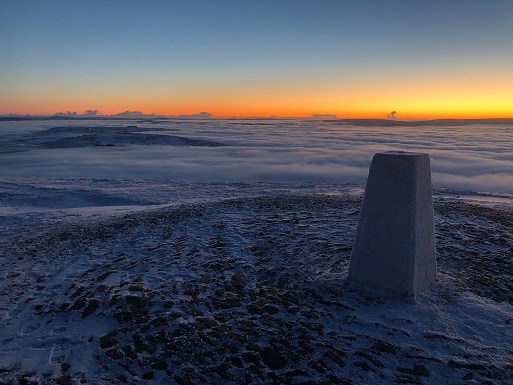
Coniston Old Man Trig Point
Trig Points were built on summits to work out the heights of hills or mountains. Theodolites (surveying instruments that measure horizontal and vertical angles) were secured to mounting plates on the top of the triangulation pillars and angles were measured to other surrounding pillars in the 6,500 pillar network. Using 'triangulation' the heights could then be accurately calculated.
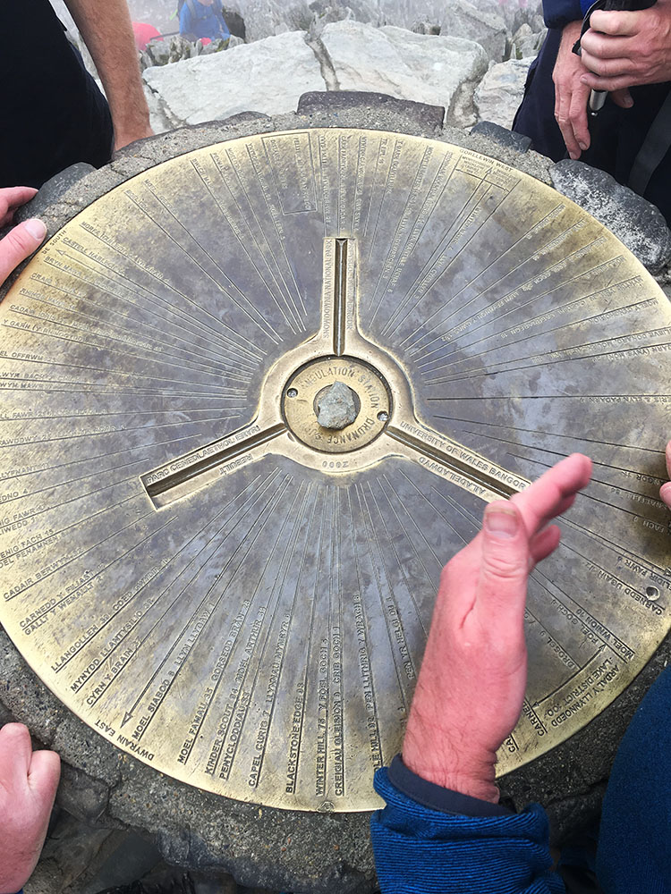
The elaborately designed brass mounting plate on top of the Snowdon Trig Point
Triangulation in surveying is a technique used for precise positioning. It is based on the laws of trigonometry, which state that if one side and two angles of a triangle are known, the other two sides and angle can be calculated.
Perhaps it was just drummed into me at the time, but all these years later I can still remember the mnemonic I was taught in trig lessons at school for working out angles and sides... Silly Old Harry Caught A Herring Trawling Off Alaska, which sadly enough I know still means: Sine (Opposite over Hypotenuse), Cosine (Adjacent over Hypotenuse) and Tangent (Opposite over Adjacent). I can't say I've ever needed this valuable nugget ever since I left school though... I guess it's just one of those things taking up space in my head that someone thought I'd need one day.
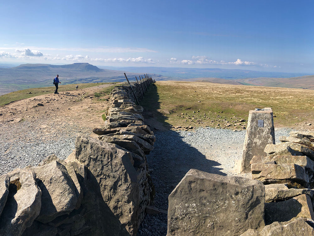
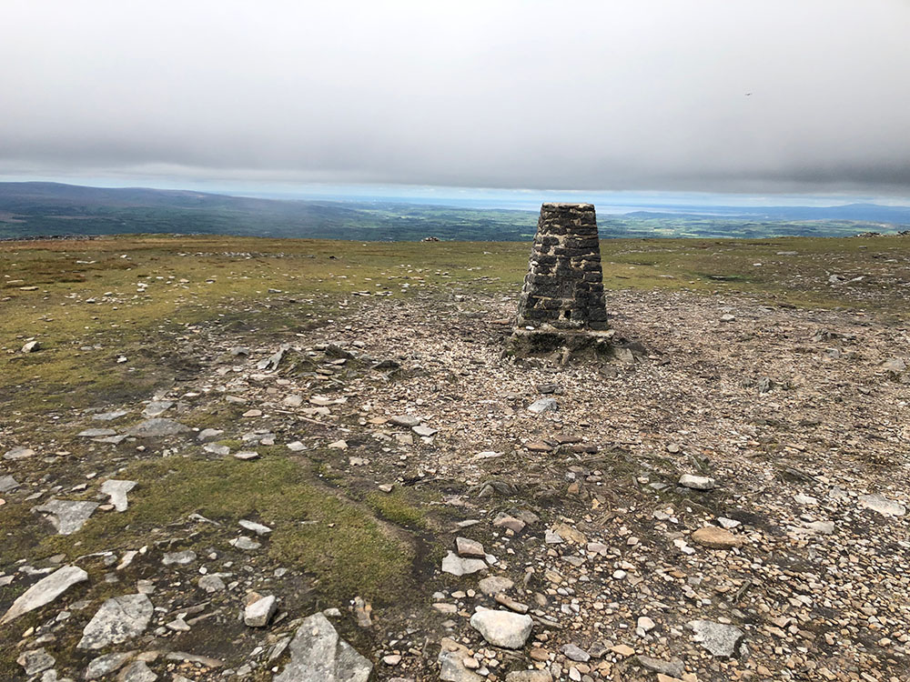
Whernside Trig Point in the Yorkshire Dales
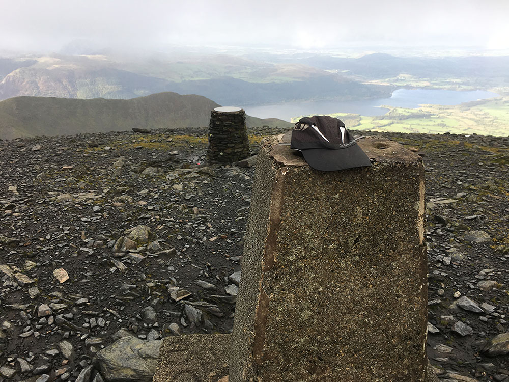
Skiddaw Trig Point
A project was set up in 1935 by Ordnance Survey to consolidate all local mapping onto one single national map and one reference system. This gave rise to the OSGB36 datum and the National Grid in Great Britain, which are both still here today and have outlasted the now obsolete (well at least for measurements anyway) trig points themselves.
Just over 6,500 trig pillars were built between 1936 and 1962, the majority of which still stand today.
The Helm Trig Point near Kendal
Calf Trig Point in the Howgills
If you ever wondered what is a Trig Point on an Ordnance Survey map or what this blue triangle symbol with a dot in the middle signified when you looked at an Ordnance Survey map...

...it's a trig point (or as per the Ordnance Survey map key, it's a Triangulation Pillar).
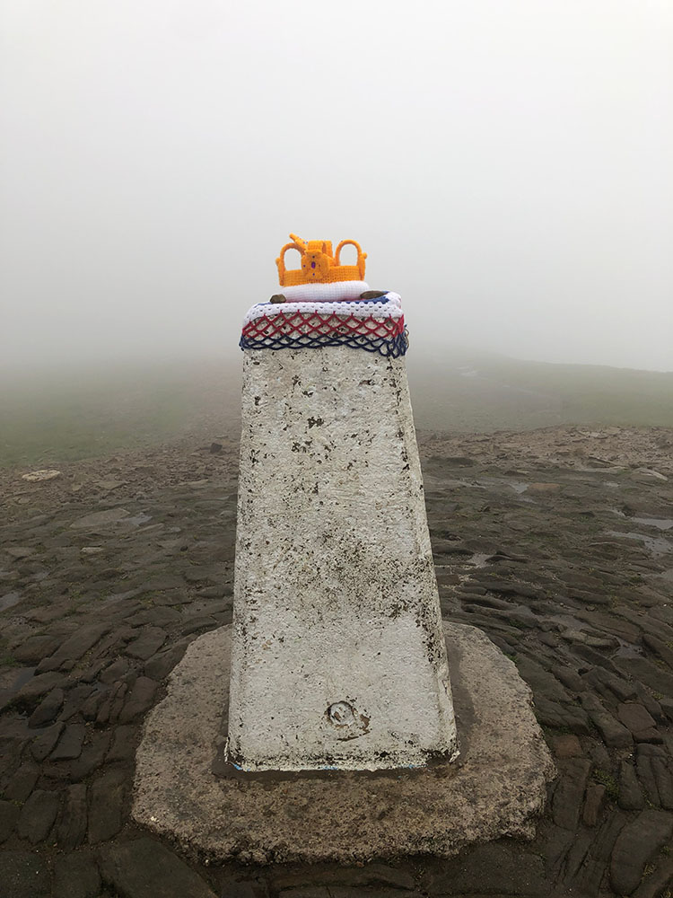
Pendle Hill Trig Point wearing a crocheted crown for the Queen's Platinum Jubilee
No surprises here... it's on Ben Nevis at 1,345m. It was originally calculated using the trig point as 1,344m high, but with new satellite technology, this was updated to 1,345m in 2016, the year the tallest just got a little taller!
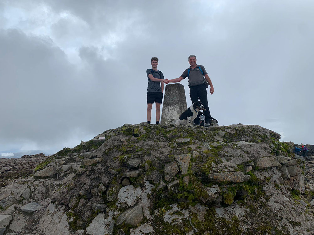
Dominic, Mick and Alfie by the Trig Point on Ben Nevis
As mentioned above, the ability to be visible means not all Trig Points are on the top of hills. The lowest Trig Point is actually -0.5m below sea level near Ely in Cambridgeshire.
If you are interested in seeing where all the Trig Points are in Great Britain and want to find trig points 'near me', then take a look at the Ordnance Survey's interactive map of Trig Points: https://public.tableau.com/app/profile/cartocraftsman/viz/Trigs2/Dashboard1?publish=yes
Ingleborough Trig Point in the Yorkshire Dales
As with many things in life, time stands still for no man or theodolite. Ordnance Survey now uses the OS Net Network of 110 global navigation Satellite system receivers, then can map accurately to within a few centimetres in seconds for what previously took hours and days to do.
They are similar to trig points but measure height above sea level, where sea level is defined as the mean sea level at Newlyn in Cornwall. Ordnance Survey also use 'Fundamental Benchmarks', of which 190 are still used by Ordnance Survey today. They are used for high-accuracy measurements. The fundamental benchmark sits above and below ground, with the above part a concrete block about a foot tall with a brass bolt on the top and an Ordnance Survey nameplate on the side.
December 2022

.jpg)