By using this website, you agree to our use of cookies (needed to provide our website’s features) and our Terms of Use.
By: Andrew Forrest - December 2023
In this article, we explore the 214 Wainwrights on an interactive Wainwrights map, with fell lists by height and guide you through Alfred Wainwright's seven-volume Pictorial Guide to the Lakeland Fells.
The Lake District in northwest England has long captivated the hearts of walkers and lovers of the great outdoors. Among them, one man stood out as a true ambassador of this breathtaking landscape: Alfred Wainwright. Wainwright, a renowned fell walker, guidebook author, and illustrator, left an indelible mark on exploring the Lake District through his detailed books and maps.
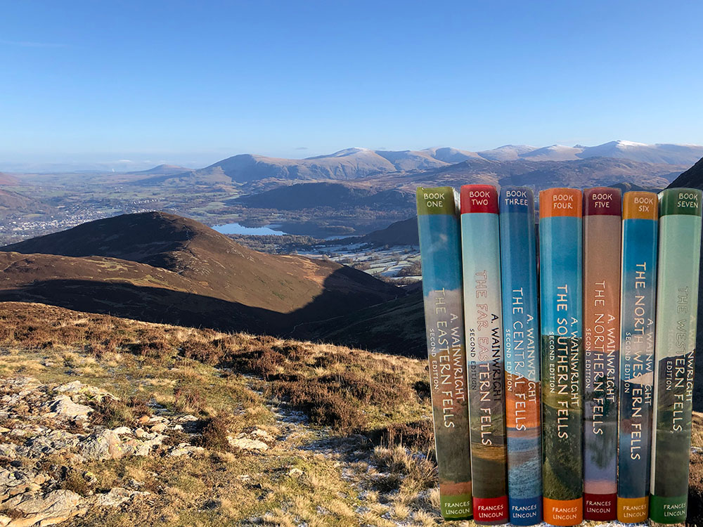
His main legacy has been leaving us the Wainwright's Pictorial Guides to the Lakeland Fells, a series of seven books that detail and describe 214 fells in the Lake District that have become known as 'Wainwrights'. These guides showcase Wainwright's dedication to the region, crafted with meticulous attention to detail and a wonderfully distinctive artistic style.
Besides providing an interactive map of the Lakeland Fells showing all of the 214 Wainwrights, split between the seven Pictorial Guides, we look at each guide in detail and the fells included before exploring the man, Alfred Wainwright himself.
This page contains affiliate links. As an Amazon Associate, we earn from qualifying Amazon purchases at no additional cost to you. We may also earn commissions from other retailers, again at no additional cost to you.
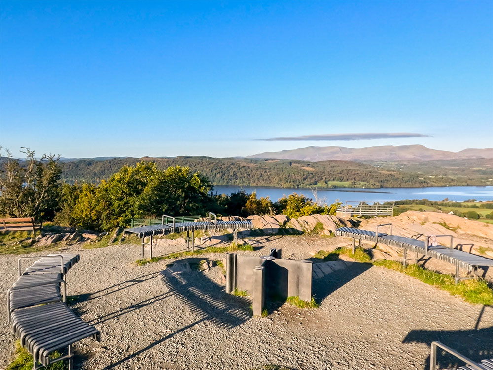
The above interactive map shows all the 214 fells Wainwright included in his seven Pictorial Guides to the Lakeland Fells. This Wainwrights map has been colour-coded and filtered by book, so you can zoom in and see in more detail where each of the fells is.
We've included more detail about each book below, including links to the current third edition and a list of all fells included within each book.
Over time, we will link these fells to video walks on our website and include photographs of all the fells.
Wainwright described the guides as 'one man's way of expressing his devotion to Lakeland's friendly hills. It was conceived, and is born, after many years of articulate worshipping at their shrines. It is, in very truth, a love letter'.
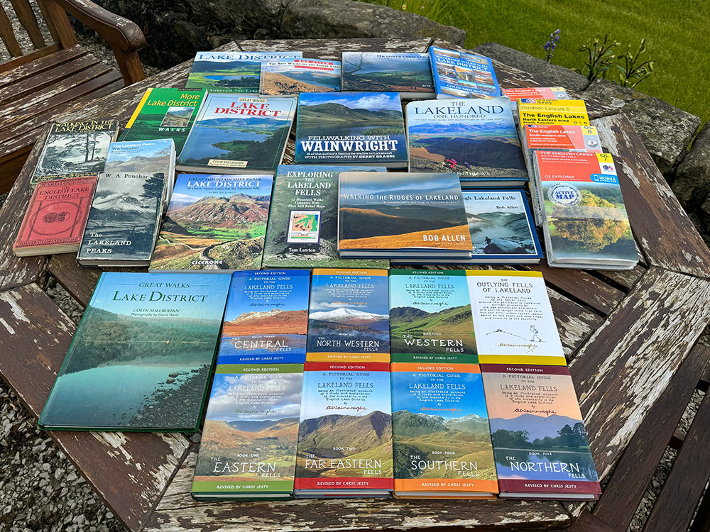
Between 1955 and 1966, the seven Pictorial Guides to the Lakeland Fells were published, and the three editions and reprints are believed to have sold over 2,000,000 copies, of which I think I own about twenty!
Wainwright explains in the guides how he divided the Lakeland Fells into seven areas. He first started by joining the outer extremities of the Lakes, from Bassenthwaite Lake in the North, over to Ullswater and Haweswater in the East, south down to Windermere and Coniston and over the Ennerdale in the West.
This left a few outliers, so he extended some lines to catch those. He then divided this into seven areas, making the fullest use of natural boundaries (lakes, valleys and low passes), which he felt gave a well-defined group of fells, and these seven areas then formed the seven books in the Pictorial Guide to the Lakeland Fell series.
Wainwright includes a drawing of himself in each guide, although usually from the side or behind. We've highlighted below where you'll find these in each book.
 |
 |
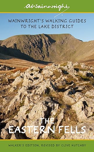
Book One of the Pictorial Guide to the Lakeland Fells was The Eastern Fells. It was originally published by Henry Marshall in 1955. The updated second edition, with revisions by Chris Jesty, was published in 2005 by Frances Lincoln Publishers. The third edition, updated by Clive Hutchby, was published in March 2015, again by publisher Frances Lincoln.
Wainwright dedicated Book One: The Eastern Fells to the 'Men of the Ordnance Survey, whose maps of Lakeland have given me much pleasure both on the fells and by my fireside'.
The Eastern Fells are centred around Helvellyn along a north-south running broad ridge, with the boundary being almost an inverted triangle, with the base at the top between Threlkeld and Pooley Bridge, coming down to a point at Ambleside.
The fells all lie to the west of a boundary drawn by Pooley Bridge, Ullswater, Goldrill Beck, Kirkstone Pass and Stock Gill and to the East of a boundary marked by Threlkeld, St John's Beck, Thirlmere, Dunmail Raise and the River Rothay.
There are 35 named fells in Book One: The Eastern Fells, and all are set out below, with their positions shown on the Interactive Lakeland Fells map above, which in effect is a Wainwright's map, as it shows all the Wainwright's by book, colour coded on the map.
The highest fell in The Eastern Fells book is Helvellyn at 950m, and the lowest is Arnison Crag at 433m.
If you want to try to spot Alfred Wainwright in the book, have a look at the Blencathra from Clough Head drawing.
The 35 fells in Book One: The Eastern Fells are:
Arnison Crag - 1421ft / 433m - 35th highest in this region - 194th highest overall
Birkhouse Moor - 2354ft / 718m - 19th highest in this region - 78th highest overall
Birks - 2047ft / 624m - 24th highest in this region - 124th highest overall
Catstye Cam - 2919ft / 890m - 3rd highest in this region - 10th highest overall
Clough Head - 2382ft / 726m - 18th highest in this region - 74th highest overall
Dollywaggon Pike - 2817ft / 859m - 7th highest in this region - 18th highest overall
Dove Crag - 2598ft / 792m - 12th highest in this region - 39th highest overall
Fairfield - 2865ft / 873m - 5th highest in this region - 13th highest overall
Glenridding Dodd - 1450ft / 442m - 34th highest in this region - 193rd highest overall
Gowbarrow Fell - 1579ft / 481m - 32nd highest in this region - 181st highest overall
Great Dodd - 2812ft / 857m - 8th highest in this region - 19th highest overall
Great Mell Fell - 1762ft / 537m - 27th highest in this region - 155th highest overall
Great Rigg - 2514ft / 766m - 15th highest in this region - 54th highest overall
Hart Crag - 2700ft / 823m - 11th highest in this region - 27th highest overall
Hart Side - 2480ft / 756m - 16th highest in this region - 61st highest overall
Hartsop Above How - 1923ft / 586m - 26th highest in this region - 135th highest overall
Helvellyn - 3116ft / 950m - 1st highest in this region - 3rd highest overall
Heron Pike - 2008ft / 612m - 25th highest in this region - 127th highest overall
High Hartsop Dodd - 1703ft / 519m - 28th highest in this region - 164th highest overall
High Pike (Scandale) - 2152ft / 656m - 21st highest in this region - 109th highest overall
Little Hart Crag - 2090ft / 637m - 23rd highest in this region - 119th highest overall
Little Mell Fell - 1657ft / 505m - 30th highest in this region - 173rd highest overall
Low Pike - 1667ft / 508m - 29th highest in this region - 171st highest overall
Middle Dodd - 2146ft / 654m - 22nd highest in this region - 111th highest overall
Nab Scar - 1476ft / 450m - 33rd highest in this region - 190th highest overall
Nethermost Pike - 2924ft / 891m - 2nd highest in this region - 9th highest overall
Raise - 2896ft / 883m - 4th highest in this region - 12th highest overall
Red Screes - 2546ft / 776m - 14th highest in this region - 49th highest overall
Seat Sandal - 2417ft / 737m - 17th highest in this region - 68th highest overall
Sheffield Pike - 2218ft / 676m - 20th highest in this region - 99th highest overall
St. Sunday Crag - 2760ft / 841m - 10th highest in this region - 22nd highest overall
Stone Arthur - 1654ft / 504m - 31st highest in this region - 174th highest overall
Stybarrow Dodd - 2768ft / 844m - 9th highest in this region - 21st highest overall
Watson's Dodd - 2589ft / 789m - 13th highest in this region - 41st highest overall
White Side - 2832ft / 863m - 6th highest in this region - 16th highest overall
|
|
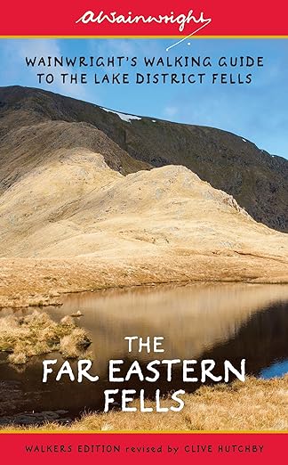
Book Two of the Pictorial Guide to the Lakeland Fells was The Far Eastern Fells. It was originally published by Henry Marshall in 1957. The updated second edition, with revisions by Chris Jesty, was published in 2005 by Frances Lincoln Publishers. The third edition, updated by Clive Hutchby, was published in October 2015, again by publisher Frances Lincoln.
Wainwright dedicated Book Two: The Far Eastern Fells to the 'Men who built the stone walls, which have endured the storms for centuries and remain to this day as monuments to enterprise, perseverance and hard work'.
The Far Eastern Fells lie to the East of the fells in Book One: Eastern Fells. Ullswater borders them to the North. They lie to the East of a boundary drawn by the South end of Ullswater, Goldrill Beck, Kirkstone Pass and Stock Gill and lie to the west of a boundary marked by the River Lowther, Swindale Beck and Little Mosedale Beck. Sour Howes and Sallows near Kentmere mark the Southern end of the Far Eastern Fells.
There are 36 named fells in Book Two: The Far Eastern Fells and all are set out below, with their positions shown on the Interactive Lakeland Fells map above, which in effect is a Wainwright's map, as it shows all the Wainwright's by book, colour coded on the map.
The highest fell in The Far Eastern Fells book is High Street at 828m, and the lowest is Troutbeck Tongue at 364m.
If you want to try to spot Alfred Wainwright in the book, have a look at the full-page drawing of Haweswater from the fence corner on Harter Fell.
The 36 fells in Book Two: The Far Eastern Fells are:
Angletarn Pikes - 1857ft / 566m - 26th highest in this region - 143rd highest overall
Arthur's Pike - 1749ft / 533m - 28th highest in this region - 157th highest overall
Beda Fell - 1670ft / 509m - 31st highest in this region - 170th highest overall
Bonscale Pike - 1719ft / 524m - 29th highest in this region - 161st highest overall
Branstree - 2334ft / 712m - 13th highest in this region - 81st highest overall
Brock Crags - 1841ft / 561m - 27th highest in this region - 144th highest overall
Froswick - 2362ft / 720m - 12th highest in this region - 77th highest overall
Gray Crag - 2290ft / 698m - 15th highest in this region - 90th highest overall
Grey Crag - 2093ft / 638m - 22nd highest in this region - 118th highest overall
Hallin Fell - 1273ft / 388m - 35th highest in this region - 203rd highest overall
Harter Fell (Mardale) - 2556ft / 779m - 6th highest in this region - 47th highest overall
Hartsop Dodd - 2031ft / 619m - 23rd highest in this region - 125th highest overall
High Raise (Martindale) - 2636ft / 804m - 2nd highest in this region - 31st highest overall
High Street - 2717ft / 828m - 1st highest in this region - 25th highest overall
Ill Bell - 2484ft / 757m - 9th highest in this region - 60th highest overall
Kentmere Pike - 2397ft / 731m - 11th highest in this region - 72nd highest overall
Kidsty Pike - 2562ft / 781m - 5th highest in this region - 46th highest overall
Loadpot Hill - 2205ft / 672m - 18th highest in this region - 103rd highest overall
Mardale Ill Bell - 2493ft / 760m - 8th highest in this region - 59th highest overall
Place Fell - 2156ft / 657m - 20th highest in this region - 108th highest overall
Rampsgill Head - 2600ft / 792m - 3rd highest in this region - 38th highest overall
Rest Dodd - 2283ft / 696m - 16th highest in this region - 93rd highest overall
Sallows - 1693ft / 516m - 30th highest in this region - 166th highest overall
Selside Pike - 2149ft / 655m - 21st highest in this region - 110th highest overall
Shipman Knotts - 1926ft / 587m - 24th highest in this region - 133rd highest overall
Sour Howes - 1585ft / 483m - 33rd highest in this region - 180th highest overall
Steel Knotts - 1417ft / 432m - 34th highest in this region - 195th highest overall
Stony Cove Pike (Caudale Moor) - 2506ft / 764m - 7th highest in this region - 55th highest overall
Tarn Crag (Sleddale) - 2178ft / 664m - 19th highest in this region - 104th highest overall
The Knott (High Street) - 2425ft / 739m - 10th highest in this region - 66th highest overall
The Nab - 1890ft / 576m - 25th highest in this region - 138th highest overall
Thornthwaite Crag - 2572ft / 784m - 4th highest in this region - 44th highest overall
Troutbeck Tongue - 1194ft / 364m - 36th highest in this region - 207th highest overall
Wansfell - 1597ft / 487m - 32nd highest in this region - 178th highest overall
Wether Hill - 2206ft / 673m - 17th highest in this region - 101st highest overall
Yoke - 2320ft / 707m - 14th highest in this region - 84th highest overall
|
|
The Central Fells was Book Three of the Pictorial Guide to the Lakeland Fells. It was originally published by Henry Marshall in 1958. The updated second edition, with revisions by Chris Jesty, was published in 2006 by Frances Lincoln Publishers. The third edition, updated by Clive Hutchby, was published in March 2016, again by publisher Frances Lincoln.
Wainwright dedicated Book Three: The Central Fells to the 'The Dogs of Lakeland, willing workers and faithful friends, and an essential part of Lakeland Life'.
The Central Fells lie in the heart of the Lake District. The area bounded by them is almost rectangular, except for a slight outlier in Loughrigg Fell, which lies south and east of all the other Central Fells. The Central Fells all lie south of Keswick and are bounded on the East by St John's Vale, Thirlmere, Dunmail Raise and on the West by Derwent Water, Borrowdale, Langstrath and Stake Pass.
There are 27 named fells in Book Three: The Central Fells, and all are set out below, with their positions shown on the Interactive Lakeland Fells map above, which in effect is a Wainwright's map, as it shows all the Wainwright's by book, colour coded on the map.
The highest fell in The Central Fells book is High Raise at 762m, and the lowest is Loughrigg Fell at 335m.
If you want to try to spot Alfred Wainwright in the book, have a look at the full-length view of Thirlmere from Raven Crag.
The 27 fells in Book Three: The Central Fells are:
Armboth Fell - 1558ft / 475m - 18th highest in this region - 182nd highest overall
Bleaberry Fell - 1936ft / 590m - 10th highest in this region - 132nd highest overall
Blea Rigg - 1775ft / 541m - 14th highest in this region - 153rd highest overall
Calf Crag - 1762ft / 537m - 15th highest in this region - 156th highest overall
Eagle Crag - 1722ft / 525m - 16th highest in this region - 159th highest overall
Gibson Knott - 1378ft / 420m - 21st highest in this region - 198th highest overall
Grange Fell - 1369ft / 417m - 22nd highest in this region - 199th highest overall
Great Crag - 1473ft / 449m - 20th highest in this region - 191st highest overall
Harrison Stickle - 2415ft / 736m - 3rd highest in this region - 70th highest overall
Helm Crag - 1329ft / 405m - 23rd highest in this region - 201st highest overall
High Raise (Langdale) - 2500ft / 762m - 1st highest in this region - 58th highest overall
High Rigg - 1165ft / 355m - 26th highest in this region - 209th highest overall
High Seat - 1998ft / 609m - 9th highest in this region - 128th highest overall
High Tove - 1690ft / 515m - 17th highest in this region - 167th highest overall
Loft Crag - 2237ft / 682m - 8th highest in this region - 98th highest overall
Loughrigg Fell - 1099ft / 335m - 27th highest in this region - 211th highest overall
Pavey Ark - 2297ft / 700m - 7th highest in this region - 88th highest overall
Pike of Stickle - 2324ft / 708m - 6th highest in this region - 83rd highest overall
Raven Crag - 1512ft / 461m - 19th highest in this region - 186th highest overall
Sergeant's Crag - 1873ft / 571m - 11th highest in this region - 141st highest overall
Sergeant Man - 2415ft / 736m - 2nd highest in this region - 69th highest overall
Silver How - 1292ft / 394m - 24th highest in this region - 202nd highest overall
Steel Fell - 1814ft / 553m - 12th highest in this region - 146th highest overall
Tarn Crag (Easedale) - 1801ft / 549m - 13th highest in this region - 150th highest overall
Thunacar Knott - 2372ft / 723m - 4th highest in this region - 75th highest overall
Ullscarf - 2372ft / 723m - 5th highest in this region - 76th highest overall
Walla Crag - 1243ft / 379m - 25th highest in this region - 204th highest overall

|
|
Book Four of the Pictorial Guide to the Lakeland Fells was The Southern Fells. It was originally published by Henry Marshall in 1960. The updated second edition, with revisions by Chris Jesty, was published in 2007 by Frances Lincoln Publishers. The third edition, updated by Clive Hutchby, was published in April 2017, again by publisher Frances Lincoln.
Wainwright dedicated Book Four: The Southern Fells to the 'The Sheep of Lakeland, the truest lovers of the mountains, their natural homes and providers of their food and shelter'.
The Southern Fells lie to the South of Wast Water, Wasdale, Sty Head, Borrowdale, Langstrath and Great Langdale, extending as far South as Birker Fell and Walna Scar Pass.
There are 30 named fells in Book Four: The Southern Fells and all are set out below, with their positions shown on the Interactive Lakeland Fells map above, which in effect is a Wainwright's map, as it shows all the Wainwright's by book, colour coded on the map.
The highest fell in The Southern Fells book is Scafell Pike at 978m, and the lowest is Holme Fell at 317m. Scafell Pike is also the highest mountain in England.
If you want to try to spot Alfred Wainwright in the book, have a look at the view of Deep Gill, the Pinnacle and the Oracle on Scafell.
The 30 fells in Book Four: The Southern Fells are:
Allen Crags - 2575ft / 785m - 11th highest in this region - 42nd highest overall
Black Fell - 1060ft / 323m - 29th highest in this region - 212th highest overall
Bowfell - 2962ft / 903m - 4th highest in this region - 6th highest overall
Brim Fell - 2611ft / 796m - 10th highest in this region - 37th highest overall
Cold Pike - 2297ft / 700m - 19th highest in this region - 89th highest overall
Coniston Old Man - 2633ft / 802m - 8th highest in this region - 32nd highest overall
Crinkle Crags - 2818ft / 859m - 6th highest in this region - 17th highest overall
Dow Crag - 2552ft / 778m - 14th highest in this region - 48th highest overall
Esk Pike - 2904ft / 885m - 5th highest in this region - 11th highest overall
Glaramara - 2569ft / 783m - 13th highest in this region - 45th highest overall
Great Carrs - 2575ft / 785m - 12th highest in this region - 43rd highest overall
Great End - 2984ft / 910m - 3rd highest in this region - 5th highest overall
Green Crag - 1603ft / 489m - 27th highest in this region - 176th highest overall
Grey Friar - 2536ft / 773m - 15th highest in this region - 51st highest overall
Hard Knott - 1801ft / 549m - 25th highest in this region - 151st highest overall
Harter Fell (Eskdale) - 2143ft / 653m - 20th highest in this region - 112th highest overall
Holme Fell - 1037ft / 316m - 30th highest in this region - 213th highest overall
Illgill Head - 1997ft / 609m - 22nd highest in this region - 129th highest overall
Lingmell - 2648ft / 807m - 7th highest in this region - 29th highest overall
Lingmoor Fell - 1542ft / 470m - 28th highest in this region - 184th highest overall
Pike of Blisco - 2313ft / 705m - 18th highest in this region - 86th highest overall
Rossett Pike - 2136ft / 651m - 21st highest in this region - 114th highest overall
Rosthwaite Fell - 1808ft / 551m - 24th highest in this region - 148th highest overall
Scafell - 3162ft / 964m - 2nd highest in this region - 2nd highest overall
Scafell Pike - 3209ft / 978m - 1st highest in this region - 1st highest overall
Seathwaite Fell - 1972ft / 601m - 23rd highest in this region - 130th highest overall
Slight Side - 2500ft / 762m - 17th highest in this region - 57th highest overall
Swirl How - 2633ft / 802m - 9th highest in this region - 33rd highest overall
Wetherlam - 2503ft / 763m - 16th highest in this region - 56th highest overall
Whin Rigg - 1762ft / 537m - 26th highest in this region - 154th highest overall
|
|
Book Five of the Pictorial Guide to the Lakeland Fells was The Northern Fells. It was originally published by Henry Marshall in 1962. The updated second edition, with revisions by Chris Jesty, was published in 2008 by Frances Lincoln Publishers. The third edition, updated by Clive Hutchby, was published in March 2018, again by publisher Frances Lincoln.
Wainwright dedicated Book Five: The Northern Fells to the 'The Solitary Wanderers on the Fells, who find contentment in the companionship of the mountains and of the creatures of the mountains'.
The Northern Fells stretch North from Keswick, bounded on the West by Bassenthwaite Lake and by the River Caldew and the River Glenderamackin to the East.
There are 24 named fells in Book Five: The Northern Fells, and all are set out below, with their positions shown on the Interactive Lakeland Fells map above, which in effect is a Wainwright's map, as it shows all the Wainwright's by book, colour coded on the map.
The highest fell in The Northern Fells book is Skiddaw at 931m, and the lowest is Latrigg at 367m.
If you want to try to spot Alfred Wainwright in the book, you will find him on Binsey Summit.
The 24 fells in Book Five: The Northern Fells are:
Bakestall - 2210ft / 674m - 12th highest in this region - 100th highest overall
Bannerdale Crags - 2244ft / 684m - 11th highest in this region - 97th highest overall
Binsey - 1467ft / 447m - 23rd highest in this region - 192nd highest overall
Blencathra - 2847ft / 868m - 2nd highest in this region - 14th highest overall
Bowscale Fell - 2303ft / 702m - 8th highest in this region - 87th highest overall
Brae Fell - 1923ft / 586m - 17th highest in this region - 134th highest overall
Carl Side - 2450ft / 747m - 4th highest in this region - 64th highest overall
Carrock Fell - 2173ft / 662m - 13th highest in this region - 105th highest overall
Dodd - 1647ft / 502m - 21st highest in this region - 175th highest overall
Great Calva - 2267ft / 691m - 9th highest in this region - 95th highest overall
Great Cockup - 1726ft / 526m - 19th highest in this region - 158th highest overall
Great Sca Fell - 2136ft / 651m - 15th highest in this region - 115th highest overall
High Pike (Caldbeck) - 2159ft / 658m - 14th highest in this region - 107th highest overall
Knott - 2329ft / 710m - 7th highest in this region - 82nd highest overall
Latrigg - 1211ft / 369m - 24th highest in this region - 206th highest overall
Longlands Fell - 1585ft / 483m - 22nd highest in this region - 179th highest overall
Long Side - 2408ft / 734m - 5th highest in this region - 71st highest overall
Lonscale Fell - 2346ft / 715m - 6th highest in this region - 80th highest overall
Meal Fell - 1802ft / 549m - 18th highest in this region - 149th highest overall
Mungrisdale Common - 2073ft / 632m - 16th highest in this region - 122nd highest overall
Skiddaw - 3052ft / 930m - 1st highest in this region - 4th highest overall
Skiddaw Little Man - 2838ft / 865m - 3rd highest in this region - 15th highest overall
Souther Fell - 1713ft / 522m - 20th highest in this region - 163rd highest overall
Ullock Pike - 2265ft / 690m - 10th highest in this region - 96th highest overall
|
|
The North Western Fells was Book Six of the Pictorial Guide to the Lakeland Fells. It was originally published by the Westmorland Gazette in 1964. The updated second edition, with revisions by Chris Jesty, was published in 2008 by Frances Lincoln Publishers. The third edition, updated by Clive Hutchby, was published in March 2019 by White Lion Publishing.
Wainwright dedicated Book Six: The North Western Fells to 'My Right Leg and My Left Leg, staunch supporters that have carried me about for over half a century, endured much without complaint and never once let me down'. Despite all his drawings and sketches in the books, he added, 'Nevertheless, they are unsuitable subjects for illustration'.
The North Western Fells are bounded to the North by the Vale of Embleton and to the East by Bassenthwaite Lake, the River Derwent and Derwent Water. At the Southern end, they lie to the North of Honister Pass, and the River Cocker, Crummock Water and Buttermere define the western side.
There are 29 named fells in Book Six: The North Western Fells, and all are set out below, with their positions shown on the Interactive Lakeland Fells map above, which in effect is a Wainwright's map, as it shows all the Wainwright's by book, colour coded on the map.
The highest fell in The North Western Fells book is Grasmoor at 852m, and the lowest is Castle Cragg at 298m.
If you want to try to spot Alfred Wainwright in the book, you will find him admiring High Stile and Red Pike in his Harris Tweed from Lanthwaite Hill whilst heading up Grasmoor.
The 29 fells in Book Six: The North Western Fells are:
Ard Crags - 1906ft / 581m - 15th highest in this region - 137th highest overall
Barf - 1539ft / 469m - 22nd highest in this region - 185th highest overall
Barrow - 1493ft / 455m - 23rd highest in this region - 187th highest overall
Broom Fell - 1674ft / 510m - 21st highest in this region - 169th highest overall
Castle Crag - 951ft / 290m - 29th highest in this region - 214th highest overall
Catbells - 1480ft / 451m - 24th highest in this region - 188th highest overall
Causey Pike - 2090ft / 637m - 14th highest in this region - 120th highest overall
Dale Head - 2470ft / 753m - 7th highest in this region - 63rd highest overall
Eel Crag (Crag Hill) - 2753ft / 839m - 2nd highest in this region - 24th highest overall
Grasmoor - 2794ft / 852m - 1st highest in this region - 20th highest overall
Graystones - 1478ft / 450m - 25th highest in this region - 189th highest overall
Grisedale Pike - 2595ft / 791m - 3rd highest in this region - 40th highest overall
High Spy - 2143ft / 653m - 13th highest in this region - 113th highest overall
Hindscarth - 2385ft / 727m - 9th highest in this region - 73rd highest overall
Hopegill Head - 2525ft / 770m - 6th highest in this region - 53rd highest overall
Knott Rigg - 1824ft / 556m - 18th highest in this region - 145th highest overall
Ling Fell - 1227ft / 374m - 26th highest in this region - 205th highest overall
Lord's Seat - 1811ft / 552m - 19th highest in this region - 147th highest overall
Maiden Moor - 1886ft / 575m - 16th highest in this region - 139th highest overall
Outerside - 1864ft / 568m - 17th highest in this region - 142nd highest overall
Rannerdale Knotts - 1165ft / 355m - 28th highest in this region - 210th highest overall
Robinson - 2418ft / 737m - 8th highest in this region - 67th highest overall
Sail - 2536ft / 773m - 5th highest in this region - 52nd highest overall
Sale Fell - 1178ft / 359m - 27th highest in this region - 208th highest overall
Scar Crags - 2205ft / 672m - 11th highest in this region - 102nd highest overall
Wandope - 2539ft / 774m - 4th highest in this region - 50th highest overall
Whinlatter - 1696ft / 517m - 20th highest in this region - 165th highest overall
Whiteless Pike - 2165ft / 660m - 12th highest in this region - 106th highest overall
Whiteside - 2320ft / 707m - 10th highest in this region - 85th highest overall
|
|
Book Seven of the Pictorial Guide to the Lakeland Fells was The Western Fells. It was originally published by the Westmorland Gazette in 1966. The updated second edition, with revisions by Chris Jesty, was published in 2009 by Frances Lincoln Publishers. The third edition, updated by Clive Hutchby, was published in June 2020 by publisher Frances Lincoln.
Wainwright dedicated Book Seven: The Western Fells to 'All Who Have Helped Me'.
The Western Fells lie to the West of a boundary drawn by joining the River Cocker, Crummock Water, Buttermere, Honister, Sty Head and Wastwater. The most northerly is Fellbarrow, just above Loweswater, and the most westerly is Grike, just southwest of Ennerdale Water.
There are 33 named fells in Book Seven: The Western Fells and all are set out below, with their positions shown on the Interactive Lakeland Fells map above, which in effect is a Wainwright's map, as it shows all the Wainwright's by book, colour coded on the map.
The highest fell in The Western Fells book is Great Gable at 899m, and the lowest is Fellbarrow at 416m.
If you want to try to spot Alfred Wainwright in the book, you will find him wearing his cap, sitting on a rock, and looking at Yewbarrow from Gatherstone Head.
The 33 fells in Book Seven: The Western Fells are:
Base Brown - 2119ft / 646m - 17th highest in this region - 117th highest overall
Blake Fell - 1880ft / 573m - 23rd highest in this region - 140th highest overall
Brandreth - 2346ft / 715m - 12th highest in this region - 79th highest overall
Buckbarrow - 1388ft / 423m - 31st highest in this region - 196th highest overall
Burnbank Fell - 1558ft / 475m - 30th highest in this region - 183rd highest overall
Caw Fell - 2287ft / 697m - 13th highest in this region - 91st highest overall
Crag Fell - 1716ft / 523m - 26th highest in this region - 162nd highest overall
Fellbarrow - 1365ft / 416m - 33rd highest in this region - 200th highest overall
Fleetwith Pike - 2129ft / 649m - 16th highest in this region - 116th highest overall
Gavel Fell - 1720ft / 524m - 25th highest in this region - 160th highest overall
Great Borne - 2021ft / 616m - 20th highest in this region - 126th highest overall
Great Gable - 2949ft / 899m - 1st highest in this region - 7th highest overall
Green Gable - 2628ft / 801m - 8th highest in this region - 35th highest overall
Grey Knotts - 2287ft / 697m - 14th highest in this region - 92nd highest overall
Grike - 1601ft / 488m - 29th highest in this region - 177th highest overall
Haycock - 2615ft / 797m - 9th highest in this region - 36th highest overall
Haystacks - 1959ft / 597m - 21st highest in this region - 131st highest overall
Hen Comb - 1661ft / 506m - 28th highest in this region - 172nd highest overall
High Crag - 2444ft / 745m - 11th highest in this region - 65th highest overall
High Stile - 2645ft / 806m - 6th highest in this region - 30th highest overall
Kirk Fell - 2631ft / 802m - 7th highest in this region - 34th highest overall
Lank Rigg - 1775ft / 541m - 24th highest in this region - 152nd highest overall
Low Fell - 1386ft / 423m - 32nd highest in this region - 197th highest overall
Mellbreak - 1680ft / 512m - 27th highest in this region - 168th highest overall
Middle Fell - 1909ft / 582m - 22nd highest in this region - 136th highest overall
Pillar - 2928ft / 892m - 2nd highest in this region - 8th highest overall
Red Pike (Buttermere) - 2478ft / 755m - 10th highest in this region - 62nd highest overall
Red Pike (Wasdale) - 2710ft / 826m - 4th highest in this region - 26th highest overall
Scoat Fell - 2759ft / 841m - 3rd highest in this region - 23rd highest overall
Seatallan - 2270ft / 692m - 15th highest in this region - 94th highest overall
Starling Dodd - 2077ft / 633m - 18th highest in this region - 121st highest overall
Steeple - 2687ft / 819m - 5th highest in this region - 28th highest overall
Yewbarrow - 2063ft / 629m - 19th highest in this region - 123rd highest overall
|
|
In addition to the seven Pictorial Guides to the Lakeland Fells, Wainwright wrote the book Outlying Fells of Lakeland in 1974. It was subsequently revised and updated by Chris Jesty in 2011. As of December 2023, unlike the seven Pictorial Guides, no third edition exists.
Wainwright, on the cover of the Outlying Fells of Lakeland book, describes it as being 'A Pictorial Guide to the lesser fells around the perimeter of Lakeland written primarily for pensioners and others who can no longer climb high fells but can still, within reason, potter about on the short and easy slopes and summits of the foothills'.
Inside the book, amongst his many thoughts, he concludes, 'Fellwalking is a pastime available to everyone... white hair is no deterrent... Fellwalking helps better than doctors to keep a man fit, and enthusiastic not only about hills but about life... The satisfaction derived from a successful climb becomes even keener with the passing years... Fellwalking is a pastime for life'.
The book has been set out differently from the seven Pictorial Guides in that it is a collection of 56 named walks, starting in the southeast with Scout Scar and then working around in a clockwise direction. The bulk of the walks in the book are in the South-East of the Lake District.
In the back of the book, Wainwright then names 110 fells and summits. As you read through the book, at the start of each walk, Wainwright names any summits walked over during the walk. On a few of the walks, these include what Wainwright has described as a nameless summit, which simply says nameless summit and gives the height of it. There are 12 of these unnamed summits in the book.
Upon closer inspection of the list of 110 fells and summits, seven are basically in twice, e.g. Cartmel Fell is the same as Ravens Barrow. There is also one Newton Fell, where there are two summits. So if you take the 110, minus the 7 (in twice), add on 1 (where there are two summits) and add on the 12 nameless summits, that totals 116, which most people seem to agree is the number of peaks in the book.
So, the 116 summits in the Outlying Fells of Lakeland are:
Bannisdale Fell - 1617ft / 493m (28th highest in this region)
Beacon Fell - 837ft / 255m (88th highest in this region)
Bigland Barrow - 633ft / 193m (111th highest in this region)
Black Combe - 1969ft / 600m (2nd highest in this region)
Blawith Knott - 814ft / 248m (92nd highest in this region)
Boat How - 1106ft / 337m (63rd highest in this region)
Brant Fell - 627ft / 191m (112th highest in this region)
Brunt Knott (Potter Fell) - 1401ft / 427m (41st highest in this region)
Buck Barrow - 1801ft / 549m (9th highest in this region)
Burney - 978ft / 298m (75th highest in this region)
Burn Moor - 1781ft / 543m (10th highest in this region)
Caermote Hill - 948ft / 289m (77th highest in this region)
Capplebarrow - 1682ft / 513m (20th highest in this region)
Carron Crag - 1030ft / 314m (70th highest in this region)
Cartmel Fell (Raven's Barrow) - 499ft / 152m (115th highest in this region)
Caw - 1736ft / 529m (15th highest in this region)
Claife Heights - 886ft / 270m (83rd highest in this region)
Clints Crags - 804ft / 245m (94th highest in this region)
Cold Fell - 961ft / 293m (76th highest in this region)
Cunswick Scar - 679ft / 207m (110th highest in this region)
Dent - 1135ft / 346m (59th highest in this region)
Dunmallet - 787ft / 240m (96th highest in this region)
Dunnerdale Fells - 919ft / 280m (80th highest in this region)
Faulds Brow - 1129ft / 344m (60th highest in this region)
Fewling Stones - 1670ft / 509m (21st highest in this region)
Finsthwaite Heights - 591ft / 180m (113th highest in this region)
Flat Fell - 892ft / 272m (82nd highest in this region)
Grandsire - 823ft / 251m (90th highest in this region)
Great Ladstones - 1444ft / 440m (37th highest in this region)
Great Saddle Crag - 1837ft / 560m (7th highest in this region)
Great Stickle - 1001ft / 305m (73rd highest in this region)
Great Worm Crag - 1401ft / 427m (40th highest in this region)
Great Yarlside - 1939ft / 591m (3rd highest in this region)
Green Pikes - 1378ft / 420m (44th highest in this region)
Gummer's How - 1053ft / 321m (67th highest in this region)
Hampsfell - 722ft / 220m (107th highest in this region)
Hare Shaw - 1650ft / 503m (23rd highest in this region)
Harper Hills - 1378ft / 420m (43rd highest in this region)
Hesk Fell - 1569ft / 478m (33rd highest in this region)
Heughscar Hill - 1230ft / 375m (54th highest in this region)
High House Bank - 1624ft / 495m (26th highest in this region)
High Knott (Williamson's Monument) - 902ft / 275m (81st highest in this region)
High Light Haw - 863ft / 263m (86th highest in this region)
High Wether Howe - 1742ft / 531m (13th highest in this region)
Hollow Moor (Green Quarter Fell) - 1398ft / 426m (42nd highest in this region)
Howes - 1913ft / 583m (4th highest in this region)
Hugh's Laithes Pike - 1375ft / 419m (45th highest in this region)
Hugill Fell - 869ft / 265m (84th highest in this region)
Humphrey Head - 174ft / 53m (116th highest in this region)
Irton Pike - 751ft / 229m (104th highest in this region)
Kinmont Buck Barrow - 1755ft / 535m (12th highest in this region)
Knipescar Common - 1119ft / 341m (61st highest in this region)
Lamb Pasture - 1204ft / 367m (57th highest in this region)
Langhowe Pike - 1316ft / 401m (48th highest in this region)
Latterbarrow - 801ft / 244m (95th highest in this region)
Little Yarlside - 1699ft / 518m (18th highest in this region)
Lord's Seat (Crookdale Horseshoe) - 1719ft / 524m (17th highest in this region)
Low Light Haw - 820ft / 250m (91st highest in this region)
Muncaster Fell (Hooker Crag) - 759ft / 231m (103rd highest in this region)
Nabs Moor - 1617ft / 493m (29th highest in this region)
Naddle High Forest (Nameless summit) - 1427ft / 435m (38th highest in this region)
Nameless (Bannisdale Horseshoe, Ancrow Brow North Top) - 1775ft / 541m (11th highest in this region)
Nameless (Brock Barrow southwest) - 725ft / 221m (106th highest in this region)
Nameless (Green Quarter Fell - Hollow Moor East Top) - 1355ft / 413m (47th highest in this region)
Nameless (Naddle Horseshoe, in Naddle Forest) - 1296ft / 395m (52nd highest in this region)
Nameless (Potter Fell - 1, Brunt Knott South Top) - 1296ft / 395m (51st highest in this region)
Nameless (Potter Fell - 2, on Potter Fell) - 1280ft / 390m (53rd highest in this region)
Nameless (School Knott) - 810ft / 247m (93rd highest in this region)
Newton Fell North - 778ft / 237m (98th highest in this region)
Newton Fell South - 581ft / 177m (114th highest in this region)
Orrest Head - 781ft / 238m (97th highest in this region)
Pikes - 1539ft / 469m (35th highest in this region)
Ponsonby Fell - 1033ft / 315m (69th highest in this region)
Raven's Crag (Nameless summit) - 1184ft / 361m (58th highest in this region)
Reston Scar - 837ft / 255m (89th highest in this region)
Robin Hood - 1614ft / 492m (30th highest in this region)
Rough Crag - 1047ft / 319m (68th highest in this region)
Scalebarrow Knott - 1109ft / 338m (62nd highest in this region)
School Knott - 760ft / 232m (102nd highest in this region)
Scout Scar - 764ft / 233m (101st highest in this region)
Seat How - 1020ft / 311m (72nd highest in this region)
Seat Robert - 1690ft / 515m (19th highest in this region)
Sleddale Pike - 1660ft / 506m (22nd highest in this region)
St. John's Hill - 935ft / 285m (78th highest in this region)
Stainton Pike - 1634ft / 498m (25th highest in this region)
Staveley Fell - 869ft / 265m (85th highest in this region)
Stickle Pike - 1230ft / 375m (55th highest in this region)
Stoupdale Head - 1549ft / 472m (34th highest in this region)
Swinklebank Crag (Nameless summit) - 1818ft / 555m (8th highest in this region)
Tarn Hill - 1027ft / 313m (71st highest in this region)
The Forest (Nameless summit) - 1732ft / 528m (16th highest in this region)
The Knott (Stainton Fell) - 1086ft / 331m (66th highest in this region)
The Knott - 932ft / 284m (79th highest in this region)
The Pike - 1214ft / 370m (56th highest in this region)
Todd Fell - 1316ft / 401m (49th highest in this region)
Top o' Selside - 1096ft / 334m (64th highest in this region)
Tottlebank Height - 774ft / 236m (99th highest in this region)
Ulgraves (Potter Fell) - 1093ft / 333m (65th highest in this region)
Ulthwaite Rigg - 1647ft / 502m (24th highest in this region)
Wallow Crag (Nameless summit) - 1421ft / 433m (39th highest in this region)
Walna Scar - 2037ft / 621m (1st highest in this region)
Wasdale Pike - 1854ft / 565m (6th highest in this region)
Watch Hill (Setmurthy Common) - 838ft / 255m (87th highest in this region)
Watch Hill - 771ft / 235m (100th highest in this region)
Water Crag - 1001ft / 305m (74th highest in this region)
Whatshaw Common - 1608ft / 490m (31st highest in this region)
Whitbarrow (Lord's Seat) - 705ft / 215m (108th highest in this region)
White Combe - 1368ft / 417m (46th highest in this region)
White Howe - 1739ft / 530m (14th highest in this region)
White Pike - 1450ft / 442m (36th highest in this region)
Whiteside Pike - 1302ft / 397m (50th highest in this region)
Whitfell - 1880ft / 573m (5th highest in this region)
Woodend Height - 1604ft / 489m (32nd highest in this region)
Wool Knott (Woodland Fell) - 732ft / 223m (105th highest in this region)
Yew Bank (Woodland Fell) - 679ft / 207m (109th highest in this region)
Yoadcastle - 1621ft / 494m (27th highest in this region)
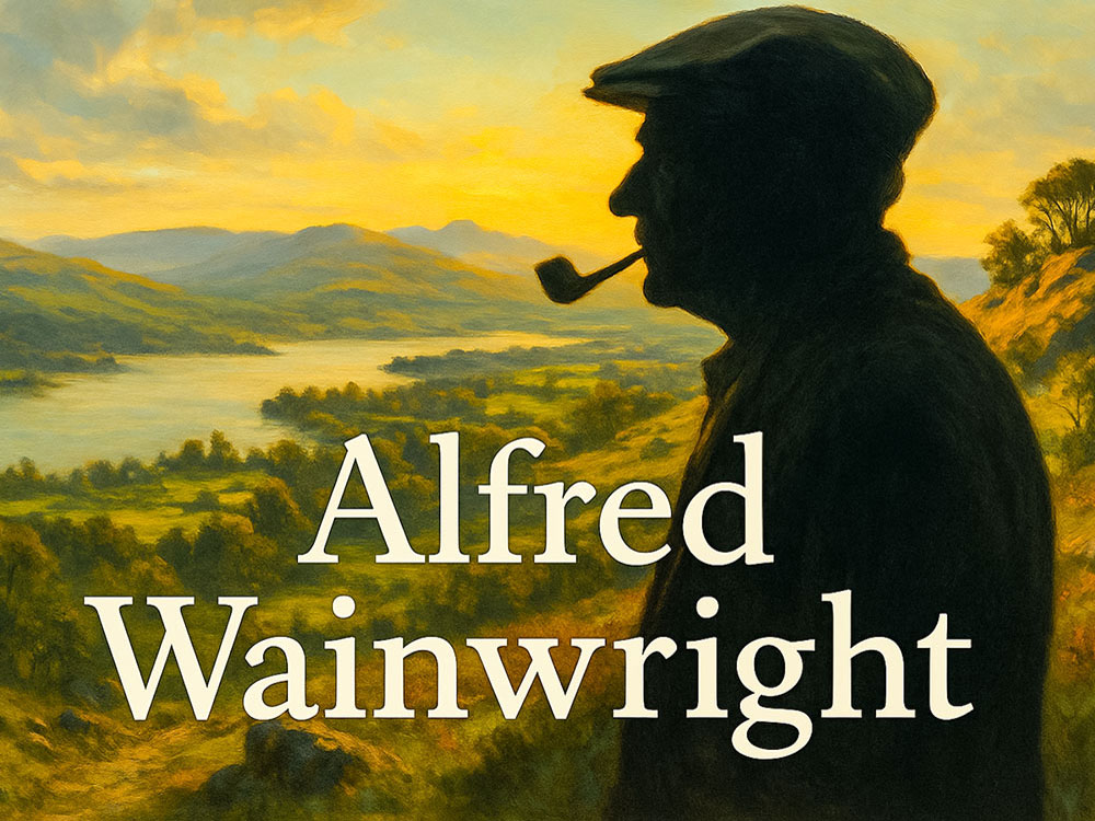
Alfred Wainwright was a renowned British author, illustrator, and fell walker, best known for his comprehensive and meticulously detailed guidebooks on the Lake District in England. Born in Blackburn, Lancashire, he left school at 13 and started working at Blackburn Borough Council as an office boy before studying to be an accountant. In 1941, he moved closer to the Lakeland Fells to Kendal, where he worked at the Borough Treasurer's Office and served as Borough Treasurer from 1948 until his retirement in 1967.
In 1930, Wainwright went on a week's walking holiday with his cousin Eric. They arrived in Windermere and walked up the nearby Orrest Head - that moment when he saw his first view of the Lakeland Fells from the summit of Orrest Head was to change his life forever, as he wrote in his autobiographical book Ex-Fellwalker '... 'It was a moment of magic, a revelation so unexpected that I stood transfixed, unable to believe my eyes. I saw mountain ranges, one after another, the nearer starkly etched, those beyond fading into the blue distance... I had seen landscapes of rural beauty pictured in the local art gallery, but here was no painted canvas; this was real. This was truth. God was in his heaven that day and I a humble worshipper'.
Wainwright's enduring legacy lies in his passion for the outdoors and dedication to documenting the beauty of the natural world. In the 1940s, Wainwright explored the many summits and valleys of the Lakeland Fells, and then in 1952, he began work on the Pictorial Guides to the Lakeland Fells. As we've set out above, these notable works consist of seven hand-written and hand-illustrated volumes that provide walkers with precise and personal insights into the region's diverse landscapes.
His meticulous attention to detail, combined with his artistic talents, made these guides not only practical tools for hikers but also works of art. Each page of his guides is adorned with intricate pen-and-ink drawings, reflecting Wainwright's deep connection to the landscapes he explored.
He wrote more guidebooks, including the Pennine Way Companion and A Coast to Coast Walk, that he devised, along with many others, some later in life, in conjunction with photographer Derry Brabbs. He also crafted a series of beautiful sketchbooks.
His works have inspired countless individuals to explore the British countryside, fostering a love for nature and hiking. His legacy endures through the continued popularity of his guidebooks, the Wainwright Society dedicated to preserving his memory, and his lasting influence on the appreciation of the Lake District and its unique charm. Alfred Wainwright's enduring legacy is a testament to the power of passion, artistry, and the profound connection between individuals and the natural world.
Much has been written about Wainwright; he is often portrayed as reclusive and anti-social. But in reading all his books, you can see he was an emotional and passionate man who cared about the landscape. A book that I found an absorbing read, which showed Wainwright in a more surprising light of being passionate, witty and generous, is 'Wainwright - The Biography' by Hunter Davies. It was produced after having full access to Wainwright's private and revealing letters and unpublished material. In my view, it is certainly worth a read.
|
|
Books one to five of the Pictorial Guide to the Lakeland Fells (The Eastern Fells, The Far Eastern Fells, The Central Fells, The Southern Fells and The Northern Fells) were all published by Henry Marshall from 1955 to 1962. The final two books, The North Western Fells and The Western Fells, were published by the Westmorland Gazette in 1964 and 1966, respectively.
There were many impressions of this first edition, some including minor corrections. I have quite a few of these first editions of the book, but sadly, not any first impressions. I have some second and third impressions, which, even though undated, must have been published before 1958, as this inside cover refers to Book 3 as being in preparation and names Books 4 to 7 to follow - 'all being well', as he puts it!
When I started hill walking, I picked up one of these pictorial guides in a charity shop, which fuelled my interest in walking in the Lake
District. The majority of the books I have, I've bought from charity shops and second-hand bookstores over the years, and these, along with
eBay/ABE books and Amazon marketplace, are probably the best places to find them if you are after some of the First Editions.
After the initial first edition publication of the book and many further reprints/impressions, Michael Joseph acquired the rights to the books before they were again sold to Frances Lincoln in 2003. Following that, Chris Jesty updated the books for the publisher Frances Lincoln for changes to the landscape and boundaries over the years, and all seven books were republished as a second edition between 2005 and 2009. The main visible difference is that footpaths were shown in red.
If you want this second edition, the best places to look are charity shops, second-hand bookstores, eBay/ABE books, and the Amazon marketplace.
All seven books were updated for a third edition by Clive Hutchby between 2015 and 2020 and published by Francis Lincoln. These are the versions we have linked to above when looking at each book.
There have also been a few boxed sets published over the years. One still in print is this one on Amazon:
|
|
At the time of writing, you could pick up the boxed set for around £30 - less than £5 per book! An excellent present for a fellow walker if ever I saw one.
If reading about Alfred Wainwright's guides has given you a yearning to read more walking books, check out our guides to the best Lake District walking books and the best Yorkshire Dales walking books.
A Wainwright is defined as one of the 214 peaks or fells that Alfred Wainwright has included in his seven Pictorial Guides to the Lakeland Fells, which all lie in the Lake District National Park.
Unlike other hill classifications that give set criteria (e.g. Monro's are Scottish Mountains over 3,000 feet), Wainwright included fells and peaks for their interest and relevance to the landscape and chose his favourites.
Alfred Wainwright was a renowned British author, illustrator, and fell walker, best known for his comprehensive and meticulously detailed guidebooks on the Lake District in England. The Seven Book series, A Pictorial Guide to the Lakeland Fells, set out 214 fells in the Lake District. He also wrote many other guidebooks and sketchbooks.
Alfred Wainwright was 84 years old when he died. His ashes were scattered next to Innominate Tarn on Haystacks, a favourite mountain of his. There is a plaque in the window in the church in Buttermere in his memory that looks up towards Haystacks.
Yes, all 214 Wainwrights are in the Lake District
There is no set time for how long it takes. Many people have made it a life achievement and have taken many years to walk all the Wainwrights. Some world-class fell runners have meticulously planned the shortest way to get around them, and the quickest continuous round is now a staggering five days, 12 hours and 14 minutes, set by John Kelly in May 2022.
There are 214 Wainwrights, split between 7 areas of the Lake District, as set out in the seven Pictorial Guides to the Lakeland Fells.
Wainwright bagging is climbing the Wainwrights. 'Bagging' refers to walking or climbing a summit or peak. So, Wainwright bagging is walking or climbing the Wainwright peaks.
There is no set order in which to walk the Wainwrights. Wainwright set out the 214 fells, known as Wainwrights, into seven separate books 'The Pictorial Guide to the Lakeland Fells', and each covered a particular area (The Eastern Fells, The Far Eastern Fells, The Central Fells, The Southern Fells, The Northern Fells, The North Western Fells and The Western Fells).
So, if you are planning to walk them, grab yourself a copy of the books and a set of Lake District maps and off you go. The order that you walk them in is entirely up to you.
There are 214 Wainwrights in the Lakes.
December 2023