By using this website, you agree to our use of cookies (needed to provide our website’s features) and our Terms of Use.
A delightful lakeside walk around one of the Lake District's most Westerly lakes. The walk itself is reasonably straight forward and provides stunning scenery along the way with the surrounding mountains providing a superb backdrop to Buttermere.
In accordance with our Disclaimer, you agree to take full responsibility for any use you make of the information contained in these pages.
This page contains affiliate links. If you buy products or services via these links, we may earn a small commission at no cost to you.
| Walk title: | Buttermere Lake walk from Buttermere |
| Author: | Andrew Forrest - December 2022 |
| Walk start point: | In front of Buttermere Court Hotel (grid reference NY 174 169). What3words: stub.cried.pink |
| Parking: | Pay and display car park to the side of Buttermere Court Hotel |
| Directions to nearest parking place: | Google Maps: get directions here / What3words: version.squish.spectacle |
| Walk distance: | 7.2 km |
| Estimated walk time: | 1 hour 50 minutes |
| Height climbed: | 90 metres |
| Technical difficulty: | Easy - as determined by our interpretation of the Ordnance Survey guidance on technical difficulties |
| Peaks / summits: | None |
| Map: | Ordnance Survey - Explorer OL4 (The English Lakes - North-western Area) Buy this map from Ordnance Survey |
| GPS/GPX file: | Download available to registered users - Register and Login here - It's FREE to register |
| Facilities / refreshments: | Syke Farm Tea Room, Bridge Hotel, Croft House Farm Café and Buttermere Court Hotel all in Butteremere |
| Nearest town: | Walk starts in Buttermere |
| Local self-catering accommodation: | View self-catering accommodation close to the start of this walk |
| Local hotels, inns and B&Bs: | View hotels and inns close to the start of this walk from The Inn Collection Group |
Estimated walk time
Walk time estimates used are from the Ordnance Survey mapping app, which uses a refined Naismith's rule, adjusted by OS overlaying their own data collected from more than one million people using the OS mapping app. Naismith's rule allowed one hour for every three miles walked and added pro-rata an additional hour for every 2000ft of ascent - roughly one hour for every 5km, plus one hour for every 600m of ascent.
Ordnance Survey Mapping App
Use on any device and make it easy to explore the great outdoors for just the price of a coffee a month. Premium allows full UK access to all OS Explorer and Landranger mapping, along with the ability to import and export routes, save maps offline, aerial 3D, and print A3/A4 maps.
This Buttermere Lake circular walk from Buttermere in the Lake District takes approximately one hour and fifty minutes. This Buttermere walk must be one of the best lake walks in the Lake District National Park, if not in the UK. The views are stunning from the very start, and the mainly flat paths make it accessible for most.
We initially head down to Buttermere's north shoreline to reveal a wonderful view of the full length of the lake down to Fleetwith Pike. Then, on to the close by Sourmilk Gill before heading down the west shore of Buttermere, which also affords delightful views back across to the mountains rising from the eastern shore of Buttermere.
As we round the southern shore, it provides views up to Haystacks and Fleetwith Pike. The return leg, up the eastern side of Buttermere, is a little rougher underfoot in places and more undulating, but still provides magnificent views back across to Fleetwith Pike and Haystacks and then round to High Crag, High Stile and Red Pike, all rising from the western shore.
This full Buttermere Lake walk is shown in the video and the route for the walk is shown on the Ordnance Survey map - both above. Below is a brief description of the walk. Places where you can eat and drink after the walk are shown at the end of the video.
We are starting today's walk from the Buttermere Court Hotel (previously The Fish Inn). There is a pay and display car park down to the right of the Buttermere Court Hotel and also a National Trust car park at Buttermere, with further parking available halfway around the walk at Gatesgarth.
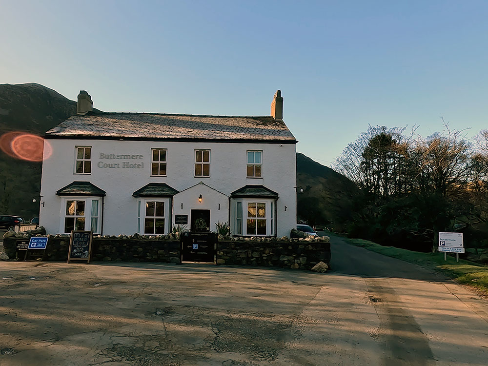
Buttermere Court Hotel
If you are eating and drinking at the pubs, they also have additional parking which you may be able to use, but best checking with them first.
There are not really a lot of detailed directions needed today, as the main path just circles the lake.
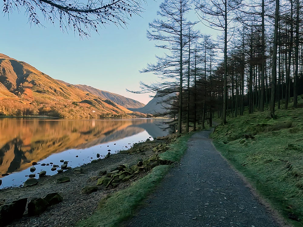
We initially head down the left-hand side of the Buttermere Court Hotel, pass through the kissing gate, and then head along the gravel track.
Over to the left, you can see the mountains encircling Buttermere Lake. Keep on the gravel track as it bends around to the left and then at a footpath sign, follow the Buttermere quarter of a mile sign to follow the gravel track through a gate.
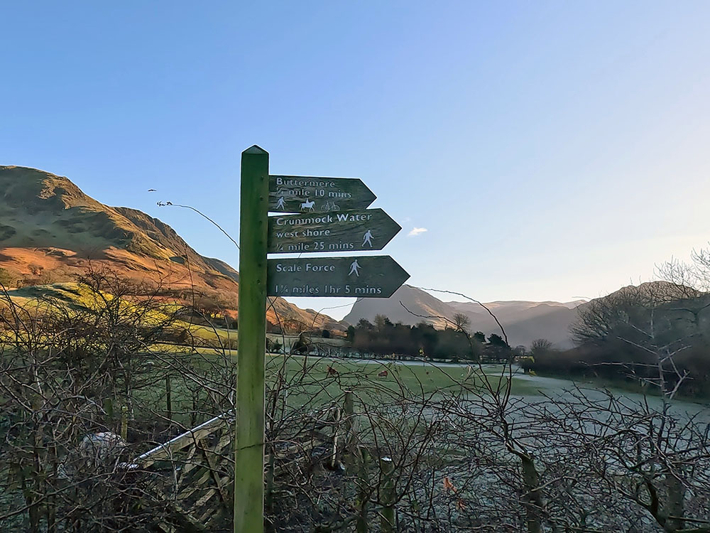
Footpath sign to Buttermere Lake
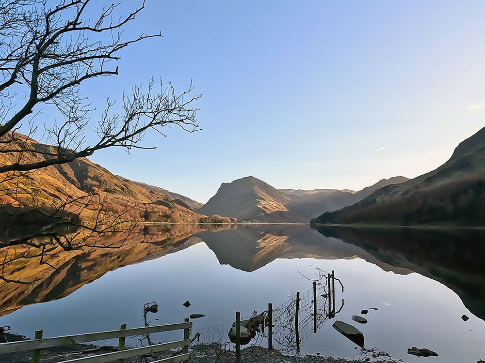
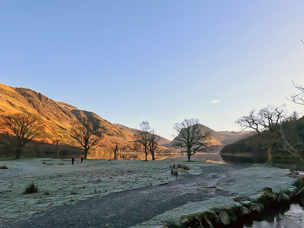
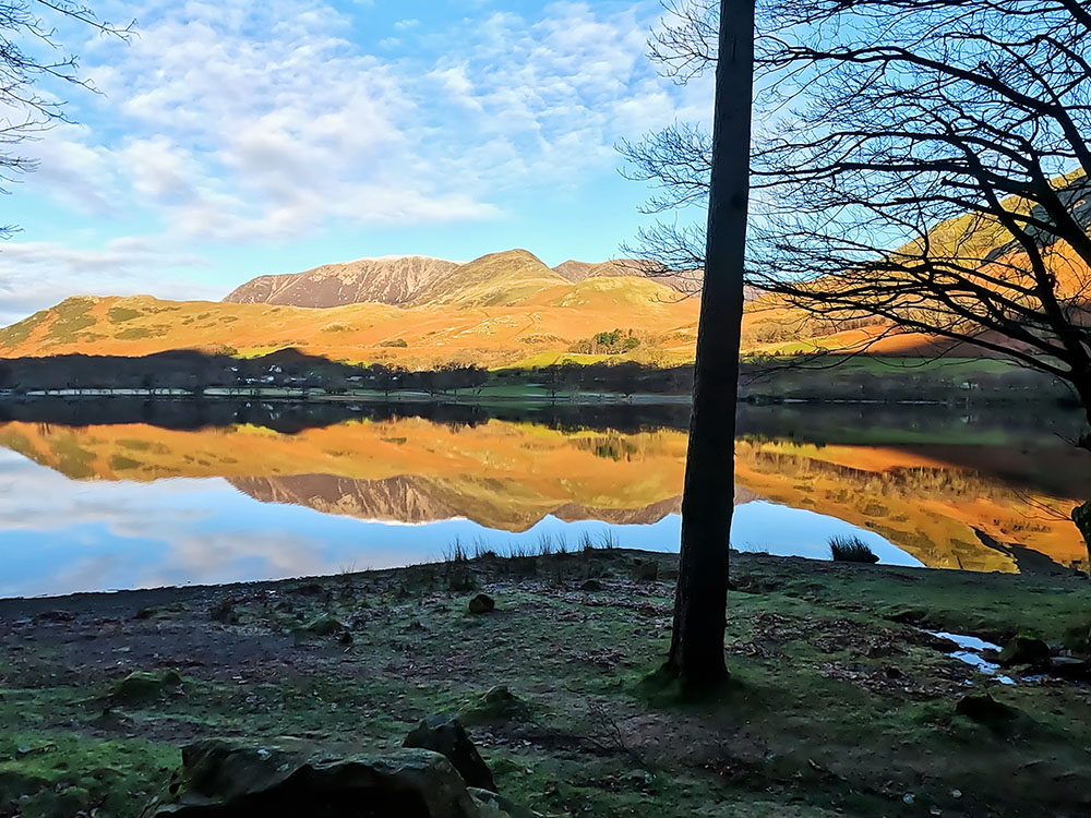
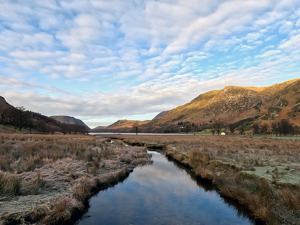
Keep on that track and then pass through the next gate by the National Trust Buttermere sign to head straight on to soon arrive at the north shore of Buttermere. On still days, the lake surface creates fantastic reflections, here looking down the lake to Fleetwith Pike and Haystacks to the right.

Looking down Buttermere Lake towards Fleetwith Pike
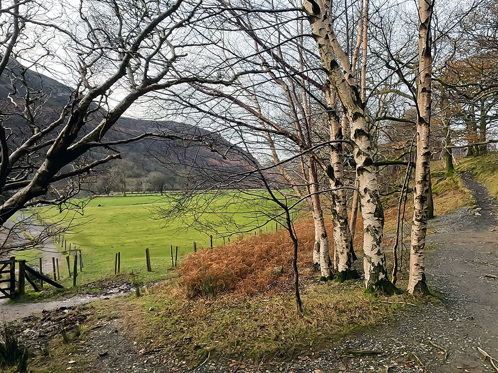
This walk is one you can do over and over again as the views through the trees, with and without leaves and at the different times of day and throughout the seasons, vary greatly.
Head along the shoreline and then around to the right and over the wooden bridge.
Buttermere Lake from the bridge
Keep walking straight on and then for a very short detour, head around to the right and through the gate to head a few yards up to have a look at the bottom of Sourmilk Gill from the wooden bridge.
The water coming down Sourmilk Gill is the outflow from Bleaberry Tarn about a kilometre up the hill. Looking around away from Buttermere here you can see Mellbreak, which is on the western side of Crummock water.
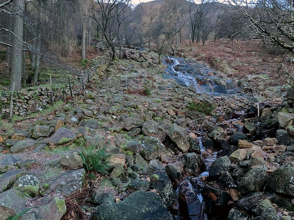
Sourmilk Gill
Mellbreak and Grasmoor from the bridge
If you took this short detour, head back down to and pass through the wooden gate and then on to re-join the main path. Turn right along it and head over the nearby wooden bridge to then pass through the next gate.
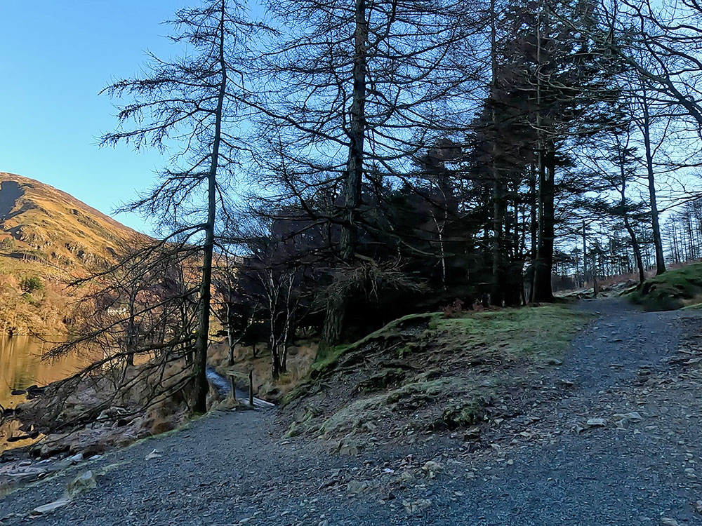
The path up into the trees on the right heads up to Bleaberry Tarn and then to Red Pike. We will ignore that and just continue on along the lakeside's mainly flat gravelled path.
Keep stopping from time to time to take in the ever-changing vista. A photographer's dream on a day like this with the reflections in the water you can see across the High Snockrigg and then around in the direction of Grasmoor and Rannerdale Knotts.

Buttermere lakeside path
Looking across to the Eastern shore of Buttermere Lake
Buttermere, the lake, is one and a quarter miles long, a quarter of a mile wide at its widest and 75 feet deep. There are two trains of thought on its name derivation, the first is that Buttermere comes from old English and literally means the lake by the dairy pastures.
The second is that it dates back to an 11th-century Norse chief called Buthar. Many Lake District land features do actually derive their names from Norse words from when the Vikings settled here in the ninth century.
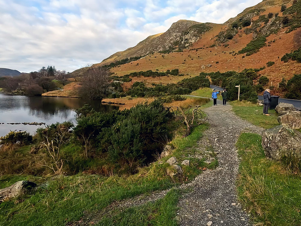
Keep walking along the lakeside path and after about a kilometre, the path splits. You can take either path, but the lakeside one, although a little rougher, affords better views. They re-join each other in a short while.
Where the path splits
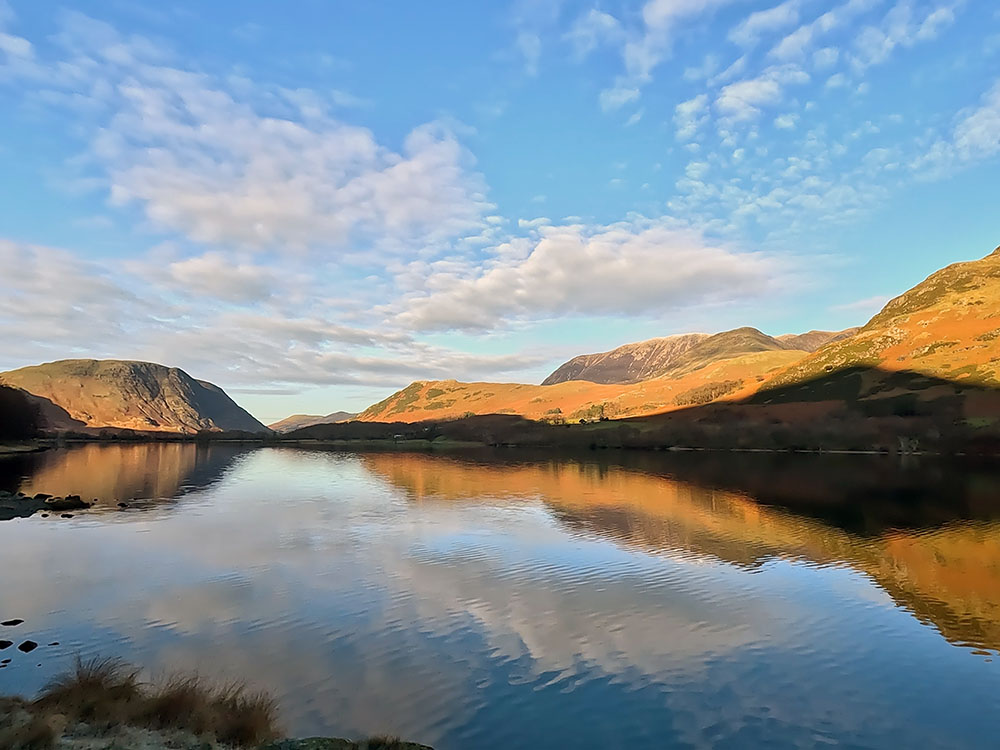
This lakeside path presents a more open panorama down to Fleetwith Pike and all the way around to Mellbreak on the western side of the water.

Looking back down Buttermere Lake towards Mellbreak and Grasmoor
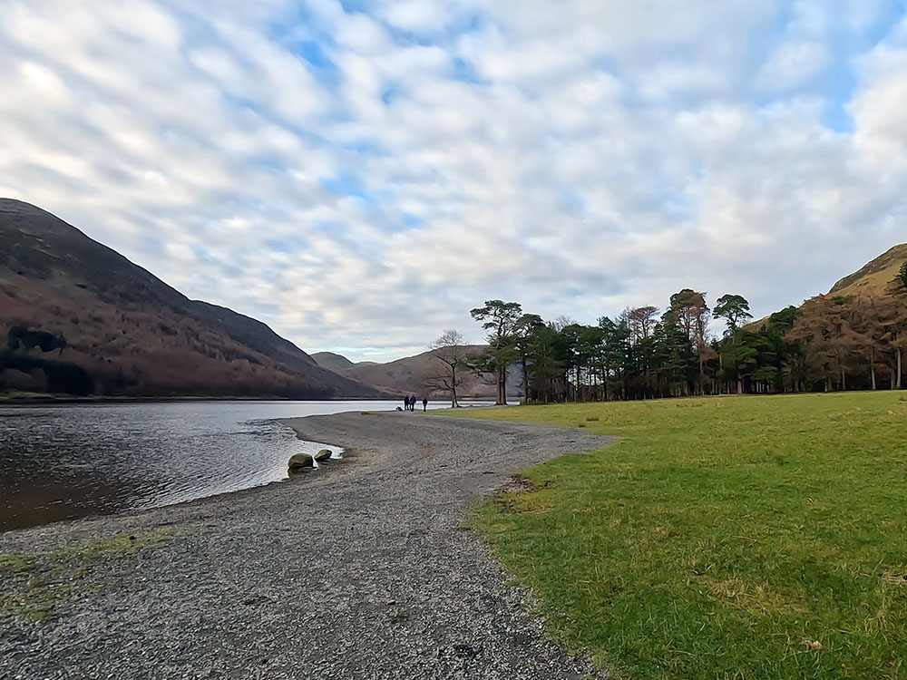
Continuing on, the alternative path joins us from the right. On exiting the trees of Bertness Wood, pass through the wooden gate and then continue along the gravel path.
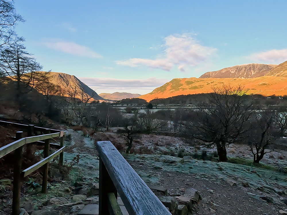
Out of the trees, the panorama is a 360-degree one. Up to the right, you can see High Crag over Comb Beck waterfall and then around to High Stile. You can see down the length of Buttermere towards Grasmoor, then towards Robinson and finally Fleetwith Pike and Haystacks.
On the next wooden footbridge, you get a better view of Comb Beck flanked by High Crag and High Stile. Continue on along the path. Ahead with the ridge running up the front of it is Fleetwith Pike and around to the right of that is Haystacks.
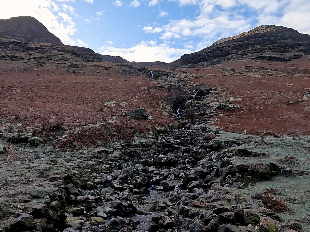
High Crag, Comb Beck and High Stile
Looking towards Fleetwith Pike and Haystacks
Haystacks with its all-around stunning views was a favourite of Alfred Wainwright and his ashes are scattered up there on the top by Innominate Tarn.
Alfred Wainwright, born in Blackburn, was a fell walker and meticulously wrote and illustrated seven pictorial guides to the Lakeland Fells, which were probably responsible for the much-increased tourism and popularity of the Lake District, which in a way is a little ironic, as Wainwright himself is mainly known as being reclusive, enjoyed his own time and space and was said to be a little antisocial.
That said, his books do show him more as a man who passionately cared for the landscape. Various editions of the Pictorial Guide are said to have sold over 2 million copies and have long been a favourite of mine. If you want to buy a set, click here.
As you head down towards a wooden kissing gate, over to the left here, you can see the wooden bridge, we will shortly be walking over, with Littledale Edge behind it as it heads up onto Robinson. Pass through the wooden kissing gate and then head along the stony track.
From this wooden bridge, named Peggy's Bridge on the map, you can see back down the length of Buttermere. Over to the right, Herdwick sheep are often grazing in the field.
The view down Buttermere Lake from Peggy's Bridge
The Herdwick are extremely hardy and are native to the Lake District. The name Herdwick is derived from the Old Norse Herdvyck, meaning sheep pasture and is believed to date in this area from the 12th century.
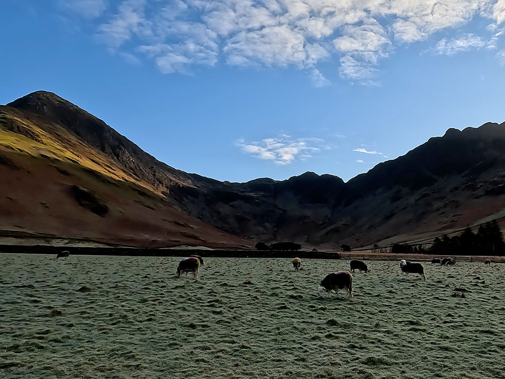
Herdwick Sheep
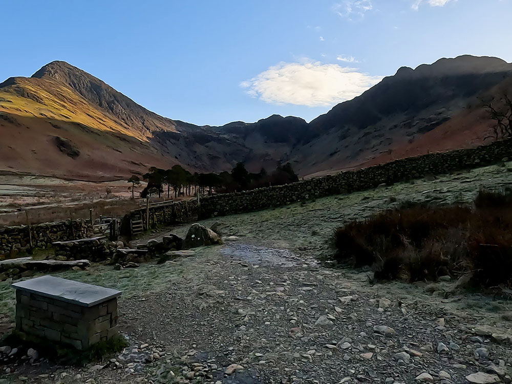
Continue on towards Gatesgarth Farm. Pass through the wooden gate and along a fenced footpath to pass out through a further wooden gate.
Here, there is another pay and display car park. So if the parking in Buttermere is busy, which it can be in the summer months and at weekends, you can start the walk from here.

The car park at Gatesgarth Farm
Turn left now onto the road and then walk along the road for about 500 metres, taking care walking along the road.
As the road starts to bend around to the left, leave the road on the gravel footpath and follow the Buttermere Village one-and-a-half-mile sign.
Where the path leaves the road to rejoin the lake
The footpath on this side of the lake whilst still quite good and easy to follow isn't as flat as the footpath on the far side and gets more uneven as we get nearer to Buttermere.
Pass through the wooden gate. As the path pulls him beside the shoreline, ahead on the other side is Comb Beck again, flanked on the left by High Crag with High Stile to the right, and then as we swing around to the left is Haystacks and then around to Fleetwith Pike.
Lakeside path
Continue along the lakeside path and pass through a metal gate. Head on to and pass through the next wooden gate and then continue on as the path starts to get a little rougher underfoot. Pass through the next gate. Pass through the short tunnel cut into the rock, which allows an easier onward passage.
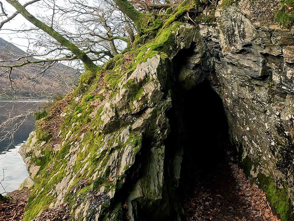
Tunnel through the rock
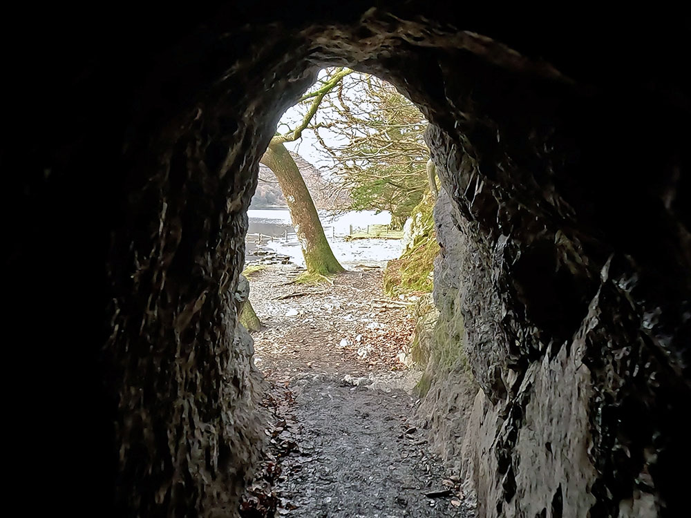
Light at the end of the tunnel
Pass through the wooden kissing gate and then on to pass through another kissing gate.
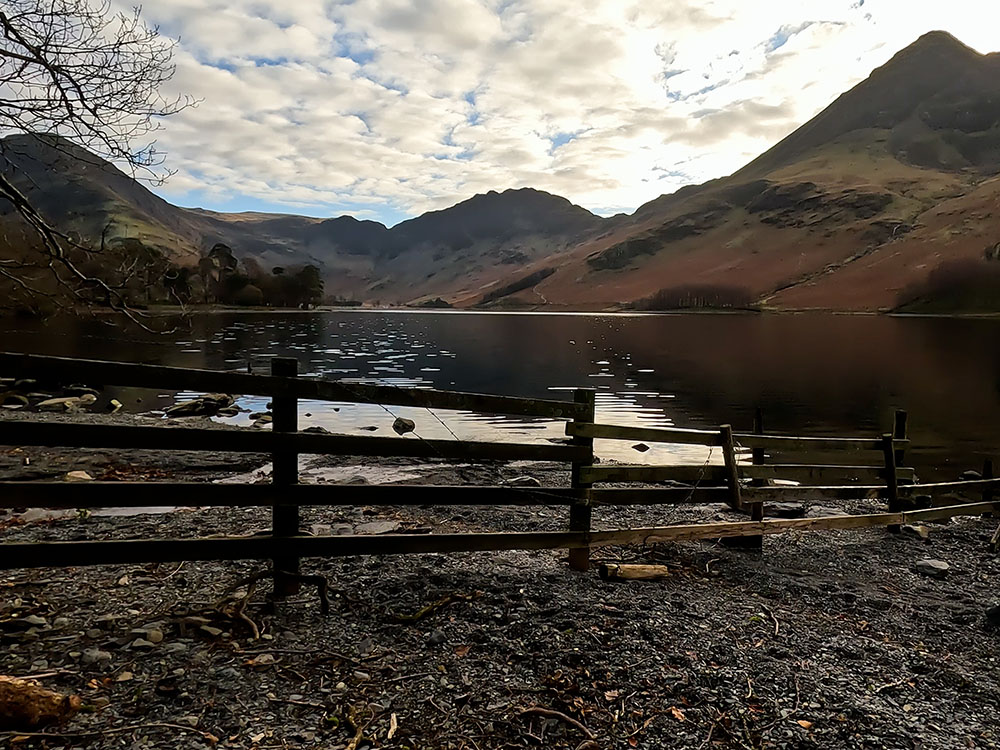
Looking down Buttermere Lake
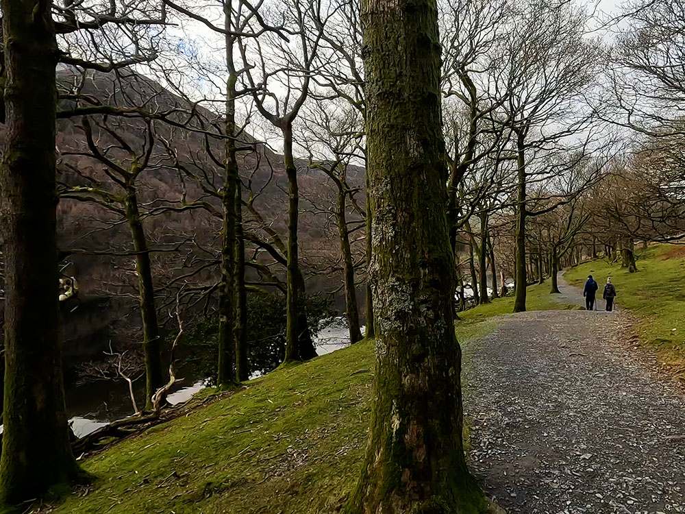
Buttermere lakeside path on eastern shoreline
Pass through the next wooden gate, then continue on to pass over a wooden footbridge. Pass through the next wooden gate. Just through this gate, you could if you wanted to take the left-hand path to head along the northern shore of the lake and in about 400 metres meet up with the outward path, where we first arrived at the lake. You can then reverse that part of the outward route.
Choice of paths
We are just going to go straight on here. Pass through the wooden kissing gate and then on over the stone flags by the side of the wall, following the path around to the left and then up to the right alongside the fence to pass through the next wooden gate. Continue on along by the side of the fence and then pass through the wooden gate and turn left along the path across the field.
On reaching the farmyard, pass through the two wooden gates then on along the track and the little bit of road to quickly reach Syke Farm Tea Room. As we are almost back to the start, this is the first of the places you can eat and drink after the walk. Syke Farm Tea Room is also dog friendly.
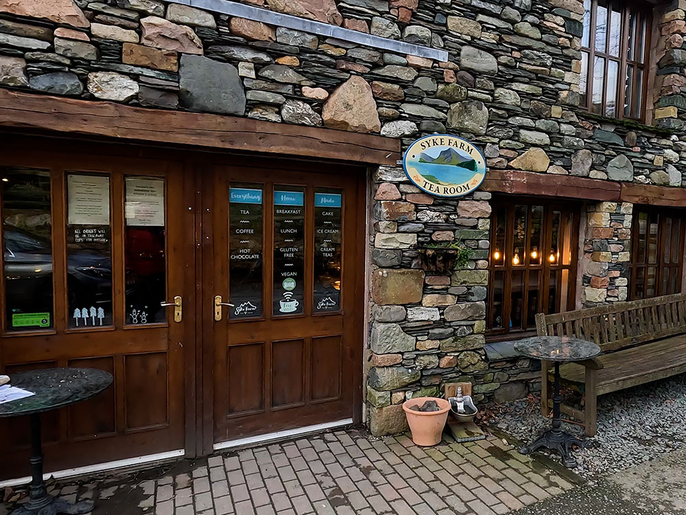
Syke Farm Tea Room
On meeting the road, just before we head back left, you can make a short detour up to the right to visit the Church of St James, which houses a memorial to Wainwright.
At the entrance, there is a wrought iron shepherd's gate. And then on the window ledge inside on the right is a stone plaque commemorating Wainwright with a view through the window, back up to Haystacks.
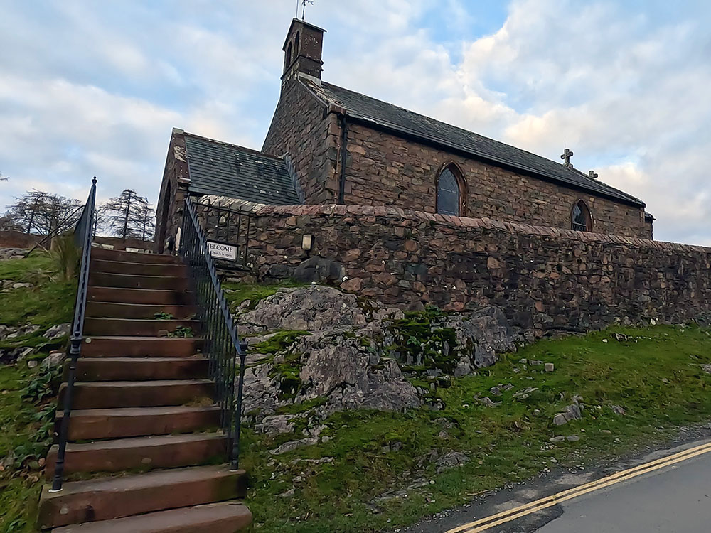
St James' Church in Buttermere
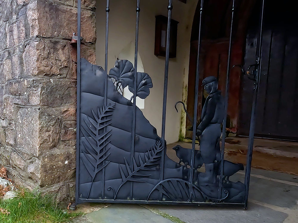
Shepherd Gate on the church
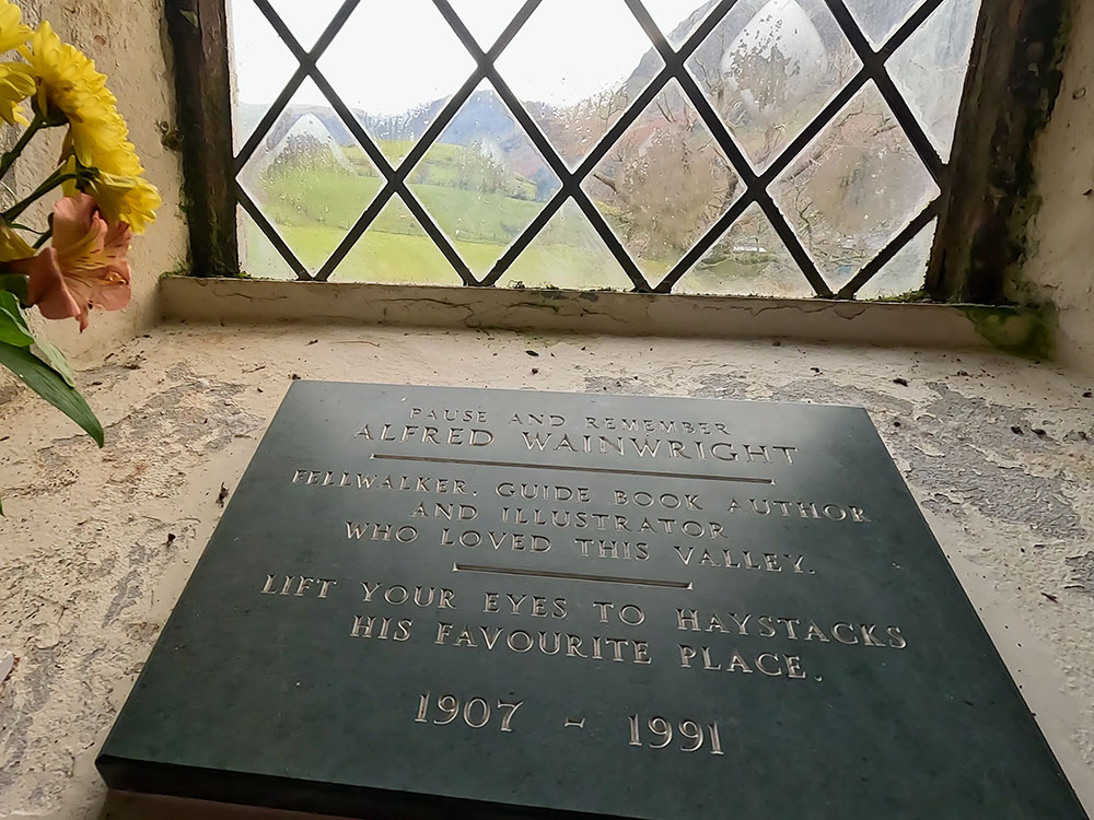
Wainwright's stone plaque looking towards Haystacks
Back outside the church, head back down the road. Over to the left, you can see the tearoom we just passed, with the additional outside seating. Follow the road past this and ahead you'll reach the Bridge Hotel.
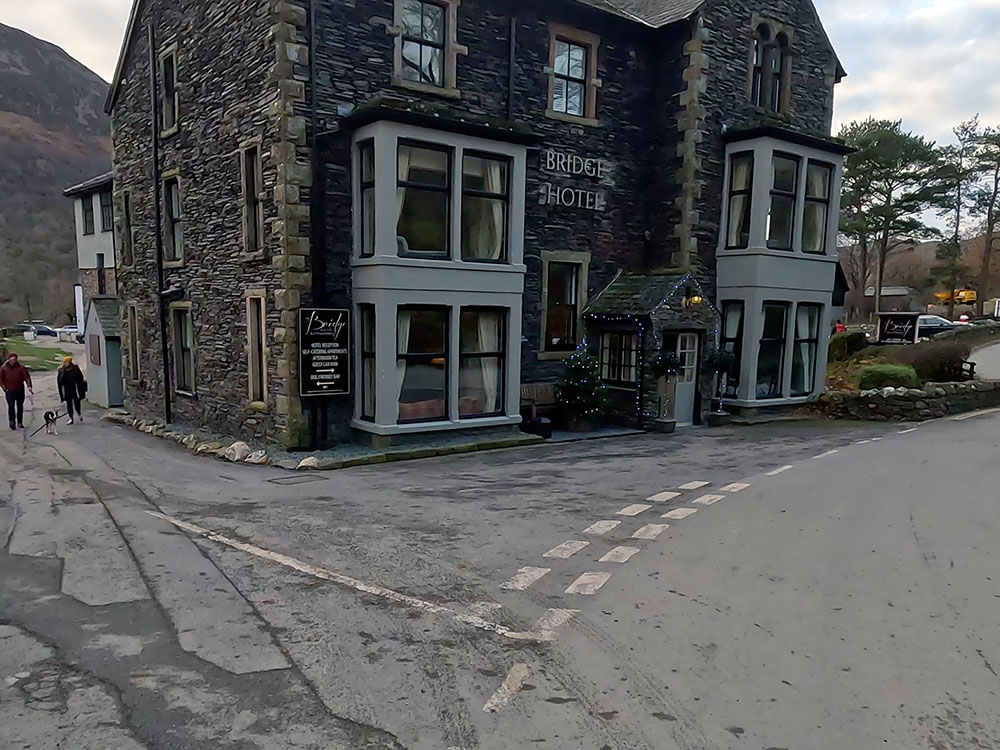
Bridge Hotel
Walkers Bar sign on Bridge Hotel
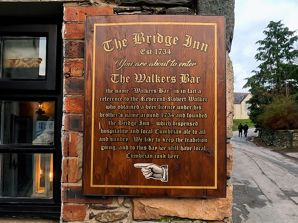
The Bridge Hotel has accommodation, serves food and drink and is also dog friendly. Around the back of it is the Walkers Bar, not named after fellow walkers, but after Reverend Robert Walker, who obtained a beer licence in around 1734 and founded the Bridge Inn. Also around the back is a beer garden.
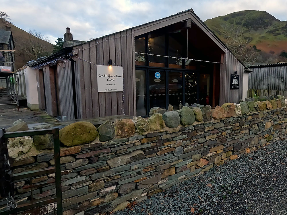
If you head down the left-hand side of the Bridge Hotel, just across from that is the Croft House Farm Cafe. It serves food, cakes and drinks and is dog friendly in the extension around the back.
Across from the Croft House Farm Cafe, we arrive back at the start at the Buttermere Court Hotel. The bar entrance is down the side and again it serves food, drink and is dog friendly. If the weather allows, there is also a spacious beer garden around the back with wonderful views.
Croft House Farm Cafe
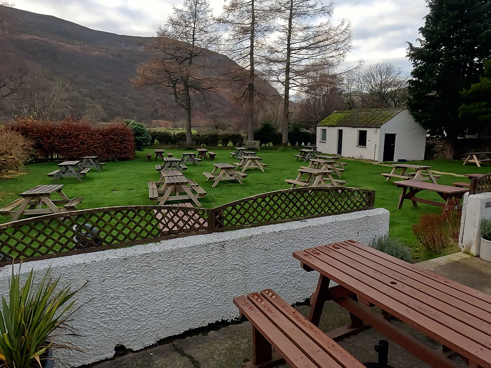
Beer garden at the bar in the Buttermere Court Hotel
Gifts and presents for hikers and walkers
Are you struggling to pick the perfect gift for your hiking-loving friend or family member? Don't fret! Explore our curated selection of top-notch gifts for walkers and hikers that will have them trekking with joy on their special day.
What to wear and take on your walk or hike
Whether you are a seasoned hiker or new to walking, wearing and taking suitable hiking kit and clothing is essential for a day hike for your comfort and safety. So we have put together a hiking essentials checklist to cover all you'll need. Our Hiking Essentials checklist for 2026 takes you through planning your walk, the hiking essentials checklist itself, optional extras, explanations, and recommendations for all the hiking essentials.
Check out the reviews for this walk: