By using this website, you agree to our use of cookies (needed to provide our website’s features) and our Terms of Use.


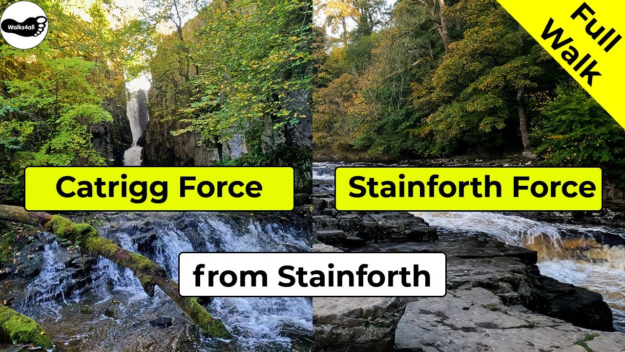
Two of the most picturesque waterfalls in the Yorkshire Dales - Catrigg Force, set in a secluded woody copse and Stainforth Force, a series of small cascades and one larger drop.
In accordance with our Disclaimer, you agree to take full responsibility for any use you make of the information contained in these pages.
This page contains affiliate links. If you buy products or services via these links, we may earn a small commission at no cost to you.
| Walk title: | Catrigg Force and Stainforth Force walk from Stainforth |
| Author: | Andrew Forrest - December 2022 |
| Walk start point: | Car park in Stainforth (grid reference SD 820 672) What3words: crisps.importers.reward |
| Parking: | As above |
| Directions to nearest parking place: | Google Maps: get directions here / What3words: treatable.vans.speaks |
| Walk distance: | 7.4 km |
| Estimated walk time: | 2 hours 10 minutes |
| Height climbed: | 264 metres |
| Technical difficulty: | Moderate - as determined by our interpretation of the Ordnance Survey guidance on technical difficulties |
| Peaks / summits: | None |
| Map: | Ordnance Survey - Explorer OL2 (Yorkshire Dales - Southern & Western Area) Buy this map from Ordnance Survey |
| GPS/GPX file: | Download available to registered users - Register and Login here - It's FREE to register |
| Facilities / refreshments: | Craven Heifer in Stainforth, Knight's Table café and restaurant in Little Stainforth, Helwith Bridge Inn and many pubs, restaurants and cafés in nearby Settle - check out the walk video for further details |
| Nearest town: | Walk starts in Stainforth, nearest larger town is Settle |
| Local self-catering accommodation: | View self-catering accommodation close to the start of this walk |
Estimated walk time
Walk time estimates used are from the Ordnance Survey mapping app, which uses a refined Naismith's rule, adjusted by OS overlaying their own data collected from more than one million people using the OS mapping app. Naismith's rule allowed one hour for every three miles walked and added pro-rata an additional hour for every 2000ft of ascent - roughly one hour for every 5km, plus one hour for every 600m of ascent.
Ordnance Survey Mapping App
Use on any device and make it easy to explore the great outdoors for just the price of a coffee a month. Premium allows full UK access to all OS Explorer and Landranger mapping, along with the ability to import and export routes, save maps offline, aerial 3D, and print A3/A4 maps.
This circular walk to Catrigg Force (waterfall) and Stainforth Force (waterfall) from Stainforth, a village in the Yorkshire Dales takes approximately 2 hours 15 minutes. The walk climbs out of Stainforth to visit the fairytale-esque waterfall of Catrigg Force, set in a wooded gorge. The height gained affords wonderful panoramic views of Pen-y-ghent and Ingleborough. Walled lanes take us on to a pleasant riverside walk before arriving at the impressive Stainforth Force waterfall, before heading over the 17th-century packhorse bridge back into Stainforth.
This full Catrigg Force and Stainforth Force circular walk from Stainforth is shown in the video and the route for the walk is shown on the Ordnance Survey map - both above. Below is a brief description of the walk.
The walk starts in the pay and display car park in Stainforth. There are a couple of signs on the toilet block in the car park in Stainforth. One shows the car park charges and the other gives you some information on Stainforth itself.
From the car park, head away from the toilets, pass through the entrance and turn right along the road. As the road bends around to the right here, turn left following the Halton Gill and Arncliffe sign.
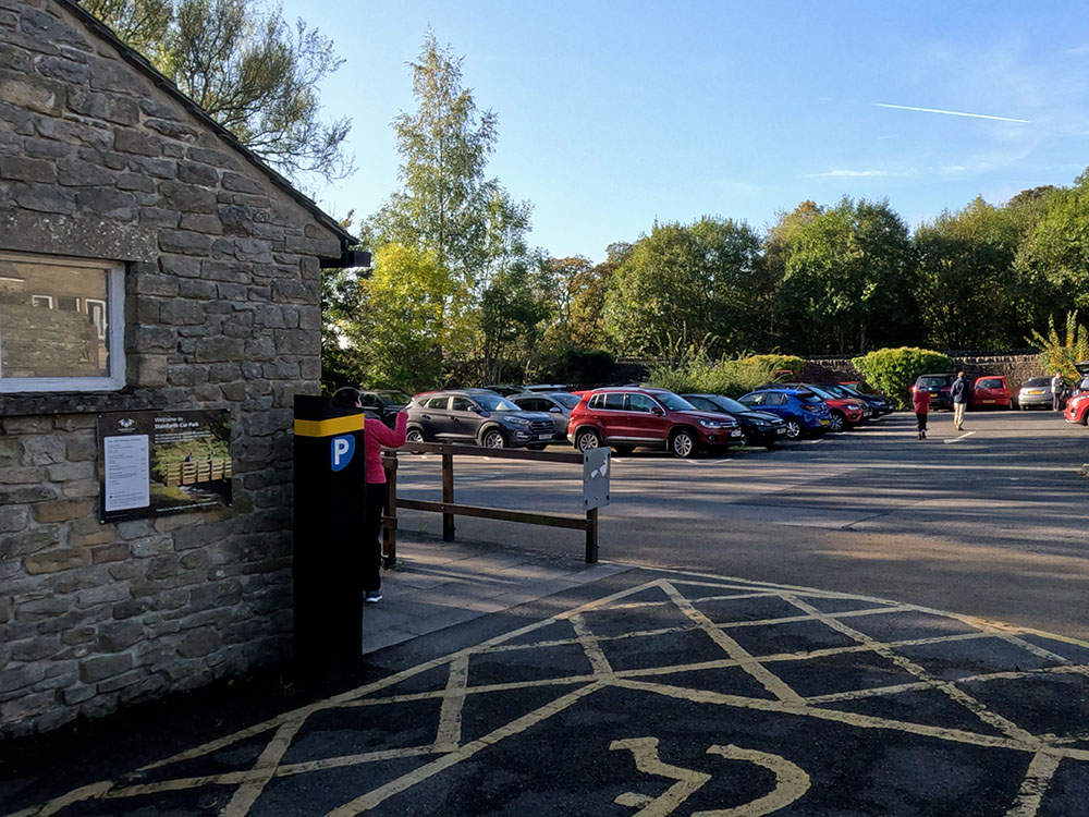
Car Park in Stainforth
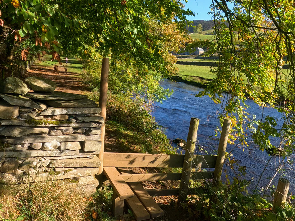
Shortly on the right-hand side, you'll reach a grass space. Here take the path down the right-hand side of the grass by the wall, where stepping stones across Stainforth Beck are revealed. Head across the stepping stones.
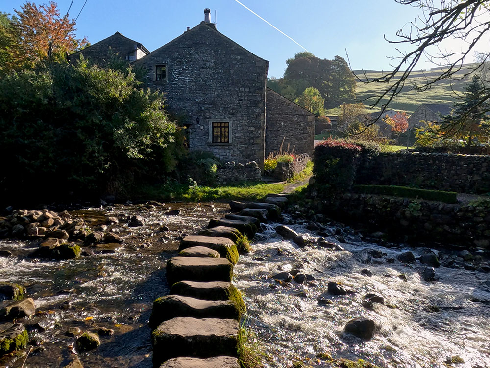
Stepping Stones in Stainforth
If the stepping stones are icy, very wet, or you just don't fancy crossing them, you can avoid them. Where we just turned left along the road, if you turn right and then first left you end up back at this same point.
Head straight on now up the hill, which is Goat Scar Lane. It's a tarmac lane to start with and then quickly becomes cobbled and a little rougher underfoot.
Looking behind, you can see Smearsett Scar on the horizon in the direction of the lane.
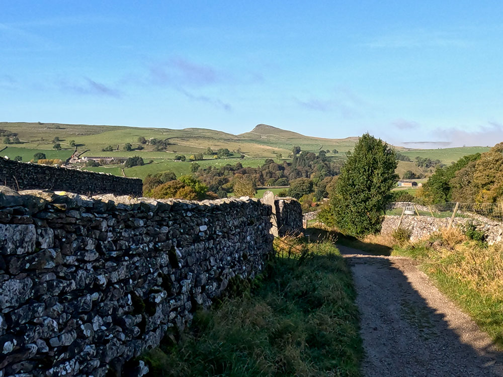
Looking back down the walled lane to Smearsett Scar
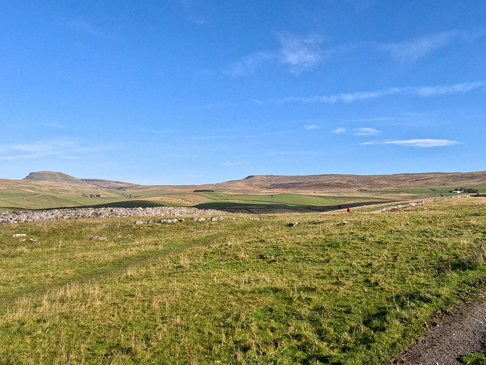
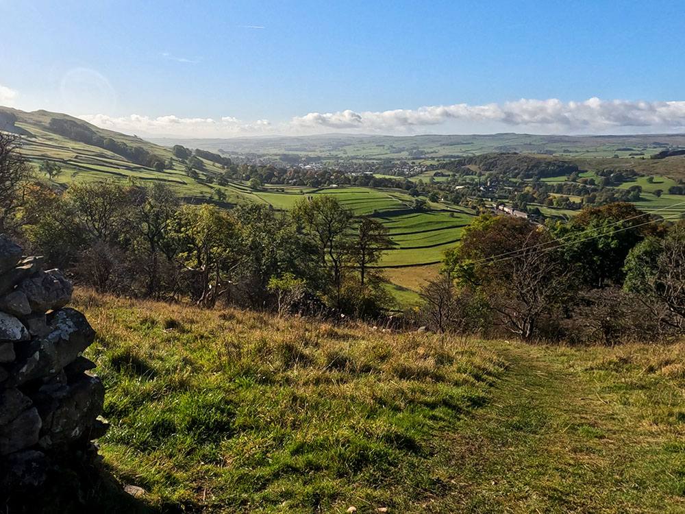
Keep climbing up this walled track, stopping from time to time to admire the ever-expanding vista behind. Across over to the left, you can see Fountains Fell appearing along with Pen-y-ghent and along the lane to Smearsett Scar on the horizon.
If you stop again a little further up Pen-y-ghent is becoming a little more obvious now. This is one of the Yorkshire Three Peaks.
Further around to the left Ingleborough, another one of the Yorkshire Three Peaks, comes into view. We'll be doing a separate video walk, taking in the whole of the Three Peaks route, which is over 24 miles long and includes almost 1500 meters of climbing.
At the end of the lane, we reach a wooden gate that we will pass through once we have visited Catrigg Force. Before following the signpost that indicates the way down to Catrigg Force, take time to look around again, you see Fountains Fell and Pen-y-ghent a bit clearer now.
Ingleborough from the walled lane
Pen-y-ghent and Fountains Fell from the walled lane
Then around to Ingleborough with its flat top in the distance, then Smearsett Scar is a little bit hidden by the tree.
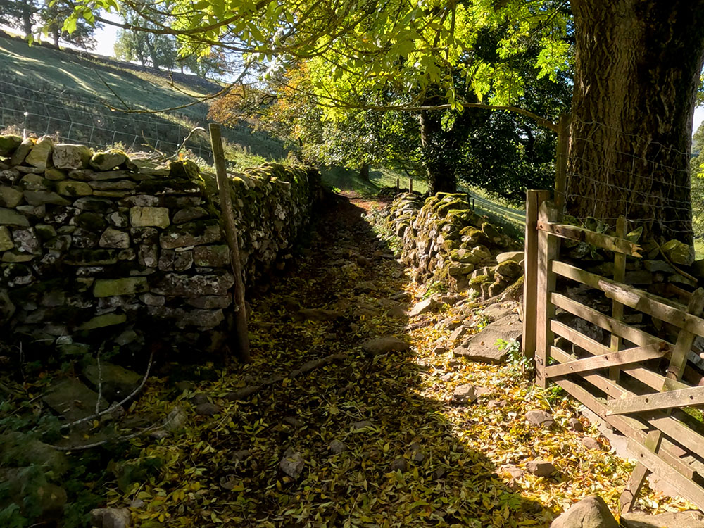
Pass through the gate and head down the side of the wall.
After a short distance the path splits. We will take the left path shortly to have a look down to the bottom of the force, but for now just head straight on so we can look at the top.
Take great care around the top of the force because it's unfenced and is a sheer drop.
Top of Catrigg Force
Turn around now and head back along the path, this time taking the right-hand fork and pass through the gate. Head along this path and turn right down some steps towards the waterfall.
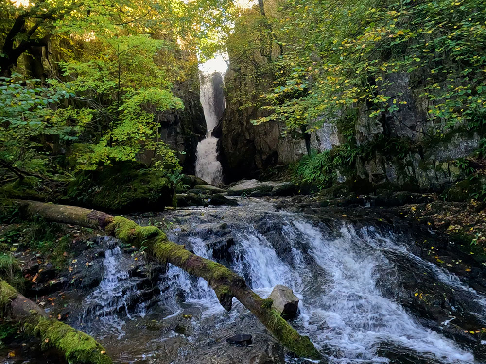
Catrigg Force
This hidden gem of a waterfall is set in its own wooded amphitheatre and almost feels enchanted like it should belong in a brothers Grimm fairy tale. It was said to be a favourite place to visit of composer Edward Elgar, of Land of Hope and Glory fame, which is played each year at the Last Night of the Proms... amongst other performances.
After admiring the falls and taking all your photos, turn around now to head back up the steps and then turn left to head back along to the gate.
Pass back through the gate and head up by the side of the wall.
Head back through the gate and then immediately left through the larger wood gate to start heading up the track. Cross the field and pass through the next gate.
Then after a few yards, turn right off the gravel track to head across the field.
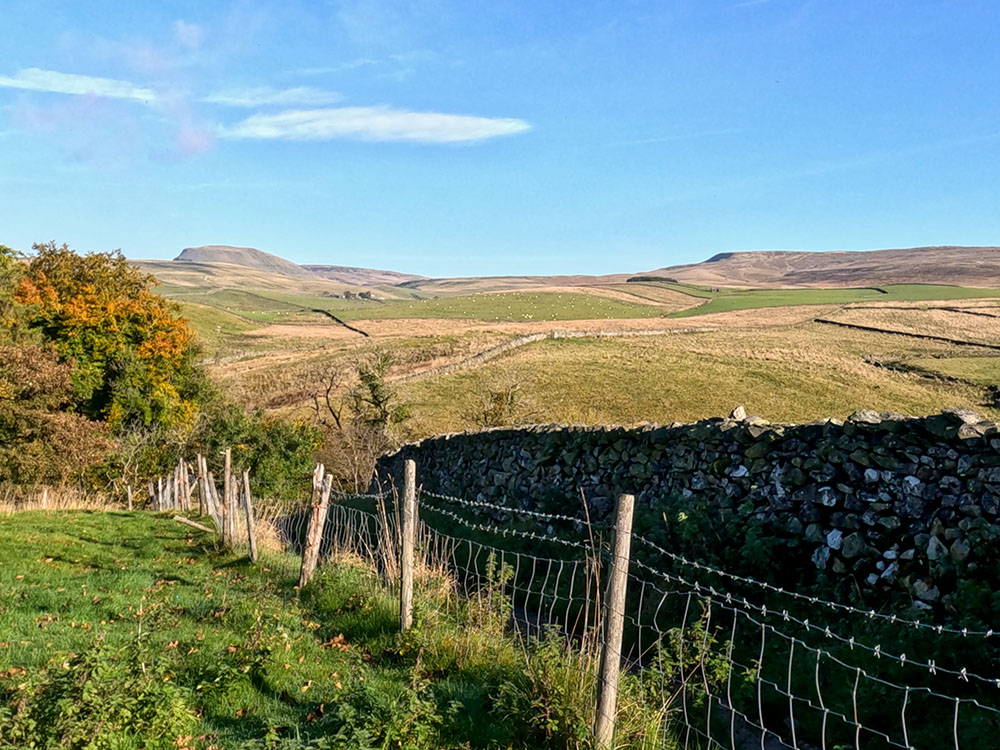
This is the highest point of today's walk at about 330 metres high and affords fantastic views all around, from Smearsett Scar and the flat-topped Ingleborough and then around to Pen-y-ghent and to the right of that Fountains Fell.
Smearsett Scar and Ingleborough
Looking back towards Pen-y-ghent and Fountains Fell
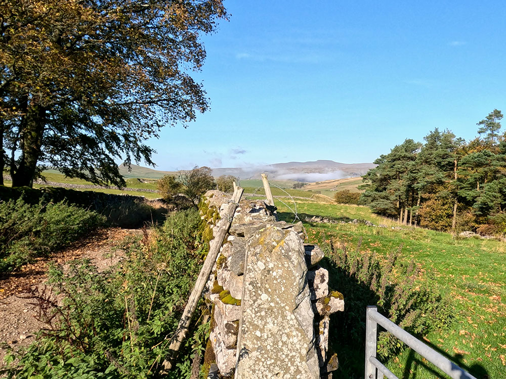
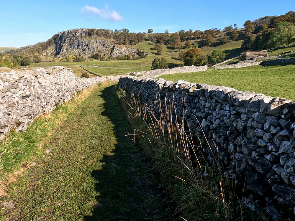
Keep on now along this track as it pulls in between two walls, passes through a gate and continues along the left-hand side of a wall to reach a signpost at Upper Winskill.
Here we go straight on following the footpath to Langcliffe and Stainforth sign that heads across initially over the cattle grid and then down the walled lane.
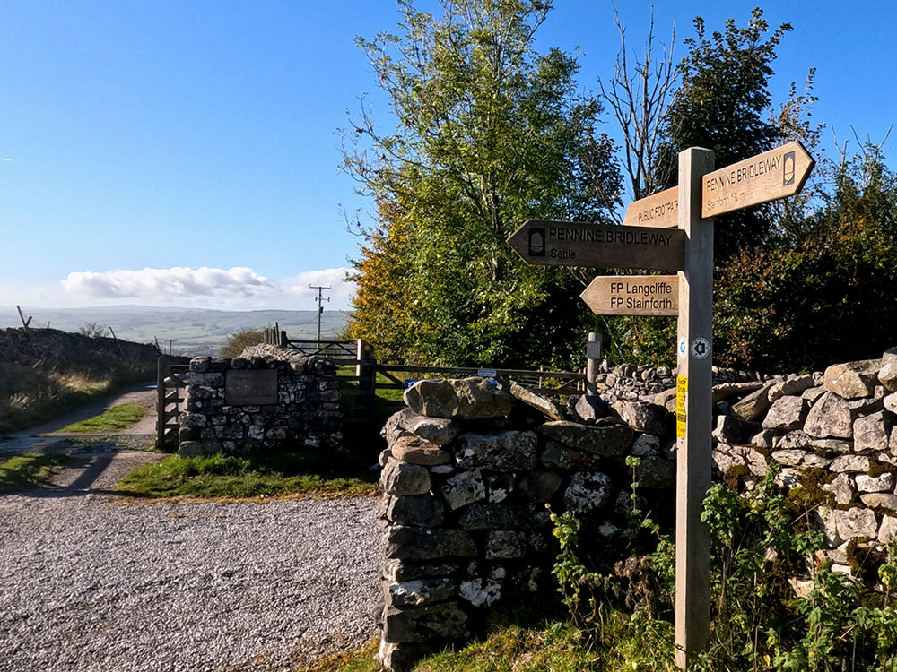
Footpath sign near Upper Winskill
The wall bends around to the right and then after a few more yards, there's a footpath sign for Langcliffe and a wall stile on your left. Head over the stile and head directly away from the wall across the field.
Pass through this next gate and turn right to head down the side of the wall.
Just before we leave the wall and head down, ahead now you can see Langcliffe and the fields and tracks that we walk across for about the next kilometre before we reach the River Ribble.
Looking down towards the walled lane and Langcliffe
Head down the grassy path and through the gate in the wall.
Head away from the gate. The walled track that we are shortly about to follow can be clearly seen in the distance now straight ahead. Before that though, follow the path down and around to the left.
Pass through the gap in the wall and continue along the path which keeps by the side of the wall.
The gap in the wall
Looking back now, you can see around to Stainforth Scar. Head down to and pass through this next gate and head along the walled track.
Stainforth Scar from the walled lane
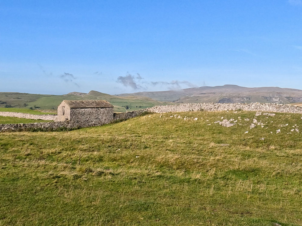
After about 600m, as you approach a small building, there's a footpath sign on the left and a gate on the right.
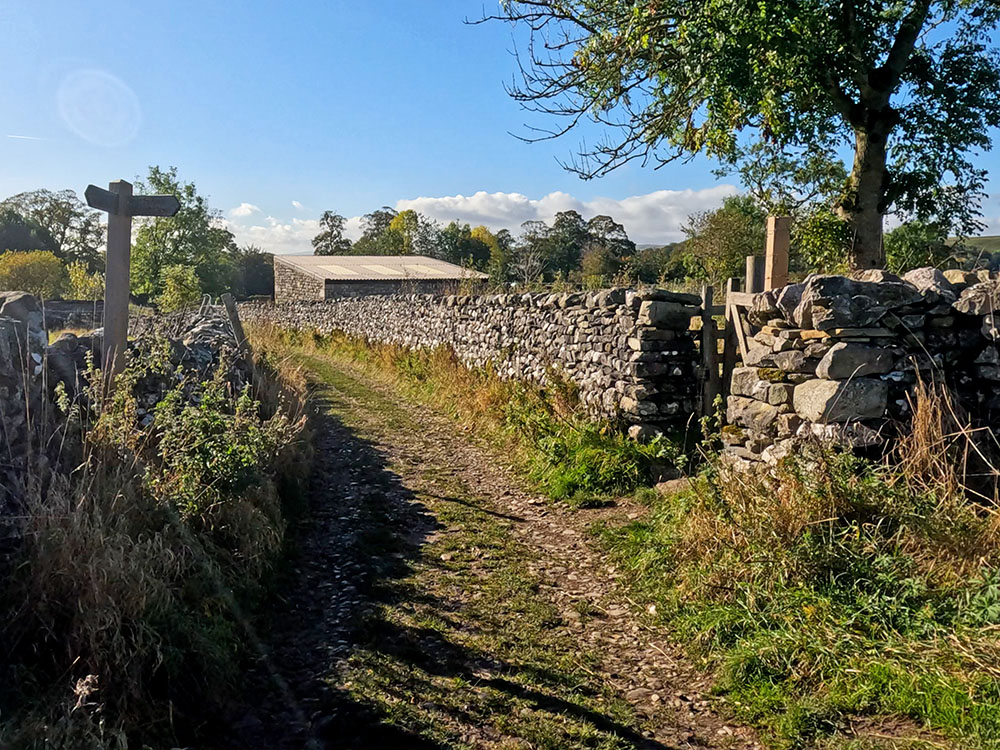
Approaching the building, footpath sign and gate in the wall
Pass through this gate on the right to head down the path between the fence and the wall. Looking around, you can see back to Stainforth Scar or just admire the wonderful Dales scenery.
Keeping on this path, you reach a gate. Pass through it and turn left along the lane and then on meeting the main road, turn right to head along the pavement and over the bridge.
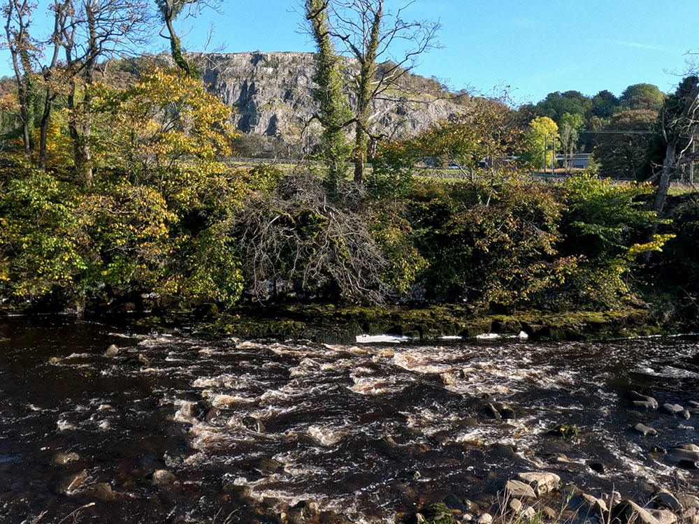
If you look over the bridge, you will see part of the Settle to Carlisle railway line.
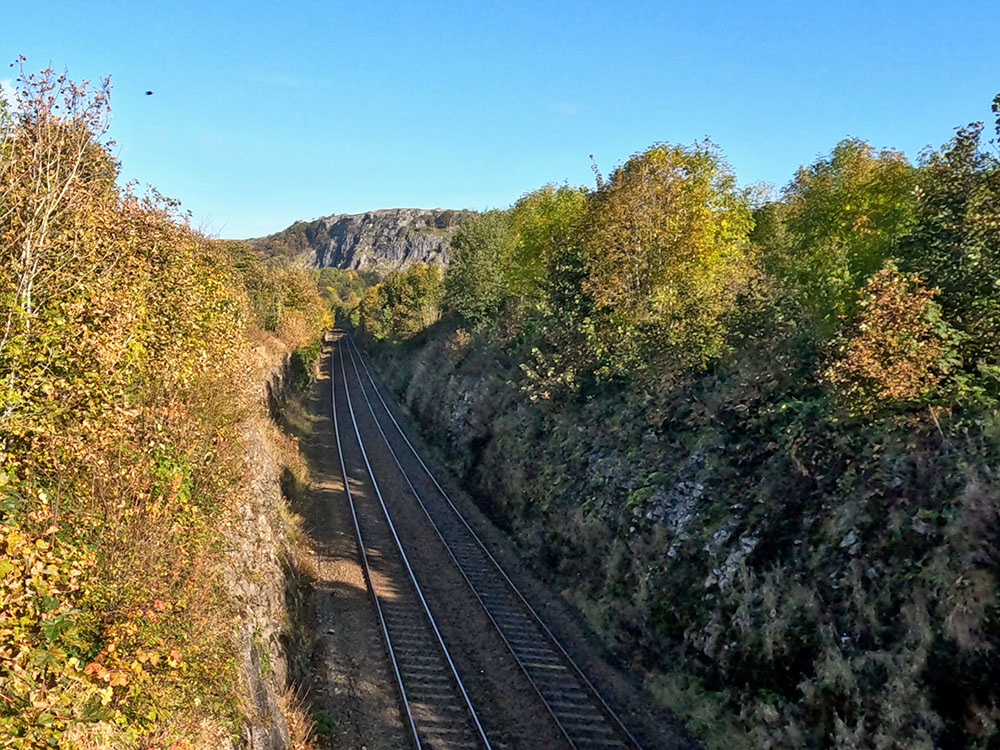
Stainforth Scar over the Settle to Carlisle railway line
Head on to the pavement and taking great care, cross the road and head down Locks Barn Lane, the lane opposite. As the lane starts to flatten you get your first view of a weir over to the right-hand side.
A few yards further on, head down a little path and then turn right to head over the footbridge to cross the River Ribble.
The weir itself was originally built to supply water to a mill just a bit further downstream. Stainforth Scar can be seen over the weir.
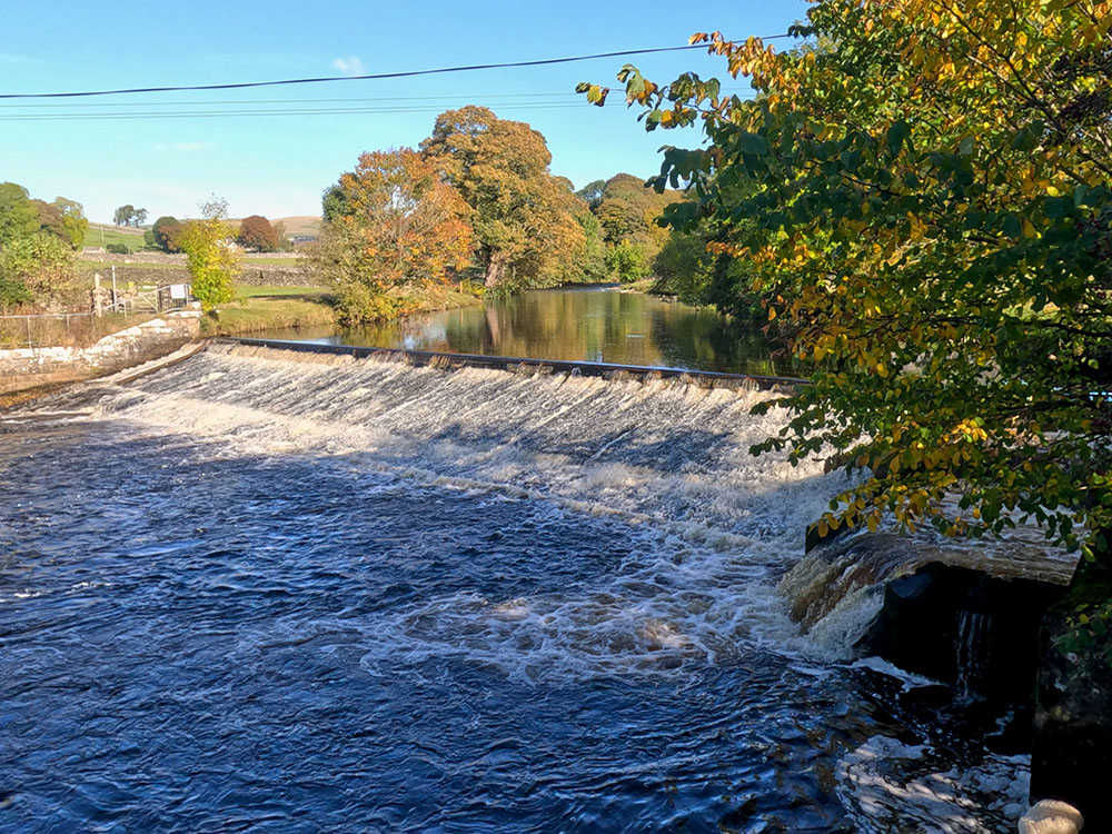
The weir
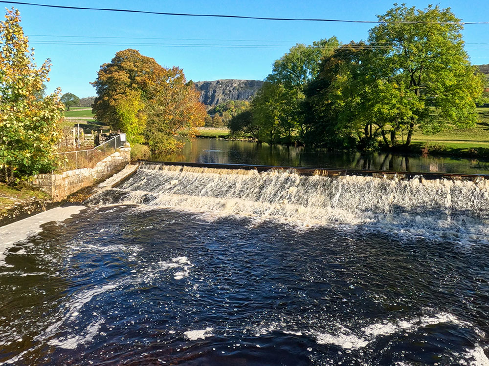
Stainforth Scar over the weir
Once over the footbridge, follow the path around to the right and a few yards further take the path off to the right again, which keeps by the side of the river.
Keep walking along the path passing through a wooden gate following the footpath sign Stainforth Foss one and a half miles.
This riverside path forms part of the Ribble Way, which is a route from Longton at the mouth of the River Ribble to the west of Preston that runs for approximately 70 miles to the river's source at Gavel Gap, which is a few kilometres north-east of the Ribblehead Viaduct in the Yorkshire Dales.
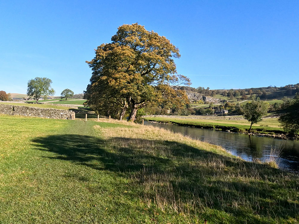
Riverside path
Pass through the next gate and on over a small stone stile. Pass over the next stile.
Stile on riverside path
Over to the right on this stretch you can see across and through to Stainforth Scar.
Stainforth Scar over the River Ribble
Pass over the next stone stile in the wall and shortly afterwards make your way across the stones to cross the small stream across the path.
Pass over the next stone stile and head across the field. After a while, there is a Stainforth woodland sign on the right-hand side next to the fence.
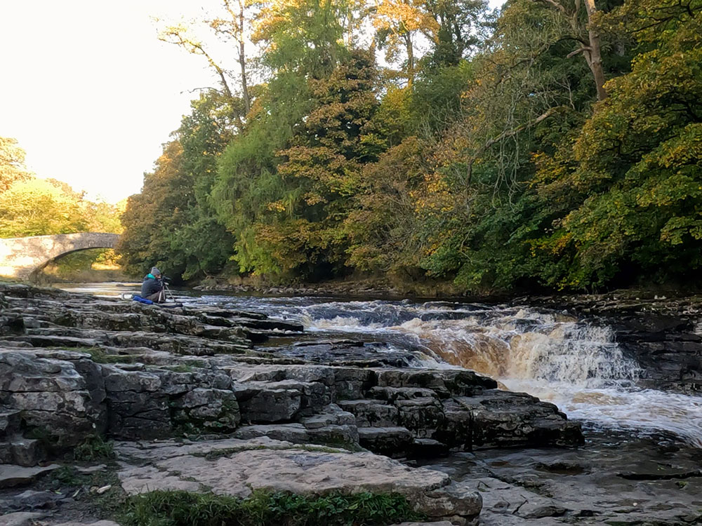
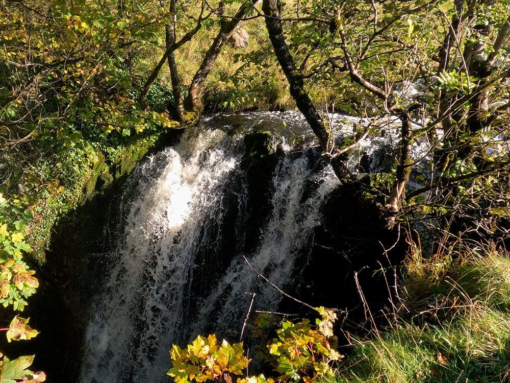
From the sign, keep straight on and then as the path splits take the right-hand path that keeps closer to the river. Just a little further on you reach Stainforth Force.
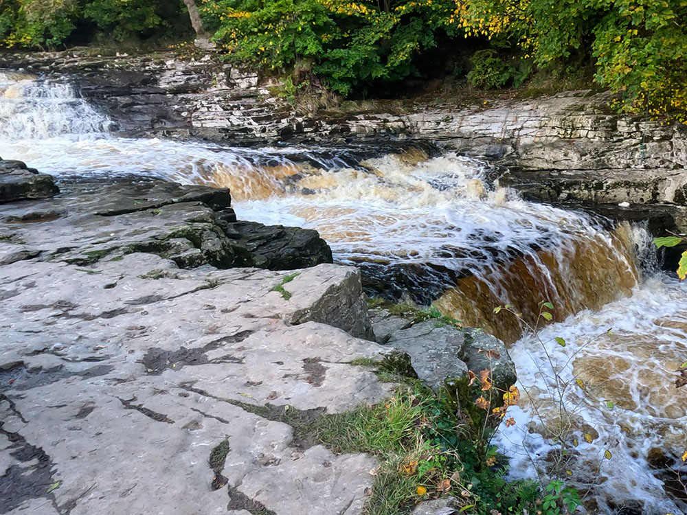
Lower end of Stainforth Force

Stainforth Force and packhorse bridge
It can get quite busy here on sunny weekends in the summer and in October and November as people come to watch the salmon jumping upstream and climbing the waterfalls.
According to Wildlife Trust, early morning and evenings during October and November are the best and a period of rain after a dry spell will provide the perfect conditions for the salmon to leap.
The waterfalls are very impressive after heavy rain and the Stainforth Force packhorse bridge in the background makes for an excellent photograph.
Carry on now, heading slightly uphill away from the falls heading in the direction of the packhorse bridge. Stainforth Packhorse Bridge was built in 1675 and was on the main Packhorse Road from Lancaster to York. It is now owned by the National Trust.
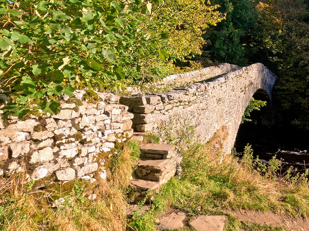
Packhorse bridge
For a short diversion here there is a cafe and tea room up to the left through the gate at Knight Stainforth Hall, caravan and camping park. To continue the walk, pass through the gate and turn right along the road to head over the bridge.
Once over the bridge, continue along the road and head up the hill. Upon meeting the main road, turn right along the pavement then cross over the road when safe to do so.
Keep on now along the pavement to turn left back across into the car park.
Gifts and presents for hikers and walkers
Are you struggling to pick the perfect gift for your hiking-loving friend or family member? Don't fret! Explore our curated selection of top-notch gifts for walkers and hikers that will have them trekking with joy on their special day.
What to wear and take on your walk or hike
Whether you are a seasoned hiker or new to walking, wearing and taking suitable hiking kit and clothing is essential for a day hike for your comfort and safety. So we have put together a hiking essentials checklist to cover all you'll need. Our Hiking Essentials checklist for 2026 takes you through planning your walk, the hiking essentials checklist itself, optional extras, explanations, and recommendations for all the hiking essentials.
Check out the reviews for this walk: