By using this website, you agree to our use of cookies (needed to provide our website’s features) and our Terms of Use.


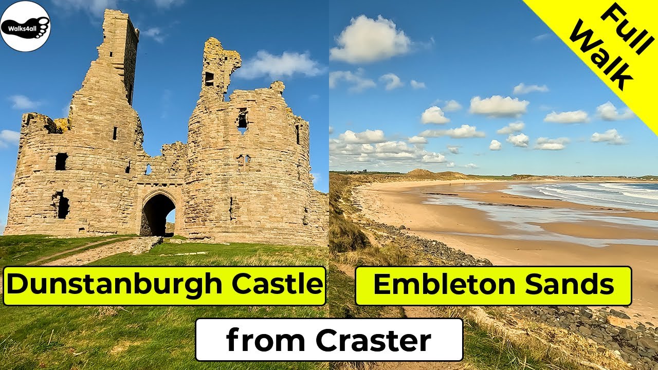
In this Dunstanburgh Castle and Embleton Bay walk from Craster in Northumberland, we head down to and then pass by Craster Harbour, heading out along the Northumberland coast path to reach Dunstanburgh Castle before reaching the golden sands of Embleton Bay.
In accordance with our Disclaimer, you agree to take full responsibility for any use you make of the information contained in these pages.
This page contains affiliate links. If you buy products or services via these links, we may earn a small commission at no cost to you.
| Walk title: | Dunstanburgh Castle and Embleton Bay walk from Craster |
| Author: | Andrew Forrest - April 2023 |
| Walk start point: | Pay and display car park in Craster (grid reference NU 256 197). What3words: ventures.palaces.wager |
| Parking: | As above. You could start the walk at the far end and do the walk in reverse - see the video. |
| Directions to nearest parking place: | Google Maps: get directions here / What3words: unloaded.plodding.forever |
| Walk distance: | 9.0 km (you can make the beach section shorter or longer to suit) |
| Estimated walk time: | 2 hours 10 minutes |
| Height climbed: | 85 metres |
| Technical difficulty: | Easy - as determined by our interpretation of the Ordnance Survey guidance on technical difficulties |
| Peaks / summits: | None |
| Map: | Majority of the walk is on: Ordnance Survey - Explorer 332 (Alnwick & Amble, Craster & Whittingham) Buy this map from Ordnance Survey The northern end of Embleton Bay and Beadnell Bay are on: Ordnance Survey - Explorer 340 (Holy Island & Bamburgh, Wooler, Belford & Seahouses) Buy this map from Ordnance Survey |
| GPS/GPX file: | Download available to registered users - Register and Login here - It's FREE to register |
| Facilities / refreshments: | Piper's Pitch Catering, The Kipper Shop, the Jolly Fisherman and Shoreline Café in Craster are all within a couple of minutes walk of the car park. Halfway round there is also Grey's Inn, the Blue Bell and Dunstanburgh Castle Hotel all in Embleton, the clubhouse on Dunstanburgh golf course and the Ship Inn and Low Newton by the Sea and the Joiner's Arms at High Newton by the Sea - check out the walk video for further details. |
| Nearest town: | The walk starts in Craster near Alnwick in Northumberland |
| Local self-catering accommodation: | View self-catering accommodation close to the start of this walk |
| Local hotels, inns and B&Bs: | View hotels and inns close to the start of this walk from The Inn Collection Group |
Estimated walk time
Walk time estimates used are from the Ordnance Survey mapping app, which uses a refined Naismith's rule, adjusted by OS overlaying their own data collected from more than one million people using the OS mapping app. Naismith's rule allowed one hour for every three miles walked and added pro-rata an additional hour for every 2000ft of ascent - roughly one hour for every 5km, plus one hour for every 600m of ascent.
Ordnance Survey Mapping App
Use on any device and make it easy to explore the great outdoors for just the price of a coffee a month. Premium allows full UK access to all OS Explorer and Landranger mapping, along with the ability to import and export routes, save maps offline, aerial 3D, and print A3/A4 maps.
In this Dunstanburgh Castle and Embleton Bay walk from Craster in Northumberland, we head down to and then pass by Craster Harbour before heading out along the Northumberland coast path to reach Dunstanburgh Castle. Dunstanburgh Castle, I believe, is owned by the National Trust and run by English Heritage. The castle itself was built between 1313 and 1322 but has been in an increasing state of ruin since the 16th century.
We then continue along the Northumberland coast path past the Dunstanburgh golf course and a World War II pillbox to arrive at the golden sands of Embleton Bay. The beach here at Embleton Bay is part of an area of outstanding natural beauty and was even voted the best beach in the UK in 2017 by BBC Countryfile magazine readers.
It's really then up to you how long to make the walk with over two kilometres of beach here and then a little further along the coast path is another three kilometres of sand at Beadnell Bay. We return to Craster along the outward path.
This Dunstanburgh Castle and Embleton Bay walk from Craster in Northumberland is shown in full in the video and the route for the walk are shown on the Ordnance Survey map - both above. Below is a brief description of the walk. Places where you can eat and drink after the walk are shown at the end of the video.
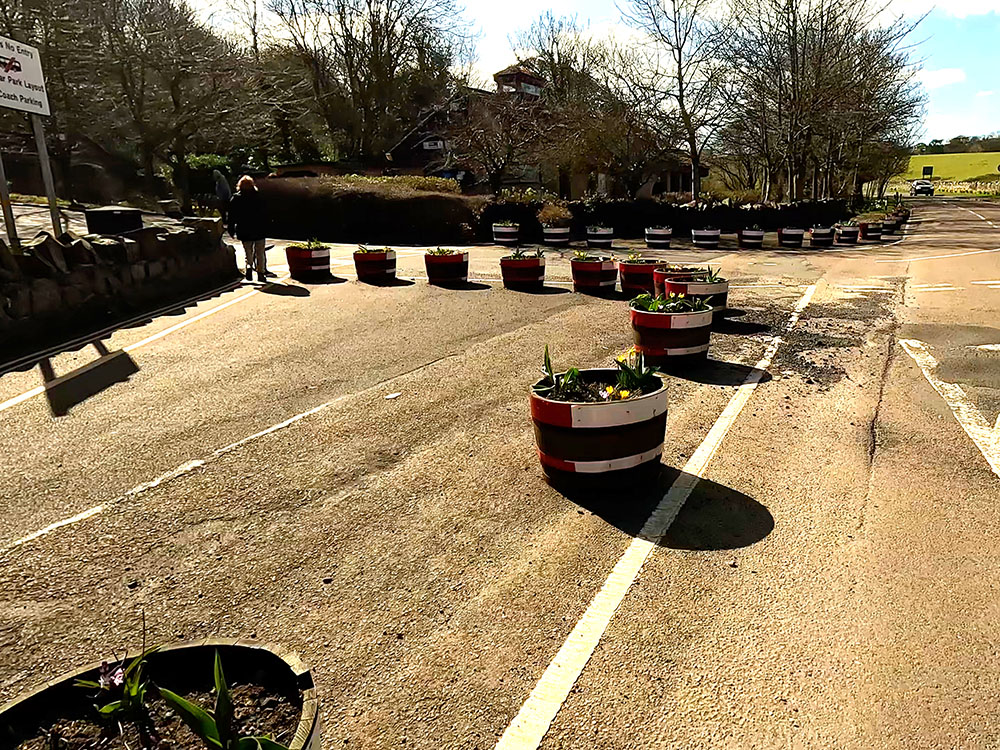
The walk starts in the pay-and-display car park in Craster, a fishing village on the Northumberland coast. Head back to the entrance of the car park towards the Craster Tourist Information Centre and the toilets. Just before reaching them, there are a few information signs, one for exploring across Craster Trail, another on the Arnold Memorial Nature Reserve and another telling you all about Craster Harbour.

Quarry Car Park in Craster
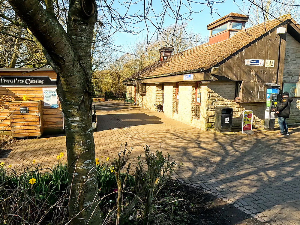
Pipers Pitch Catering and Tourist Information in the Quarry Car Park in Craster
Craster Tourist Information Centre has more information about the local area and if you want to read more before you set off on your walk, on the side of the building are further information signs about the area in the Stone Age, the Bronze Age and the Iron Age.
To start the walk we head away from Craster Tourist Information Centre to turn right along the road and follow it the short distance down to Craster Harbour.
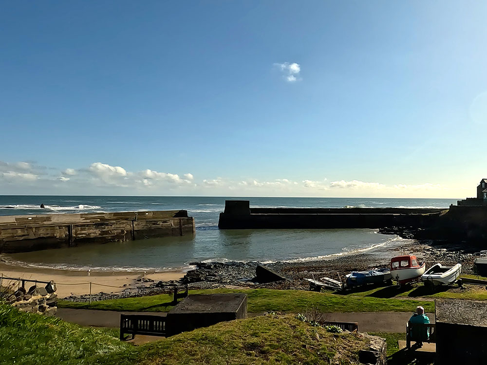
Craster Harbour
We turn left just before the harbour along Dunstanburgh Road. Take time to look at the harbour, whose construction started in 1906 by the Craster family to commemorate the loss of Captain John Craster, who died during the Tibetan expedition in 1904. The harbour was built to provide protection for fishing boats.
The concrete rectangle on the end of the South wall of the pier was a base for an aerial ropeway used for transporting stones to the harbour from the nearby quarry, which is now the car park in which we started the walk.
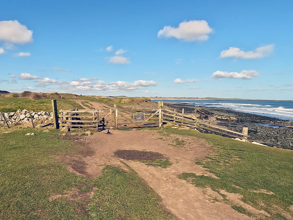
Walk along Dunstanburgh Road a short distance to pass through the wooden gate to the right of the English Heritage 'Dunstanburgh Castle' sign. Walk along the wide track and pass through the next wooden gate.
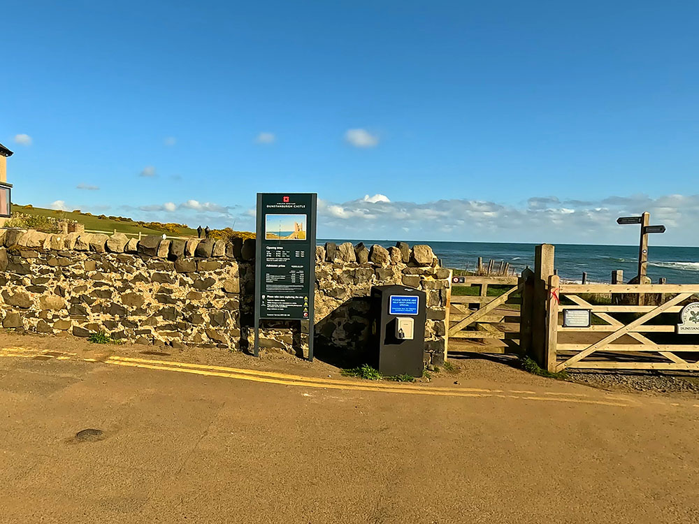
Gate at the end of Dunstanburgh Road
The footpath we walk along now for most of this walk is the Northumberland Coast Path, which is a 62-mile path from Creswell at the southern end of Druridge Bay to Berwick upon Tweed on the England-Scotland border.
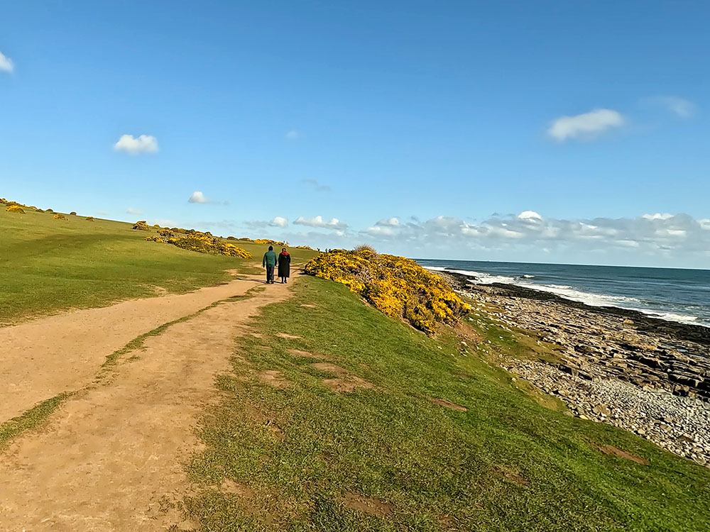
Heading out of Craster along the Northumberland Coast Path
This section of footpath also forms part of St Oswald's Way, which is a 97-mile walk from Holy Island down the coast and then inland, ending in Heaven Fields near Hexham on the Hadrian's Wall path. The St Oswald's Way links places associated with St Oswald, who was the king of Northumbria in the seventh century and takes in the wonderful Northumbrian countryside. St Oswald played a major part at that time in bringing Christianity to his people.
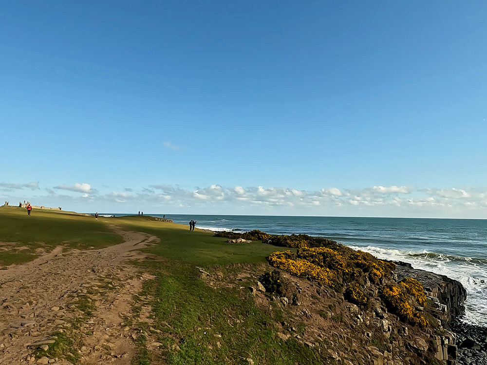
Pass through the gate and keep walking straight on towards the castle.
Northumberland Coast Path as Dunstanburgh Castle comes into view ahead
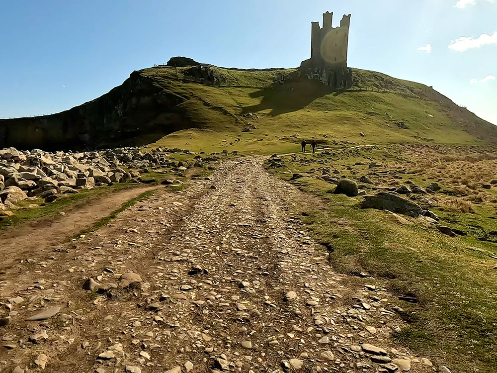
Pass through the next gate and walk straight on up the grassy bank to reach Dunstanburgh Castle.
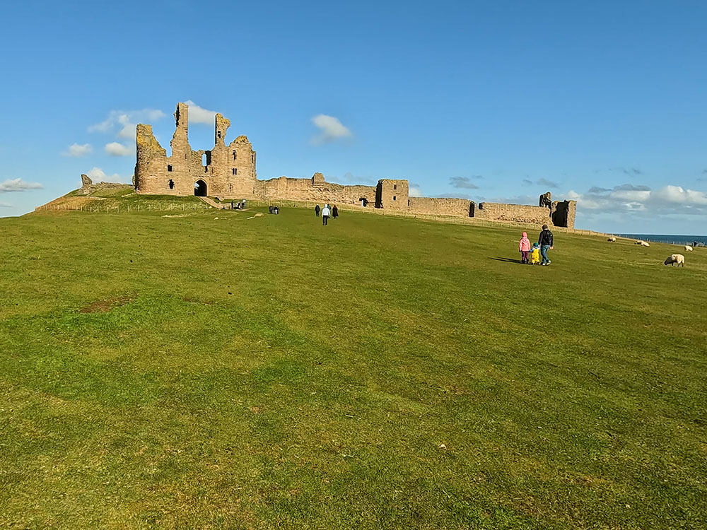
Grassy bank heading up to Dunstanburgh Castle
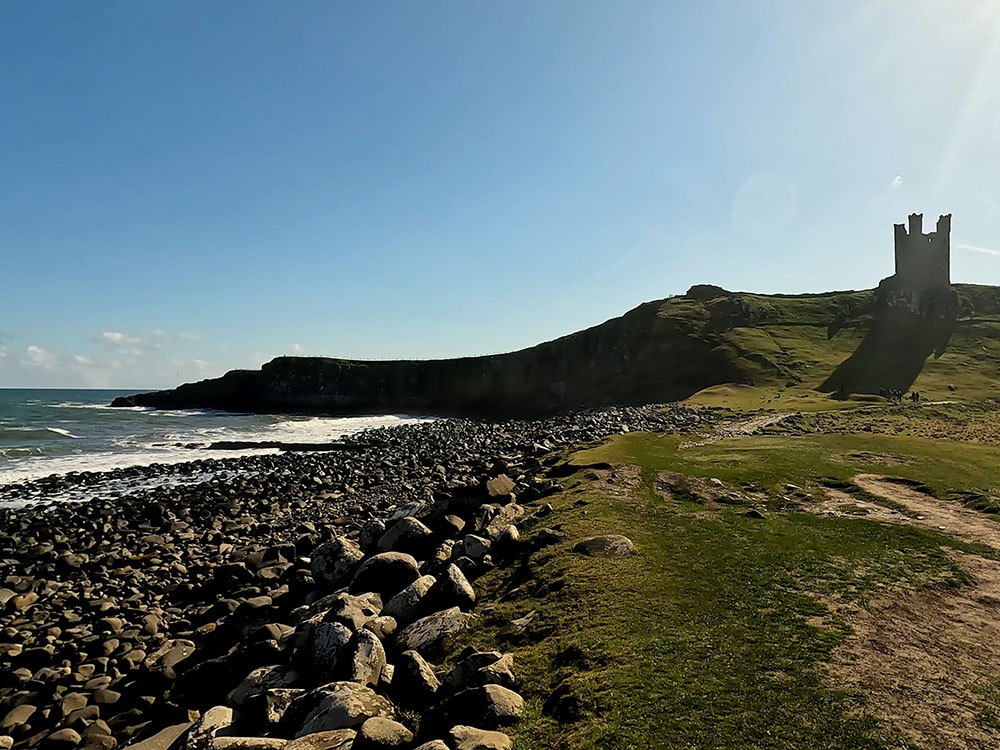
Dunstanburgh Castle I believe is now owned by the National Trust and run by English Heritage. The castle itself was built by Earl Thomas of Lancaster between 1313 and 1322. Thomas at the time was opposed to King Edward II. He was captured at the Battle of Boroughbridge as he attempted to escape for the safety of Dunstanburgh Castle.
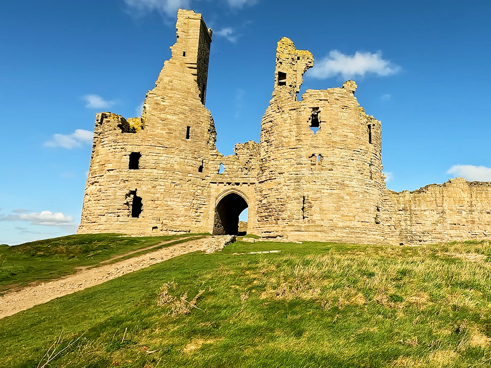
Entrance to Dunstanburgh Castle
John of Gaunt, later on, increased the castle defences in the 1380s in light of threats from Scotland and the castle itself changed hands several times between the rival houses of Lancaster and York during the War of the Roses from 1455 to 1487, but it never really recovered from that and has been in an increasing state of ruin since the 16th century.
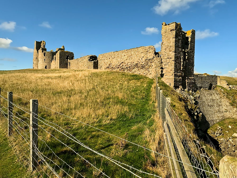
Dunstanburgh Castle
The castle has been popular with artists over the years, including J.M.W. Turner, who sketched and painted it several times.
Looking back towards Craster from Dunstanburgh Castle
When you're finished exploring the castle, take the path around to the left of it, which heads down to the shoreline.
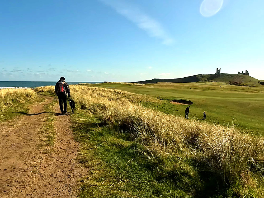
Northumberland Coast Path and St Oswald's Way as it passes by the 13th hole on Dunstanburgh golf course
Looking back up at Dunstanburgh Castle from the edge of the golf course
After a short distance, pass through another gate where over to your left you can see the 13th green on the Dunstanburgh golf course.
If you have any thoughts about this walk or find any issues with any of the footpaths used, please share that with us in the review section below.
Walk along the path where a few yards further on the path splits. The Northumberland Coast Path here heads down the left-hand side of the golf course. We split away from that here, taking the right-hand path that keeps close to the shoreline.
Where we leave the Northumberland Coast Path, taking the right-hand path nearer the sea shore
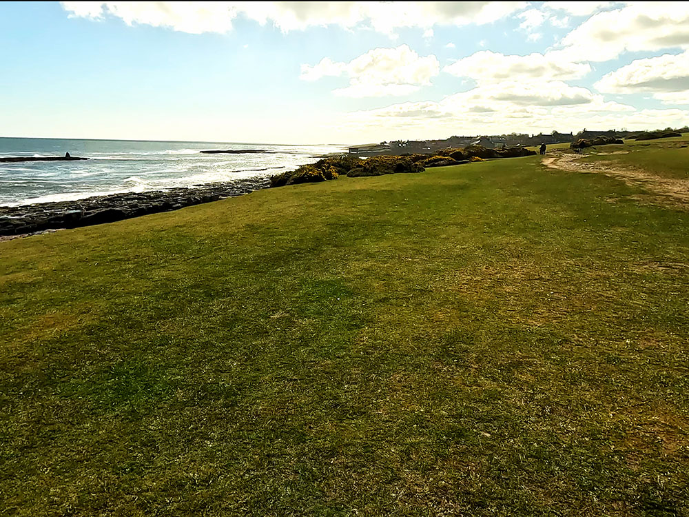
We walk along between the golf course and the beach.
Footpath between Dunstanburgh golf course and the rocky beach
A little further along the path, we reach a concrete structure, which is actually what is known as a pillbox - a fortified structure built in 1940 at the start of World War Two. I believe this to be a type 22 hexagonal pillbox used for observation and rifle and light machine gun placements.
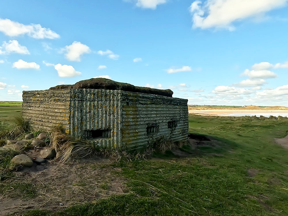
Hexagonal pillbox next to the footpath by Dunstanburgh golf course
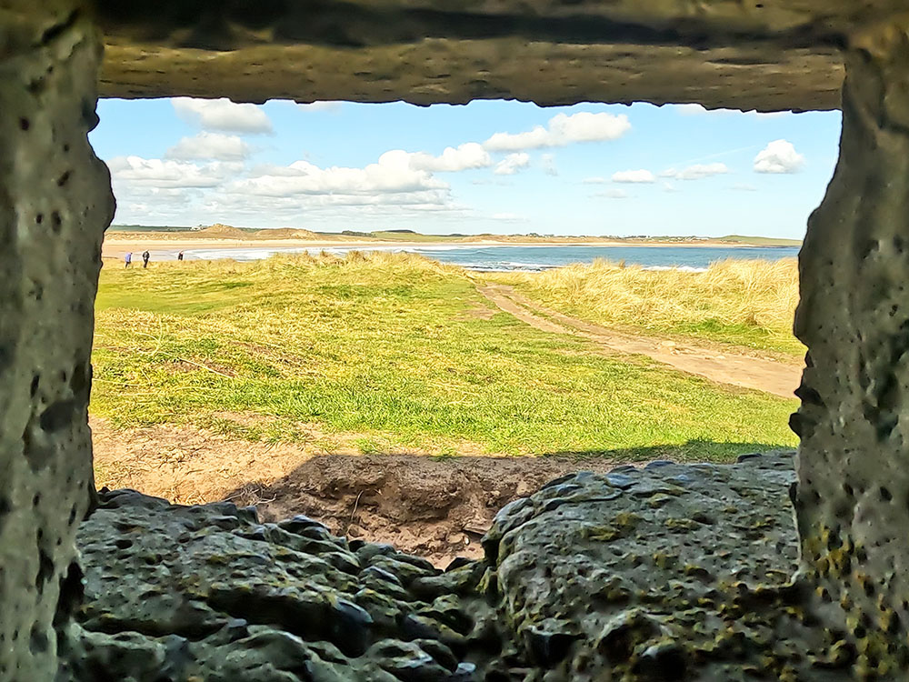
View through one of the embrasures in the hexagonal pillbox
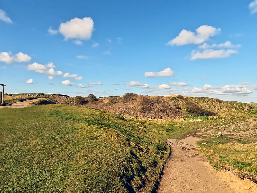
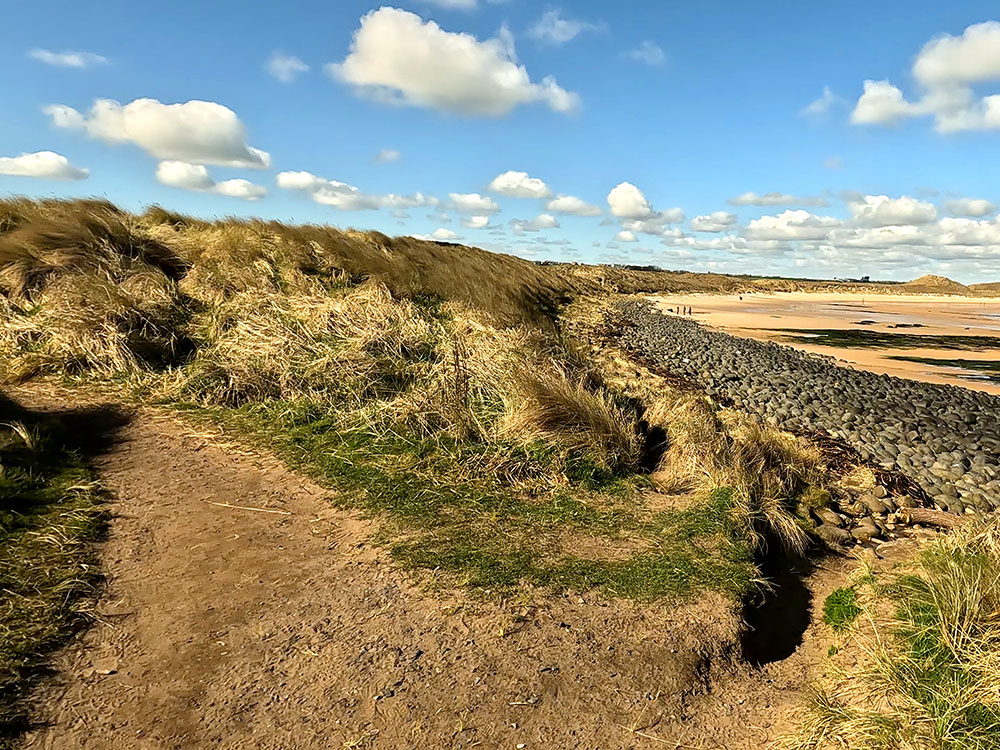
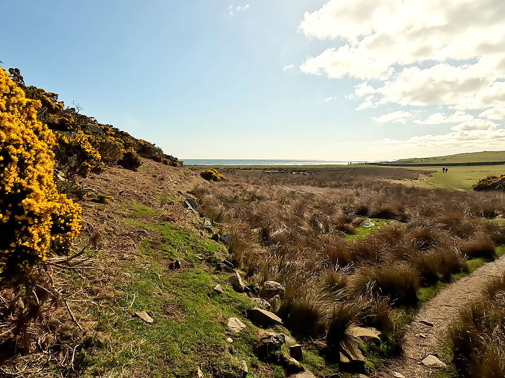
After exploring the pillbox, continue along the path. As the sand starts over on the right-hand side, you can head down to the beach here through the rocks, or you can join the beach just a little further on, when the path bends around to the left to Dunstan Steads, we take the right-hand fork to head down onto the golden sands of Embleton Bay.
Path splits - we take left-hand fork rather than dropping onto the beach
Path junction, we head down onto the beach, left-hand path rejoins Northumberland Coast Path
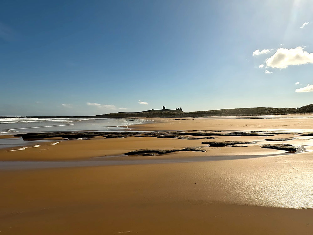
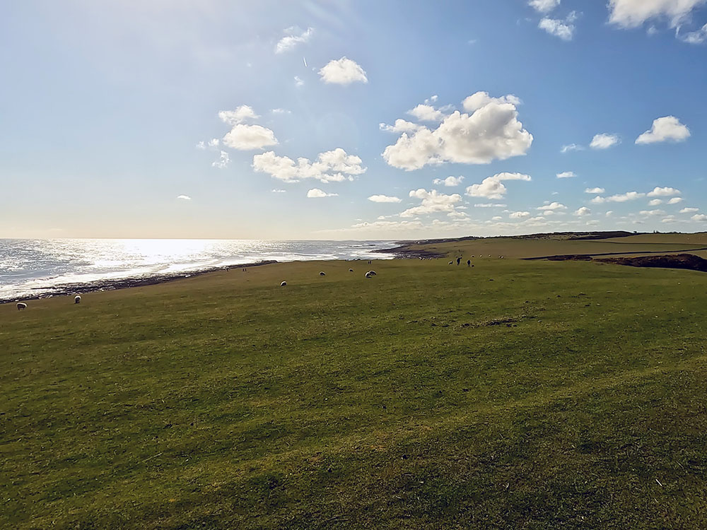
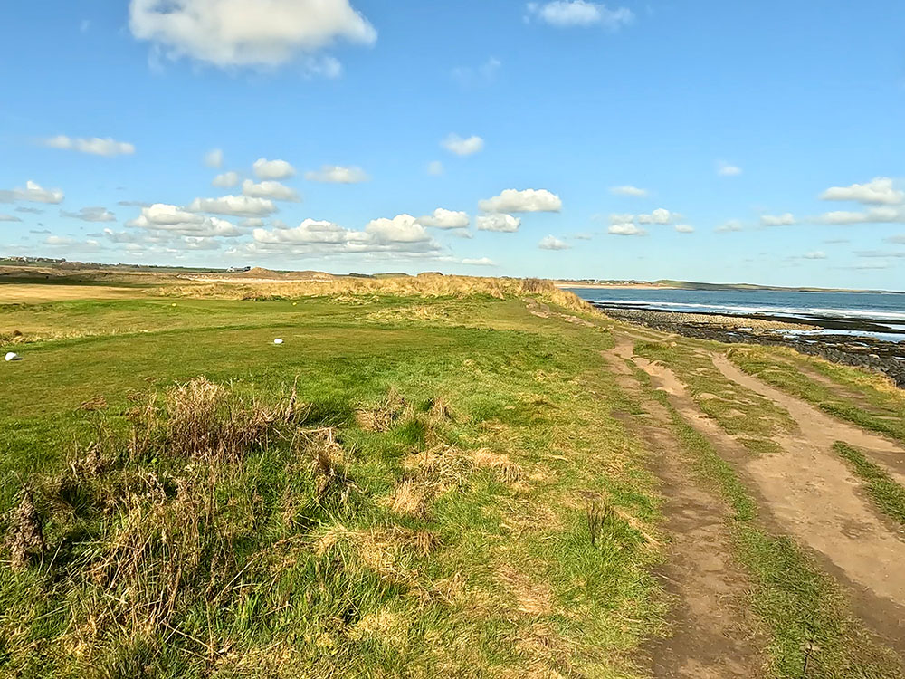
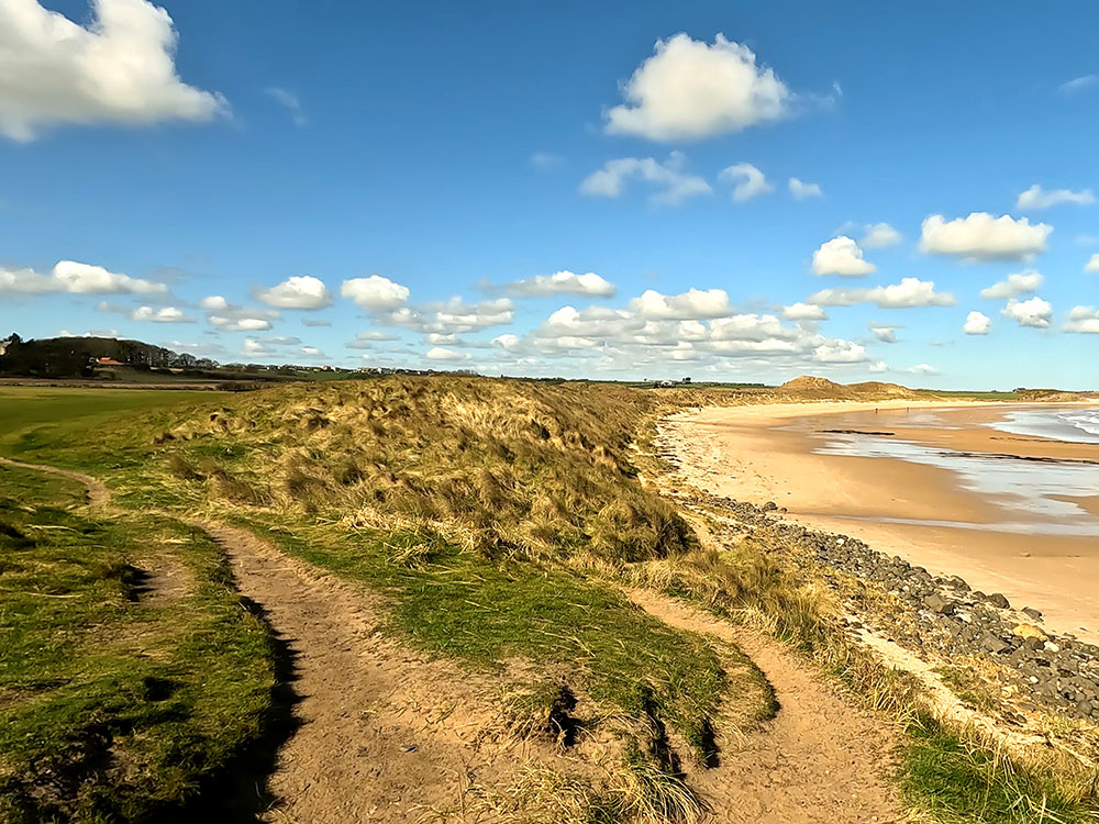
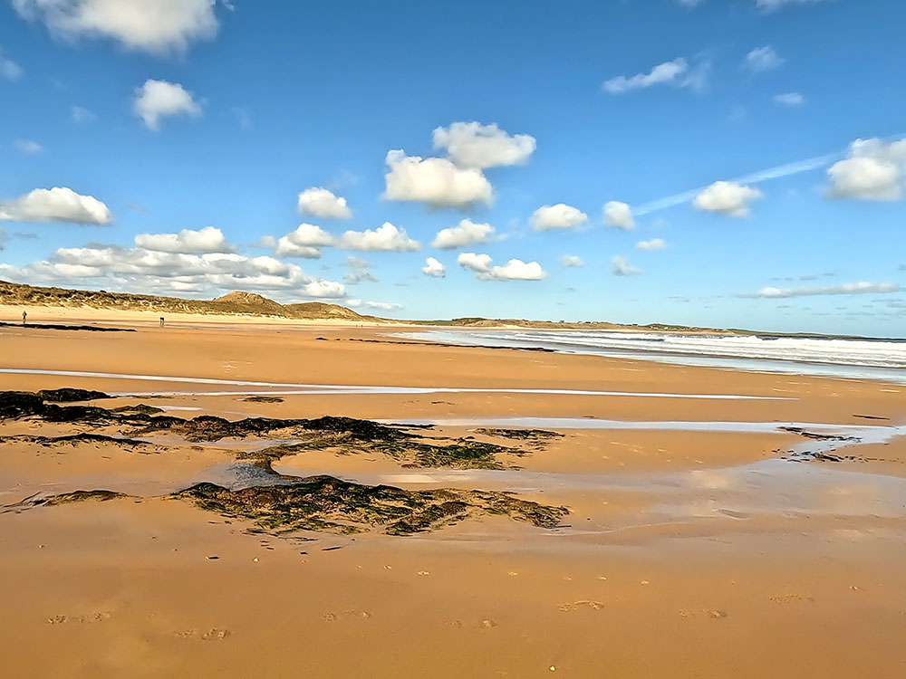
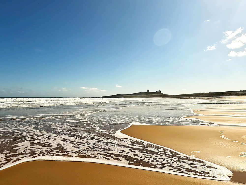
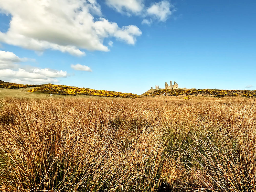
The beach here at Embleton Bay is part of an area of outstanding natural beauty and was even voted the best beach in the UK in 2017 by BBC Countryfile magazine readers. The beach is backed by sand dunes where a variety of flora thrive. The nearby cliffs and coast are home to seabirds and waders such as kittiwakes, eider ducks, fulmars, grey plovers, purple sandpipers and shags.
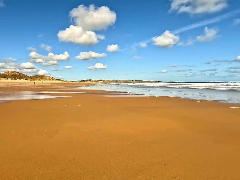
Looking forward along Embleton Bay
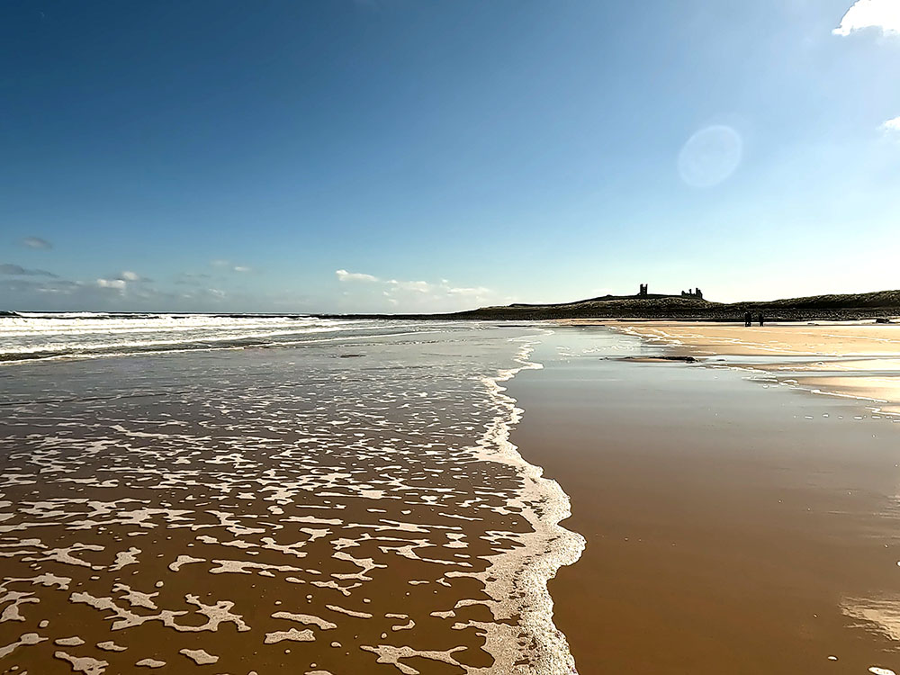
Looking back along the beach at Embleton Bay towards Dunstanburgh Castle
Once on the sands, it's really up to you how long to make the walk with over two kilometres of beach here, and then a little further along the coast path is another three kilometres of sand at Beadnell Bay.
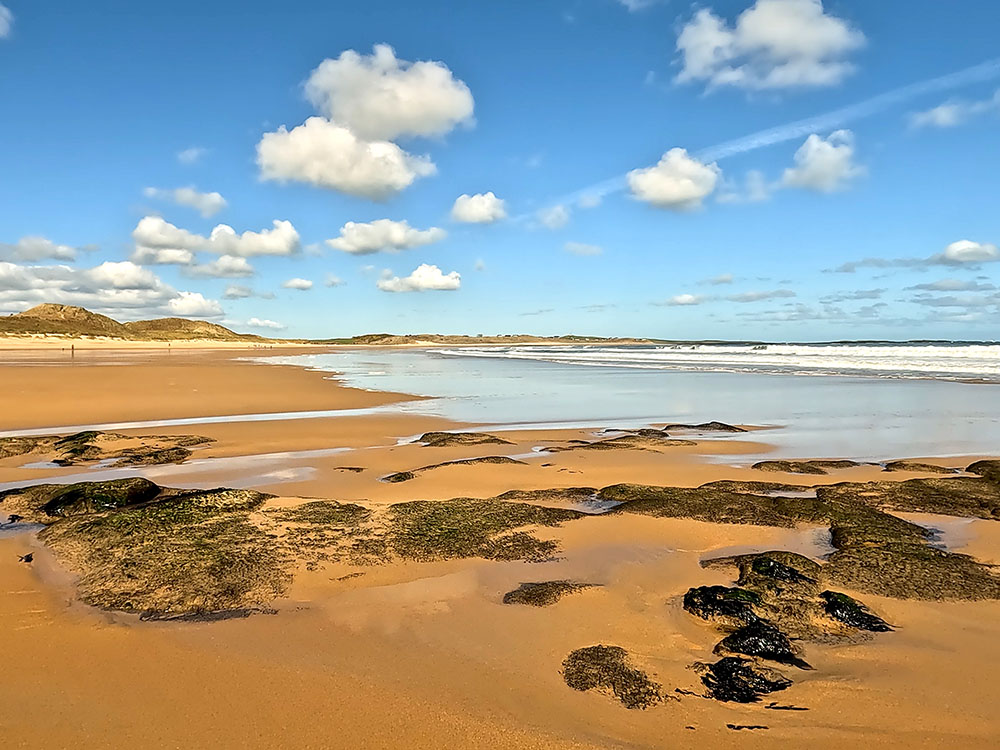
Seaweed and rocks on the beach at Embleton Bay
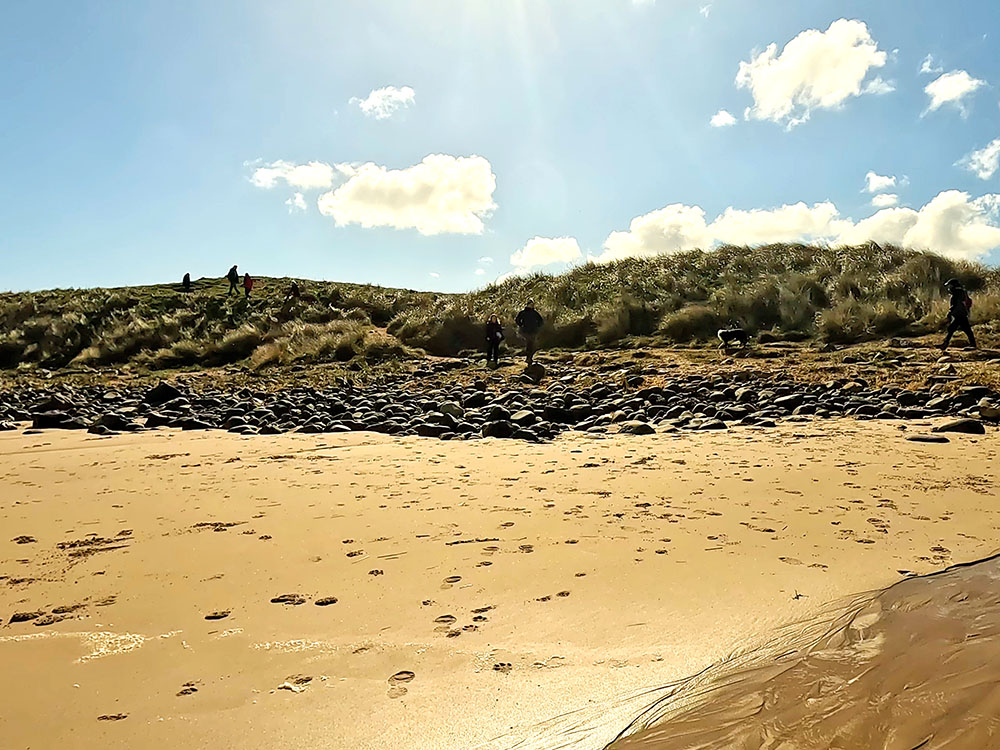
Walking along the sandy beach looking towards the sand dunes at Embleton Bay
The walk as set out in the video continues along the sand for about a kilometre before turning round. In the Ordnance Survey flythrough in the video, we do point out additional places to eat and drink mid-walk not far from the beach, or you can maybe start your walk at this end and do the walk in reverse.
In the video, the eating and drinking places mentioned are...
Just over half a mile inland from the beach is Embleton. The Greys Inn in Embleton offers food and real ales and is dog friendly. For the cooler days, there are three open fires and on warmer ones, there's a terraced beer garden. The Blue Bell Inn in Embleton serves food and drink and I believe is dog friendly. Then finally in Embleton is the Dunstanburgh Castle Hotel. This is dog friendly, serves food and drink and has a bar area and outside seating.
On the way up to Embleton, almost just off the beach, is the clubhouse for the Dunstanburgh golf course. Visitors are welcome and it serves food and drink and has outside seating to take in the views.
At the North end of Embleton Sands, you can either take the coast path to join Beadnell Bay or get there by passing through Low Newton by the Sea and High Newton by the Sea, each of which has a pub. The Ship Inn the Low Newton by the Sea is at the end of Embleton Sands, just as you leave the beach. It's dog friendly as long as you abide by their 'dog rules', serves food and even has its own onsite brewery. The Joiners Arms gastropub in High Newton by the Sea is a further half a mile down the road. It serves food and drink and again is dog friendly.
Turn round and head back along the beach. The walk in the reverse direction provides great views of Dunstanburgh Castle.
Walking back along the beach at Embleton Bay with Dunstanburgh Castle on the horizon

Walking along Embleton Bay sands in the direction of Dunstanburgh Castle
Head back to the path where we dropped down onto the beach initially and then left back along the path beside the golf course towards Dunstanburgh Castle.
Leaving Embleton Bay sands heading back onto the coast path
Walking between the sea and Dunstanburgh golf course
Before reaching the castle, you may have to wait just in case any golfers are teeing off on the par 3 13th hole - they do play over the footpath to the green.
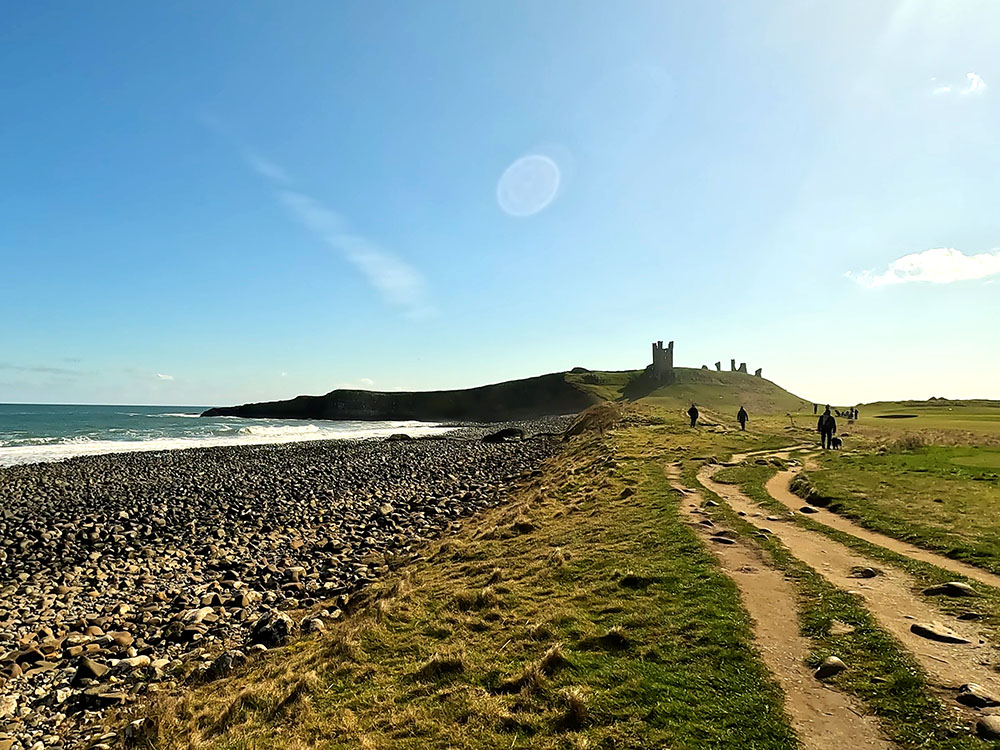
The rocky beach as Dunstanburgh Castle is approached
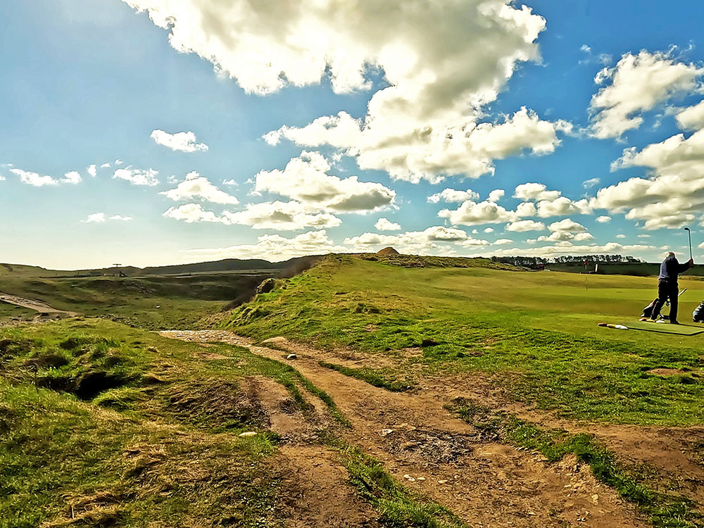
Waiting for golfers to play over the footpath to the par 3 13th green on Dunstanburgh golf course
Pass back through the next gate. Walk straight on, but this time, instead of heading off uphill left back to the castle, keep right along the lower path and then at a path junction, take the right-hand path.
Following the footpath around the base to the right of Dunstanburgh Castle

Looking up at Dunstanburgh Castle
The path briefly becomes a little rougher underfoot as it passes through some gorse before heading on to the gate we passed through earlier.
Footpath heading through the yellow gorse
Looking back up at Dunstanburgh Castle
Pass through this gate and head now back along the coast path.
Heading along the Northumberland Coast Path and St Oswald's Way back towards Craster
Upon reaching the outskirts of Craster, pass back through the gate and by the footpath sign and then on through the next gate.
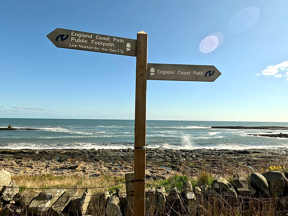
Coast path footpath sign
Then just walk back along the road towards the harbour. At the end of the road, we turn right and walk along the road for a short distance before turning left back into the car park.
Heading back into the Quarry car park at Craster
Before heading back to the car park, if you wanted to eat in Craster, turn left instead of right at the end of Dunstanburgh Road. After a short climb, on your right is the famous Craster Kipper Shop. The business has been run here by the Robson family since the early 1900s and they still smoke kippers in the traditional way. The kippers have been featured on a few TV programs.
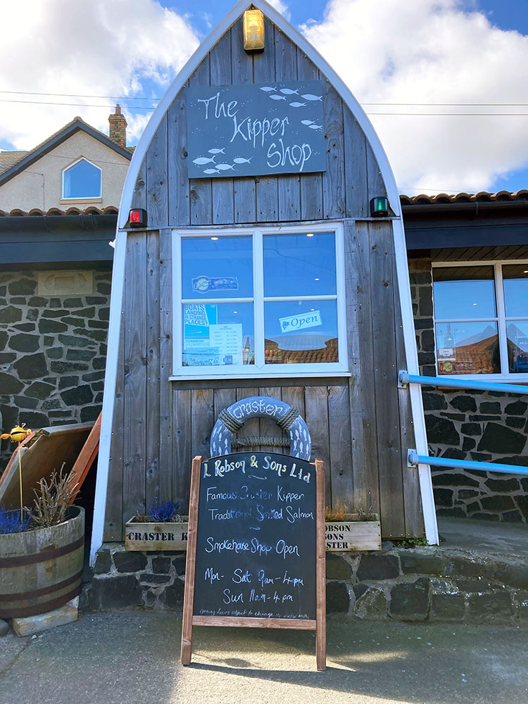
L Robson & Sons famous kipper shop in Craster
Across from the kipper smokehouse is the Jolly Fisherman, a gastropub and seafood restaurant. Dogs are welcome in the bar area and in the garden. It does have wonderful sea and castle views from the beer garden.
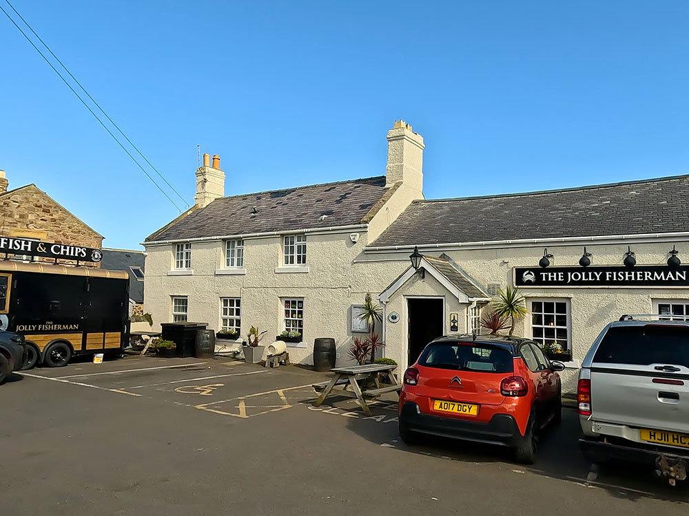
Jolly Fisherman pub in Craster
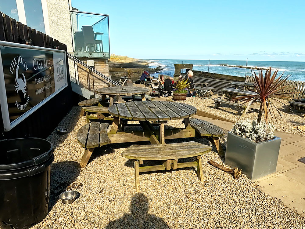
Jolly Fisherman beer garden with Dunstanburgh Castle and sea view in Craster
Just a little further along the road is the Shoreline Cafe, which again is dog friendly and serves a range of food and drink.
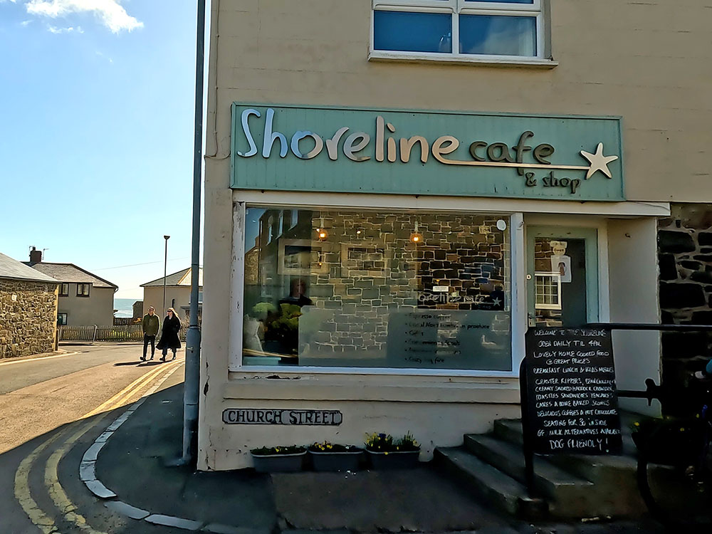
Shoreline Cafe in Craster
The final eating place is back at the car park entrance by the tourist information, where you will find Piper's Pitch Catering, which again serves food and drink. It's home of the Craster kipper in a bun and also their famous Auchtermuchty - haggis and bacon in a bun.
Gifts and presents for hikers and walkers
Are you struggling to pick the perfect gift for your hiking-loving friend or family member? Don't fret! Explore our curated selection of top-notch gifts for walkers and hikers that will have them trekking with joy on their special day.
What to wear and take on your walk or hike
Whether you are a seasoned hiker or new to walking, wearing and taking suitable hiking kit and clothing is essential for a day hike for your comfort and safety. So we have put together a hiking essentials checklist to cover all you'll need. Our Hiking Essentials checklist for 2026 takes you through planning your walk, the hiking essentials checklist itself, optional extras, explanations, and recommendations for all the hiking essentials.
Check out the reviews for this walk: