By using this website, you agree to our use of cookies (needed to provide our website’s features) and our Terms of Use.


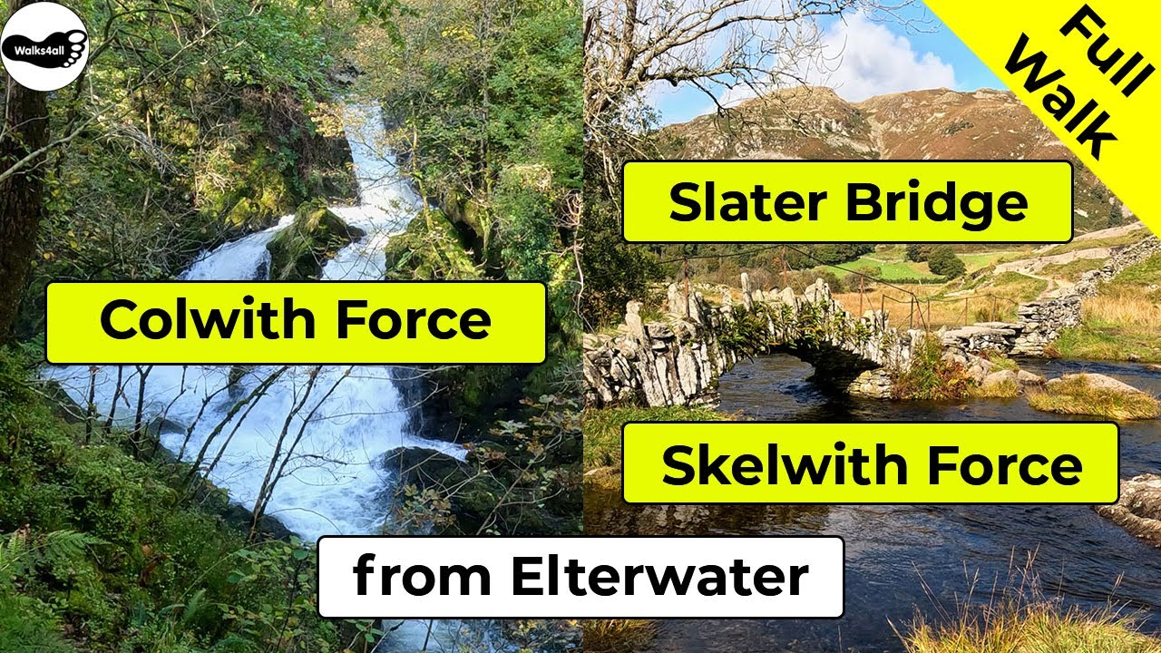
From Elterwater, take in Great Langdale Beck, Elter Water, Skelwith Force, Colwith Force and Slater Bridge with this delightful walk in the Lake District. Enjoy wonderful views of the Langdale Pikes.
In accordance with our Disclaimer, you agree to take full responsibility for any use you make of the information contained in these pages.
This page contains affiliate links. If you buy products or services via these links, we may earn a small commission at no cost to you.
| Walk title: | Skelwith Force waterfall, Colwith Force waterfall and Slater Bridge walk from Elterwater |
| Author: | Andrew Forrest - December 2022 |
| Walk start point: | Car park in Elterwater (grid reference NY 327 047) What3words: format.compose.chucked |
| Parking: | As above |
| Directions to nearest parking place: | Google Maps: get directions here / What3words: custard.dressings.bicker |
| Walk distance: | 9.8 km |
| Estimated walk time: | 2 hours 45 minutes |
| Height climbed: | 265 metres |
| Technical difficulty: | Moderate - as determined by our interpretation of the Ordnance Survey guidance on technical difficulties |
| Peaks / summits: | None |
| Map: | Ordnance Survey - Explorer OL7 (The English Lakes - South-eastern Area) Buy this map from Ordnance Survey |
| GPS/GPX file: | Download available to registered users - Register and Login here - It's FREE to register |
| Facilities / refreshments: | Chesters by the River and Talbot bar in Skelwith Bridge, Three Shires Inn in Little Langdale and Eltermere Inn, Britannia Inn and Slates Coffee and Kitchen in Elterwater - check out the walk video for further details |
| Nearest town: | Walk starts in Elterwater, nearest larger town is Ambleside |
| Local self-catering accommodation: | View self-catering accommodation close to the start of this walk |
| Local hotels, inns and B&Bs: | View hotels and inns close to the start of this walk from The Inn Collection Group |
Estimated walk time
Walk time estimates used are from the Ordnance Survey mapping app, which uses a refined Naismith's rule, adjusted by OS overlaying their own data collected from more than one million people using the OS mapping app. Naismith's rule allowed one hour for every three miles walked and added pro-rata an additional hour for every 2000ft of ascent - roughly one hour for every 5km, plus one hour for every 600m of ascent.
Ordnance Survey Mapping App
Use on any device and make it easy to explore the great outdoors for just the price of a coffee a month. Premium allows full UK access to all OS Explorer and Landranger mapping, along with the ability to import and export routes, save maps offline, aerial 3D, and print A3/A4 maps.
This Skelwith Force, Colwith Force and Slater Bridge walk from Elterwater in the Lake District takes approximately 2 hours and 45 minutes. We start from the National Trust Car Park in Elterwater and initially walk along the Cumbria Way footpath alongside the Great Langdale Beck and Elter Water with its wonderful views back towards the Langdale Pikes.
Walking a little further on, we soon reach Skelwith Force waterfall, which is always quite impressive and noisy after heavy rain.
We continue climbing through trees and across fields to arrive at Colwith Force waterfall, with a total drop of about 15 metres, which again is impressive after heavy rain.
We head on through the woods, then down a picturesque, quiet lane to arrive at Slater Bridge. The much-photographed 17th-century Packhorse Bridge is our way over the river Brathey before we head back over and down a walled track back into Elterwater.
This full Elterwater walk is shown in the video and the route for the walk is shown on the Ordnance Survey map - both above. Below is a brief description of the walk.
We start the walk from the National Trust Car Park in Elterwater in the Lake District. It is free if you are a National Trust member. There is other parking in Elterwater and some more parking en-route. So, as this is a circular walk, you could start it from a different location.
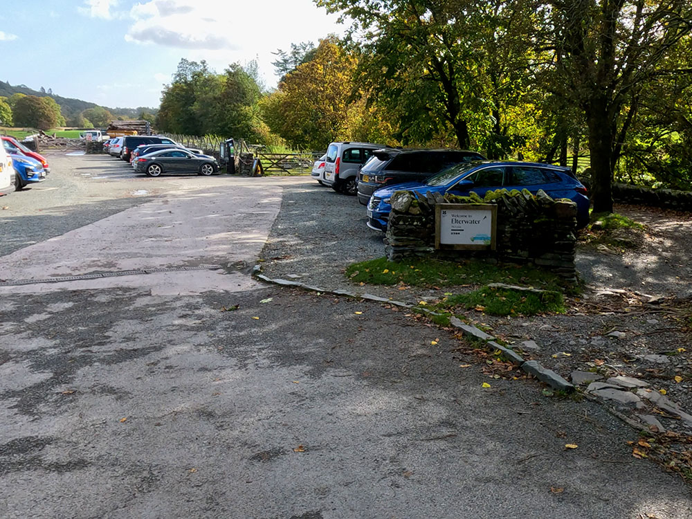
National Trust Car Park Elterwater
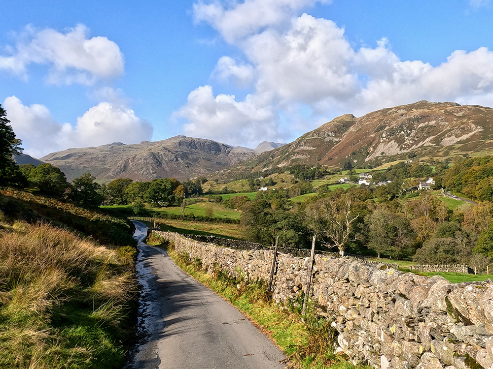
Head around to, and then pass through the gate in the corner of the car park by Great Langdale Beck. Head along this gravel track that now forms part of the Cumbria Way footpath alongside the water.
Over to the left, you can see towards Loughrigg Fell. This path is part of the Cumbria Way, which is a 72-mile route starting in Ulverston and ending in Carlisle, passing through the Lake District. It passes alongside Coniston Water before reaching here and continues on and then alongside Derwent water before passing through Keswick on its way to Carlisle.
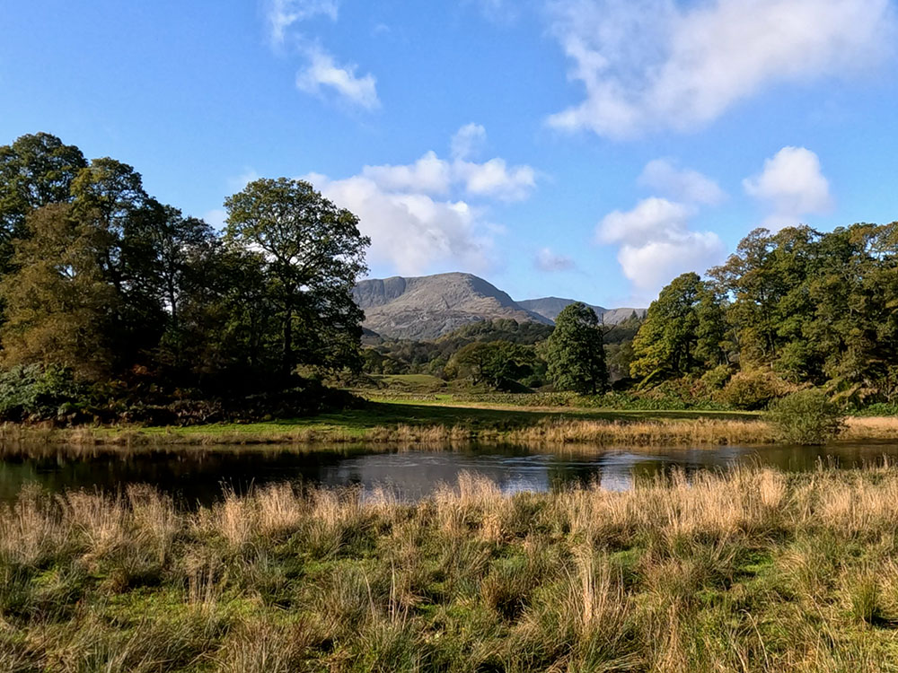
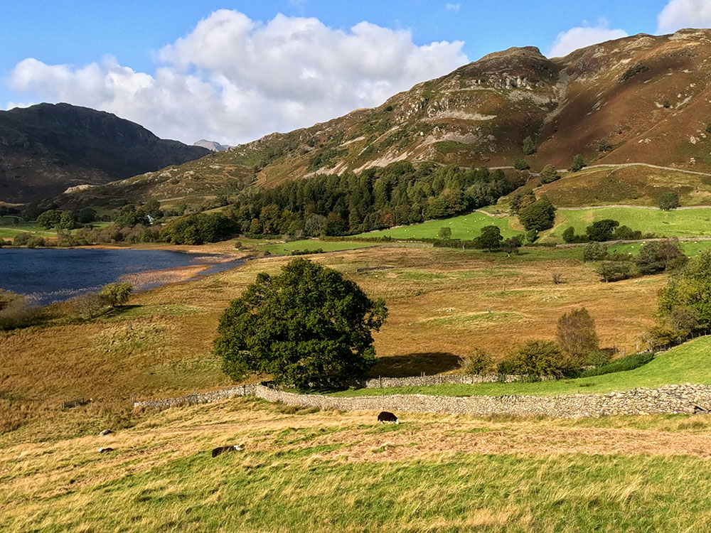
After a while, pass through the next gate to pull in alongside Elter Water itself. There are panoramic views all around, but the view back over Elter Water towards the Langdale Pikes is always an impressive one.
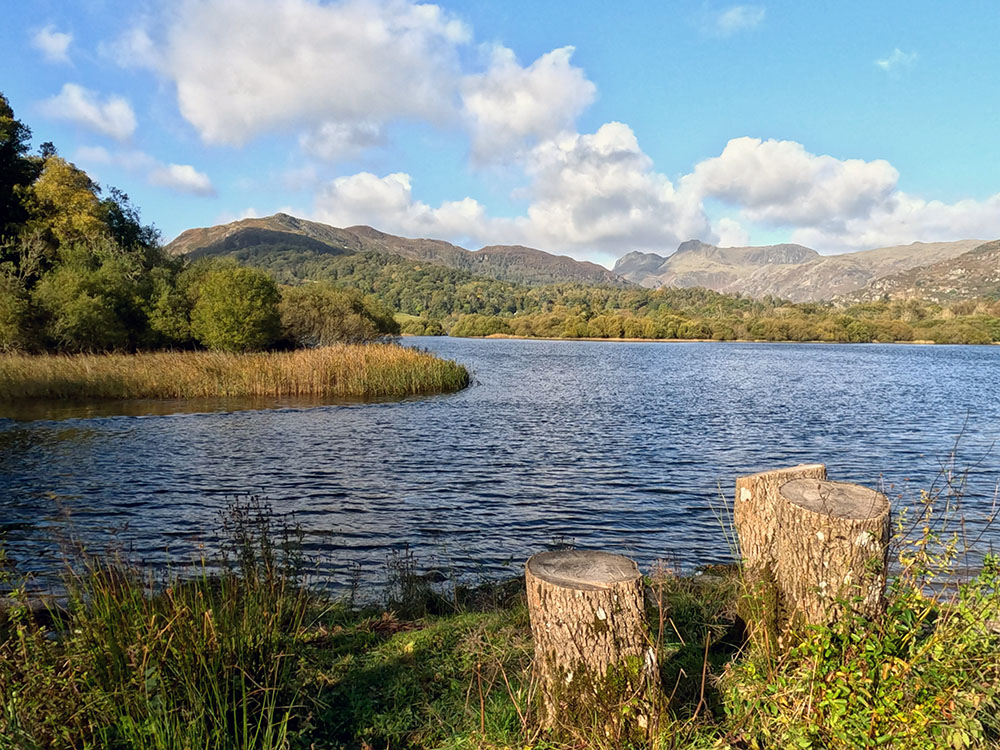
Looking towards the Langdale Pikes over Elter Water
Keep on now along the gravel track. Across to the right, you're looking towards Wetherlam and looking behind, you still have the view across to the Langdale Pikes.
Looking towards Wetherlam over Elter Water
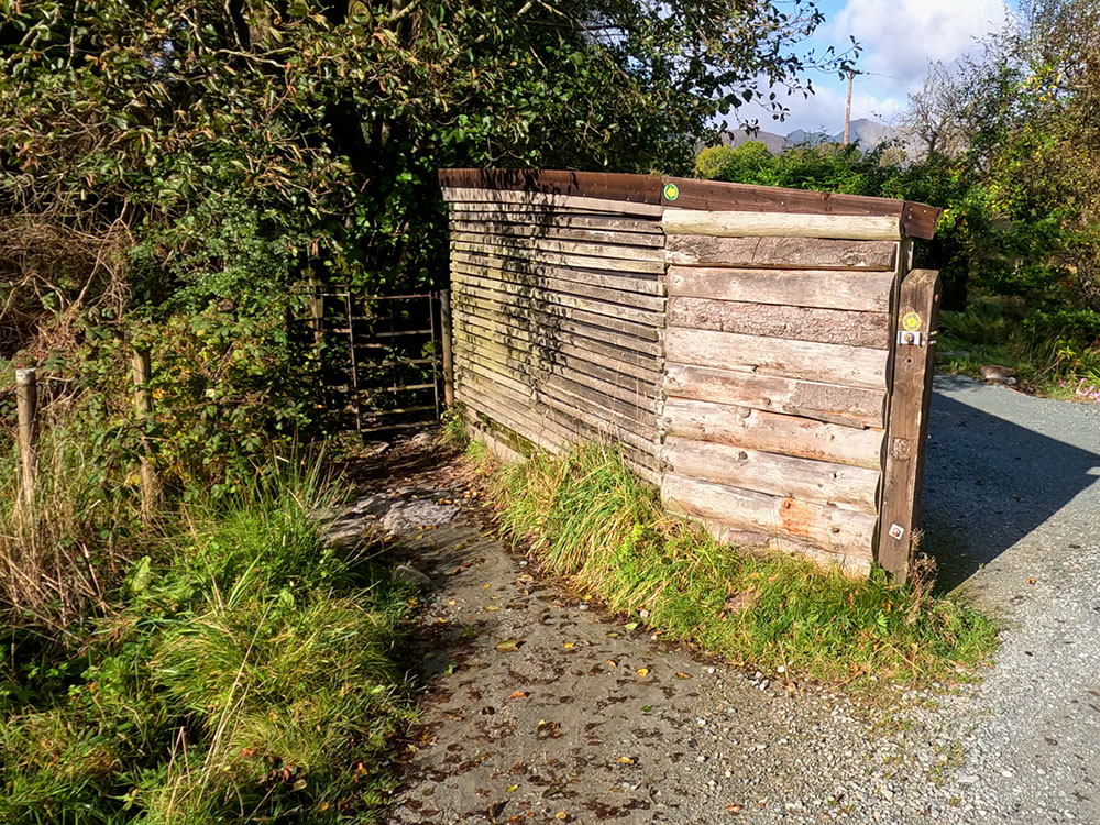
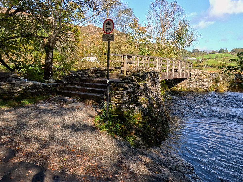
Further on, as you reach the trees, pass through the gate and continue on. Then a few yards further on, you reach a bridge over the river Brathay. We're going to return to this point, but first, before we do, we will just have a quick look down Skelwith Falls and also where there's somewhere to eat and drink.
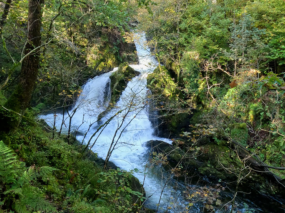
Ignoring the bridge, keep on along the gravel path that you were originally walking along. You soon reach a wooden fence on the right, at the end of which are some steps down to a viewpoint to have a close look at Skelwith Force waterfall. Take care heading down the steps.
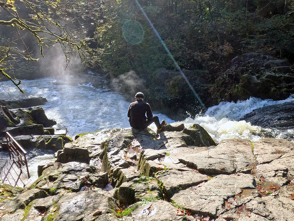
Skelwith Force waterfall
While not the biggest drop waterfall around, after rain, the narrowing of the river Brathay here causes quite an impressive sight and it's quite noisy.
Turn around and return back to the path. You can turn back left to continue the walk which we will come back to shortly. But first we'll head right for another short diversion to show you where you can eat and drink on the way around.
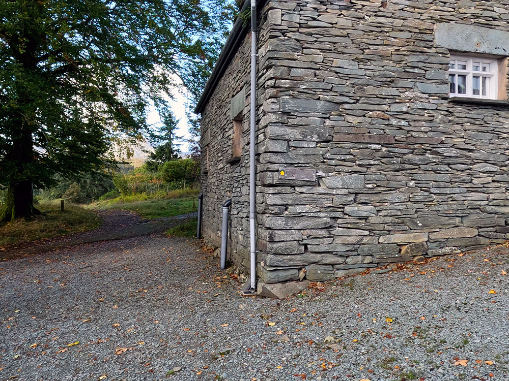
Continue along the gravel track to pass through some buildings. At these buildings, you could turn left if you wanted to, and on the road, about 50 yards to the right, is Talbot Bar in the Skelwith Bridge Hotel. It serves food and drink and has a beer garden. It's dog friendly and has a range of Jennings ales.
If you carry on between the buildings, a few yards further on, opposite a car park, turn right to arrive at Chesters by the river. This cafe may now have lost its table service during COVID and apparently, according to the notices on the tables due to struggles getting staff is continuing for now, but it does still serve coffees, teas, cakes and a few vegetarian dishes.
Dogs are allowed both inside and out, so once you've got your coffee, you pass through to the tables out on the balcony, which give a great view of the river.
If you've finished inside Chesters pass back along the front of it and then turn left back along the outward path. Retrace your steps now back along the gravel track and then this time upon meeting the bridge where we were earlier, turn left to pass over the bridge.
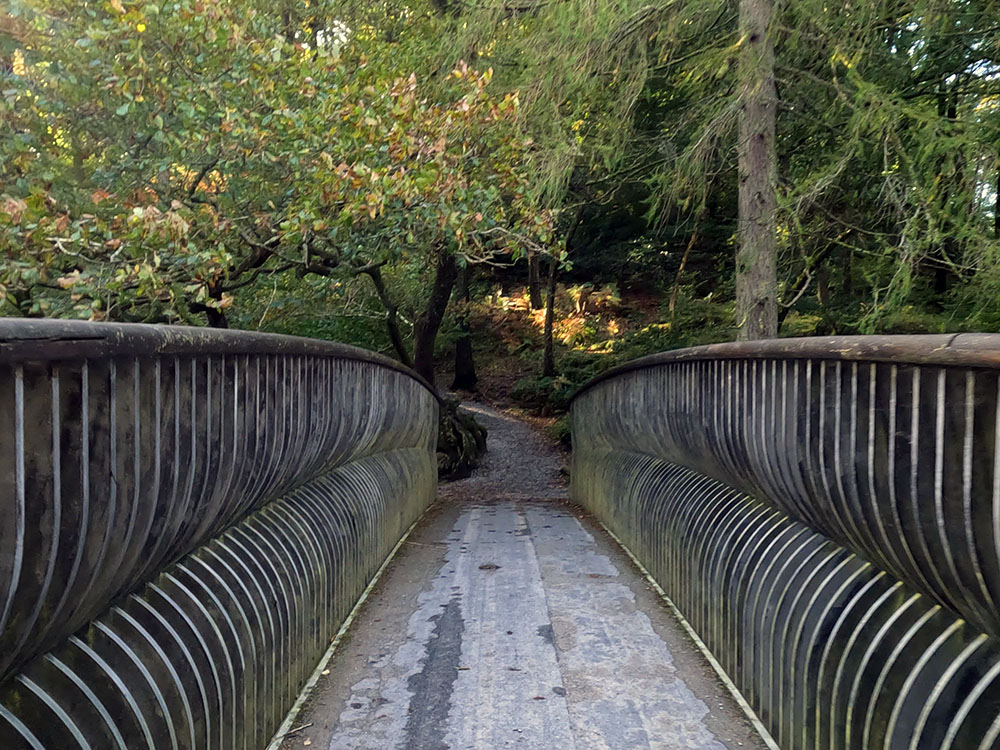
Footbridge over the river Brathey
If you wanted to keep this walk easy, level and short you could just head back to Elterwater here along the outward route.
But for now, we are heading over the bridge. Once over it, head away from the bridge up the gravel path. Then at a three-way footpath sign, head straight on following the Colwith Bridge sign up the hill.
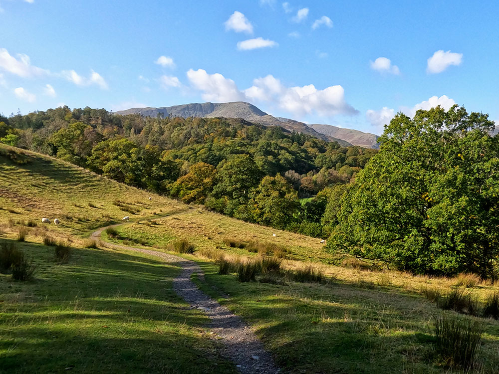
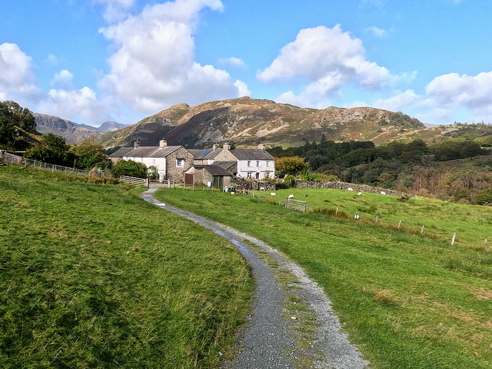
Pass through the next kissing gate and keep straight ahead, turning right upon meeting the track. An extra bit of height affords wonderful panoramas towards the Langdale Pikes.
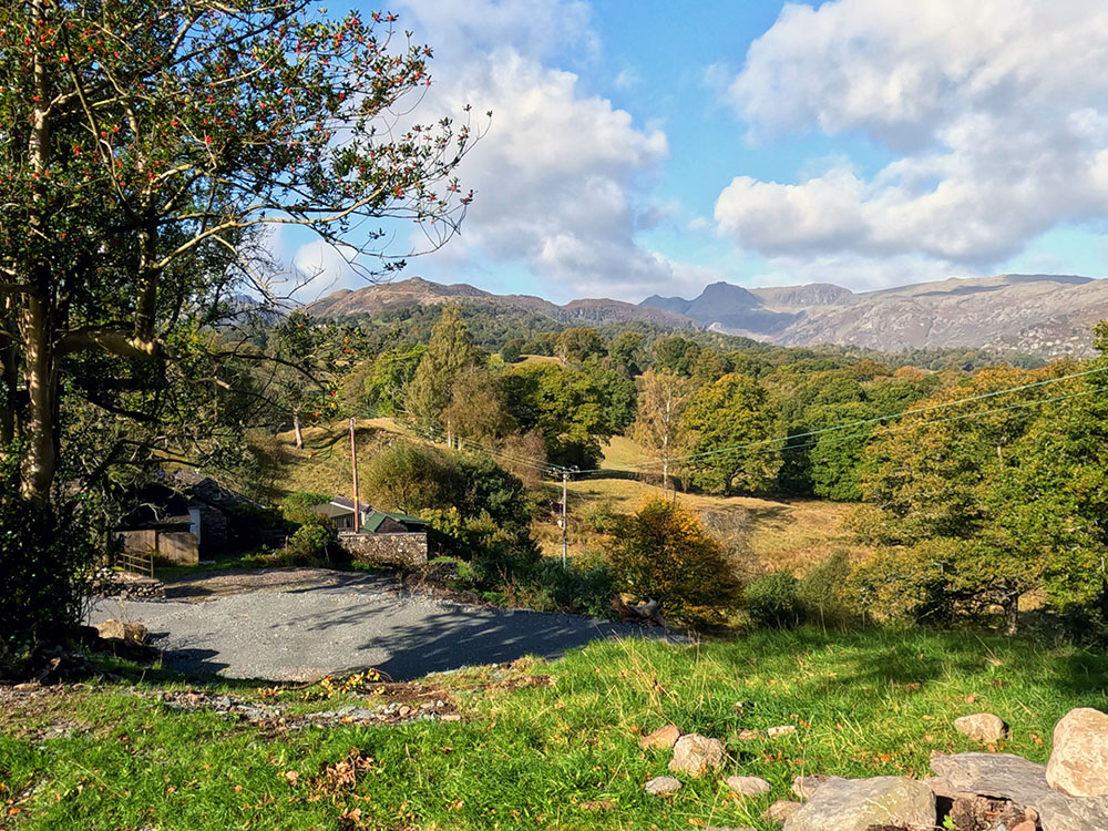
View towards the Langdale Pikes approaching Park House
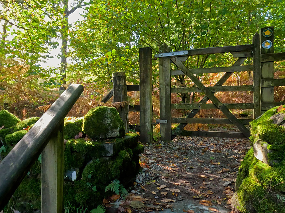
Keep on along the track and just after the houses as the track bends around to the right, we turn left here following the yellow footpath sign to pass through a metal kissing gate.
Yellow footpath sign pointing the way through the metal kissing gate
A few yards further on, pass through a second metal gate again to continue on along the narrow path, with the fantastic views all around.
If you have any thoughts about this walk or find there are any issues with any of the footpaths used, please share that in the review section below.
Pass through the next wooden gate and continue on. Pass through the next wooden gate to pass between the houses at Park Farm. Then, pass to the left of the last building and out along the gravel path to shortly afterwards pass over a stile.
Footpath down the side of the last building at Park Farm
Head over the next stile built into the wall. Walk on to pass through a wooden gate then across the track to pass through the metal kissing gate opposite it. Take time to admire the views and then continue along the path with Wetherlam on the horizon in the distance.
Looking towards Wetherlam
Continuing on, pass over the next stile and head then down the steps through the trees and then along the gravel path. Pass over the stile to walk along the path and then up and over the stone stile built into the wall to turn right along the road.
After about 50 yards, turn left off the road, heading up the stone steps to arrive at a wooden gate. There's a choice of footpaths here. We're going to take the right-hand one to pass by Colwith Force. These two paths do merge again in about another 800 metres.
Gate at the top of the steps entering the woods
Having passed through this gate, there's a National Trust sign just ahead signed Colwith Force and a board underneath that informing us about the woods we're walking through. Take this path to the right.
After a few minutes of walking, as you reach some stone steps, head right off this path for a short distance, to reach the viewpoint for Colwith Force waterfall.
Colwith Force waterfall
The falls themselves are very impressive after heavy rain. Colwith Force waterfall is about 15 metres in height across its various drops and is situated on the river Brathay, which rises on the Wrynose Pass and eventually flows into the river Rothay just before it enters the north end of Windermere.
Turn around now and retrace the path back to the bottom of the manmade steps. Walk up the steps and continue on through the trees.
On the side of the path, you meet a fallen tree with coins pressed into it, known as a wish tree, the tradition of wish trees where coins were pressed into the bark of fallen tree dates back hundreds of years when it was believed that the offering would help cure an illness. If you look to the right here, you can see down onto the top of Colwith Force.
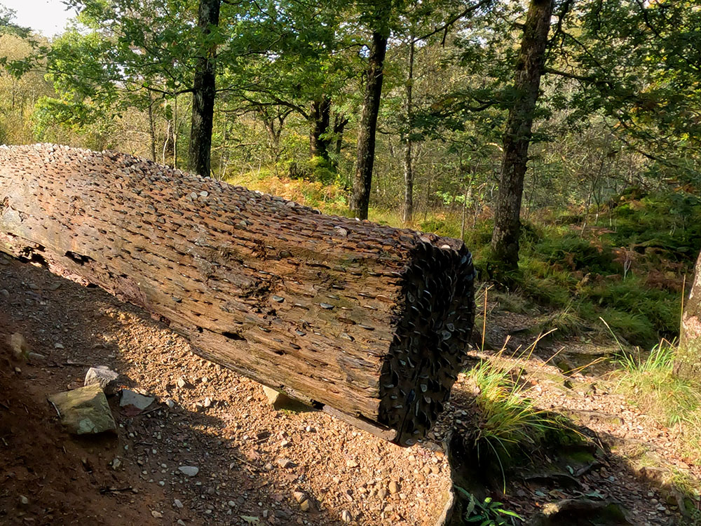
The wish tree at the side of the path
The disused weir
Continue to walk along the path where over to the right is a weir. The path keeps on slowly climbing through the trees for about another 500 metres.
The path then merges with another path by a wall, which is the path we split away from just after entering Colwith Woods. Head through the gate and along this wider gravel track, stopping from time to time just to admire the views.
Approaching High Park
Pass through the gate and follow the yellow arrow turning left or just before you head left here, you can actually just go on for a few yards through the gap and there's a small tea garden with wonderful views, which, according to the sign, is open until three, but that is weather, grandchildren and health permitting!
Turn back around and pass the gate that you came through and continue up the hill until you pass by the side of a cattle grid to turn right onto the road. Just down the road, pass by the sign pointing toward Coniston and then just continue down this road.
The surrounding panorama is wonderful from here, with Lingmoor Fell just over to the right. We follow this quiet lane now downhill for about 800 metres but stop from time to time to admire the ever-changing views.
View from the lane
After a while, the tarmac road changes to a wide gravel track and this meets the river Brathay by a wooden bridge. Turn left here to walk upstream to keep on the path by the water. Pass through the wooden gate across the track and then just over to the right you can see Slater Bridge.
Meeting the footbridge across the river Brathey
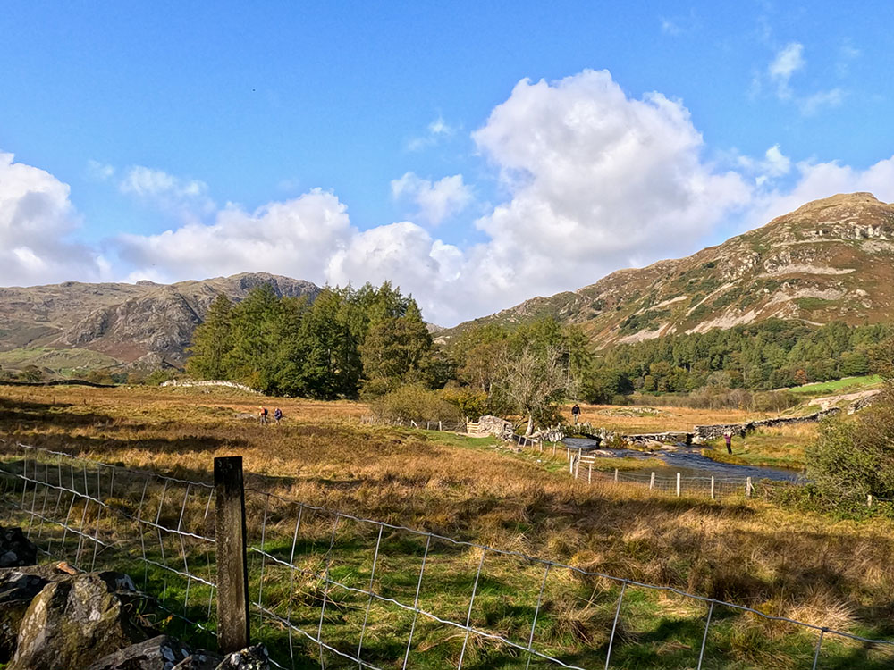
Looking across towards Slater Bridge
Continue on for about 50 metres and then pass through the wooden kissing gate on the right to leave the track.
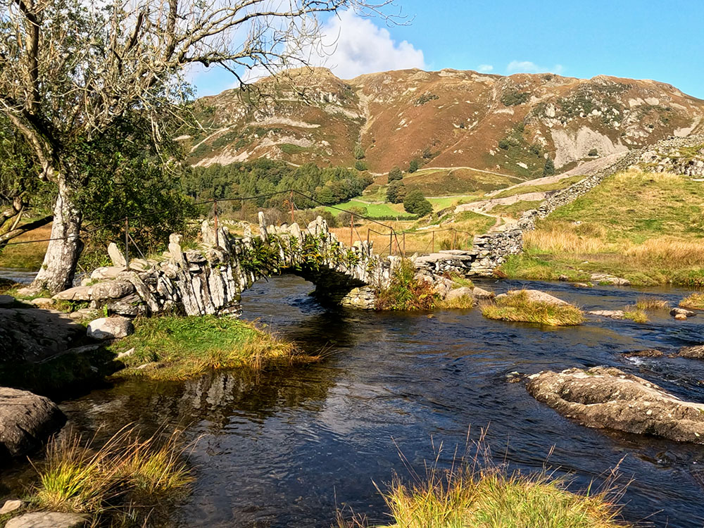
Once through the gate, head down to Slater Bridge. Before crossing Slater Bridge, if you head a little to the right, you can get the much-photographed view of Slater Bridge with Lingmoor Fell in the background.

Slater Bridge and Lingmoor Fell
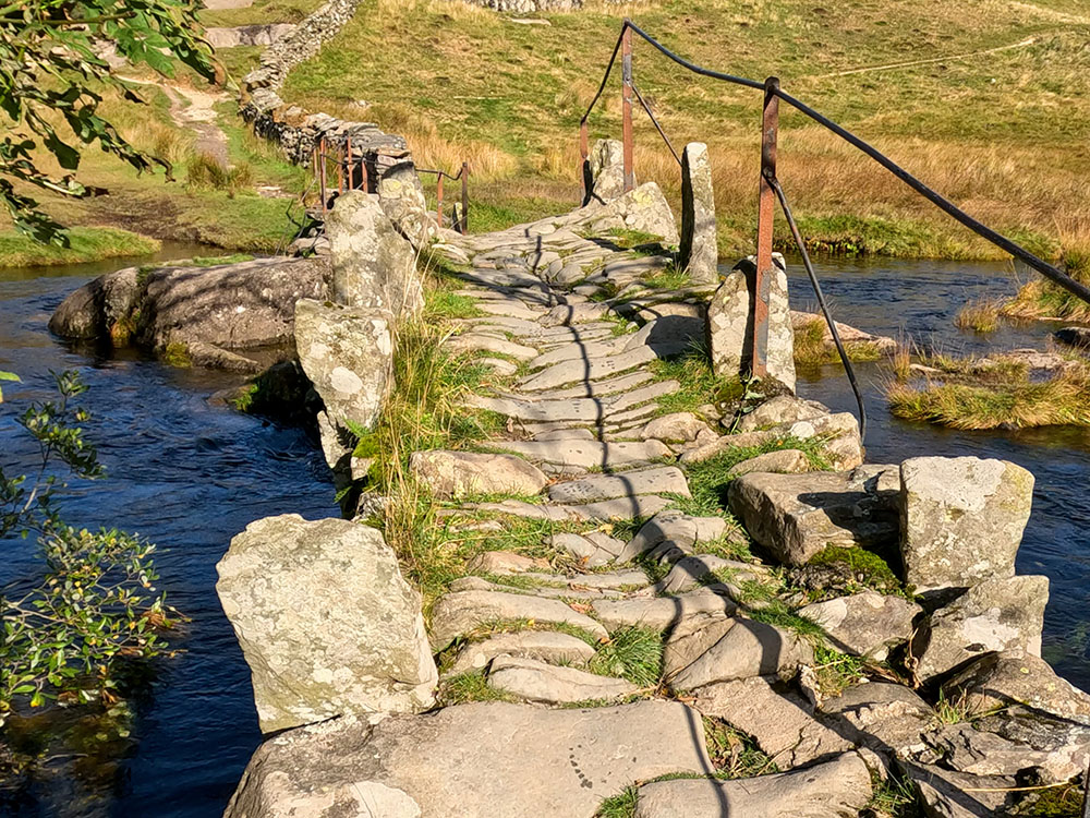
Slater Bridge - 17th-century packhorse bridge
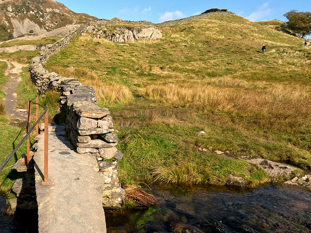
Slater Bridge itself is a 17th-century packhorse bridge that was built to allow close-by slate quarry workers easy access over the river Brathay. Head over the stile in the wall to pass over the bridge.
The bridge is actually two spans built over a large natural boulder in the middle. From the bridge, you can see a footpath coming in from the right that we're not taking today. If you wanted to short detour though, you could take that path and in about 600 metres you come out at the Three Shires pub in Little Langdale. It serves food, drink and is dog friendly.
Looking ahead - the path right to the Three Shires Inn can be seen
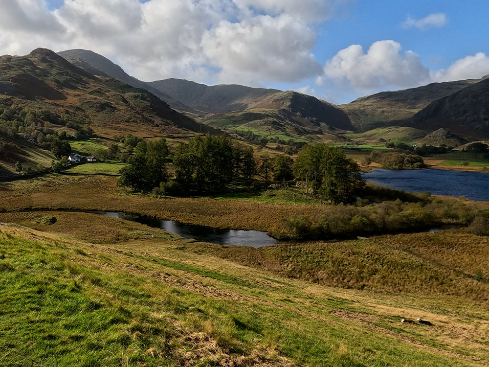
Head up the path alongside the left-hand side of the wall. As more how it is gained, if stop to look around now, you'll see Lingmoor Fell and then around and down to Little Langdale tarn and then around to Wetherlam.
Lingmoor Fell and Little Langdale Tarn
Looking back along the path just climbed towards Little Langdale Tarn and Wetherlam
Pass through the wooden kissing gate and then on and through the next gate. Walk up the short gravel path, pass through the next gate and turn left along the track. Stop and look back from time to time to admire the view.
We then meet a road where we're going to turn left. But, if you did visit the Three Shires, then if you look up to the right here, the Three Shires is about 400 metres down the road. So if you come out of the pub, turn right and walk back along this road to this point.
At this point, we are turning left here though, and then turning immediately right, up the road that heads for the right-hand side of Lingmoor fell.
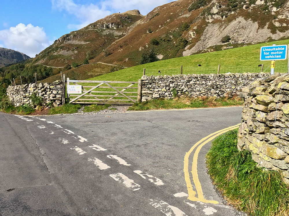
The road junction where we head right back towards Elterwater
A little way up this road, there is some additional parking on the right-hand side. Parking is a bit of a scarce commodity down these valley roads.
Just past the White House at Dale End, the tarmac road turns into a gravel track. Keep straight on here. Pass through the metal gate and keep on the track.
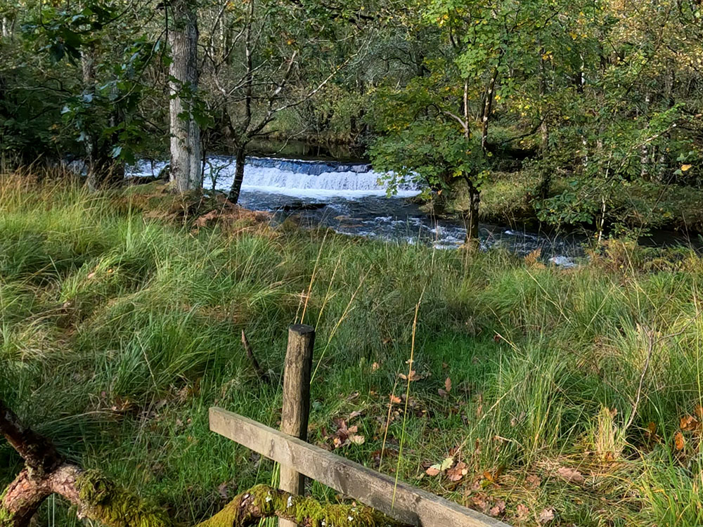
This stone and gravel track is now followed for about three-quarters of a mile back into Elterwater. The track does provide views over towards Loughrigg Fell and beyond.
Pass through the gate across the track and keep descending. Over to the right, you can see back down to the Elter Water.
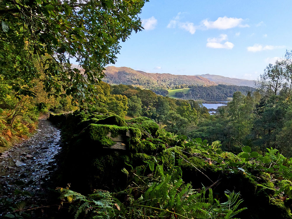
View through to Elter Water from the walled track
After a while, the stony track becomes tarmacked underfoot. You then arrive at a road junction.
As we're almost back to the start, you could take a short diversion to the Eltermere Inn, which serves food and drink and is dog friendly. If not taking the diversion, turn left at the Eltermere Inn sign and continue walking down the road, where the bridge over Great Langdale Beck is soon reached. Over to the right is the car park where we started the walk.
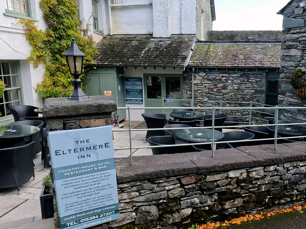
Eltermere Inn in Elterwater
Just before heading back into the car park to finish the walk, there are two more places within 50 yards that you can eat and drink after the walk.
If we head on past the car park, not far up the road over to the left is the Britannia Inn. The Britannia Inn serves food and drink. It's dog friendly and has a range of real ales on the bar and if the weather is not too inclement, there's plenty of outside seating.
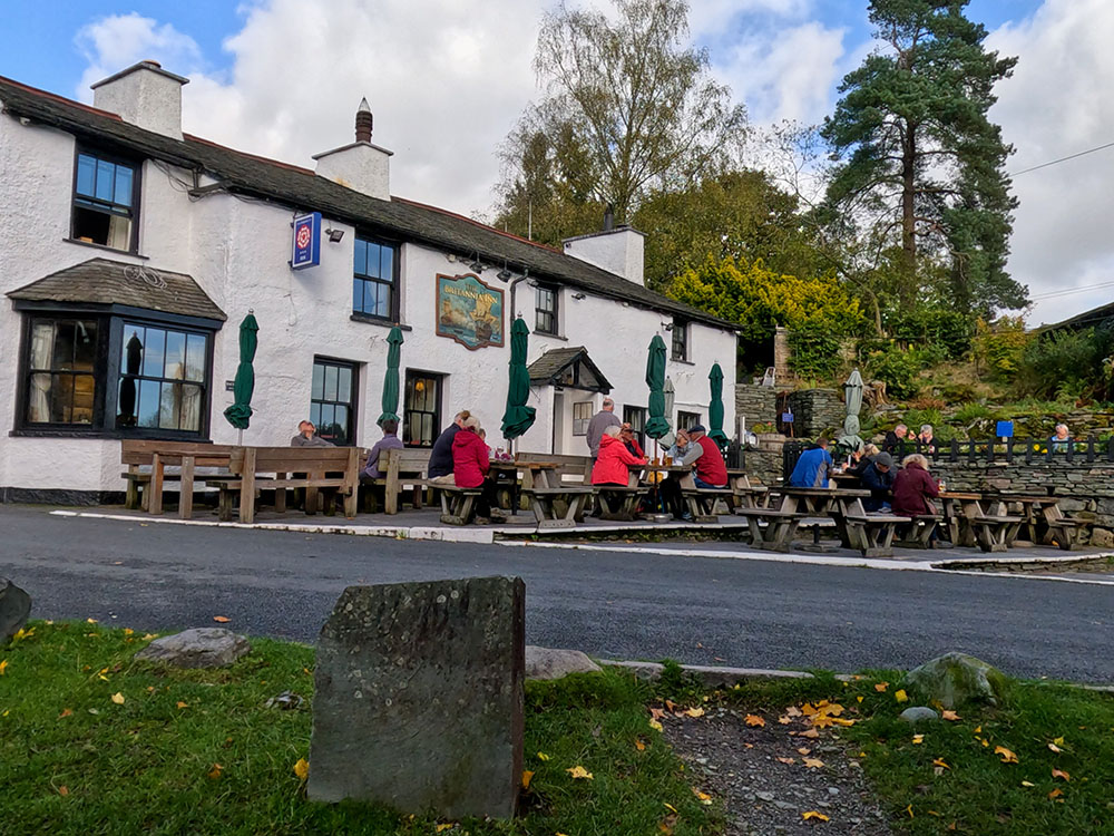
Britannia Inn in Elterwater
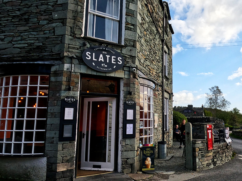
Slates Coffee and Kitchen in Elterwater
Just across from that is Slates Coffee and Kitchen. Again they serve food, including a tasty full Cumbrian breakfast, various cakes and tray-bakes and drinks along with a range of specials. It's also dog friendly.
Gifts and presents for hikers and walkers
Are you struggling to pick the perfect gift for your hiking-loving friend or family member? Don't fret! Explore our curated selection of top-notch gifts for walkers and hikers that will have them trekking with joy on their special day.
What to wear and take on your walk or hike
Whether you are a seasoned hiker or new to walking, wearing and taking suitable hiking kit and clothing is essential for a day hike for your comfort and safety. So we have put together a hiking essentials checklist to cover all you'll need. Our Hiking Essentials checklist for 2026 takes you through planning your walk, the hiking essentials checklist itself, optional extras, explanations, and recommendations for all the hiking essentials.
Check out the reviews for this walk: