By using this website, you agree to our use of cookies (needed to provide our website’s features) and our Terms of Use.
By: Andrew Forrest - May 2025
.jpg)
Imagine standing on a hilltop looking at your map and compass - which way is really north? In navigation, there are three 'norths' - True North, Grid North and Magnetic North.
This page contains affiliate links. If you buy products or services via these links, we may earn a small commission at no cost to you. If you are thinking of buying, please use our links, as it helps support our website and YouTube channel.
True North points to the geographic North Pole (the top of Earth's axis).
Grid North is the straight-up direction of the vertical grid lines on a map (such as the Ordnance Survey grid).
Magnetic North is where your compass needle points - the direction of the Earth's magnetic field at your location.
These three norths are all very close but not identical, and the differences matter for precise navigation. In fact, map legends often include a diagram with arrows indicating Grid, True, and Magnetic North.
In the example below from an Ordnance Survey map (OL2 Yorkshire Dales and Southern and Western Areas), the vertical line represents Grid North, the arrow to the right indicates True North, and the arrow to the left denotes Magnetic North (indicating Magnetic North currently lies slightly west of Grid North at the time the map was printed - 2007).

Extract from an Ordnance Survey map legend, showing True North, Grid North and Magnetic North, with the difference between them
True North is simply 'straight up' along the Earth's meridians to the North Pole.

A globe showing all the lines heading to the North Pole (True North)
Grid North follows the map's rectangular grid. On an OS map the grid lines run (nearly) north-south, but they are based on a simple flat grid projection and converge on the pole at 2° W longitude.

Extract from an Ordnance Survey map showing the faint blue Grid North lines vertically on the map
Thus, Grid North and True North coincide exactly only along the 2° W meridian; elsewhere, Grid North is offset by a fraction of a degree to the west or east.
By contrast, Magnetic North is the direction in which your compass points, specifically towards the Magnetic North Pole. This currently lies north of Canada and Siberia, although it is slightly closer to Siberia.

A compass sat on a map, with the red compass arrow pointing towards Magnetic North
Due to the wandering of the magnetic pole, Magnetic North on a compass is never fixed. In Britain today, compasses typically point slightly west of True North (negative variation) in the south and east of True North (positive variation) in the far north.
More formally, magnetic declination (also called magnetic variation) is defined as the angle between Magnetic North and True North - positive if Magnetic North lies east of True North and negative if it lies to the west. In practice, when consulting a map, you often compare Magnetic North to Grid North, but the principle remains the same. When reading a map, you need to adjust for this declination between Grid North and Magnetic North to achieve an accurate reading.
Centuries ago, mariners were the first to notice this phenomenon. Long before Europeans, medieval Chinese sailors utilised compasses. When European explorers began using compasses at sea in the 13th to 15th centuries, they noticed that the needles didn't align exactly with the true North Pole. This fascinating difference, known as magnetic variation, was mapped as early as the late 1500s.

A sailor from the 15th century on a boat in the middle of an ocean, looking at his map and compass
Edmond Halley, known for having a comet named after him, later charted isogonic lines (equal declination lines) to show variations across the Atlantic. With engineers and scientists, including William Gilbert in 1600, examining the Earth's magnetism, it became clear that the compass pointed to a magnetic pole instead of the geographic one.
Supposedly, even Columbus kept the unusual behaviour of the compass needle a secret from his crew during his 1492 voyage to prevent panic. By the 17th and 18th centuries, it was recognised that the Earth acts like a massive bar magnet, with its magnetic poles shifting because of fluid movements in the core.
In Britain, detailed surveys have measured local declination for centuries. On 19th-century Admiralty charts and early OS maps, local variation was indicated in the corner of each sheet.

An extract from the legend on an Ordnance Survey Map describing the North Points and where they lay in 2004, in relation to this Yorkshire Dales map
The small superscript circle next to a number indicates that it represents a degree. A compass has 360 degrees. The superscript dash following the second number denotes minutes, a subdivision of a degree. There are 60 minutes in a degree. In practice, with the scale on a compass, you will only ever use degrees.
What this signifies for the image above is that in July 2004, on the North Sheet of the Yorkshire Dales map, Magnetic North was 3.65° west of Grid North at the centre of that map, and each year the variation decreased by approximately 0.217° (13') per annum (moving east).
One can estimate that compasses in that location would align with the Grid or True North, where declination is zero in Autumn 2021. According to the table below, an examination of Skipton reveals that this was due to occur in 2024, indicating that the movement in variation is currently slowing.
Any future estimates are merely that - estimates, as the variation is not a constant.
Unlike True North (fixed) or Grid North (fixed by map grid), Magnetic North is not stationary. The Magnetic North Pole is currently on the move. Over the past few decades, it has accelerated from Canada toward Siberia, at times shifting some 30-50 km each year. In late 2019, the pace even surpassed early 21st-century rates, though it has recently slowed somewhat.
This 'wandering' pole shows that the magnetic declinations in the UK are altering annually. Throughout most of the 20th century, the Magnetic Pole remained west of Britain's longitudes, which led compasses in the UK to point west of True North. In fact, OS indicates that Magnetic North has been consistently positioned to the west of Grid North in Great Britain since the 1660s, until approximately 2014. Around that time, it crossed over: Magnetic North shifted slightly east of Grid North in parts of southern England.
Today, this gradual shift persists. As the pole moves, compass variation in the UK alters by approximately a few minutes of arc each year.
In southern England, the change is approximately +6' to +12' per year (eastward), whereas in Scotland, it is less pronounced. Overall, declination across the UK varies from about -1½° (west) in northern Scotland to roughly +1° (east) in southern England.
The British Geological Survey (BGS) provides a UK magnetic model. The table below summarises the declinations for 2020 and roughly indicates when each is or was expected to cross zero (align with True North) if trends continue. (For example, Skipton - very nearly at 0 in 2020 - will have had a declination of approximately 0 around 2024.) These values are all measured east or west of True North (positive = east).
| Location | Latitude | Current Declination | Approx. Year Magnetic = True North |
| London | 51.5° N | +0.96° (east) | early 2020s (≈2021) |
| Edinburgh | 55.9° N | -0.60° (west) | mid 2020s (≈2026) |
| Cardiff | 51.5° N | -0.07° (west) | 2023 (≈2023) |
| Belfast | 54.6° N | -1.49° (west) | about 2030 (≈2030) |
| Kendal | 54.3° N | -0.22° (west) | late 2020s (≈2027) |
| Skipton | 54.0° N | +0.09° (east) | 2024 (≈2024) |
| Plymouth | 50.4° N | -0.34° (west) | mid 2020s (≈2025) |
| York | 53.9° N | +0.26° (east) | ~~~2022~~ (≈2023) |
Magnetic declination (east positive, west negative) for selected UK locations (approximate, from the World Magnetic Model/WMM2020)
and the estimated year when compasses there will (or did) align with True North (declination = 0). These estimates assume the current rate of
change (secular variation) continues.
To obtain an accurate compass correction, hikers should always check the current value on their map legend or from an up-to-date magnetic model. That said, I have noticed that electronic app versions of maps do not include this information in their legends. I believe this is because modern GPS units and smartphones typically manage this correction automatically as they incorporate a magnetic compass model.
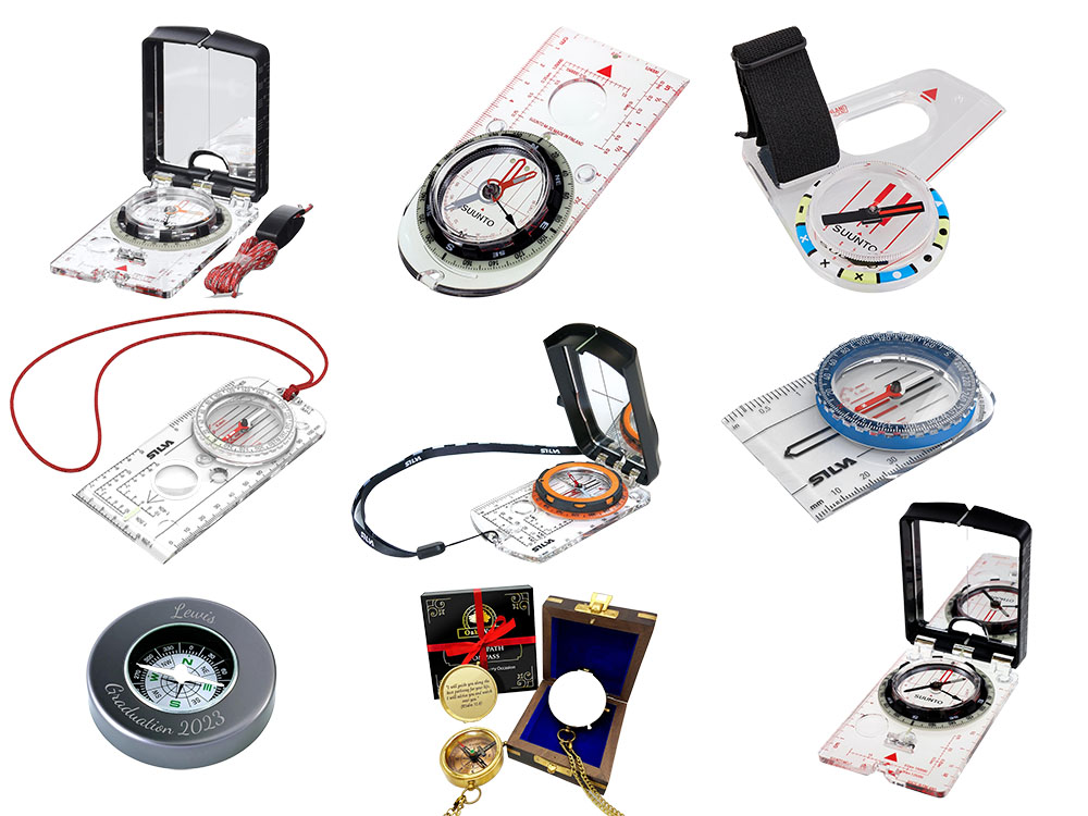
When utilising a map and compass for navigation, adjusting for local magnetic declination is crucial. This requires either adding or subtracting the declination angle from your compass or map direction. In simpler terms, if your compass shows west of Grid North, you add that angle to your compass bearing to obtain a true/grid bearing; if it points east, you subtract it instead. To account for magnetic variation in your bearing, rotate the compass housing appropriately.
If you use paper maps, particularly older ones, always verify the latest declination for your area before heading out on a hike. You can do this on the Magnetic Declination website.
Many outdoor enthusiasts have seen classic British triangulation pillars ('trig points') scattered across hilltops for many years. These concrete columns were used to establish the OS map grid. Each trig pillar features a brass flush plate set into its side, stamped with the OS benchmark (OSBM) height and the trig station reference number.
The top generally has a three-armed 'spider' to mount a theodolite. Initially, surveyors aligned each trig pillar according to the grid. Essentially, one pillar was positioned 'north' of another along a line of longitude, thereby contributing to the definition of Grid North within the national network. (The 2° W line at Langton Matravers, Swanage, was selected to ensure that Grid North corresponded with True North in that location.) Some trig sites also feature orientation plates or toposcopes: circular plaques located on or near the pillar, inscribed with the names and bearings of visible hills or landmarks. These are generally aligned to True (or Grid) North.

The elaborately designed brass mounting plate on top of the Snowdon Trig Point
For instance, a toposcope may feature an arrow labelled 'N' that directs towards True North, along with additional arrows that point to nearby hills, providing walkers with bearings from True North to help them recognise peaks. It does not rely on the traditional Magnetic North (compass) for orientation. Thus, the triangulation network and its plates are incorporated into the Grid and True North system instead of the fluctuating Magnetic North.
While reading the resources for this article, I came across a few other interesting facts that I thought I would include here:
Understanding all three norths is essential for accurate navigation. True North is the fixed geographic reference, Grid North corresponds to our mapped grid, and Magnetic North is what the compass indicates (and it moves!).
By keeping in mind which 'north' a compass indicates, and utilising map legends or apps to correct for declination, you can ensure your route-finding remains on course. Always match the correct north - and remember to consider that moving magnetic needle on your next outdoor adventure.
Happy map reading...
Magnetic North is the direction a compass needle points, aligning with Earth's magnetic field. It is not fixed and gradually moves due to changes within the Earth's molten core.
Currently, Magnetic North is located in the Arctic Ocean, north of Canada, moving gradually towards Siberia, Russia.
True North points directly towards the geographic North Pole, while Magnetic North points towards Earth's wandering magnetic pole, influenced by Earth's magnetic field.
Globally, it varies significantly. In the UK, the difference (declination) currently ranges between about -1.5° (west) in northern Scotland to around +1° (east) in southern England.
The Magnetic North Pole is currently located in the Arctic Ocean, drifting northwest from Canada toward Siberia, Russia.
Magnetic North is currently located hundreds of kilometres south of the geographic North Pole, approximately drifting from Canada toward Russia, while True North is a fixed location at the Earth's geographic pole.
The Earth's Magnetic North Pole is in the Arctic, currently north of Canada and slowly moving toward Siberia.
Yes, technically, you can visit the vicinity of Magnetic North, but it's a remote location in the Arctic Ocean and requires careful expedition planning.
True North is the exact direction along Earth's surface toward the geographic North Pole.
In slang, 'True North' refers to someone's fundamental guiding values or principles - essentially, one's moral compass or authentic self.
True North aligns directly with the geographic pole. Grid North refers to the north direction of grid lines on maps, slightly offset from True North due to map projection.
Check your map legend for the local grid convergence. Add or subtract the indicated small angle to convert between Grid and True North accurately.
Typically, there are three main types of north: True North, Magnetic North, and Grid North. Occasionally, a fourth, Astronomic North (based on stars), is mentioned.
It depends on context. For navigation with maps, typically, Magnetic North is used (with adjustments), while True North is useful for precise geographical tasks or GPS systems.
Grid North is the direction of north indicated by vertical grid lines on maps like those from the Ordnance Survey, which differ slightly from True North.
Grid North is used for navigation with maps that feature grid references, which is particularly beneficial for walkers and hikers using OS maps.
No. At present, Magnetic North differs slightly from Grid North in the UK, and this difference (declination) changes gradually each year.
True North points to the fixed geographic North Pole, whereas Magnetic North points to the Earth's moving magnetic pole.
Globally, this varies; in the UK, the difference currently ranges from approximately -1.5° to +1°, depending on the location.
Currently around -1.5° (west) in northern Scotland to approximately +1° (east) in southern England.
GPS devices typically use True North as they rely on satellites aligned with the Earth's geographic coordinates.
Typically, compasses are set to Magnetic North for outdoor navigation. Always adjust bearings based on local declination.
True North is a geographically precise and fixed point, whereas Magnetic North varies and requires periodic adjustment for accuracy. For most navigation purposes, adjusted Magnetic North is a practical and dependable option.
In the UK, the current difference varies from approximately -1.5° to +1°, depending on your location.
The North Magnetic Pole is presently shifting northwest across the Arctic Ocean towards Siberia, Russia.
The Magnetic North Pole is situated geographically north of Canada and is gradually moving towards Siberia in the Arctic Ocean.
Grid North aligns with the vertical grid lines on maps, such as OS maps, which are clearly marked by vertical lines and indicated in the map legend.
Grid North differs slightly from True North due to the flattening of the Earth's curved surface onto a flat grid, which creates minor angular differences.
Refer to your map's legend for the accurate local grid convergence value. Adjust compass bearings by adding or subtracting this small angle to ensure accurate conversion.
Currently, it's not in a specific country; it is located in international waters in the Arctic Ocean but moving closer to Siberia, Russia.
Ordnance Survey
British Geological Survey
NOAA information on declination
Magnetic-Declination
May 2025