By using this website, you agree to our use of cookies (needed to provide our website’s features) and our Terms of Use.
This Arnside Knott walk is a short circular walk around and over Arnside Knott, which affords beautiful views of the Lake District Fells and Morecambe Bay.
In accordance with our Disclaimer, you agree to take full responsibility for any use you make of the information contained in these pages.
This page contains affiliate links. If you buy products or services via these links, we may earn a small commission at no cost to you.
| Walk title: | Arnside Knott Circular Walk |
| Author: | Andrew Forrest - January 2024 |
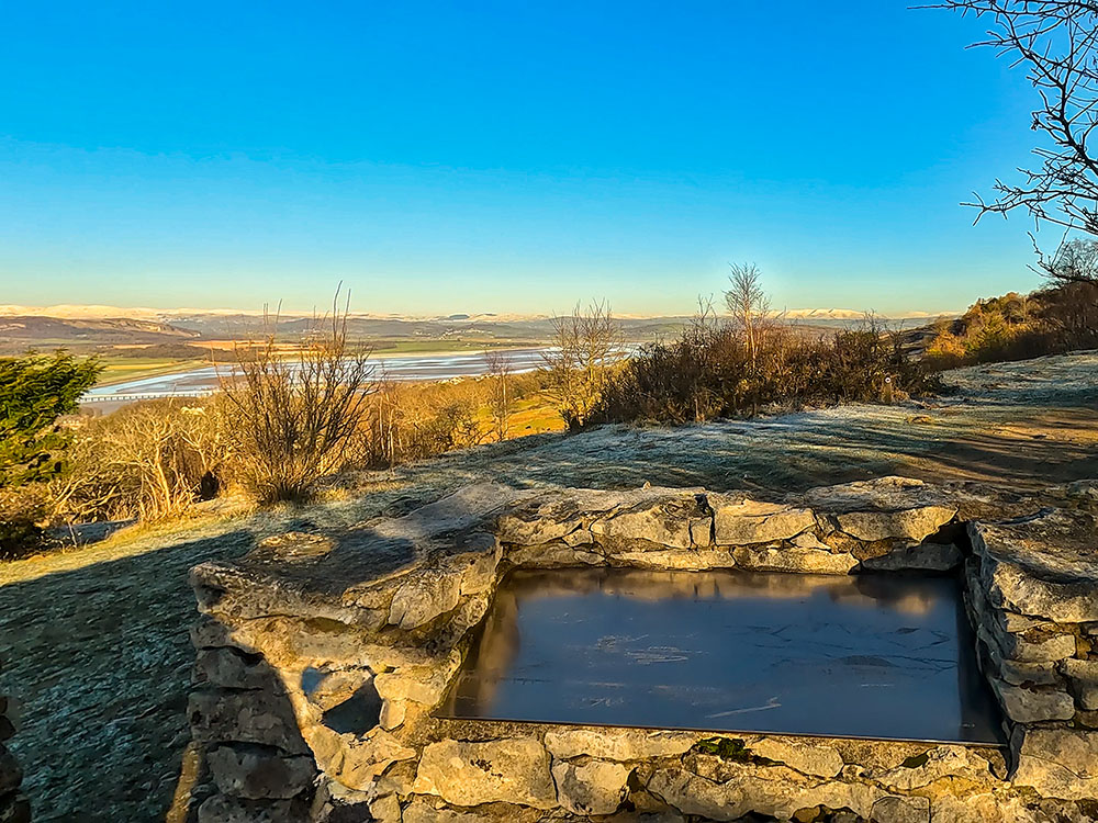
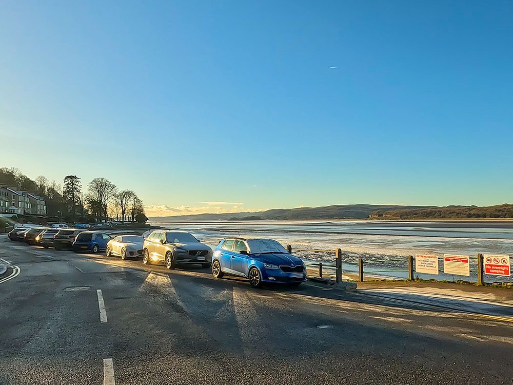
| Walk start point: | The walk starts in the small, free National Trust car park on Arnside Knott (grid reference SD 449 774) - it can get busy on weekends and bank holidays. You can start the walk in Arnside and walk out to the car park (approx. 20 minutes walk). What3words: intruded.minimums.warmers |
| Parking: | As above |
| Directions to nearest parking place: | Google Maps: get directions here / What3words: sedative.birthdays.breeze |
| Walk distance: | 2.9 km |
| Estimated walk time: | 55 minutes |
| Height climbed: | 98 metres |
| Technical difficulty: | Moderate - as determined by our interpretation of the Ordnance Survey guidance on technical difficulties |
| Peaks / summits: | Arnside Knott |
| Map: | Ordnance Survey - Explorer OL7 (The English Lakes - South-eastern Area) Buy this map from Ordnance Survey |
| GPS/GPX file: | Download available to registered users - Register and Login here - It's FREE to register |
| Facilities / refreshments: | Toilets in nearby Arnside. Pubs, cafés and a chip ship in Arnside |
| Nearest town: | The walk starts in on Arnside Knott, close to Arnside |
| Local self-catering accommodation: | View self-catering accommodation close to the start of this walk |
| Local hotels, inns and B&Bs: | View hotels and inns close to the start of this walk from The Inn Collection Group |
Estimated walk time
Walk time estimates used are from the Ordnance Survey mapping app, which uses a refined Naismith's rule, adjusted by OS overlaying their own data collected from more than one million people using the OS mapping app. Naismith's rule allowed one hour for every three miles walked and added pro-rata an additional hour for every 2000ft of ascent - roughly one hour for every 5km, plus one hour for every 600m of ascent.
Ordnance Survey Mapping App
Use on any device and make it easy to explore the great outdoors for just the price of a coffee a month. Premium allows full UK access to all OS Explorer and Landranger mapping, along with the ability to import and export routes, save maps offline, aerial 3D, and print A3/A4 maps.
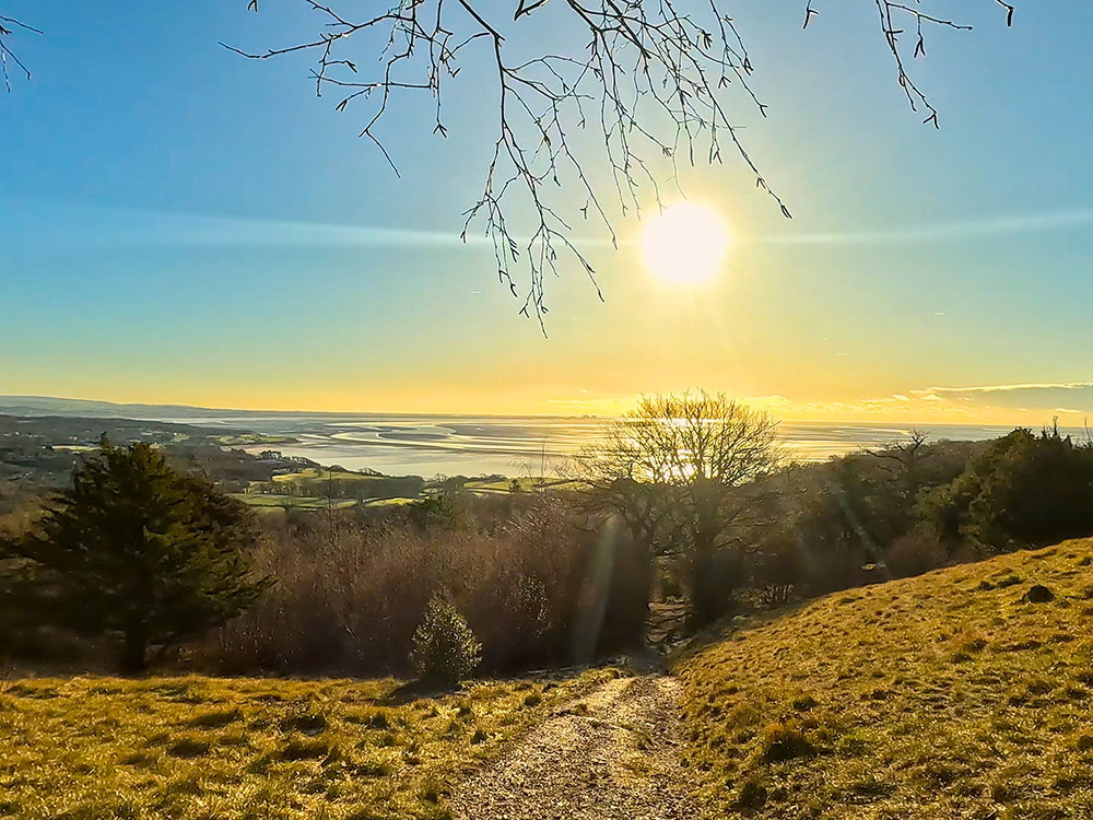
We start this Arnside Knott circular walk in the small, free National Trust car park on Arnside Knott and then head along a gravel path through a wood before arriving at our first view of Morecambe Bay. We then climb and soon arrive at a bend in the path that affords our first real view across to Grange-Over-Sands and out into Morecambe Bay.
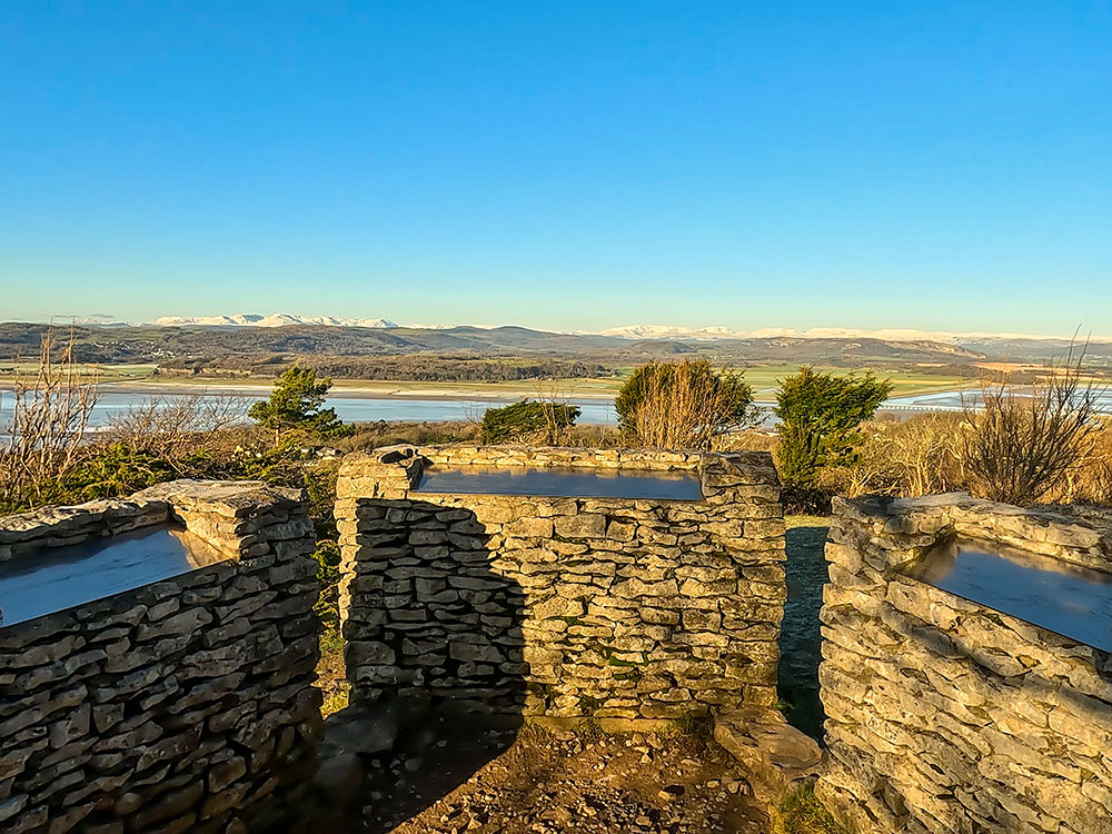
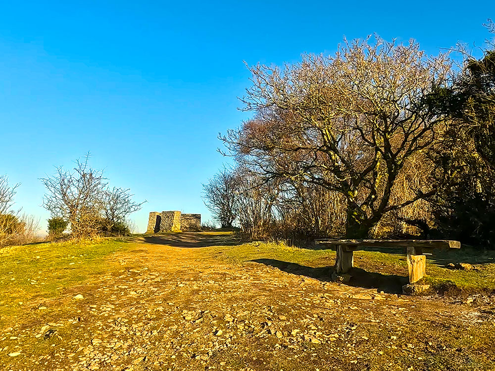
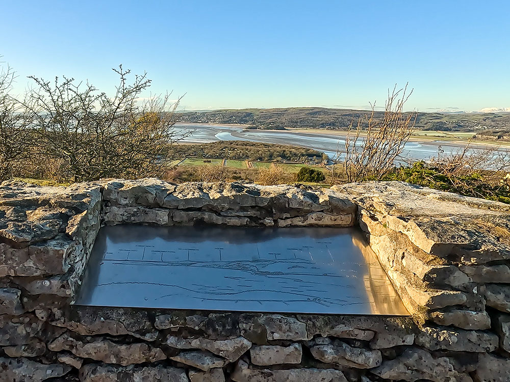
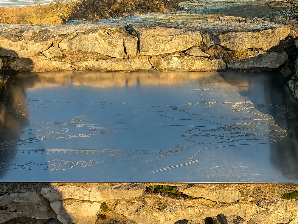
We continue climbing and soon reach the toposcope on Arnside Knott. A toposcope is a monument that contains a pictorial display of the distinctive features that can be seen from that point and often includes distances to those features or their heights. In this case, it gives views down to Arnside Viaduct, all around the snow-capped Lakeland Fells and out towards Morecambe Bay.
After leaving the toposcope, we climb further and pass by the unusual knotted larch. This is known as the 'h' tree or the giraffe tree. Just a little further up the path is a stone and wooden bench that again affords the same stunning views as from the toposcope across the snow-capped Lake District Fells.
The walk continues to the trig point of the top of Arnside Knott, but as it's on a mini plateau and surrounded by trees, there are no real views from it.
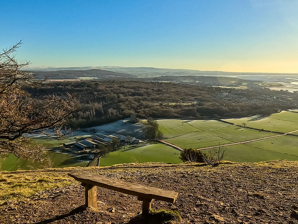
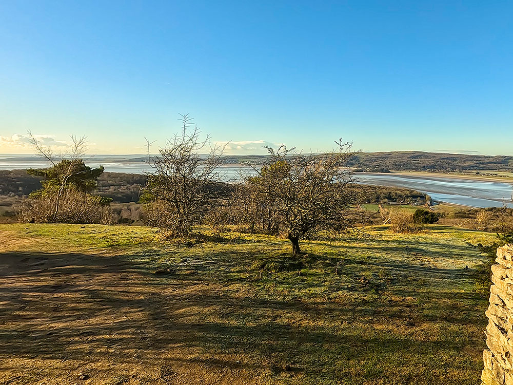
We continue across Arnside Knott to reach the south side, where a bench just off the path affords a view down to what remains of Arnside Tower and wonderful views over Silverdale and out across Morecambe Bay.
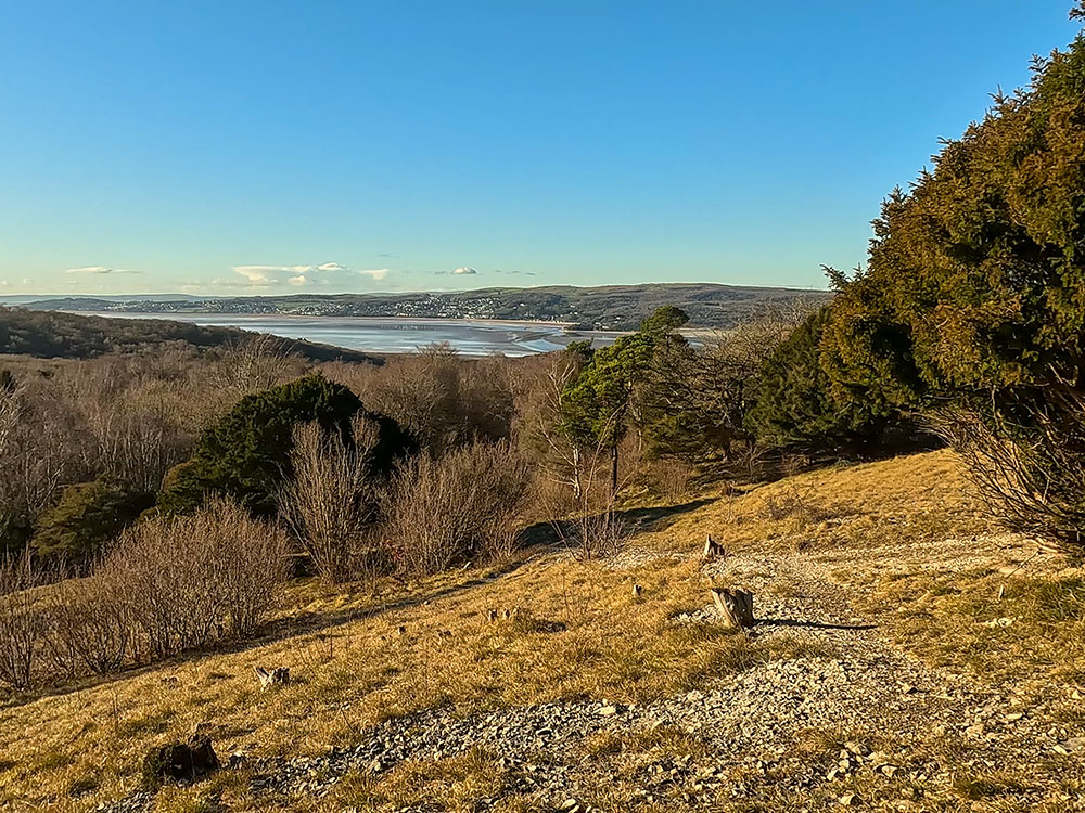
After heading through the wood in a westerly direction, we are again awarded with another magnificent view - this time towards Humphrey Head and Morecambe Bay.
We descend off Arnside Knott, again with delightful views across Morecambe Bay, and head back down to the car park to end this Arnside Knott walk.
The video shows this full Arnside Knott circular walk, and the route is shown on the Ordnance Survey map - both above. Below is a brief description of the walk. Places where you can eat and drink after the walk are shown below and at the end of the video.
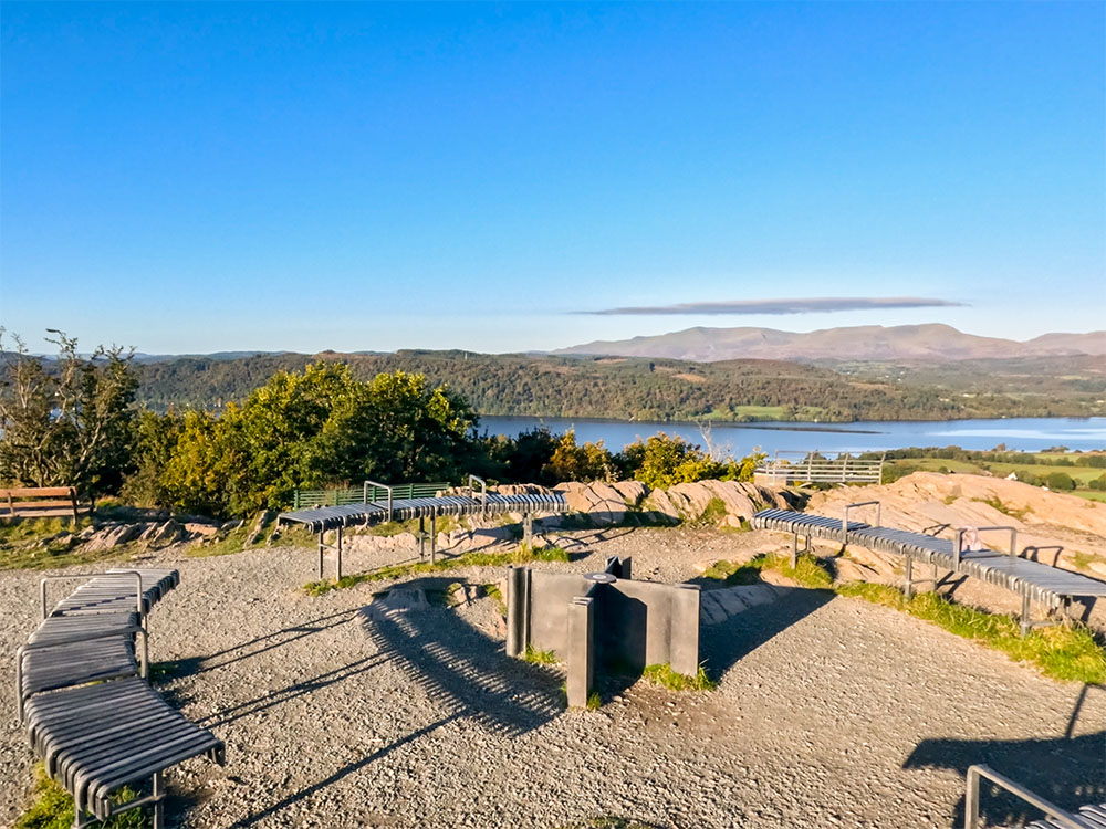
We start this Arnside Knott circular walk in the small, free National Trust car park on Arnside Knott, in Cumbria, just outside the Lake District National Park in Northern England.
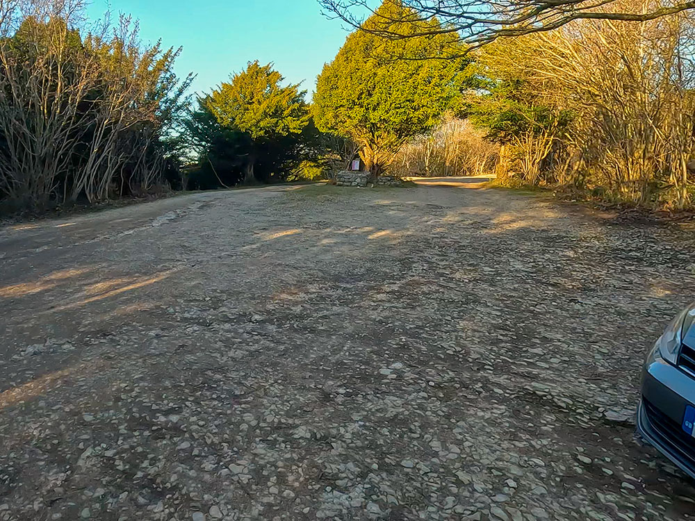
The National Trust car park at Arnside Knott
You can start the walk in Arnside village and walk to the car park if you wish. Depending on where you park in Arnside village, that walk takes about 15-20 minutes. There are footpaths that you can use, or walk along Knott Lane and then Saul's Drive.
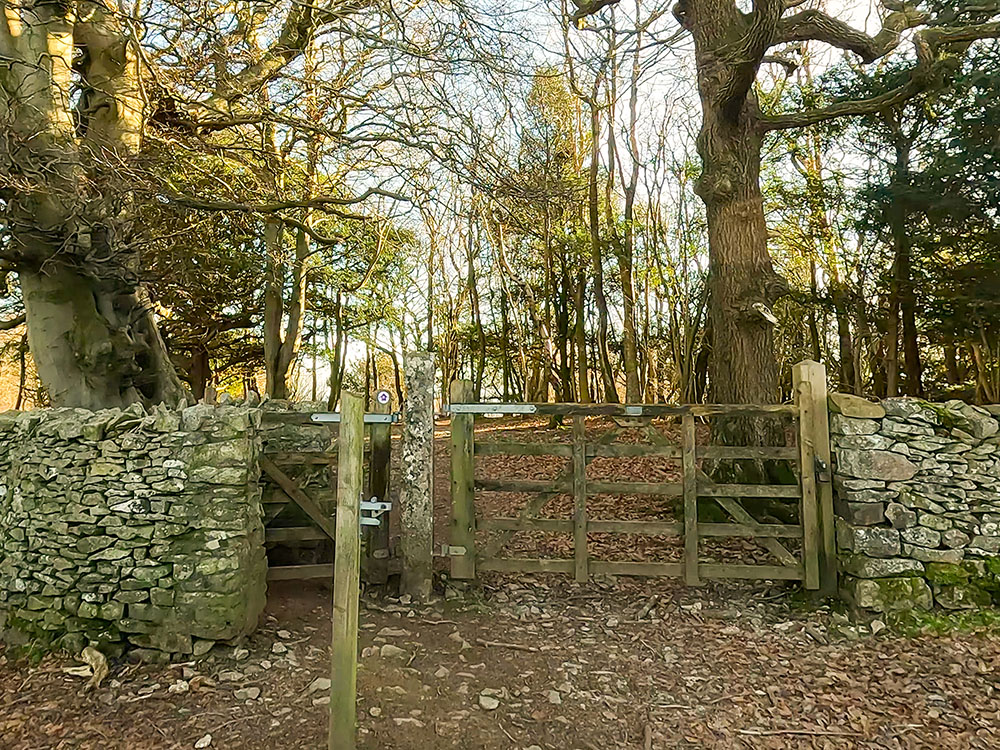
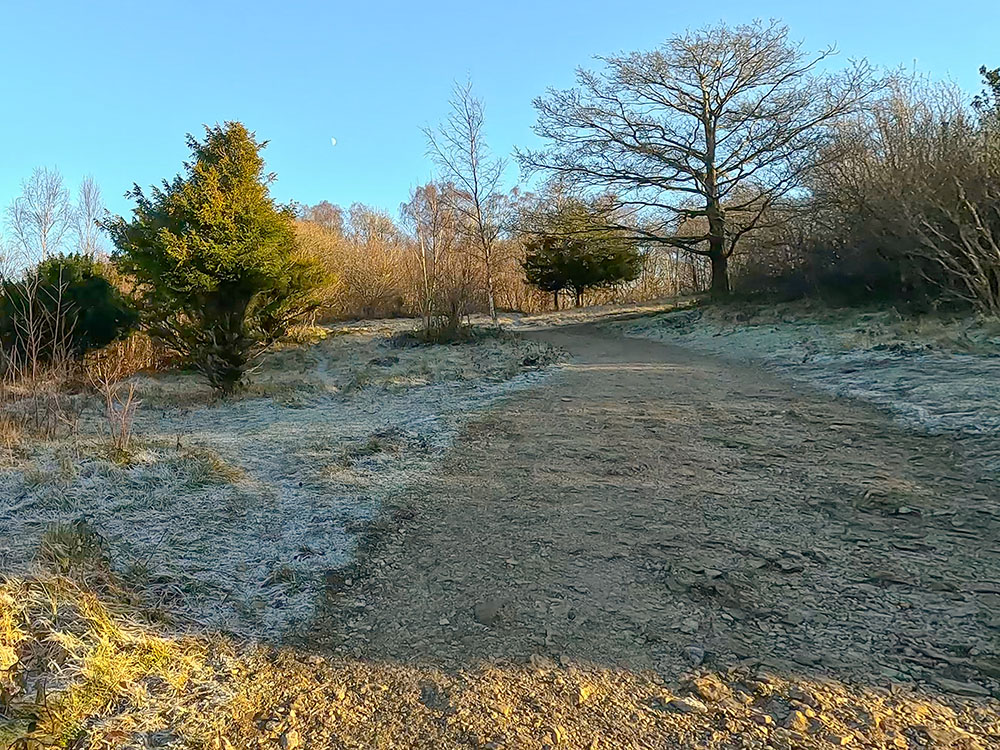
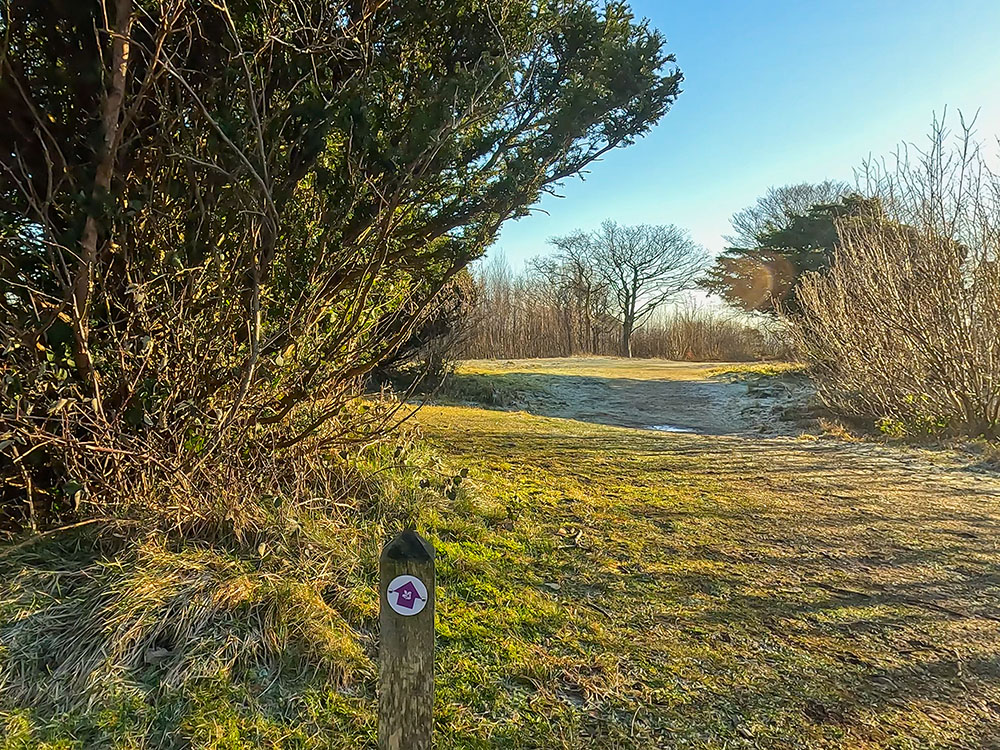
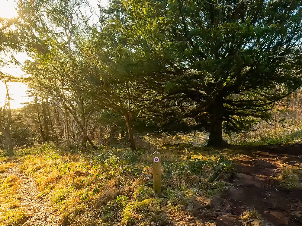
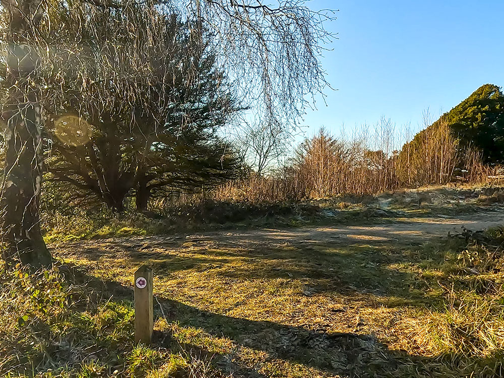
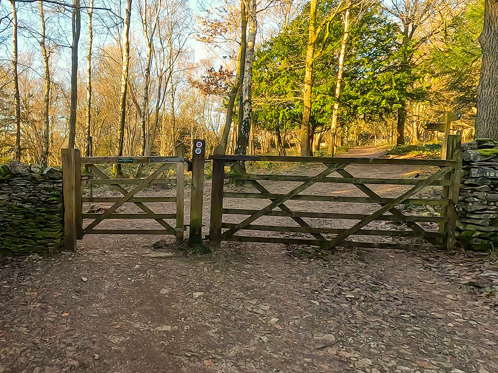
From the end of the car park, follow the wide track to a gate. You'll notice a purple arrow on the gate. We will be following these all around this walk. Pass through the gate and then head straight on along the wide path.
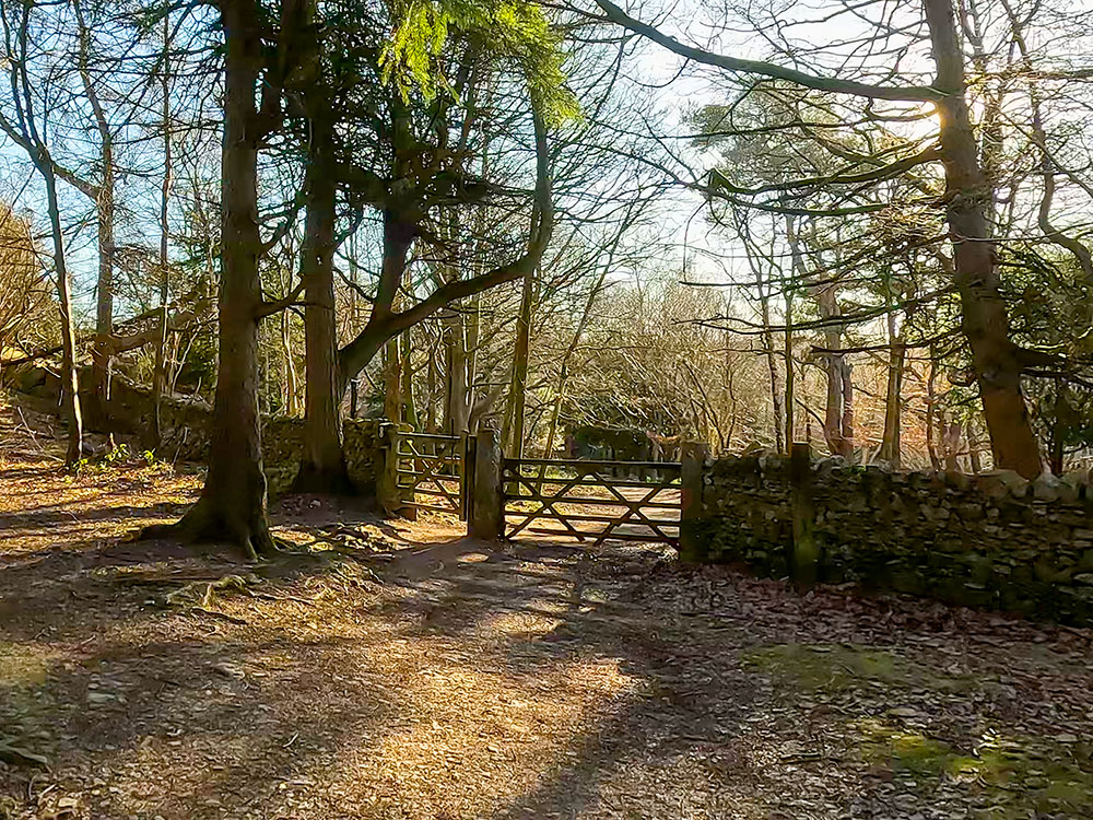
Pass through the gate
There is a footpath sign for Copridding Wood and New Barns Bay just before the next gate. Ignore these and continue straight on.
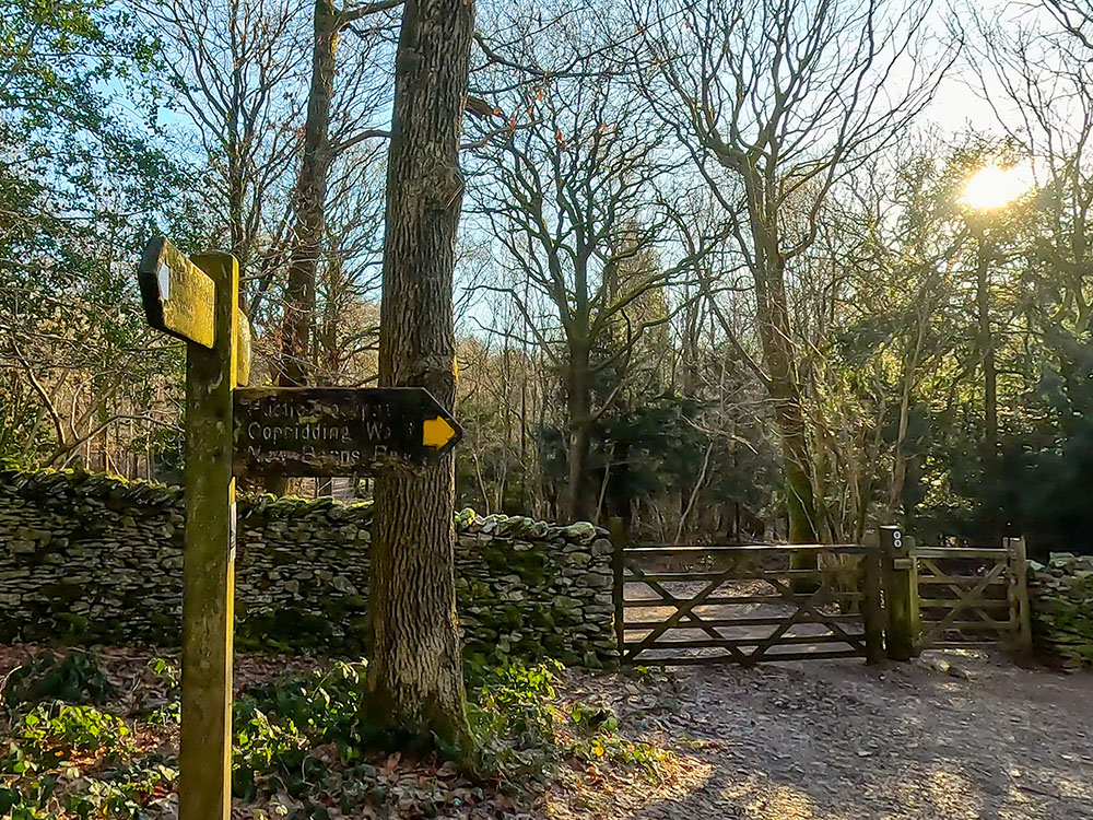
At the footpath sign, continue straight on following the purple signs
Pass through the gate. Once through the gate, continue straight on, ignoring the path that heads off up to the left. The path then reaches two gates, one heading towards Heathwaite, over which you can see out towards Morecambe Bay.
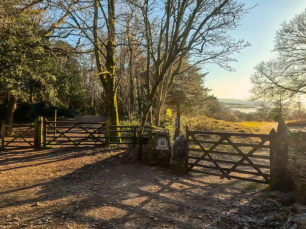
Upon meeting the gate to head towards Heathwaite, ignore that and follow the path around to the left
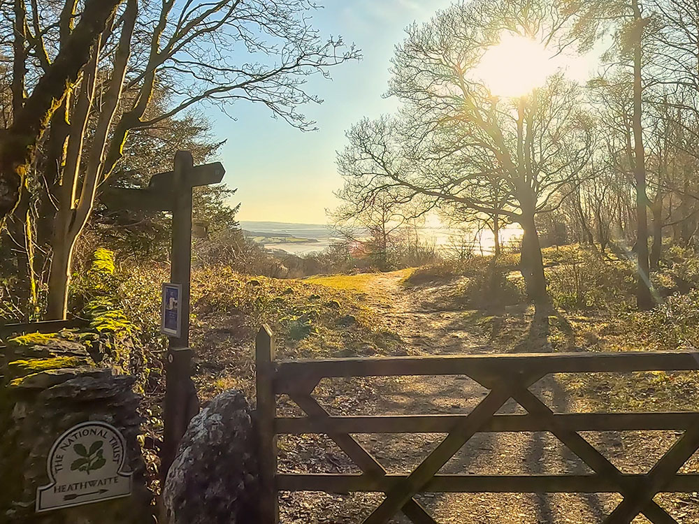
View towards Heathwaite and out towards Morecombe Bay
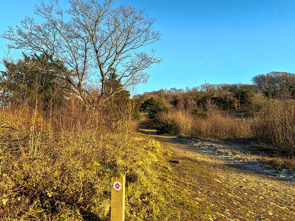
Ignore both of these gates. Follow the purple waymarker arrow, turn left here, and start heading up the hill. In spring, summer and autumn, the woods come alive with the sound of bullfinches, nuthatches, woodpeckers, marsh tits and other woodland birds.
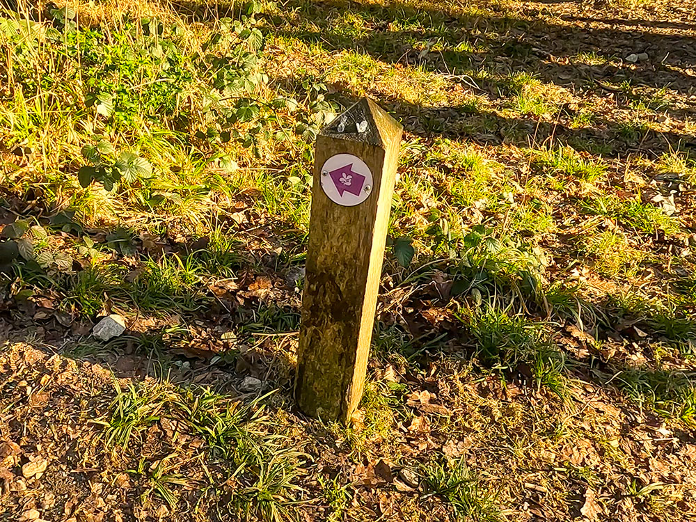
One of the purple National Trust waymarkers that mark the path around Arnside Knott
The path up through Arnside Knott Wood
After a short climb, as the path bends around sharply to the right, from this bend, you get the first real view of the day looking out towards Grange-Over-Sands and out over Morecambe Bay.

View across to Grange-Over-Sands from Arnside Knott
A few yards further, turn left off the main uphill path, following the purple waymarker arrow towards the two benches. The benches are ideally placed to enjoy the view out across Morecambe Bay.
View across to Grange-Over-Sands from the two benches on Arnside Knott
Past the benches, keep walking along this narrow path, where you soon reach a stone wall. Pass through the wall by way of the wooden gate and then turn right again, following the purple waymarker arrow to head up the hill.
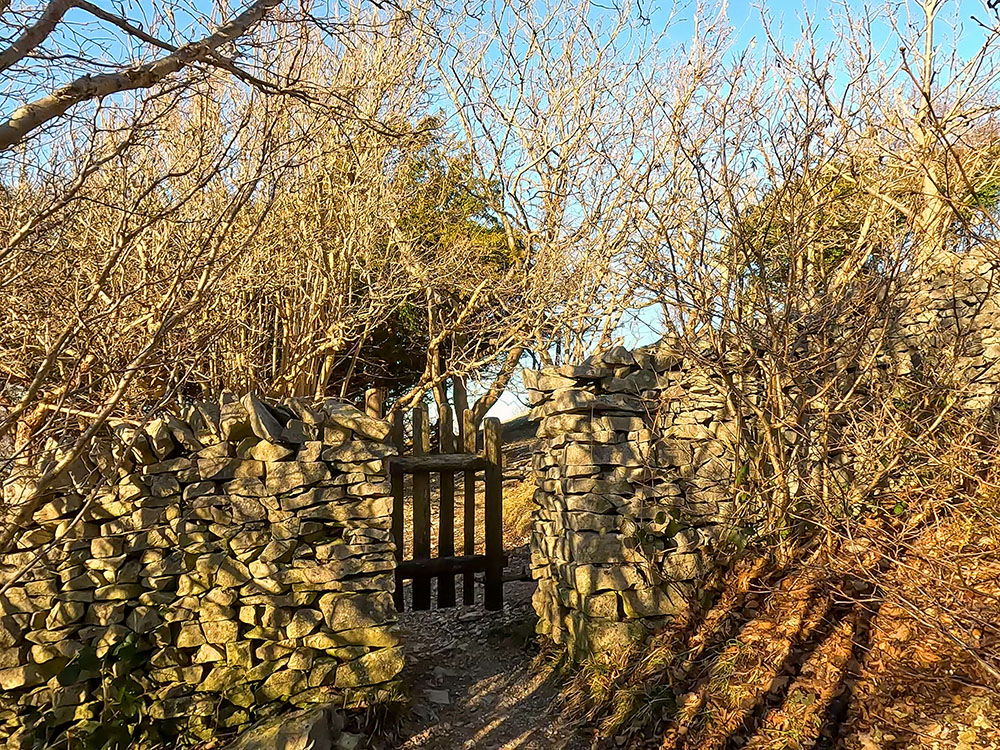
Pass through the gate in the wall
We continue climbing and soon reach the toposcope on Arnside Knott.
The path up towards the toposcope on Arnside Knott just through the gate
A toposcope is a monument that contains a pictorial display of the distinctive features that can be seen from a given point, often including distances to those features or their heights.
Approaching a bench and the toposcope on Arnside Knott
Looking out towards Morecambe Bay from the Toposcope on Arnside Knott
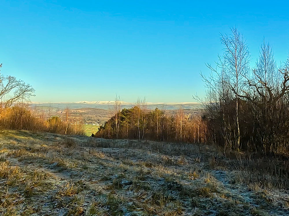
The toposcope affords fantastic panoramic views from the Howgills and the Arnside Viaduct to the snow-capped Lake District Fells, the Kent Estuary, and Morecambe Bay. Nearer than those are views down to Red Hills, Red Hills Wood and Arnside just below.

Looking towards the Lakeland Fells from the toposcope on Arnside Knott
Looking out towards Morecambe Bay from the Toposcope on Arnside Knott
The left-hand toposcope shows what you can see from Walney Island on the left, around past Humphrey Head, and around to Caw on the right-hand side.
The view from the left-hand toposcope from Walney Island around to Black Combe and Caw
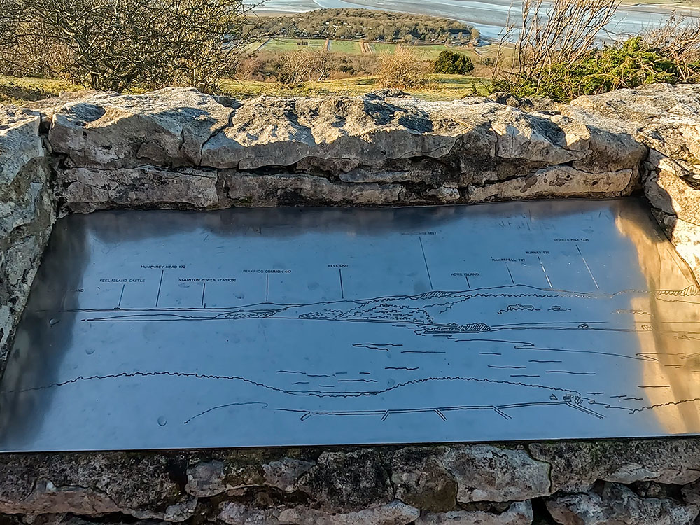
Close-up of the left-hand toposcope on Arnside Knott
The larger middle toposcope continues this on through Coniston Old Man, Bowfell, Wetherlam, Glaramara, Skiddaw, Helvellyn and then around to Ill Bell and Harter Fell on the Kentmere Horseshoe on the right-hand side.
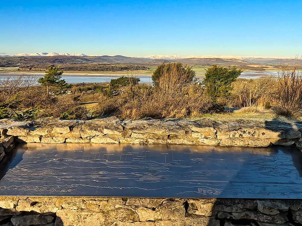
View from the larger middle toposcope towards the Lakeland Fells from on the left Walna Scar Pass, round to amongst others Coniston Old Man, Bowfell, Skiddaw, and Harter Fell (Mardale)
The right-hand toposcope continues this panorama with the Shap Fells above the Arnside Viaduct and then around to the Howgills on the right-hand side.
Close-up of the right-hand toposcope on Arnside Knott
View from the right-hand toposcope on Arnside Knott looking over Arnside Viaduct with Shap Fells and Howgills beyond
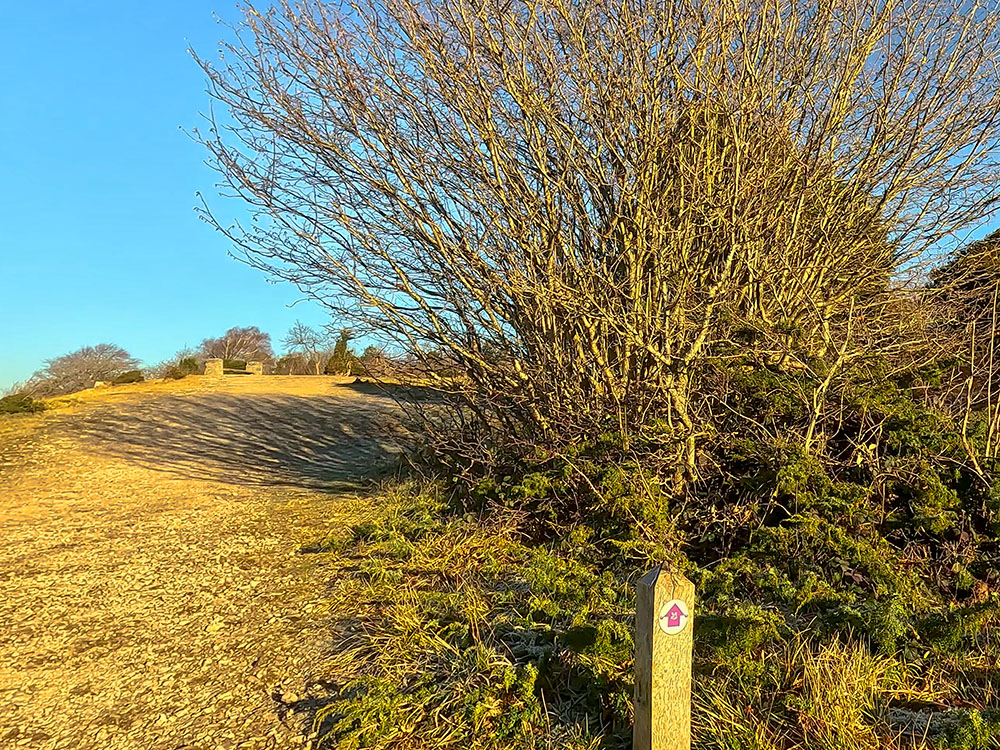
From the toposcope, this Arnside Knott walk continues straight in the same direction, following the purple arrow as the path bends to the right.
Head on to the wooden gates just ahead, pass through the wooden kissing gate and continue along the path directly away from the wall.
The path follows the purple waymarker through the gate in the wall on Arnside Knott
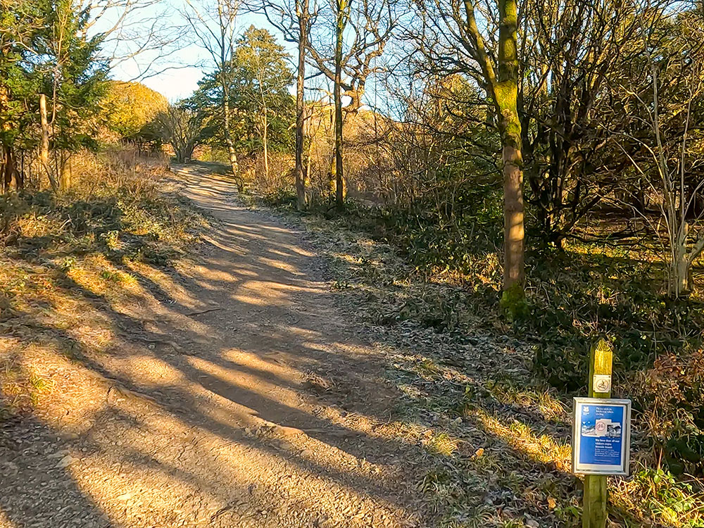
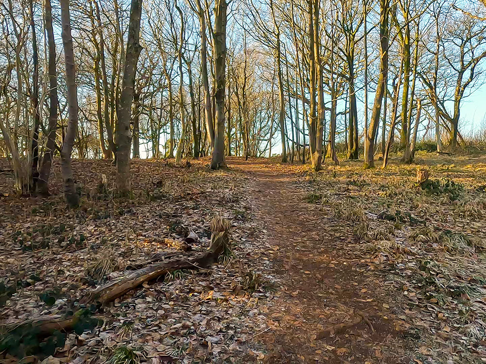
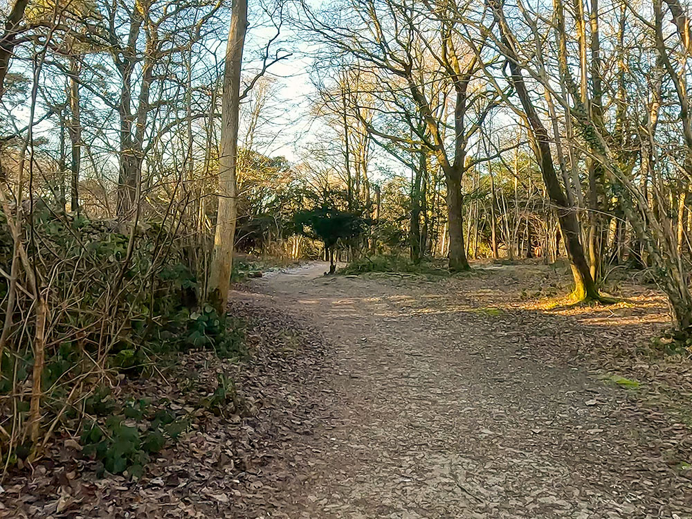
After walking a short distance, we meet another path. Just keep straight on here, following the purple waymarker arrow as the path heads up through Arnside Knott Wood.
Head on up the wide gravelled path following the purple waymarker
The path heading on up through Arnside Knott Wood
After a further short climb and just before the next waymarker arrow, you pass by an unusual knotted larch, which, due to its shape, is known as the 'h' tree or the Giraffe Tree. But I guess it's more of a headless giraffe. They are believed to be a pair of larch trees tied together as saplings by a sailor and his bride on their honeymoon around 1860.
Heading up towards the 'h' Tree / Giraffe Tree on Arnside Knott
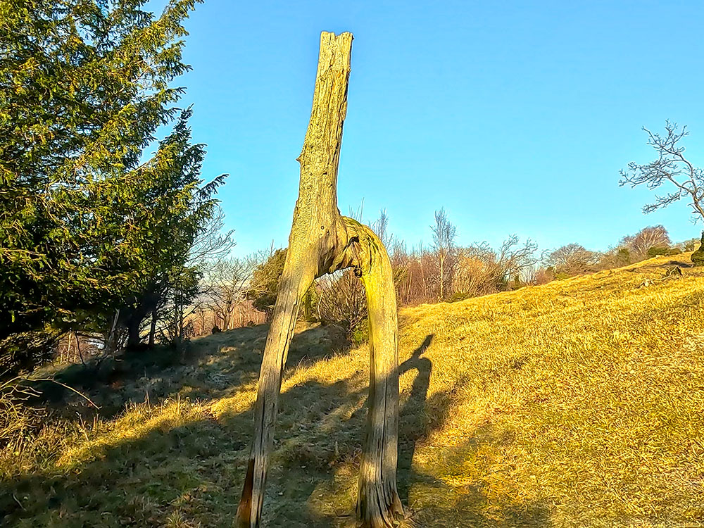
The Knotted Larch Tree on Arnside Knott, often known as the 'h' tree or Giraffe Tree
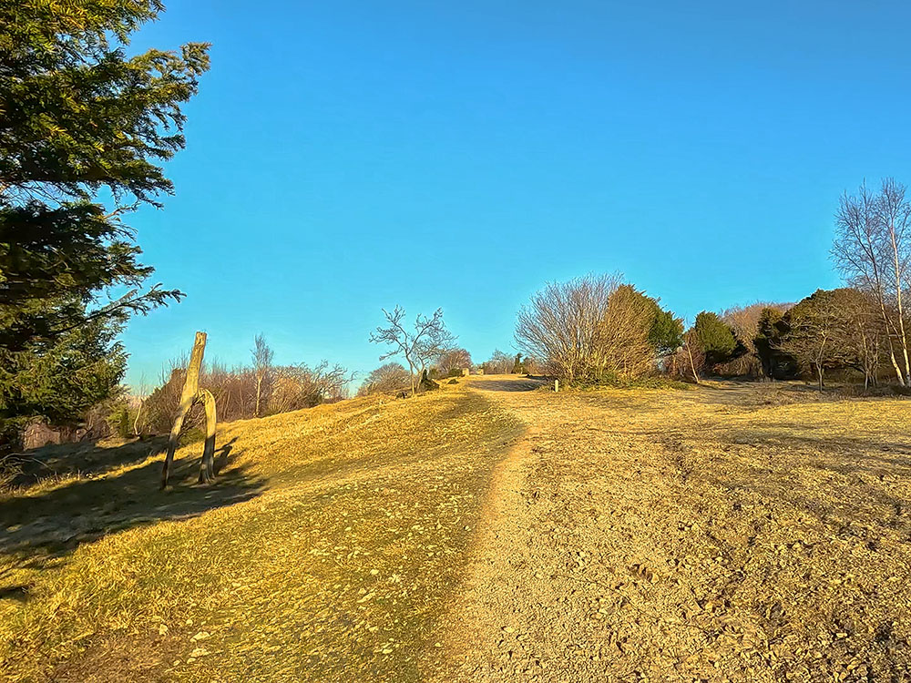
We continue straight on from the tree, following the path up the hill.
Purple arrow waymarker pointing uphill towards the bench
Arnside is in Cumbria, just outside of the Lake District National Park. Arnside Knott is part of the Arnside and Silverdale AONB - an area of outstanding natural beauty, which is bounded in the north by the Kent Estuary, the A6 to the East, Morecambe Bay out to the west and as far south as Warton, just above Carnforth. The Arnside and Silverdale area of outstanding natural beauty is recognised for its stunning scenery, wildlife, birds and wildflowers in an area with a rich cultural and industrial heritage, and as you can see from the views so far, it is an area with beautiful walks.
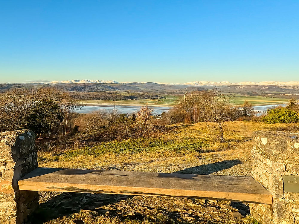
View towards the Lakeland Fells from the stone and wood bench on Arnside Knott
We soon reach a wooden and stone bench, which again offers extensive views down to Arnside Viaduct, the snow-capped Lake District Fells, the Kent Estuary, and Morecambe Bay.
View across to Grange-Over-Sands and out towards Morecambe Bay from the stone and wooden bench on Arnside Knott
We continue along the path from the bench, following the purple waymarked arrows.

The path onwards continues to follow the purple wooden waymarker across Arnside Knott
Arnside Knott itself is owned and managed by the National Trust and is one of the best places in the UK to see butterflies, especially in June and July, where rare species such as the High Brown Fritillary, White-letter Hairstreak, Duke of Burgundy, Pearl Bound Fritillary and the Scotch Argus amongst many others can be found.
As you can see, Arnside Knott is covered with mixed woodland and limestone grassland, which attracts a wide variety of insects and wildflowers.
After about 100 metres from the bench, before a stone wall is reached and at a path junction, we turn right again, following the purple National Trust arrow, and head along the path.
Turn right off the path along another path following the purple waymarker
We continue to the trig point on the top of Arnside Knott, but as it's on a mini plateau surrounded by trees, there are no real views. Arnside Knott is currently the lowest Marilyn in England, which is a classification of hills and mountains. Marilyns are defined peaks with a prominence of 150 metres or more, regardless of height.
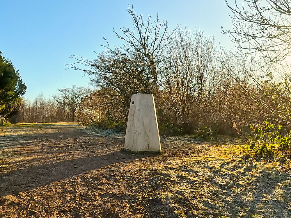
The triangulation point on Arnside Knott
So, Marilyns can be mountains or relatively small hills, as in the case of Arnside Knott. The name Marilyn was coined as a pun on the Munro classification of mountains over 3,000 feet in Scotland... so Marilyn Munro (Monroe).
Whilst you may seem to be on the highest point in the near vicinity, Warton Crag, just north of Warton at 163 metres, is four metres higher than Arnside Knott, so sneaks in as the highest point in the Arnside and Silverdale area of outstanding natural beauty.
Continue to follow the purple wooden waymarker through Arnside Knott Wood
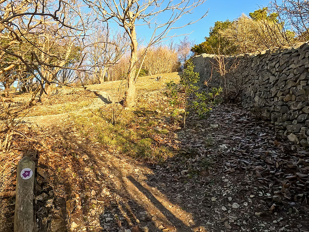
From the trig point, we continue walking straight on, following the wide path and the purple arrow. As you head along this section of path, if you look over to the left from time to time, you see through gaps in the trees over to the Howgills in the Yorkshire Dales.
Looking to the left off the path towards the Howgills from Arnside Knott
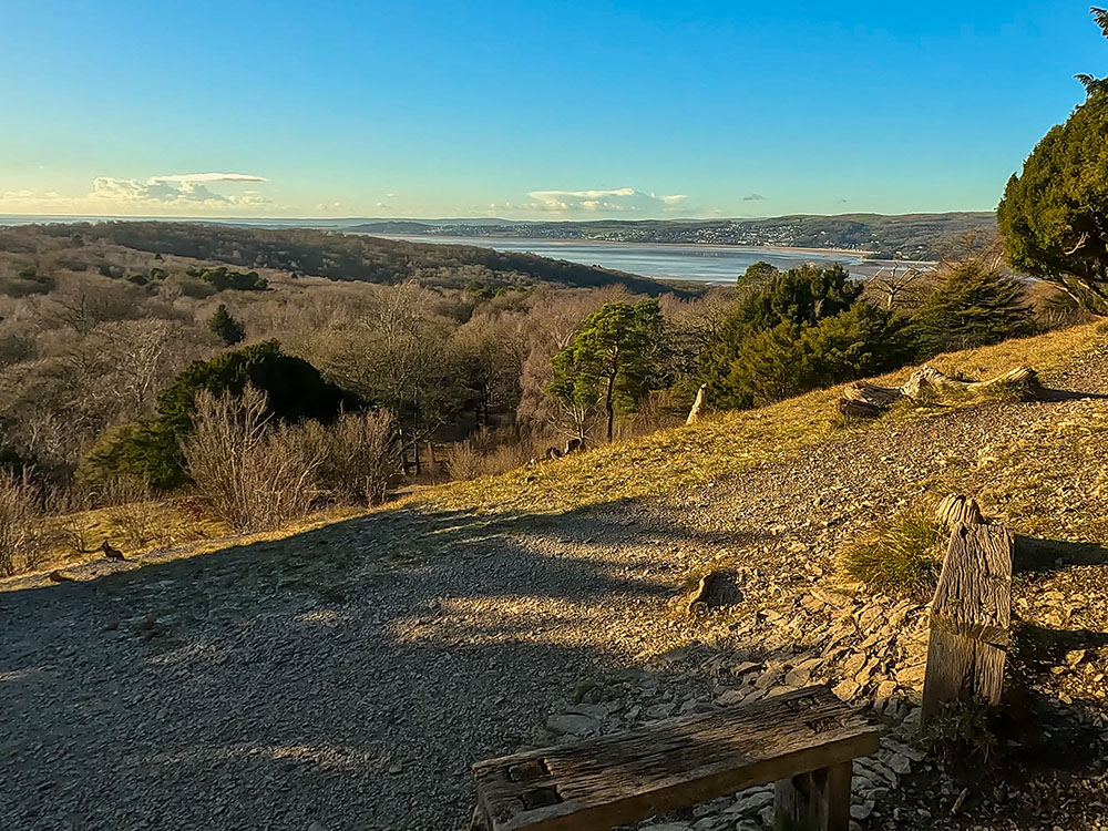
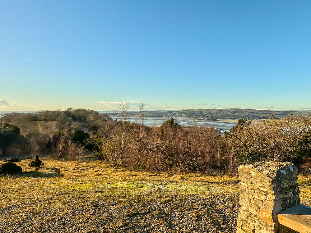
Continue across Arnside Knott to head towards the south side. As Silverdale and Morecambe Bay appear ahead, the path bends round to the right, following the purple waymarker arrow.
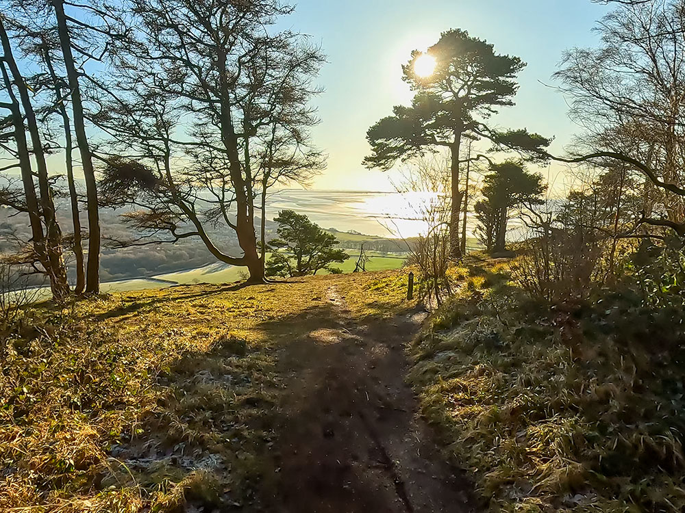
Heading towards the south side of Arnside Knott, looking out towards Morecambe Bay
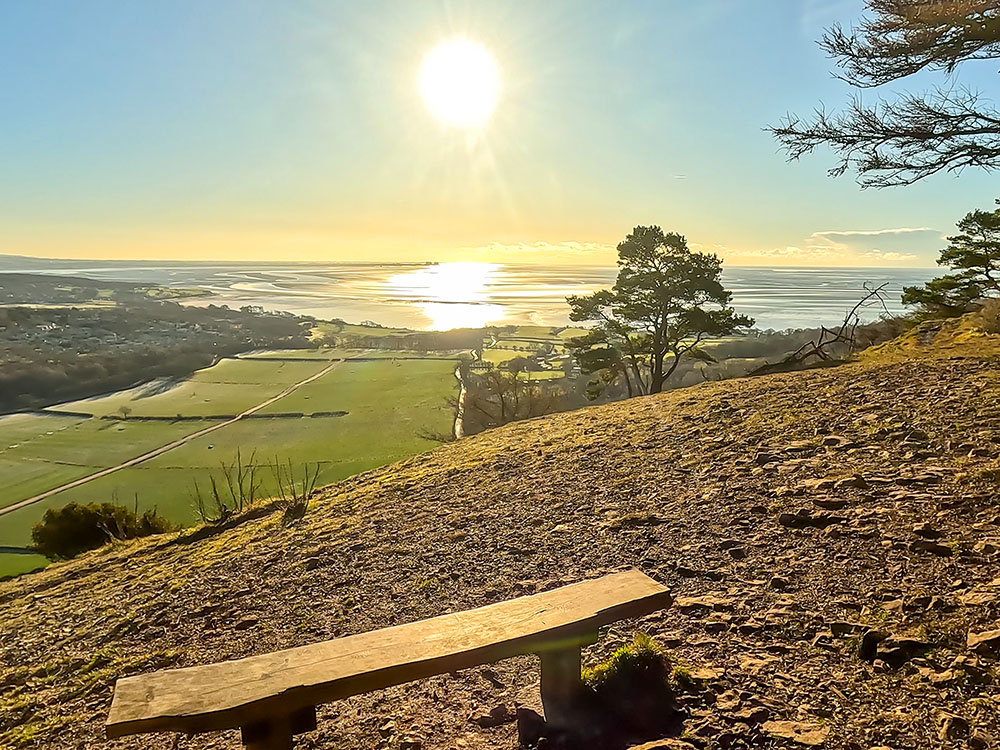
Just before we do that, though, just off the path to the left is another bench with a view. From the bench, straight on over the farm buildings below, you can see the remains of Arnside Tower. The five-storey limestone tower was believed to have been built in the late 1400s as a defensive tower.

Looking down towards Arnside Tower from a bench on the south side of Arnside Knott
There was a fire in Arnside Tower in 1602, but it was repaired and continued in use for another couple of hundred years. A storm in the late 1800s caused one side to collapse, and it has remained in a state of ever-increasing ruin since. While Arnside is in Cumbria, the Cumbria-Lancashire border runs through the woods on the far side of the tower, so Silverdale is in Lancashire.
Looking out towards Morecambe Bay from a bench on the south side of Arnside Knott
This bench gives fantastic views across the Arnside and Silverdale AONB, the surrounding countryside and out into Morecambe Bay. After sitting and enjoying the views across Morecambe Bay, we head back up to the path and turn left onto it, continuing in the same direction as before, following the purple arrow.
A little further on, at a split in the path, take the wider path to the right again, following the purple waymarker arrow.
At a split in the path, take the right-hand path following the purple waymarker arrow
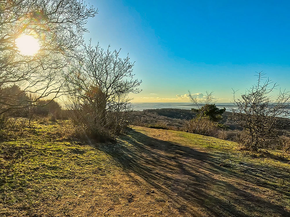
After another couple hundred metres, the path again affords a beautiful view through the Scots Pine out over Humphrey Head and into Morecambe Bay. We will turn back diagonally right here, back on ourselves, following the purple waymarker arrow, but first, take time to wander in the opening to enjoy the view.
The path heads on through Arnside Knott Wood
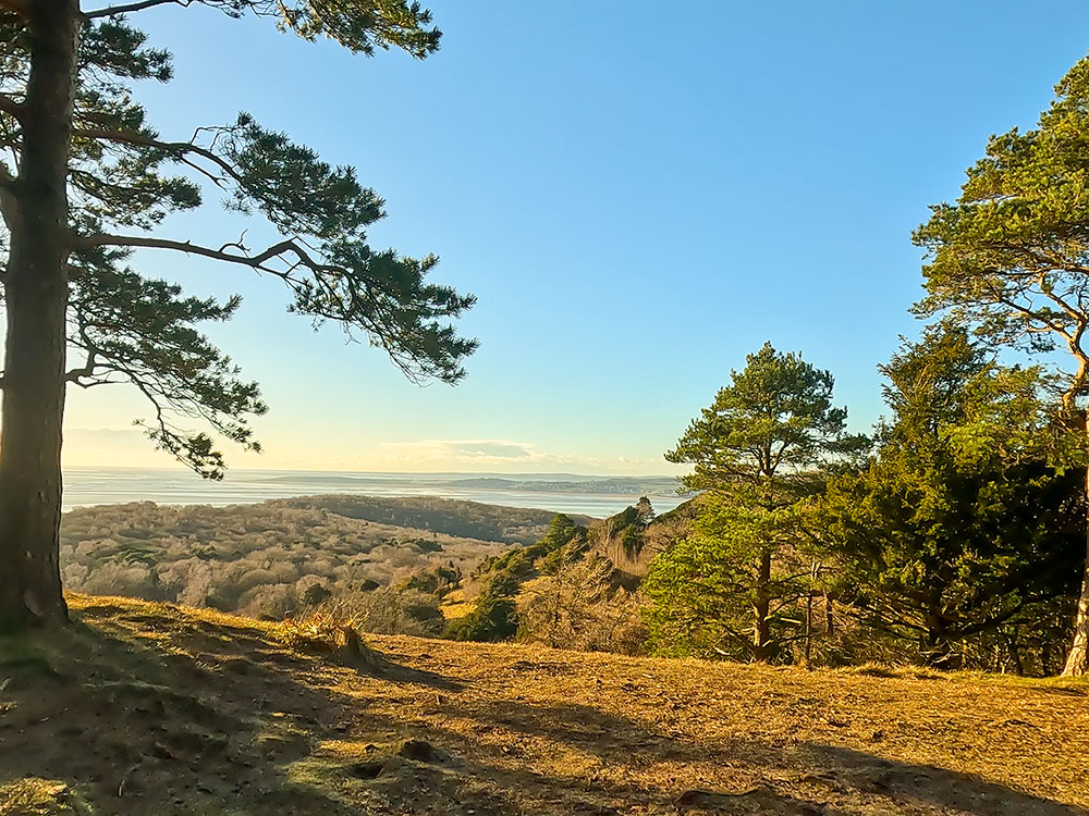
Looking out towards Morecambe Bay through the Scots Pine on Arnside Knott
Head back to follow the purple waymarker arrow along the path through the trees.
The path heads on through Arnside Knott Wood
We then meet the main track that we walked up earlier. We will turn left this time, following the purple waymarker arrow to head downhill.
As the path starts to rise, we turn left off the main path again, following the purple waymarker arrow. This section of the path affords lovely views again across Morecambe Bay as it starts to descend.
The path heads downhill, with Morecambe Bay ahead in the distance
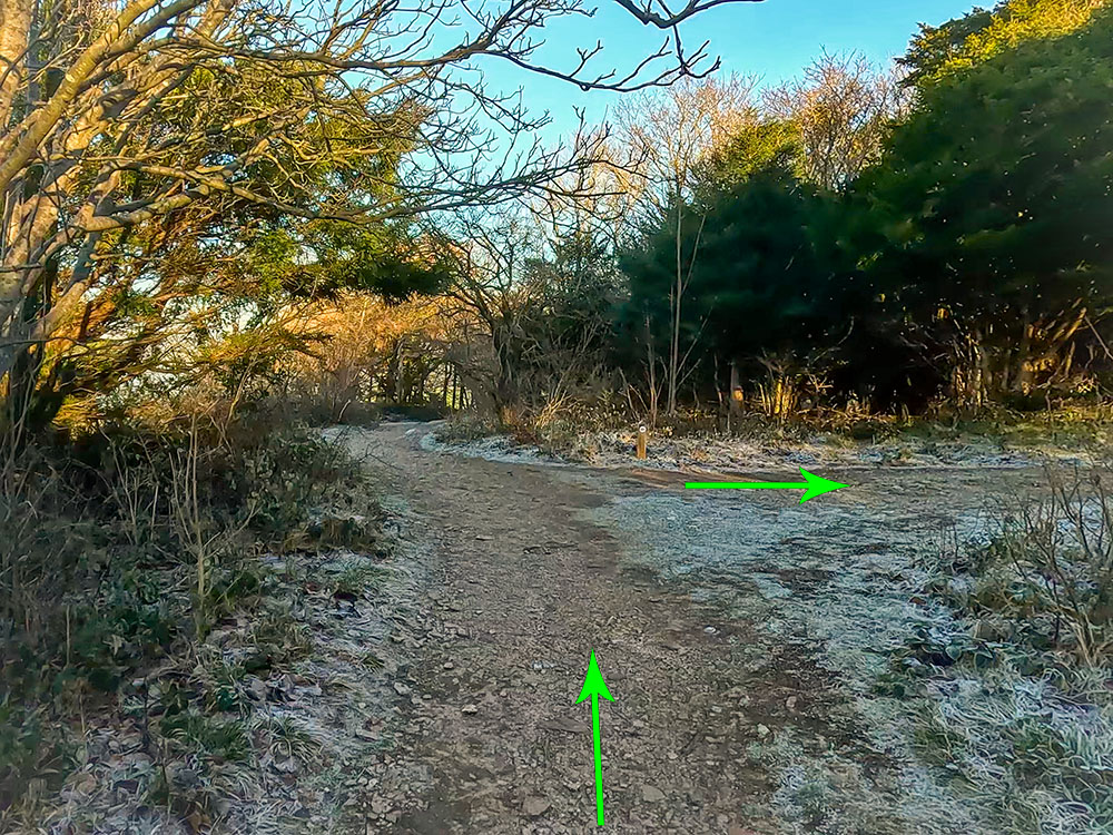
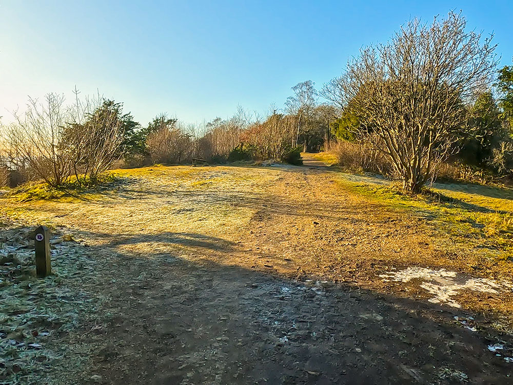
After about 200 metres of descent, we turn right off the wider path again following the purple waymarker arrow through Arnside Knott Wood. This next short section of the path is not marked as a path on the Ordnance Survey map, so if you miss this arrow and continue straight on after about another hundred and fifty metres descending, you meet a wide track where you would turn right and follow that track back to the car park.
At the path junction, turn right following the purple arrow on the waymarker
However, we are turning right here to follow the purple National Trust waymarker arrow. After about 100 metres of walking, we meet the wide path we used to climb to the toposcope at the start of the walk.
On meeting the main path, turn left to head downhill through Arnside Knott Wood
This time, we turn left onto the path here, following the purple waymarker arrow yet again to head down it this time. At the bottom of this path, we reach the gates we passed earlier.
The path heads along the right-hand side of the wall through the woods
This time, we turn right to head back alongside the wall. We pass through the gate and continue walking straight on.
Pass through the wooden gate following the purple National Trust arrow
Pass through the next gate and continue straight ahead, where we soon arrive back in the car park.
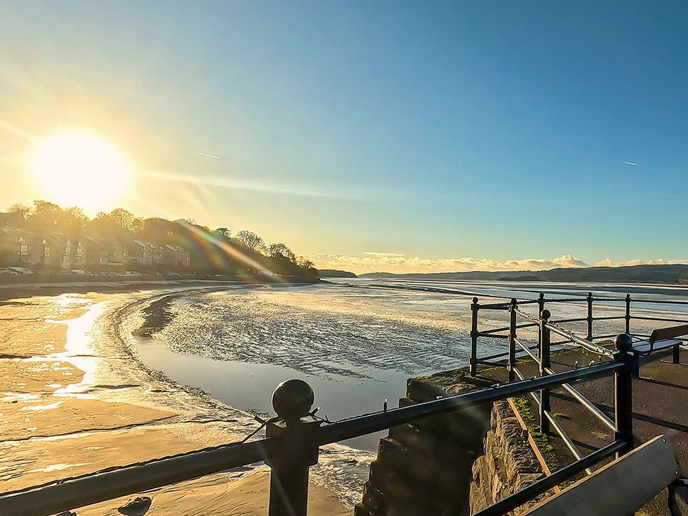
There are no refreshments on Arnside Knott itself, but there are plenty just back down the hill in Arnside. Most of them are found by wandering along the promenade.
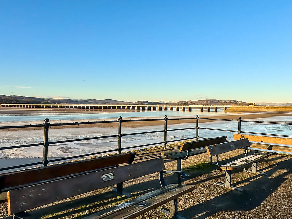
Starting at the western end of the promenade, opposite the Albion pub, you can see some roadside parking, after which you can wander along the path with benches. So if you buy some fish and chips, sandwiches, cakes, coffees, and ice creams, you can walk down there and enjoy them sitting on a bench to enjoy the view. There is other roadside parking in Arnside, but it can get busy, especially at weekends and bank holidays.
Looking along the road and estuary opposite the Albion at Arnside
Opposite the Albion pub, there is an information board where you can read about Arnside and a picturesque water fountain next to that.
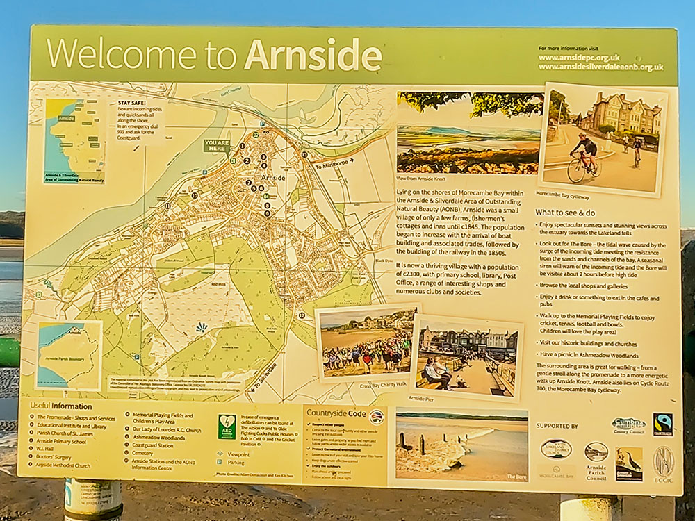
Arnside information sign
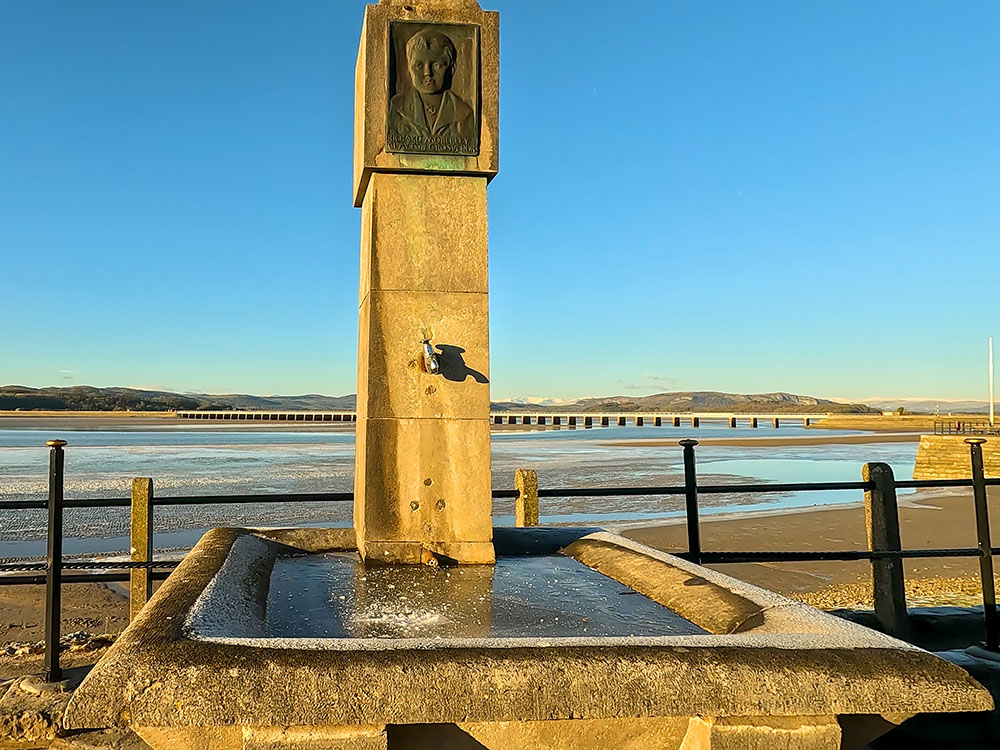
The frozen water fountain with Arnside Viaduct behind
Across the road is the Albion Pub. It offers a selection of traditional pub foods and a range of beers, wines, cider, and spirits. The Albion is also dog-friendly. I've often had fish and chips sat on the bench from down the road and then washed it down with a pint or two sat out here in the beer garden, watching the sunset over the estuary. They also won the Thwaites Hospitality Best Pint Award in 2023 and are Cask Mark accredited.
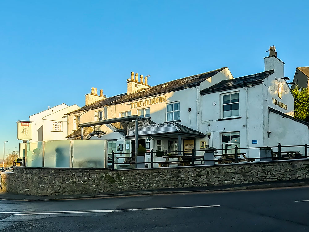
The Albion Pub at Arnside
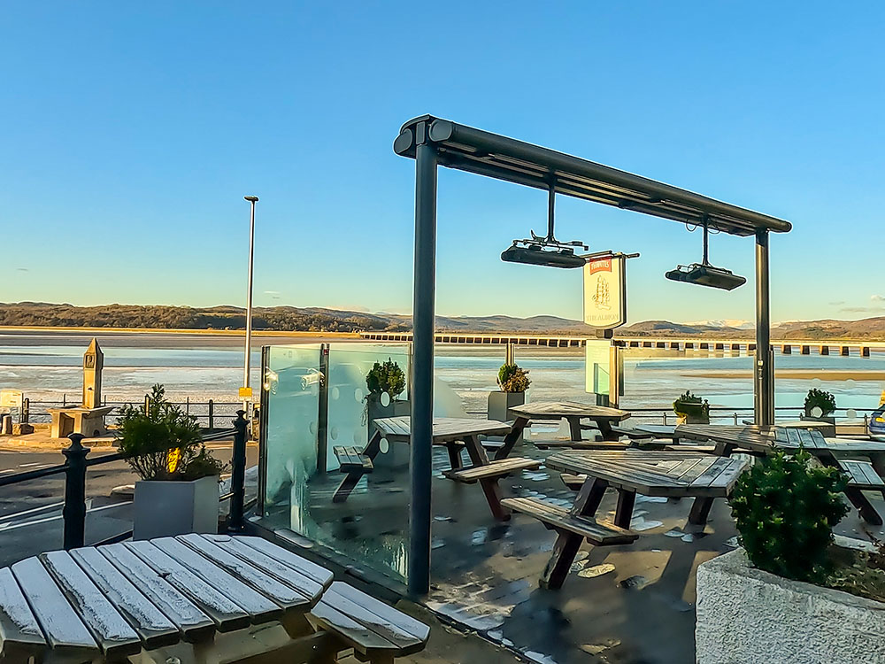
View out across the estuary and Arnside Viaduct from the Albion Beer Garden
Next door to the Albion is the Arnside Bakehouse, which is a café, bakehouse and farm store serving a range of homemade pies, sandwiches and cakes, and I believe it's dog-friendly.
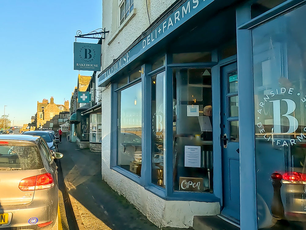
Bakehouse Deli and Farm Store in Arnside
Just down from that is JJ Crossfield's, a new café and wine bar that opened in June 2023. They offer a wide range of draught beers, 16 hand-pump cask beers, stouts, lagers, and ciders, along with wine, spirits, tea, and coffee. On the food side, they have some pizzas and tapas-style dishes on the bar menu. Again, this is dog-friendly.
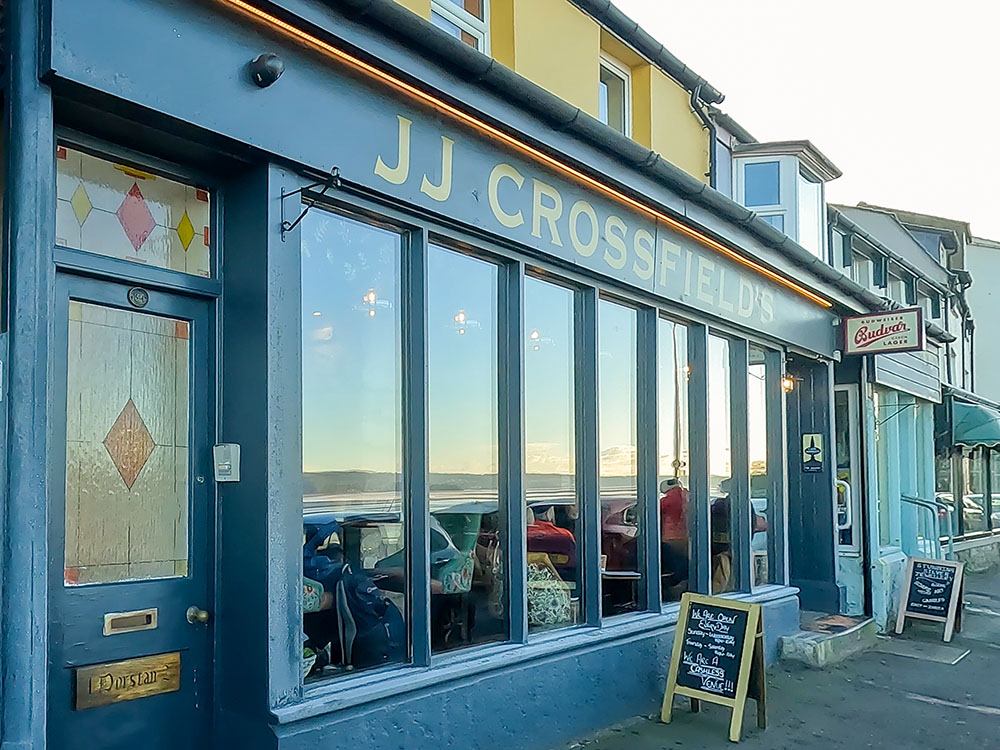
JJ Crossfield's Café and Wine Bar in Arnside
Next door is Sandpipers Café, another relatively new addition to Arnside that serves a wide range of good homemade cakes, coffees, and lunches. They also made the final three of the Best Coffee Shop award for the Cumbria Life Awards in 2023 after being open for less than 18 months.
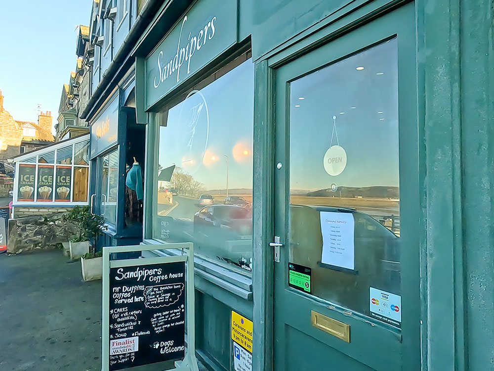
Sandpipers Coffee House in Arnside
Next is the Arnside House Gift Shop. If you want to get an ice cream or a coffee and a cake, there are over 30 flavours of ice cream on offer.
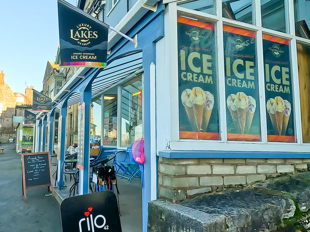
Arnside House Gift Shop
I've not mentioned them because they don't serve food or drink, but there are some other shops in Arnside that you can visit and a gallery.
Just a little further on is the Coast Office, which offers interesting and varied gifts and decorations for the home and the garden sourced from local artists. They also serve Howgill Fellside ice cream.
As you wander along the promenade on your left, there are some toilets, should you need them, and a few more benches to sit and enjoy the view.
On the next bend on the right-hand side is Ye Olde Fighting Cocks Pub. It is a Thwaites pub that has accommodation. It serves homemade food, a selection of real ales, guest beers, and wines and spirits. It's also a dog-friendly. There is a small roadside beer garden in front and a larger one up to the side.
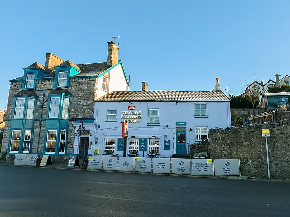
Ye Olde Fighting Cocks, Arnside
The beer garden, just like the Albion's, offers excellent views across the estuary to Arnside Viaduct and Lake District Fells beyond.
View from the Ye Olde Fighting Cocks beer garden at Arnside across to the Arnside Viaduct and Lakeland Fells
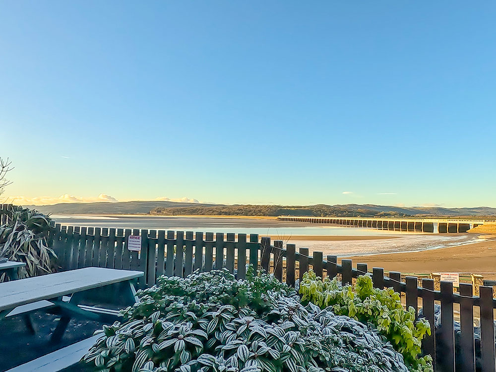
From here, we continue along the front, where, from time to time, you may see a train passing over Arnside Viaduct. The Arnside Viaduct, at 505 metres in length, carries the Carnforth and Whitehaven railway line over the estuary of the River Kent and is a 51-span structure.
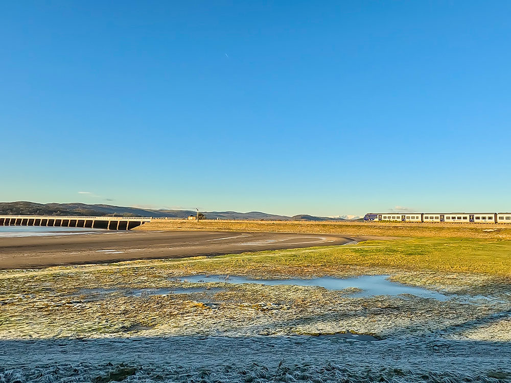
Train heading on to the Arnside Viaduct
It lies just outside and just to the west of Arnside train station. Arnside Viaduct was initially constructed in 1856 as a single-line viaduct, with the structure being extended to a twin track in 1863. After 50 years of service, it needed renewal, so in 2010 and 2011, the entire 51-span superstructure with prefabricated girder units, each averaging 24 tonnes in weight, and the track were both renewed.
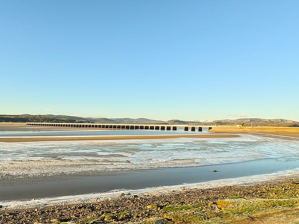
Arnside Viaduct from the promenade across the frozen sandbanks
A little further on the right-hand side is Arnside Chip Shop, which can get very busy. Arnside Chippy is one of the few chip shops I know where you can order online, which saves the queuing. Then, you can avoid the queue and just pick up inside before finding a bench to sit on, eat, and take in the views.

Arnside Chip Shop
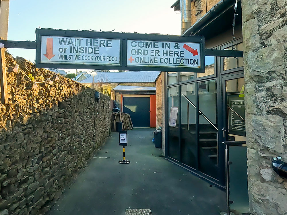
Waiting and queueing signs outside Arnside Chip Shop
The final place with a few more benches to sit and enjoy the view is Arnside Pier, which is on the other side of the road opposite Arnside House, which we passed earlier.
View down the estuary from Arnside Pier
Arnside was once a fishing village but eventually lost its trade to other, more accessible harbours. It still retains a pier built by the Ulverston and Lancaster Railway Company in 1860 to compensate for the new viaduct they built across the River Kent, which effectively prevented ships from reaching the port of Milnthorpe further upstream.
View towards Arnside Viaduct and the Lakeland Fells from Arnside Pier
The pier was destroyed by a storm in 1983, but subsequently, it was rebuilt by Arnside Parish Council, paid for by public subscription and grants it received in 1984 for £25,000.
If you want to see this walk from above and get a bit more perspective on where you have been on the walk, we have created a short fly-through using the Ordnance Survey app, which you can see at the end of the Arnside Knott video.
Finally, talking of videos, if you watched and enjoyed our video, don't forget to click the like button, subscribe to our channel and hit the notification bell so you know when any more new walks have been uploaded. Subscribing on YouTube is free, and your likes and comments about the video or the walk do help promote our channel - thanks. 😊
Gifts and presents for hikers and walkers
Are you struggling to pick the perfect gift for your hiking-loving friend or family member? Don't fret! Explore our curated selection of top-notch gifts for walkers and hikers that will have them trekking with joy on their special day.
What to wear and take on your walk or hike
Whether you are a seasoned hiker or new to walking, wearing and taking suitable hiking kit and clothing is essential for a day hike for your comfort and safety. So we have put together a hiking essentials checklist to cover all you'll need. Our Hiking Essentials checklist for 2026 takes you through planning your walk, the hiking essentials checklist itself, optional extras, explanations, and recommendations for all the hiking essentials.
Check out the reviews for this walk: