By using this website, you agree to our use of cookies (needed to provide our website’s features) and our Terms of Use.


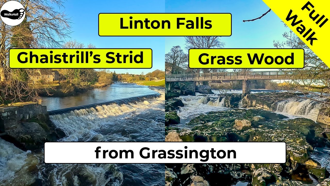
This circular walk in the Yorkshire Dales around the picturesque Linton Falls and Ghaistrill's Strid ends with wandering through Grassington's main square with its many cafes, pubs and an eclectic mix of shops.
In accordance with our Disclaimer, you agree to take full responsibility for any use you make of the information contained in these pages.
This page contains affiliate links. If you buy products or services via these links, we may earn a small commission at no cost to you.
| Walk title: | Linton Falls, Ghaistrill's Strid and Grass Wood walk from Grassington |
| Author: | Andrew Forrest - December 2023 |
| Walk start point: | Pay and display car park at the Yorkshire Dales National Park Centre in Grassington (grid reference SE 002 637) - it can get busy on weekends and bank holidays. What3words: probable.times.ripen |
| Parking: | As above |
| Directions to nearest parking place: | Google Maps: get directions here / What3words: capers.built.cups |
| Walk distance: | 8.3 km |
| Estimated walk time: | 2 hours 15 minutes |
| Height climbed: | 200 metres |
| Technical difficulty: | Moderate - as determined by our interpretation of the Ordnance Survey guidance on technical difficulties |
| Peaks / summits: | None of note |
| Map: | Ordnance Survey - Explorer OL2 (Yorkshire Dales - Southern & Western Area) Buy this map from Ordnance Survey |
| GPS/GPX file: | Download available to registered users - Register and Login here - It's FREE to register |
| Facilities / refreshments: | Toilets in the car park at Grassington. Many pubs, cafés and restaurants are in the centre of Grassington, 5 minutes from the car park. |
| Nearest town: | The walk starts in Grassington |
| Local self-catering accommodation: | View self-catering accommodation close to the start of this walk |
| Local hotels, inns and B&Bs: | View hotels and inns close to the start of this walk from The Inn Collection Group |
Estimated walk time
Walk time estimates used are from the Ordnance Survey mapping app, which uses a refined Naismith's rule, adjusted by OS overlaying their own data collected from more than one million people using the OS mapping app. Naismith's rule allowed one hour for every three miles walked and added pro-rata an additional hour for every 2000ft of ascent - roughly one hour for every 5km, plus one hour for every 600m of ascent.
Ordnance Survey Mapping App
Use on any device and make it easy to explore the great outdoors for just the price of a coffee a month. Premium allows full UK access to all OS Explorer and Landranger mapping, along with the ability to import and export routes, save maps offline, aerial 3D, and print A3/A4 maps.
This Linton Falls, Ghaistrill's Strid and Grass Wood walk from Grassington in the Yorkshire Dales takes approximately 2 hours and 15 minutes, and after viewing the waterfalls and fantastic Yorkshire Dales scenery ends with wandering through Grassington's main square with its many café, pubs and an eclectic mix of shops.
We leave the Yorkshire Dales National Park Centre car park and head down the much-photographed walled Sedber Lane to reach the impressive Linton Falls and weir, which can be viewed from the footbridge that crosses them or from the riverside bank a little downstream.
We then head on along the picturesque riverside path past a second weir before passing by Grassington Bridge. Continuing upstream along the River Wharfe, we walk past Ghaistrill's Strid, where the Wharfe narrows, creating a fast-flowing section of the river after heavy rain. We then walk through Lower Grass Wood before a short road section brings us to Grass Wood.
We follow the gravel track through the delightful woods, full of flora and fauna in the spring, summer and autumn, and then at the four-way signpost, there is an optional short detour to the ruins of Fort Gregory.
From Grass Wood, we pass out onto Cove Lane, which heads back into Grassington. On reaching Grassington centre, we wander through the main street and square past the quaint mix of eclectic shops, cafes and pubs, many of which may look familiar to you if you are a fan of All Creatures Great and Small, as Grassington is the home of the fictional town of Darrowby.
The whole of this Linton Falls, Ghaistrill's Strid and Grass Wood walk from Grassington is shown in the video and, the route for the walk is shown on the Ordnance Survey map - both above.
Below is a brief description of the walk. Places where you can eat and drink after the walk are shown at the end of the video.
The walk starts in the pay and display car park at the Yorkshire Dales National Park Centre, where there are some toilets should you need them. If you plan on visiting the centre, check the opening hours first, as I don't believe it is open daily.
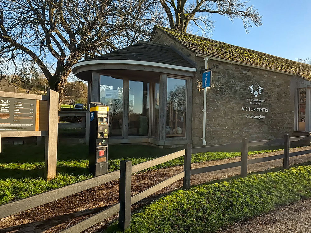
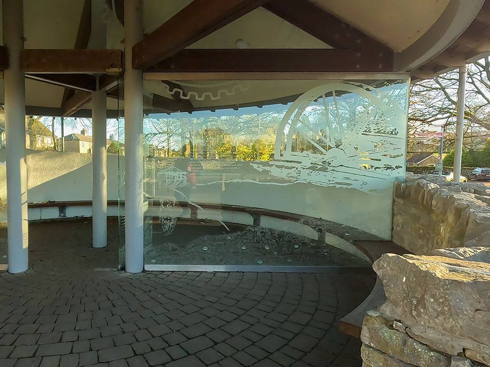
Yorkshire Dales National Park Visitor Centre at Grassington
Walk away from the toilets and National Park Centre through the car park to the far corner, to the sign for 'Linton Falls and Riverside path 200 metres'. Turn right here and follow the sign towards the gate in the wall.
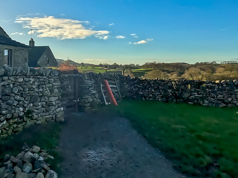
Gate from pay and display car park at Grassington leading onto Sedber Lane
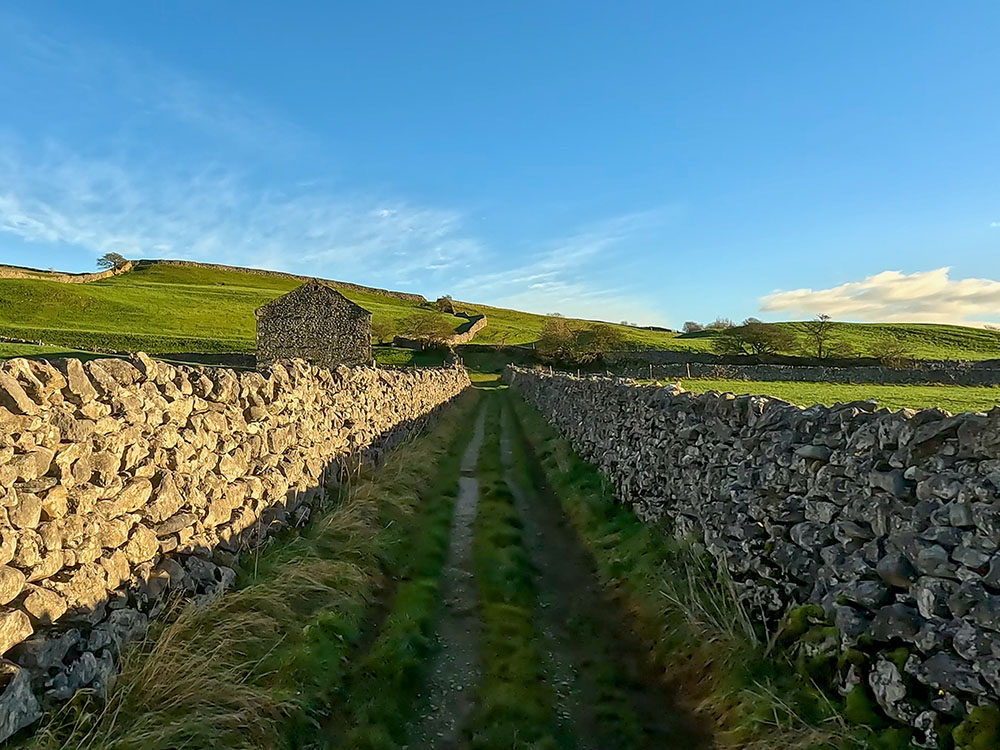
Pass through the gate and turn right to start heading down the walled Sedber Lane. The much-photographed Sedber Lane leads us down towards Linton Falls. After heavy rain, the falls can be heard from quite a distance away.
The walled Sedber Lane in Grassington
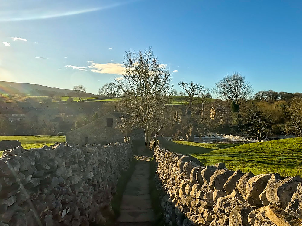
Heading down Sedber Lane towards Linton Falls
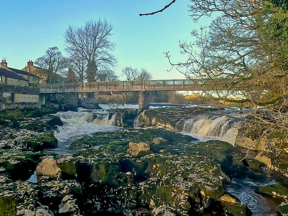
As you approach the waterfalls, you can also see a weir just upstream of the falls. There is a wooden bridge over Linton Falls, just before which we reach a signpost showing Burnsall to the left and Grass Wood to the right.
Wooden footbridge over Linton Falls
Ignore it for now and explore the falls from the bridge. The noise from the bridge can be pretty loud after heavy rain. You can almost feel the sheer power of the water gushing underneath.
Upstream from the bridge, you can see another weir that we will pass by shortly. The nearer weir once served a textile mill that has been demolished.
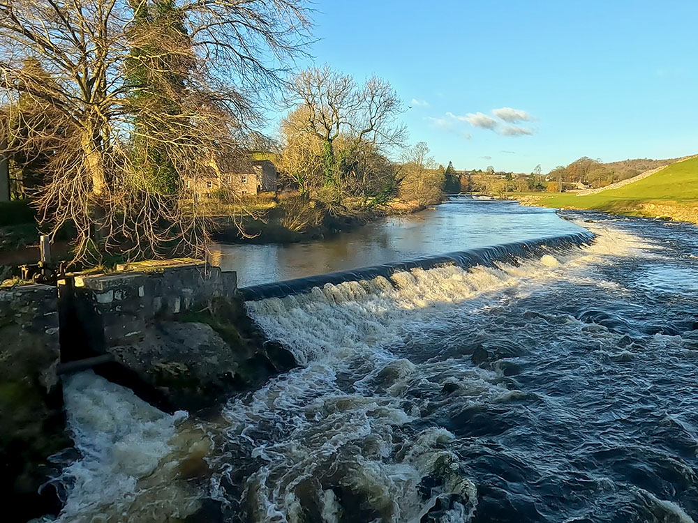
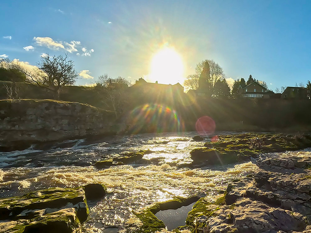
Linton Falls and the weir
Linton Falls is a natural limestone waterfall. It is believed it was formed millions of years ago by a movement in the Earth's crust.
Looking downstream from the wooden bridge at Linton Falls
Before continuing the walk, it is worth viewing the falls from the riverbank for an optional short detour, especially for any photographer.
Linton Falls at Grassington
To do this, leave the footbridge and head through the gap in the wall on the right, follow the riverbank down for about 50 metres, and head down towards the river, taking care as the rocks are slippery. Pick your spot to get a view of the falls. When you're finished viewing the falls, head back up onto the bank and head back towards the gap in the wall.
Pass through the gap in the wall and then directly ahead through the next gate to head along the riverbank north along Wharfe.
Wooden gate heading onto the riverside path at Linton Falls
Walk towards the second weir, next to the restored hydroelectric plant. It was initially built in 1909 and then abandoned in 1948, after which it fell into ruin.
But with support from the Yorkshire Dales National Park Authority and English Heritage, it was restored and reopened in 2012 to produce up to 500,000 kilowatt hours of electricity per annum, roughly equivalent to the energy usage of 90 family homes. The plant itself uses two Archimedean screws, which water flows through, spinning them fast enough to generate energy.
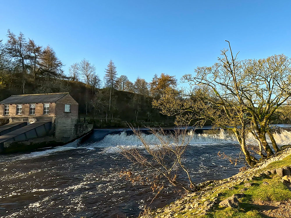
Weir by the restored hydroelectric station
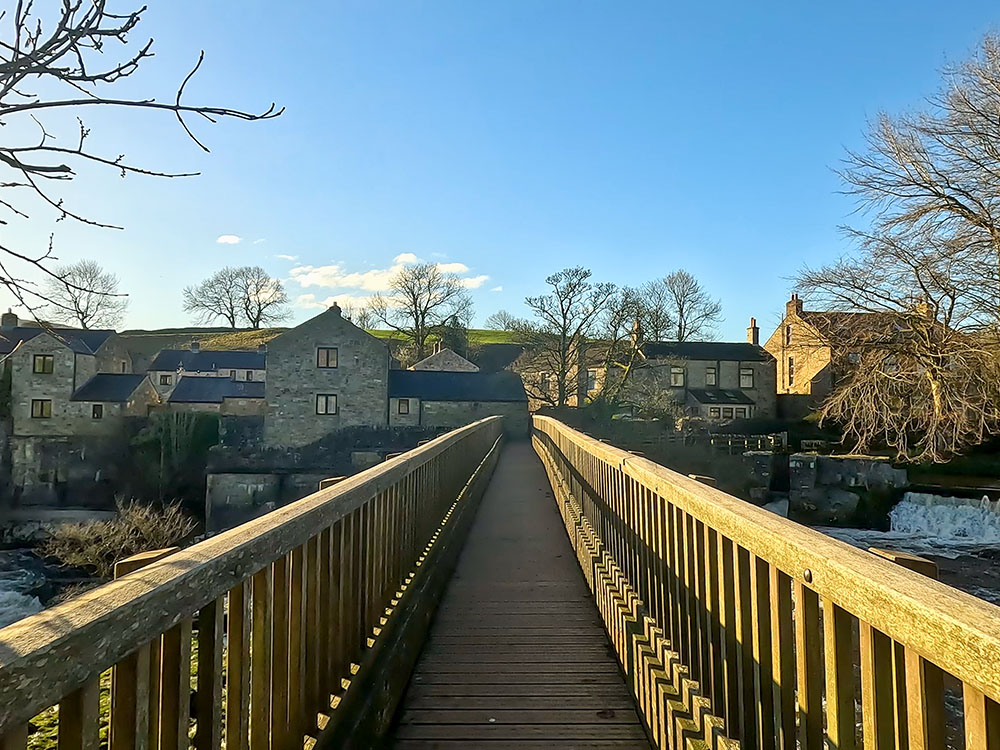
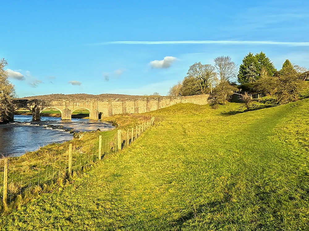
To continue, walk along the riverside path. As you approach Grassington Bridge, head right, uphill, away from the river on the wider grassy path and then turn left along the gravel path.
Heading along the River Wharfe towards Grassington Bridge
Pass through the wooden gate and then onto and through the next gate, taking care here as you pass straight out onto the road.
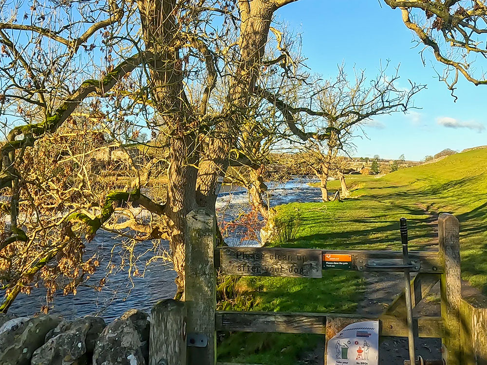
Carefully cross over the road and head down the path opposite. Pass through the next gate, following the footpath sign for Wood Lane via Low Grass Wood. Walk down the track, and then as the fence bends around to the right, keep straight on to head back across to the riverbank. Continue walking upstream alongside the river Wharfe.
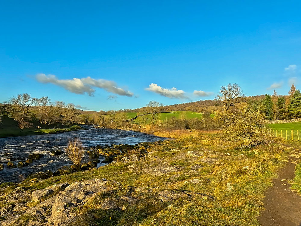
Heading along the River Wharfe towards Ghaistrill's Strid
Pass through the gate and over the wooden footbridge.
The River Wharfe is 65 miles long; for much of its length, it is the boundary between West Yorkshire and North Yorkshire. The watercourse first becomes known as the River Wharfe at the confluence of Greenfield Beck and Oughtershaw Beck at Beckermonds and then flows by or through Kettlewell, Grassington, Bolton Abbey, Ilkley, Otley, Wetherby and Tadcaster before joining the River Ouse just north of Cawood.
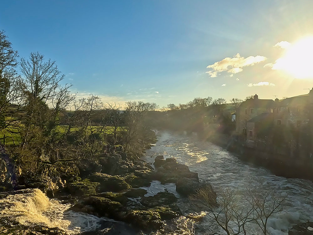
Pass through the gap in the wall and then on through the gap in the next wall. Over to the left is the end of Ghaistrill's Strid, which the narrowing of the River Wharfe has formed to produce this faster-flowing section over the rocks.
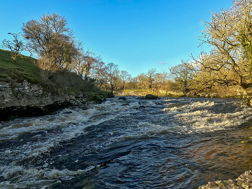
Looking upstream at Ghaistrill's Strid
Ghaistrill is believed to be a surname, while stride, from which Strid has been formed, is the old English word for narrow channel. Just before heading over the wall stile, if you went down to the left to the riverside, Ghaistrill's Strid is more impressive and faster flowing.
Return to the path and pass over the stone stile built into the wall. Walk on and pass over the next stone stile, pass through the wooden gate, and head down the steps to head back to the riverbank.
This then brings us out to the top end of Ghaistrill's Strid. Another well-known Strid is called The Strid, which is probably even more dramatic after heavy rain. It is further downstream in the wooded area between Barden Bridge and Bolton Abbey.

Ghaistrill's Strid
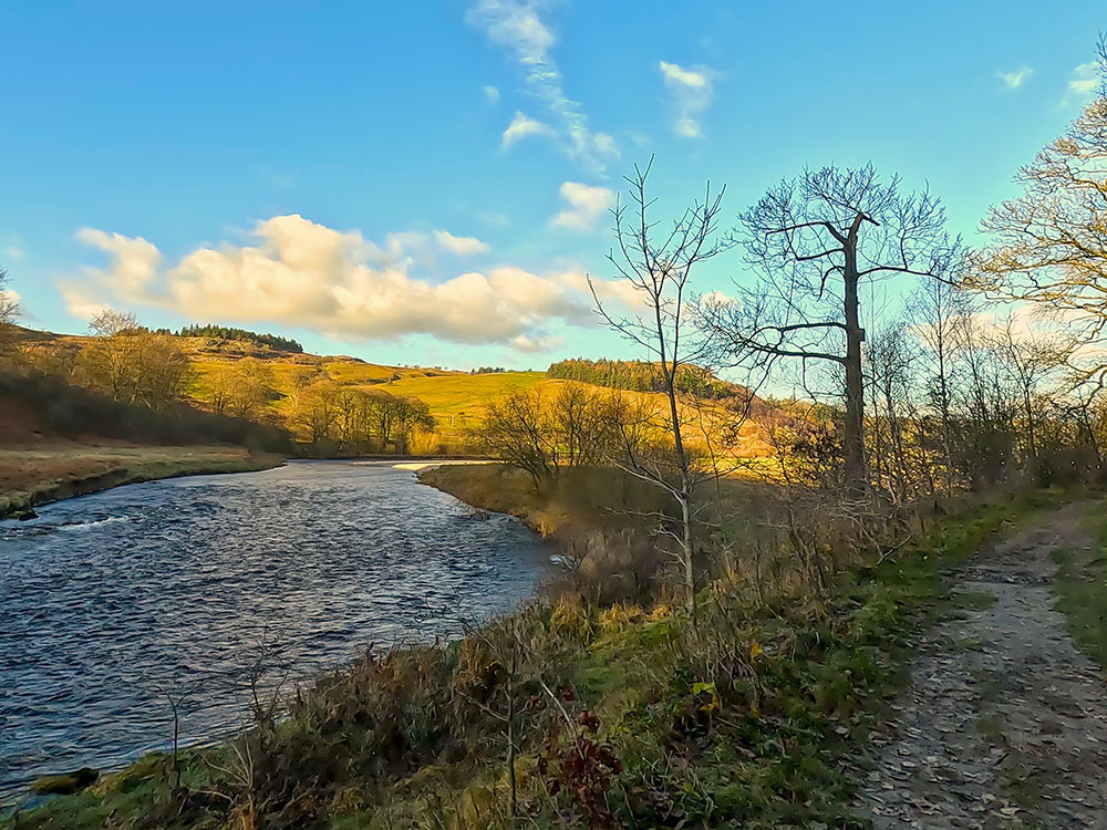
Continue now, just walking alongside the River Wharfe. Wharfe is believed to be derived from the old English word Weorf or the Old Norse Hverfr. Both of which mean winding so effectively a winding river, so Wharfedale through which Wharfe flows is a valley of the winding river.
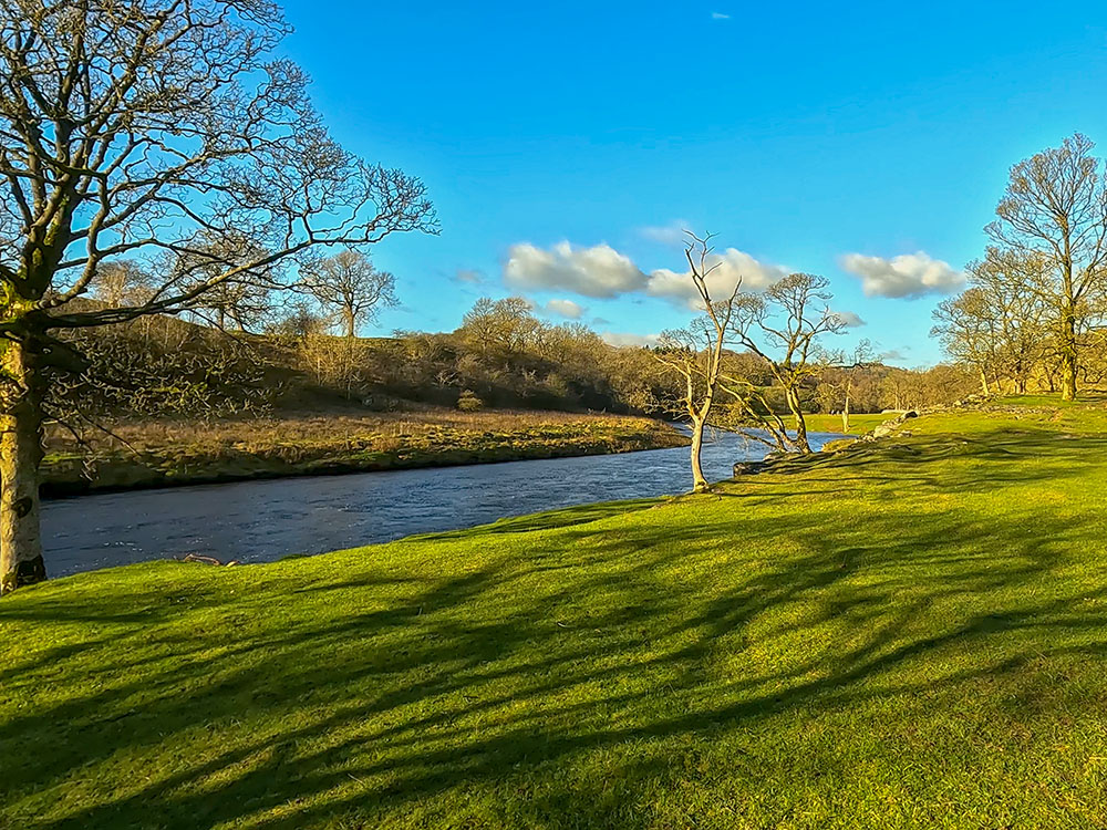
The path alongside the River Wharfe
At the footpath sign, keep along the riverbank. Along the side of the River Wharfe in late November, when the video was filmed, there are not too many birds around, but there are believed to be over 200 species of bird to be found along the River Wharfe at various times during the year.
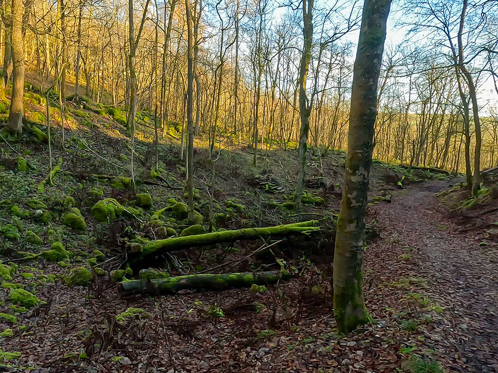
After a while, pass through the wooden gate to enter Lower Grass Wood.
The path heading into Lower Grass Wood alongside the River Wharfe
We continue walking along the riverbank through Lower Grass Wood before heading away from it, up some steps.
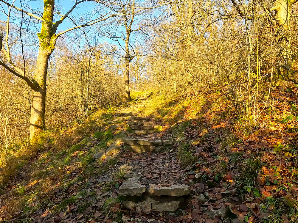
The steps in Lower Grass Wood
Not long after the steps, you can choose either path at a path junction as they meet up again 500 metres further on. The right-hand path keeps your height, but I took the left-hand path for this walk, which heads back down and continues along the riverbank.
The path junction in Lower Grass Wood
Just after the path pulls in close to the river, it bends away to the right. Shortly after, there is a path junction.
The path alongside the River Wharf in Lower Grass Wood
Again, you can take either path as the left ends up on the road. But here, we will take the right one to head up towards the gate in the wall.
Just before reaching the gate, if you look around to the right, you can see another path coming into us. If you carried straight on earlier, taking the right-hand fork in the path about 500 yards back, this is a path you would have walked along.
The gate onto Grass Wood Lane
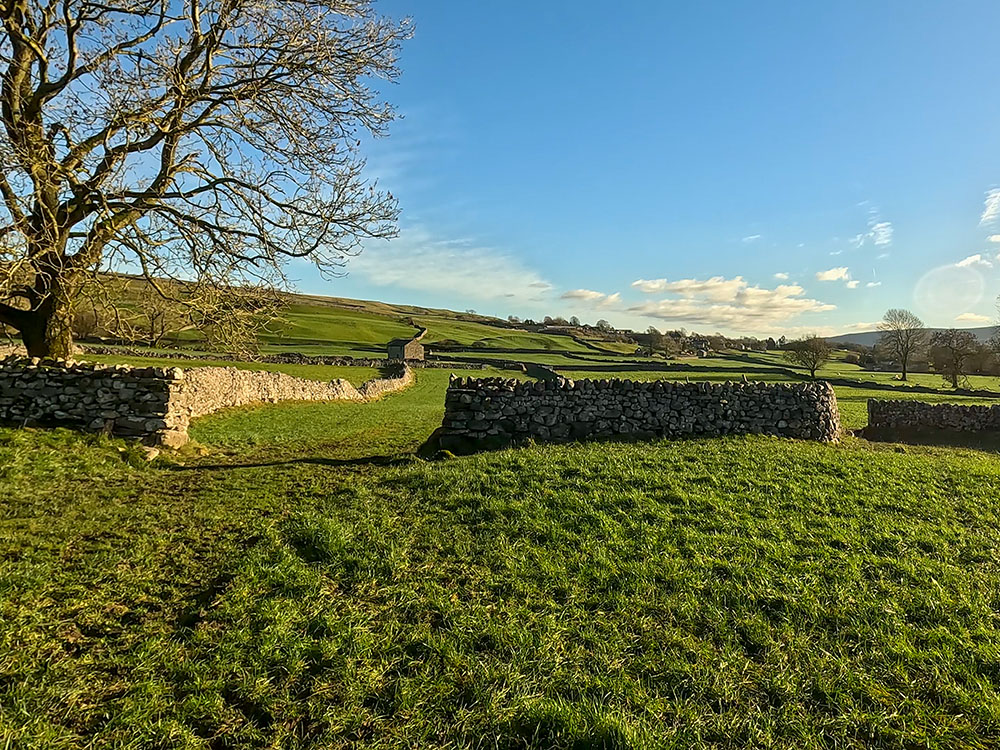
Pass through the gate and then turn left along the road. We walk now along the quiet Grass Wood Lane for about 500 metres.
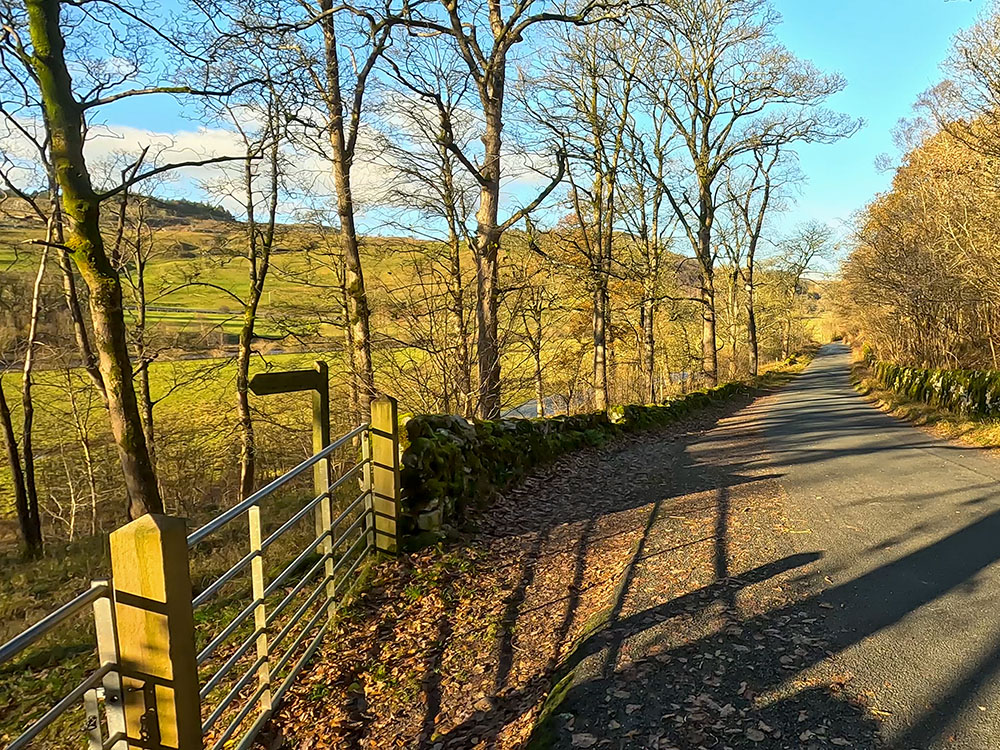
Grass Wood Lane
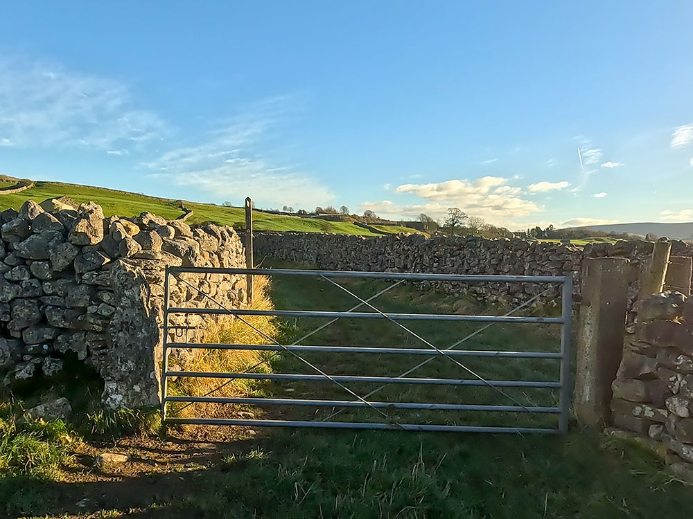
Just before the road bends to the right, we cross over, follow the footpath 'Grassington two miles' sign, and pass through the wooden gate to enter Grass Wood.
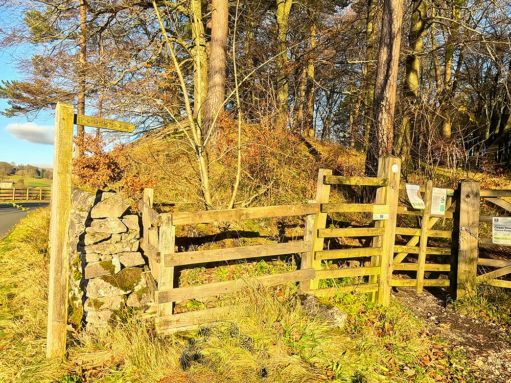
Footpath sign heading into Grass Wood
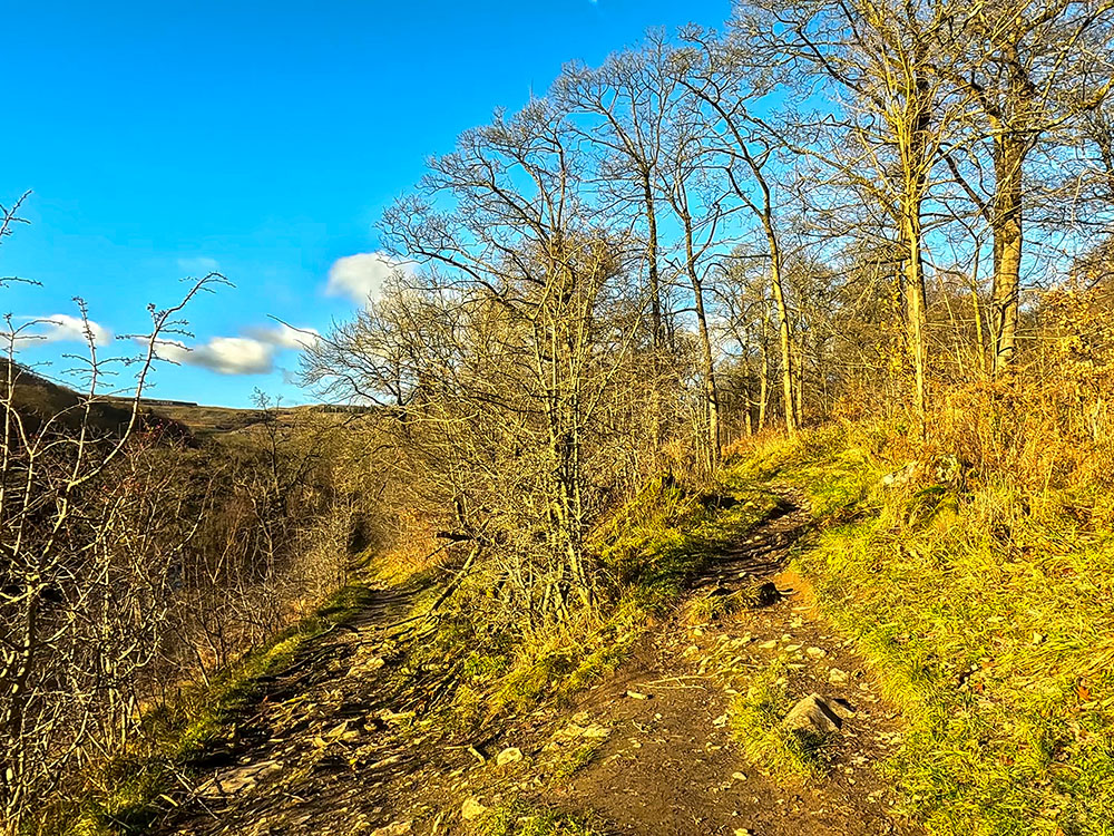
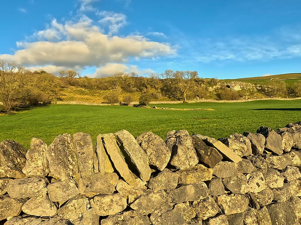
Head up along the gravelled path. We soon reach an information board telling you all about Grass Wood. From the information board, walk up the hill along the gravel path for about 400 metres.
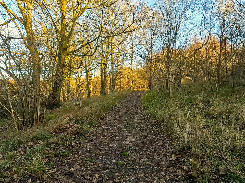
Footpath heading along the side of Grass Wood
If you look over to the left from the path as you climb, you see Kilnsey Crag in the distance. As the gravel path bends to the right, another, much more minor footpath goes straight on, which you can take if you want to explore the woods further.
Ignore that and follow the gravelled path around to the right.
After a steady climb of about 400 metres, the path begins to level out, and you come across a footpath sign. If you had gone straight on about 600 metres further back to explore the woods further, this is where you'd re-join the gravelled path.
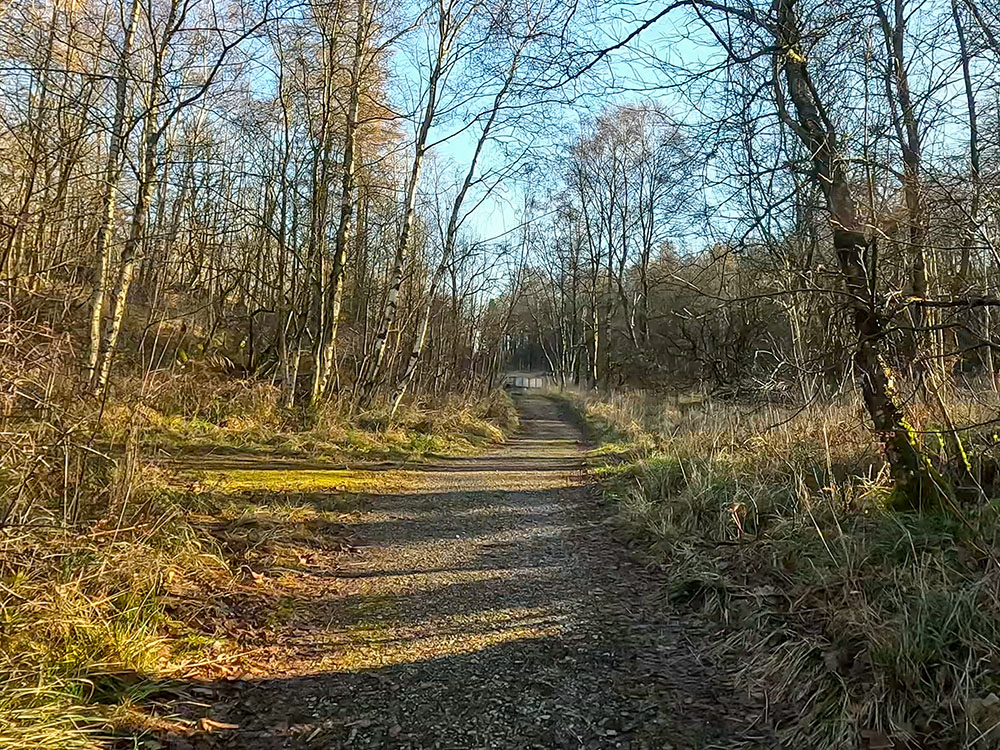
Footpath heading through Grass Wood
Continue walking along the gravel path, soon reaching a four-way signpost. We are going to continue straight on here in the direction of Grassington.
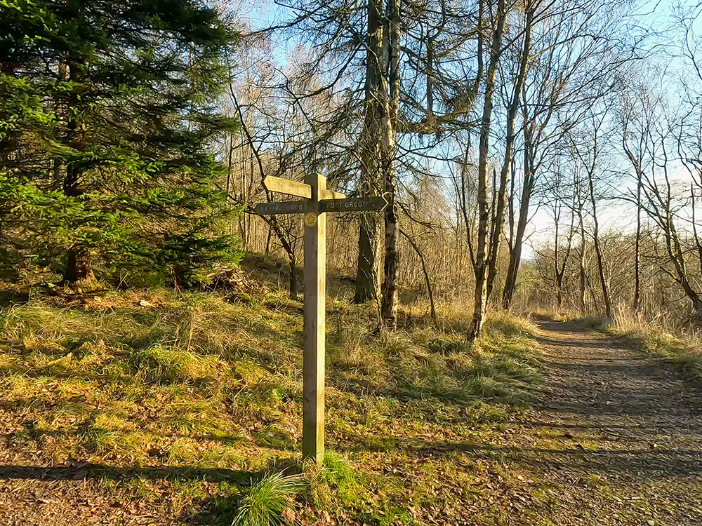
4-way footpath sign in Grass Wood
But, if you want, for a short diversion, you can head up to the right to visit Fort Gregory, albeit when you arrive there, you may be a little underwhelmed by the lack of a fort. Watch the video first to see if you think the detour is worth it, especially if you are unstable on your feet.
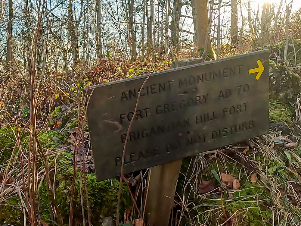
The sign pointing up towards Fort Gregory in Grass Wood
To take the short detour, follow the sign to the right, the path through the trees, and then up some steps as it heads up onto Far Gregory, the Iron Age Fort Gregory site, also known as Gregory's Fort. Its Victorian discoverers considered the fort a Brigantine fort established against the Roman invasion around AD70.
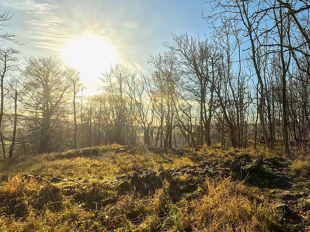
The site of Fort Gregory in Grass Wood
Unless you are an archaeologist or set your expectations relatively low before heading off here, you may be disappointed to find out that these stones are the remnants of the fort, or at least that's all I could find.
You can wander a little higher and follow the path further up through the trees, where if you do look around and imagine the place without the trees, it would have given a fantastic panoramic view from the Fort.
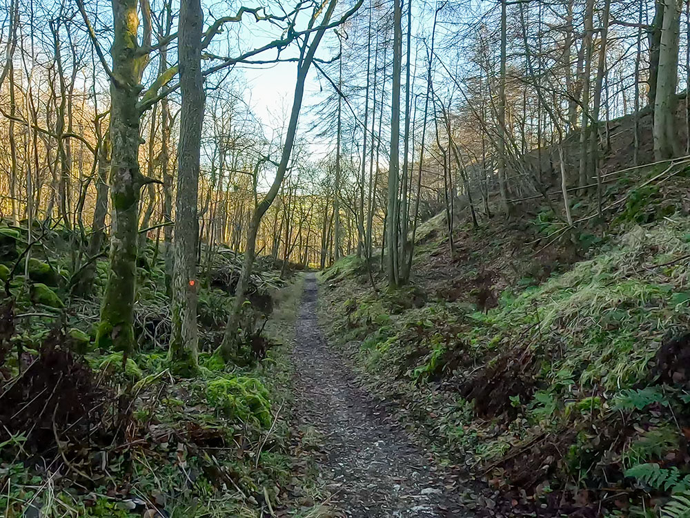
The paths up here aren't the easiest to walk on, and the steps were a little bit slippery, so if you are unstable on your feet, maybe give this diversion a miss.
If you took the diversion, return to the 4-way signpost you left earlier.
On reaching the 4-way sign, continue straight on in the direction we were walking in previously, following the Grassington sign along the gravelled path.
Footpath heading down out of Grass Wood
These woods are a delight to walk through in the spring and summer when there is lots of flora in bloom and the air is filled with birdsong. The path now starts to descend.
Just before we reach the edge of Grass Wood and Park Stile, there is another Iron Age settlement site around this area.
Footpath meandering down through Grass Wood
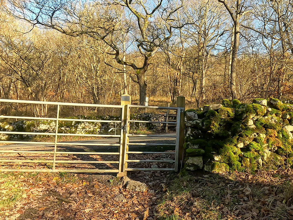
At the edge of the woods, pass through the gate stile in the wall and head across the field to the right of the building, where we pass through the gap in the wall.

Gate stile in the wall to exit Grass Wood
The footpath heads through the gap in the wall in the direction of the barn
We then head across this short field, just keeping to the left of the wall and then pass through the gate to enter Cove Lane.
Gate leading onto Cove Lane
Just head now along the walled Cove Lane.
View from Cove Lane, Grassington
A footpath sign goes straight on as Cove Lane bends sharply around to the right. Just ignore this now and continue along the walled Cove Lane.
Heading along the walled Cove Lane, Grassington
Over to the right, you can look back across to Grass Wood, which we just walked through.
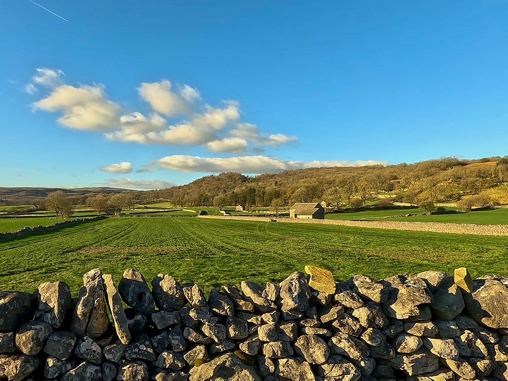
The view back towards Grass Wood from Cove Lane, Grassington
On meeting a metal gate across the lane, pass through it and continue straight on again. As the lane meets the road, turn left to head up, follow the road as it bears around to the right, and head into Grassington.
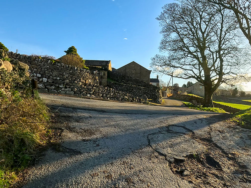
The left turn off Cove Lane to head into Grassington
Just walk along this road where, after a while, we walk by Grassington Methodist Church.
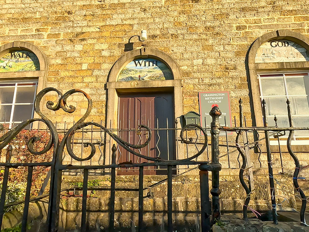
Grassington Methodist Church
We then head onto and pass by the first of many galleries, shops, cafés and pubs in the centre of Grassington. Across the road from the gallery is Grassington Town Hall, run by the Parish Council. It holds many events and activities.
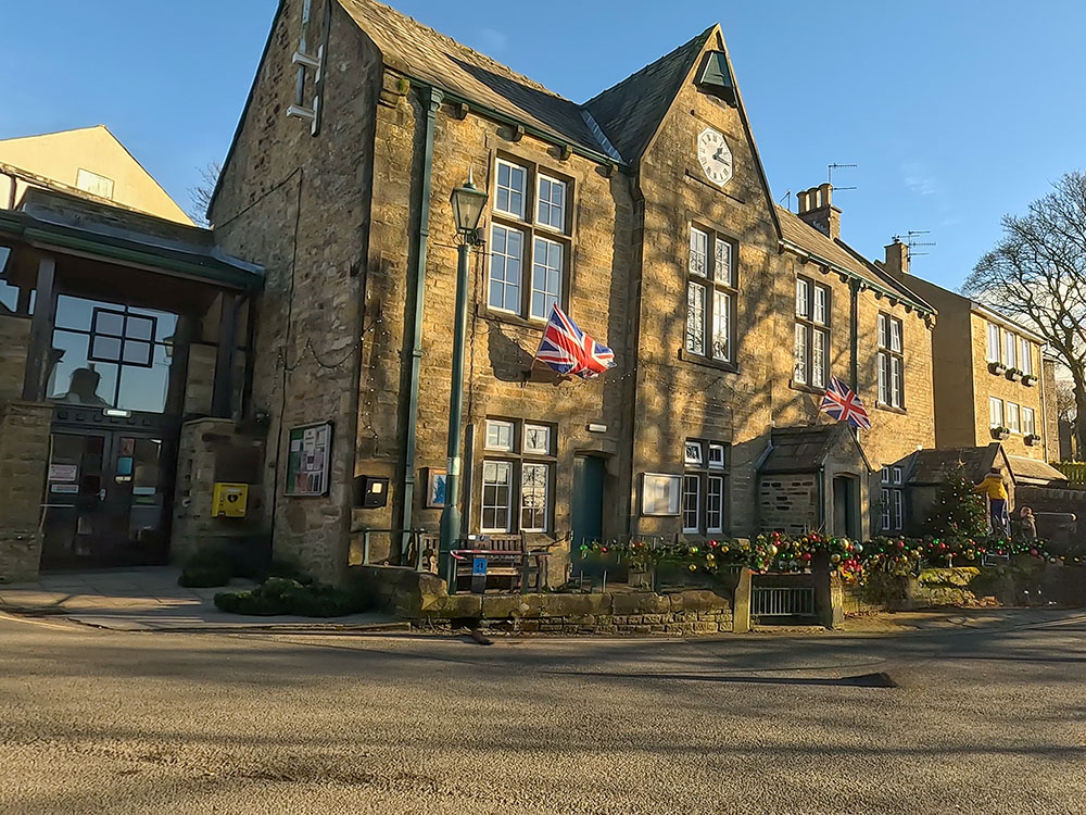
Grassington Town Hall
Turn right now to head back towards the centre. Take time now to wander down the main street, side streets and square to check out the many galleries, shops, cafés and pubs. I've just set out a few below that I passed on the way back to the car park.
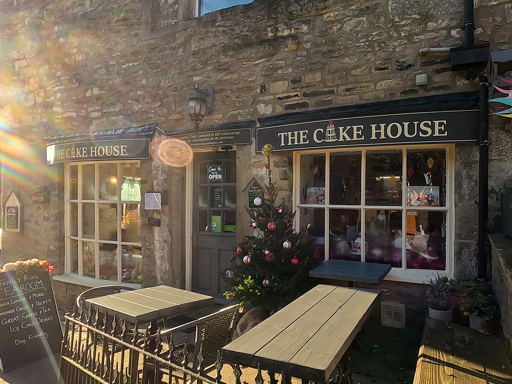
Cake House, Grassington
Grassington is the home of the fictional market town of Darrowby, in the remake of All Creatures Great and Small, which is showing on Channel Five and is based upon the classic James Herriot Books.
The first of the new series was filmed to coincide with the 50th anniversary of the publication of the first James Herriot book. As you wander around Grassington, you may recognise many of the shops and buildings used in the show.
Filming took place earlier this year for the fourth series. As you can see, as you wander down the street, there are many places to stop off for something to eat and drink, along with potteries, craft shops and galleries.
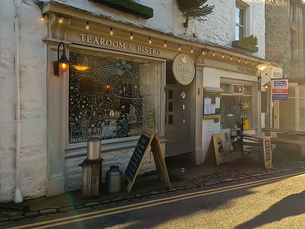
Retreat - Tearoom and Bistro in Grassington
You soon pass by the Foresters Arms on the left, which serves food and drink, has some accommodation and is dog friendly. It generally has around four real ales on the bar.
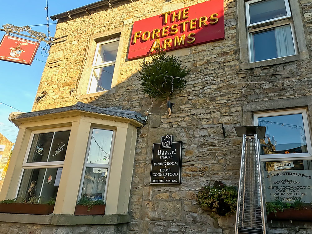
The Foresters Arms in Grassington
Just past that is The Devonshire, which may be better known to you as the Drovers Arms in All Creatures Great and Small. It serves food, has around five real ales on the bar and stocks over 50 gins. It is dog-friendly and has some accommodation.
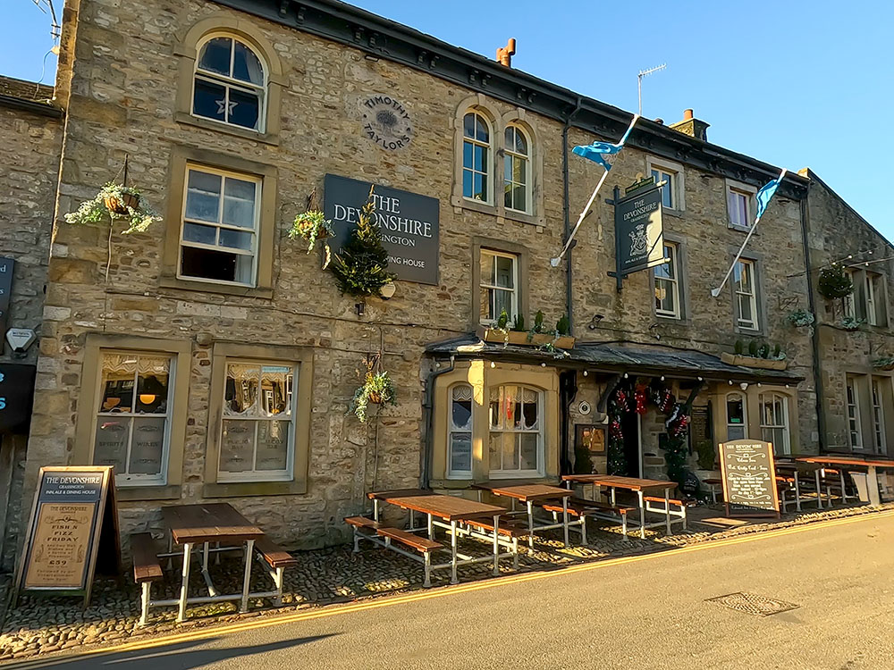
The Devonshire in Grassington
Opposite is the Stripey Badger Bookshop with its coffee shop next door, which is again transformed into a grocery store and a private house for the TV series.
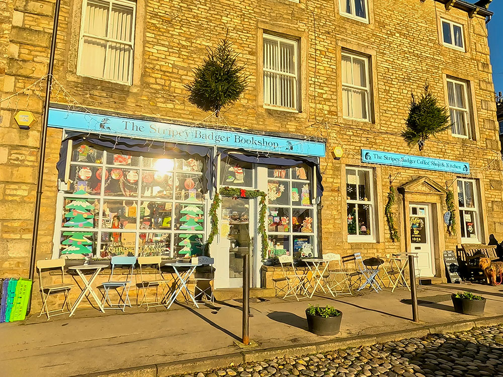
The Stripey Badger Bookshop and Coffee Shop in Grassington
Just before reaching the Folk Museum on the corner of the square, if you turn up to the left, you arrive at the Black Horse Hotel, a 17th-century coaching inn. It serves food and drink and has around five real ales on the bar. It has accommodation and is also dog-friendly.
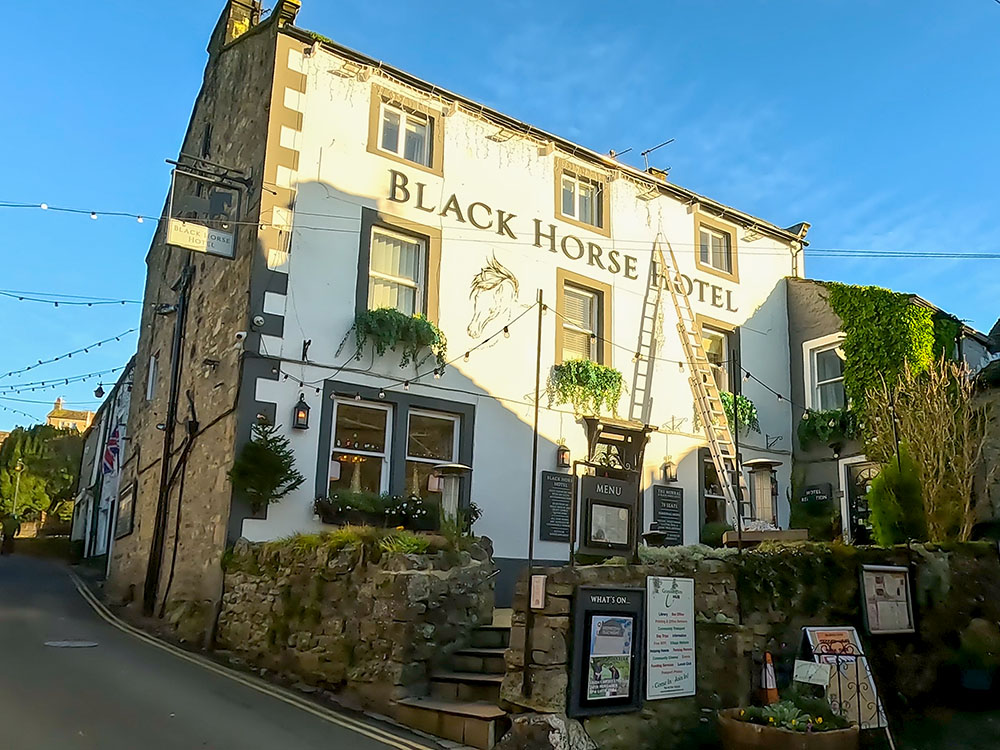
The Black Horse Hotel in Grassington
Just past the Black Horse is another café, and then, on the other side, on the right, if you want something slightly different, is a fish and chip shop.
Turning around, we pass back down into the square by the Grassington Folk Museum, which houses memorabilia from Wharfedale of yesteryear.

The Folk Museum in Grassington
Just past that is Grassington House, a restaurant and bar with accommodation. It serves food and drink, has a couple of real ales on the bar, and has accommodation. I believe dogs are allowed in the bar area.
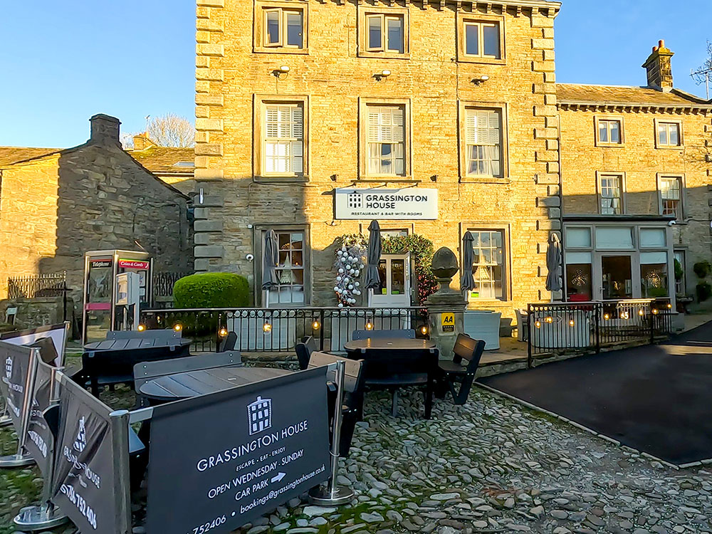
Grassington House in Grassington
On the other side of the square is Grassington Post Office and Robert Bunney menswear, which in the TV series becomes Wood's General Store and Robert Bunney menswear, so no changes are needed for that one.
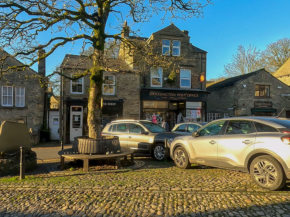
Grassington Post Office
Depending on when you visit Grassington, you may arrive at a 1940s weekend, the Christmas market, or even a Dickensian festival.
After passing by yet another coffee shop and a couple of other shops, we continue on to meet the road to the bottom.
The left turn to head back towards the car park
After meeting the road, we turn left to return to the car park. Just before the National Park Centre, cross over the zebra crossing and enter back into the car park by the wooden gate at the side of the National Park Centre.
The car park also has a circular building, which is a bus terminus. Grassington is served by a daily bus service from Skipton, which continues to Kilnsey, Kettlewell and Buckden. I believe there are also buses to Burnsall, Bolton Abbey and Ilkley.
Grassington Bus Terminus in the National Park Centre car park
If you want to see this walk from above and get a bit more perspective on where you have been on the walk, we have created a short fly-through using the Ordnance Survey app, which you can see at the end of the video.
If you enjoy waterfall walks, be sure to check out our Ingleton Waterfalls Trail walk.
Finally, talking of videos, if you watched and enjoyed our video, don't forget to click the like button, subscribe to our channel and hit the notification bell so you know when any more new walks have been uploaded. Subscribing on YouTube is free, and your likes and any comments you have about the video or the walk, really do help promote our channel - thanks. 😊
Gifts and presents for hikers and walkers
Are you struggling to pick the perfect gift for your hiking-loving friend or family member? Don't fret! Explore our curated selection of top-notch gifts for walkers and hikers that will have them trekking with joy on their special day.
What to wear and take on your walk or hike
Whether you are a seasoned hiker or new to walking, wearing and taking suitable hiking kit and clothing is essential for a day hike for your comfort and safety. So we have put together a hiking essentials checklist to cover all you'll need. Our Hiking Essentials checklist for 2026 takes you through planning your walk, the hiking essentials checklist itself, optional extras, explanations, and recommendations for all the hiking essentials.
Check out the reviews for this walk: