By using this website, you agree to our use of cookies (needed to provide our website’s features) and our Terms of Use.

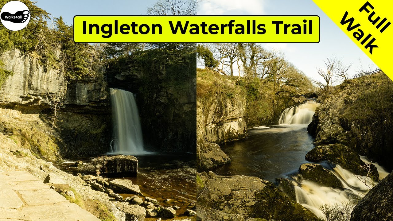
This Ingleton Waterfalls Trail walk in the Yorkshire Dales is probably the most spectacular waterfall and woodland walk in the UK. You pass by Pecca Falls, Hollybush Spout, Thornton Force, Beezley Falls, Rival Falls, Baxenghyll Gorge, and Snow Falls.
In accordance with our Disclaimer, you agree to take full responsibility for any use you make of the information contained in these pages.
This page contains affiliate links. If you buy products or services via these links, we may earn a small commission at no cost to you.
| Walk title: | Ingleton Waterfalls Trail walk |
| Author: | Andrew Forrest - March 2024 |
| Walk start point: | Car park at the start of the Ingleton Waterfalls Trail (grid reference SD 693 734) - there is an entrance fee payable for the walk What3words: into.gracing.urge |
| Parking: | As above. There is also other parking available in Ingleton |
| Directions to nearest parking place: | Google Maps: get directions here / What3words: sweated.intervene.flotation |
| Walk distance: | 6.7 km |
| Estimated walk time: | 2 hours 5 minutes (with stops, taking photographs, etc. - it could be longer) |
| Height climbed: | 310 metres |
| Technical difficulty: | Moderate - as determined by our interpretation of the Ordnance Survey guidance on technical difficulties |
| Peaks / summits: | None of note |
| Map: | Ordnance Survey - Explorer OL2 (Yorkshire Dales - Southern & Western Area) Buy this map from Ordnance Survey |
| GPS/GPX file: | Download available to registered users - Register and Login here - It's FREE to register |
| Facilities / refreshments: | There are many pubs, restaurants, cafés, and takeaways in Ingleton - check out the walk description and video for further details. |
| Nearest town: | The walk starts in Ingleton |
| Local self-catering accommodation: | View self-catering accommodation close to the start of this walk |
| Local hotels, inns and B&Bs: | View hotels and inns close to the start of this walk from The Inn Collection Group |
Estimated walk time
Walk time estimates used are from the Ordnance Survey mapping app, which uses a refined Naismith's rule, adjusted by OS overlaying their own data collected from more than one million people using the OS mapping app. Naismith's rule allowed one hour for every three miles walked and added pro-rata an additional hour for every 2000ft of ascent - roughly one hour for every 5km, plus one hour for every 600m of ascent.
Ordnance Survey Mapping App
Use on any device and make it easy to explore the great outdoors for just the price of a coffee a month. Premium allows full UK access to all OS Explorer and Landranger mapping, along with the ability to import and export routes, save maps offline, aerial 3D, and print A3/A4 maps.
This Ingleton Waterfalls Trail walk starts in the car park at the trail's start in Ingleton, Yorkshire Dales.
We leave the car park and follow the well-made riverside path upstream along the river Twiss, where we soon pass by a money tree.
After heading through Swilla Glen, we then cross the river Twiss by a footbridge. Not too much further on, we pass back over it by another footbridge called Pecca Bridge, which affords the first views of the lower parts of Pecca Falls. We then continue on the path alongside the river Twiss as it passes by the upper parts of Pecca Falls.
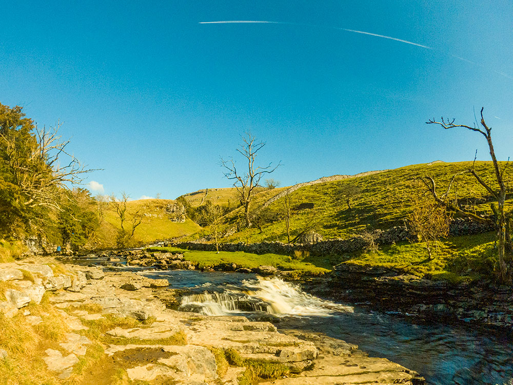
Pecca Falls is actually a collection of five waterfalls which drop 30 metres over the slate and sandstone. After Pecca Falls, we quickly arrive at Hollybush Spout, and then, in the clearing, we reach Thornton Force on this Ingleton Falls walk.
We then leave the river Twiss and head to the river Doe for the return to Ingleton, with views of Ingleborough ahead. On reaching the river Doe, the first falls you see are the Beezley Falls.
These are soon followed by the Rival Falls, before reaching the smaller waterfalls through Baxenghyll Gorge. Further down the path, you can look back towards the Snow Falls. After that, we cross over another footbridge and leave the river, passing by the disused Storrs Quarry before heading back through the centre of Ingleton to reach the car park.
The video shows this full Ingleton Waterfalls Trail walk, and this Ingleton Falls route is shown on the Ordnance Survey map - both above. Below is a brief description of the walk. Places where you can eat and drink after the walk are shown below and at the end of the video.
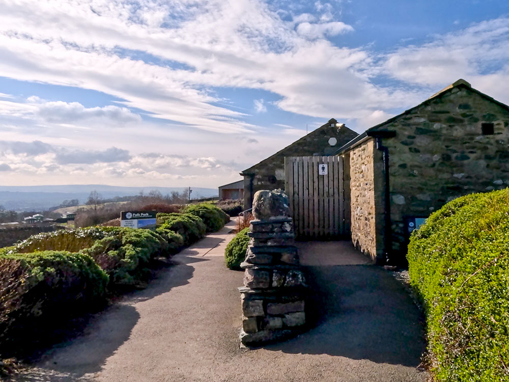
This Ingleton Waterfalls Trail walk starts in the car park at the trail's start in Ingleton, Yorkshire Dales. This has to be my favourite waterfall walk in the UK. At the car park, there is a café (currently closed for refurbishments as of March 2024), an information board and toilets.
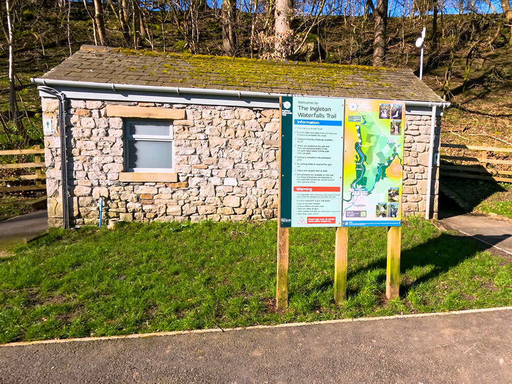
Toilets and information board in Broadwood car park at the start of the Ingleton Waterfalls walk
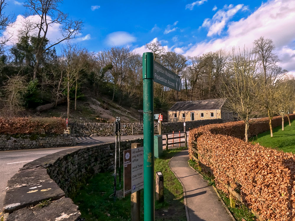
Head through the large car park until you reach the ticket office. The Ingleton Waterfalls Trail has an entrance fee, which goes towards the upkeep of the paths and insurance costs, as most of the footpaths are on private land. The Ingleton Waterfalls trail tickets are bought from the ticket office that we will pass through shortly. The car park is large, but it can get busy on weekends and in the summer. There is additional parking available in Ingleton.
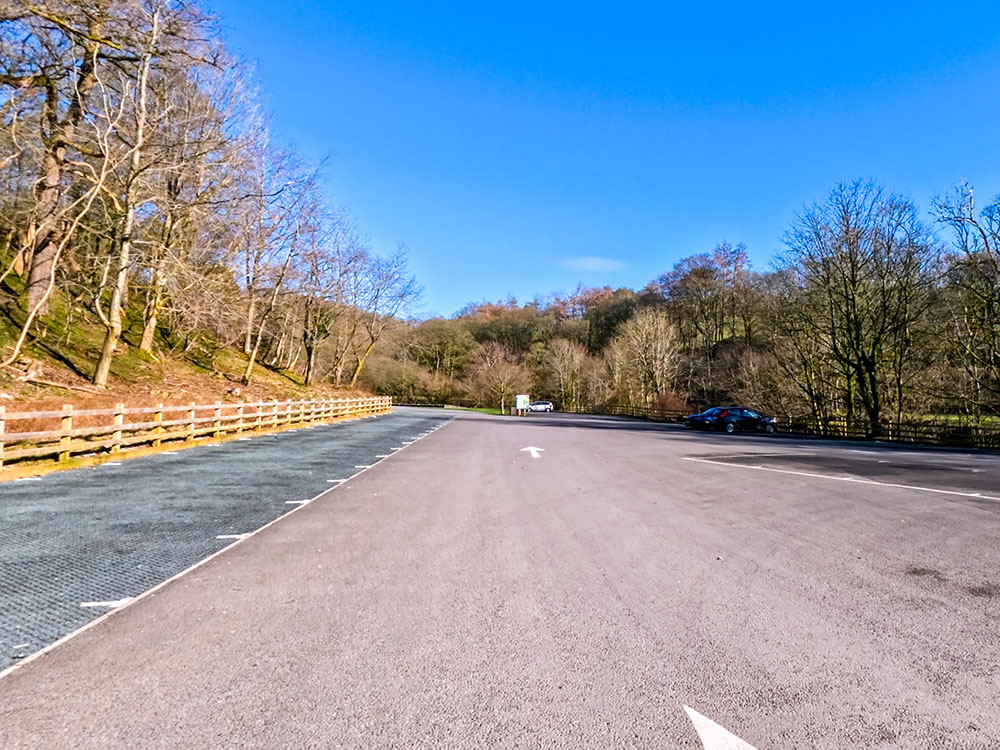
Heading through the Broadwood car park
Even though you have to pay, for me, this still has to be my favourite waterfall walk in the UK. At the end of the car park, pass through the ticket office and purchase your Ingleton Waterfalls trail tickets.
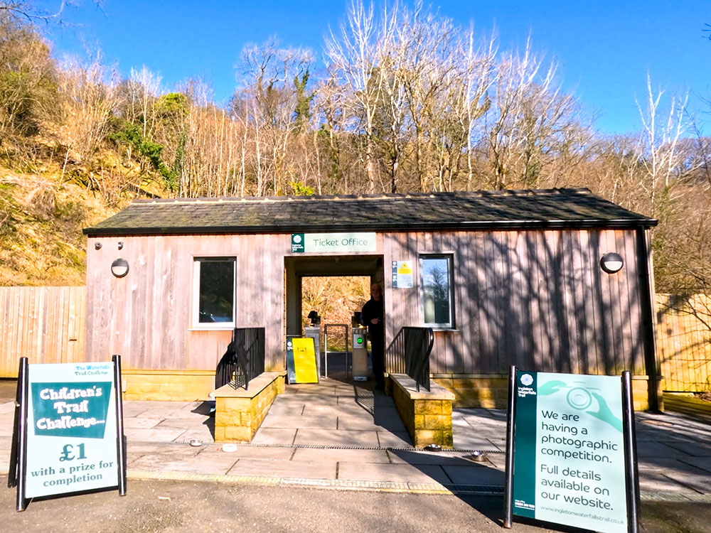
Ticket office at the far end of the car park at the entrance to the Ingleton Waterfalls Trail
Just past the Ingleton Falls ticket office is an information board with information about the Ingleton Waterfalls Trail, warnings about following the path, keeping children under control, etc. When you buy your Ingleton Waterfalls trail tickets, a visitor leaflet showing the trail and the falls is available when you pass through the ticket office. If you want to look at that in advance, it is available as a download on the Ingleton Waterfalls Trail website, which also includes information on opening times and prices.
Whilst the height gain isn't too substantial on the Ingleton Waterfalls Trail, there are quite a few steps, so if you are unsteady on your feet and you don't like too many steps, watch the video, as I've tried to show what you'll be walking on as you go around.
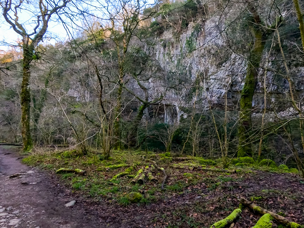
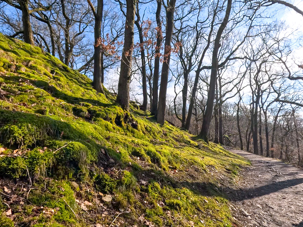
The Ingleton Waterfalls Trail is pretty obvious all the way around, as it is on well-marked paths, including the middle section between the two rivers. Walking the Ingleton Waterfalls at different times of the year offers different sights and sounds. In late Autumn, Winter, and early Spring, most of the trees are without leaves, so visibility is better, but when the leaves are on the trees, there is much more birdlife and birdsong to listen to.
I enjoy the walk, both with and without leaves on the trees, but I do find the best time to do it is a day or two after a period of prolonged heavy rain.
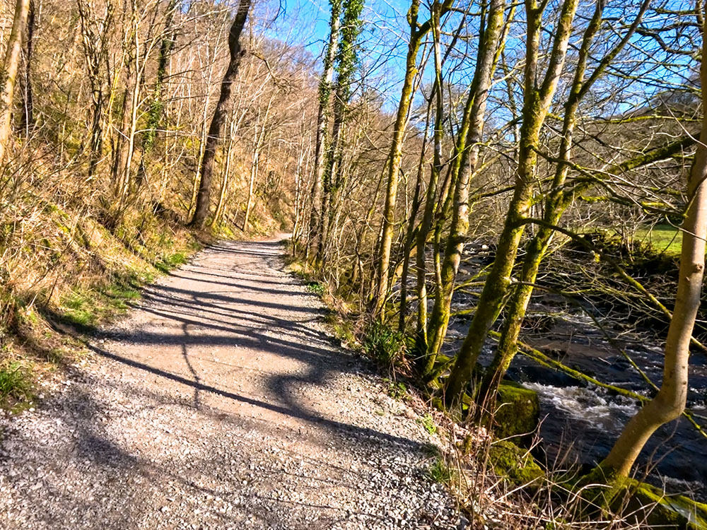
The initial gravelled path alongside the River Twiss
Head along the gravel track away from the ticket office. After a while, pass along a fenced section and then drop down back towards the river Twiss.
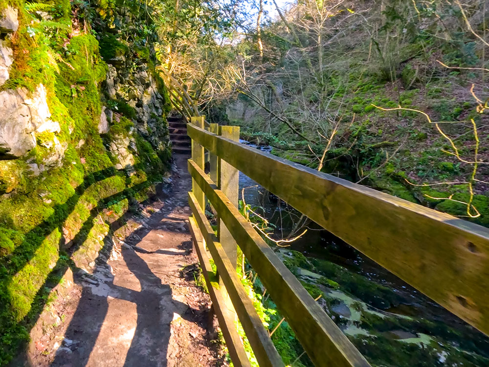
Fenced path and steps on the path beside the River Twiss on the Ingleton Waterfalls Trail
Dropping down onto the path beside the River Twiss
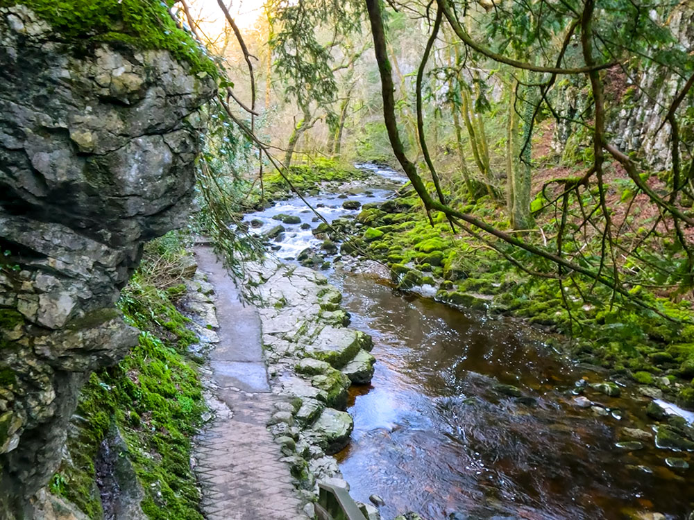
The path then starts to pass through Swilla Glen.
The path passing through Swilla Glen
Continuing on, you reach an impressive money tree... who says money doesn't grow on trees? It is believed that the origins of putting coins into trees, so-called money trees or wish trees, dates back to pagan times.
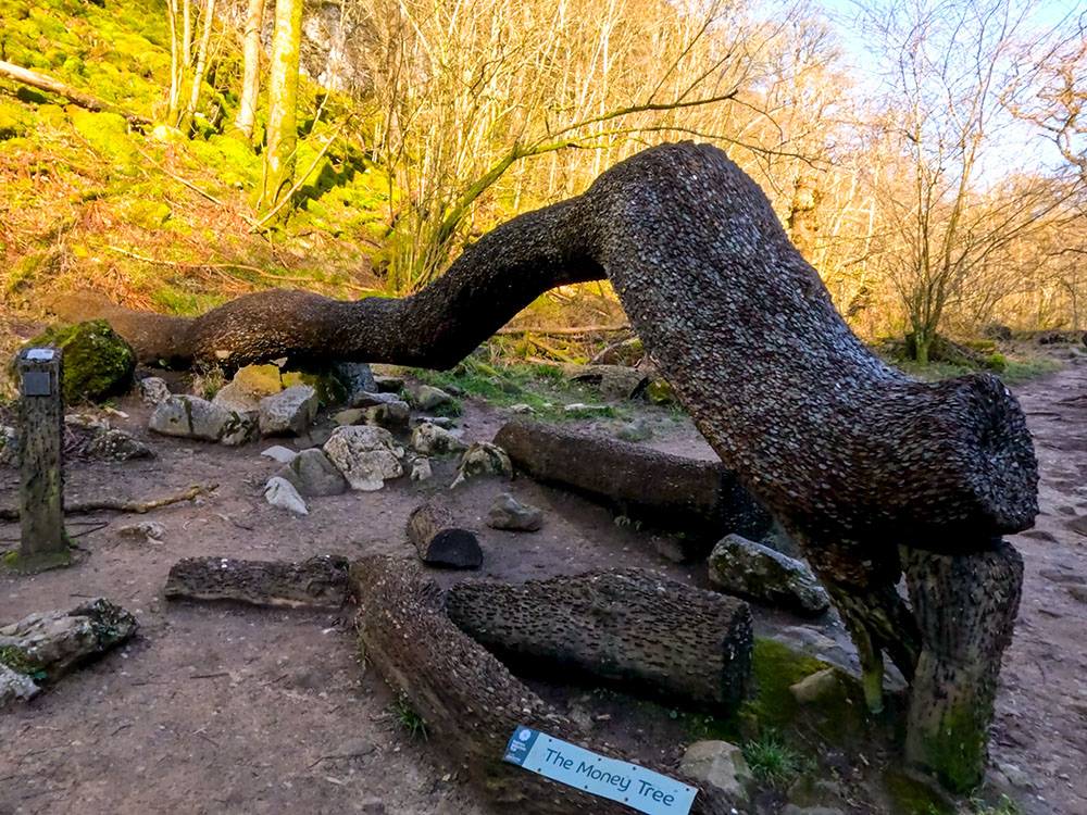
The 'money tree' at the side of the path
People believed that mystical spirits resided in the trees, and by offering gifts to them, they would receive wisdom, healing and good luck. This tradition is similar to throwing coins into fountains or into wishing wells.
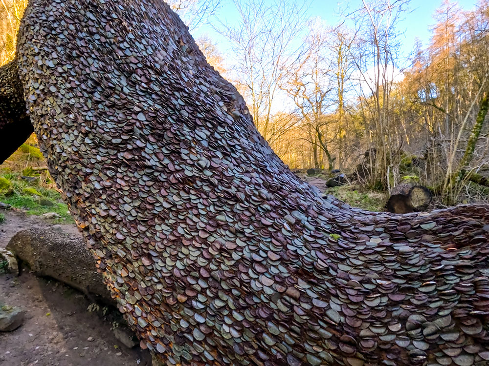
Close-up of the 'money tree'
Just past the money tree, you will see one of the many small informational signs interspersed throughout the walk. This one lets you know that you are in an oak woodland.
Continue walking along the footpath.
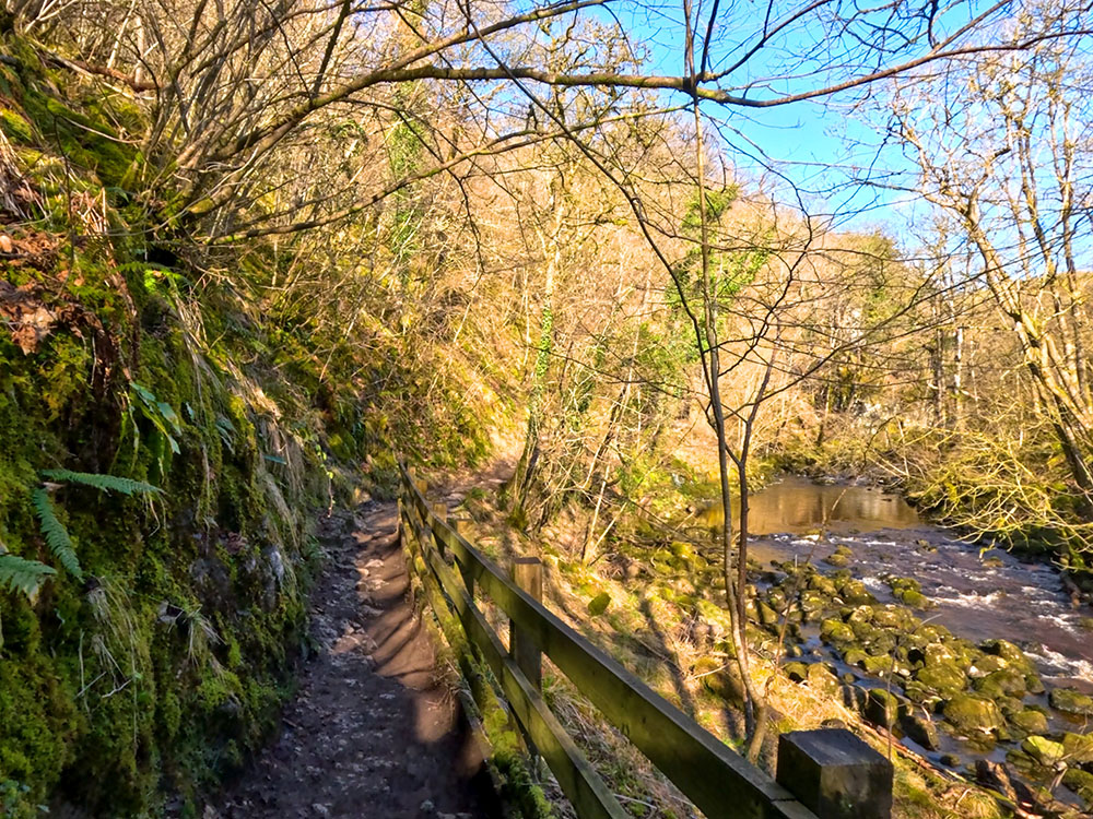
Path between moss-covered rocks and a fence heading alongside the River Twiss on the Ingleton Waterfalls walk
After passing through the wooded Swilla Glen and walking on for about a kilometre, we reach and pass over Manor Bridge, a footbridge that crosses the river Twiss.
Footbridge crossing over the River Twiss
View from the footbridge over the River Twiss
The bridge affords views downstream and upstream. Continue walking along the trail, and you soon reach what the trail classifies as a viewpoint for Pecca Falls. They do look a bit distant, though, from here, and much better views will be had shortly.
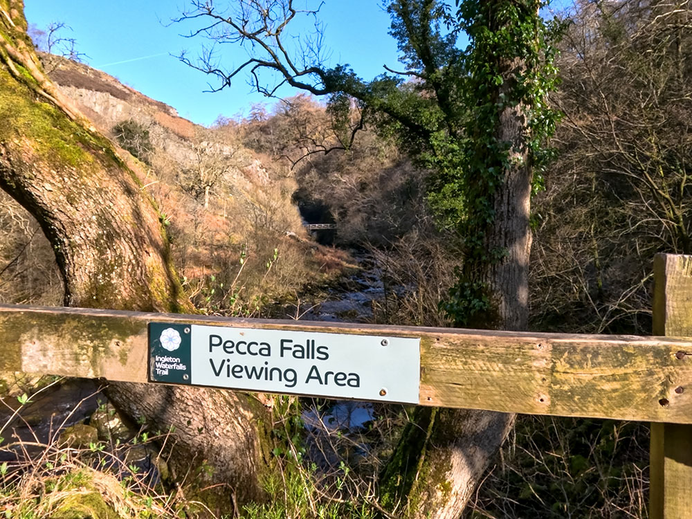
Initial Pecca Falls Viewing Area
Keep on walking along the Ingleton Waterfalls Trail, where you soon reach a second bridge. We cross Pecca Bridge here to head over the river Twiss again, from which we got a much better view of the start of Pecca Falls.
Crossing Pecca Bridge to head back over the River Twiss
A couple of the falls making up Pecca Falls from Pecca Bridge
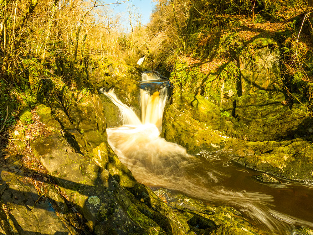
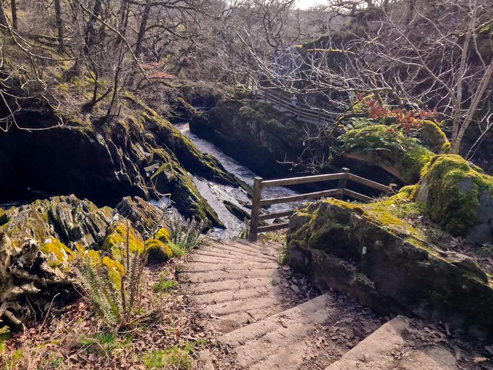
Once over the bridge, we then climb the steps to pass by the rest of Pecca Falls.
Pecca Falls on the Ingleton Falls walk effectively forms three groups of waterfalls: the lower falls, visible from Pecca Bridge, the middle falls, and the upper falls. The lower falls are visible from Pecca Bridge, the middle falls, and the upper falls. Overall, Pecca Falls drops 30 meters in height over the alternating beds of Ingleton Group Slate and Sandstone Graywackes. The slate, which is more easily eroded, forms the plunge pools, while the sandstone forms the falls.
Head up the steps alongside Pecca Falls, where you soon reach the middle falls.
Waterfalls at Pecca Falls
Pecca Falls on the Ingleton Waterfalls Trail
Continuing on you then pass by the Twin Falls at the top of Pecca Falls.
Top of Pecca Falls on the Ingleton Waterfalls Trail
Heading onwards, we soon arrive Hollybush Spout.
Hollybush Spout on the Ingleton Waterfalls Trail
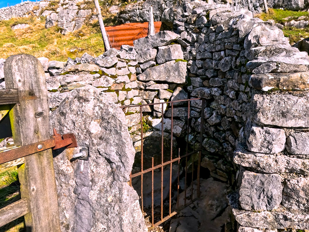
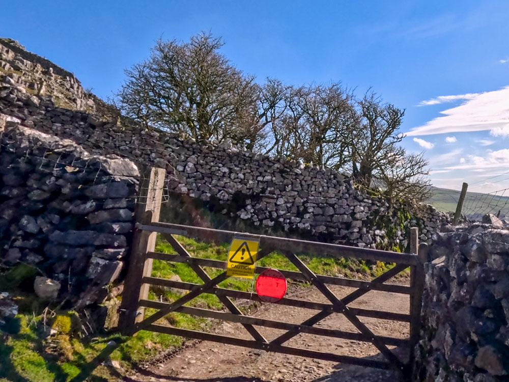
We then follow the path as it climbs the steps and passes through a gate.
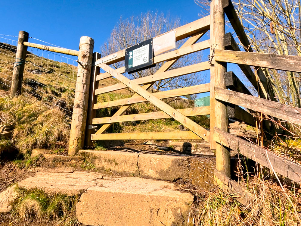
Gate heading out of the woods
Just through the gate, you pass by a green shack, which, on previous occasions when I've passed, used to be a snack bar.
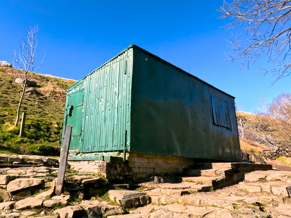
Path heading past the green shack on the Ingleton Waterfalls walk
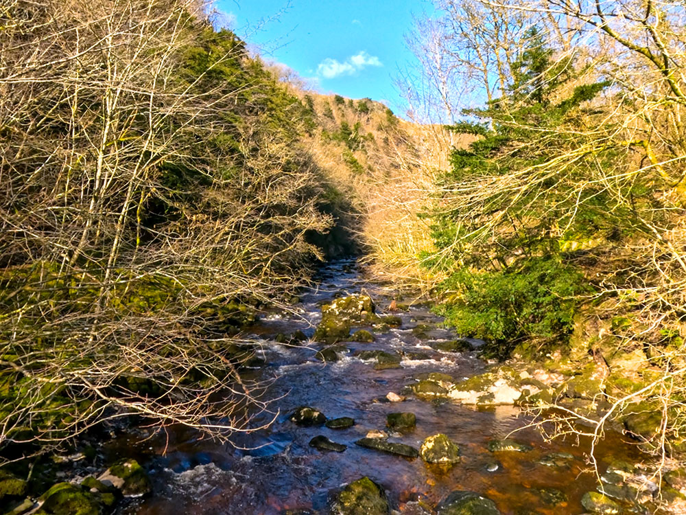
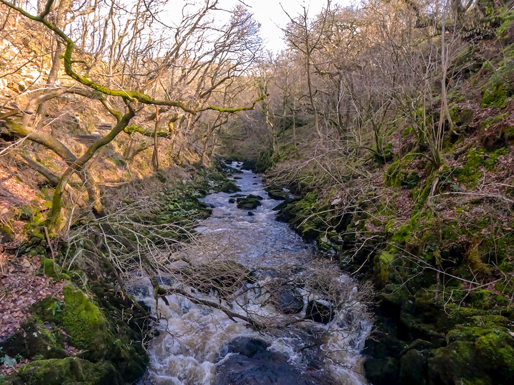
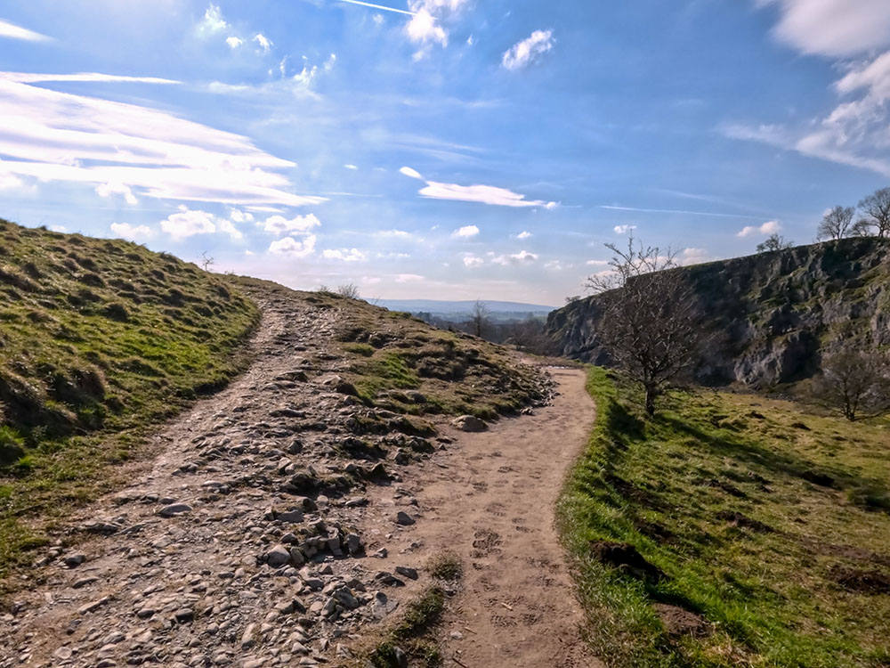
Keep on walking along the path, where now we are quite a way above the river Twiss below. This next section of the walk is much more open along the wider valley as we pass by Cuckoo Island below in the river Twiss, which has been formed by the river dividing.
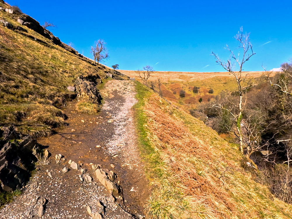
The more open path running parallel and above the River Twiss on the Ingleton Waterfalls walk
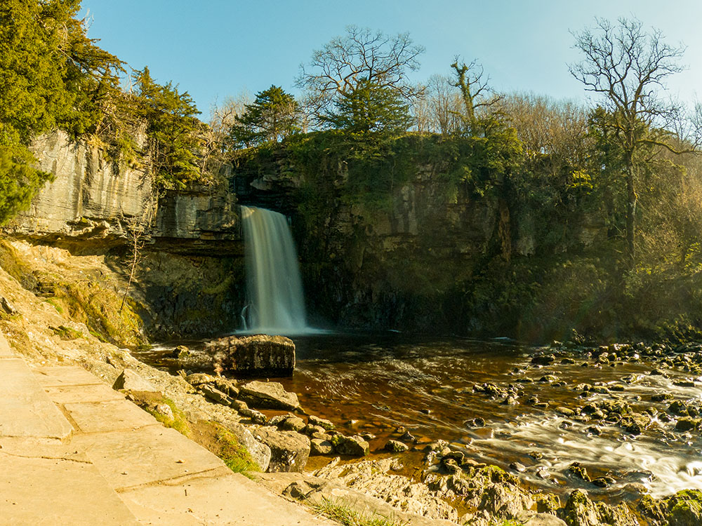
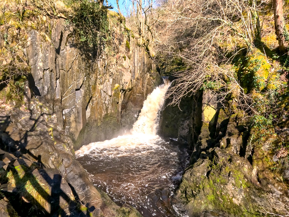
Not too far after that, the impressive Thornton Force comes into view ahead. Thornton Force falls 14 meters into its plunge pool below.
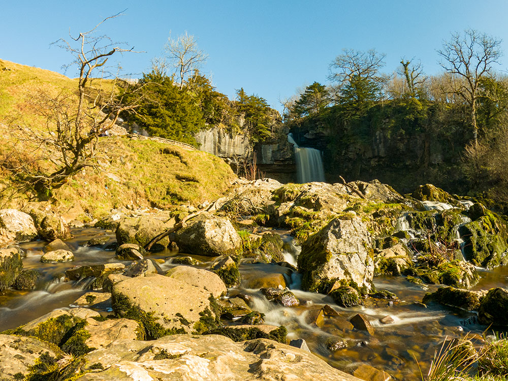
Thornton Force on the Ingleton Waterfalls Trail
The word 'Force' is derived from the Viking word Foss, which is another name for a waterfall. Over the years, as the overhanging limestone has been undercut, it is believed that the waterfall has retreated about 50 metres from its original post-glacial location about 17,000 years ago.

Thornton Force on the Ingleton Waterfalls Trail
There are some seats near the path where you can sit and admire Thornton Force.
Seating and steps heading up over Thornton Force
To continue, head up the steps to the side of Thornton Force.
Looking back down the River Twiss
At the top of the steps, we reach Raven Ray, which is a moraine made up of glacial till and boulder clay, which was deposited by a glacier running down Kingsdale (the next valley along) during the last Ice Age. The moraine basically created a dam at the end of Kingsdale, which is believed to have formed a lake in the Kingsdale Valley itself.
River Twiss just above Thornton Force beside Raven Ray
After many years, water cut through it, resulting in Thornton Force. The river Twiss, which you see here, cut through it and created the gorge.
The word 'Twiss' is believed to be derived from the old English word twizzla, meaning the wedge of land formed by a river fork. In this case, I'm assuming it is referring to nearby Twisleton that the walk passes shortly, which is a farm on a wedge of land created by the river Twiss and the river Doe as they head on to merge in Ingleton.
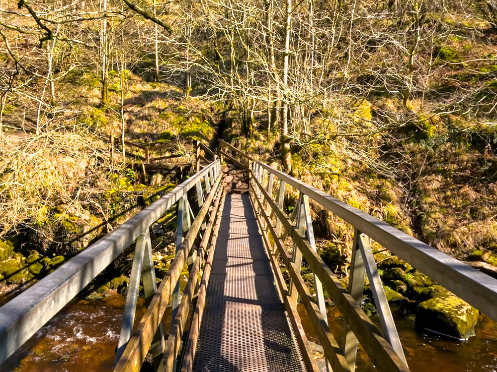
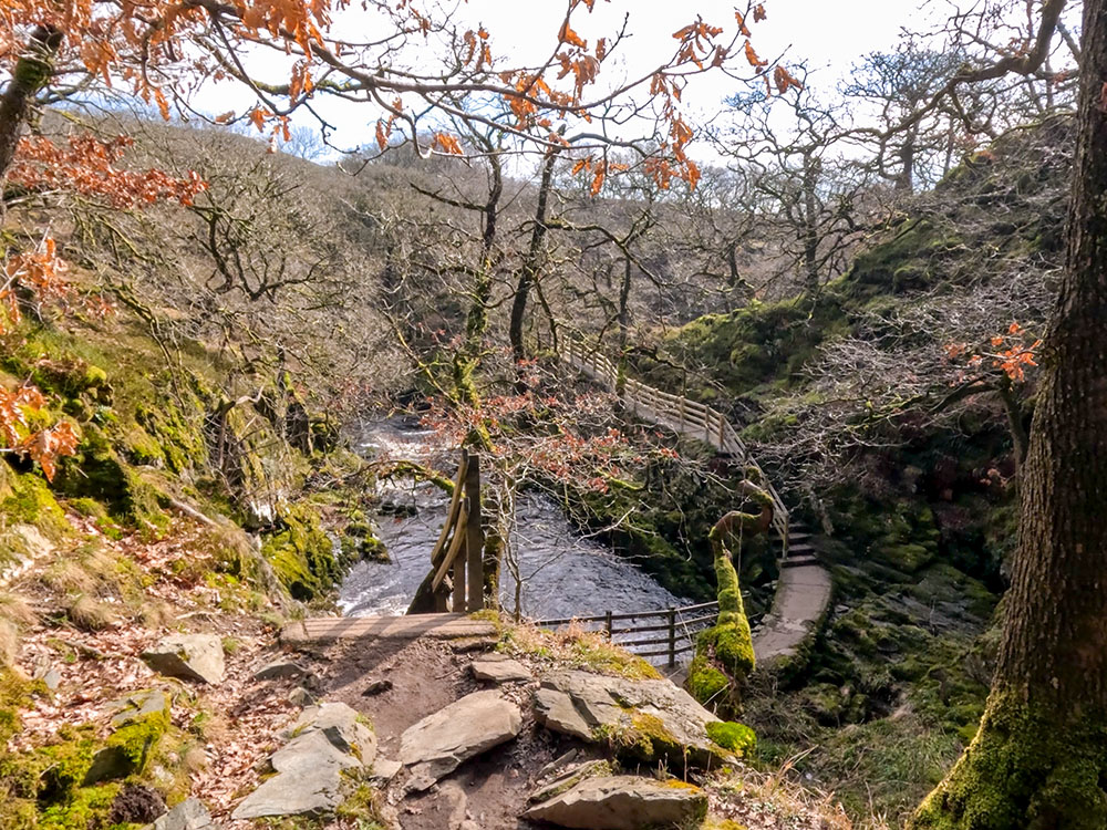
As you continue along the path, looking back down to the right, you can see the top of the gorge. With the Kingsdale valley ahead, cross the footbridge over the river Twiss and then head up the steps.
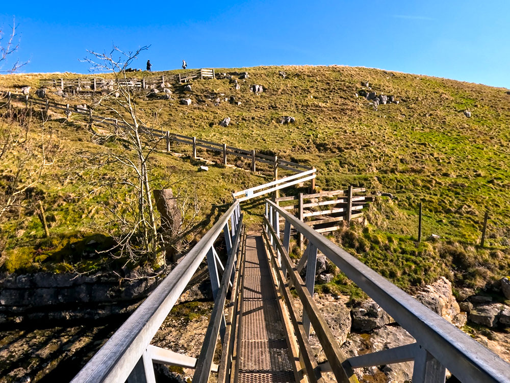
Footbridge over the River Twiss
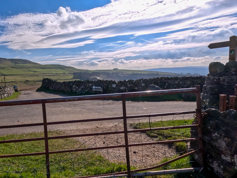
To continue this Ingleton Falls walk, at the top of the field, pass through the gate and turn right onto Twisleton Lane.
Gate heading on to Twisleton Lane
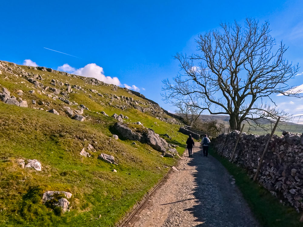
Head along the walled Twisleton Lane.
Heading along Twisleton Lane
After a short distance, pass through a kissing gate and then continue ahead on the lane. Very few times have I done this walk when there was not an ice cream van just through the kissing gate on this lane.
Kissing gate on Twisleton Lane
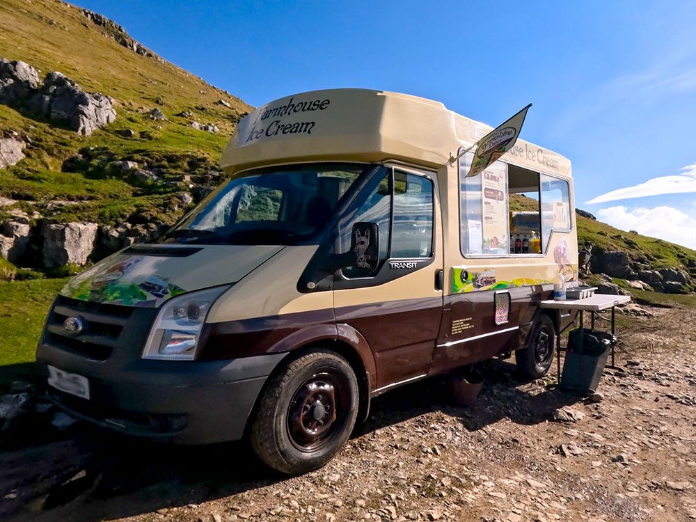
The often-seen ice cream van on Twisleton Lane on the Ingleton Waterfalls Trail
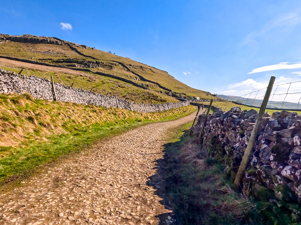
As you walk along the walled track, in the distance, you can see views towards the Forest of Bowland. Up to the left as you walk along this lane is Twisleton Scar End, the Twisleton mentioned above. The Gordale limestone here is now a series of scars and terraces.
Twisleton Lane
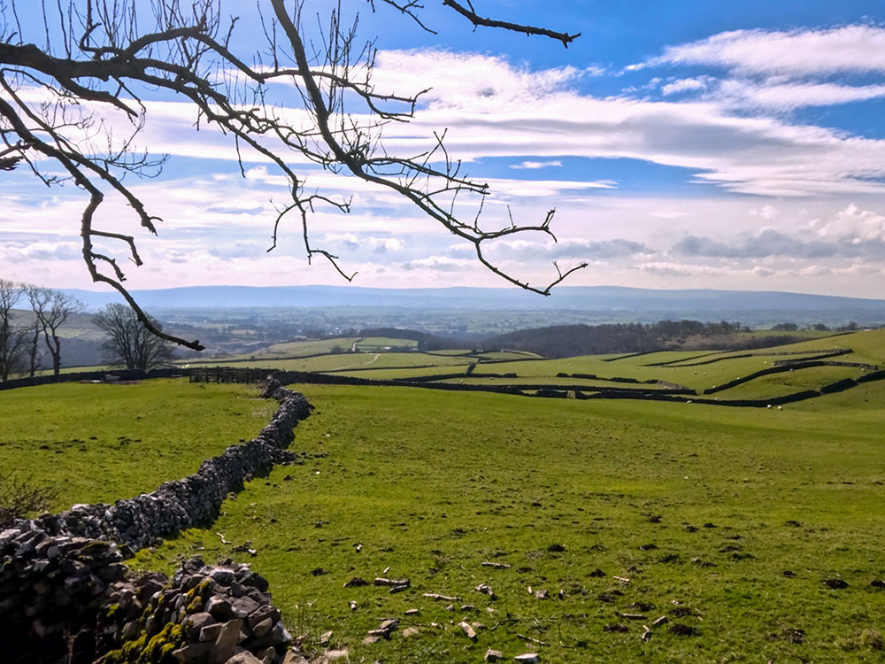
View from Twisleton Lane
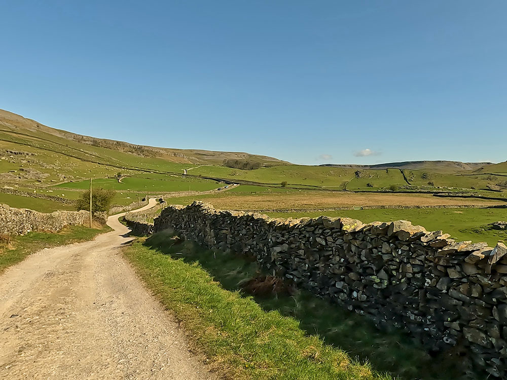
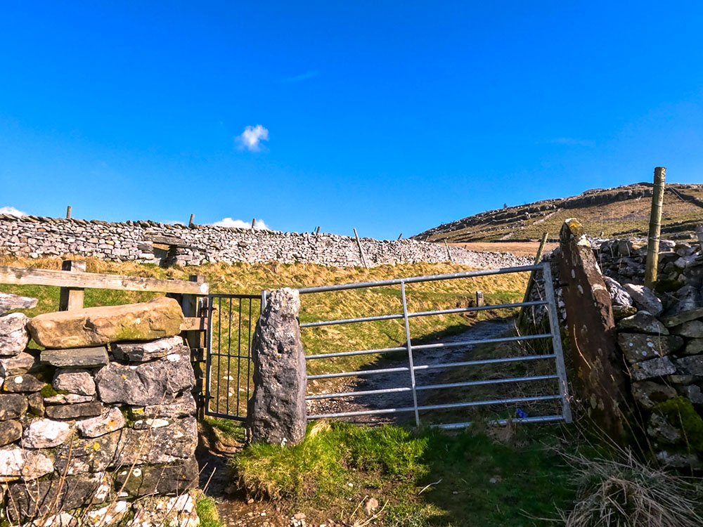
Upon reaching a gate, pass through it and continue down the lane. The lane here has dry stone walls on either side of it. There are believed to be over 5,000 miles of dry stone walling in the Yorkshire Dales alone.
Pass through the gate on Twisleton Lane
After a short distance, over the wall to the left, is our first view of Ingleborough, one of what is known as the Yorkshire Three Peaks. If you want to see the whole of that walk, check out our Yorkshire 3 Peaks walk.
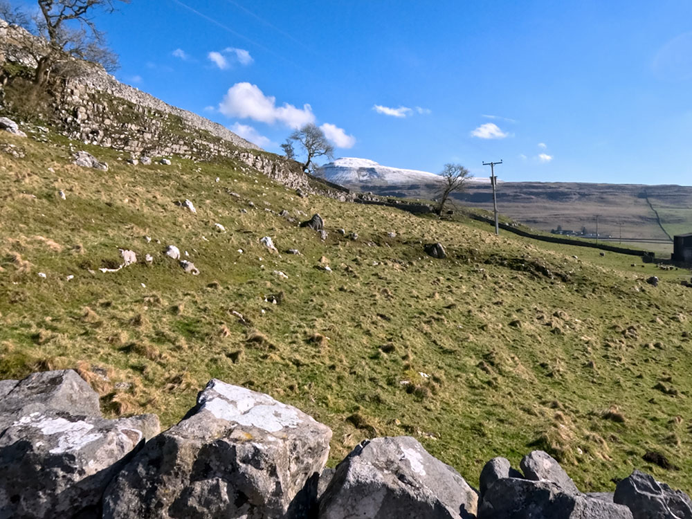
View over to the snow-capped Ingleborough from Twisleton Lane
Continue straight on down the lane past the left-hand side of Scar End and Twisleton Hall, following the signs for the Waterfalls walk.
Upon meeting a stile built into a wall by a gate, pass over it and continue straight on along the track ahead.
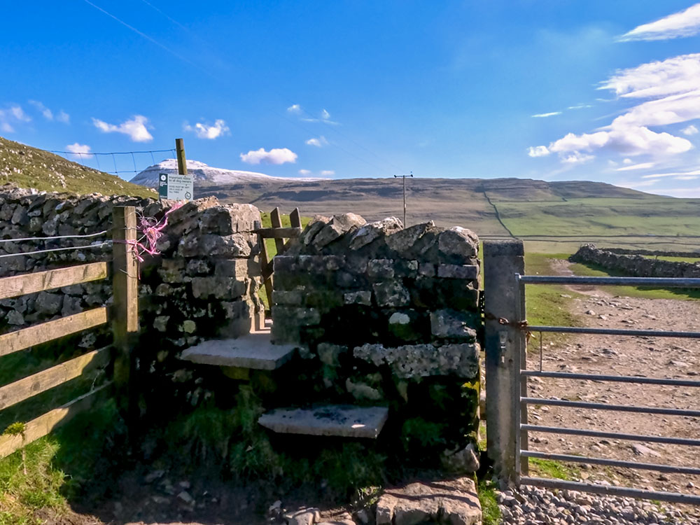
Pass over the stile in the wall, with Ingleborough ahead
Ingleborough again lies straight ahead in the distance. If you want to learn more about Ingleborough and our videos of the various ways to climb it, check out our Ultimate Guide to Ingleborough.
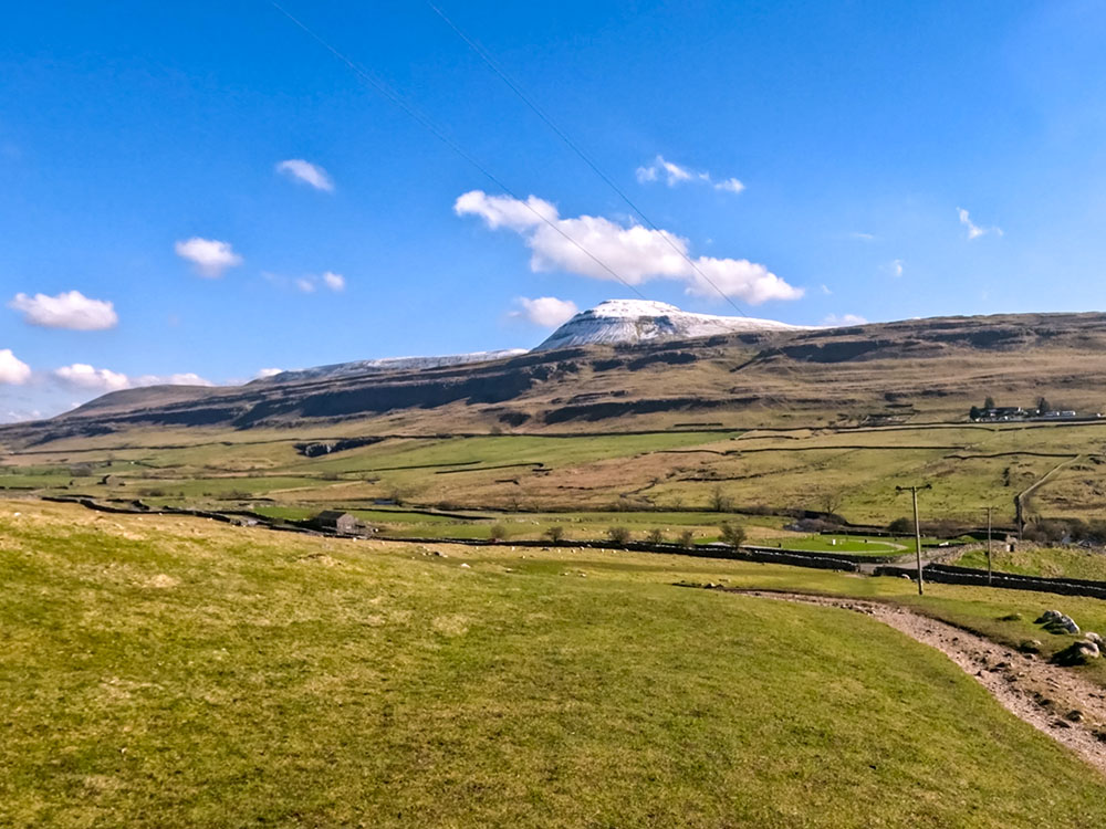
The Ingleton Waterfalls path heading down towards Oddie's Lane with the snow-capped Ingleborough on the horizon ahead
Follow the path across the field as it drops down to a gate next to Oddie's Lane. Pass through the gate and cross Oddie's Lane to head down the road opposite, which is signed for Falls Park and the Ingleton Waterfall Trail.
Pass through the gate and across Oddie's Lane to head down the track opposite
We are now heading down towards the river Doe that provides the second half of the Ingleton Waterfalls Trail as it winds its way down into Ingleton.
To the left, you can see the pitches of the touring side of Falls Park, which offers picturesque views.
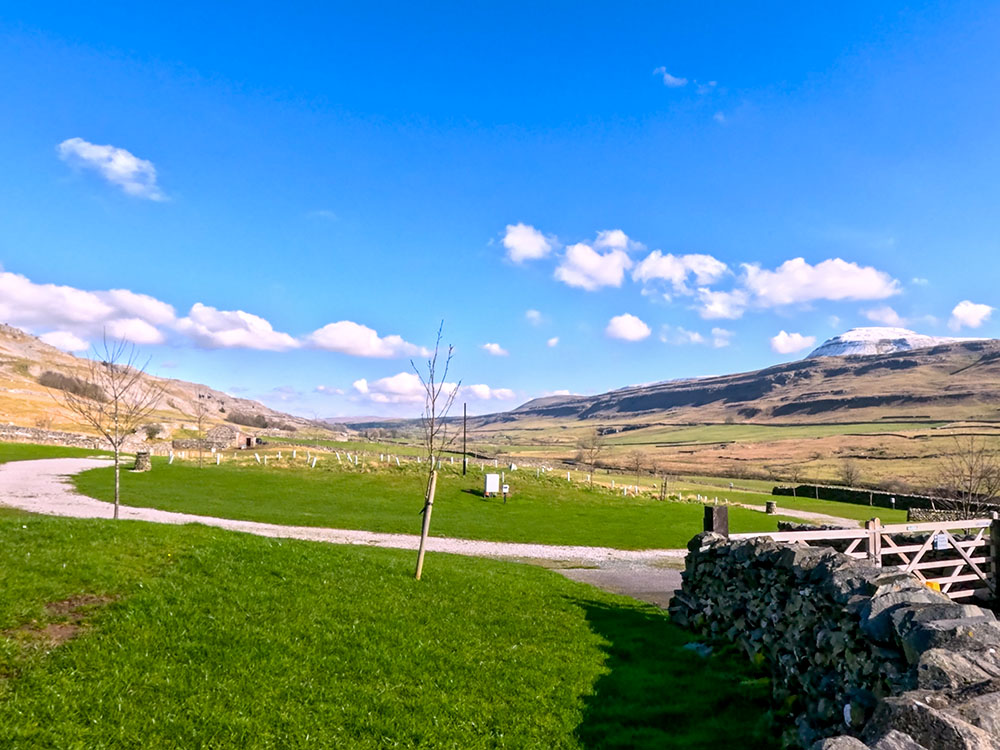
Looking across Falls Park towards Ingleborough
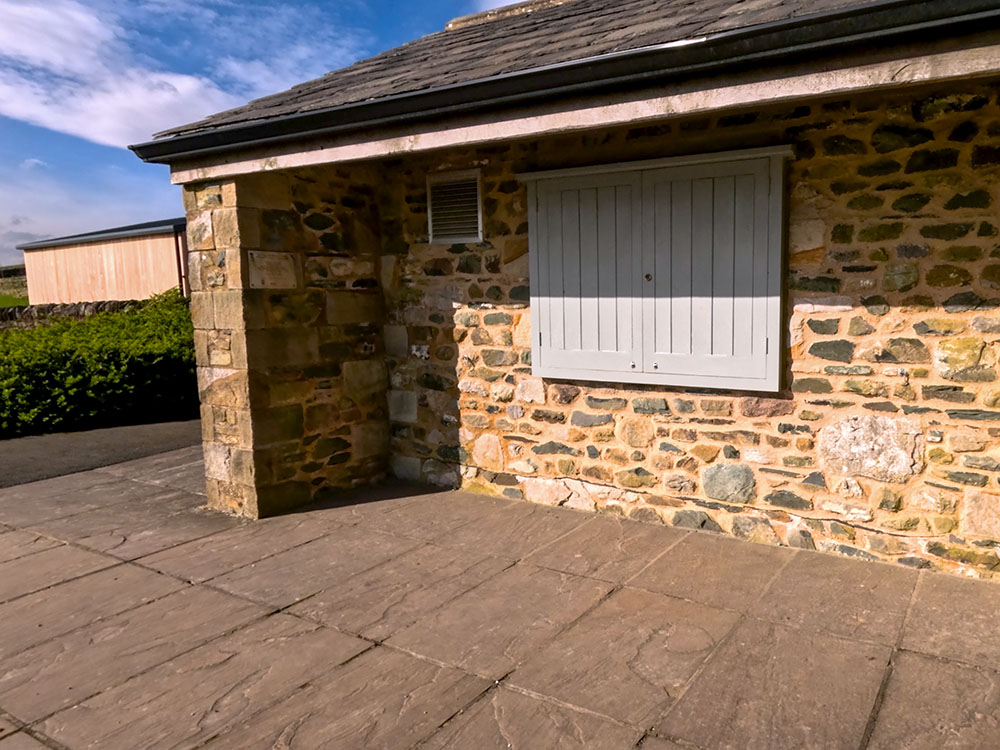
Follow the road down and around, then branch off to the left between the hedges, following the Ingleton Waterfalls Trail sign. Shortly after, you will pass by some toilets.
The toilets at Beezley Farm on the Ingleton Waterfalls walk
A few yards further on, you pass by the Falls refreshment centre. I'm just not sure of its opening times, though.
The Falls refreshment centre at Beezley Farm on the Ingleton Waterfalls Trail
Continue along by the side of the wall. And then again, rather than following the road around to the right, go down between the hedge and the wall, following the Ingleton Waterfalls Trail footpath sign.
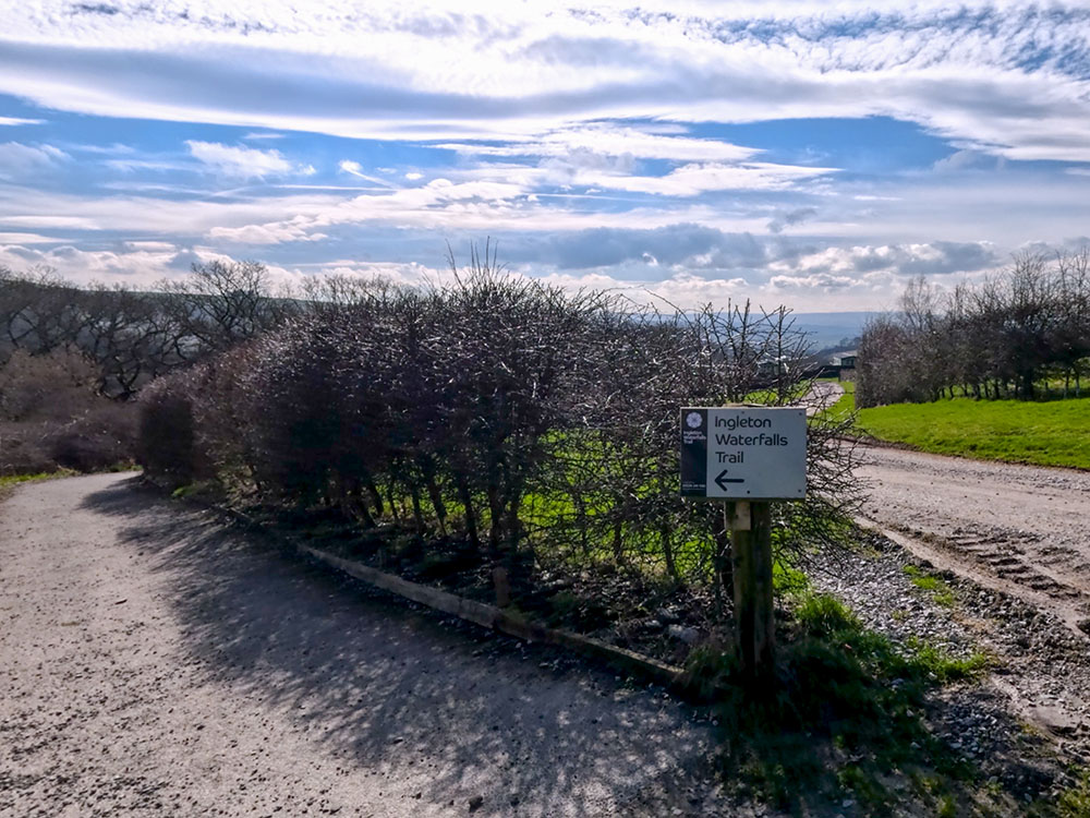
As the track splits, head left following the Ingleton Waterfalls Trail sign
Just before dropping down to Beezley Falls, there is an 'alternative footpath' sign on the right-hand side that keeps to the higher ground if the path we are about to follow gets flooded. This rejoins the path we are about to follow near the Snow Falls.
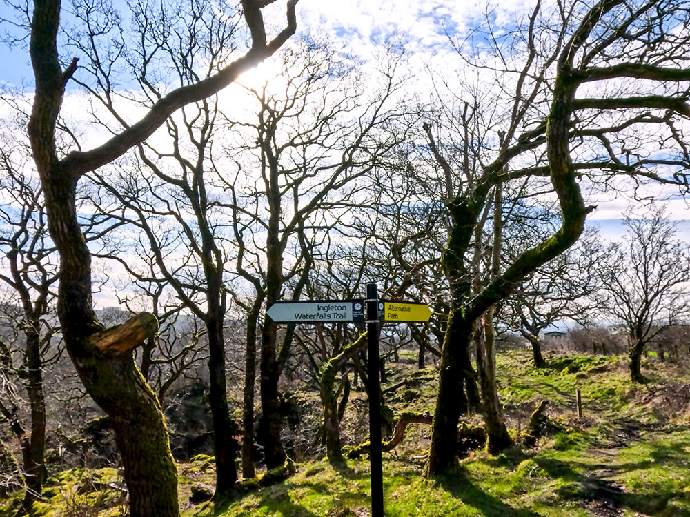
If the paths are flooded, there is an alternative path signed, that misses out Beezley Falls and Baxenghyll Gorge and rejoins the walk at Snow Falls
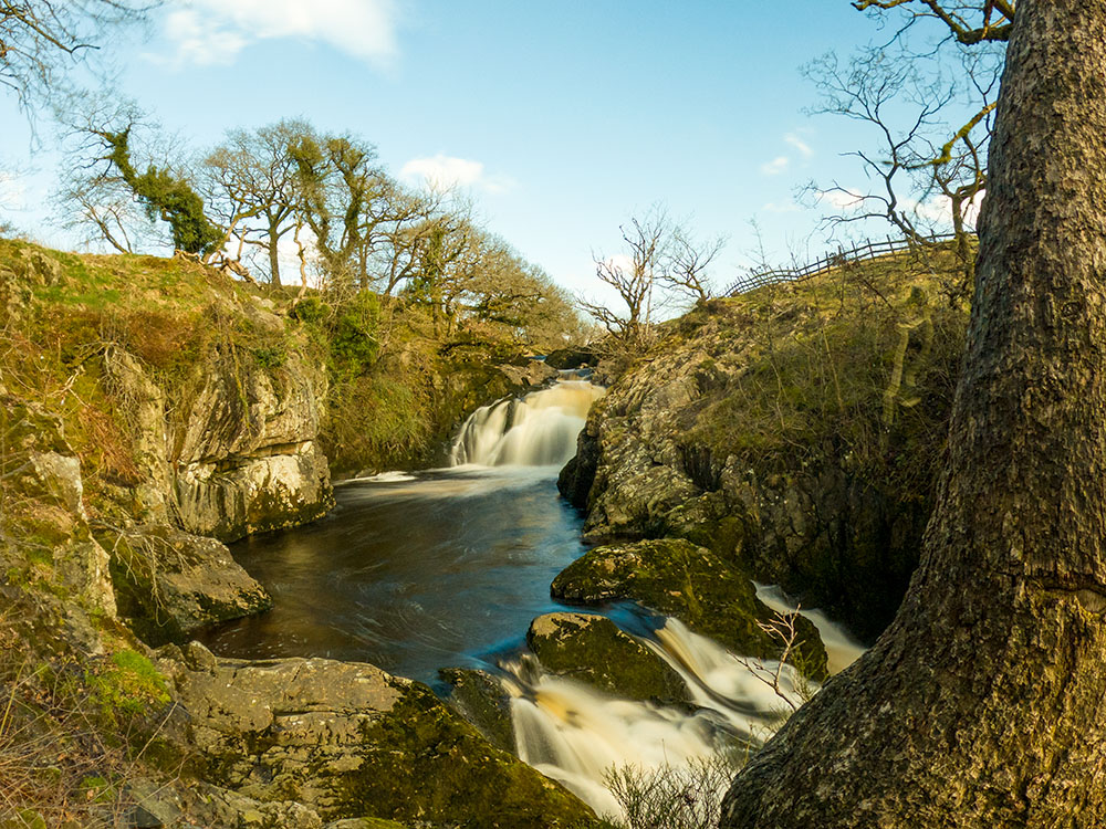
Ignoring that, continue down the main path. After a few yards, over to the left, you can see the top of Beezley Falls.
Top of Beezley Falls
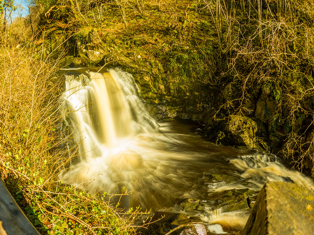
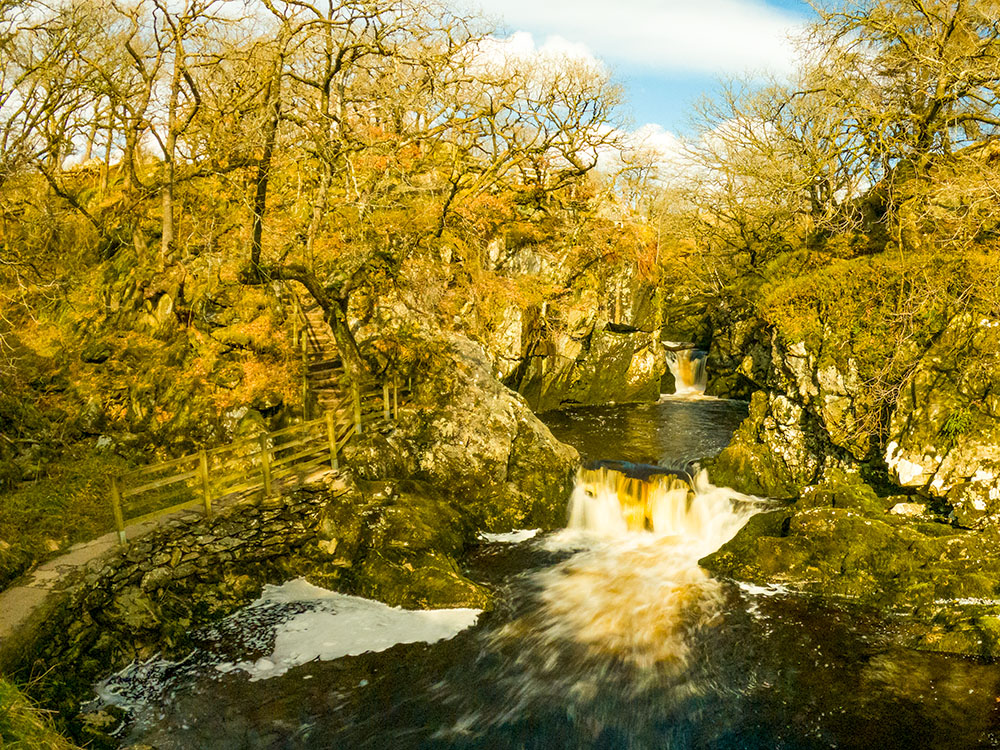
A few yards further down is what is known as the Triple Spout within Beezley Falls.

Beezley Falls on the Ingleton Waterfalls walk
We'll see it again shortly when we look at it from head-on just below. Follow the path down the steps to look back up at Beezley Falls.
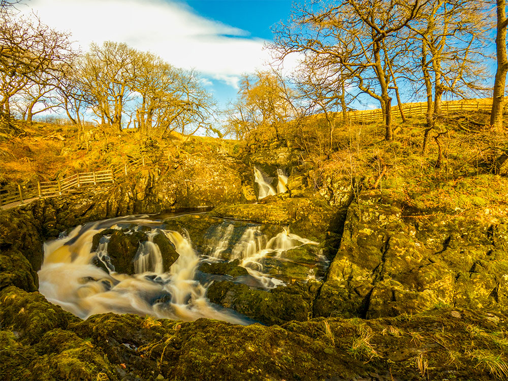
Beezley Falls on the Ingleton Waterfalls Trail
Continue this Ingleton Falls walk by heading on along the path, where you soon look down upon the top of Rival Falls. A little further down the walk, you will get a better view of it.
Steps heading down alongside Beezley Falls
Concrete path and steps on the Ingleton Falls Trail
As you continue on, looking back to the left, you can see the two falls of Rival Falls. Between them is a plunge pool that is reputed to be over 25 metres deep.
Rival Falls on the Ingleton Waterfalls Trail
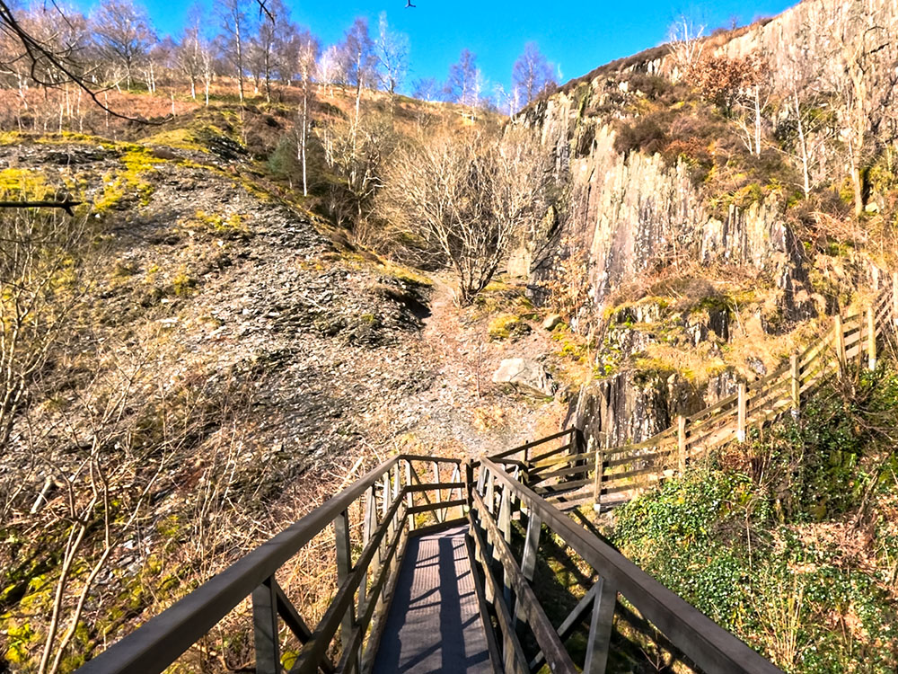
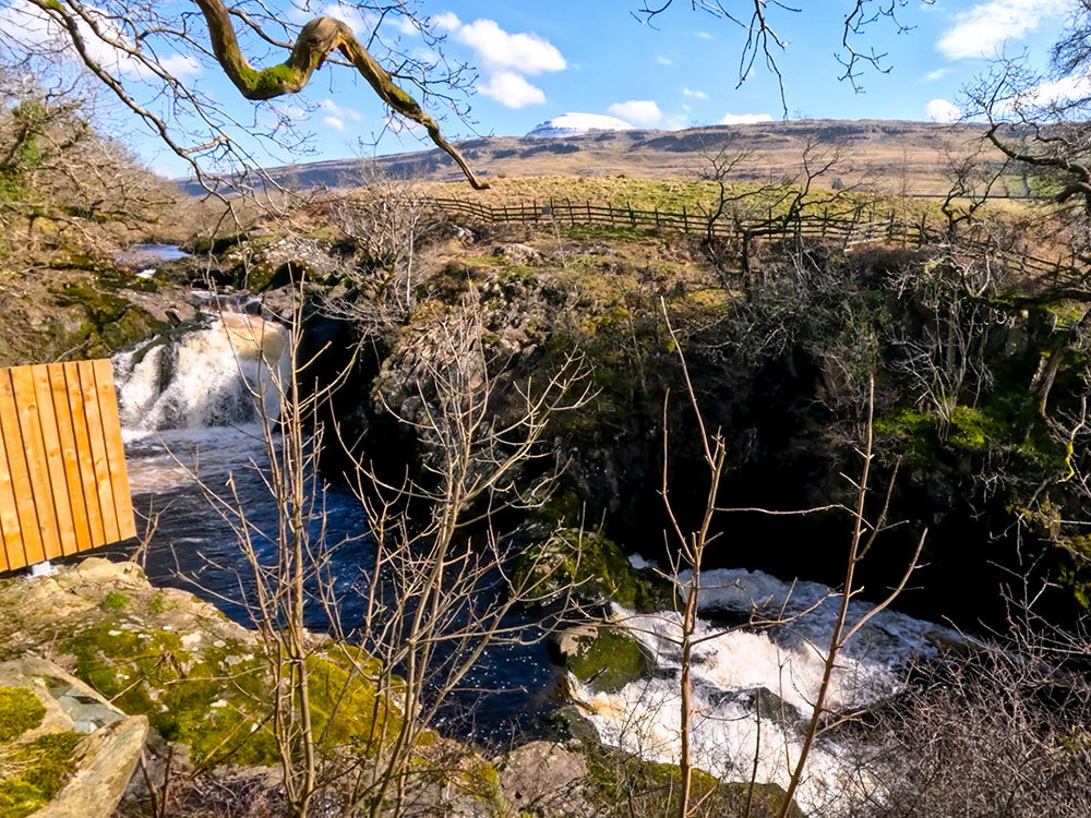
Keep on walking along the well-marked path. The river Doe over to the left enters Baxenghyll Gorge ahead. We will get a much clearer view of that shortly from a viewing platform. Walk a little further on, and down to the left here, we can head down to the viewing platform.
Footbridge to view Baxenghyll Gorge
From the viewing platform, Baxenghyll Gorge on the Ingleton Waterfalls Trail always looks impressive. The sound of the fast-running water echoes more around this area.
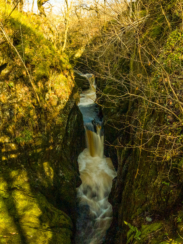
Baxenghyll Gorge on the Ingleton Waterfalls Trail
Head back up the steps and turn left to continue along the trail. You will soon pass by one of the wooden sculptures scattered throughout it.
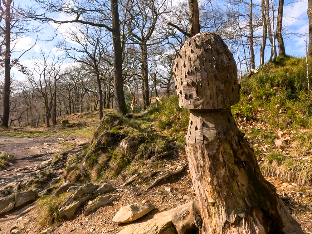
Wooden carving with money on the Ingleton Waterfalls walk
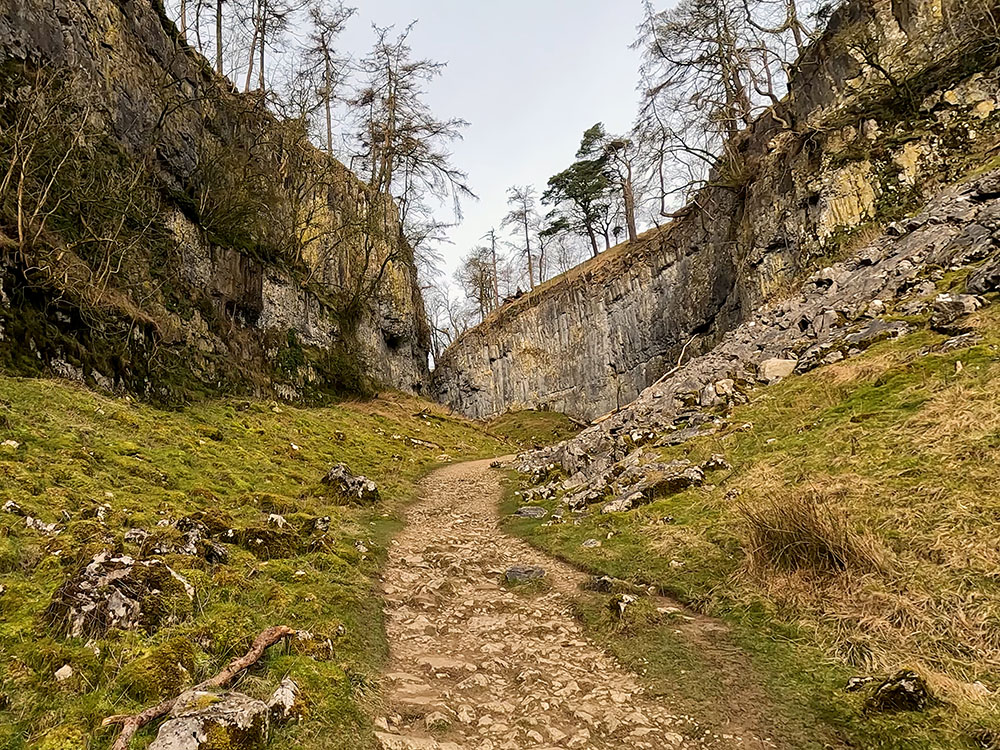
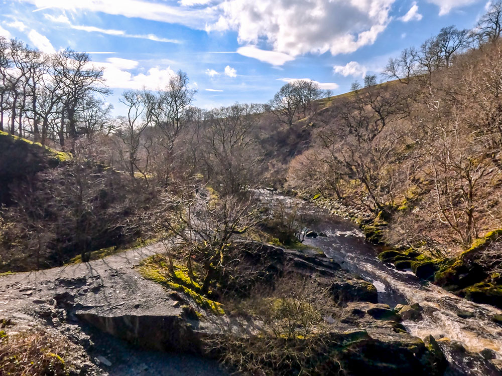
Walking on, we now drop down to the remains of one of the disused slate quarries alongside the river Doe.
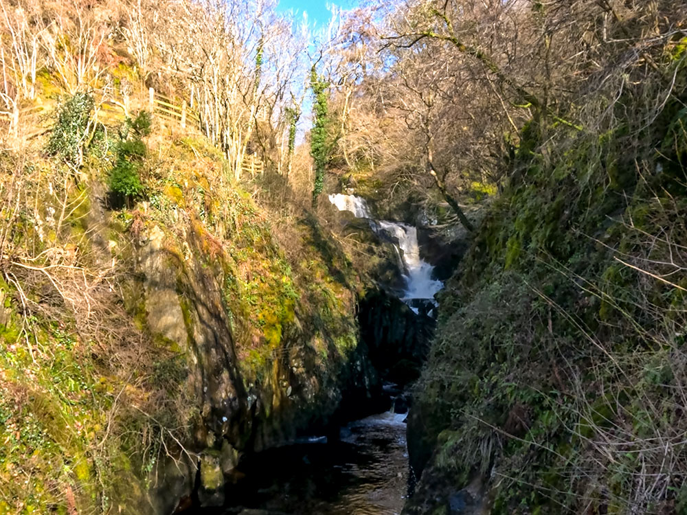
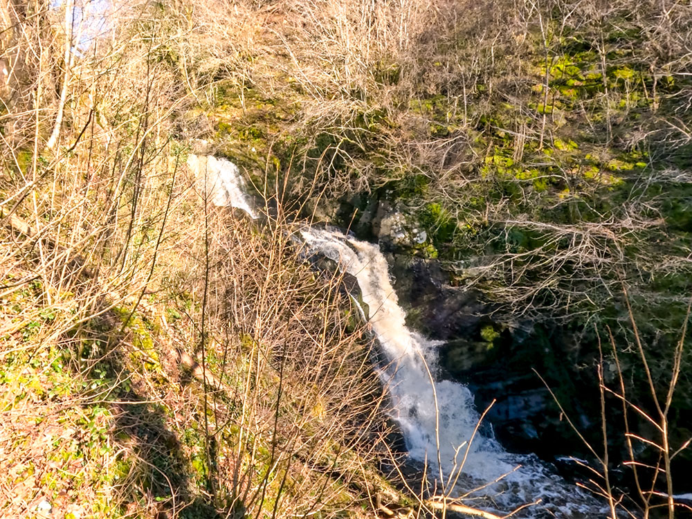
Then, further on, down to the left, the Snow Falls can be seen. If you carry on walking and then look back, you will then get a better view of the Snow Falls.
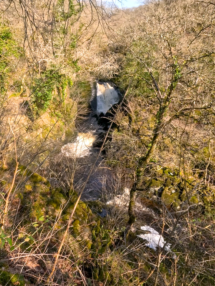
Snow Falls on the Ingleton Waterfalls Trail
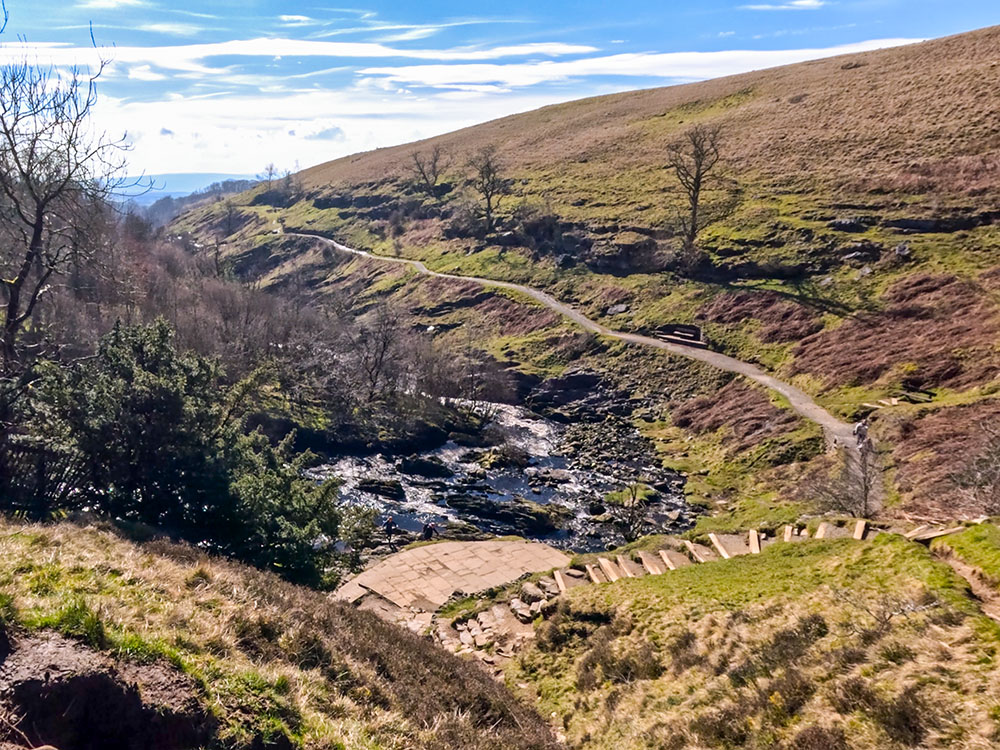
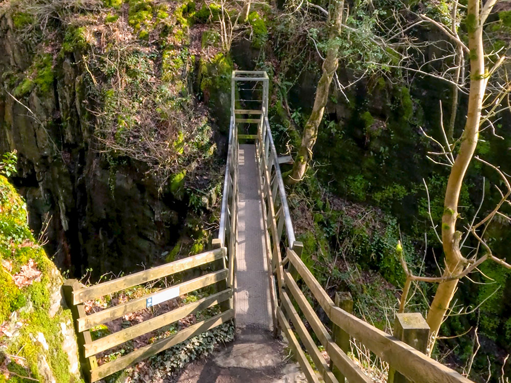
Keep on walking along the path, and then pass over the river Doe by way of this footbridge.
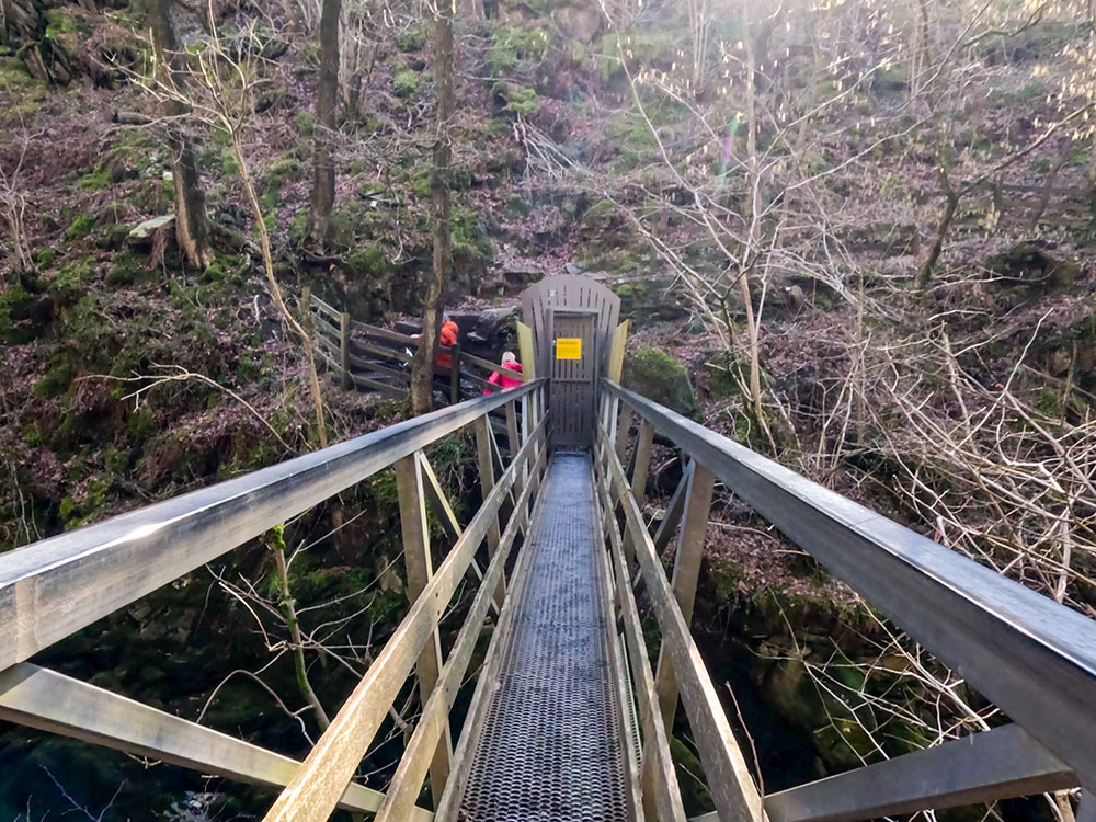
Footbridge over the River Doe in Twisleton Glen
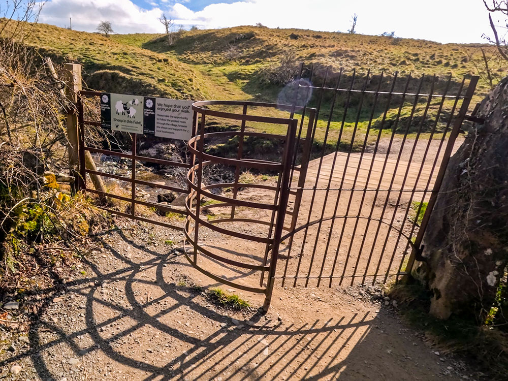
At the far side of the footbridge, pass through this gate, which locks behind you, as there is no access from the far side, as the Ingleton Waterfalls Trail walk is designed to be one-way.
View from the footbridge on the Ingleton Waterfalls Trail
Looking downstream along the River Doe
Once over the footbridge, head up the steps and just continue along the trail as it passes through part of a disused slate quarry.
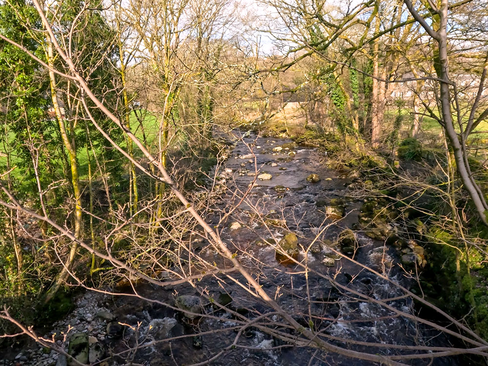
Continuing on, the path now starts to climb and move away from the river Doe as it passes through the aptly named Quarry Wood.
The path through Quarry Wood
Once through the wood, pass through a kissing gate and then cross over the small wooden footbridge.
Pass through the metal kissing gate
Continue straight on along the path directly ahead. The path splits, but either path can be taken here as they just join up a little further on.
As the path splits, any can be followed as they meet up a short distance further on
On the other side of the river Doe, you can see the remains of the disused Millbank Quarry, which is a geological site of Special Scientific Interest. The quarry closed in 1909. It used to have two lime kilns.
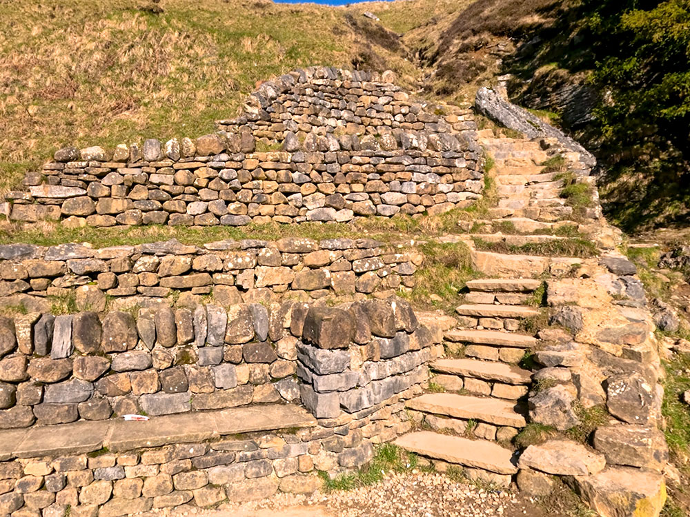
Continuing along the Ingleton Waterfalls Trail, we reach some walled remains on the left of Storrs Quarry. The quarry was also believed to have had two lime kilns, and the large structural remains, around fifteen metres by six metres, are believed to be the remains of those two kilns.
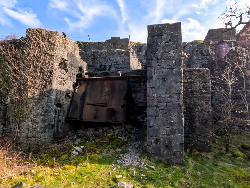
Parts of the disused pit
Keep on along the wide gravelled track. Upon meeting a gate just after an Ingleton village information sign, pass through it to start heading along Thacking Lane.
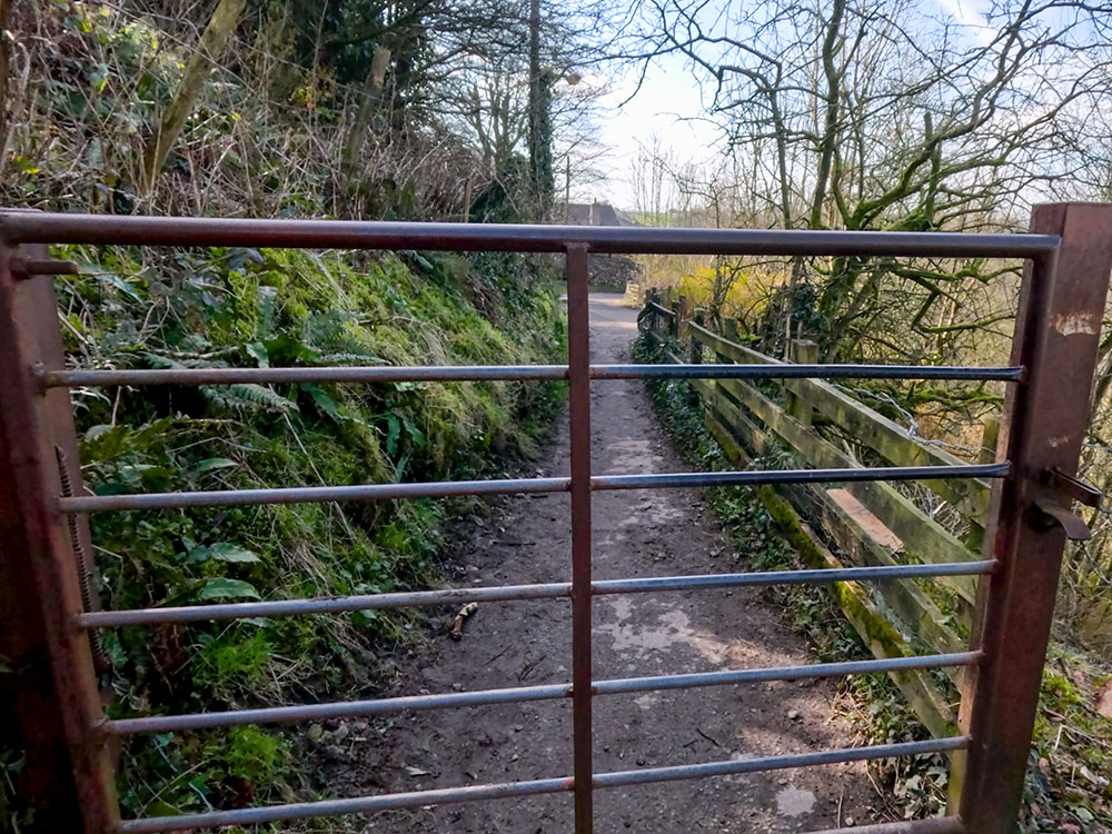
Pass through the gate to start to head along Thacking Lane
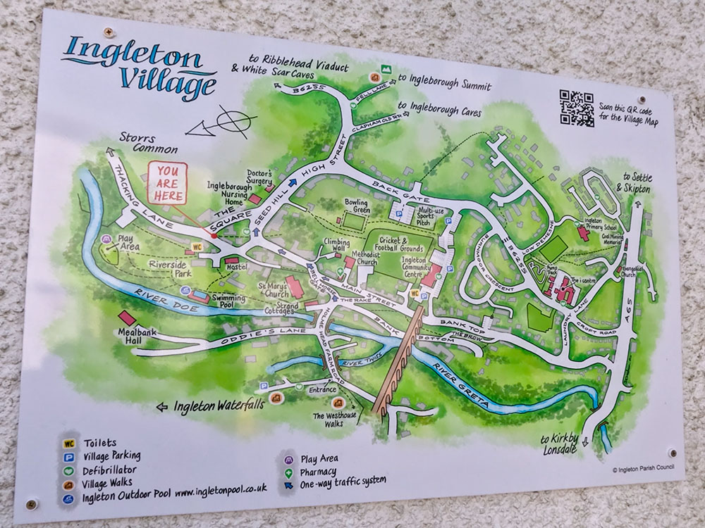
We soon arrive at the corner of the square where a sign shows the Ingleton Waterfalls Trail to the left, and an information board on the wall shows what is where in Ingleton.
Ingleton Village sign at the junction of The Square and Thacking Lane
As we have almost finished the Ingleton Waterfalls Trail walk, we can start to have a look now where you can eat and drink in Ingleton. If fish and chips are your choice for the post-walk food, then across from the sign is the Ingleton Chippy.
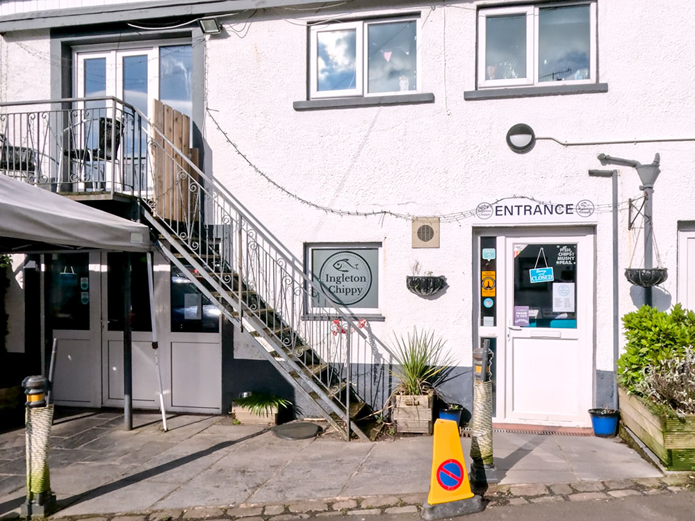
Ingleton Chippy
Heading back up to the sign, follow the route around to the right following the Ingleton Waterfalls Trail sign. You will soon pass by a garden centre on your right.
At the road junction a few yards further on, to end the walk without looking around Ingleton, you basically turn right here and then, after a short distance further on, right again down the hill and follow the signs back to the waterfalls car park.
At the road junction by the garden centre, opposite is Bernie's of Ingleton Café. The café closed in early 2023, but I believe from reading online that it is about to reopen.
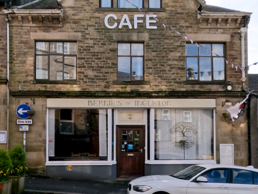
Bernie's of Ingleton Cafe
Next door to that is Peaks and Troughs, which is a small bar and restaurant. Due to the space and only six tables inside, dogs are not allowed.
This walk was voted in the top 50 walks in Britain in ITV's Britain's Favourite Walks. If you want to try another one that came in at number 3, not too far away is the Malham Cove, Gordale Scar and Janet's Foss walk from Malham.

Peaks and Troughs Bar and Restaurant, Ingleton
Next door to that is the OPO, or the Old Post Office, a microbar. This award-winning bar appeared in the Good Beer Guide 2024. It serves a range of cask ales, craft beers, wines, spirits, and cocktails and, I believe, is dog-friendly.
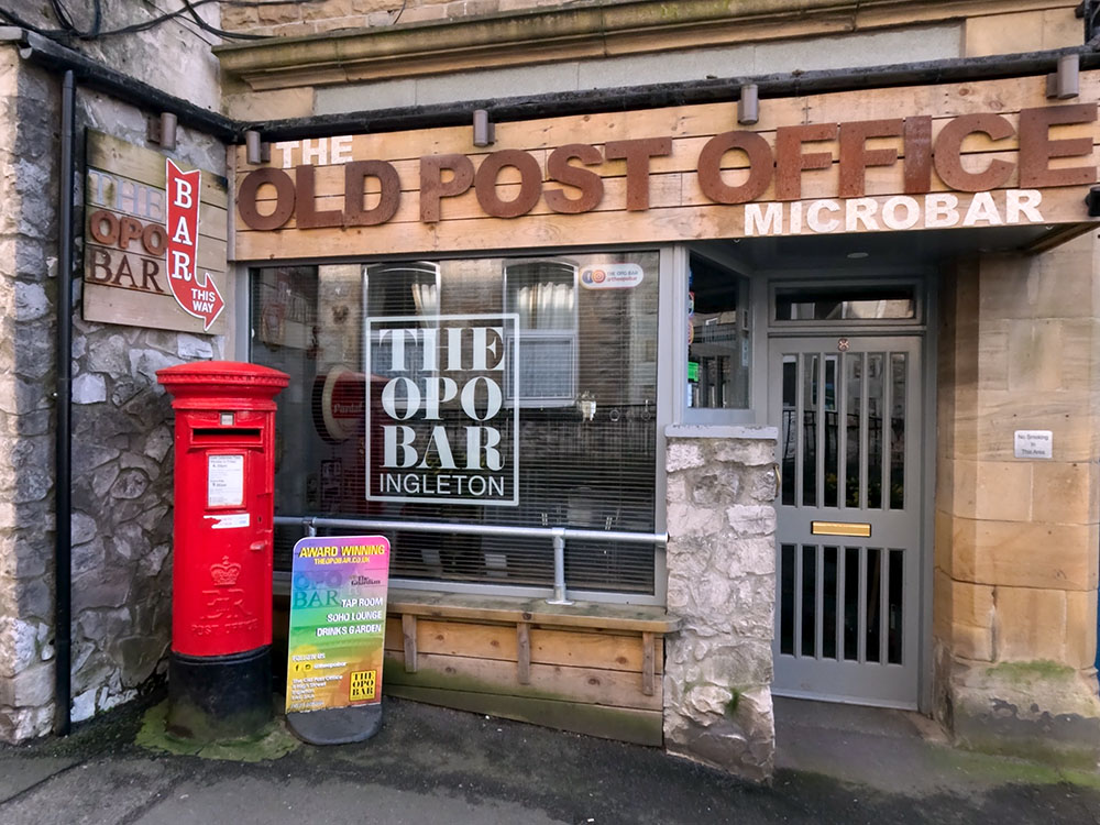
The OPO Bar, Ingleton
For a short detour, continue past the OPO up the road, where we find the Wheatsheaf Inn. The Wheatsheaf was built in the 17th century and serves cast ales, wines, spirits, and food. It has some accommodation and a good-sized beer garden in the back, and it is dog-friendly.
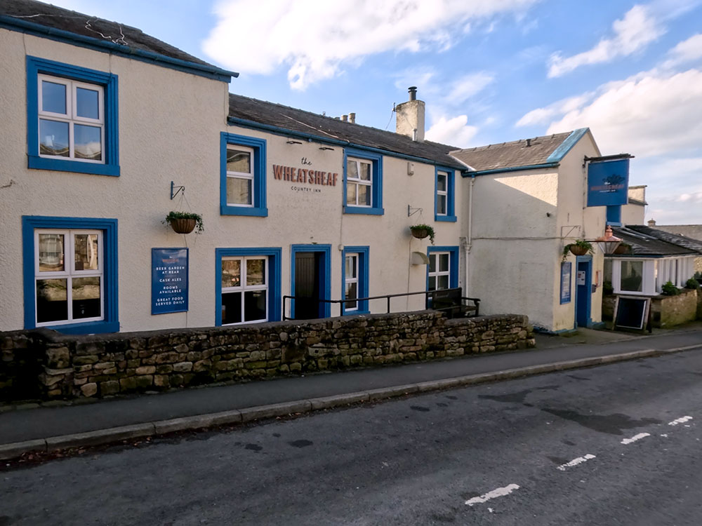
Wheatsheaf Country Inn, Ingleton
From the Wheatsheaf Inn, head back past the OPO. A short distance further on, we reach Inglesport, an outdoor shop with a café upstairs. Amongst other things, they serve a selection of breakfasts, toasties, and specials of the day, along with home-baked cakes, scones, and tray bakes. Again, it is dog-friendly.
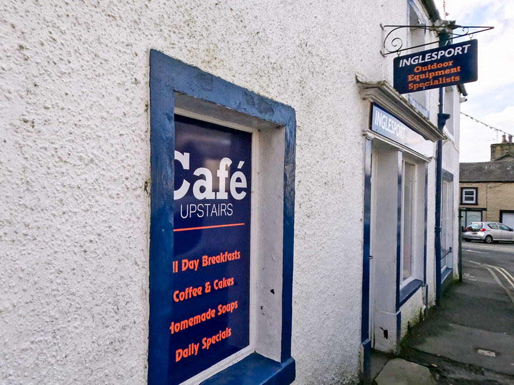
The Cafe upstairs at Inglesport outdoor shop in Ingleton
Across the road from it is the Village Kitchen, which serves sweets, savouries and refreshments, along with a range of teas and coffees. It is all fresh, local and homemade.
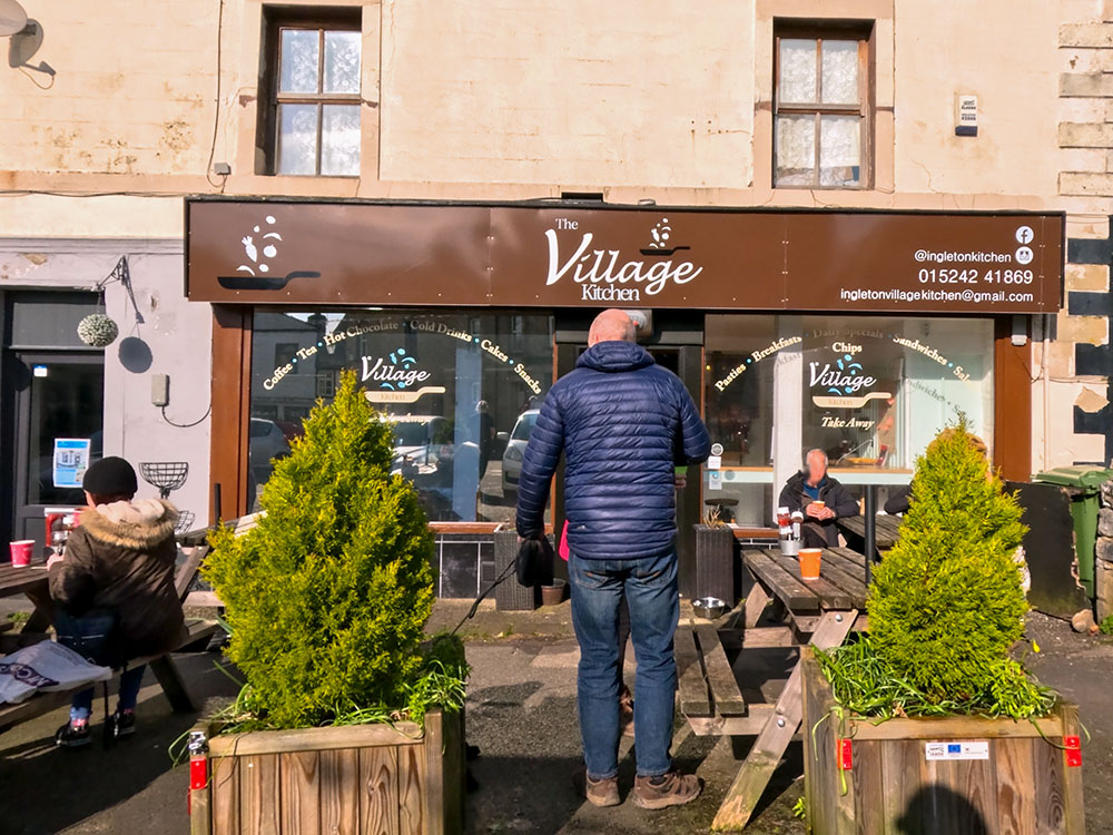
The Village Kitchen in Ingleton
Heading further along the road between the food and drink stops, you could visit one of the craft shops or galleries in Ingleton.
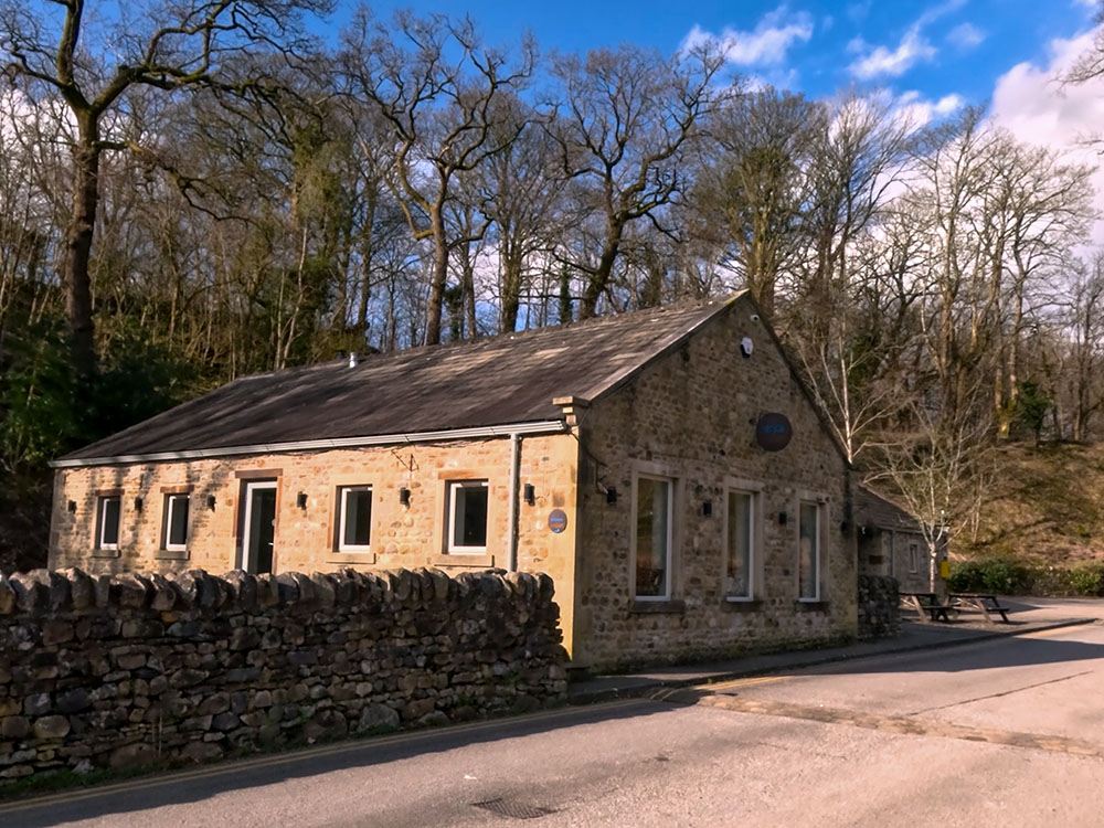
Around the next corner, if pizzas are more your thing, there is Ingleton Pizza.
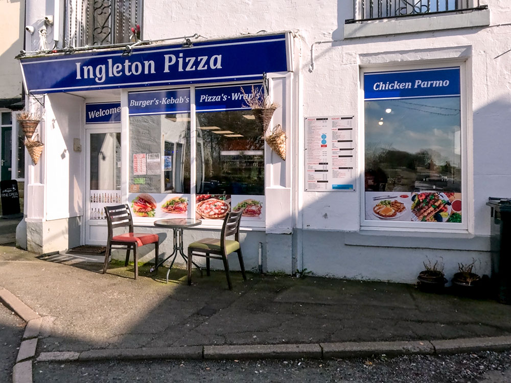
Ingleton Pizza
A few yards further on is La Tavernetta, a family-run Italian restaurant serving pizzas, pasta, and other mains, along with bottled beers, spirits, and wines.
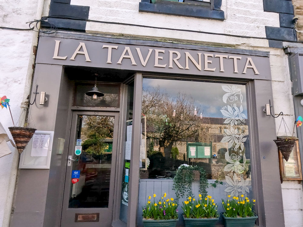
La Tavernetta in Ingleton
Across the road is St Mary's Church, which dates from 1886. The font dates back to Norman times, suggesting that there has been a place of worship on this site since the 12th century. The oldest remaining part of the church is a 15th-century perpendicular-style tower.
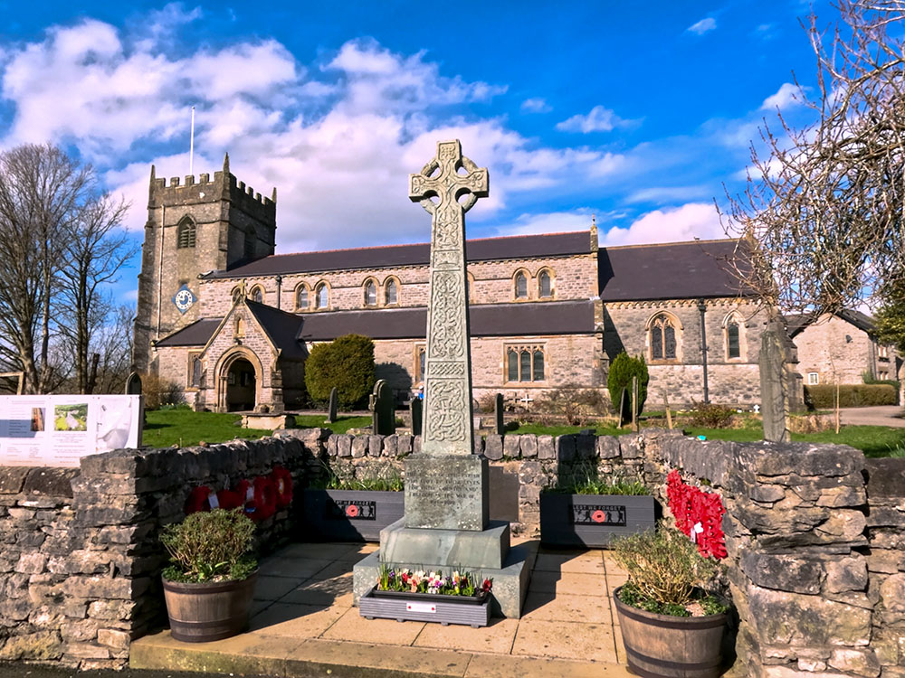
St Mary's Church in Ingleton
Just past the church, the way back to the car park is down the slope to the right.
Head down right off Bank Top
But for a further detour, we'll ignore that again and continue wandering along the road. We soon pass by a memorial water fountain in memory of Joseph Carr, who was instrumental in setting up and promoting the Ingleton Waterfalls Walk after writing a series of articles for local newspapers about the scenic attractions near Ingleton.
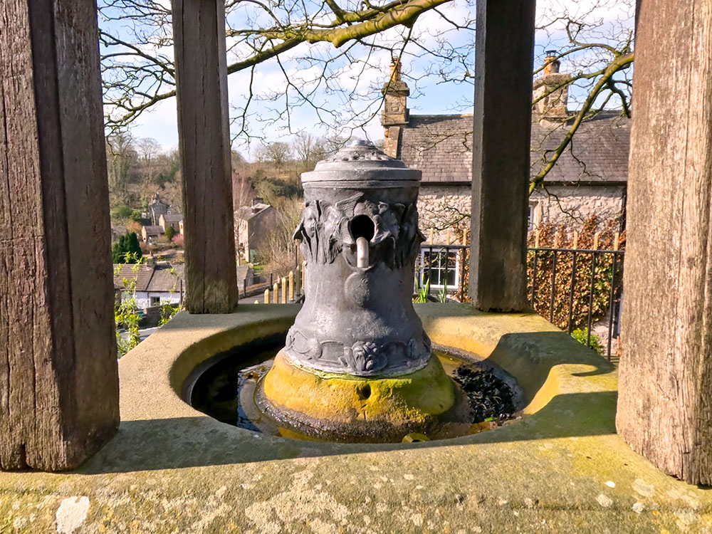
Joseph Carr Memorial Water Fountain in Ingleton
Across from the memorial is G&T's Cafe and Kitchen, which serves breakfast, brunch, homemade cakes, and teas and coffees.
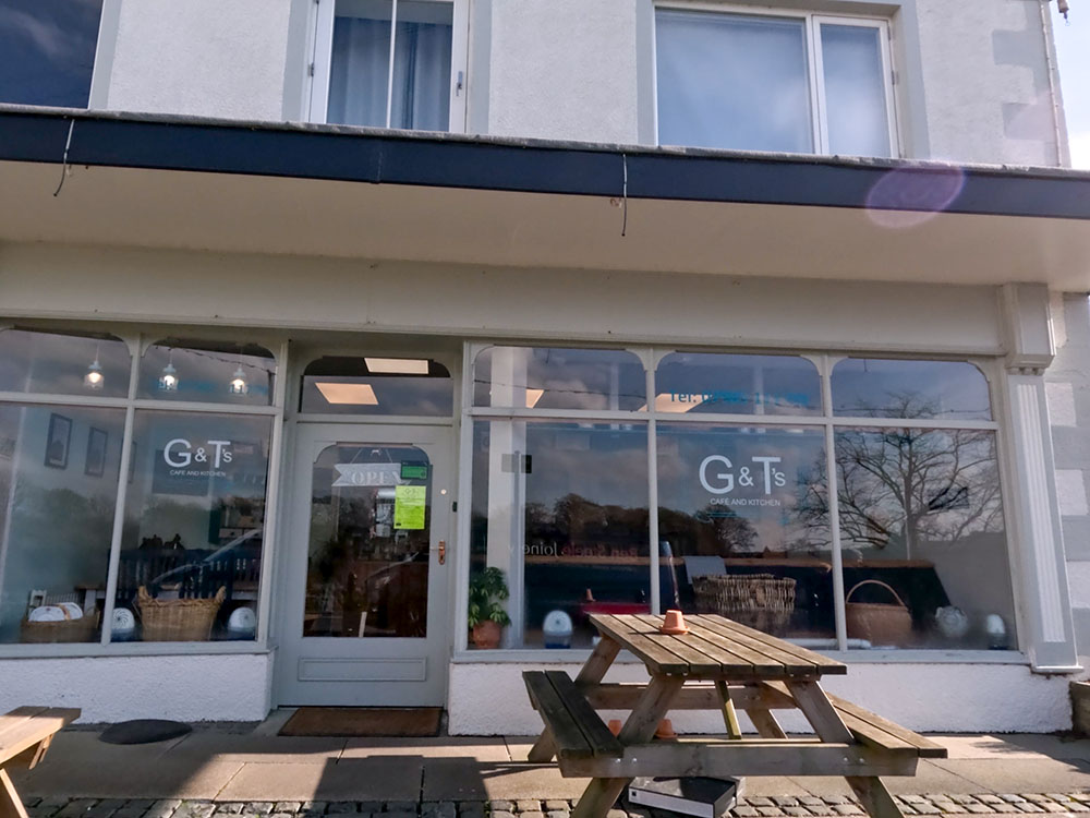
G&T's Cafe and Kitchen in Ingleton
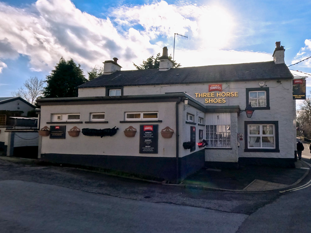
Just opposite that is the Three Horse Shoes, a Thwaites pub that serves a range of food and drink. It's dog-friendly and has a beer garden around at the back.
Three Horse Shoes Pub, Ingleton
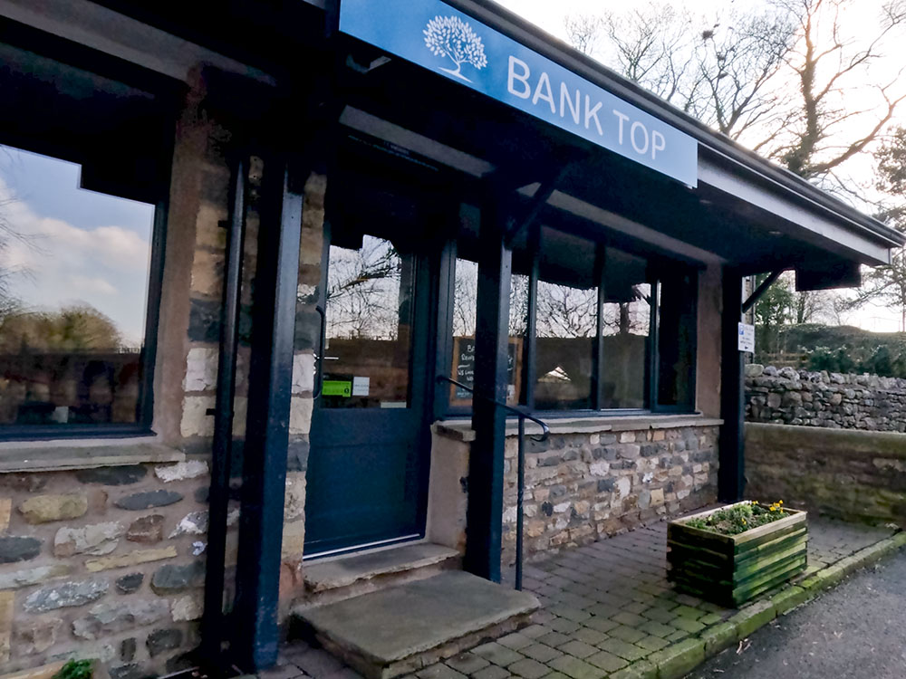
Just further along the road is the Bank Top Restaurant. It offers a dining experience with a menu that is seasonal, locally sourced and caters to all tastes. The restaurant is licensed, but dogs are not allowed.
Bank Top Restaurant in Ingleton
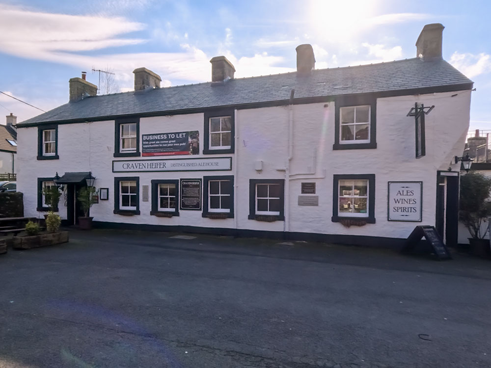
If you continue along this road under the bridge, you will see more parking and toilets on your left. A hundred yards further on is the Craven Heifer. They serve a wide range of ales, spirits, wines, and lagers, along with homemade meals. They also have some accommodation and are dog-friendly.
Craven Heifer in Ingleton
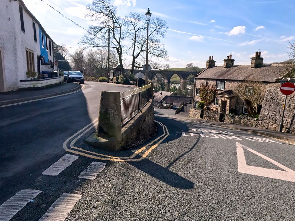
Now, opposite the Bank Top Restaurant, you can see the viaduct, which dominates the immediate skyline. It once carried the Ingleton branch railway line and was meant to form part of the mainline from London to Scotland. But it fell victim to the ongoing rivalry between competing railway companies, so eventually, it didn't.
As we turn back around, we now head down the road to the left. At the bottom of the road is the Ex-Servicemens Club.
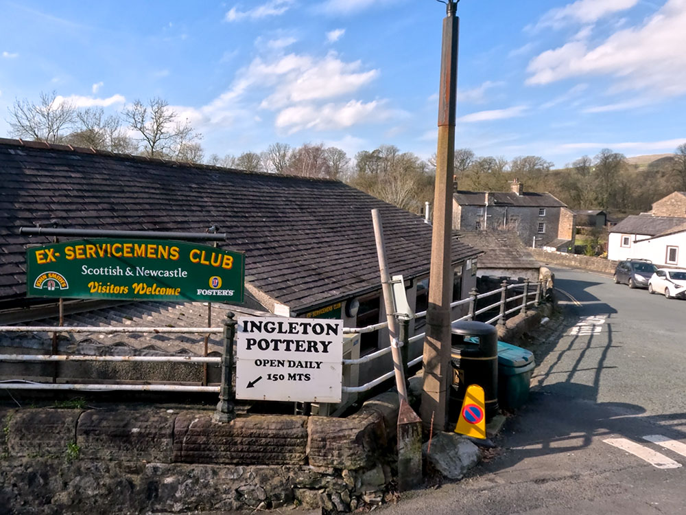
Ex-servicemens Club in Ingleton
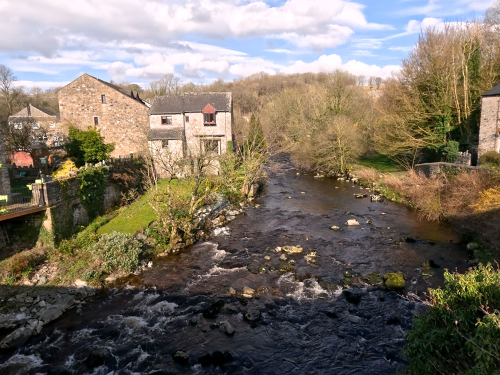
Turn left and head along the road to cross over the bridge that passes back over the river Doe. From the bridge looking downstream, you can again see the 245-yard-long viaduct, which is comprised of 11 brick arches spanning 57 feet each and is about 85 feet above the river Greta. It opened to passengers in 1861, and passenger services stopped in January 1954, with the last train being played out by the Kirkby Lonsdale Brass Band. With the eventual closure of the line coming in July 1966, the track was pulled up in the following year.
View upstream from the bridge of the River Doe
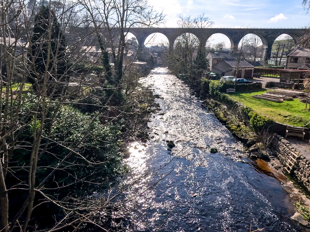
View downstream from the bridge of the River Doe and the old railway viaduct
Head on now to the next bridge which crosses over the river Twiss.
View upstream from the bridge of the River Twiss
The rivers Twiss and Doe join together just a little bit further downstream, just before the viaduct. They both lose their name and form the river Greta.
To finish this Ingleton Falls walk, once over the bridge, we head a few yards to turn right into the Ingleton Waterfalls Trail car park.
Turning back towards the Ingleton Waterfalls car park
On heading back into the car park, the last place we pass by where you may be able to eat and drink is the Ingleton Falls Bar and Kitchen. Unfortunately, as of March 19th, 2024, the café is currently closed, but I believe it is awaiting renovation.
The Falls Bar and Kitchen at the entrance to the Ingleton Waterfalls Trail
If you want to see this walk from above and get a bit more perspective on where you have been on the walk, we have created a short fly-through using the Ordnance Survey app, which you can see at the end of the Ingleton Waterfalls Trail video.
If you enjoy waterfall walks, be sure to check out our Linton Falls walk from Grassington, also in the Yorkshire Dales.
Finally, talking of videos, if you watched and enjoyed our video, don't forget to click the like button, subscribe to our channel and hit the notification bell so you know when any more new walks have been uploaded. Subscribing on YouTube is free, and your likes and comments about the video or the walk do help promote our channel - thanks. 😊
Gifts and presents for hikers and walkers
Are you struggling to pick the perfect gift for your hiking-loving friend or family member? Don't fret! Explore our curated selection of top-notch gifts for walkers and hikers that will have them trekking with joy on their special day.
What to wear and take on your walk or hike
Whether you are a seasoned hiker or new to walking, wearing and taking suitable hiking kit and clothing is essential for a day hike for your comfort and safety. So we have put together a hiking essentials checklist to cover all you'll need. Our Hiking Essentials checklist for 2026 takes you through planning your walk, the hiking essentials checklist itself, optional extras, explanations, and recommendations for all the hiking essentials.
Check out the reviews for this walk: