By using this website, you agree to our use of cookies (needed to provide our website’s features) and our Terms of Use.

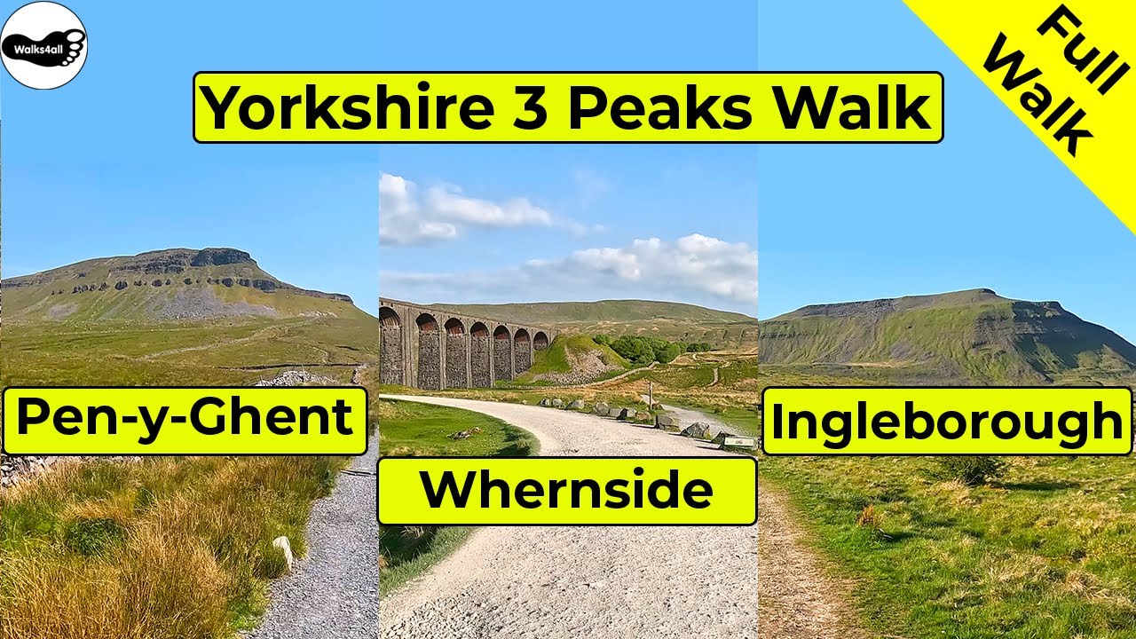
This Yorkshire Three Peaks Walk from Horton in Ribblesdale takes in Pen-y-ghent, Whernside and Ingleborough in a 24.6-mile walk, which includes 1,610 metres of climbing.
In accordance with our Disclaimer, you agree to take full responsibility for any use you make of the information contained in these pages.
This page contains affiliate links. If you buy products or services via these links, we may earn a small commission at no cost to you.
| Walk title: | Yorkshire Three Peaks Walk from Horton in Ribblesdale |
| Author: | Andrew Forrest - Updated October 2023 |
| Walk start point: | Pay and display car park in Horton in Ribblesdale (grid reference SD 807 725). What3words: tonality.curl.routs |
| Parking: | As above. Some paid parking at Golden Lion Hotel. A small amount of roadside parking is available, but please park responsibly as Horton does get busy, especially at weekends and bank holidays. |
| Directions to nearest parking place: | Google Maps: get directions here / What3words: harmless.outgrown.fake |
| Walk distance: | 39.4 km |
| Estimated walk time: | 11 hours 40 minutes (very dependent on fitness level - could be a few hours less, could be longer) |
| Height climbed: | 1,610 metres |
| Technical difficulty: | Difficult - as determined by our interpretation of the Ordnance Survey guidance on technical difficulties. The paths are Moderate, but we've classed them as difficult due to the length of the walk and the overall amount of climbing involved. |
| Peaks / summits: | Pen-y-ghent (694m), Whernside (736m) and Ingleborough (724m) |
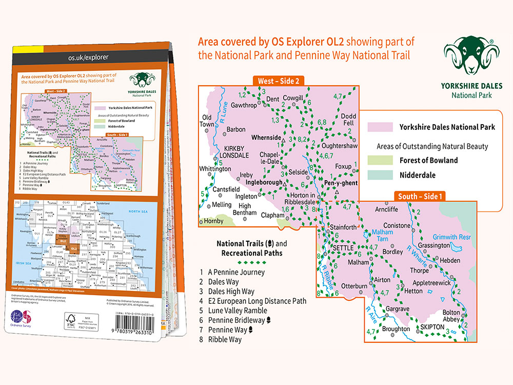
| Map: | Ordnance Survey - Explorer OL2 (Yorkshire Dales - Southern & Western Area) Buy this map from Ordnance Survey |
| GPS/GPX file: | Download available to registered users - Register and Login here - It's FREE to register |
| Facilities / refreshments: | See the video for the detail, but in summary: Helwith Bridge Inn and Middle Studfold Farm Tearoom are within 2 miles on the road to Settle and Game Cock Inn in Austwick (3 miles away). Golden Lion Hotel and Crown Hotel in Horton in Ribblesdale itself. On the walk Station Inn at Ribblehead and the Old Hill Inn and also on the walk Philpin Café and Ice cream van at Ribblehead. For a wider selection, there are many pubs, restaurants and cafés in nearby Settle, Ingleton and Hawes. |
| Nearest town: | Walk starts in Horton in Ribblesdale |
| Local self-catering accommodation: | View self-catering accommodation close to the start of this walk |
Estimated walk time
Walk time estimates used are from the Ordnance Survey mapping app, which uses a refined Naismith's rule, adjusted by OS overlaying their own data collected from more than one million people using the OS mapping app. Naismith's rule allowed one hour for every three miles walked and added pro-rata an additional hour for every 2000ft of ascent - roughly one hour for every 5km, plus one hour for every 600m of ascent.
Ordnance Survey Mapping App
Use on any device and make it easy to explore the great outdoors for just the price of a coffee a month. Premium allows full UK access to all OS Explorer and Landranger mapping, along with the ability to import and export routes, save maps offline, aerial 3D, and print A3/A4 maps.
Even though walking any of Pen-y-ghent, Whernside, or Ingleborough in isolation is a satisfying walk in itself, there's one thing that many people seem to like: a challenge! The Three Peaks of Yorkshire Walk provides that challenge.
Traditionally, to be able to join the Yorkshire Three Peaks club, you needed to finish in under 12 hours and with reasonable levels of fitness and proper preparation, most people do manage that.
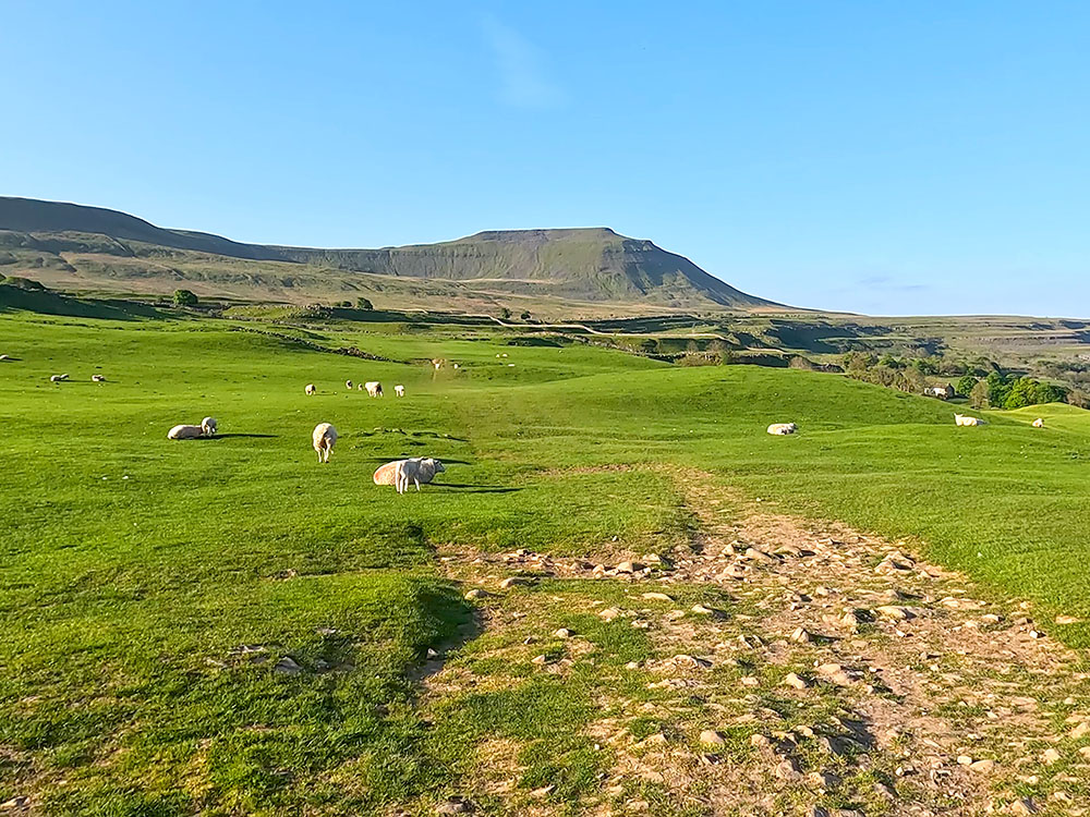
The Yorkshire 3 Peaks Walk leaves Horton in Ribblesdale by Brackenbottom and then heads up along the path by the wall that passes over Brackenbottom Scar, to meet and turn left along the Pennine Way, which then climbs much more steeply to reach the summit of Pen-y-ghent, the lowest of the 3 Peaks at 694 metres.
From Pen-y-ghent, we descend and pass over Whitber Hill and then on towards Ribblehead and the viaduct. We walk parallel with the Settle to Carlisle railway for a while, before leaving it to climb up to the summit of Whernside, the highest of the 3 Peaks at 736 metres.
From the summit, we head down to Chapel Le Dale and pass by the Old Hill Inn, before crossing fields and through limestone outcrops before climbing Ingleborough (724 metres).
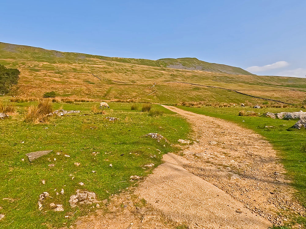
From the summit, we descend initially across Simon Fell Breast and then along the gravel and flagged path through Sulber. From here it's just a matter of crossing the final few fields and passing through Horton in Ribblesdale train station to arrive back at the start.
How long it takes to do the Yorkshire 3 Peaks walk depends upon your level of fitness and how much you have prepared and trained for the walk. The Yorkshire 3 Peaks 'challenge' is to do the walk in under 12 hours. Most reasonably fit, well-prepared walkers average between 9 and 11 hours to do the walk.
We have put together a free Yorkshire 3 Peaks Guide, which includes tips for before, during and after the walk, parking, where to eat and drink, training, what to wear, what to take and much more.
This full Yorkshire Three Peaks walk is shown in the video and the route for the Yorkshire 3 Peaks Walk is shown on the Ordnance Survey map - both above.
Below is a brief description of the walk. Details on places where you can eat and drink after the walk are shown below and at the end of the video.
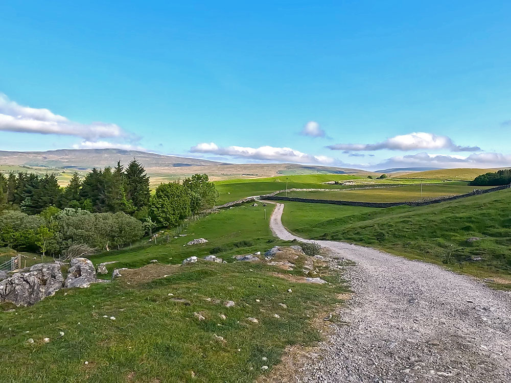
We start the walk from the pay and display car park in Horton in Ribblesdale in the Yorkshire Dales, but other parking is available nearby. If you need them, there are some toilets in this car park.
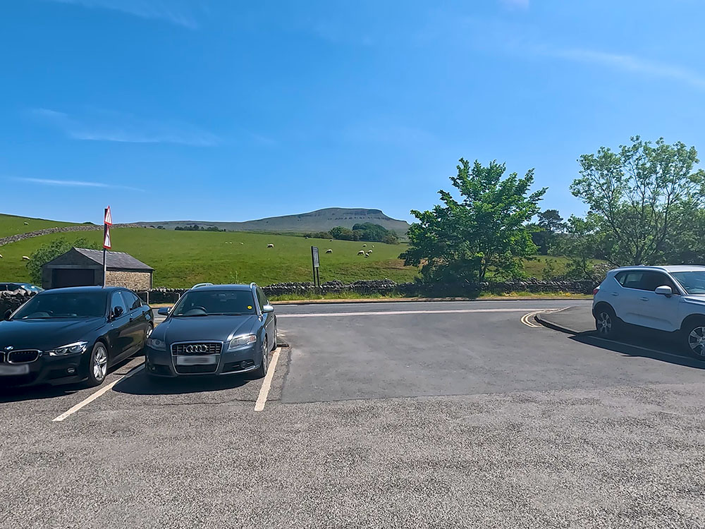
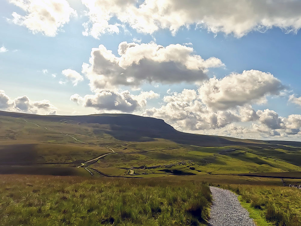
Pen-y-ghent from Horton in Ribblesdale car park
We turn right out of the car park and then just head along the pavement alongside the road. After a short distance on the right, we pass by the Pen-y-ghent Café, which used to double as the Tourist Information Centre. The café also used to provide a clocking in and out machine along with a safety service. Unfortunately, the café and Tourist Information closed in 2018.
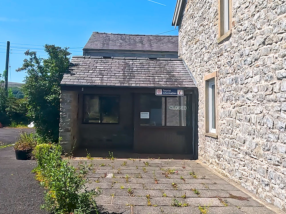
The old Pen-y-ghent-Café
Pass the Pen-y-ghent Café and continue along the pavement. On the right here we pass by Holme Farm Campsite. So, if you wanted somewhere to stop very close to the start, before or after the walk, maybe check out this campsite.
Just past the campsite, cross over the road and follow the pavement around St Oswald's church, parts of which date back to the 12th century. A couple of noteworthy features here are a Norman doorway and a tub font with a herringbone decoration.
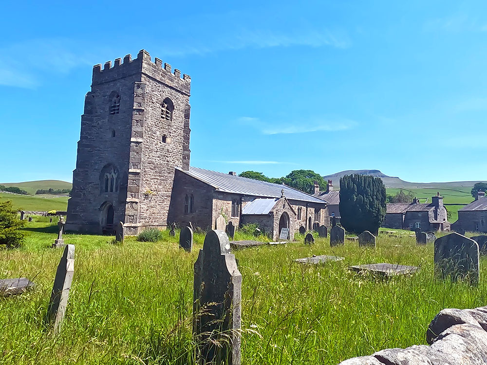
St Oswald's Parish Church in Horton in Ribblesdale
On the opposite side of the road is the Golden Lion Hotel, which we'll come back to later at the end when we look at where to eat and drink after the walk - it does offer additional parking.
After having followed the road around past the church, cross over a road junction, and then a few yards further pass over Horton Bridge and immediately take the next left to follow the road that runs initially to the right of the stream. This road is now followed for almost a kilometre to Brackenbottom.
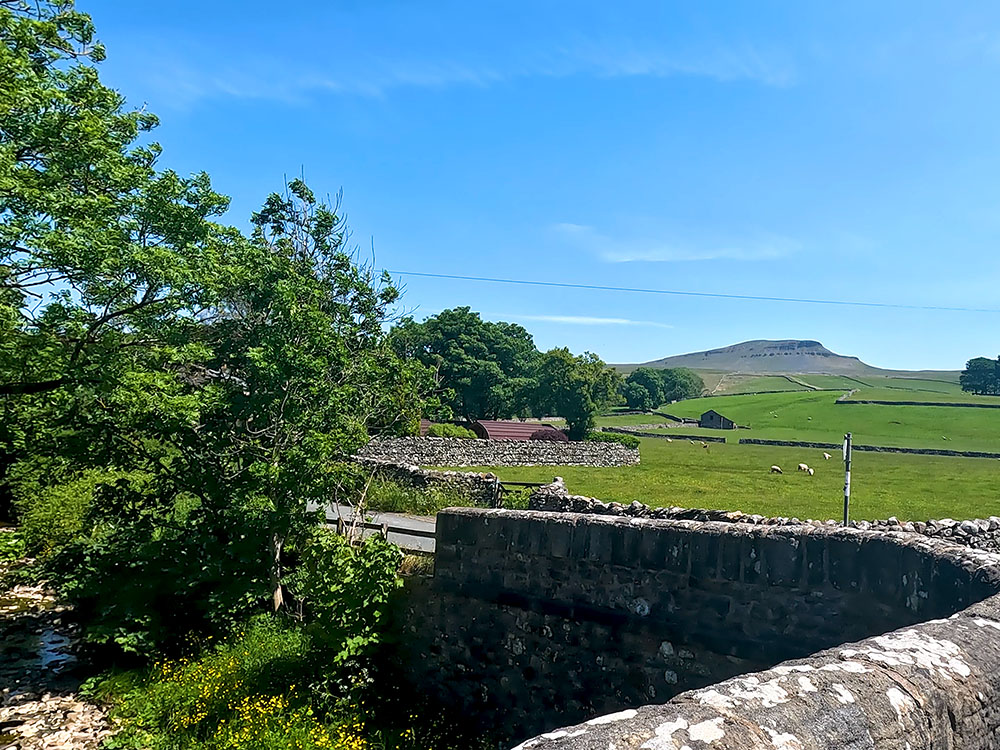
The road heading over Horton Bridge with Pen-y-ghent in the background
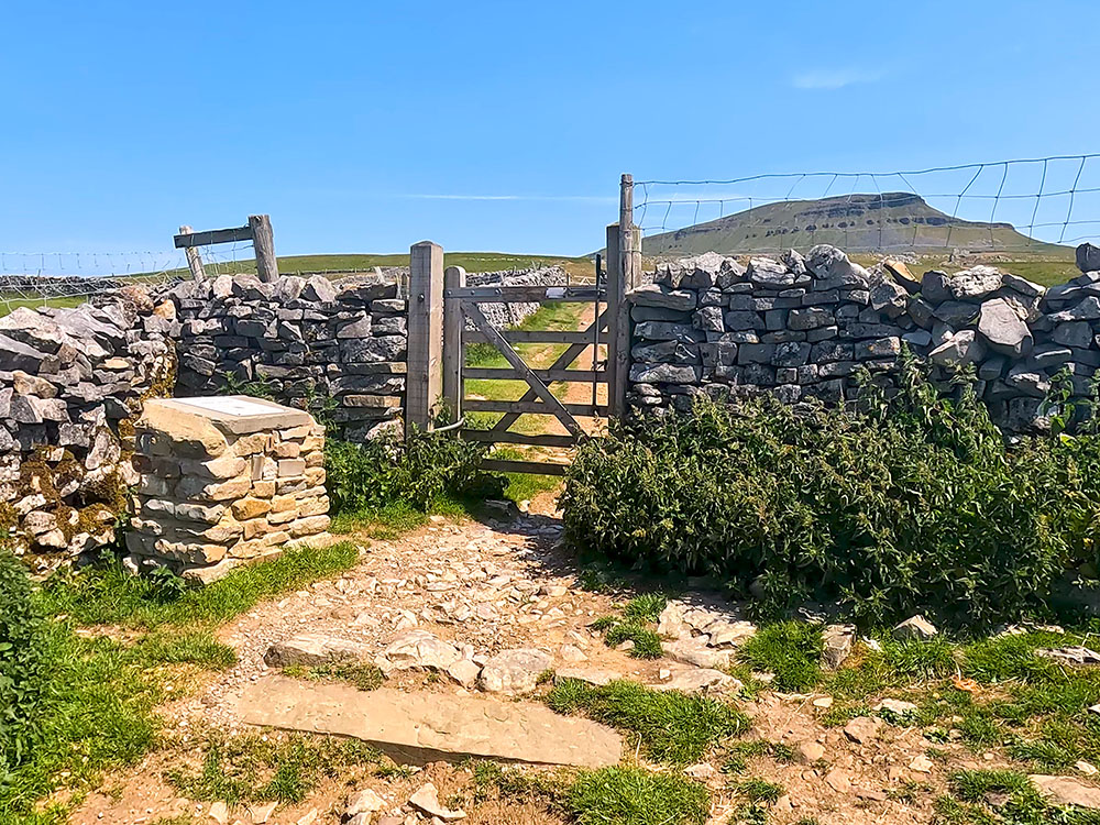
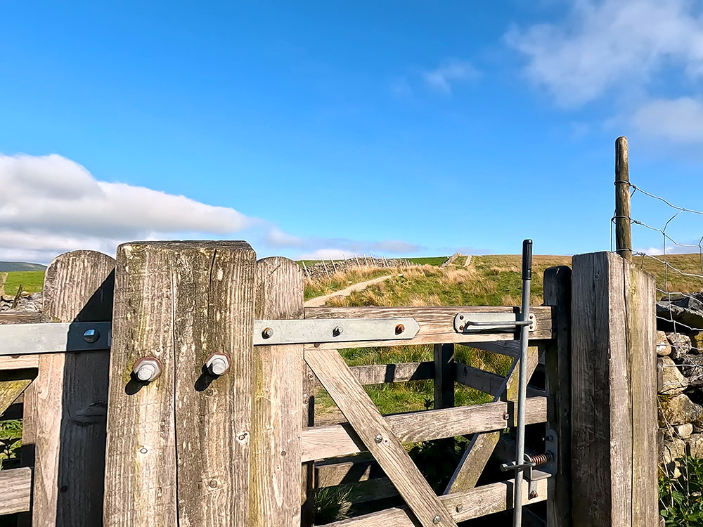
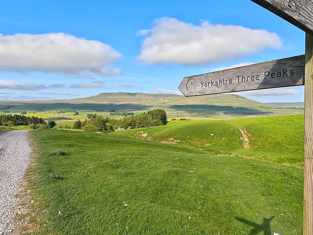
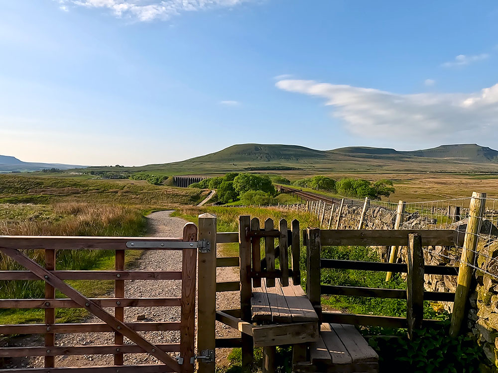
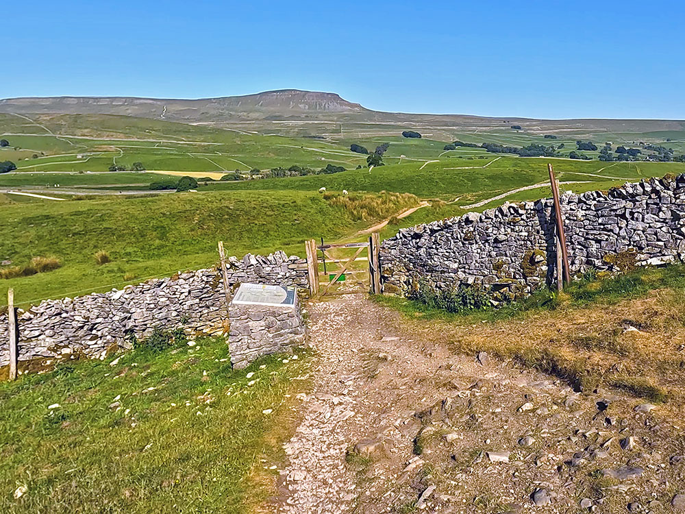
Just before reaching the buildings at Brackenbottom, we turn left following the Yorkshire Three Peaks Footpath sign to Pen-y-ghent summit one and three-quarter miles. Head on a few yards to the next gate and then pass through it to turn left to start heading up the man-made steps by the side of the wall.
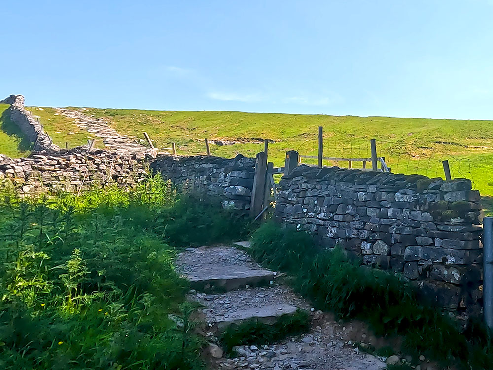
Gate stile at Brackenbottom
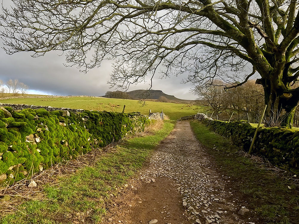
If you stop and look behind every so often, you can now see that even with this small amount of height gain, Ingleborough is on the horizon, which is the final hill to be climbed today.
Keep walking on climbing by the side of the wall. On reaching a crossing wall, pass through the gate. Next to the gate, there is a plaque asking for donations towards the Three Peaks path. It costs £35/metre to look after the paths in this area, so please consider donating via the Yorkshire Dales National Park Three Peaks Donations Page.
Gate stile by 3 Peaks collection box on the path heading towards Pen-y-ghent
Once through the gate, just continue walking beside the wall. After a while, pass through another gate then just keep straight on. Every so often, the path just moves away from the wall a few yards.
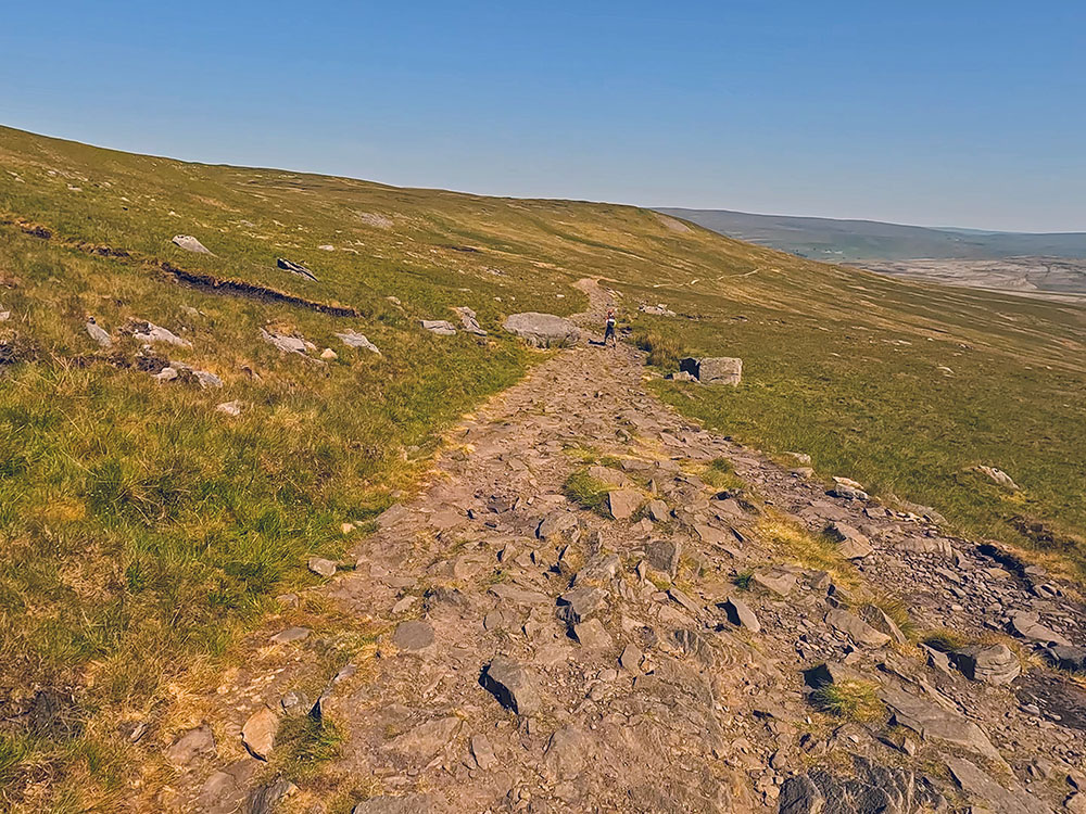
Continuing by the wall, pass through another next gate with Pen-y-ghent now looking much nearer and much more imposing directly ahead.
Looking ahead now at Pen-y-ghent, you can see the two distinct climbs that we'll come on to shortly.
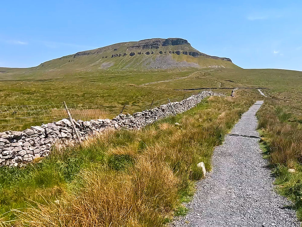
Footpath heading up towards Pen-y-ghent
After a dip and a rise, pass through the next gate, where we can see from the footpath sign, that we're joining the Pennine Way. The Pennine Way is a 268-mile walk from Edale in the Derbyshire Peak District to Kirk Yetholm in the Scottish borders.
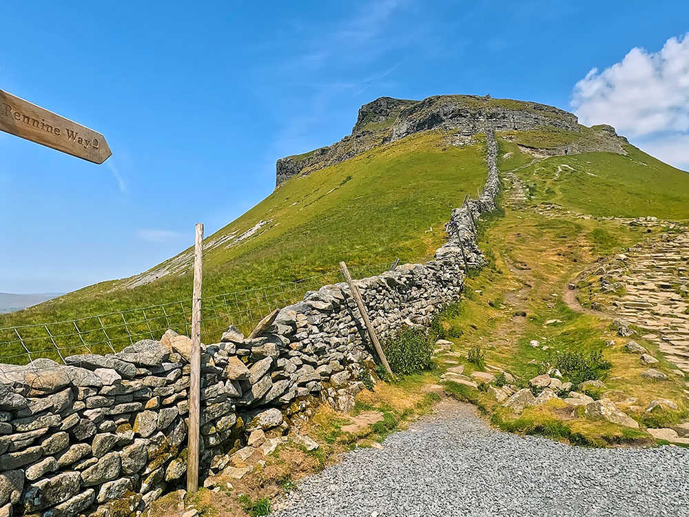
Where the footpath joins the Pennine Way before climbing the steps up Pen-y-ghent
Just through the gate, if you look over the Pennine Way path to the right, you can again see the faint, distinctive shape of Pendle Hill on the horizon, and then as you pan around to the left Fountains Fell is directly across. The Fountains Fell name comes from when the land was used by the Cistercian monks from Fountains Abbey 25 miles away.
From the gate, we follow the Pennine Way sign to head left and start the first steep climb of the day.
As part of your training for the Yorkshire 3 Peaks Walk, walking the 3 Peaks individually will give you a feel for what lies ahead and will give you more confidence for knowing you can find your way around. For training and familiarising with the Pen-y-ghent part of the walk, we'd suggest including our Pen-y-ghent walk from Horton in Ribblesdale as part of your training.
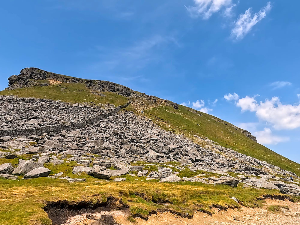
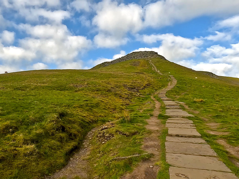
The path is obvious to start with up the steps and then keeps next to the grass border. Just before the top of this initial climb, the path swings back diagonally left in front of the large crag, so you never go on the grass. Some hands may be needed just over this short stretch.
At the top of this first climb, you get a brief respite before climbing the steep steps that lie ahead.
The second steep climb up towards Pen-y-ghent summit
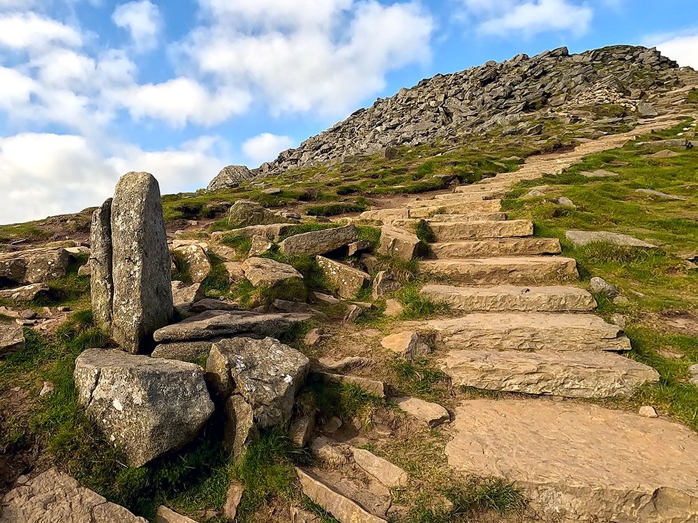
Continue and climb the steps. As with the initial first climb, there is a short section towards the top of the second climb where the path becomes a little more sketchy and hands again may be needed. But the top of the climb is soon reached and you can see the man-made steps ahead that soon turn into flags underfoot.
Looking back down the Pennine Way path on Pen-y-ghent
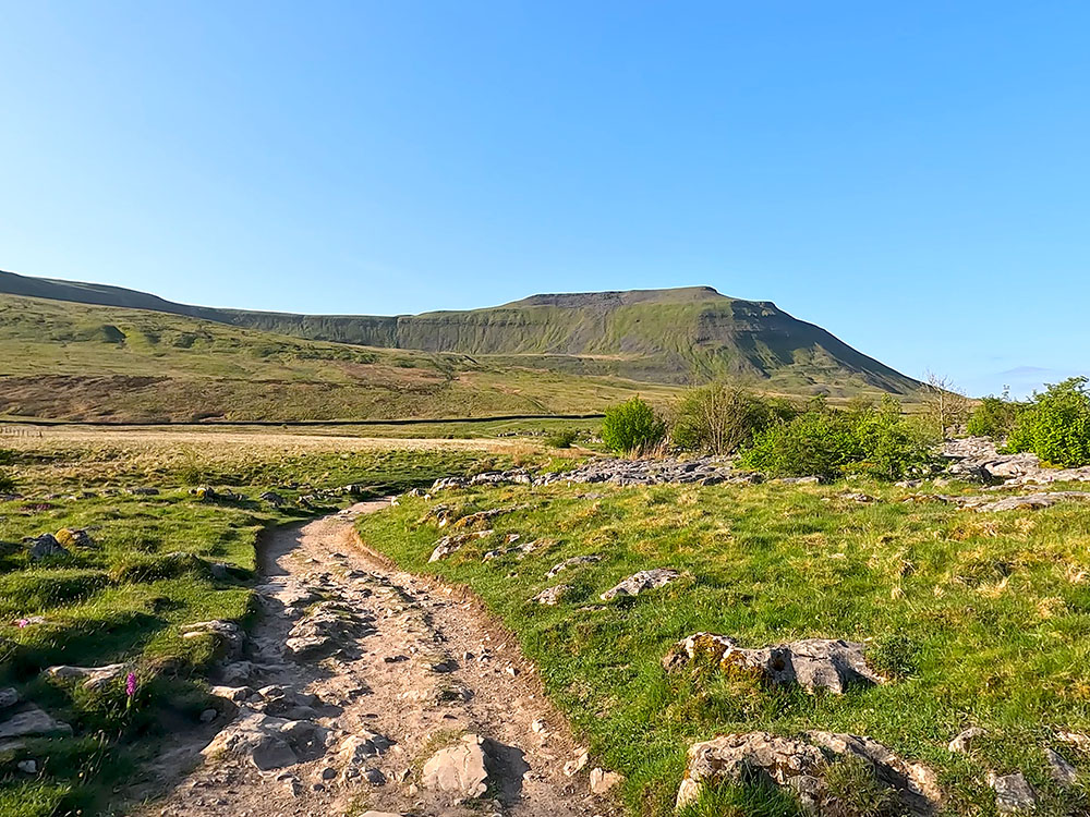
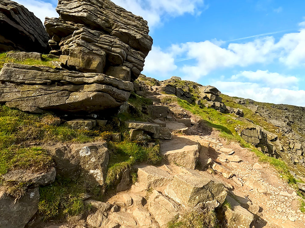
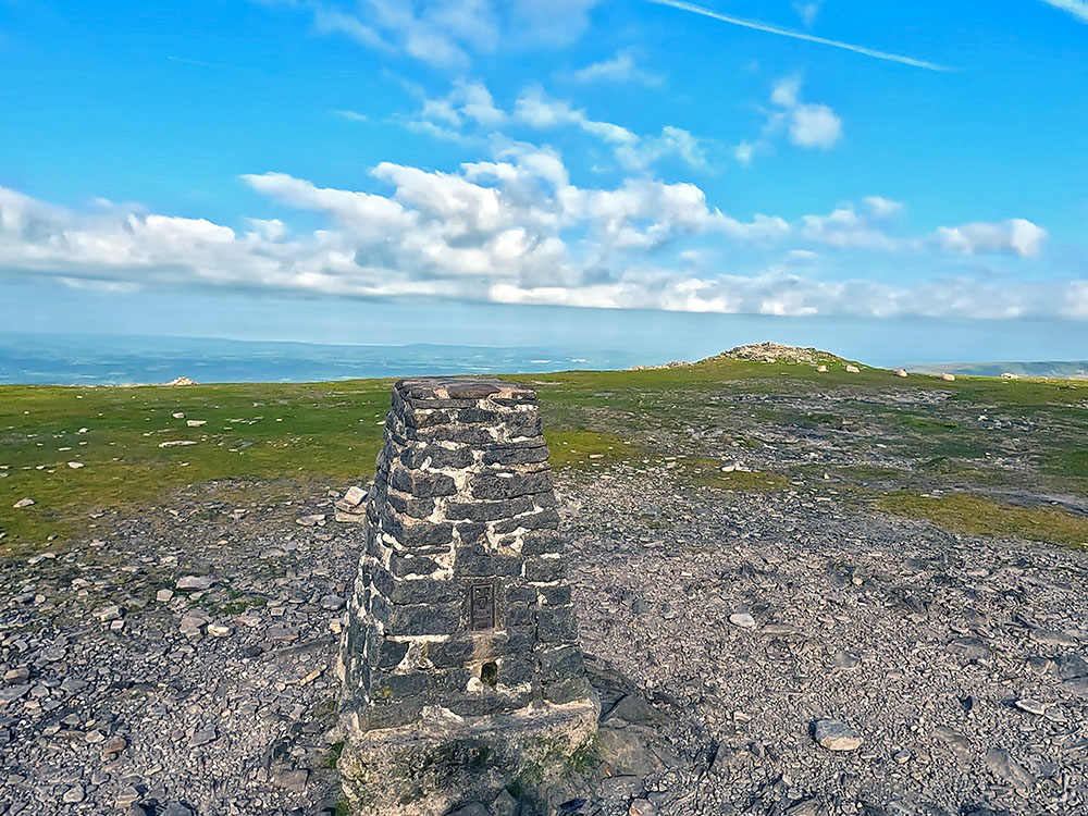
Just continue now and follow the flags up to the trig point on the summit of Pen-y-ghent. Pen-y-ghent itself is the lowest of the Yorkshire Three Peaks at 694 metres high.
Trig point on Pen-y-ghent summit
The Ordnance Survey map shows Pen-y-ghent with hyphens, but many people and old text have it without. The name derivation is a little ambiguous. 'Pen' is from Cumbric and as in today's Welsh language, means 'top' or 'head', 'y' is taken from the definitive article, 'the'. 'Ghent' is the uncertain part. It could mean 'edge' or 'border' if taken from a derivative of 'gint' but also may mean 'heathen'. So possibly, 'The hill on the border' or 'The top of the edge'. In the past, it's also been translated as 'The hill of the winds'.
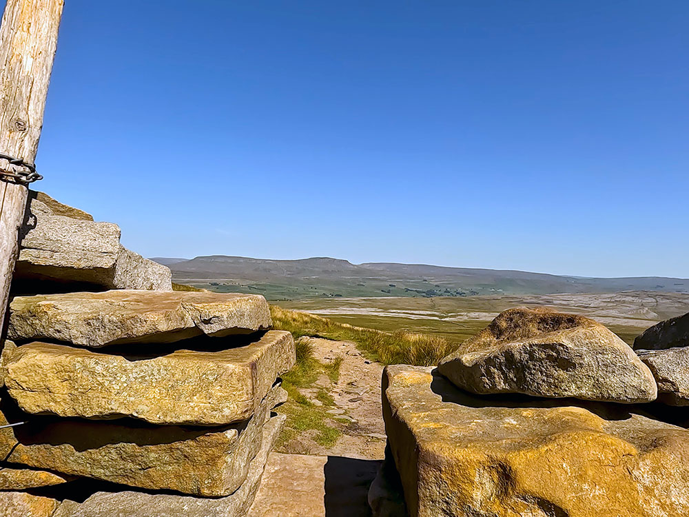
The onward route is through the gate stile in the wall behind the trig point.
Fountains Fell from Pen-y-ghent summit
From the gate stile behind the trig point you get a great 360-panorama - looking ahead, you see Whernside and Ribblehead Viaduct below it and then as you pan left is the flat top of Ingleborough, and then the faint outline of Pendle Hill again, just to the right of the trig point on the far horizon and then around to the Fountains Fell.
View towards Ingleborough and Whernside from Pen-y-ghent summit
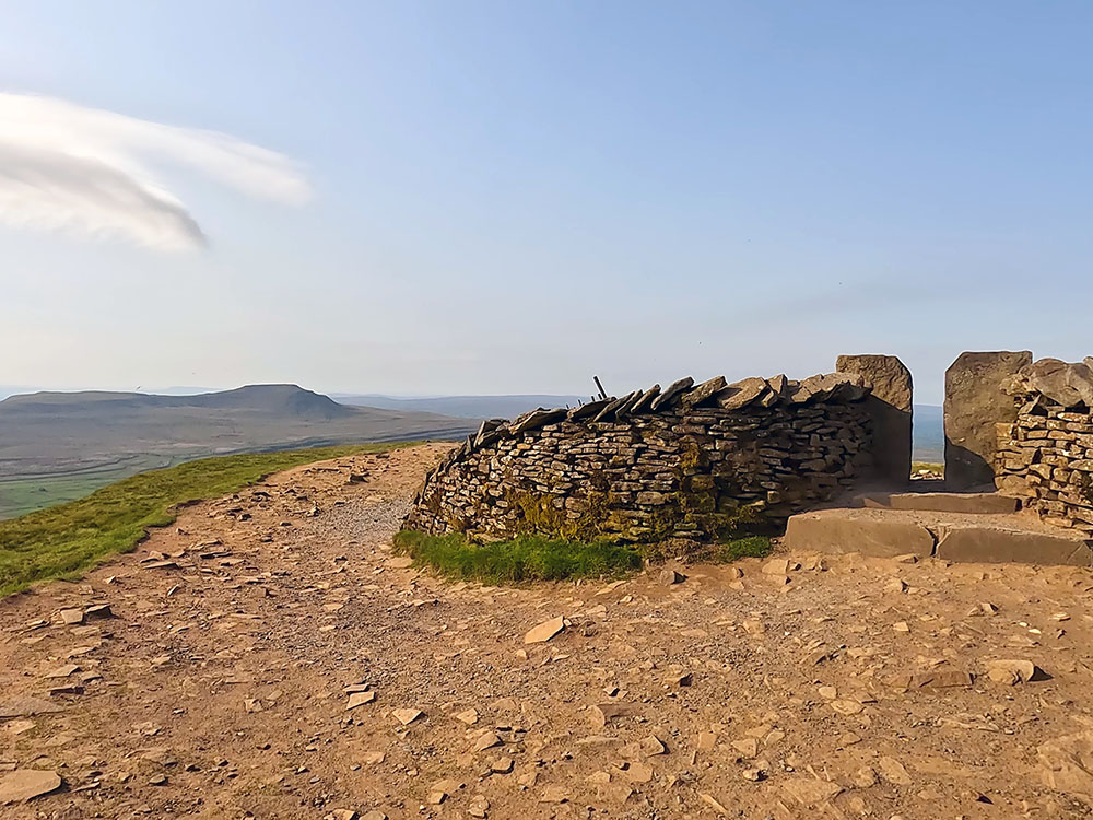
There are also a couple of weather shelters on the top of Pen-y-ghent if you want to stop and have a sandwich.
Once you have passed through the stile in the wall behind the trig point, we follow the Pennine Way Yorkshire Three Peaks footpath sign directly away from the wall.
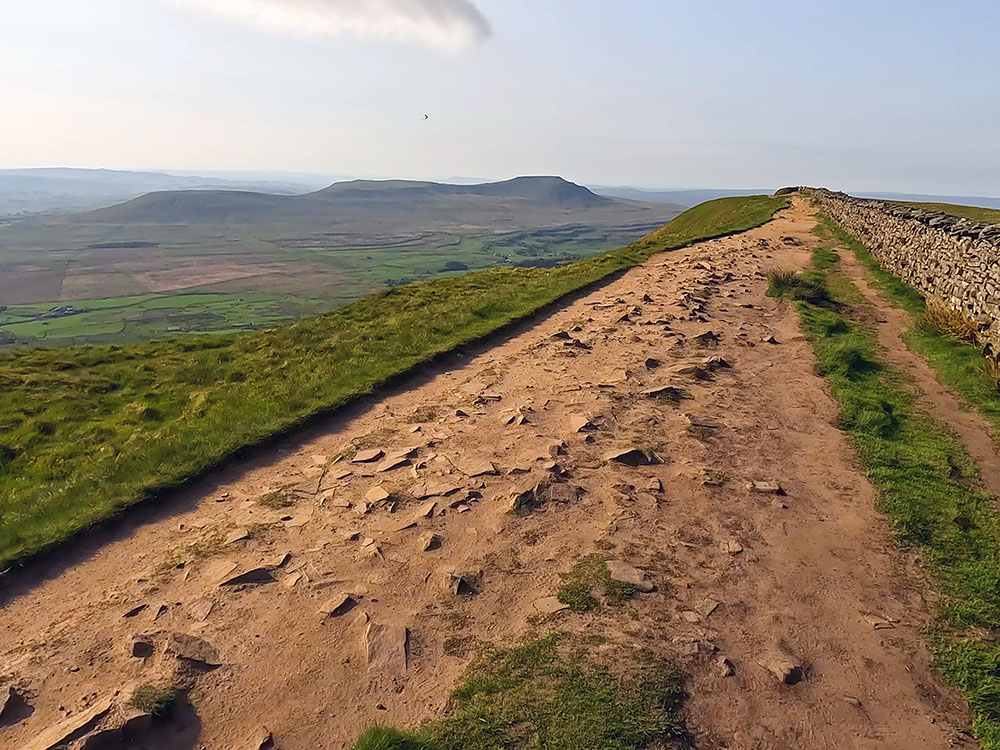
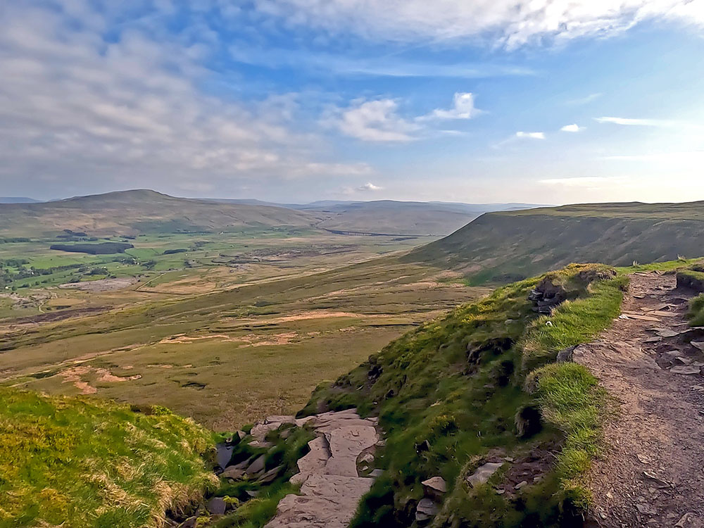
If you look ahead now, you can see our white onward path stretching out in front of us on the line just to the right of Ingleborough. Head down some steps, at the bottom of which, the path bends around to the right.
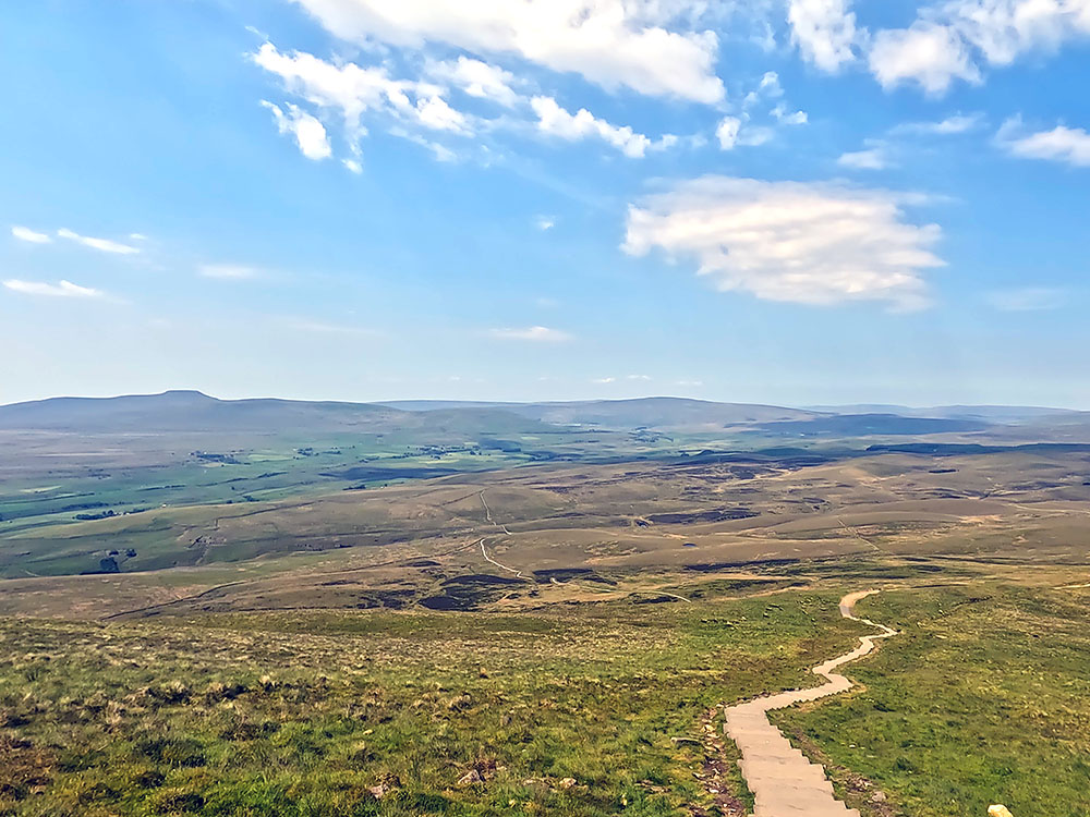
Steps heading down from Pen-y-ghent summit with Ingleborough and Whernside ahead on the horizon
A couple of hundred yards further on, the path bends sharply around to the left at a signpost and we follow this path. The old Three Peaks route went on diagonally left here before the new path was built over Whitber Hill.
Signpost where the path heads to the left - the old 3 Peaks path went straight on here
The new path is much easier to walk on and follow and misses out on Black Dub and Red Moss, where I have everlasting memories of wading through thigh-high mud on my first few Yorkshire Three Peaks walks. So if you read anywhere, the Three Peaks route has been changed, and it was quite a few years ago now, this is the section that changed.
We just follow the main path around downhill following the Yorkshire Three Peaks sign for High Birkwith via Whitber.
Pennine Way path heading down from Pen-y-ghent summit
Pass through the next gate across the path and just continue straight on. Pass through another gate and just head on the few yards to the path junction and the 4-way footpath sign. We're going to continue straight on here, which is a new path over Whitber Hill.
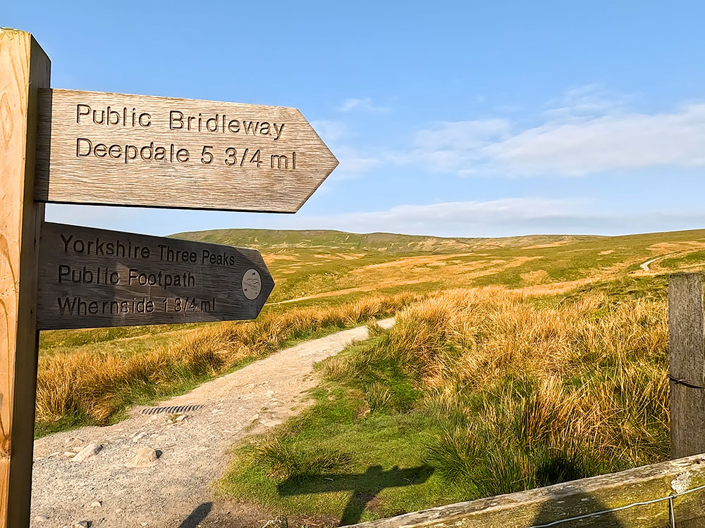
4-way signpost where the Pennine Way heads left down Horton Scar Lane and the 3 Peaks path keeps straight on towards Whitber Hill
If you look at the sign that's pointing to the left, you can see this is where we leave the Pennine Way as it heads off into Horton. So if you're unsure whether you can complete the Three Peaks, and there's a long way to go yet, you can bail here and follow the walled lane back into Horton, where you started.
Looking back up at the path coming off Pen-y-ghent
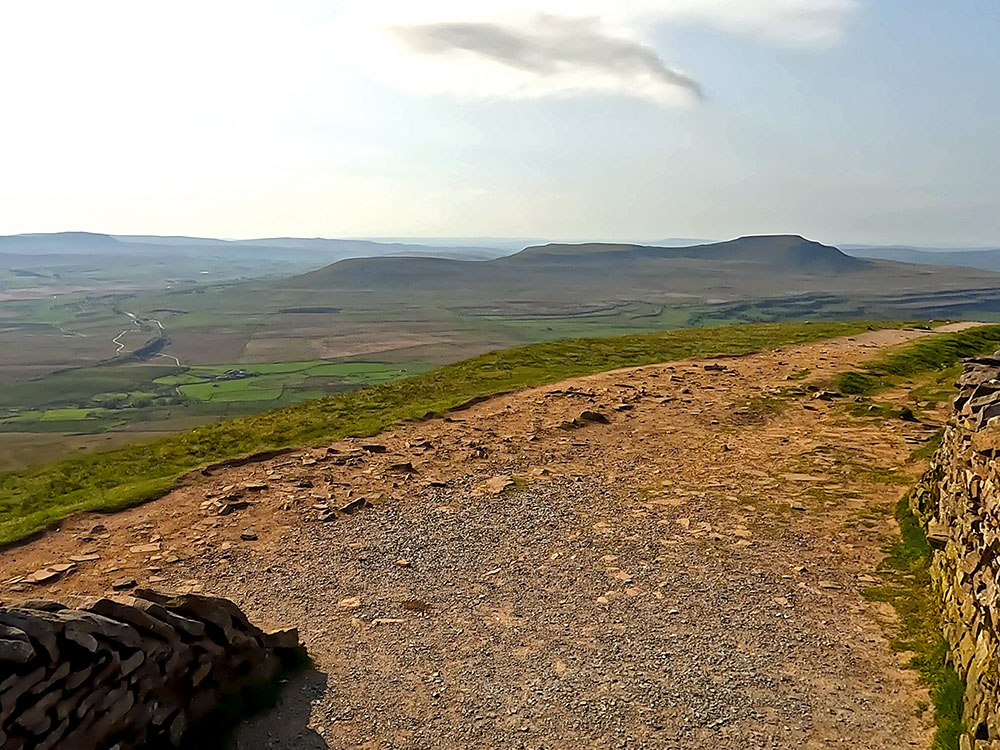
As you pan to the left, you can see the path that we just came down from Pen-y-ghent and then the path that goes directly away from the wall heads past Hull Pot. It's only 400 metres away and Hull Pot is reputed to be the largest natural hole in England. It is 91 metres long, 18 metres wide, and 18 metres deep. If you check out our Pen-y-ghent walk, you can see what it's like after periods of extreme rainfall - Hull Pot fills with water!
For now, though, we'll just continue straight on, on the gravel path that heads up over Whitber Hill. After a while, the path pulls in by a wall.
If you look around here now, you can see the path down from Pen-y-ghent that we just walked down. Further around, you can still just about see the flat top of Ingleborough. The path continues and passes over Whitber Hill and then goes down through a gap in the wall and over a wooden footbridge.
Keep on and then pass through either of the gate stiles and then follow the footpath down to the left at the bottom of the next drop.
We reach a footpath sign and re-join the Pennine Way for a short stretch. Again, if you do feel you can't manage the whole of the Three Peaks, there is another chance to cut it short here, as the lane to the left follows the Pennine Way back into Horton where we started.
Where the path over Whitber Hill turns right upon meeting the Pennine Way again
We are going to ignore that though, and follow the Yorkshire Three Peaks footpath sign to the right to High Birkwith and follow the gravel track.
Heading along the Pennine Way
After about half a mile, pass through a gate. Over to the left, you can see towards the viaduct and Whernside beyond. For now, just continue straight ahead along the gravel track.
After about a further 300 metres you meet a Yorkshire Three Peaks Footpath sign to High Birkwith by two gates in a wall on your left. We leave the Pennine Way here and pass through either of the gates. If you look behind here, this is where the old Three Peaks route re-joins us after it had passed through Red and Black Dub Moss.
Gate stile through which the 3 Peaks path passes to leave the Pennine Way to head towards High Birkwith
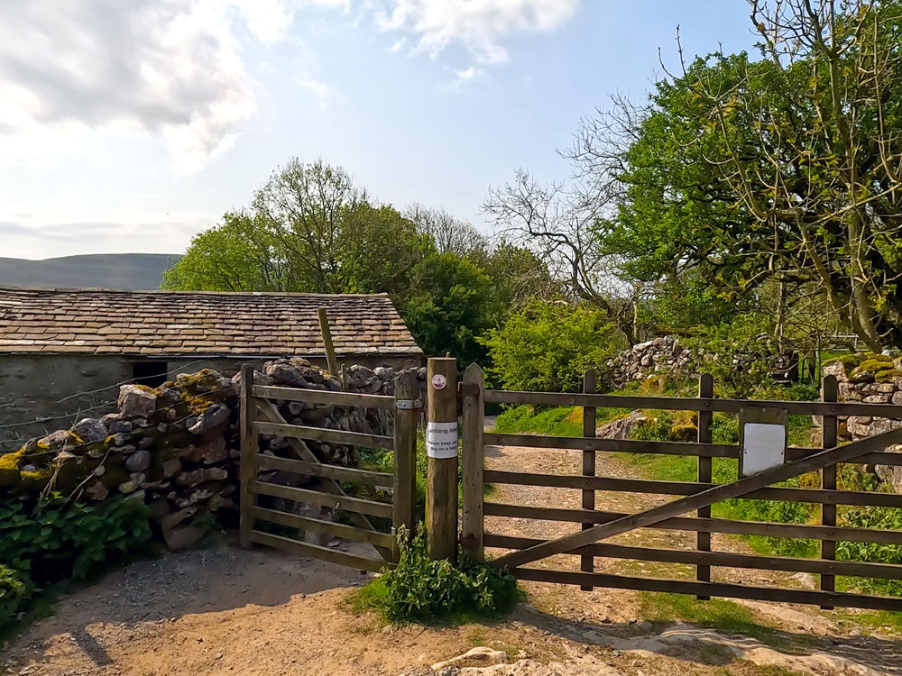
Just continue straight ahead again, now following the path by the side of the wall. Upon reaching the next gate stile, pass through the stile and just continue straight ahead. Where the footpath meets the track, turn left to walk along the track. Just ahead are the trees at High Birkwith and High Birkwith Cave. Pass through the wooden gate stile to the side of the metal gate.
Passing by the trees at High Birkwith
Then again, just continue along the track. Shortly afterwards, at a T-junction, follow the track around to the left, following the Yorkshire Three Peaks Footpath sign.
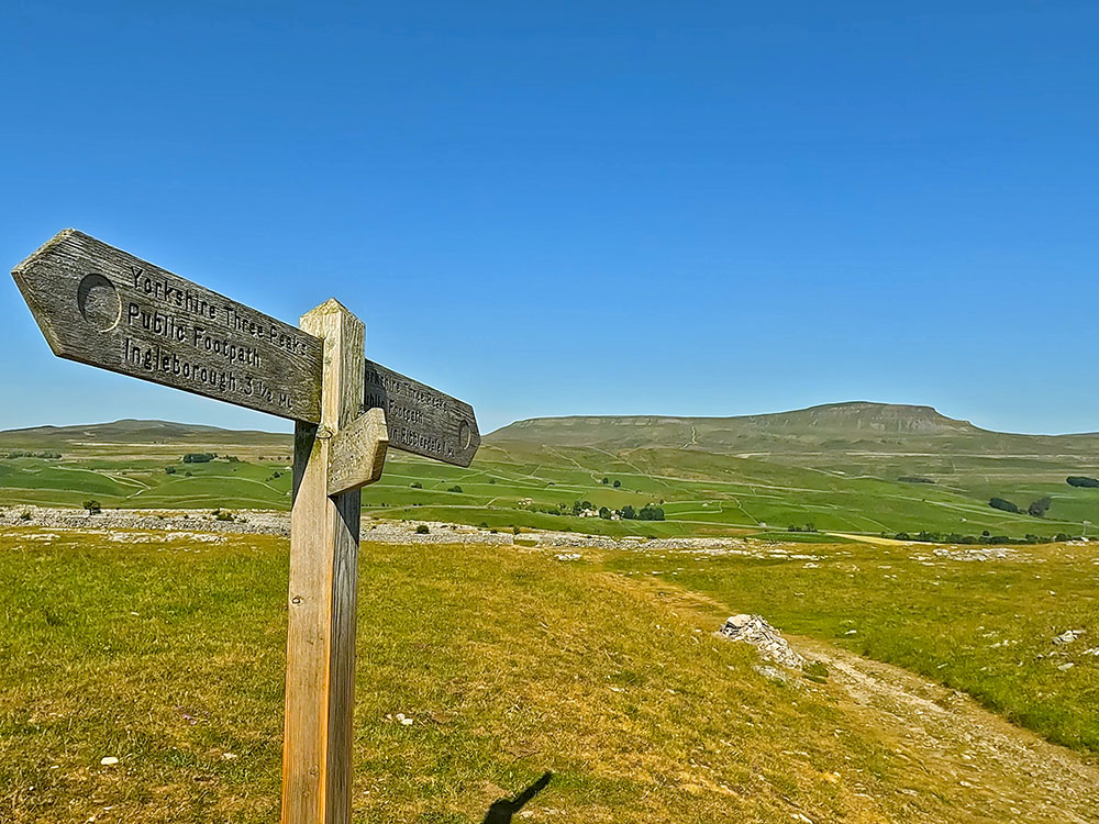
Yorkshire Three Peaks signpost pointing towards Ingleborough
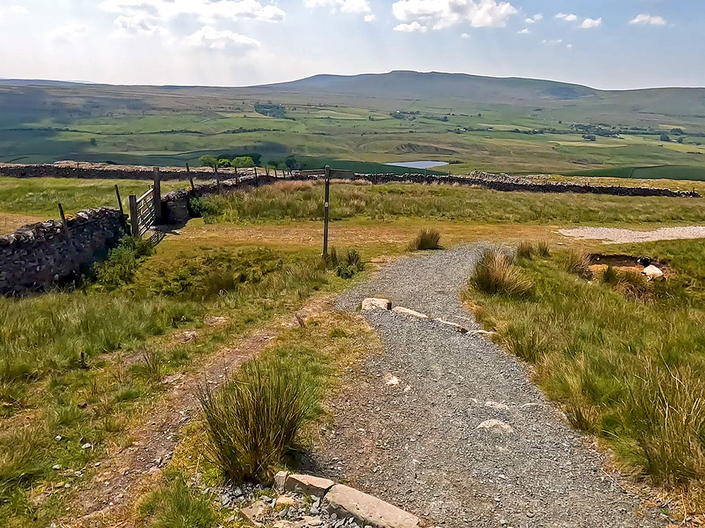
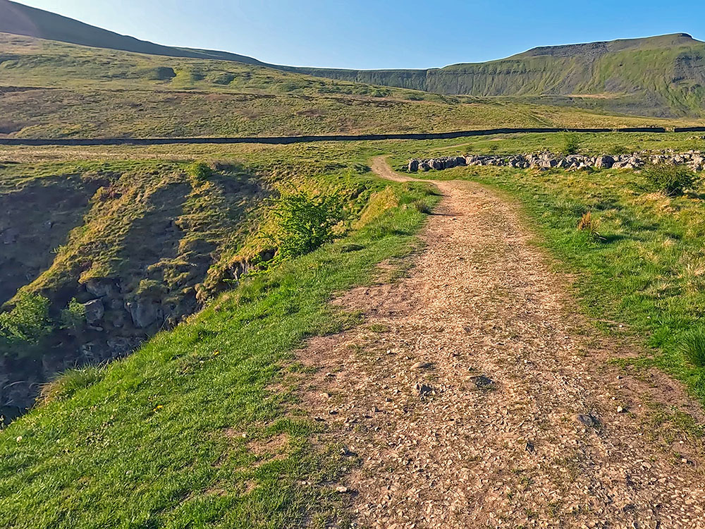
Head downhill for a short distance, and then at another path/track junction, we turn right to follow the Yorkshire Three Peaks Footpath sign to Nether Lodge one and a half miles.
The wide gravel track that forms part of the Ribble Way
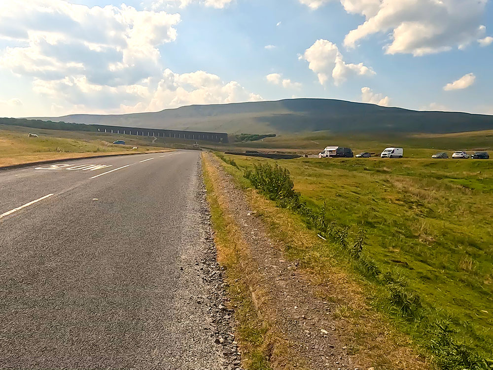
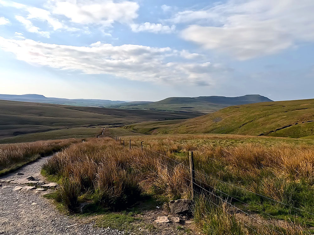
Continue along the track and then pass over the stone stile built into the wall. Walk away from the gate following the path and, as we crest the hill, we get the first real view of the Ribblehead Viaduct in front of Whernside now directly ahead. Shortly we meet a path that splits away left from the main track. Take this path, which is signed public footpath Ribblehead.
Take the narrower left-hand path where the track splits - Whernside on the horizon
Keep on and pass through this metal gate. Just through to the right you can see God's bridge.

God's Bridge
From the gate, we just carry straight on along the track, which slowly climbs the next hill. At the next footpath sign, we just keep straight on following the Ribblehead two and a half miles of sign. Shortly after the footpath sign, we pass over a wooden footbridge and then continue to the gate just ahead.
Wooden footbridge by Nether Lodge
Pass through the gate and just continue along the gravelled path. At the next footpath sign, which has been taking us around Nether Lodge, we follow the track around to the right following the Yorkshire Three Peaks Ribblehead two-and-a-quarter-miles footpath sign along the wide gravel track. Pass over the wooden stile to the right of the gate and again continue straight on along the track.
At one point the track passes over a wooden footbridge. The water under which, is forming the start of the River Ribble, a 75-mile river that starts from a water source on nearby Gayle Beck and flows westwards to enter the Irish Sea at Lytham St. Annes.
Footbridge passing over the River Ribble
Looking back towards Pen-y-ghent from the footbridge
There is also a footpath called the Ribble Way, which is a 72-mile route which closely follows the River Ribble from its start to its end. After having crossed the bridge, continue straight on. Pass through the next gate that crosses the track, and again, just continue along the track.
On reaching the buildings at Ingman Lodge, pass through the metal gate and then continue ahead along the track, which soon becomes tarmacked underfoot. Follow the road as it bends around to the left and climbs to meet the B6479 Horton to Ribblehead road.
Looking back at Pen-y-ghent from the cattle grid where the 3 Peaks path meets the B6479 road towards Ribblehead
Pass over the cattle grid and turn right here along the road. The next mile of walking is along the road with very little footpath to use, so take great care along this section. Remember when road walking always face oncoming traffic except on a sharp bend when oncoming cars can't see you - cross over the road for those.
Path beside the road heading towards the Ribblehead Viaduct
As the viaduct comes into view ahead, pass through the gate and continue alongside the road. We then arrive at the T-junction at Ribblehead, where we are going to cross the road and continue straight on.
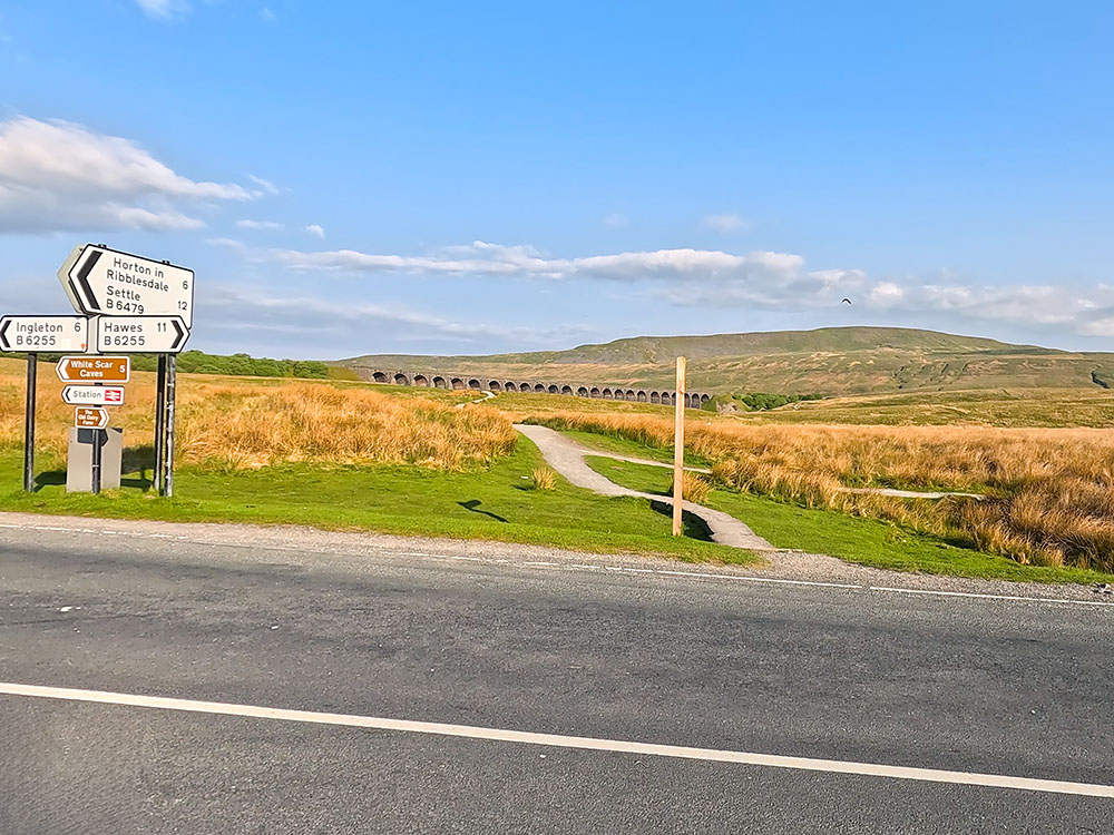
Path heading towards the Ribblehead Viaduct and Whernside from the junction of the B6479 and the B6255
Up to the left is the Station Inn and some additional parking, but more on that at the end of the video when we look at where you can eat and drink. Just around to the right are two large laybys that do fill up during the day, mainly at weekends and in summer.
If you have two vehicles, you could leave one here and drive back to Horton to start the walk. In the car, you could then leave additional food and drink to pick up on the way around so you don't need to carry as much. If you are taking your own water, then consider taking a hydration bladder in addition to any water bottles, so that you can keep yourself hydrated on the way around. Also in the layby on many days is the ice cream van which has been coming here for many, many years. It's called itself the Fourth Peak, and besides ice creams, it does have tea, coffee, soup and egg bacon or sausage balms, if you need that something extra to get you around.
Back at the T-junction, just cross the road and then follow the path directly away from the road, following the Yorkshire Three Peaks Public Footpath sign. Continue along the gravel path towards the Ribblehead Viaduct.

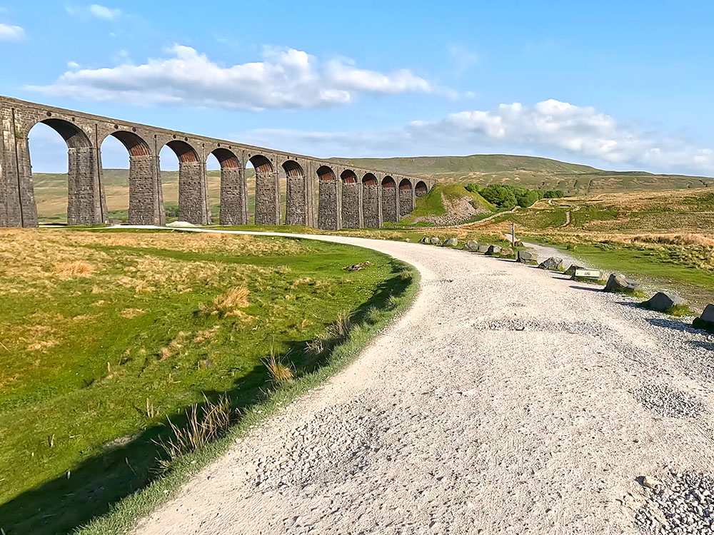
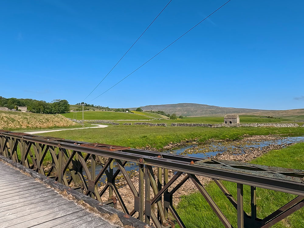
Ribblehead Viaduct and Whernside
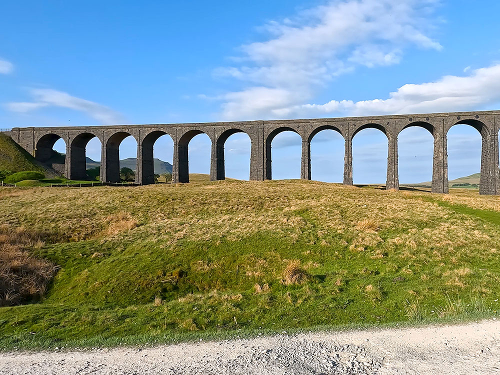
Upon meeting another gravel track which, if you look around to the left, is coming in from the Station Inn, we turn right to head towards the viaduct. The Ribblehead Viaduct or Batty Moss viaduct, as it used to be known, carries the Settle to Carlisle railway over Batty Moss.
Its construction started in 1869 by over 200 men, most of whom lived in shanty towns purposely set up nearby. Over 100 men lost their lives whilst it was being built, many of whom are buried in the Church of St Leonard in nearby Chapel Le Dale, which has a plaque in their memory. The viaduct itself was completed in 1874 and the Settle to Carlisle railway line was opened for passengers in May 1876.
Looking over to the left here, Ingleborough is framed between a couple of the 24 stone arches that make up the viaduct, which are 32 metres above the ground at their highest point. Steam trains can also be seen passing over the viaduct on certain days, mainly in the summer months.
Looking towards Ingleborough through the arches of the Ribblehead Viaduct
Before reaching the viaduct, we leave the wide track here to head along the narrow path towards the footpath sign 'Whernside four and a half miles'. Head straight on up some steps to pull in to the right of the railway. The path now runs parallel to the railway for quite a way.
Keep on and pass through the next gate, and then if you look behind you get a view of Pen-y-ghent and then around to the Ribblehead Viaduct, which is just above the path.
Looking back over the gate towards Pen-y-ghent on the far horizon and Ingleborough to the right
As you pan around to the right you can see the flat-topped Ingleborough, which is the next destination once we've been over Whernside.
Walk away from the gate and keep straight ahead on this gravel path. After a while, we reach the Blea Moor signal box, which according to the Network Rail website, is the most remote signal box on their railways. Besides being remote, there cannot be many signal boxes with better views in the country than this one. From the signal box, again continue straight along the path.
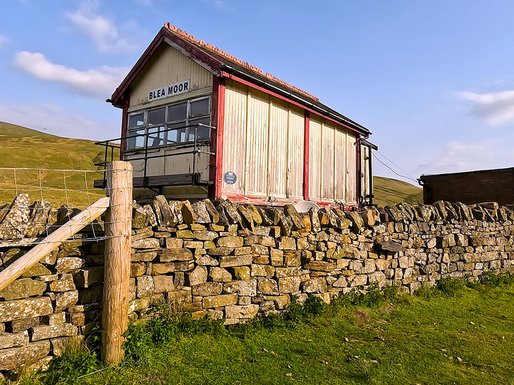
Blea Moor signal box
If you have any thoughts about this walk or find there are any issues with any of the footpaths used, please share that in the review section below.
Head along the path for about a kilometre and then pass over the footbridge over Little Dale Beck. Or if you are walking in midsummer, you may find there's no need to use the footbridge as the beck has dried up.
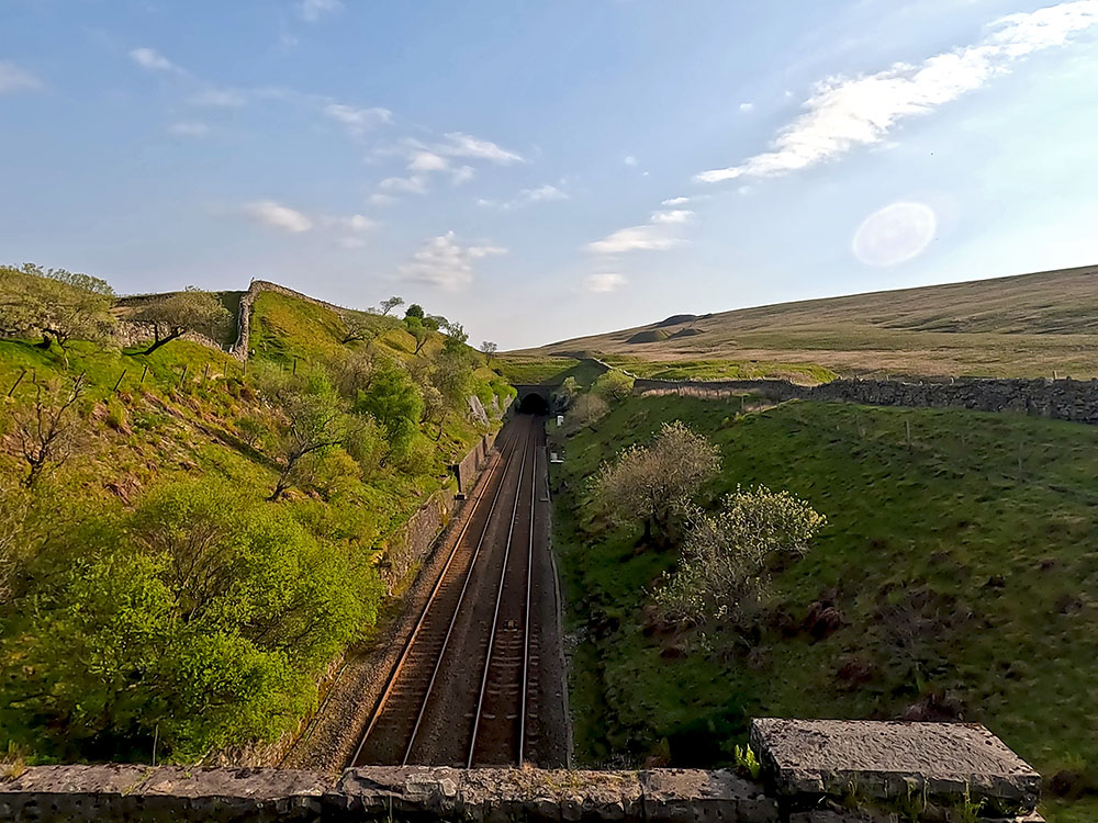
Continue again along the track which soon pulls in beside the aqueduct to cross over the Settle to Carlisle railway line. As you cross over the aqueduct, if you look over to your left you'll see Simon Fell, which heads up onto Ingleborough, whereas over to the right, the railway track disappears into Blea Moor Tunnel in Smithy Hill.
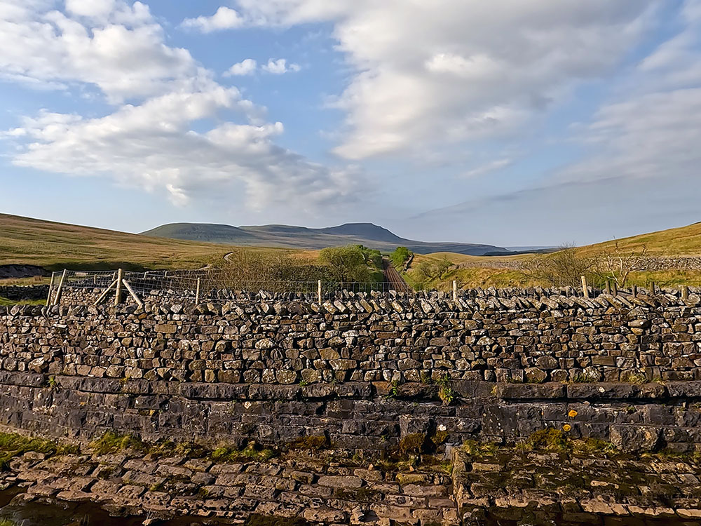
View over the aqueduct along the Settle to Carlisle railway line in the direction of Ingleborough
The couple of mounds that you can see just on the horizon on the top of the hill are air shafts that go down into the tunnel. Four air shafts were built to ventilate the Settle to Carlisle railway line as it passes through the tunnel.
Looking along the Settle to Carlisle railway line towards the air shafts from the aqueduct
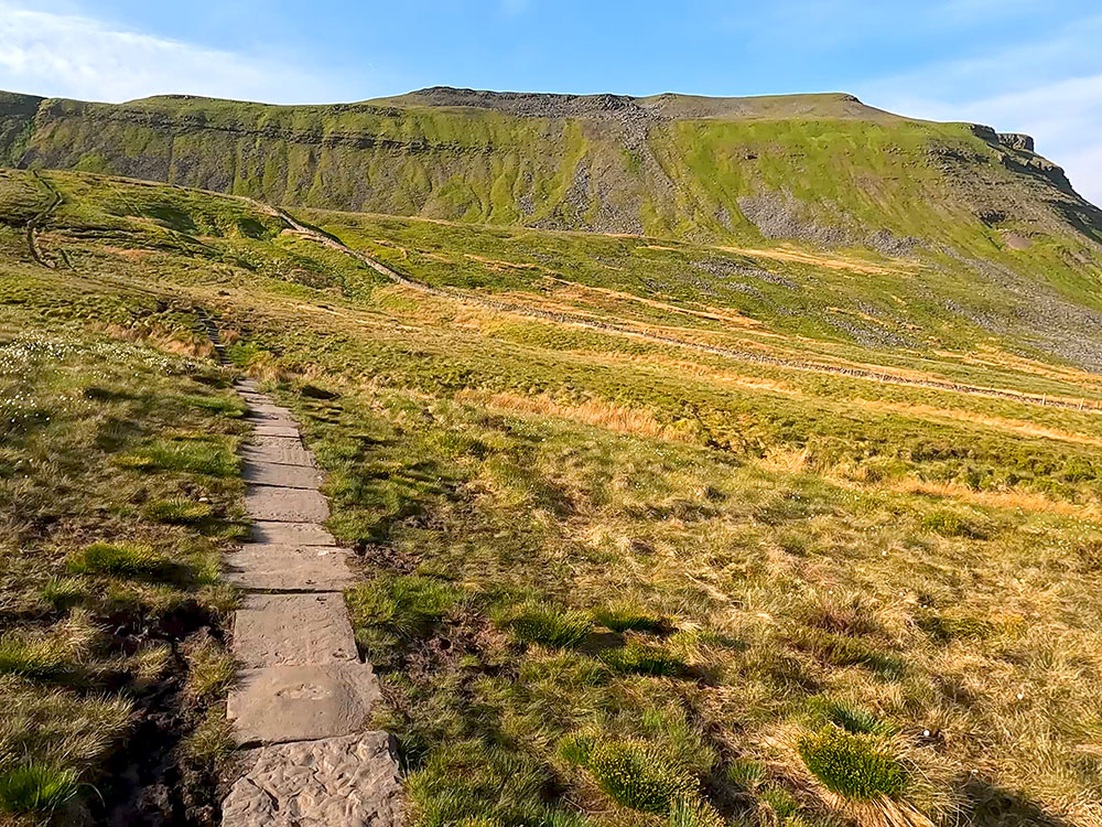
Once over the aqueduct, pass through the wooden gate and keep straight on. You just keep straight on following the Bridleway sign for a Dent Dale four miles. The path climbs up some steps, where, over to the left Force Gill waterfall can be seen.
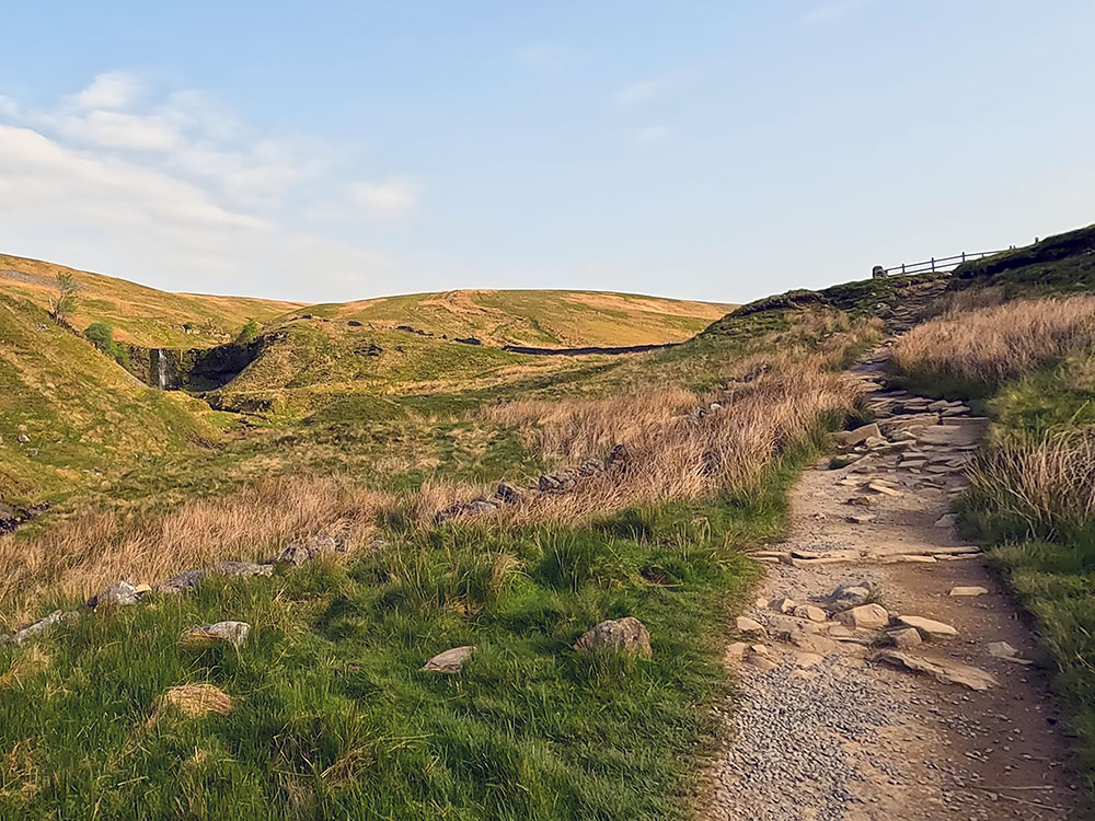
Looking across towards Force Gill waterfall
It may come as a bit of a tonic, or maybe not(!), to know that this spot here is half-distance on the walk. Pass through the next wooden gate and then start the steeper climb along the path and then the man-made steps up the hill.
Man-made steps on the Dales High Way heading up Slack Hill
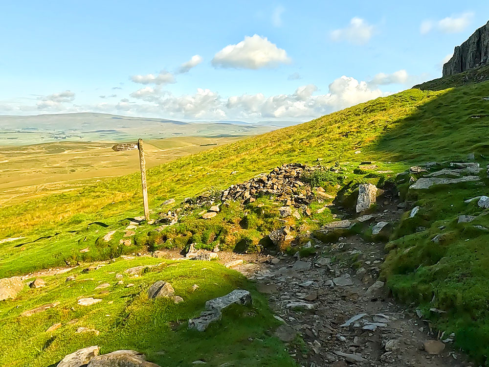
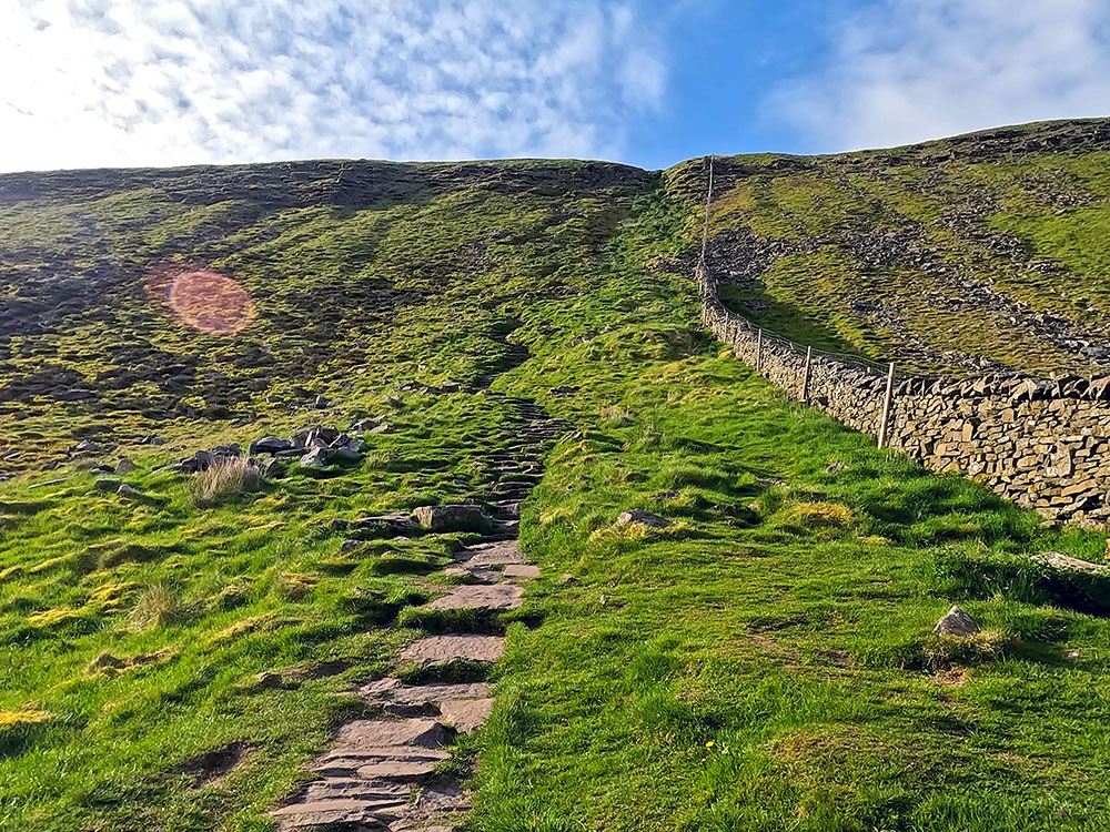
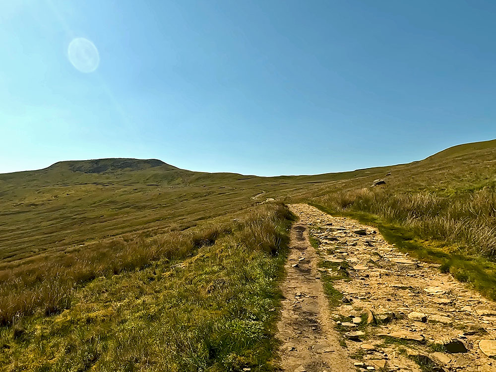
After about 500 metres, the path arrives at a wooden stile by a footpath sign. Just before reaching the stile, you'll also be glad to know we've now climbed half of the overall height of the walk.
Climb over the stile, where we are going to follow the 'Whernside one and three-quarter mile' sign. Head away from the stile, continue climbing along the gravel path, and stop from time to time to take in the ever-expanding view.
Yorkshire Three Peaks footpath sign pointing towards Whernside as the path leaves the Dales High Way
Looking back down the path from the signpost towards Pen-y-ghent and Ingleborough on the horizon
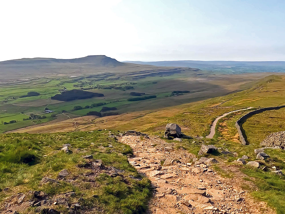
The path runs parallel with the wall for a short section and then after a while becomes flagged underfoot. Just after the flags end, the path pulls in by the side of a wall.
Flagged path climbing Whernside
This wall is now followed to the summit of Whernside. Over to the left here, as more height has been gained, you can see Greensett Moss tarn down below.
As part of your training for the Yorkshire 3 Peaks Walk, for familiarising yourself with the Whernside part of the walk, we'd suggest including our Whernside from the Ribblehead Viaduct walk as part of your training.
Path by the side of the wall approaching Whernside summit, with Ingleborough ahead and Ribblehead Viaduct below
After following the wall for about one kilometre, the summit is reached. The trig point indicating the summit itself on Whernside is just through the gap on the other side of the wall.
Gap through the wall on Whernside summit to reach the trig point
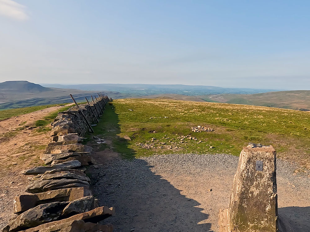
Trig point on Whernside summit
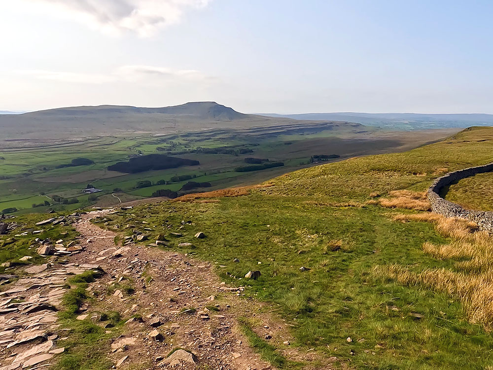
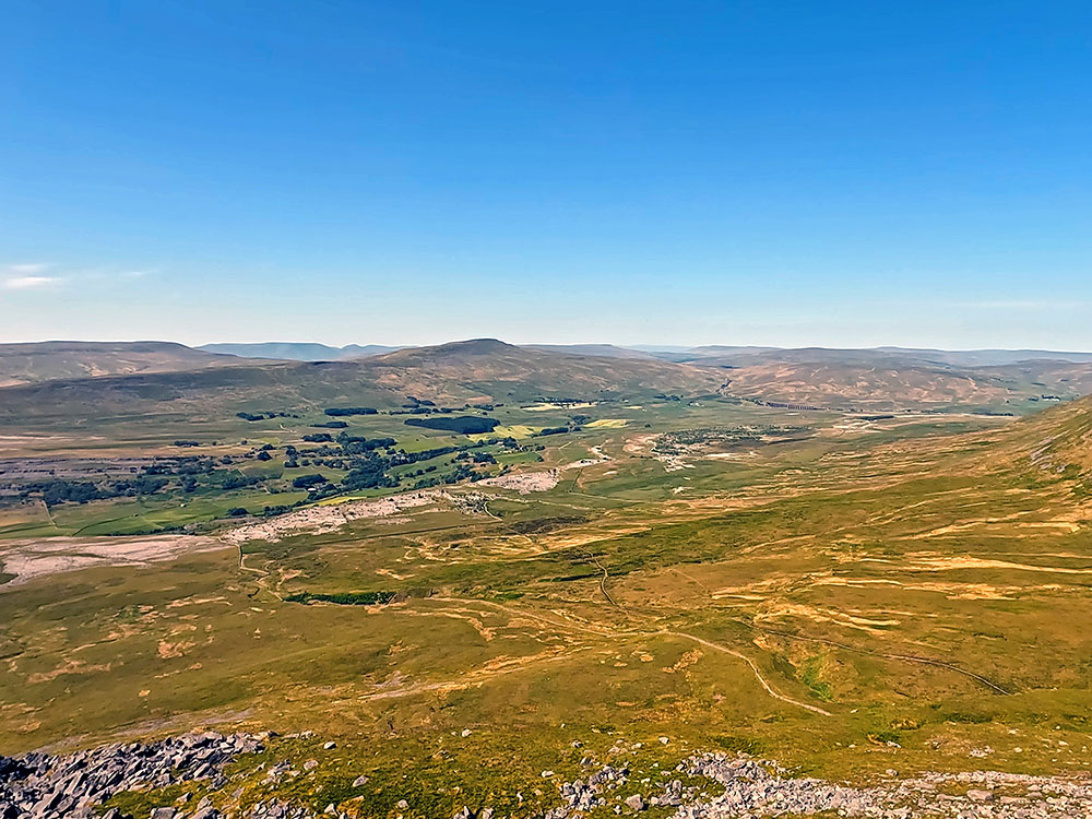
Whernside is the highest of the Yorkshire Three Peaks at 736 metres high. From the trig point, you can see out to the sea at Morecambe Bay and then around along the line of the Lakeland Fells. Further around you can see the Calf and the Howgill Fells and below in the direction of Pen-y-ghent the Ribblehead Viaduct. Finally, as we pan around there is Ingleborough, our next target.
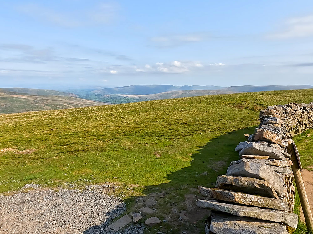
Looking towards the Howgills from Whernside summit
Looking towards Ingleborough and the Ribblehead Viaduct from Whernside summit
On both sides of the wall here, there's a weather shelter which is very useful to get out of the wind. Pass back through the gap in the wall from the trig point and turn right to continue walking along the path that keeps beside the wall and starts to descend. Pass through either of the wooden gates.
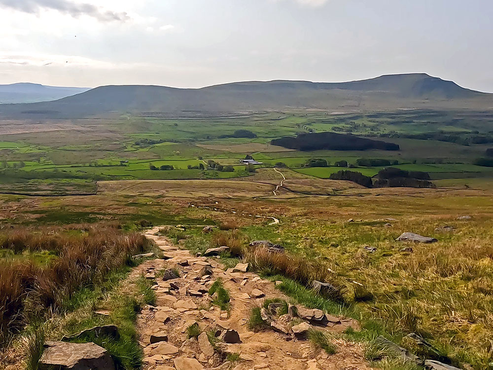
After about half a mile, we reach the first of two shorter, steeper downhill sections before we leave the wall. Head down this steeper section of path. At the top of this second slightly steeper downhill section, our path down below can now clearly be seen leaving the wall. Looking away from the wall, you can pick out our white-coloured path as it weaves its way down towards Bruntscar in the direction of Ingleborough.
Where the path starts to drop more steeply on the descent from Whernside summit
At the bottom of this second steeper section, follow the path now as it heads away from the wall in the direction of Ingleborough.
Where the path heads left away from the wall to start its descent towards Bruntscar
These initial steep steps down have much improved over the years, but are still a little bit difficult to walk down. So take extra care if your legs are starting to tire.
The rough path forming part of A Pennine Journey heading down towards Bruntscar from Whernside
As the path starts to get less steep, pass through a wooden gate. If you look behind it, you can see what you've just come down. As you look further around again, you can see the Ribblehead Viaduct and Pen-y-ghent. Continue ahead down this path.
Looking back up the path heading down from Whernside
Pass through this next gate, and continue heading down the path. Just before reaching the next gates and the buildings, looking around again, you see the path that we just walked down coming off Whernside.
Pass through the gate before turning right towards Bruntscar
Head down to and pass through the gate and head down the track. Now, follow it around to the right, following the sign for the 'Three Peaks Hill Inn one-and-a-quarter mile' sign. Shortly after we've turned right, we now turn left, again following the 'Yorkshire Three Peaks Hill Inn one-and-a-quarter mile' sign.
Start heading down the road. Pass the right-hand side of the farm buildings at Bruntscar. Continue down the road and pass over three cattle grids or through the gates by the side of them and keep walking along the road.
Cattle grid on Philpin Lane heading in the direction of Ingleborough
The road then bends around to the right and starts to rise. Over to the right you pass by the campsite at Philpin Farm, where if you wanted somewhere to stay in the area again, you could stop here.
Remember, you don't have to start the Three Peaks Walk in Horton, you could start it from the campsite here, or similarly, you can park at Whernside and start from there and then just do the circle. As it's a circular walk, you can start it from anywhere on the circle.
We then reach a barn on our right that has a café in it that opens at weekends during certain times of the year (see the video) and also has a vending machine.
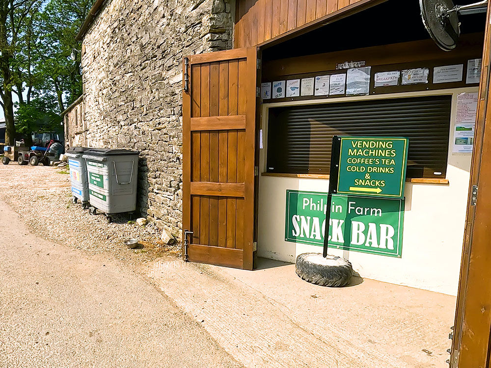
The path passing by Philpin Farm Snack Bar on Philpin Lane
Pass the barn and continue walking on the road. Pass over the cattle right or through the gate to the side and continue straight along the road heading towards Ingleborough.
Upon reaching the B6255 Ingleton to Ribblehead road, pass over the cattle grid or through the gate and then turn left onto the road.
Turn left on reaching Low Sleights Road with Ingleborough ahead on the horizon
Head up the road. We soon pass by the Old Hill Inn. Again, if this is open, you may be able to call in here for something to eat or drink - again see the video as currently I believe only serving residents.

The Old Hill Inn
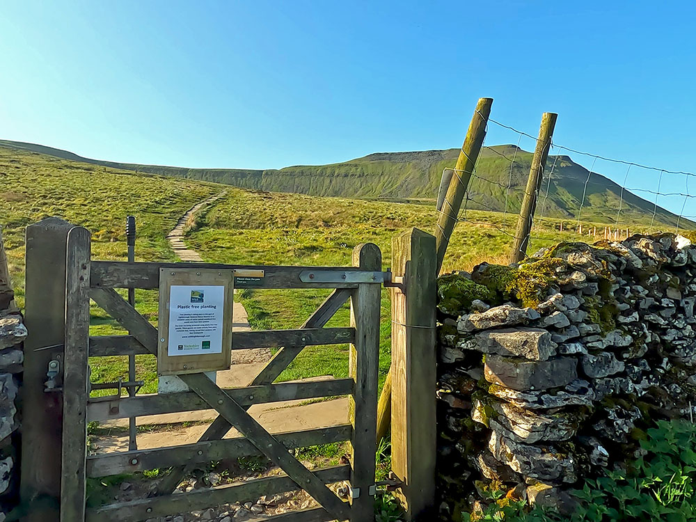
Continue past the Old Hill Inn, up the road until you reach a gate and a footpath sign just before the small building. Just past this, there is a small layby where you could also park if there is space. Before reaching the small building, turn right off the road, passing through the gate following the 'Yorkshire Three Peaks public bridleway Great Duke' sign. Just through the gate, there is an information board welcoming you to Ingleborough and informing you about Ingleborough National Nature Reserve.
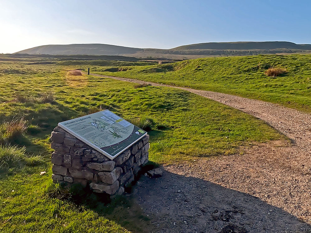
Welcome to Ingleborough information board just through the gate after turning off the Low Sleights Road
Head away from the wall along the wide gravel track. Pass through a wooden gate and continue straight ahead heading in the direction of Ingleborough. Pass through the next gate and then continue straight ahead on the path heading towards Ingleborough.
Heading along the path towards Ingleborough
Pass through another gate and then just continue straight on. As the path passes through Southerscales Scar, take time to have a look around at the limestone.
Path heading through limestone at Southerscales Scar as it heads towards Ingleborough
The limestone pavements around here have been formed by the movement of glaciers over time. The blocks of limestone themselves are called clints and the gaps or fissures in between them are called grykes. The underlying flora around here is generally ferns in the grykes, along with any other lime-loving flowers that can take hold.
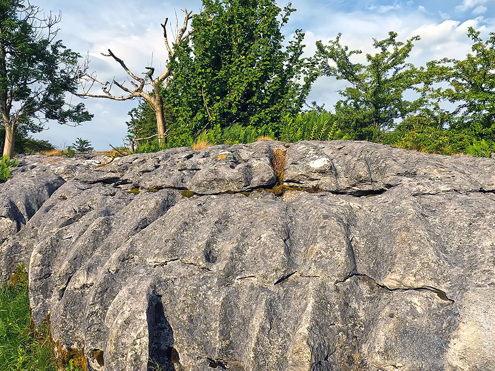
Large limestone clint on Southerscales Scar
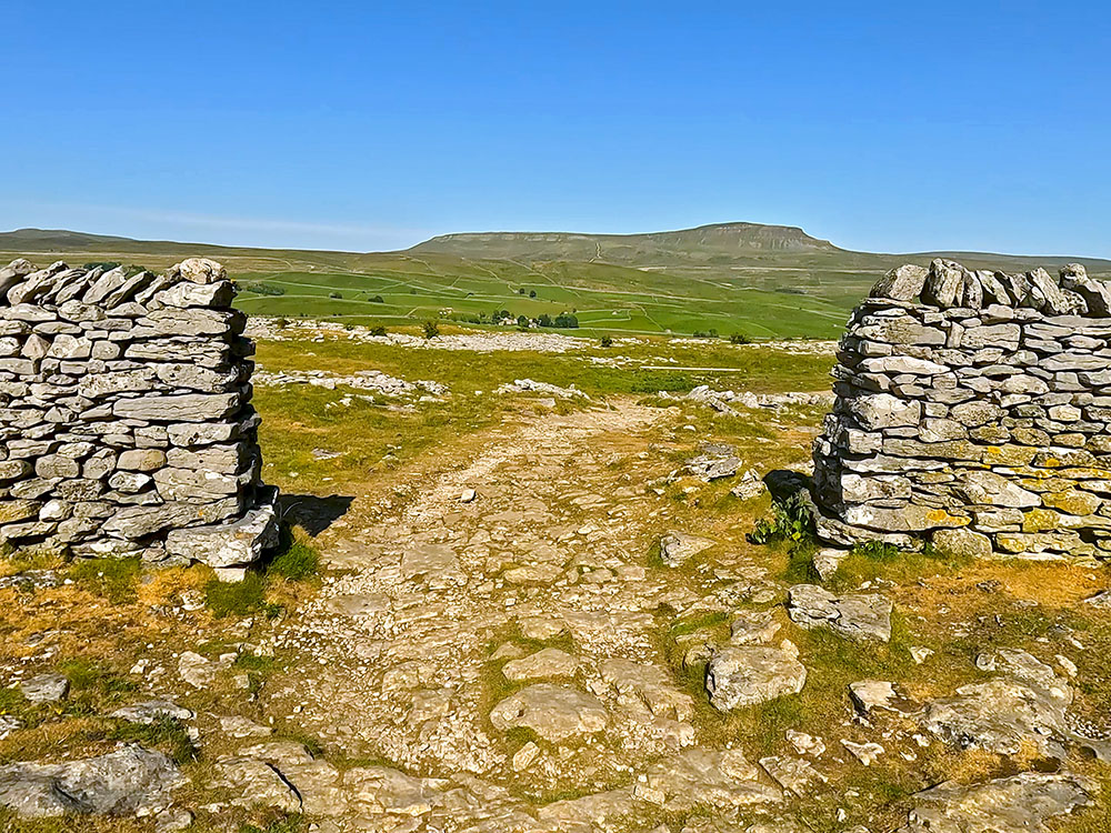
On passing through the limestone, the large hole to the left of the path is Braithwaite Wife Hole, a collapsed doline or shake hole in which there is a cave entrance. Continue past that to where you soon reach a gate in the wall.
Path heading by the entrance to Braithwaite Wife Hole cave with Ingleborough ahead
Pass through the gate and head away from the wall along the flags.

Flagged steps leading away from the gate on the way towards Ingleborough
Stop and look around every so often as more height is gained. You can see now back across to the Ribblehead Viaduct, then back around to Whernside, which is starting to look more distant on the horizon.
Flagged path heading towards Ingleborough
We now reach the foot of almost the last climb, where you just head up the steps. The steep wall in front of us does look imposing this late in the walk with no doubt tired legs. The steps and a small zigzag make the walk-up easier (well a little!) than it looks. Part-way up at a small wall, the path does zigzag heading away to the left and then coming back to the right, so it's less steep for a little while.
Steep steps heading up the side of Ingleborough
Towards the top of this climb, hands may be needed in a couple of places. We soon reach the top of this initial climb, where the path flattens and affords excellent views behind.
Looking back down the steps just climbed with Whernside and Ribblehead Viaduct ahead in the distance
Head on to and then pass through the next wooden gate, then start to walk up the next set of steps.
Flagged steps heading up towards Ingleborough's summit plateau
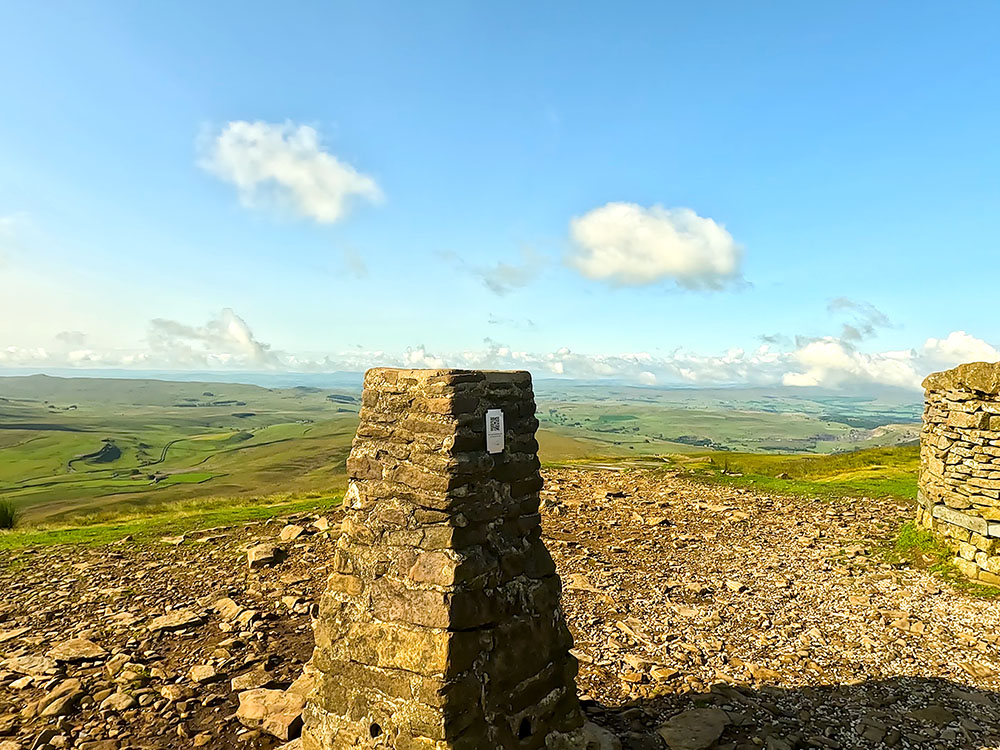
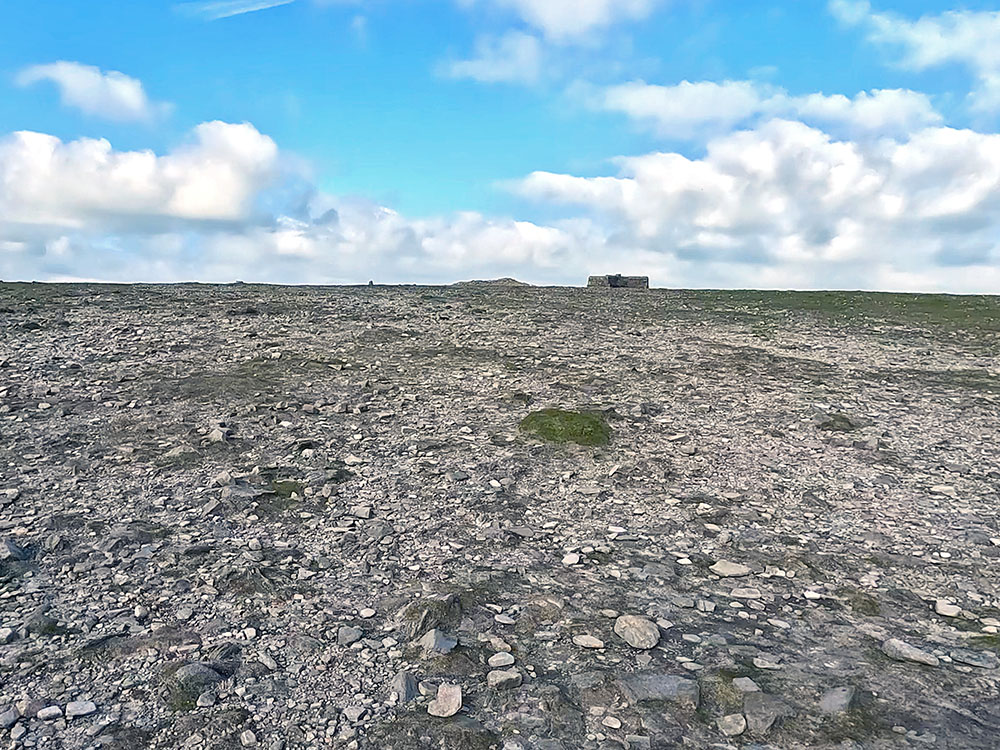
Just before reaching the summit plateau of Ingleborough, we reach a stone marker. This is a very important marker as, after having visited the summit of Ingleborough, we return to it as part of our home-bound leg.
Passing by the stone waymarker that marks where the path splits on the return down from Ingleborough summit
If you look behind at this marker, besides getting the wonderful view, you can see the path that we've just come up to the marker and then to the right of that you can see another path leading away across Simon Fell Breast. This is the path that we're going to take when we come down to the marker.
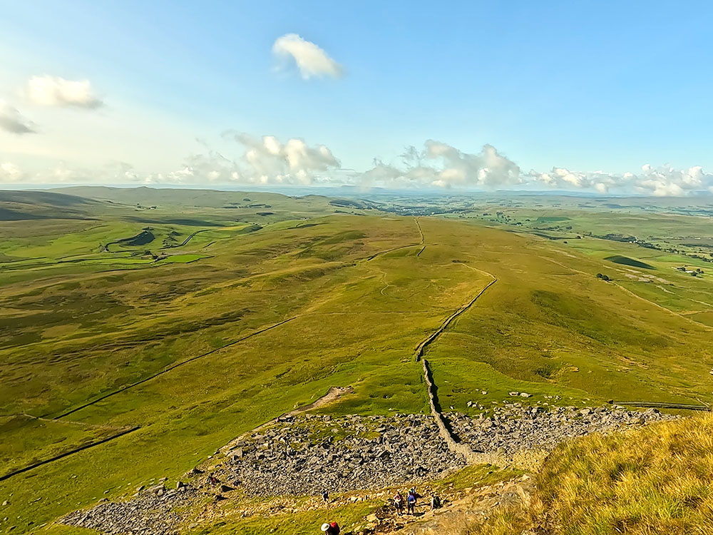
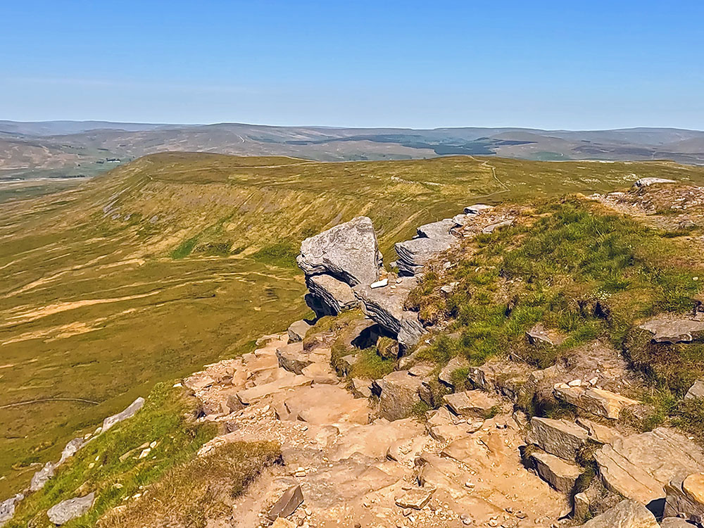
Continue past the stone marker up the steps. Just before reaching the summit plateau, you pass to the right of this large boulder. Take note of this, as when you are coming off the summit plateau, you need to spot this and spot the path that comes back down to the left of it.
The path that passes by the large boulder just before reaching the summit plateau on Ingleborough
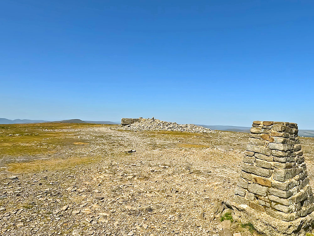
On reaching the summit plateau, you can see a couple of cairns to the right. The path passes by the second one keeping more or less along the edge and then heads diagonally left across to the weather shelter and the trig point about 100 metres further on. In bad visibility, you should take a compass bearing from this point to the trig as this is the point where people are tired and more likely to make mistakes, and this is where most people get lost on the top of Ingleborough.
If you want to find out more about Ingleborough, its fascinating geology, both above and below ground and our selection of the best Ingleborough walks, then check out our Ultimate Guide to Ingleborough.
Heading across Ingleborough summit plateau towards the trig point and weather shelter
On a clear day, there's no issue with that because when you reach the second cairn, you can start to see the weather shelter up on the horizon. Ingleborough's trig point is just past the weather shelter.
Looking over the trig point on Ingleborough out towards Morecambe Bay
At 724 metres high, Ingleborough is the second highest of the Yorkshire Three Peaks behind Whernside. Ingleborough on a clear day provides views to the Lakeland Fells to the north and as far away as the Snowdonia range to the south. From here you can see out to the sea at Morecambe Bay, and then as you look around to the right, you can see the faint outline of the Lakeland Fells and then to the left of the weather shelter you can see the top of Whernside and on the far horizon behind it, the Howgills. Then, as you look around, you can again see the top of Pen-y-ghent.
Looking over the trig point on Ingleborough over the weather shelter and Whernside towards the Howgills
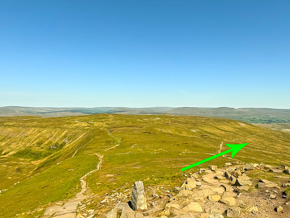
We start the descent now by reversing the outward route, so pass by the weather shelter. The four-sided weather shelter makes sure there's somewhere to sit out of the wind. Continue reversing the path we came up, as we reach the edge of Ingleborough's summit plateau.
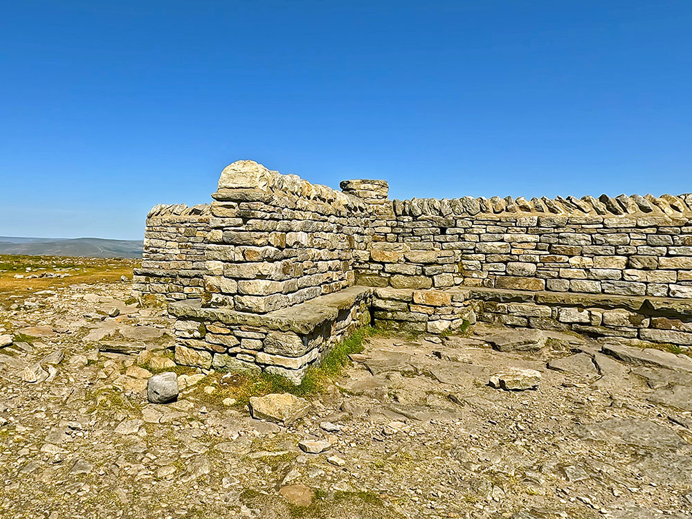
Weather shelter on Ingleborough
Wandering the edges of Ingleborough does provide some additional views. Down below you can see the Ribblehead Viaduct and then again around Whernside. For now, just continue along the path that keeps quite close to the edge. After passing by the cairns we passed on the way up, look for where the path branches off to the left to head down the left-hand side of the large boulder we passed on the way up.
Path heading back past the boulder from the summit plateau
From the large boulder, you again get a great view down towards the Ribblehead Viaduct and to Whernside. Just continue down now along the rough path - hands may be needed on odd sections until you reach the stone marker.
Looking across towards the Ribblehead Viaduct, Whernside and the Howgills beyond from the large boulder
As mentioned earlier, the left-hand path here is the one that we came up from the Old Hill Inn. This time to get back to Horton, we will take the right-hand path that heads across Simon Fell Breast.
Back at the stone waymarker where the path splits - the right-hand path heads back towards Horton in Ribblesdale
Follow the path that initially heads down some steps and passes by a small tarn on your left to head across Simon Fell Breast.
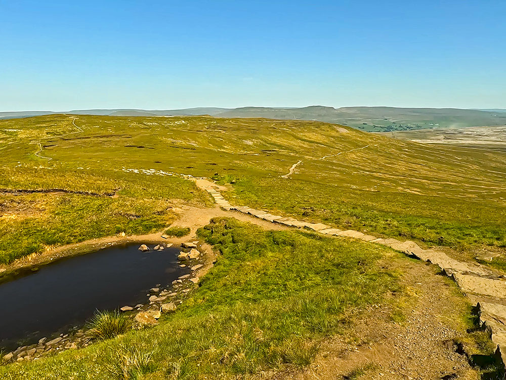
Flagged path passing by a small tarn as it starts heading across Simon Fell Breast
Whilst walking along this path, if you look over and back to the right, you can see Little Ingleborough leading up onto Ingleborough which we have just walked over.
Path heading across Simon Fell Breast
Looking back up at Ingleborough from the path on Simon Fell Breast
After about one mile from the stone marker, a wall stile is reached. Pass over this and then continue along the path in the direction of Pen-y-ghent directly ahead.
Looking over the wall stile on Simon Fell Breast towards Pen-y-ghent
As part of your training for the Yorkshire 3 Peaks Walk, for familiarising yourself with the Ingleborough part of the walk, we'd suggest including our Ingleborough walk from Horton in Ribblesdale as part of your training. You will then be able to familiarise yourself with the route off Ingleborough, which can be a little tricky in bad visibility.
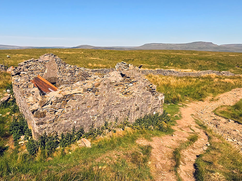
At one point, the path heads over some boards that keep you out of the marshy area underneath. Then, just after a short flagged section, pass by a disused shooting hut. The shooting hut is mentioned and marked on the Ordnance Survey map.

Heading across the wooden boards with Pen-y-ghent ahead
Passing the ruins of the shooting hut with Pen-y-ghent on the horizon
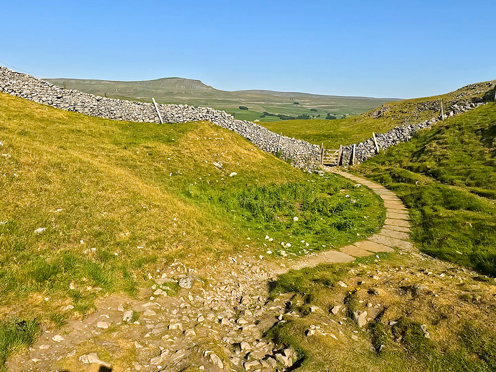
The path then crosses a small stream, straight after which pass through the wooden gate. There is a signpost at that gate showing two-and-three-quarter miles back to Horton in Ribblesdale. Head away from the wall and a short distance further on, where the path splits, we take the left-hand path in the direction of Pen-y-ghent following the yellow arrow on the wooden waymarker.
At the path split the 3 Peaks path takes the left-hand fork, continuing in the direction of Pen-y-ghent ahead
We then walk along between the wall and the limestone pavement, which is nearby to Sulber Pot. Pass through the next gate and then just continue straight along the path.
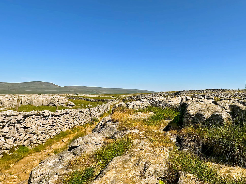
Passing through the limestone pavement on the 3 Peaks path
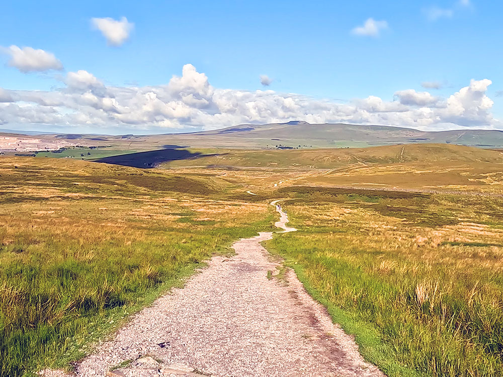
For most of the route back to Horton, there are views of Pen-y-ghent ahead. The path that we follow back now is mainly either gravel or flagged, but very easy to follow.
Flagged path heading in the direction of Pen-y-ghent on the horizon
After a further 400 metres, we arrive at the three-fingered, which used to be a four-fingered, signpost. Here, we just head straight across following the Horton in Ribblesdale two miles footpath sign.
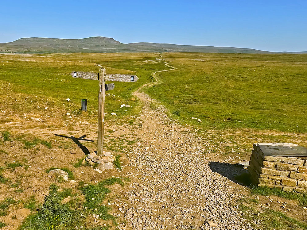
Yorkshire 3 Peak's path continues straight ahead at the signpost.
Pass through the next gate and again just continue straight on.
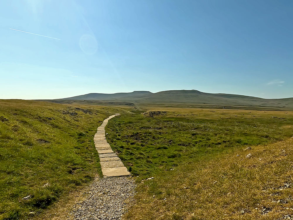
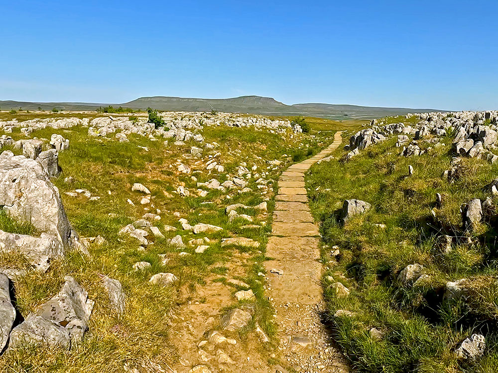
Walking along the flagged Yorkshire 3 Peak's path through Sulber
Flagged Yorkshire 3 Peak's path heading down towards the gate in the wall just past Sulber Nick, with Pen-y-ghent on the horizon
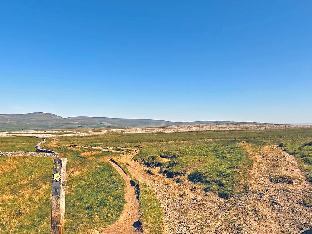
At the next signpost again, head straight on following the Yorkshire Three Peaks Horton in Ribblesdale one-mile footpath sign.
Yorkshire Three Peaks footpath sign to Horton in Ribblesdale pointing towards Pen-y-ghent on the horizon
The path heads through bits of exposed limestone, then through a gap in a wall and then bends around to the right.
3 Peaks path passes through the gap in the wall with Pen-y-ghent ahead on the horizon
The path now passes by various waymarkers and cairns. Pass through the gate by the side of the information board and then continue straight on along the path.
3 Peaks path passes by the information board before passing through the gate
Upon meeting a wall, pass through another gate and again continue straight ahead.
Heading across the fields back towards Horton in Ribblesdale with Pen-y-ghent on the horizon
Through one more gate, the end is almost in sight. You can see Horton now down below. Head across this final field, and pass through the gate from where you can see Horton in Ribblesdale train station below.
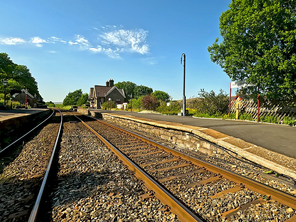
Cross the Settle to Carlisle railway line at Horton in Ribblesdale train station
Once through the gate, head down the side of the fence. As the sign says - Stop, Look and Listen for any oncoming trains. If all is clear, cross, taking great care. Once over the track pass through the gate across and then head down to the road and then just continue straight across until we meet the road at the bottom.
Heading along the pavement with Pen-y-ghent ahead on the horizon
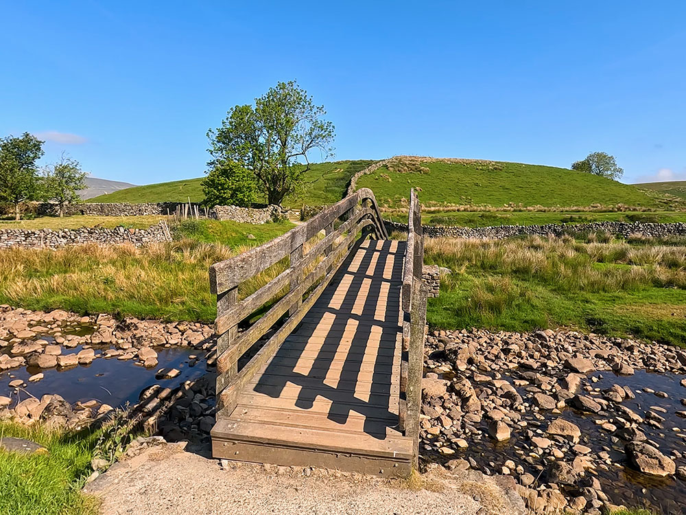
Upon meeting the road just continue straight on along the pavement. At the end of the pavement, follow the pavement around to the right to head over the wooden footbridge. The slight rise on the footbridge is the very, very last climb of the day and we're almost back in the car park!
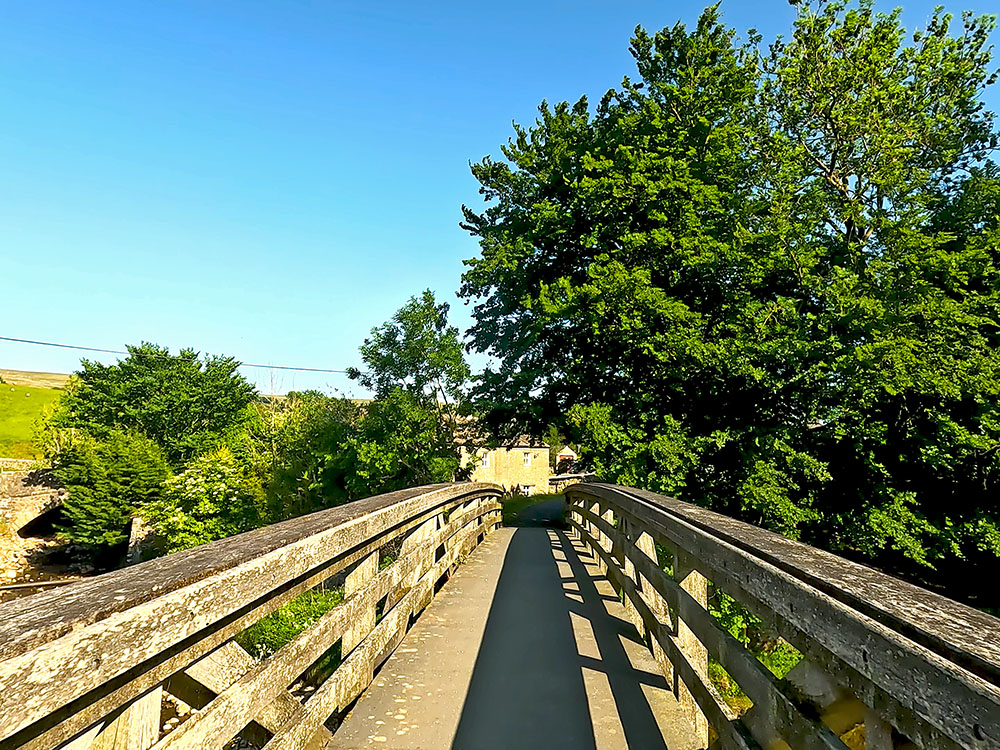
Heading over the wooden bridge over the River Ribble
If you look over to the left from the bridge, you can see the Crown Hotel, which is one of the two pubs in Horton, along with the Golden Lion.
Over the bridge, we head back into the car park to finish the walk.
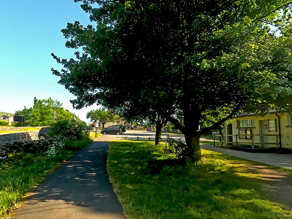
Arriving back at the car park in Horton in Ribblesdale - the end of the Yorkshire 3 Peaks Walk
If you are enjoying this walk, whilst you are in the area, and if you have time on another day, why not check out the Ingleton Waterfalls Trail?
If you have finished the Three Peaks Walk, after just over 24 miles of walking and 1,600 metres of climbing, you might need something to eat and drink.
If you have travelled and are staying in nearby Settle, Ingleton or Hawes or elsewhere in the area, there are many great pubs and restaurants there. But if you need something more local we have set out a few places within 2-3 miles of the walk.
The first place is the Crown Hotel which could be seen from the bridge. Turn left out of the car park, head over the bridge and in front of you is the Crown Hotel. As of August '23, I believe the Crown Hotel is still open, but there is a sign saying the business is up for sale. It serves food and drinks and on reading some online reports, and I've not been in for a while, I'm not sure whether it's dog-friendly or not. So best to check first if you've got a dog with you.
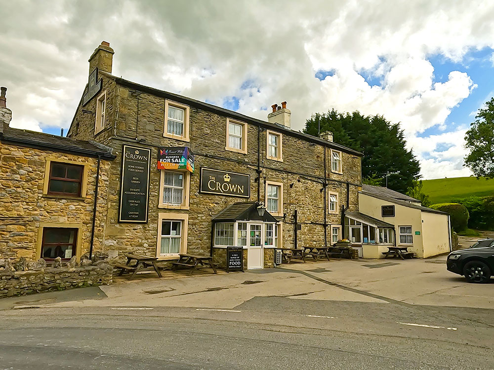
The Crown Hotel Horton in Ribblesdale
Instead of turning left out of the car park, if you turn right, as we did at the start of the walk, after walking a couple of hundred metres you reach the Golden Lion Hotel. The Golden Lion Hotel serves food and drink and has some accommodation. I believe dogs are allowed in the bar and the taproom. It also offers all-day parking.
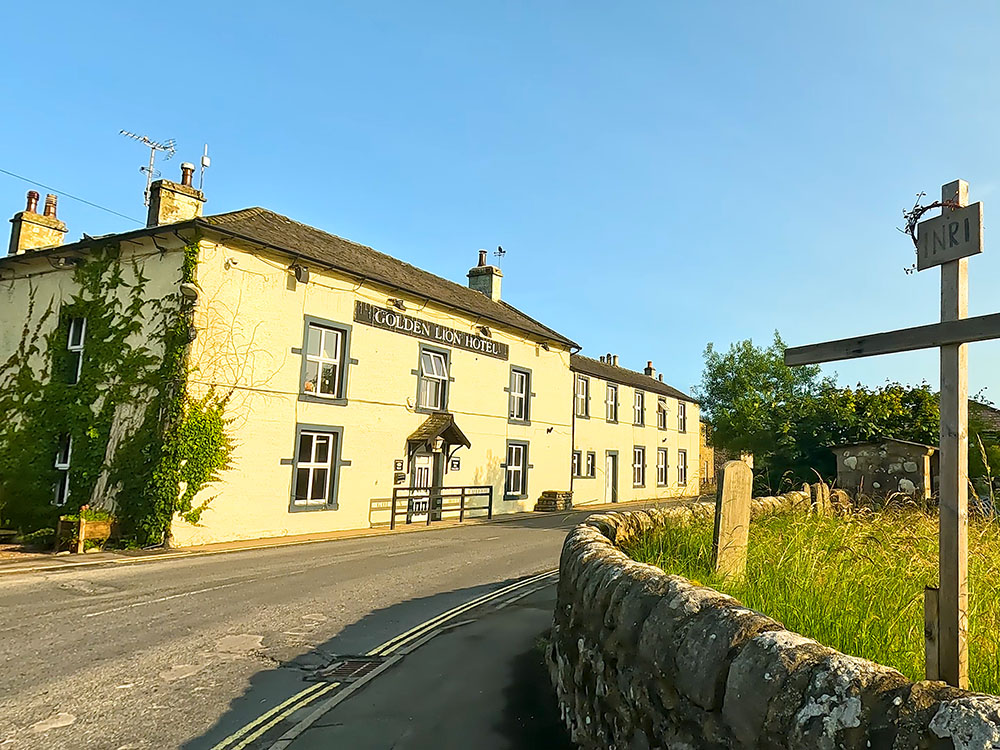
The Golden Lion Hotel Horton in Ribblesdale
There is also the Blindbeck Tearoom in Horton, which when you exit the train station, if you turn left the tea room is about 400 metres along the road on the right-hand side and according to their website, serves hot and cold refreshments and has its own car park. It does say that dogs aren't allowed in the tea room.
Everyone will have their favourites, but if I wanted something to eat or drink after the walk locally, currently I generally call in Middle Studfold Tarm Tea Room or the Helwith Bridge Inn, both within two miles on the road to Settle or the Gamecock Inn about three miles away in Austwick.
I like Middle Studfold as you are off the main road and it has views. It serves homemade food, sandwiches, all-day breakfasts, toasties and cakes, along with a range of alcohols, teas and coffees.
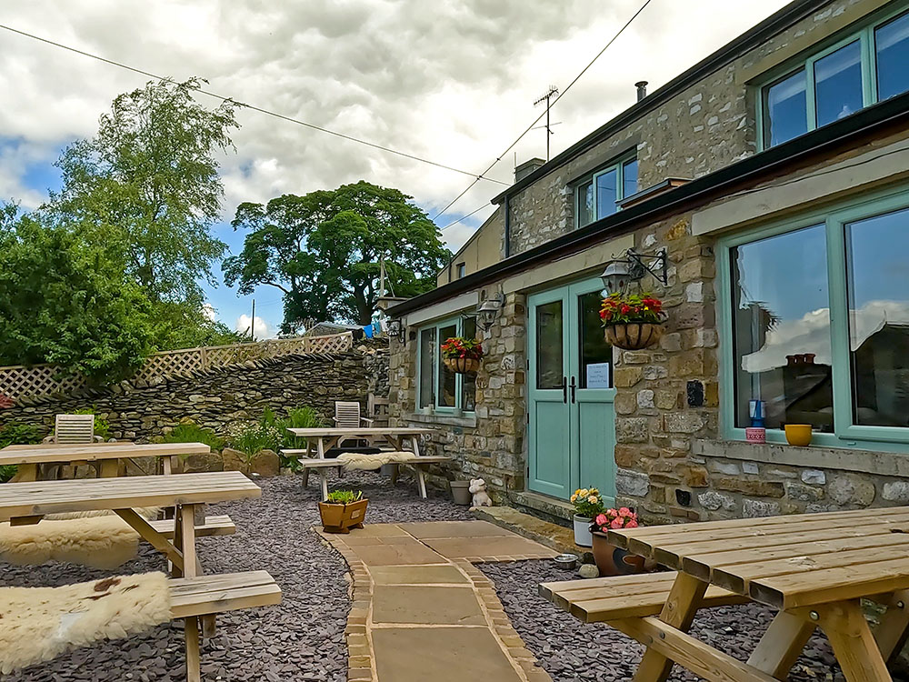
Middle Studfold Farm Tea Room near Horton in Ribblesdale
A little further on, just off the road to Settle is the Helwith Bridge Inn. It serves food and for me, a plus point is up to eight real ales on the bar, many brewed locally. It is on the side of the River Ribble and has the Settle to Carlisle railway line running right past it. It's also dog-friendly. It has a bunk barn and check with them first, but I also believe it allows camper vans overnight in the car park and basic camping in the field next to the pub, if you need low-cost accommodation near the walk.
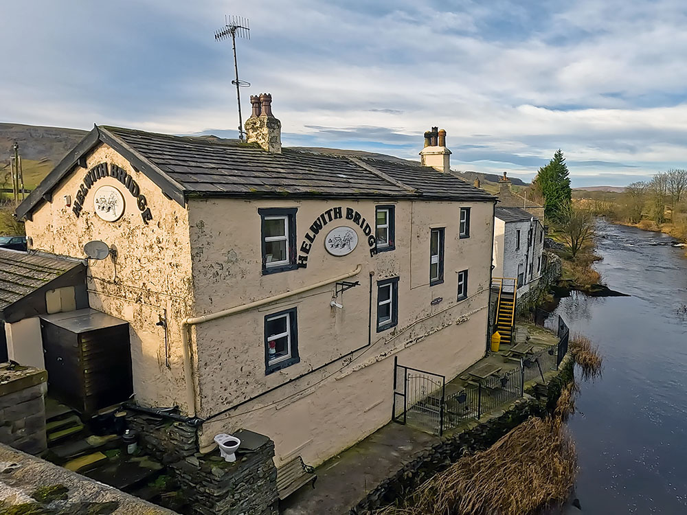
The Helwith Bridge Inn
The other place I mentioned is the Game Cock Inn, just under three miles away in Austwick. It has good food with a French twist, has a range of cask ales and is dog-friendly in the bar area. There is some accommodation and another beer garden around the back. It also has a bakery with desserts and pastries to take out. You may notice the sign saying business to let. But since I filmed the Gamecock, I've read that Eric the French chef and owner is now staying for a few more years, which is good as I've always enjoyed the food there.
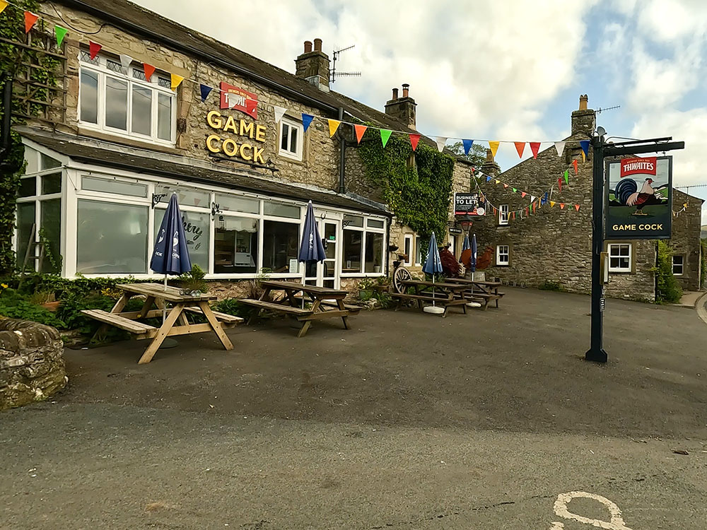
Game Cock Inn in Austwick
We also passed two pubs on the way around - the Station Inn and the Old Hill Inn. I've had a few good meals in the Old Hill Inn in the past, but I believe at the moment it is only open in the evenings and they generally only serve food to the residents staying there. But they do take extras from time to time if they have the staff. So I would suggest ringing them first to confirm.
The Station Inn at Ribblehead is handy if you started the walk there or if the timing is right if you want to call by on the way around. The Station Inn serves food and drink, is dog-friendly and has some accommodation.
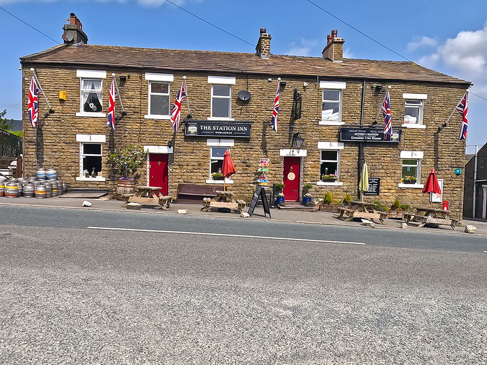
The Station Inn near the Ribblehead Viaduct
It was built at a similar time to the Ribblehead Viaduct and was licensed in 1879. It also has a beer garden around the back with views of Whernside and the Ribblehead Viaduct. I believe you can book in at the bar and stop in a camper van here in the car park.
The Station Inn beer garden looking towards Whernside and the Ribblehead Viaduct
If you've enjoyed our video of the Yorkshire Three Peaks walk and you haven't already, please go onto YouTube and click the like button, subscribe to our channel and hit the notification bell, so you know when any new walks have been uploaded. It is free to subscribe and your likes and comments really do help promote our channel. 😊
Whilst the 3 Peaks Club run by the Pen-y-ghent Café may be a thing of the past, so no more 'official' Yorkshire 3 Peaks Club 'ties' or 'sew-on patches', we've come across a few items of Yorkshire 3 Peaks merchandise that you may wish to purchase to celebrate completing the walk.
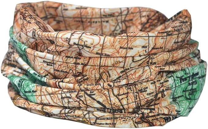
A hypoallergenic, microfibre neck warmer / snood featuring the Yorkshire 3 Peaks - almost a base layer for your head and neck!
 |
 |
You've done the walk, now get the T-shirt to show everyone what you've done! Available in 6 colours.

|
|

|
|
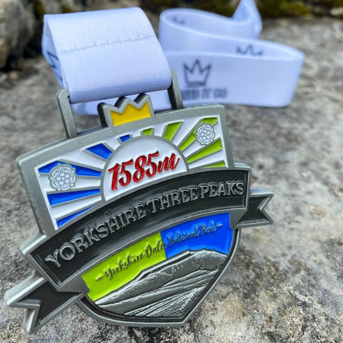
If T-shirts aren't your thing... how about a medal to say 'I've done the walk'?
|
|
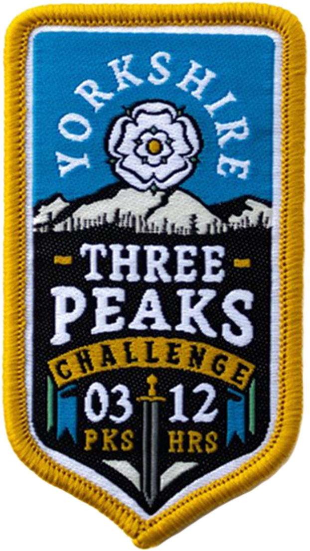
A Yorkshire Three Peaks Challenge woven patch celebrating climbing Pen-y-ghent, Ingleborough and Whernside within 12 hours.
The mountains known as the Yorkshire 3 Peaks are Pen-y-ghent, Whernside and Ingleborough. The 24.6-mile circular walk that takes in the summits of Pen-y-ghent, Whernside and Ingleborough is called the Yorkshire 3 Peaks Walk or the Yorkshire 3 Peaks Challenge and includes just over 1,600 metres of climbing.
The vast majority of walkers walk Pen-y-ghent first, then Whernside and finally Ingleborough, starting and ending in Horton in Ribblesdale, so doing them in an anti-clockwise manner.
As there is no official start point and it is a circular walk, you can start anywhere on the walk and do it anti-clockwise or clockwise.
Most walkers start the walk in Horton in Ribblesdale.
As it is a circular walk, you can start the walk from another point, such as Ribblehead or Chapel le Dale, but Horton in Ribblesdale is by far the most used starting point.
April to early September is the best time of the year to do the Yorkshire 3 Peaks Walk. From April to early September, the days are longer than the nights, so there are more than 12 hours of sunshine.
You can take as long as you like to do the Yorkshire Three Peaks walk, but the 'challenge' is to do the walk in under 12 hours, so having more than 12 hours of potential sunshine helps with this. Many people set off early just before the sun rises, to extend the period of daylight that they have in which to complete the walk.
The Yorkshire 3 Peaks Walk is a 24.6-mile long walk from Horton in Ribblesdale in the Yorkshire Dales and includes 1,610 metres of ascent. The Yorkshire Three Peaks Walk passes over the summits of Pen-y-ghent (694 metres), Whernside (736 metres) and Ingleborough (724 metres).
No, you do not have to do the Yorkshire 3 Peaks walk for charity.
Most people walk the Yorkshire Three Peaks on their own, with small groups of friends or work or club colleagues. If you are unsure of the directions or want to raise money for your chosen charity, there are many organised charity Yorkshire 3 Peaks Walks that you could sign up for.
Yes, the Yorkshire 3 Peaks charity walk route map takes in Pen-y-ghent, Whernside and Ingleborough joining them together in a circular route from Horton in Ribblesdale.
If you have a phone or GPS device you can download for free the GPX route for the Yorkshire 3 Peaks Walk.
Many people just download the GPX route file onto their smartphone and look at it in a mapping app. The mapping app I currently use is the Ordnance survey mapping app, and for just £2.99/month I get access to all their 1:25,000 maps in the UK along with many other maps and features, including the ability to print maps.
Ordnance Survey Mapping App
Use on any device and make it easy to explore the great outdoors for just the price of a coffee a month. Premium allows full UK access to all OS Explorer and Landranger mapping, along with the ability to import and export routes, save maps offline, aerial 3D, and print A3/A4 maps.
If you already have the Ordnance Survey mapping app, then simply look at Horton in Ribblesdale on the map, choose 'Find Routes'
from the menu, click on 'walk/hike' and drag set the length setting to (say) 32km, so it only shows the longer walks from Horton in
Ribblesdale. Click 'Find Routes'. It will return you to the map and show a number in a circle. This is the number of walks on the OS
mapping app that meet those criteria.
In that list you will see a walk called 'Walks4all: Yorkshire Three Peaks Walk'. Simply click on that and you will have the Yorkshire 3 Peaks Walk route shown on the map on your phone. There are options to download offline, which is advisable, so the map and route will be there even if you have no signal whilst out on the walk. Then simply click on 'Start Route' and away you go!
The Walks4all walk is shown on the Ordnance Survey mapping app because we (Walks4all) are a recommended Route Partner to Ordnance Survey. All our walks on the website can be found on the Ordnance Survey mapping app.
Just in case my phone runs out of power I always take a power bank with me. Mobile phones and GPS devices use more power when utilising GPS and that and taking lots of photographs on the way around can cause your battery to run low or run out of power.
So, I also always ensure I have a paper map of the area that I'm walking in as well. If you have the mapping app, you can print the relevant map areas out and take them with you, or just take the OS map that includes the walk. The Ordnance Survey map that includes the Yorkshire 3 Peaks walk is the Ordnance Survey - Explorer OL2 (Yorkshire Dales - Southern & Western Area) map.
How long it takes to do the Yorkshire 3 Peaks walk depends upon your level of fitness, the level of fitness of others in your group or walking partyy and how much you have prepared and trained for the walk. The Yorkshire 3 Peaks 'challenge' is to do the walk in under 12 hours. Most reasonably fit, well-prepared walkers take on average between 9 and 11 hours to do the walk.
The Yorkshire Three Peaks Challenge for Charity is walking the 24.6 miles Yorkshire 3 Peaks walk, starting from Horton in Ribblesdale in the Yorkshire Dales and climbing the 1,610 metres of ascent needed to pass over Pen-y-ghent, Whernside and Ingleborough within 12 hours for your chosen charity.
The Yorkshire 3 Peaks charity walk route in the Yorkshire Dales as shown above in the Ordnance Survey map goes over Pen-y-ghent, Whernside and Ingleborough joining them together in a circular route from Horton in Ribblesdale that is 24.6 miles long and includes over 1,600 metres of climbing.
If you have a phone or GPS device you can download for free the GPX route for the Yorkshire 3 Peaks Walk.
The GPX file can be used on mapping apps such as the Ordnance Survey mapping app, from which besides having the app on your phone, you can also print a paper copy of the Yorkshire 3 Peaks charity walk route. The Walks4all Yorkshire 3 Peaks route is already on the Ordnance Survey mapping app, because Walks4all is an Ordnance Survey recommended route partner.
Mobile phones and GPS devices can run out of power, so consider taking a power bank with you - mine has been a mainstay on my rucksack now for many years! As a backup you should always have a paper map of the area in which you are walking. I always carry the relevant Ordnance Survey map with me, which in this case is the Ordnance Survey - Explorer OL2 (Yorkshire Dales - Southern & Western Area) map, which includes the paths used in the Yorkshire Three Peaks walk.
Gifts and presents for hikers and walkers
Are you struggling to pick the perfect gift for your hiking-loving friend or family member? Don't fret! Explore our curated selection of top-notch gifts for walkers and hikers that will have them trekking with joy on their special day.
What to wear and take on your walk or hike
Whether you are a seasoned hiker or new to walking, wearing and taking suitable hiking kit and clothing is essential for a day hike for your comfort and safety. So we have put together a hiking essentials checklist to cover all you'll need. Our Hiking Essentials checklist for 2026 takes you through planning your walk, the hiking essentials checklist itself, optional extras, explanations, and recommendations for all the hiking essentials.
Check out the reviews for this walk: