By using this website, you agree to our use of cookies (needed to provide our website’s features) and our Terms of Use.

One of the 'Yorkshire Three Peaks'. See the wonderful panoramic views from the summit of Pen-y-ghent before returning via Hull Pot.
In accordance with our Disclaimer, you agree to take full responsibility for any use you make of the information contained in these pages.
This page contains affiliate links. If you buy products or services via these links, we may earn a small commission at no cost to you.
| Walk title: | Pen-y-ghent walk from Horton in Ribblesdale |
| Author: | Andrew Forrest - Updated October 2023 |
| Walk start point: | Pay and display car park in Horton in Ribblesdale (grid reference SD 807 725). What3words: tonality.curl.routs |
| Parking: | As above. Some paid parking at Golden Lion Hotel. A small amount of roadside parking is available, but please park responsibly as Horton does get busy, especially at weekends and bank holidays. |
| Directions to nearest parking place: | Google Maps: get directions here / What3words: harmless.outgrown.fake |
| Walk distance: | 10.1 km |
| Estimated walk time: | 3 hours 5 minutes |
| Height climbed: | 470 metres |
| Technical difficulty: | Moderate - as determined by our interpretation of the Ordnance Survey guidance on technical difficulties |
| Peaks / summits: | Pen-y-ghent (694m) |
| Map: | Ordnance Survey - Explorer OL2 (Yorkshire Dales - Southern & Western Area) Buy this map from Ordnance Survey |
| GPS/GPX file: | Download available to registered users - Register and Login here - It's FREE to register |
| Facilities / refreshments: | Helwith Bridge Inn and Middle Studfold Farm Tearoom within 2 miles on road to Settle. Golden Lion Hotel and Crown Hotel in Horton in Ribblesdale itself. For a wider selection, there are many pubs, restaurants and cafés in Settle 6 miles away - check out the walk video for further details. |
| Nearest town: | Walk starts in Horton in Ribblesdale |
| Local self-catering accommodation: | View self-catering accommodation close to the start of this walk |
Estimated walk time
Walk time estimates used are from the Ordnance Survey mapping app, which uses a refined Naismith's rule, adjusted by OS overlaying their own data collected from more than one million people using the OS mapping app. Naismith's rule allowed one hour for every three miles walked and added pro-rata an additional hour for every 2000ft of ascent - roughly one hour for every 5km, plus one hour for every 600m of ascent.
Ordnance Survey Mapping App
Use on any device and make it easy to explore the great outdoors for just the price of a coffee a month. Premium allows full UK access to all OS Explorer and Landranger mapping, along with the ability to import and export routes, save maps offline, aerial 3D, and print A3/A4 maps.
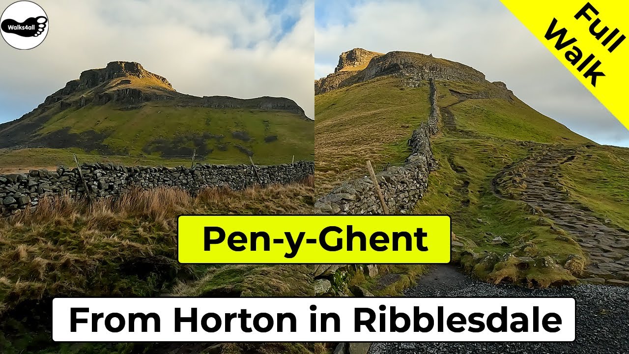
This Pen-y-ghent walk from Horton in Ribblesdale via Hull Pot in the Yorkshire Dales takes approximately 3 hours and 5 minutes. Pen-y-ghent along with Ingleborough and Whernside make up what is known as the 'Yorkshire Three Peaks' and this walk is one of the most popular Yorkshire Dales walks.
Pen-y-ghent is visible from the start of the walk and most of the way around. We leave Horton in Ribblesdale via Brackenbottom and then gradually climb along the '3 Peaks' path until we meet the Pennine Way. Here the path climbs two steeper sections to arrive at the trig point on the top of Pen-y-ghent, which affords wonderful panoramic views, including Fountains Fell, Ingleborough and Whernside.
We take a short detour on the return to visit Hull Pot, reputed to be the biggest natural hole in England.
This full Pen-y-ghent walk is shown in the video and the route for the walk is shown on the Ordnance Survey map - both above. Below is a brief description of the walk. Places where you can eat and drink after the walk are shown at the end of the video.
From the pay and display car park in Horton in Ribblesdale in the Yorkshire Dales, you can see the distinctive outline of Pen-y-ghent on the horizon. There is an information sign on the outside of the toilet block in the car park, informing us about the village.
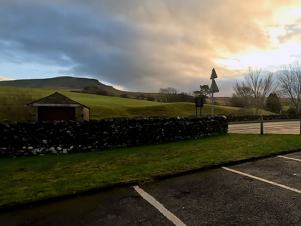
Pen-y-ghent from the car park in Horton in Ribblesdale
Horton in Ribblesdale was mentioned as far back as in the Domesday Book. For those of you whose histories are a distant memory, the Domesday is Britain's earliest public record, commissioned by William I in 1085. A guide to who owned what land and what it was used for.
We start the walk by exiting the car park and then turning right along the road. We soon pass by the Pen-y-ghent Café, which unfortunately has been closed for a few years now. You used to be able to clock out and back in there when doing the Yorkshire Three Peaks walk using their antique clocking-in machine. It also used to act as a safety feature as they then know who hadn't returned and who may still be out on the hills, as you left your details on the clock card.
Continue on along the pavement, away from the car park and the café. Over to the right if you want to stop in Horton, is Holme Farm campsite.
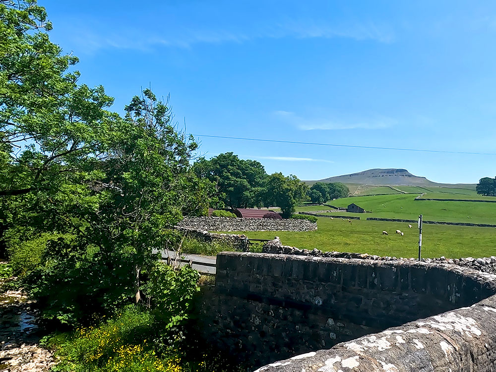
Walk on and cross the road and then as the road bends around to the left, Pen-y-ghent can be seen on the horizon behind St Oswald's church, parts of which date back to the 12th century. A couple of noteworthy features here are a Norman doorway and a tub font with herringbone decoration.
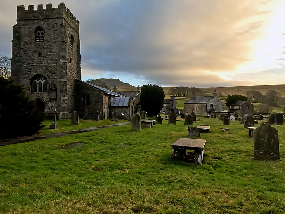
St Oswald's Church and Pen-y-ghent
If you look around across the road, you can see the Golden Lion Hotel, which if the main car park is full does offer some all-day parking as well.
Continue walking along the pavement, crossing a road junction, and then immediately over a stream. Straight after the stream, turn left along the road with the stream now over to your left-hand side.
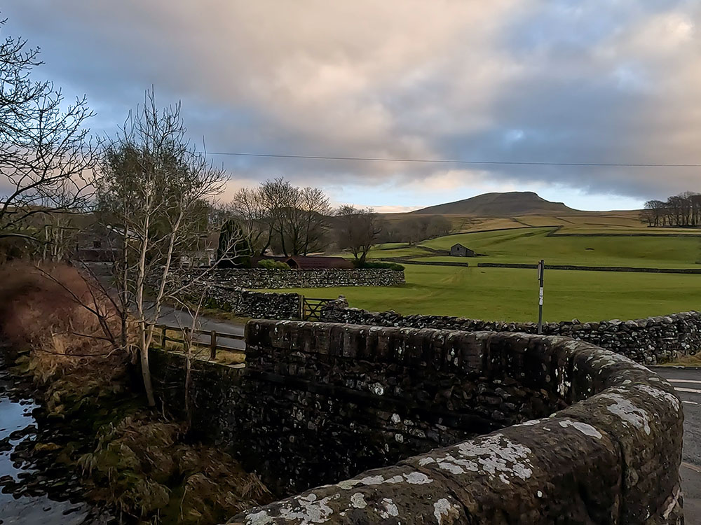
Left turn onto the road by the stream in Horton in Ribblesdale
Walk along the road, which soon passes by the old primary school. Continue walking along the road for about another 500 metres and when you reach the buildings at Brackenbottom, turn left through the gate just before them.
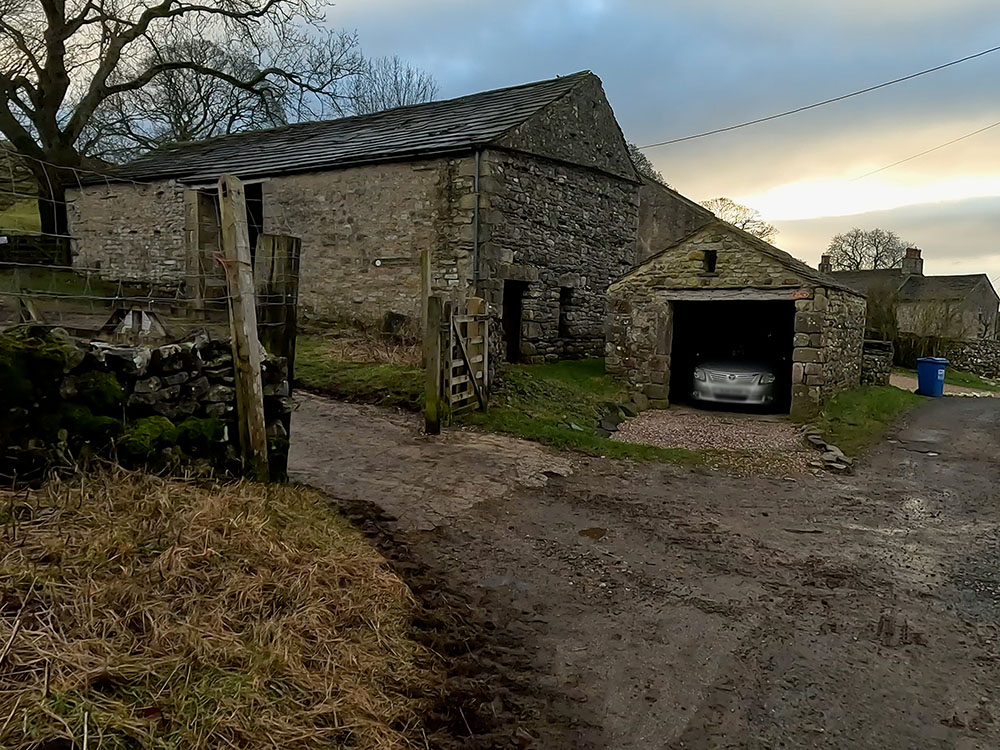
Approaching the buildings and footpath sign at Brackenbottom
Then follow the sign for Pen-y-ghent summit one and three-quarter miles. A few yards further on, pass through the gate in the wall and then turn left to start to climb the newly laid steps close by the wall.
Keep on climbing beside the wall. A gate in a crossing wall is soon reached, next to which there is a plaque asking for donations towards the Three Peaks paths. It costs £35 per meter to look after the paths in this area, so please consider donating. Pass through the gate, and then continue walking alongside the wall.
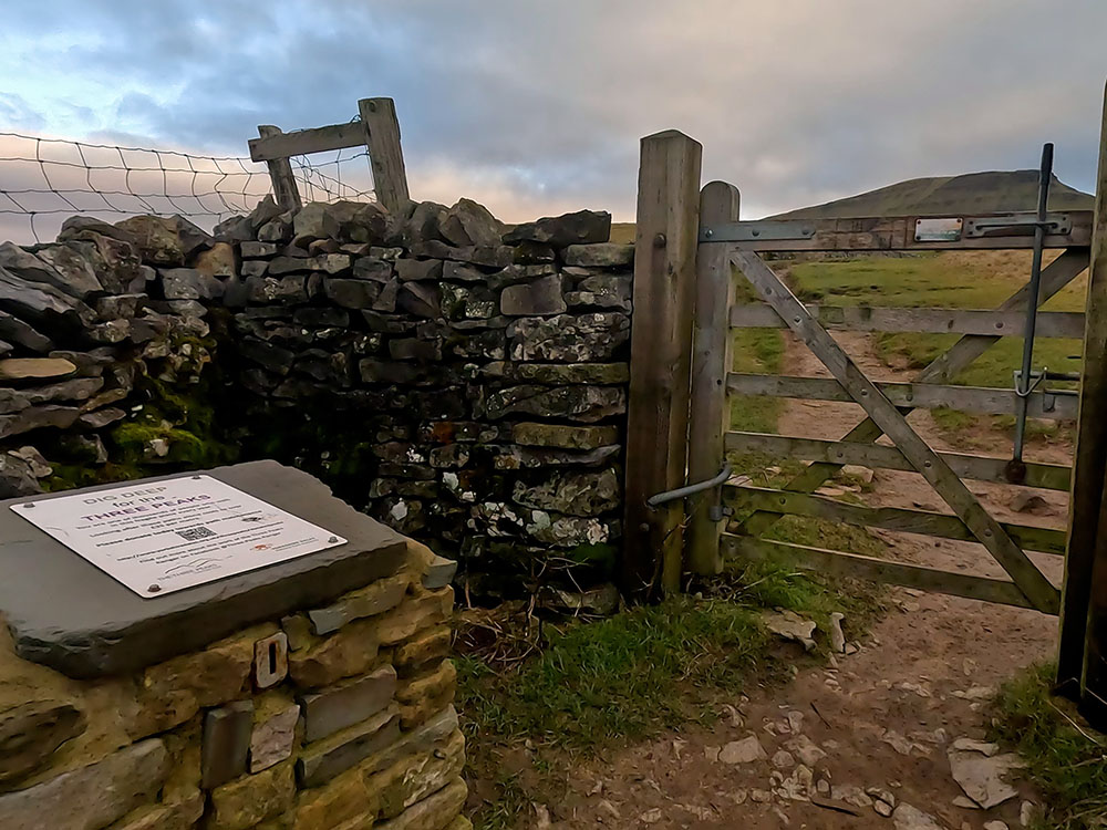
Three Peaks donation box and Pen-y-ghent
Pass through the next gate. If you stop to look around now, whilst Pen-y-ghent and Plover Hill are visible ahead, if you look around to the left, you can see through to the summit of Whernside and then the flat-topped Ingleborough. Behind us is the path we just walked up and behind that the quarry. Then as you follow the horizon around, you can see the distinctive shape of Pendle Hill in the distance.
Path alongside wall heading to Pen-y-ghent
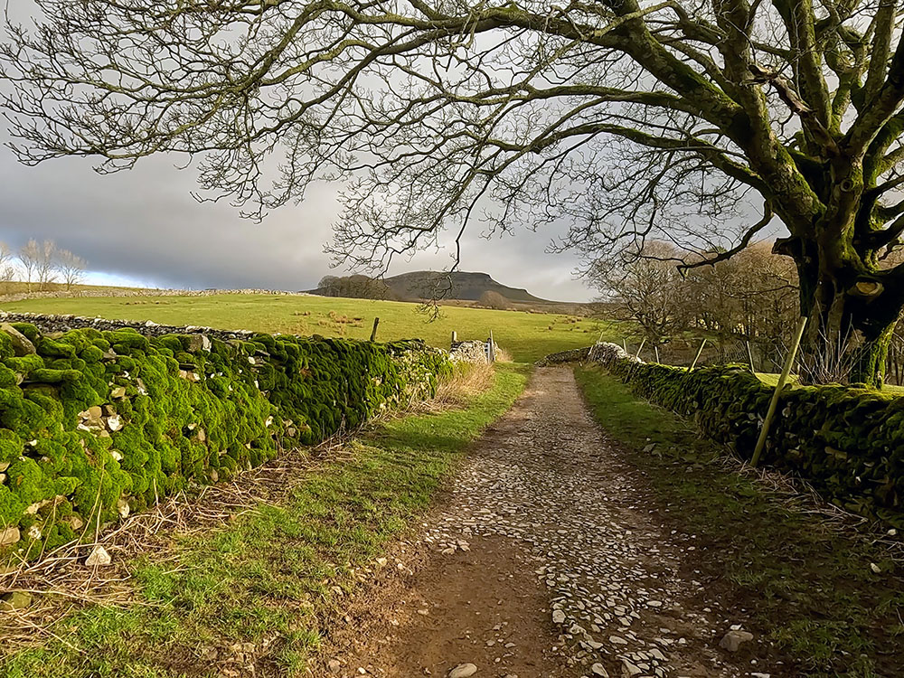
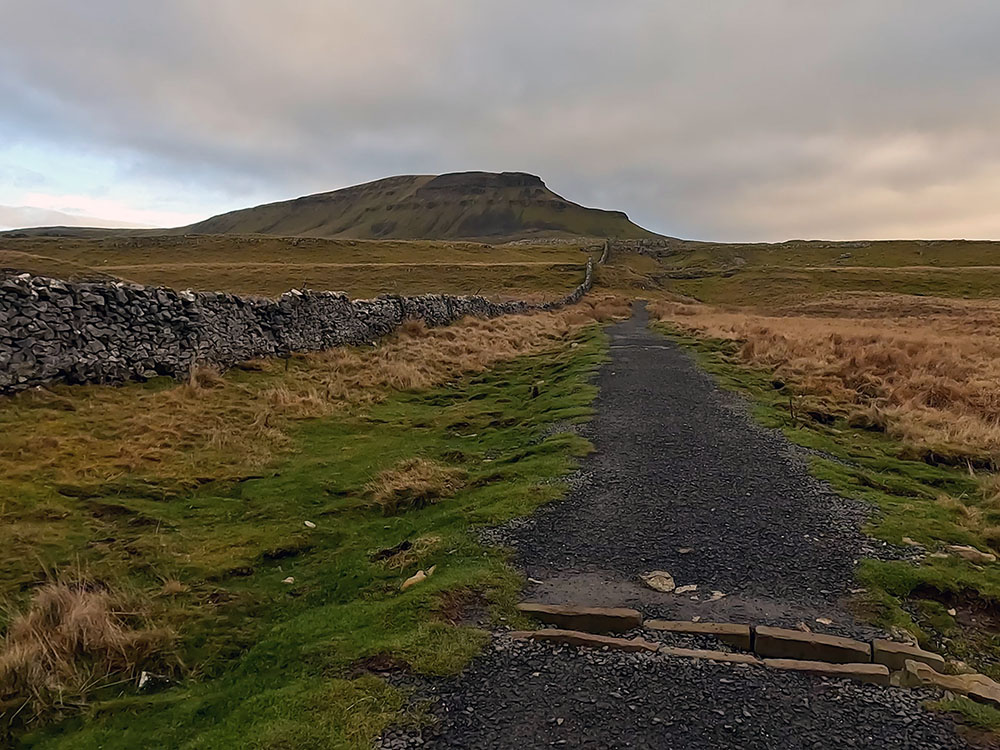
Keep on walking along the wide gravel path by the side of the wall. The path just leaves the wall from time to time to meander its way through various limestone outcrops.
If you have any thoughts about or comments on this walk or find there are any issues with any footpaths used when you walk it, please share that in the review section below.
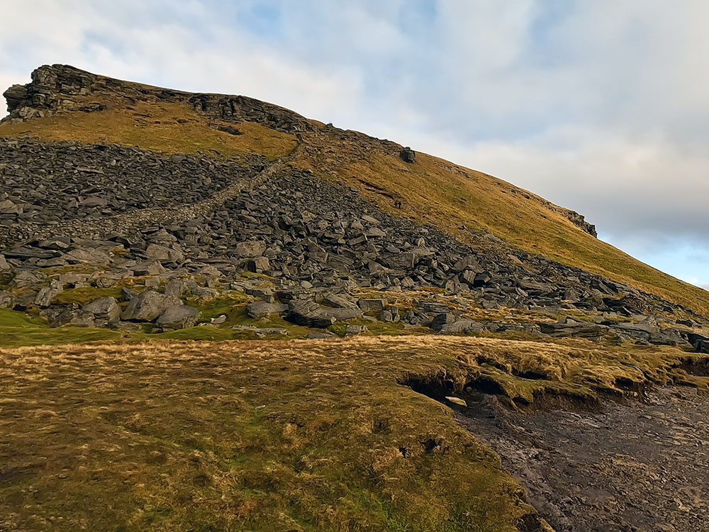
Pass through this next gate and then continue along the gravel path. The familiar 'crouching lion' shape of Pen-y-ghent is much nearer now and much more imposing with the two steeper climbs, both now visible.
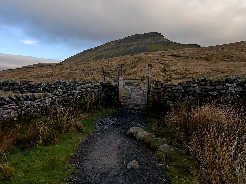
Gate on path heading towards Pen-y-ghent
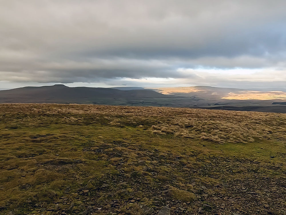
Looking behind now, the panorama has expanded further, with more of Whernside and Ingleborough being visible. As mentioned, the three of them make up what is known as the 'Yorkshire Three Peaks' with the walk around them being approximately 24 miles with just over 1500 meters of climbing. Pen-y-ghent is the shortest at 694 metres, Ingleborough is 724 metres and Whernside is the highest at 736 metres.
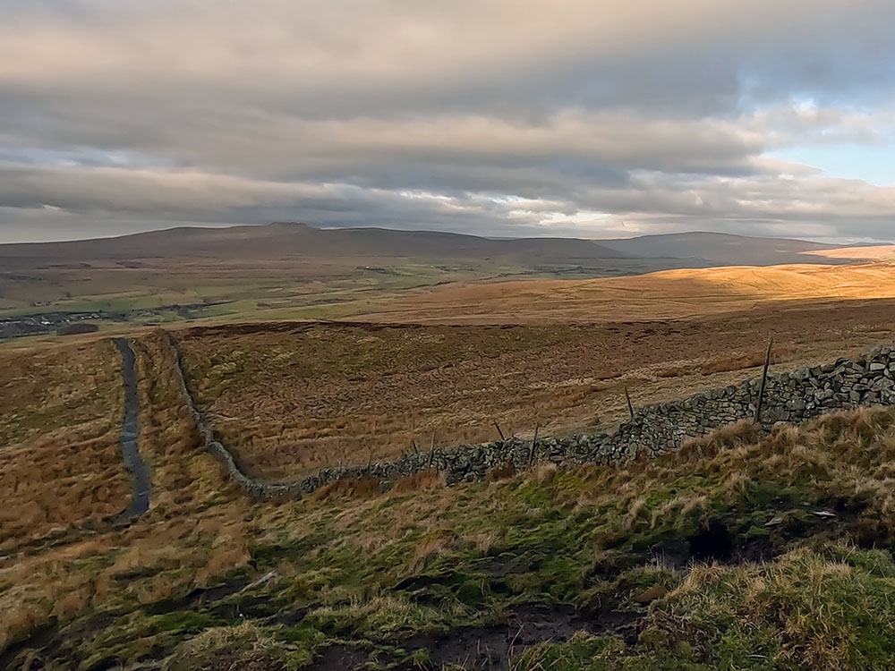
Looking back down path to Pen-y-ghent with Ingleborough on the horizon
Looking back down the path to Pen-y-ghent with Pendle Hill on the horizon
Through the next gate, directly across is Fountains Fell.
Gate through which the Pen-y-ghent path meets the Pennine Way
The path we join here is the Pennine Way Path, which you can see coming in from the right. The Pennine Way is a 268-mile walk from Edale in the Derbyshire Peak District to Kirk Yetholm in the Scottish Borders.

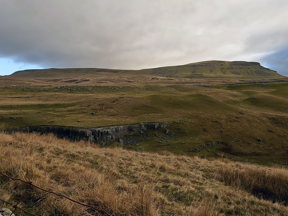
Looking across at Fountains Fell from the Pennine Way
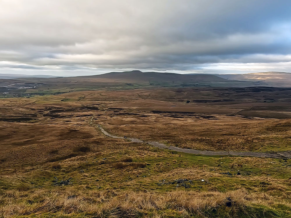
Looking back down the Pen-y-ghent path walked up from the Pennine Way with Ingleborough on the horizon
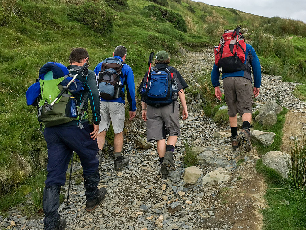
We turn left here and follow this Pennine Way sign as we start the first of two steeper climbs. The first one is initially up the steps.
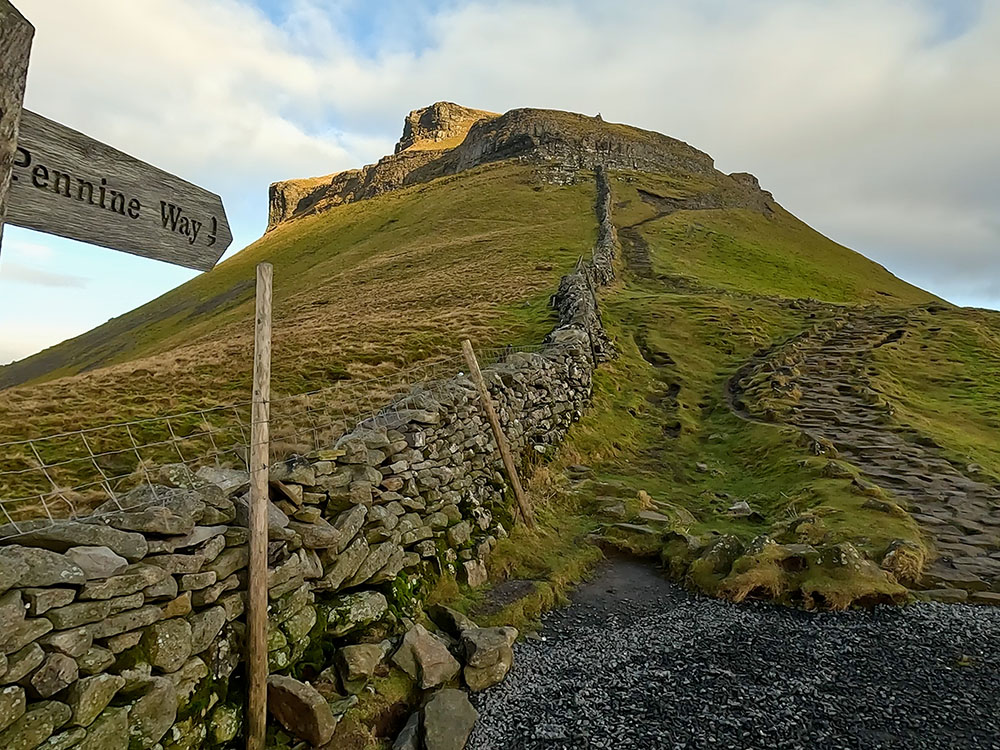
The initial steep steps up Pen-y-ghent on the Pennine Way
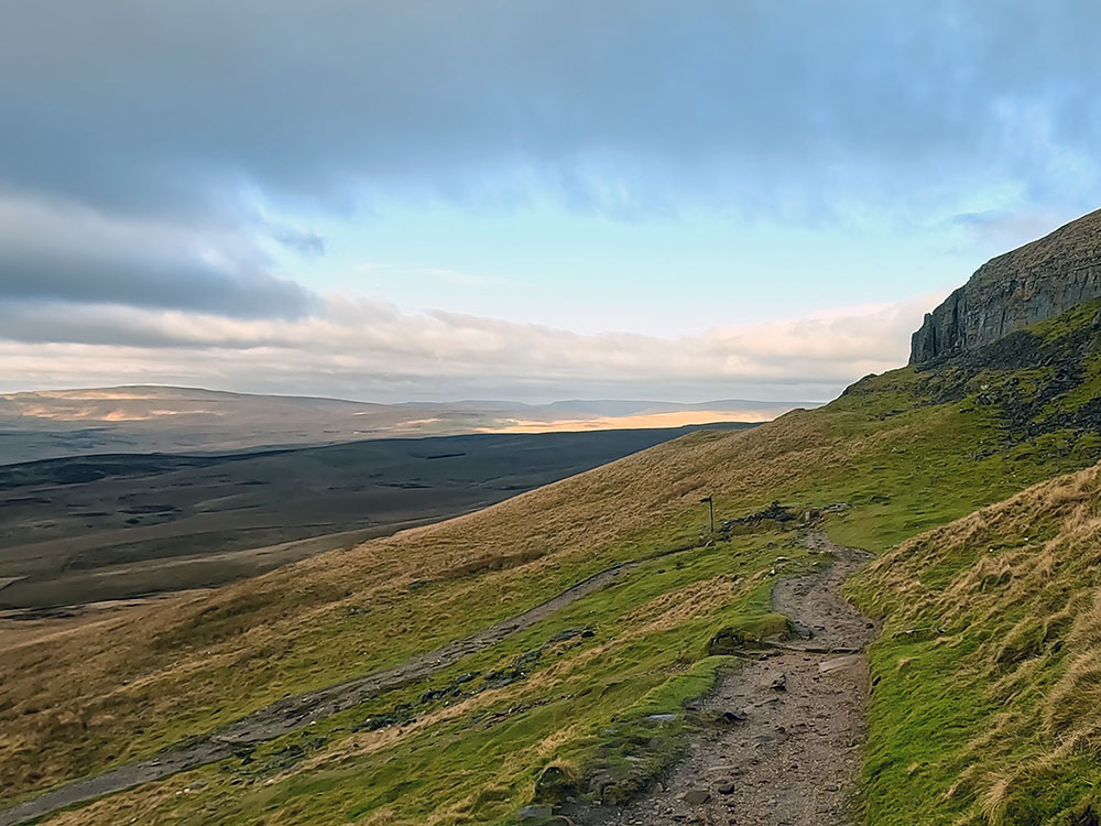
Once at the end of the man-made stepped section, the main path keeps to the right on the border of the grass and the stone, before heading back across to the left where you need to pick your way across the stone.
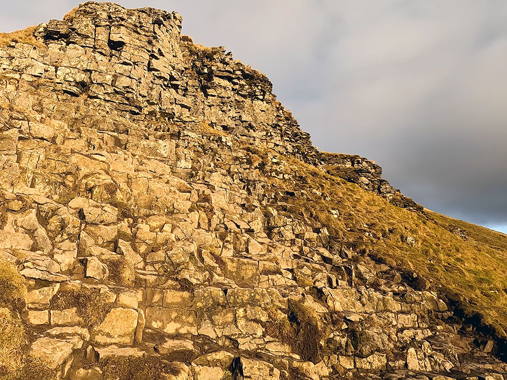
Where the path bends around to the left under the craggy outcrop
You may need to use your hands briefly in this section. Straight on here, you are looking in the direction of Halton Gill and Foxup, then around to the right is a large mass of Fountains Fell, the name being derived from the Cistercian monks of Fountains Abbey, who used it for grazing sheep in the 13th century.
Back to the climb, continue on heading up left across the stone under the crag above, where you will very quickly reach a plateau. Walk along a short flat section and then follow the path as it starts to climb the next set of steps.
The second set of steep steps up Pen-y-ghent on the Pennine Way
Take time to look around at the ever-expanding vista and looking back now, you can see the path we've just walked up.
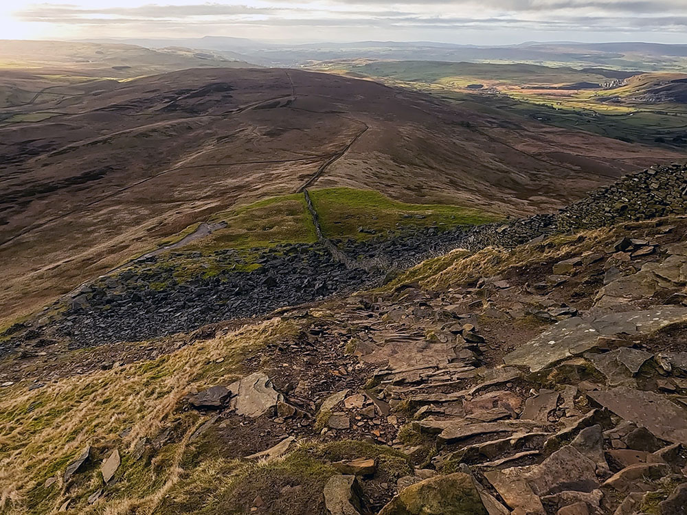
Looking back at the Pennine Way path climbed up Pen-y-ghent
This last bit of the steeper section may involve hands again to climb some of the rocks. As the path starts to flatten we then follow the flags up to the summit.
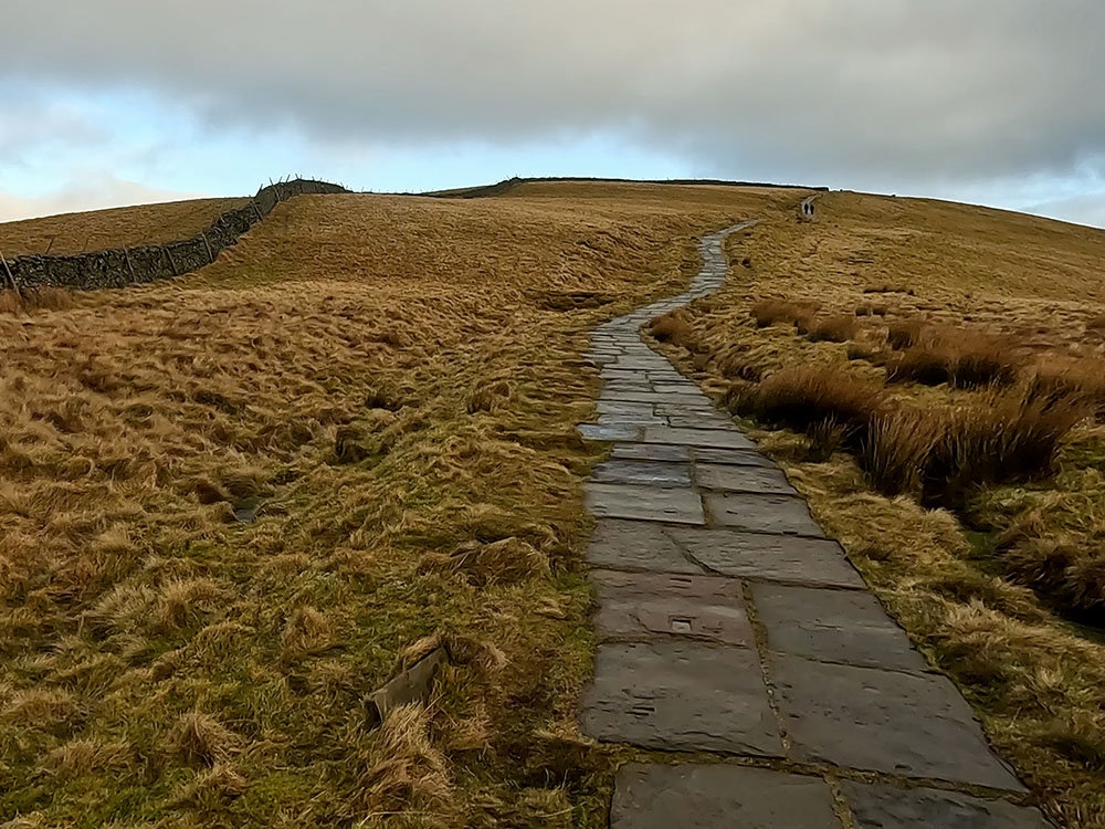
Flagged path heading to the summit of Pen-y-ghent
The onward route is over the wall, but before that, take time to explore Pen-y-ghent's summit and its panoramic views.
It is acceptable to write Pen-y-ghent with or without the hyphens on either side of the 'y'. Its derivation, though, is a little ambiguous. Pen is from Cumbric and as in today's Welsh language means top or head. 'Y' is taken from the definitive article 'the'. Ghent is the uncertain part. It could mean edge or border if taken from a derivative of 'gint' but also may mean heathen.
So possibly 'hill on the border' or 'top of the edge'. Traditionally, in the past, it has been translated as 'hill of the winds'. Attached to the trig point on Pen-y-ghent's summit is a QR code to access Pen-y-ghent's toposcope, an augmented reality view showing the names of the surrounding hills. Unfortunately, I couldn't get it to work whilst I was there.
Penyghent or Pen-y-ghent is a mountain in the Yorkshire Dales in England. The top surface is comprised of millstone grit and under that is carboniferous limestone. It is this limestone that has helped create Hunt Pot, Hull Pot and Penyghent Pot on the slopes of Pen-y-ghent and the waters around and through there have helped create an extensive cave system, from which water emerges at Brants Gill Head.
Besides the many footpaths around and over Pen-y-ghent, the are three main walking paths, two of which pass over Pen-y-ghent's summit (the Pennine Way and the Yorkshire Three Peaks walk) and one which passes through its lower slopes (A Pennine Journey).
The Pennine Way is a long-distance footpath in England, stretching approximately 268 miles from Edale in the Peak District National Park to Kirk Yetholm in the Scottish Borders in the north, traversing some of the most rugged and picturesque landscapes of Northern England and the southern Scottish Lowlands, making it one of the most famous and challenging long-distance hiking trails in the United Kingdom.
The Yorkshire Three Peaks footpath is a 24 miles walk with just over 1,600 meters of climbing, in the Yorkshire Dales, passing over the summits of Pen-y-ghent (the lowest at 694 metres), Whernside (the highest at 736 metres) and Ingleborough (724 metres). Most people start and end the walk in Horton in Ribblesdale, but being a circular walk, you can start it wherever you like on the circle.
'A Pennine Journey' was devised using current roads and rights of way to closely follow Wainwright's original 1938 walk, which he documented. His 'A Pennine Journey' walk was published in 1986. This circular walk is 247 miles long, starting and ending in Settle in the Yorkshire Dales National Park. The walk heads mainly up the eastern side of the Pennines to Hadrian's Wal, which is followed for 21 miles before heading back south on the western side of the Pennines over Cross Fell and and down the Eden Valley before passing through Sedbergh and Kirkby Lonsdale on its way back to Settle.
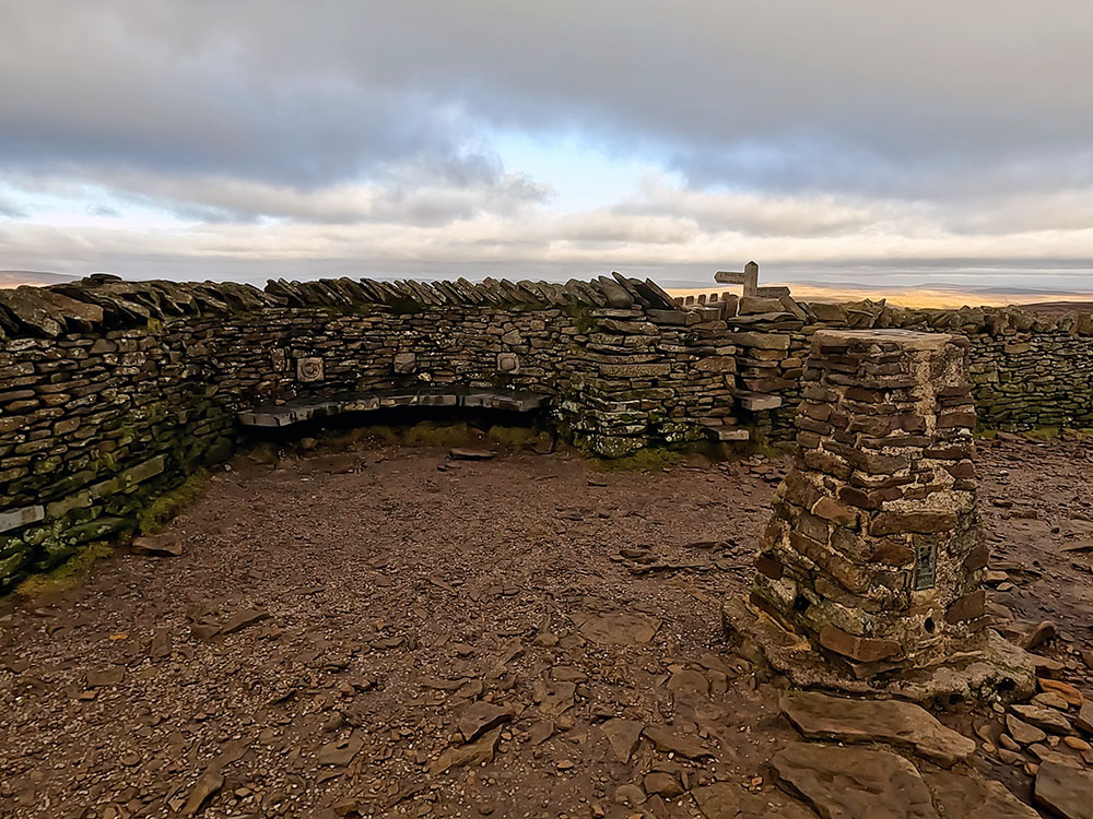
Trig Point and seat weather shelter on the summit of Pen-y-ghent
Ingleborough, the Ribblehead Viaduct and Whernside from the summit of Pen-y-ghent
Two seats are built into both sides of the wall that provide protection from the wind. Pass through the gap in the wall. We will head directly away from the wall here following the Pennine Way 'Yorkshire Three Peaks' sign.
To start the descent head directly away from the wall to pick up the flagged steps. Head down the steps. Directly ahead you are looking at Ingleborough and Whernside. When the flags end, the path swings around to the right.
If this walk is giving you a taste for the Yorkshire Dales, don't forget to check out our list of the best Yorkshire Dales walking books.
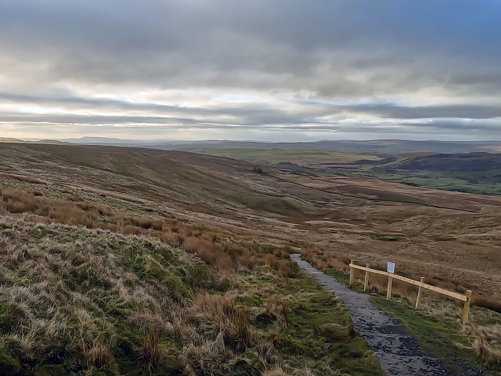
Follow this path along the edge for about 400 metres until you reach a signpost where the path swings around to the left. The Three Peaks route now follows this path, but previously you headed diagonally down from here across Horton Moor, through Black Dub Moss and Red Moss before picking up Pennine Way, both of which were generally very boggy.
Signpost where the path swings around to the left on the Pennine Way path off Pen-y-ghent
Follow the path as it swings around to the left following the signpost for 'Pennine Way, Horton in Ribblesdale and Yorkshire Three Peaks' as it starts to head more steeply again downhill for about one kilometre.
The path down to be followed off Pen-y-ghent
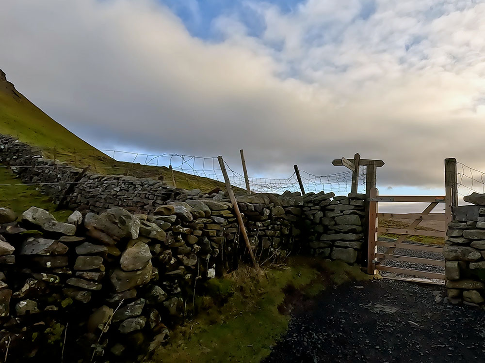
Pass through the next gate and walk straight on down to and through the next gate to arrive at a path junction with a 4-way sign. The Pennine Way path back to Horton that we will eventually follow is enclosed in the walls off to the left down Horton Scar Lane here. Straight on here is the Three Peaks path that heads over to pick up the Pennine Way as it leaves Horton again.
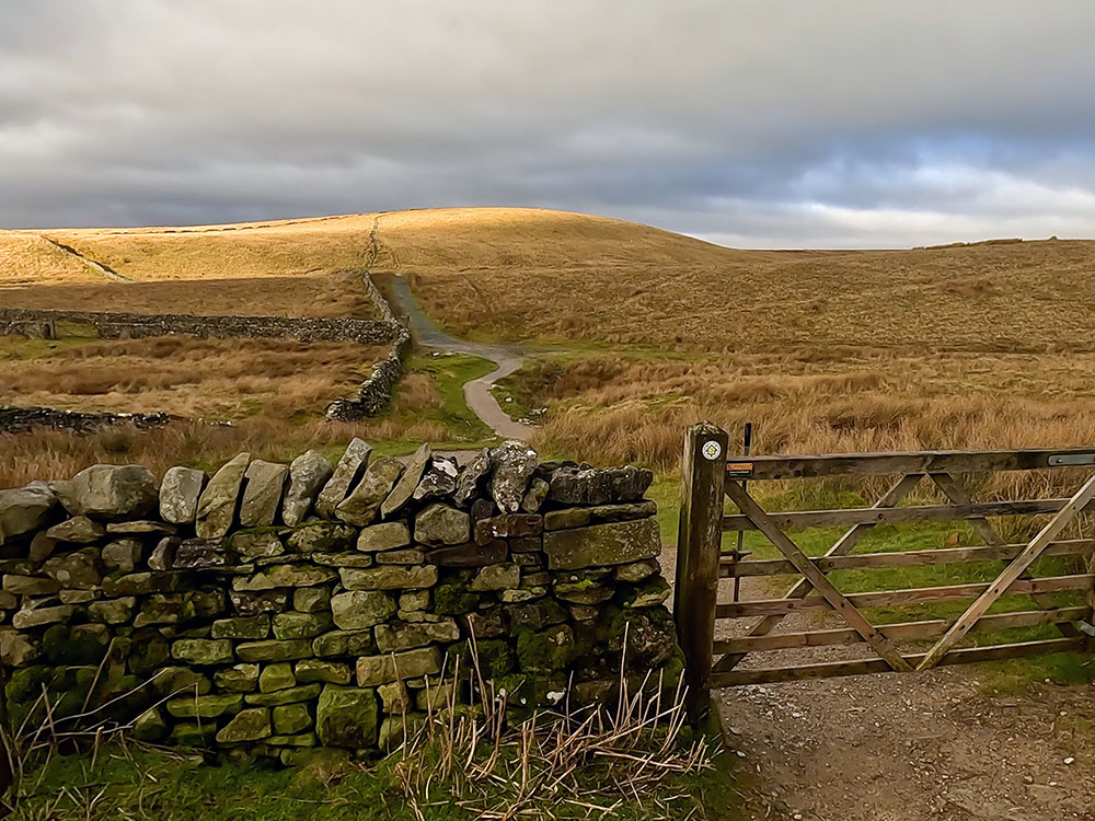
Gate through which the walled Horton Scar Lane can be seen heading off to the left
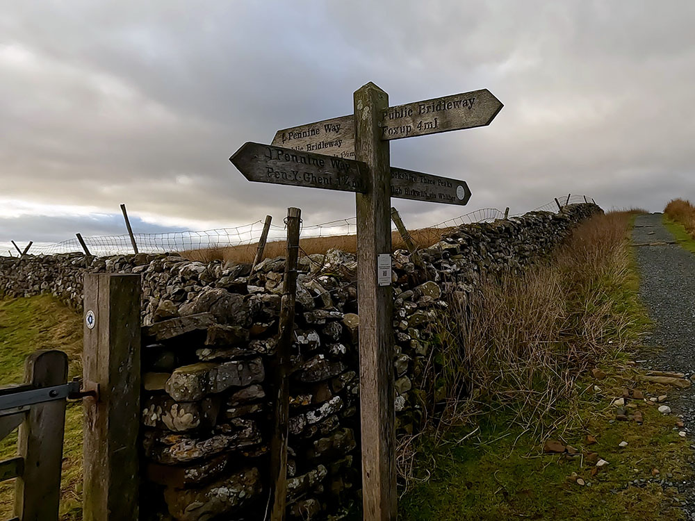
4-way signpost at path junction with Horton Scar Lane
Over to the right is a short diversion that we are going to follow to have a look at Hull Pot. If you want to miss Hull Pot, simply head down the walled lane.
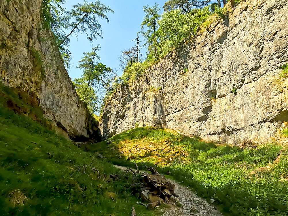
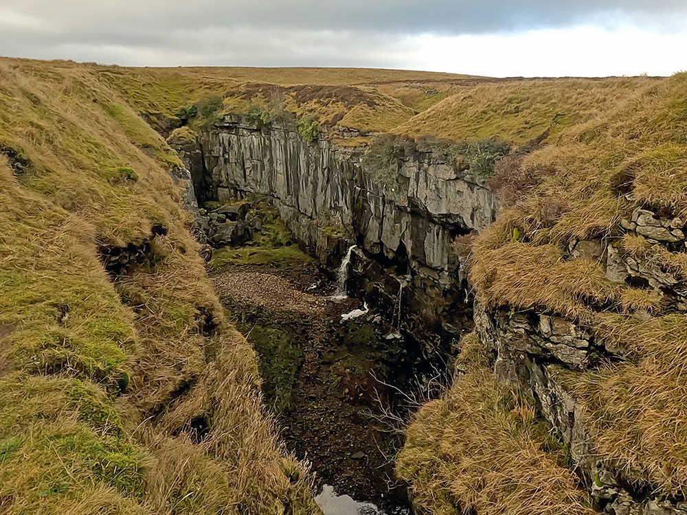
But for the diversion, we will head away from the wall following the Foxup sign. In a couple of hundred metres, you arrive at Hull Pot. Be very careful around Hull Pot as there are shear drops that are unfenced. So keep dogs and children well away.
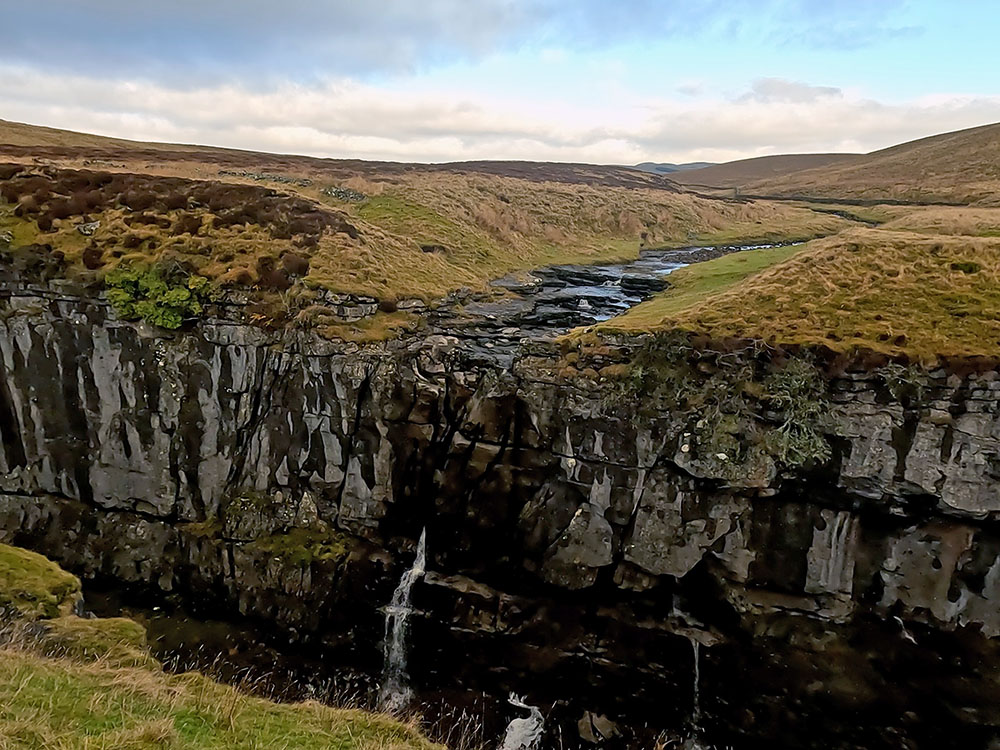
Hull Pot with waterfall

Looking along Hull Pot
Hull Pot itself is reputed to be the largest natural hole in England and is 91 metres long, 18 metres wide and 18 metres deep. In dry conditions, Hull Pot beck on the other side disappears before reaching the top and appears as a waterfall further down. After periods of rain, the water can head along the top and form a waterfall over the side of the pot itself. In periods of extreme rain, as we had on the 10th of January 2023, Hull Pot can completely fill with water. That's the equivalent of filling almost 200,000 baths!
From Hull Pot, we retrace our steps back to the wall with the 4-way signpost. Head straight on through the gate to follow the Pennine Way sign to Horton in Ribblesdale down the enclosed walled track.
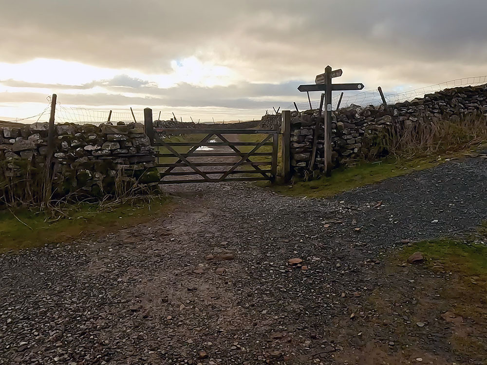
The homeward path is straight on down Horton Scar Lane
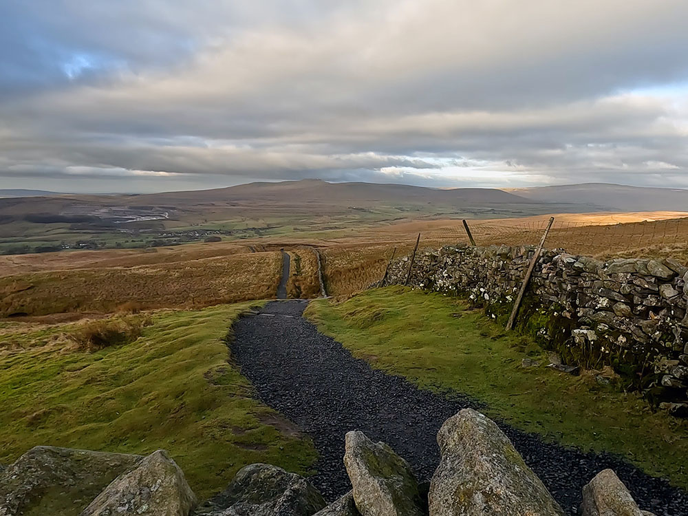
Stop from time to time along the lane to take in the wonderful Yorkshire Dales landscape and scenery.
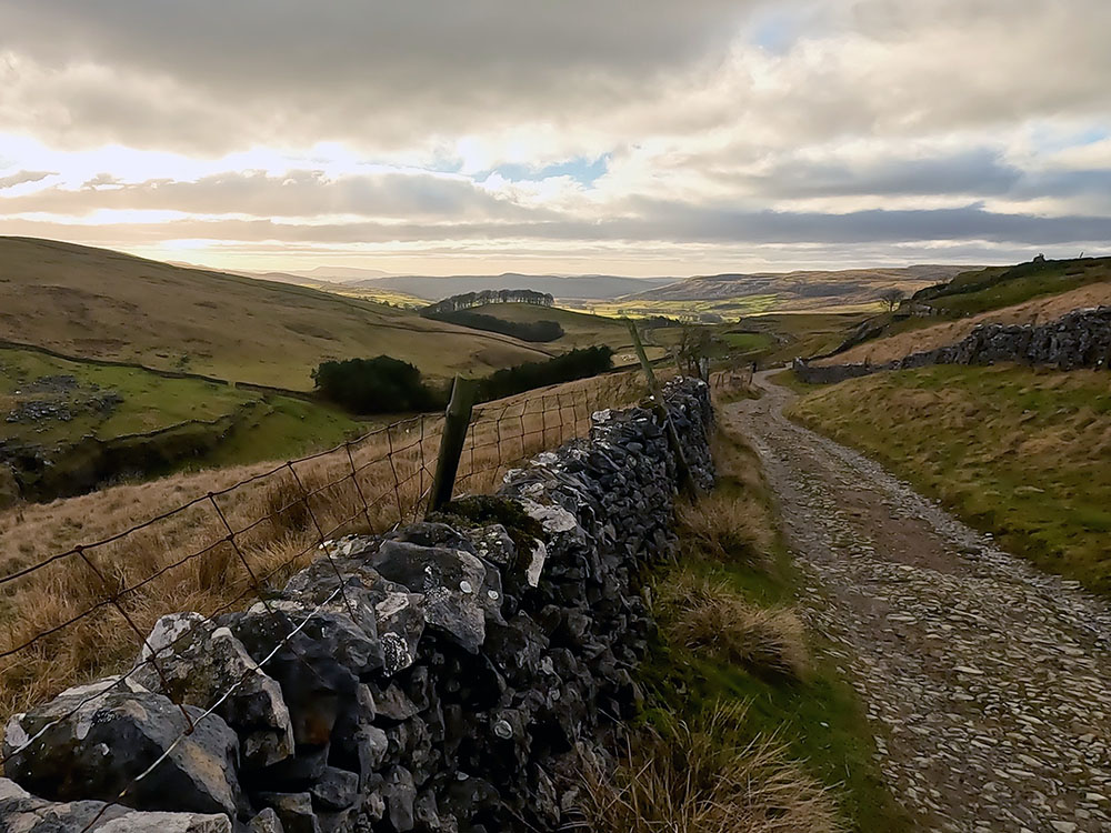
Yorkshire Dales landscape from Horton Scar Lane
Over to the left, the full length of Pen-y-ghent and Plover Hill can now be seen. After a while, pass through a gate across the lane. These dry stone walls that enclose the Pennine Way path here are a characteristic feature of the Yorkshire Dales and there are thought to be over 5,000 miles of them in the Yorkshire Dales alone, dating back hundreds of years.
Pen-y-ghent and Plover Hill from Horton Scar Lane
Keep on walking down the track and pass through another gate.

Walled view back up to Pen-y-ghent
As Horton gets nearer, the path splits. We take the right-hand fork here to then almost immediately pass through a wooden gate. We soon then arrive back at the road in Horton. Turn right here. Cross the road and head back along towards the car park, which ends the walk.
In the Pen-y-ghent walk video, we've put together a short fly-through created using the Ordnance Survey app, the link for which is above to show you where the walk goes and give the area a little more perspective.
If you are wanting somewhere to eat and drink after the walk everyone will have their own favourites, but my preferences for somewhere nearby, if you have a car, are Middle Studfold Farm tearoom and Helwith Bridge Inn both within two miles heading along the Settle road. Middle Studfold is on your left as you head towards Settle and serves homemade food, sandwiches, all-day breakfasts, toasties and cakes, along with a range of alcohol, teas and coffees.
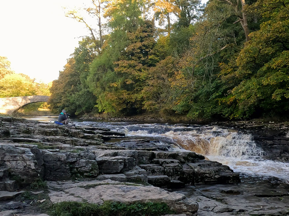
Just further on, well signed is the Helwith Bridge Inn. On a left-hand bend, you turn right for a short distance to arrive at the Helwith Bridge Inn. They serve good food and also have 8 real ales on the bar, many brewed locally. It is on the side of the river Ribble and has the Settle to Carlisle railway line running right past it. It's also dog friendly.
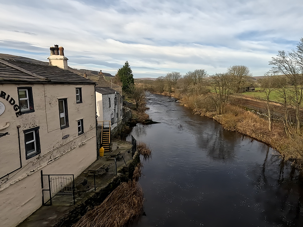
Helwith Bridge Inn and River Ribble
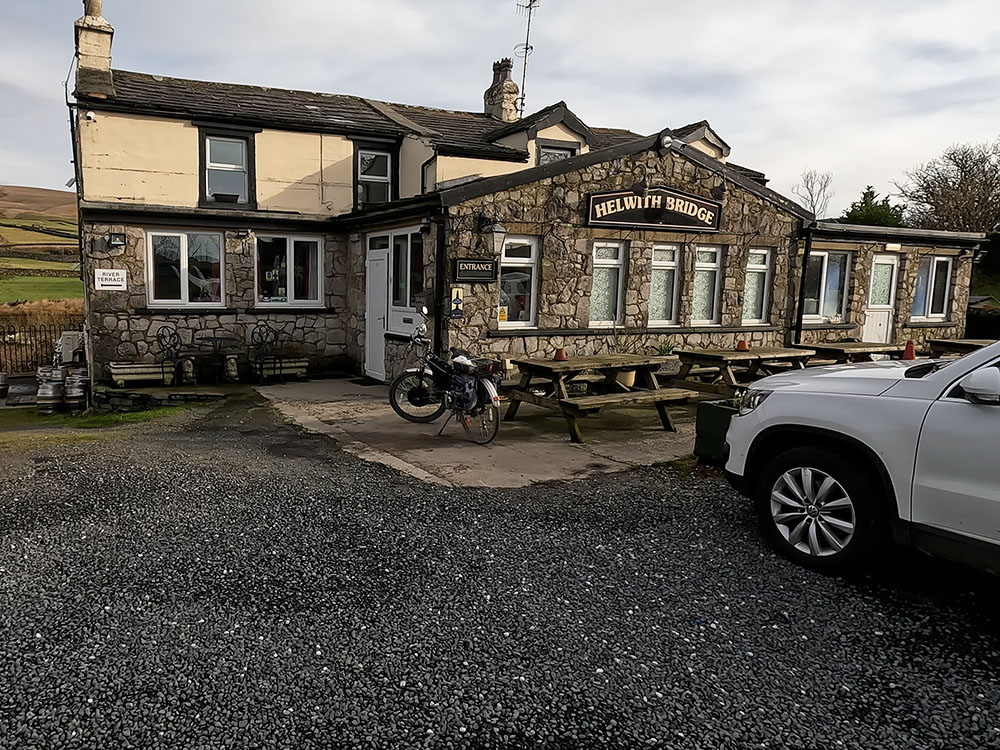
Helwith Bridge Inn
If you want somewhere in Horton in Ribblesdale itself, there is the Crown Hotel. To get there, just turn left out of the car park and it is about 100 metres down the road just over the bridge. I believe the Crown is still open (Jan 23), but there is a sign on it saying the business is currently for sale. It serves food and drinks but after reading some online reports, I can't confirm as I've not been in for a while, I'm not sure whether it's dog friendly, so it's probably best to check first.
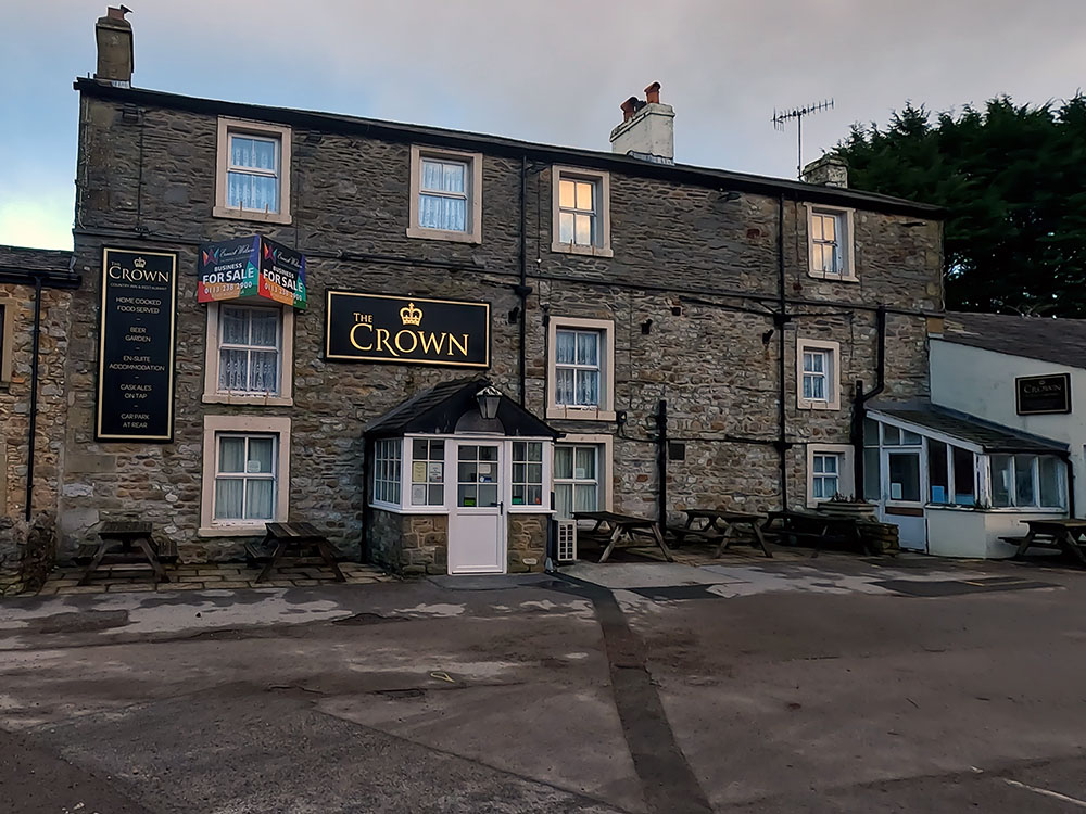
Crown Hotel Horton in Ribblesdale
The other pub we passed at the start of the walk is the Golden Lion Hotel. Again, this serves food and drink and has accommodation. I believe dogs are allowed in the bar and in the taproom.
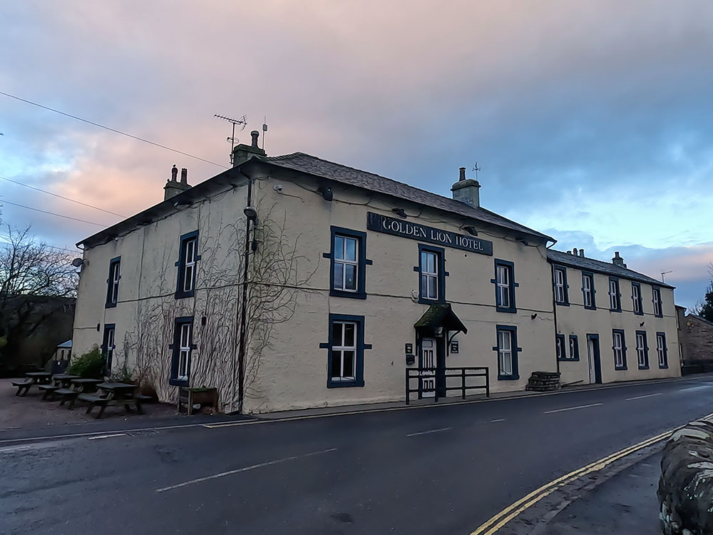
Golden Lion Hotel Horton in Ribblesdale
The Pen-y-ghent circular walk starts in Horton in Ribblesdale, so the best place to park is the pay-and-display car park in Horton in Ribblesdale. There is also some roadside parking in Horton in Ribblesdale, but please park courteously.
The Pen-y-ghent circular walk starts from the car park in Horton in Ribblesdale in the Yorkshire Dales.
Whilst there are no toilets on Pen-y-ghent itself, there are toilets at the start of the walk in the car park at Horton in Ribblesdale.
The Pen-y-ghent walk is a 6.3-mile circular walk from Horton in Ribblesdale in the Yorkshire Dales over the summit of Pen-y-ghent, which includes 470 metres of ascent.
Yes, Pen-y-ghent is one of the Yorkshire 3 Peaks. The other two are Whernside and Ingleborough.
As long as you are reasonably fit, Pen-y-ghent is a good introduction to mountain walking. The paths are well-made and easy to follow in good visibility. There are two steeper climbs just before reaching the summit and on the first of which is a short scramble.
If you are a little unsure as to whether the walk will be suitable for you, watch the whole walk first on the above video and you can see what the walk and climb are like.
The Pen-y-ghent walking route is the 6.3-mile circular walk from Horton in Ribblesdale over the summit of Pen-y-ghent. The route map for the walk is set out above on the Ordnance Survey map.
The Pen-y-ghent circular walk distance from Horton in Ribblesdale is 6.3 miles or 10.1 kilometres long.
As long as the children have done previous walks and have been out walking for 3 hours before, then Pen-y-ghent is a good introduction for them to mountain walking. The paths are well-made and easy to follow in good visibility. There are two steeper climbs just before reaching the summit of Pen-y-ghent on the first of which is a short scramble, which no doubt they'll find exciting.
If you are unsure watch the whole walk first on the above video and you can see what they would need to climb.
The Pen-y-ghent walking route used for the circular walk over Pen-y-ghent from Horton in Ribblesdale along with the Pen-y-ghent circular walk route map is shown above.
The postcode for the car park at the start of the Pen-y-ghent walk from Horton in Ribblesdale is BD24 0HG.
The What3words for the Pen-y-ghent circular walk from Horton in Ribblesdale is tonality.curl.routs.
Gifts and presents for hikers and walkers
Are you struggling to pick the perfect gift for your hiking-loving friend or family member? Don't fret! Explore our curated selection of top-notch gifts for walkers and hikers that will have them trekking with joy on their special day.
What to wear and take on your walk or hike
Whether you are a seasoned hiker or new to walking, wearing and taking suitable hiking kit and clothing is essential for a day hike for your comfort and safety. So we have put together a hiking essentials checklist to cover all you'll need. Our Hiking Essentials checklist for 2026 takes you through planning your walk, the hiking essentials checklist itself, optional extras, explanations, and recommendations for all the hiking essentials.
Check out the reviews for this walk: