By using this website, you agree to our use of cookies (needed to provide our website’s features) and our Terms of Use.
By: Andrew Forrest - Updated March 2024
Explore Ingleborough with our Ultimate Guide, where history, geology, nature, and adventure come together in the Yorkshire Dales. From the Roman invaders to exhilarating walks, intricate underground and overground features, a Nature Reserve and other hidden gems, this comprehensive guide will unveil the secrets of Ingleborough, making your visit an unforgettable journey.
This page contains affiliate links. As an Amazon Associate, we earn from qualifying Amazon purchases at no additional cost to you. We may also earn commissions from other retailers, again at no additional cost to you.
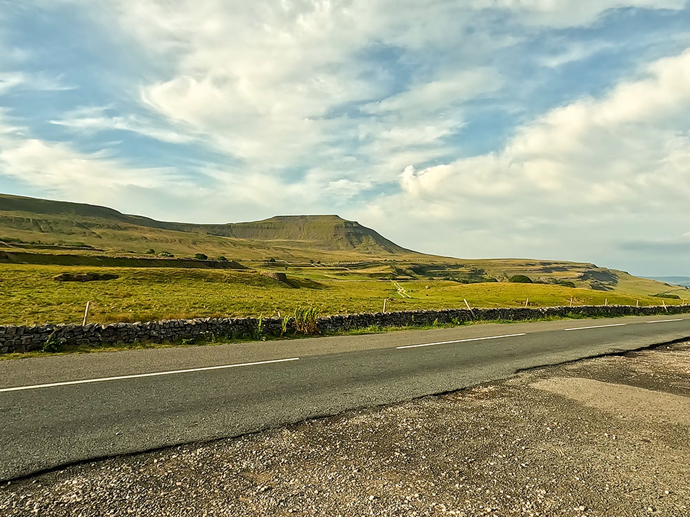
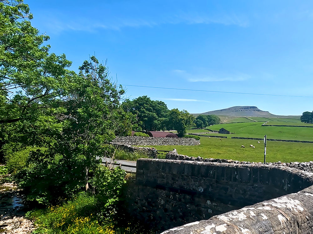
Ingleborough, a prominent landmark in the Yorkshire Dales National Park, is located at the western end of North Yorkshire, England. At 724 metres in height, it is classified as a mountain and a Marilyn and is one of the Yorkshire Three Peaks, alongside Whernside and Pen-y-ghent. It is renowned for its distinctive flat-topped profile, visible for miles around.

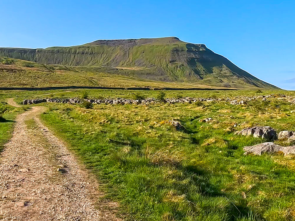
Ingleborough's distinctive flat-topped summit from the descent off Whernside
Whilst Ingleborough's height and paths provide plenty of walking routes and breathtaking panoramic vistas of the nearby and distant landscapes, Ingleborough is also renowned for what you can't see at first glance - its intricate underground features, including captivating caves, such as the Ingleborough Caves, White Scar Caves and Gaping Gill, and a network of potholes.
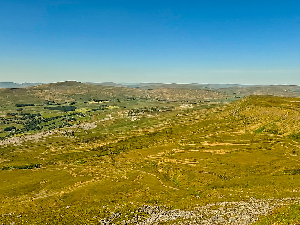
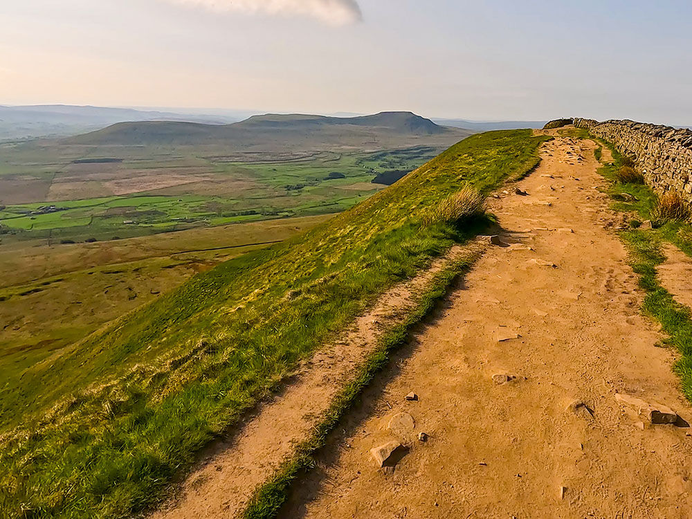
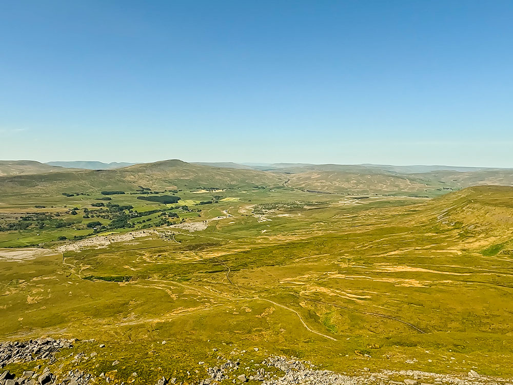
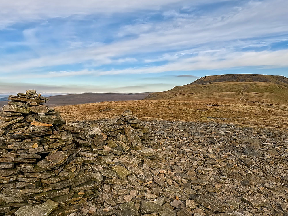
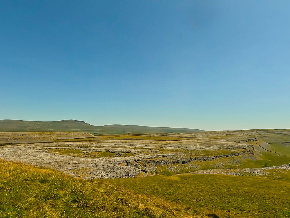
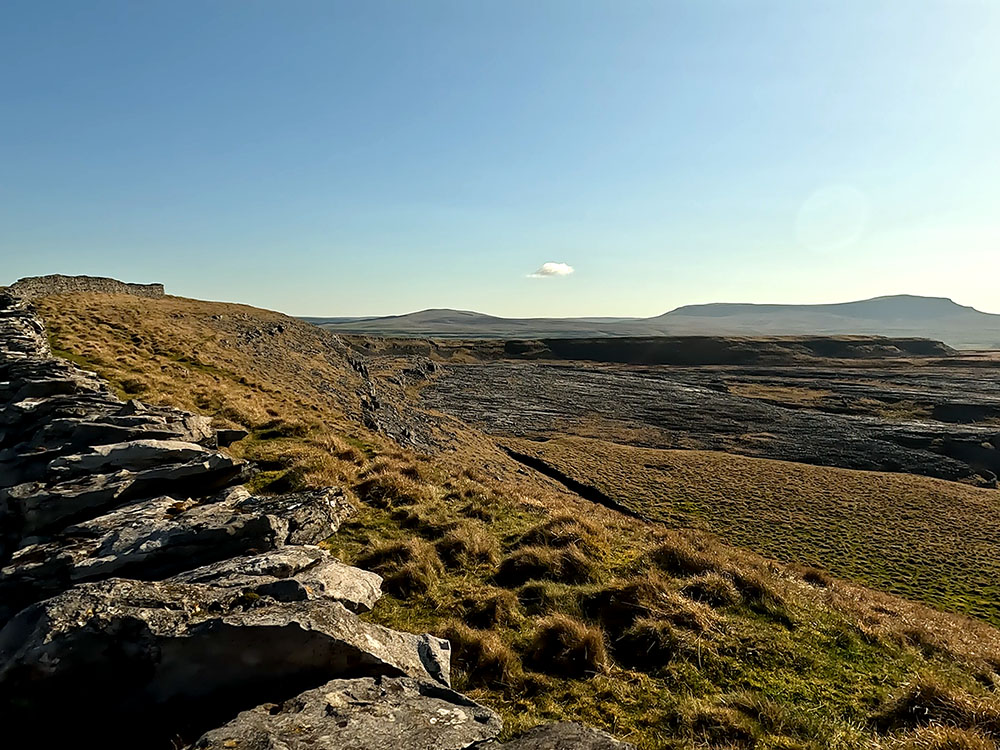
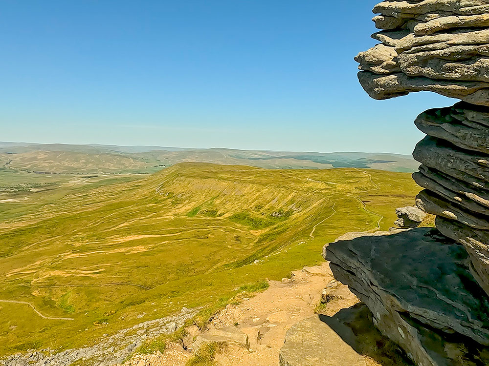
View from Ingleborough looking towards Whernside, the Howgills, Ribblehead Viaduct and Simon Fell
Many of Ingleborough's slopes form the Ingleborough National Nature Reserve, which was designated as a Site of Special Scientific Interest. These areas and the many fine examples of limestone pavements mean that Ingleborough is an exceptional location to observe a comprehensive array of ecosystems and wildlife profoundly shaped by the area's underlying geology, adding to the allure of this geological and historical wonder.
Ingleborough, a mountain in the Yorkshire Dales National Park, is located at the western end of North Yorkshire, England. Ingleborough's geographical coordinates using WGS84 are 54.1662° N latitude and 2.3978° W longitude.
The nearest village to Ingleborough with facilities is the quaint village of Ingleton, which is at the foot of the southwestern slopes of Ingleborough. It is easily accessible on the A65 and sits in the middle of three market towns - Settle, Hawes and Kirkby Lonsdale, making it a popular destination for hikers, cavers, and nature enthusiasts alike.
The name Ingleborough or Ingelburh has been around since 1165. 'Ing-hyll' comes from Old English, meaning hill, and 'Burh' is again from Old English, meaning a fortified place. An Iron Age Fort once covered most of Ingleborough's summit, so in this case, Ingleborough or Ingelburh effectively means the fort on the hill.
A visit to Ingleborough is incomplete without experiencing the exhilarating walks over and around Ingleborough. From the long and strenuous Yorkshire Three Peaks Challenge to more gentle strolls like heading through the Ingleborough Estate Nature Reserve, there are walks that offer something for everyone.
Whilst not entirely on the slopes of Ingleborough itself, we can't miss the Ingleton Waterfalls Trail walk - my favourite waterfall walk in the United Kingdom!
We've set out below our favourite walks over, around and near Ingleborough, all with pubs and cafés at the start, finish or nearby. Each walk showcases different facets of this timeless and geology-rich terrain where history, nature, geology and adventure intertwine, so get your walking boots on and get out there and explore!
If you are new to walking, don't forget to check out our beginner's guide to walking and hiking and our hiking safety tips. If you are unsure what to wear and take on your walk, especially when undertaking some of the longer walks, check out our day hiking essentials checklist.
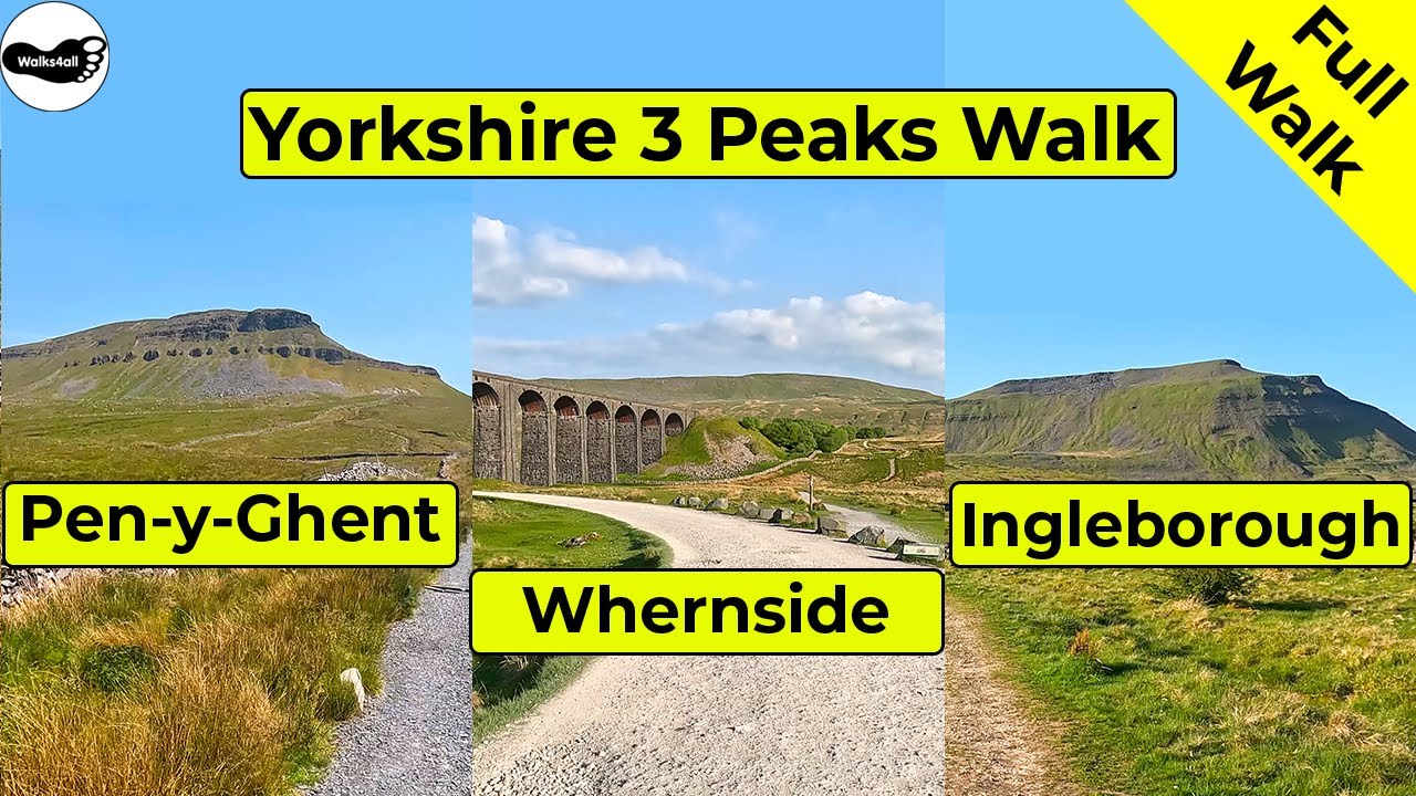
We start our best Ingleborough walks with the longest - not only do we climb Ingleborough, but we also scale Whernside and Pen-y-ghent, where the three forms what is known as the Yorkshire 3 Peaks.
The Yorkshire Three Peaks walk in the Yorkshire Dales is a 24.6-mile circular walk that takes in the mountaintop summits of Pen-y-ghent, Whernside and Ingleborough and involves just over 1,600 metres of ascent.
The Yorkshire Three Peaks Challenge is to do the Yorkshire Three Peaks walk in under 12 hours.
Traditionally, to be able to join the Yorkshire Three Peaks club, you needed to finish in under 12 hours and with reasonable levels of fitness and proper preparation, most people manage that.
As the walk is circular, you can start from anywhere on the route, but most people start from Horton in Ribblesdale or Ribblehead. If you don't have a car, there is a train station at Horton in Ribblesdale and one at Ribblehead.
Heading towards Pen-y-ghent on the Yorkshire 3 Peaks Walk
Our Yorkshire 3 Peaks walk, which can be seen in full in the above video, starts in Horton in Ribblesdale, leaves it by Brackenbottom and then heads along the path to climb over Brackenbottom Scar before meeting and turning left along the Pennine Way, which then climbs much more steeply.
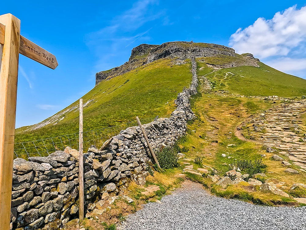
Meeting the Pennine Way heading up Pen-y-ghent on the Yorkshire 3 Peaks Walk
Once up this steep climb, we head along the flagged path to reach the summit of Pen-y-ghent. At 694 metres, Pen-y-ghent is the lowest of the Yorkshire 3 Peaks.
View from Pen-y-ghent summit on the Yorkshire 3 Peaks Walk
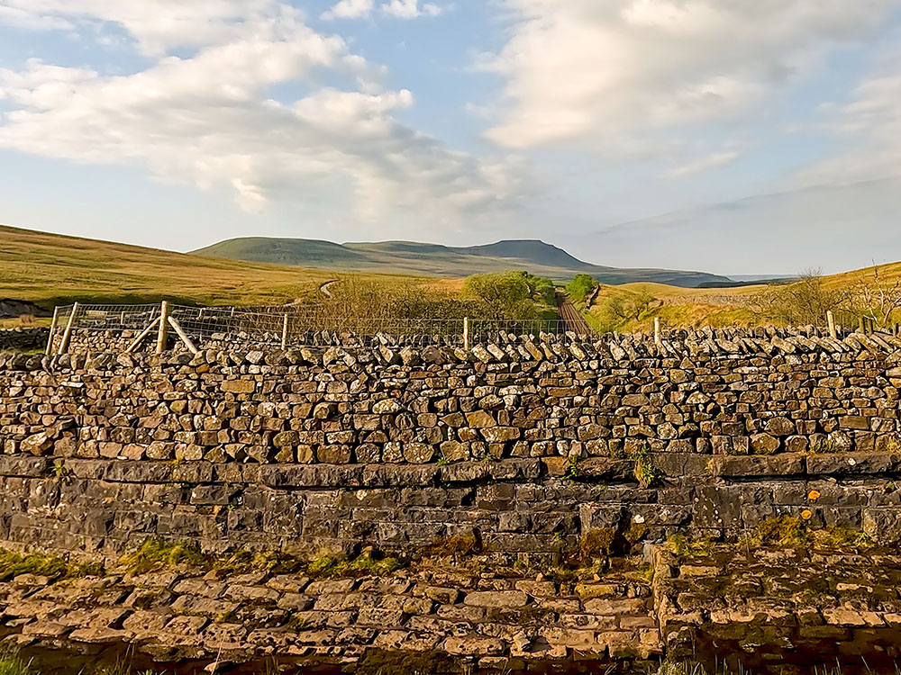
From Pen-y-ghent, the path heads on and down a descent before passing over Whitber Hill and then on the path towards Ribblehead and the viaduct.
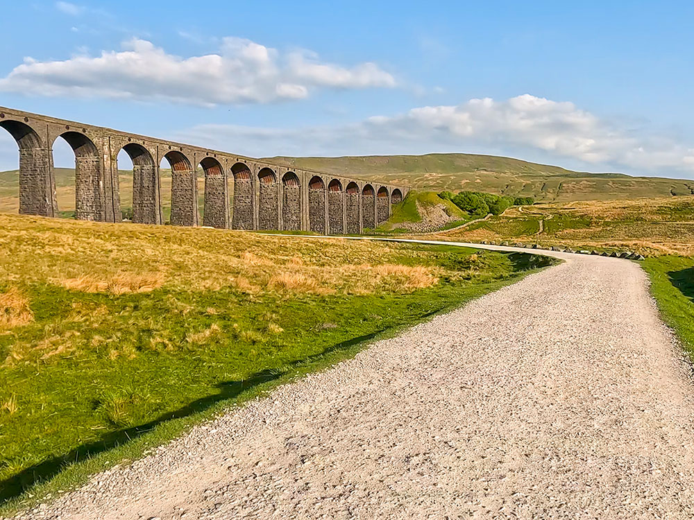
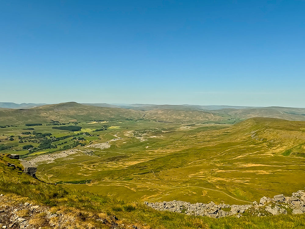
Approaching the Ribblehead Viaduct with Whernside in the background on the Yorkshire 3 Peaks Walk
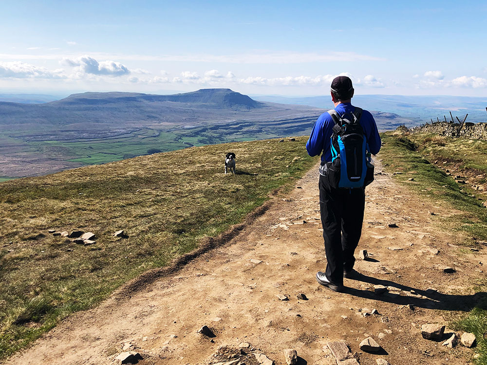
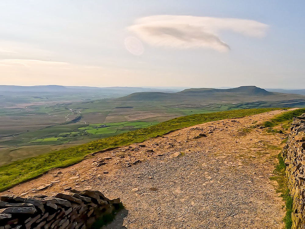
View looking back towards Ingleborough from the Whernside path
The path continues parallel with the Settle to Carlisle railway before leaving it to climb to the summit of Whernside. At 736 metres, Whernside is the highest of the Yorkshire Three Peaks.
Heading along the top of Whernside with Ingleborough in the distance
Pen-y-ghent, the Ribblehead Viaduct and Ingleborough from the summit of Whernside
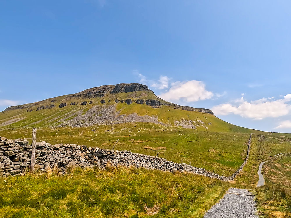
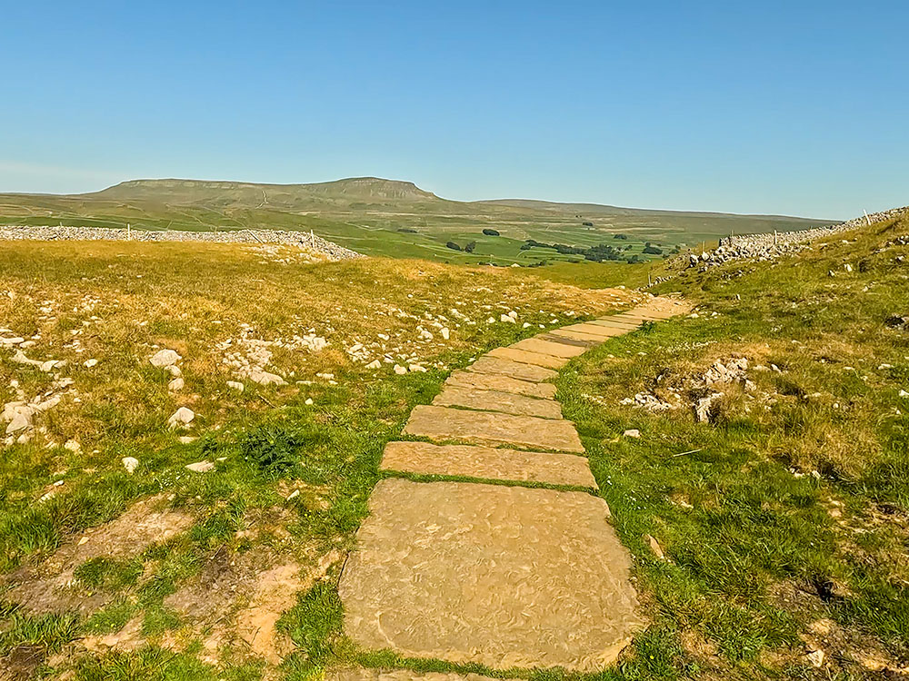
From Whernside's summit, the path continues to Chapel Le Dale and the Old Hill Inn. The path then crosses fields, passes limestone pavements and outcrops, and ascends a steep climb to reach Ingleborough's summit, which stands at 724 metres in height.
Path heading towards Ingleborough
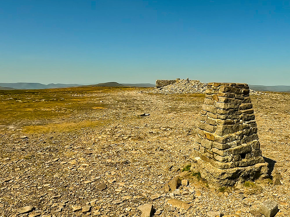
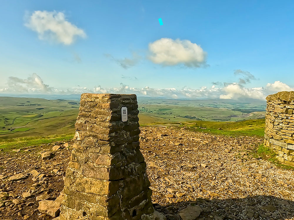
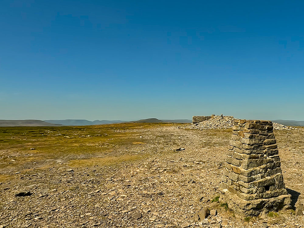
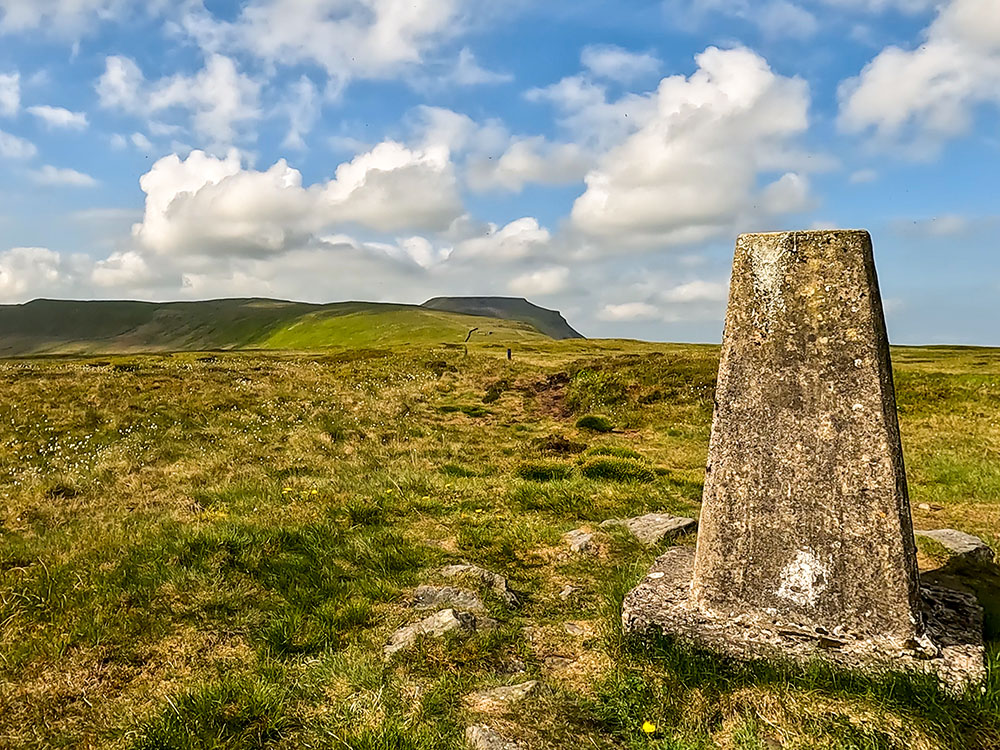
Trig point and weather shelter on the summit of Ingleborough, looking towards Whernside
From the summit, there are views out into Morecambe Bay in the west and around the Lake District Fells, as well as to the nearby Whernside and Pen-y-ghent.
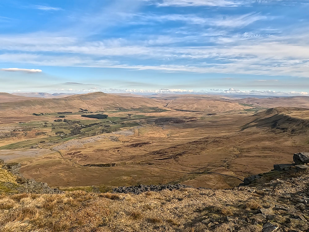
View of the Ribblehead Viaduct and Whernside from the summit edge of Ingleborough
From Ingleborough's summit, the descent heads across Simon Fell Breast and on through Sulber. The path continues through a few fields to pass through Horton in Ribblesdale train station before arriving back at the start. The summits of each of the Yorkshire Three Peaks offer stunning views.
Flagged path on the Yorkshire 3 Peaks walk heading back to Horton in Ribblesdale, with Pen-y-ghent ahead
We have put together a free Yorkshire 3 Peaks Guide, which includes tips for before, during and after the walk, parking, where to eat and drink, training, what to wear, what to take and much more.
For where to start this Yorkshire 3 Peaks walk, directions to the parking, GPX download of this Yorkshire 3 Peaks Challenge from Horton in Ribblesdale walk, OS route map of the walk, elevation profile, and detailed walk directions, check out our Yorkshire Three Peaks Walk from Horton in Ribblesdale.
After the walk, you can relax with a drink or something to eat - there is more on where to eat and drink after the walk at the end of our video above.
If you want to explore Ingleborough's southern slopes, try this circular walk over Ingleborough from the picturesque village of Clapham in the Yorkshire Dales. The walk is approximately 10 miles long and takes 660 metres of climbing, taking about 4 hours and 50 minutes to complete.
After leaving Clapham, the path passes the entrance to Ingleborough Cave, one of the best show caves in Britain, before passing through Trow Gill, a narrow, steep-sided limestone gorge.
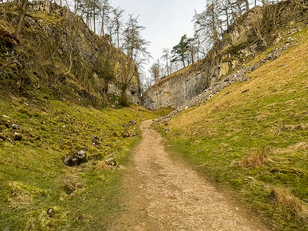
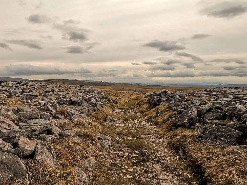
Path heading through Trow Gill
From there, we head on the path to Gaping Gill, a 98-metre-deep pothole and one of the UK's most famous caves and largest underground chambers.
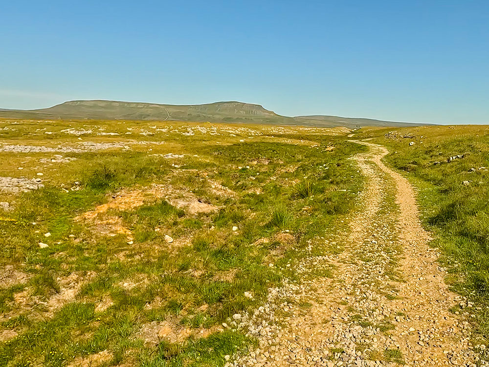
Ingleborough summit from the path over Little Ingleborough
The path heads up a steep climb as it heads over Little Ingleborough and then up another short, steep climb onto Ingleborough itself, which, at 724 metres high, provides views to the Lake District Fells to the north, out towards Morecambe Bay in the west and as far away as the Snowdonia range to the south.
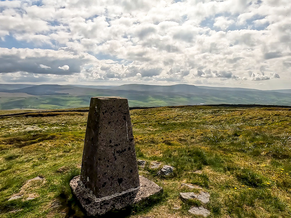
Trig point and weather shelter on the summit of Ingleborough, looking towards Whernside and the Howgills
I prefer wandering the edges around the summit plateau, which provides excellent views across the Howgills, Whernside and the Ribblehead Viaduct.
Whernside, the Howgills, the Ribblehead Viaduct and Simon Fell
The return route initially crosses Simon Fell Breast, passing through areas of limestone pavement before walking along Long Lane to return to Clapham.
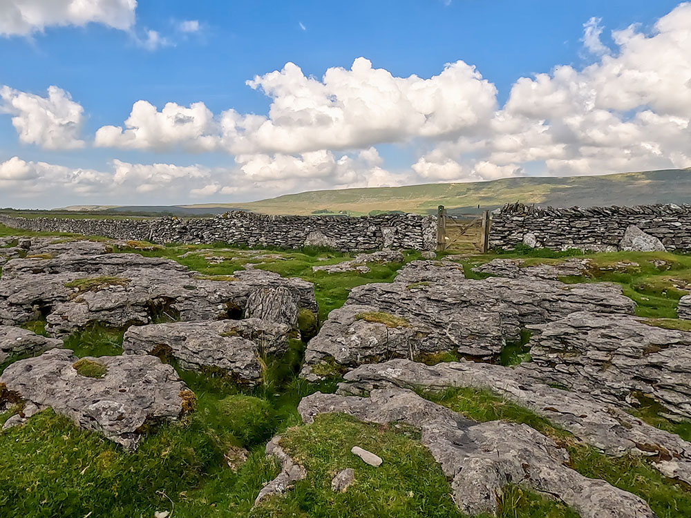
The path heading back through limestone pavements and outcrops
Long Lane
For where to start this Ingleborough walk from Clapham, directions to the parking, GPX download of this Ingleborough from Clapham walk, OS route map of the walk, elevation profile and detailed walk directions, check out our Ingleborough from Clapham walk.
After the walk, you can relax with a drink or something to eat. Clapham has the Lakehouse Bar and Kitchen, The New Inn and the Old Sawmill Café. There is more on these below and at the end of our video above.
Again, if you want to explore Ingleborough's southern slopes but prefer to do that from Horton in Ribblesdale, try this circular walk over Ingleborough from Horton in Ribblesdale in the Yorkshire Dales. The walk is approximately 11.5 miles long and takes 690 metres of climbing, taking about 5 hours and 20 minutes to complete. A train station is at Horton in Ribblesdale if you don't have a car.
This walk follows some of the same route as the Ingleborough walk from Clapham but returns to Horton in Ribblesdale by following the Yorkshire 3 Peaks route back from the summit of Ingleborough.
The walk leaves Horton in Ribblesdale over the train tracks that form part of the Settle to Carlisle railway, then follows the path through fields and limestone outcrops before turning left at Sulber as it heads on the path towards Ingleborough.
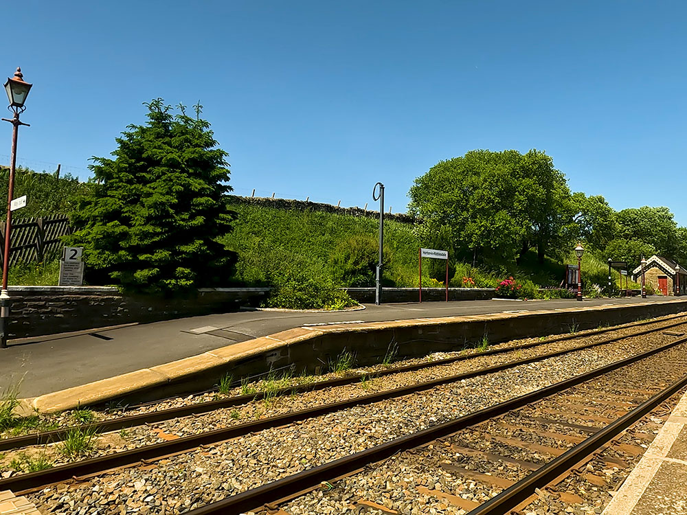
The path crossing the railway line at Horton in Ribblesdale station
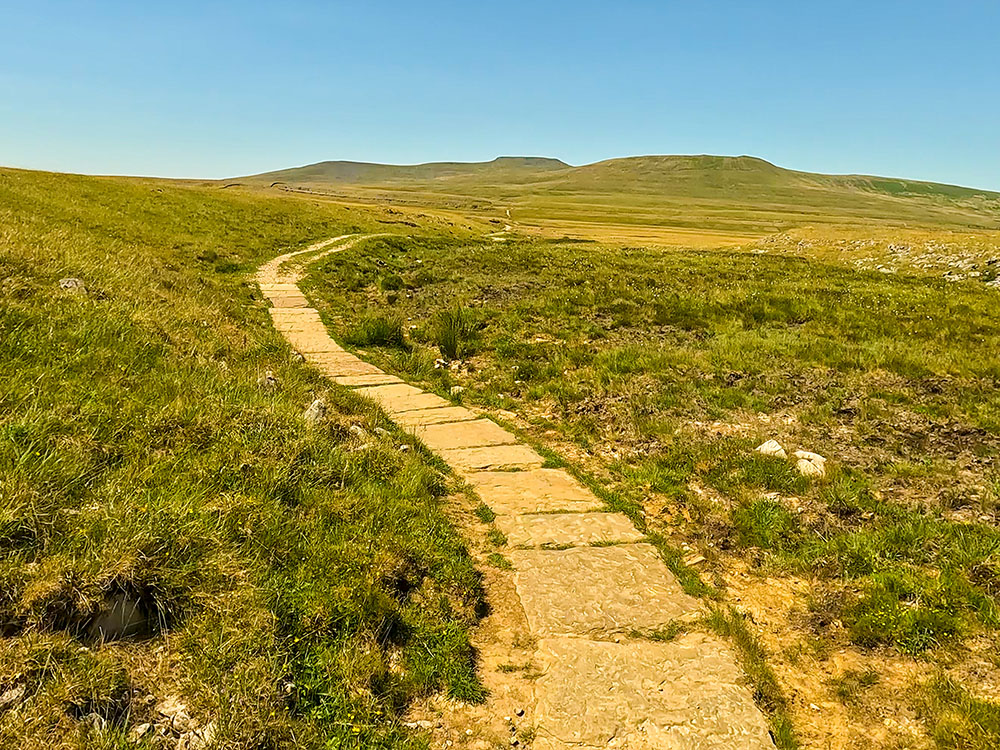
Flagged path heading up in the direction of Ingleborough
There are panoramic views over Thieves Moss and Moughton Scars to the left, with Pen-y-ghent visible on the horizon.
Looking across Moughton Scar and Thieves Moss towards Pen-y-ghent
The path heads through Trow Gill, a narrow, steep-sided limestone gorge, before arriving at Gaping Gill, a 98-metre-deep pothole and one of the UK's most famous caves and largest underground chambers.
The top of Gaping Gill
The path heads up a steep climb towards Little Ingleborough before arriving at the top of Ingleborough itself after another short, steep climb.
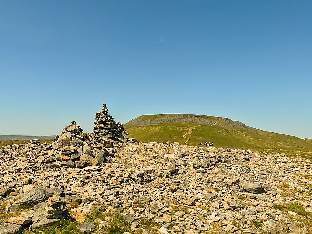
Looking towards the summit of Ingleborough from Little Ingleborough
On a clear day, this provides views of the Lakeland Fells to the north and as far away as the Snowdonia range to the south.
As with the Clapham walk, I prefer wandering Ingleborough's flat-topped summit edges, which provide excellent views across the Howgills, Whernside and the Ribblehead Viaduct.
The return route is on the path that descends across Simon Fell Breast and then on, passing through areas of limestone pavement and outcrops near Nick Pot.
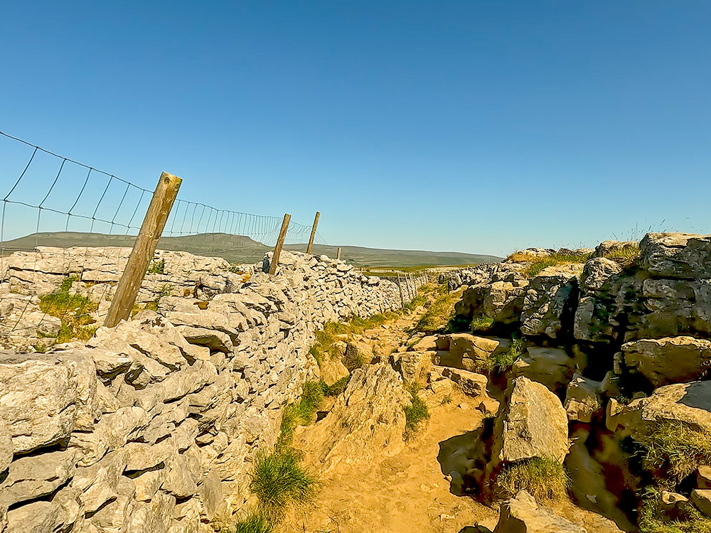
Passing through the limestone pavement at Sulber on Ingleborough's southern slopes
From Sulber, the path back towards Horton in Ribblesdale affords views of Pen-y-ghent for most of the way back. We pass back through Horton in Ribblesdale train station to arrive back at the start.
The path off Ingleborough heading towards Pen-y-ghent
For where to start this Ingleborough walk from Horton in Ribblesdale, directions to the parking, GPX download of this Ingleborough from Horton in Ribblesdale walk, OS route map of the walk, elevation profile and detailed walk directions, check out our Ingleborough from Horton in Ribblesdale walk.
After the walk, you can relax with a drink or something to eat. In Horton in Ribblesdale, there is the Crown Hotel, Golden Lion Hotel, and the Blindbeck Tea Room. Nearby, within a couple of miles, there is also the Middle Studfold Tearoom and the Helwith Bridge Inn. There is more on these below and at the end of our video above.
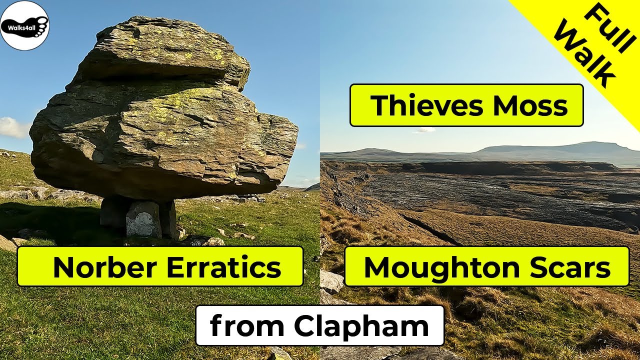
Without scaling Ingleborough itself, this walk on the south-eastern slopes of Ingleborough affords panoramic views of Ingleborough and Pen-y-ghent whilst taking in the fantastic limestone scenery of the Yorkshire Dales and the peculiar Norber Erratics.
The walk starts in Clapham and is 13.8 Km long with 410 metres of ascent, although there are alternatives to cut it shorter. If you only wanted to visit the Norber Erratics, you could do the end part of the walk in reverse.
Looking across to Ingleborough Cave from Long Lane
We leave Clapham, walking up a walled lane before walking along Long Lane, a track that forms part of the Pennine Bridleway. A cairn shortly after leaving Long Lane affords views of Ingleborough, Little Ingleborough, and Simon Fell, and this wonderful 360-panorama also includes Pen-y-ghent on the horizon in the direction of Moughton Scars.
Ingleborough and Simon Fell from a cairn
We continue walking along the Pennine Bridleway path before dropping onto and through the limestone outcrops and limestone pavements at Thieves Moss and Moughton Scars.
Thieves Moss and limestone pavement at Moughton Scars
We then head on the path across Crummack Dale to arrive at Norber, where many unusual Erratics can be found. Erratics are rocks that glaciers have transported and the movement of ice and are usually a different composition to the underlying bedrock on which they came to rest. From there, we follow walled lanes back down into Clapham.
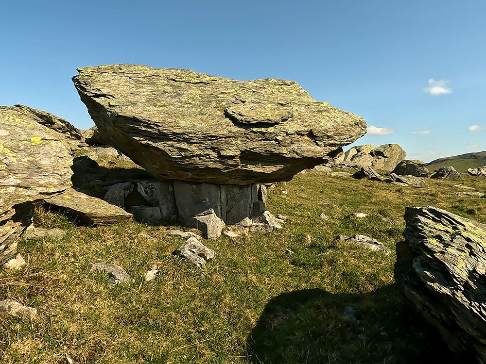
An Erratic at Norber
For where to start this walk, directions to the parking, a GPX download of this walk, an OS route map of the walk, an elevation profile, and detailed walk directions, check out our Thieves Moss, Moughton Scars, and Norber Erratics walk from Clapham walk.
After the walk, you can relax with a drink or something to eat in Clapham, where you will find the Lakehouse Bar and Kitchen, The New Inn, and the Old Sawmill Café. There is more on these below and at the end of our video above.
This is the shortest route to Ingleborough's summit from the small roadside lay-by parking near the Old Hill Inn in Chapel le Dale, in the Yorkshire Dales. From the parking, it is just 4.1 kilometres to the summit of Ingleborough, albeit with 430 metres of elevation.
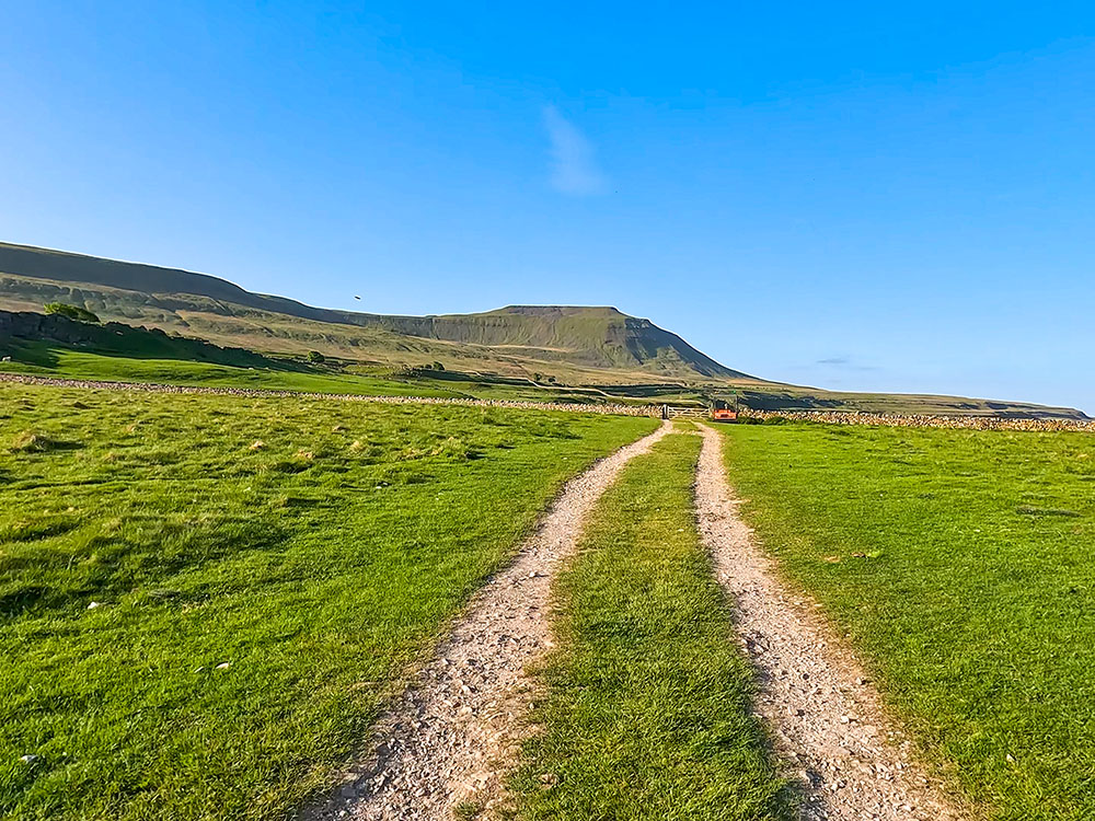
Inglebrough from roadside parking at Chapel le Dale
The route initially follows the Yorkshire Three Peaks route (see the Yorkshire Three Peaks video above for full details). It initially crosses fields before passing through limestone outcrops as it heads past Southerscales Scars. Along this section, if you want a short detour, you can head up the path to see the entrance to Great Douk Cave.
Heading towards Southerscales Scar and Ingleborough
We keep on the path as it passes by sections of limestone pavement and Braithwaite Wife Hole before starting to climb more steeply by way of wooden boards and flags, and then heading up even more steeply for around 100 metres before climbing more steps that lead up onto the summit plateau and on a short distance to the summit itself, which affords excellent panoramic views.
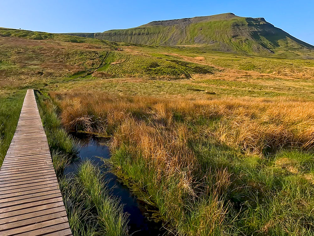
Heading across the wooden boards as the path climbs Ingleborough
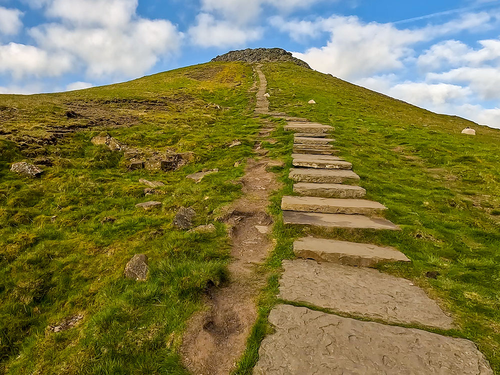
The final steep climb up onto Ingleborough's summit
From the summit, there are views out into Morecambe Bay in the west and around the Lake District Fells, as well as to the nearby Whernside and Pen-y-ghent.
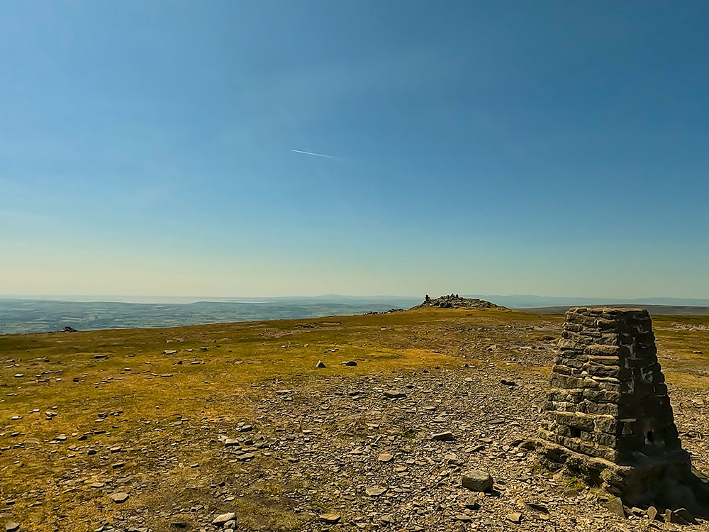
View from the trig point on Ingleborough out towards the west and Morecambe Bay
You can return down the same path, but we head towards Simon Fell to extend the walk and make it circular.
Whernside, the Ribblehead Viaduct and Simon Fell
Looking along the top of Simon Fell from Ingleborough
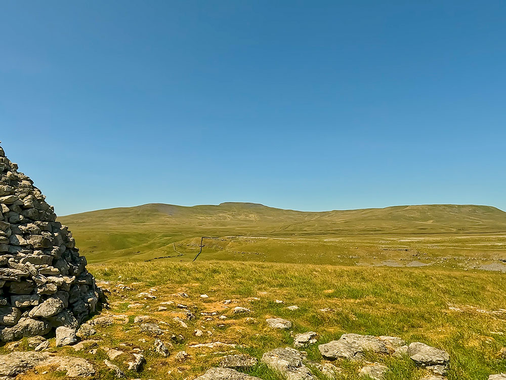
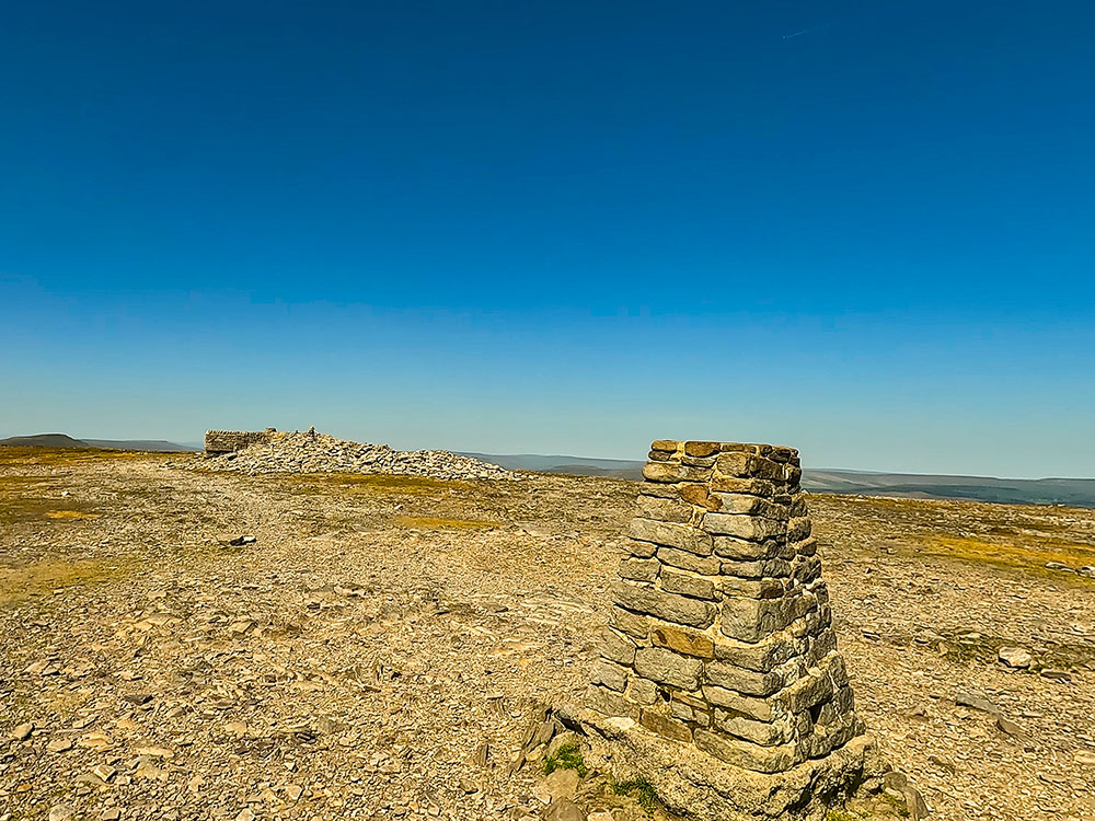
We head on the path across Simon Fell before heading along the path towards Park Fell. We take a slight detour to visit the nearby triangulation point on Park Fell.
Looking back towards Ingleborough from the trig point on Park Fell
Looking towards Pen-y-ghent from the trig point on Park Fell
We descend off Park Fell and head back along the path across fields and more limestone outcrops to reach the road where we started. This section affords views across to Park Fell, Simon Fell and Ingleborough.
Path heading through some limestone outcrops
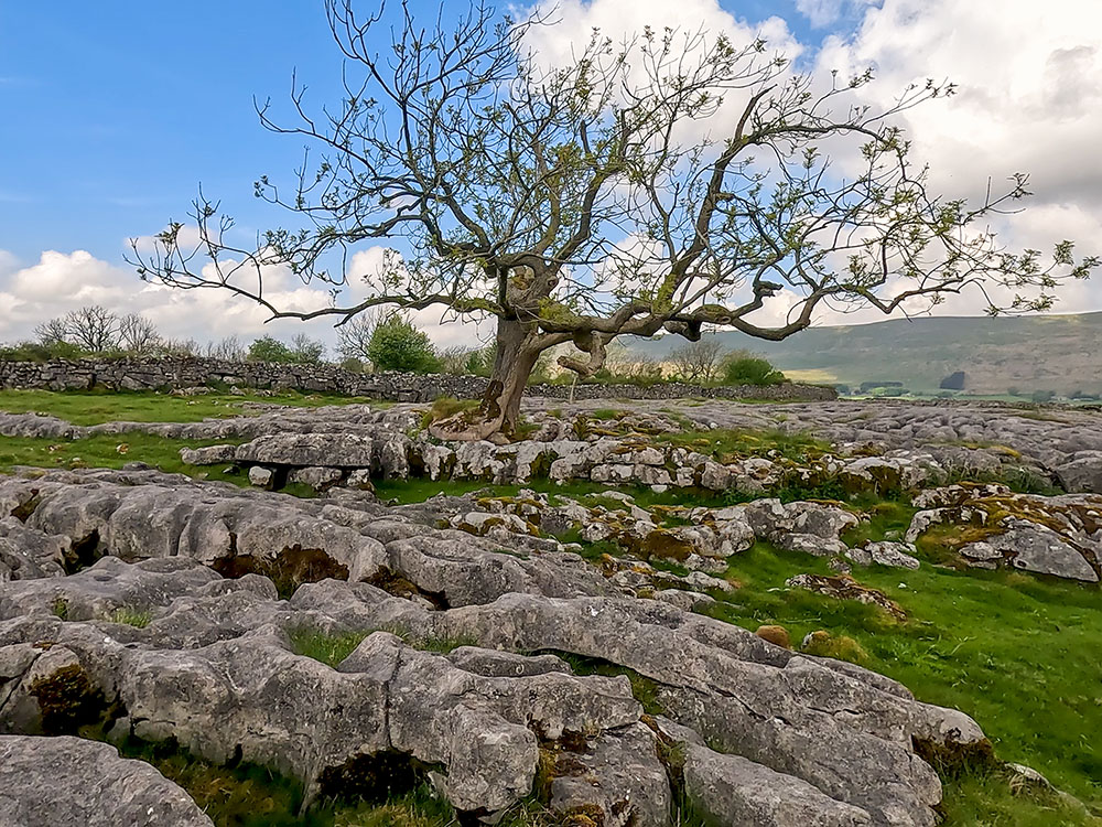
A tree sat amongst a limestone pavement, looking towards Whernside
From here, you can either walk the 800 metres or so back along the road to the parking or, to keep off the road, detour around and back along Philpin Lane to keep the road section to a minimum. Doing the whole route, rather than just the out and back from the summit, is 14.6 Km and includes 530 metres of ascent.
Keep checking back with us as we will soon add a video showing the whole walk, where to start this walk, directions to the parking, GPX download of this Ingleborough Walk from Chapel le Dale, OS route map of the walk, elevation profile and full detailed walk directions.
After the walk, why not try something to eat or drink further along the road in the Station Inn at Ribblehead or, if it is open, the nearby Old Hill Inn? Ingleton is just four miles down the road for a wider selection of pubs, cafés, and restaurants.
We start this walk from the roadside parking on the eastern edge of the village of Ingleton in the Yorkshire Dales. Depending upon where you park, you can begin the walk in Ingleton Village, which adds about three-quarters of a mile each way.
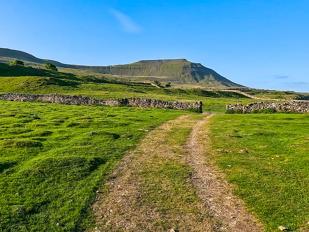
The walk up Ingleborough from Ingleton is 9.45 Km and includes 566 metres of ascent. We leave the road by way of Fell Lane (a track) that rises initially over Storrs Common. After a short distance, the track becomes walled on both sides, and we follow it as it slowly climbs for about 1 mile.
From the track, the path continues past Crina Bottom, the site of many photographs of Ingleborough. From here, the real climbing starts, as Ingleborough is climbed via a well-maintained footpath that affords ever-expanding views as more height is gained.
From the summit, there are views out into Morecambe Bay in the west and around the Lake District Fells, as well as to the nearby Whernside and Pen-y-ghent. You could extend and make this walk a circular by heading on to Little Ingleborough and down to Newby Cote or further along the Old Road, but it does mean a couple of miles of road walking at the end to get back to Ingleton, albeit along a generally quiet road.
Because of the road sections, as much as I prefer circular walks, on this walk, I think the out-and-back is just fine, so we retrace the path back to Ingleton, as it does afford different views in the reverse direction.
Keep checking back with us as we will soon add a video showing the whole walk, where to start this walk, directions to the parking, GPX download of this Ingleborough Walk from Ingleton, OS route map of the walk, elevation profile and full detailed walk directions.
After the walk, why not try something to eat or drink just down the road in Ingleton, with its selection of pubs, cafés, and restaurants?
This Ingleborough Estate Nature Trail walk starts in Clapham in the Yorkshire Dales, where there is a small fee to pay to pass into the Ingleborough Estate Nature Trail. The trail heads 1.25 miles through the delightful woods alongside the lake and then close to Clapham Beck before arriving at Ingleborough Cave.
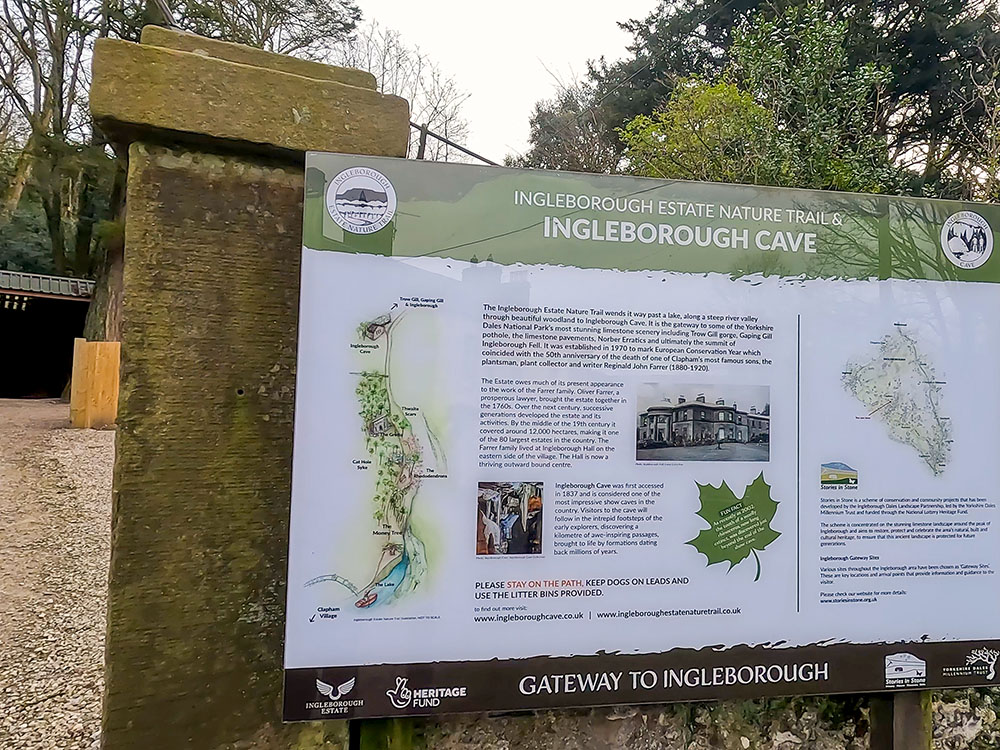
Entrance to the Ingleborough Estate Nature Trail
The path through the woods showcases the area’s biodiversity with its limestone landscapes. You can stop off and visit Ingleborough Cave (entrance fee is payable) to head 500 metres below Ingleborough, where in the show cave, you can take in the stunning cave formations.
Many people return down the same path back to Clapham, but we only do so for about the first 300 metres before heading over a footbridge and up the short, steep climb onto Long Lane. This climb affords different views from the woods walked through on the way out. Long Lane (a track) is followed back into Clapham.
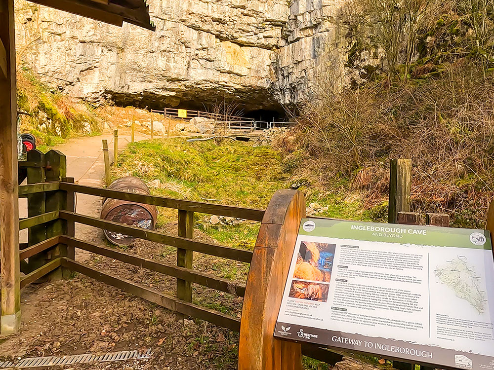
Sign at the entrance to Ingleborough Cave
The whole circular walk is 5.1 Km in length and includes 170 metres of ascent. The out-and-back walk is 2.5 miles long and includes 130 metres of ascent.
Keep checking back with us as we will soon be adding a video showing the whole walk, where to start this walk, directions to the parking, GPX download of this Ingleborough Estate Nature Trail walk from Clapham, OS route map of the walk, elevation profile and full detailed walk directions for this Ingleborough Estate Nature Trail walk from Clapham.
As with the other walks that started and ended in Clapham, after the walk, you can relax again with a drink or something to eat in Clapham, where you will find the Lakehouse Bar and Kitchen, The New Inn, and the Old Sawmill Café. There is more on these below and at the end of our Ingleborough from Clapham video above.
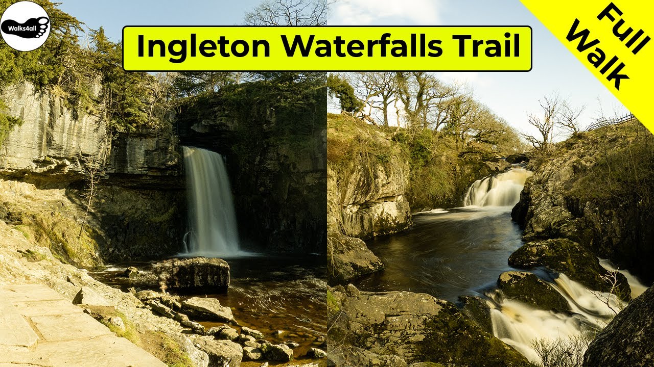
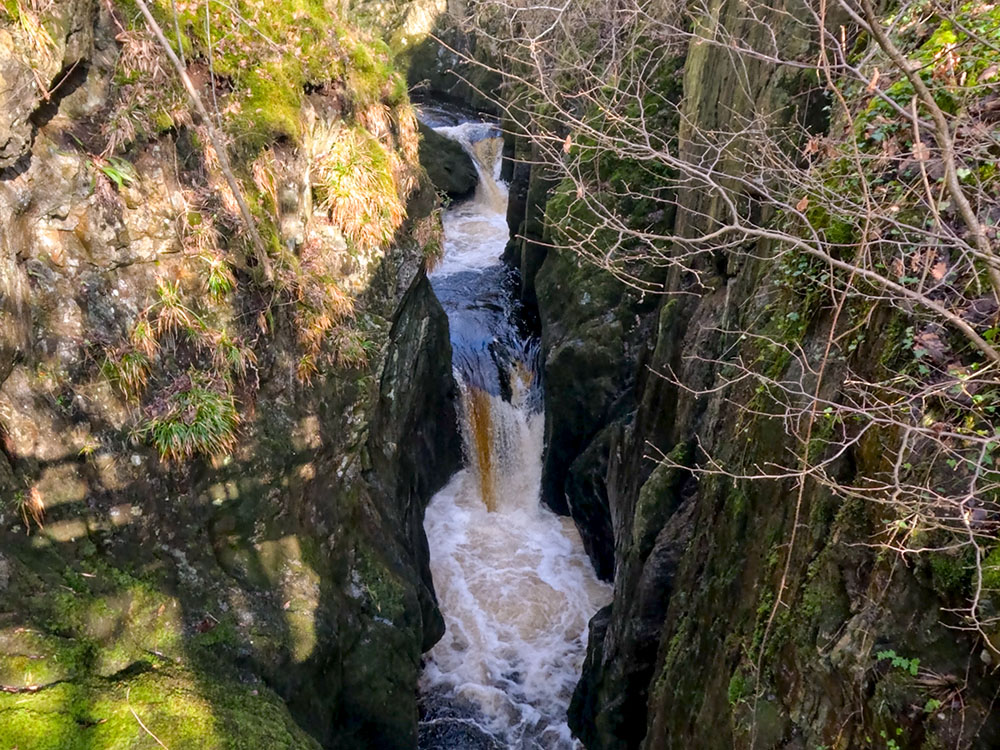
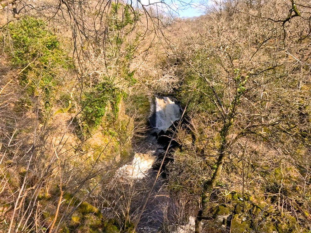
We couldn't do a section on Ingleborough walks without including the Ingleton Waterfalls Trail walk. Technically, you could probably get away with saying it is on the far eastern slopes of Ingleborough, but even if it isn't, it is near enough to be included, so if you are in the area, consider trying it.
Upper waterfalls at Pecca Falls
The Ingleton Waterfalls Trail walk, or the Ingleton Falls walk as it is often known, has to be my favourite waterfall walk in the country. Visitors have to pay an entrance fee, but the walk is all on private land, and the fee goes towards the path's upkeep and insurance.
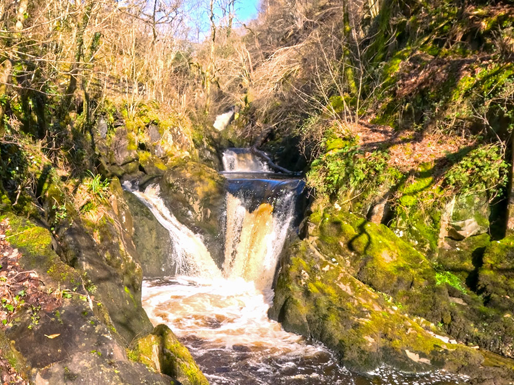
Middle waterfalls at Pecca Falls
Lower waterfalls at Pecca Falls
It is open most of the year, but it is always best to check their website after bad weather or when snow and ice are on the ground, as they close it occasionally. Their website also includes the current entry prices and opening and closing times for visitors.
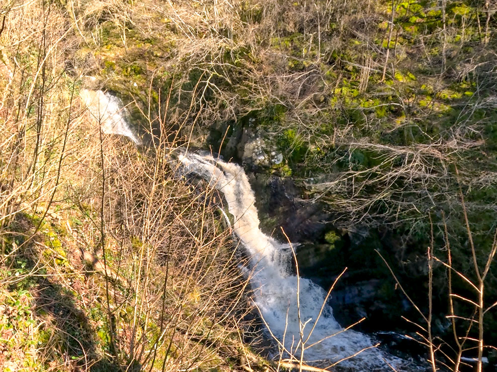
Hollybush Spout
The walk starts from their car park in Ingleton and follows the path alongside the river Twiss upstream before a section that takes you over to the river Doe, which is followed downstream back into Ingleton.
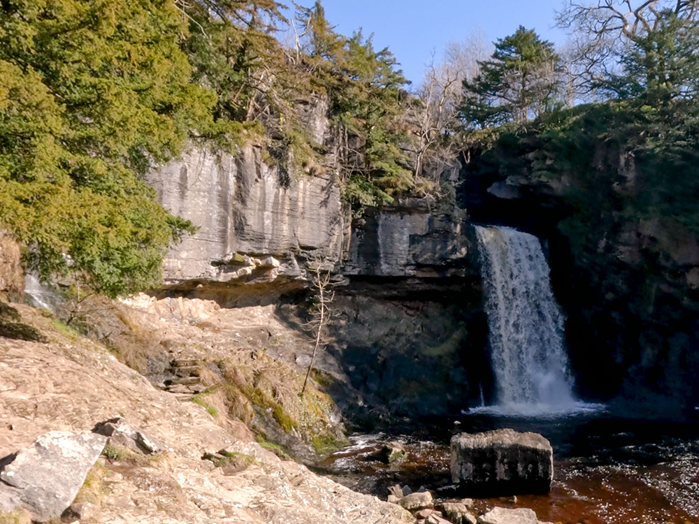
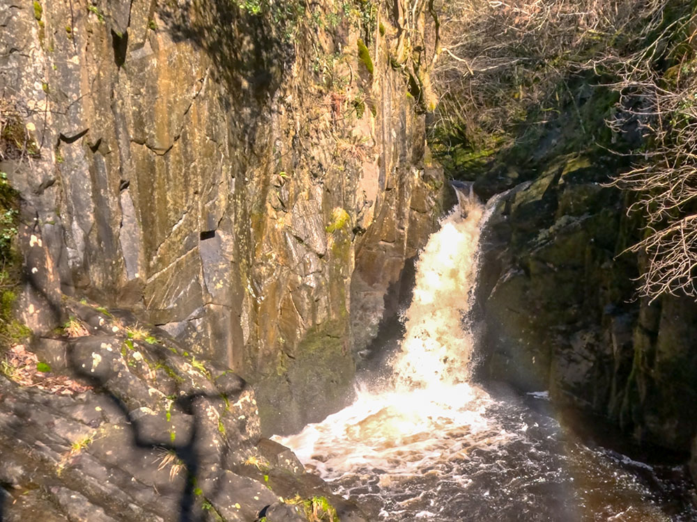
Thornton Force
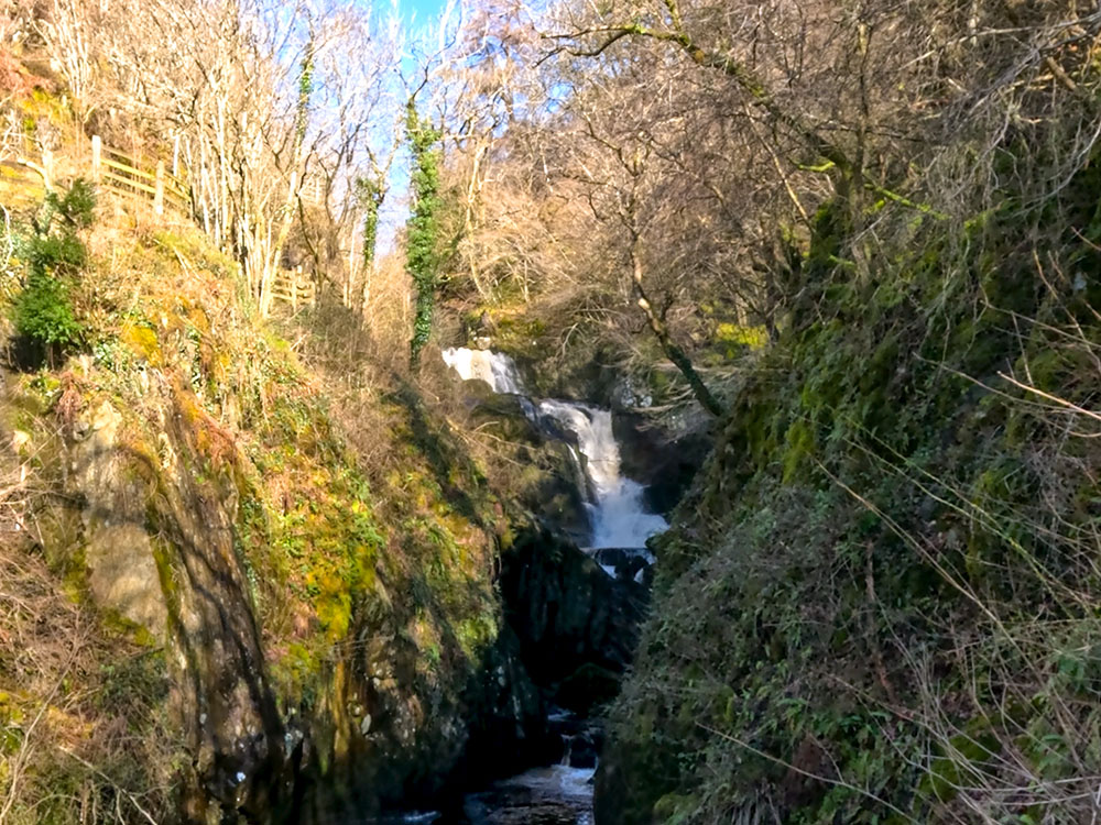
Top of Beezley Falls
The well-marked path through the ancient woodland passes by Pecca Falls, Hollybush Spout, Thornton Force whilst walking alongside the river Twiss.
Bottom of Beezley Falls
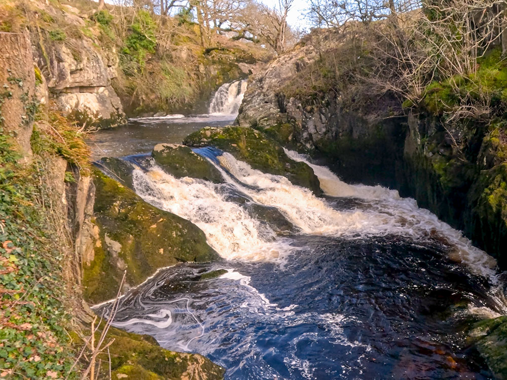
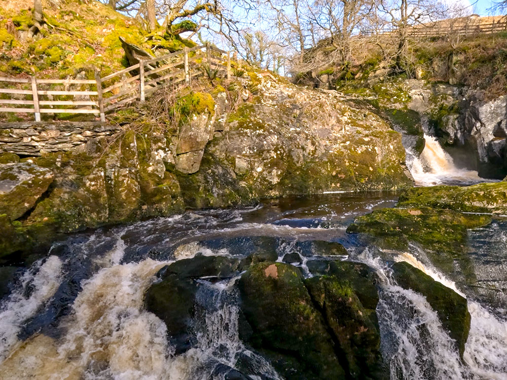
It then passes by the Beezley Falls, Rival Falls, Baxenghyll Gorge and Snow Falls whilst walking back alongside the river Doe.
Rival Falls
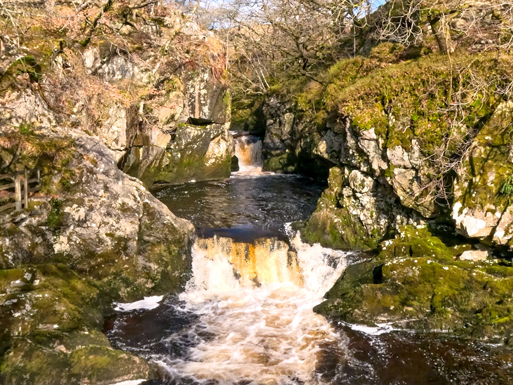
Baxenghyll Gorge
I always try to go on a sunny, clear day after a couple of days of heavy rain, which shows the waterfalls at their best.
Snow Falls
For where to start this walk, directions to the parking, a GPX download of this walk, an OS route map of the walk, an elevation profile, and detailed walk directions, check out our Ingleton Waterfalls Trail walk.
After the walk, why not try something to eat or drink in Ingleton, with its pubs, cafés, and restaurants? Towards the end of the walk, you pass quite a few of these before returning to the car park. Many of these are set out below and covered in more detail at the end of our Ingleton Waterfalls Trail walk video.
Ingleborough, a geological marvel in the Yorkshire Dales, is a testament to the power of natural forces that have sculpted its landscape over millions of years. The mountain is part of the Craven Fault system, which significantly influenced its geology.
The limestone characterising Ingleborough was formed over 300 million years ago during the Carboniferous period when a tropical sea covered the area. The remains of marine organisms accumulated on the sea floor, and this, along with lime mud, compacted over time to form the limestone.
Limestone is known for its permeability, allowing water to flow through and dissolve the calcium carbonate of which it is composed, which has led to the creation of extensive cave systems, such as White Scar Cave and the Ingleborough Cave, and numerous potholes, such as Gaping Gill. There are miles and miles of underground passages and many caves and caverns underneath Ingleborough.
The surface features, including the distinctive limestone pavements with clints and grikes, result from glaciation and chemical weathering. The ice age glaciers that once covered the land scoured the landscape, exposing and wearing away some of the limestone beneath. In the chemical weathering process, rainwater, slightly acidic from dissolved carbon dioxide, further eroded the limestone and contributed to developing the limestone pavements, gorges, caves, and potholes.
Ingleborough's summit plateau is a large, flat expanse of limestone capped with millstone grit. The millstone provides a harder coating, and the rocks above it have been worn away, creating a flat top. The mountain's base is made up of ancient Silurian and Ordovician rocks.
Ingleborough's geological wonders are visually stunning and provide insights into the Earth's ancient past, making it a fascinating destination for geologists, speleologists (cavers), nature enthusiasts, and walkers alike.
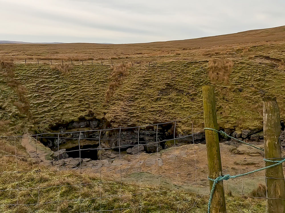
We've set out below some of those features that you can see and visit, but there are many caves and potholes, including the Northern Caves, such as Great Douk Cave and Meregill Hole, that are best left to experienced potholers. Another more obvious one of the Northern Caves is Braithwaite Wife Hole, whose imposing entrance at the bottom of the large hole passed on our Ingleborough walk from Chapel le Dale.
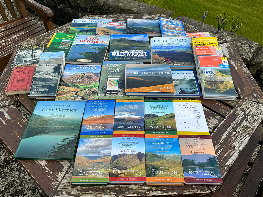
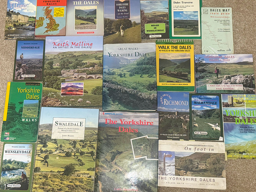
If Ingleborough has given you a liking for the Yorkshire Dales, check out our list of the best Yorkshire Dales walking books to find out more about the area.
Ingleborough Cave is a 1.25-mile walk from Clapham. To get to the show cave, you can walk through the Ingleborough Estate Nature Trail, as in the walk above, or walk parallel with that along Clapdale Lane out of Clapham and then drop down to meet Clapdale Drive just after it has exited the Nature Trail.
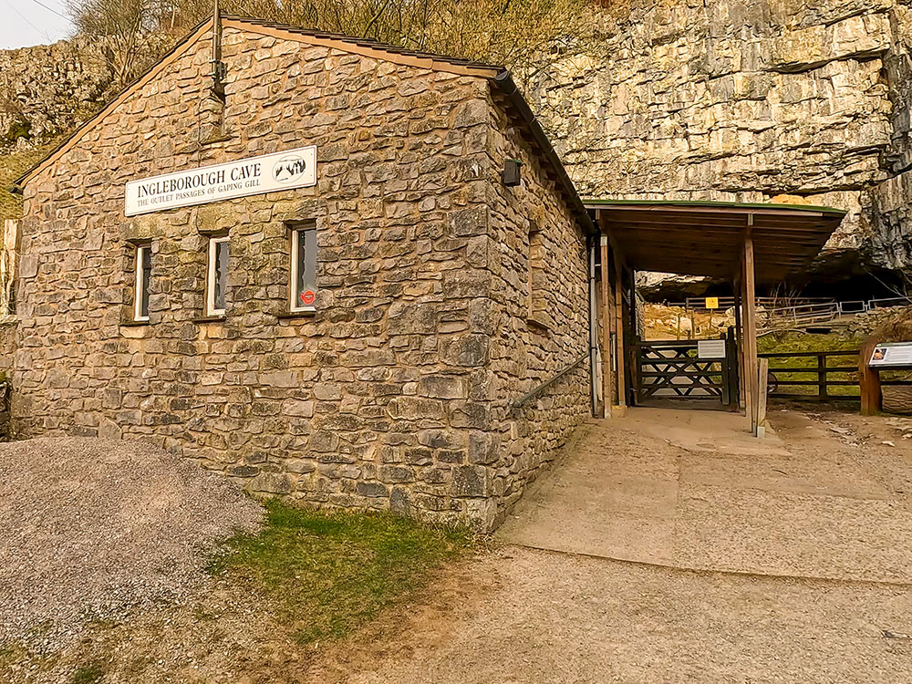
Entrance to Ingleborough Cave
The imposing entrance to Ingleborough Cave has always been visible, but in 1837, James Farrer and his workmen broke down the stalactite that blocked further access, removed various damns and drained a lake to reveal an accessible route through naturally sculpted passages and magnificent cave formations of stalactites, stalagmites and columns.
There is now a concrete path that heads 500 metres under Ingleborough, with lighting that highlights the formations at their best. Entry prices and opening times for visitors are available on the Ingleborough Cave website. Inside Ingleborough Cave, the temperature is a constant 8° Celsius, so you may need a fleece or a jacket. Visitors are allowed to take well-behaved dogs on a lead in the cave.
The formations have taken many different shapes, with the more well-known ones being The Beehive, the Sword of Damocles, the Inverted Forest, Queen Victoria's Bloomers, the Curtain Range, the Gothic Arch, Skittle Alley and the Pool of Reflections.
The cave continues past where members of the public can access it, through which Fell Beck, the stream that was believed to have formed Ingleborough Cave, is reached. In 1983, cavers from the Bradford Pothole Club made the connection from the cave to Gaping Gill.
White Scar Caves are on the eastern slopes of Ingleborough. They can be accessed by heading out of Ingleton about two miles along the B6255, where the show cave is reached on the right-hand side. The caves have parking, a shop, and a café. Visitors' opening times and entrance fees are on their website.
White Scar Cave is the longest show cave in Britain. The guided tour covers 1 mile and takes about 80 minutes. Check their home page if you are considering visiting, as the cave does close in bad weather, depending on water levels.
Discovered in August 1923 by Christopher Long and J.H. Churchill, this cave is home to a myriad of unique formations. Each feature tells a story of geological processes spanning thousands of years, from towering stalagmites to delicate stalactites.
As you pass through the cave, you will pass formations known as the First Waterfall, the Witch's Fingers, the Judge's Head, the Squeeze, the Arum Lily, the Devil's Tongue, the Carrots, the Battlefield Cavern, and the Face.
There are a couple of low roof passages in the cave, so you need to be able to bend at the waist, and hard hats must be worn (provided as part of the entrance fee). Visitors are informed that there are 97 steps, and much of the trail is on metal grid flooring, so walking sticks are unsuitable, and high heels should not be worn. As with Ingleborough Cave, the temperature inside is a constant 8° Celsius, so you'll need a fleece or a jacket. Dogs are not permitted in the cave.
Gaping Gill on the south-south-eastern slopes of Ingleborough in the Yorkshire Dales is one of the largest underground chambers in the UK. We pass by Gaping Gill on two of the walks above, Ingleborough from Clapham and Ingleborough from Horton in Ribblesdale, so you can see where it is in the video.
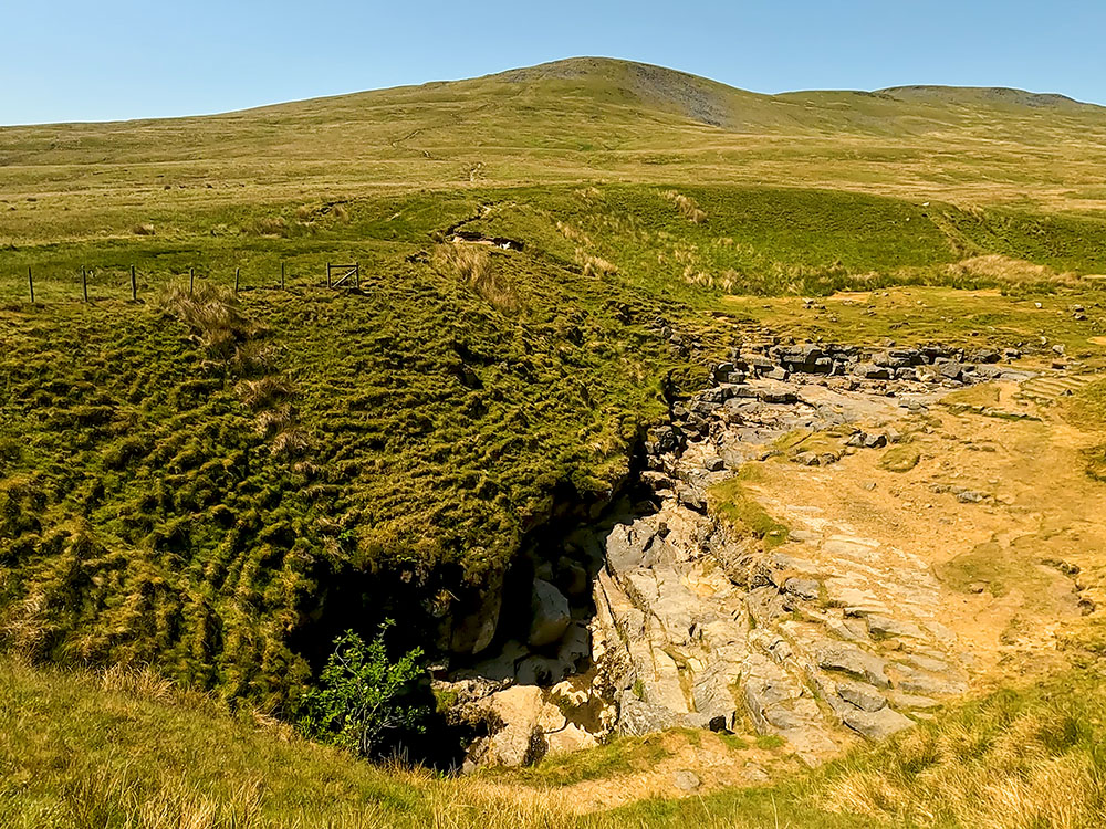
Gaping Gill with Little Ingleborough in the background
Fell Back runs into the Gaping Gill pothole and falls 98 metres to the floor of the chamber, so forming the highest unbroken waterfall in England. It forms the largest cave chamber in Britain, approximately 140 metres long. The water heading down the shaft draws air down, creating a constant draft, giving it its nickname of Hall of the Winds.
Visitors to Gaping Gill should take note, though, that various signs say to keep yourself and any children or dogs well away from the top as it's unfenced and a sheer drop. Very sadly, people have died at Gaping Gill.
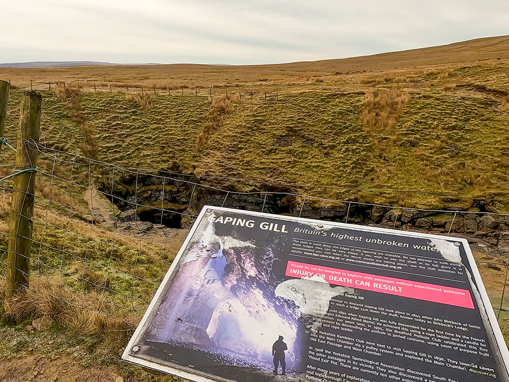
Top of Gaping Gill and Gaping Gill sign
If you do feel the need to explore it further, twice a year, Bradford Pothole Club for a week in May and Craven Pothole Club for a week in August, set up a winch above it, and you can be lowered into it in a chair. Much of the water is diverted whilst they do this so as not to soak those descending in the winch! More information about the charge, what to wear and when it takes place is available on their respective websites. As mentioned above, in 1983, cavers from the Bradford Pothole Club made the connection from Gaping Gill to Ingleborough Cave.
Trow Gill is a dry gorge on the south-south-eastern slopes of Ingleborough in the Yorkshire Dales. We pass by Trow Gill on two of the walks above, Ingleborough from Clapham and Ingleborough from Horton in Ribblesdale, so you can see where it is in the video.
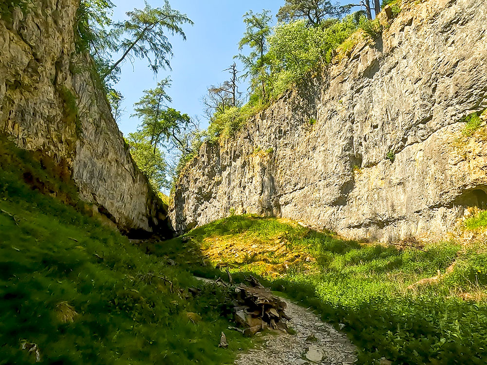
Trow Gill
Ingleborough's flat summit was once the site of a large hill fort. The hill fort dates back to the Iron Age and is believed to have been built by the Brigantes around the first century AD. At that time, The Brigantes were a tribe of Celtic people living in Northern England from the East to the West coast, the bulk of which is now Yorkshire. They were territorially the biggest tribe in Britain at the time.
The Brigantes were believed to have been under attack from the invading armies of Rome, and the large summit plateau on top of Ingleborough was chosen as their defensive site for the hill fort. With its size and the number of huts inside its perimeter wall, it is believed that it was also used as a fortified village and for military use. Whilst it might be chilly up on top now in winter, back then, the climate in the UK was much warmer.
The large flat-topped plateau on Ingleborough's summit
It is believed that a 3000-foot rampart wall of millstone grit rocks encircled Ingleborough's flat-topped summit, with entrances on the northern, eastern, and southwestern sides and inside this were around 20 huts measuring between 5 metres and 8 metres in circumference.
In some places, the rocks making up the remains of the outlines of the encircling wall and the circular huts can still be seen, so don't go picking up rocks for cairns when they might have great historical significance in the place where they lie!
The walks above all start in Ingleton, Chapel le Dale, Clapham, or Horton in Ribblesdale, so we've selected just some of the pubs, takeaways, and cafés in the villages and hamlets around Ingleborough.
More information can be found at the end of the walk videos.
The Lake House Bar and Kitchen is dog-friendly and specialises in local real ales, small brewery craft ales and real cider. It offers food all day long, including its speciality pizzas. I don't think they open every day of the week, so maybe check first.
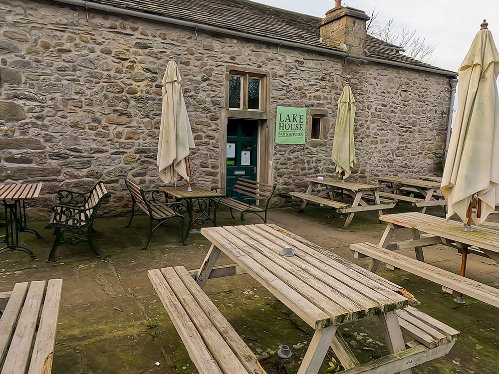
Lake House Bar and Kitchen
The New Inn has accommodation and, I believe, is dog-friendly. It serves brunch from 10:00 to 12:00, lunch from 12:00 until 15:00, and evening meals from 17:00 to 21:00. It also serves coffees, teas, a range of ales, and gins from around the world. There are a few seats at the front and a beer garden around the back.
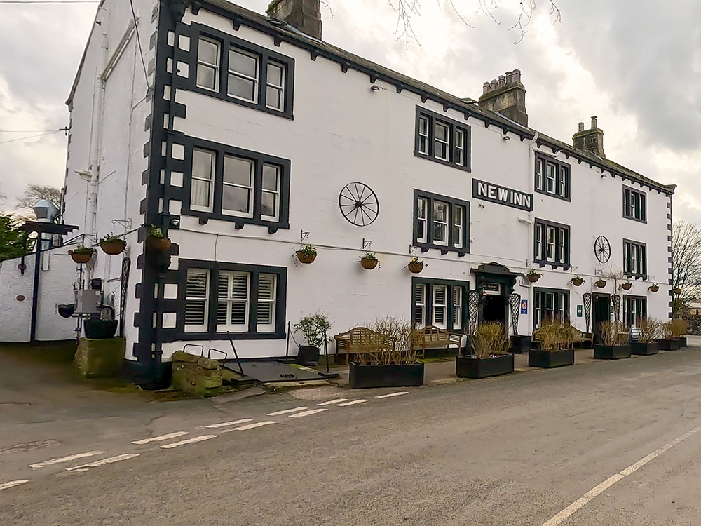
The New Inn at Clapham
The Old Sawmill Café is open from 9:30 to 4:30 each day except for a short period over Christmas. It is dog-friendly, serves teas and coffees, and has a small menu and cake bakes. It also has outside seating.
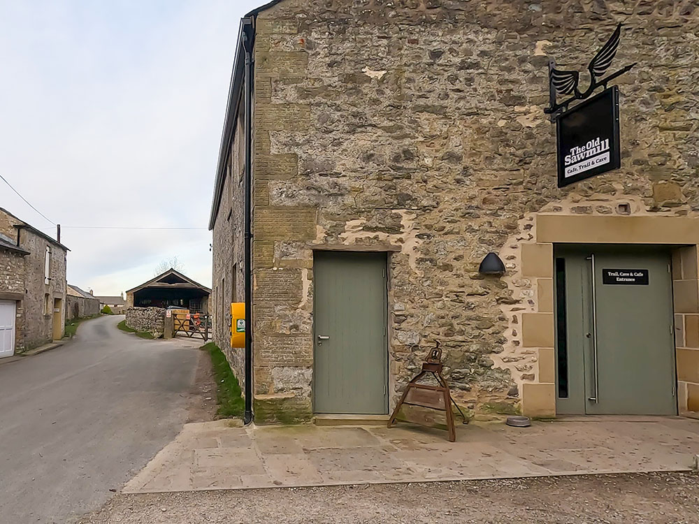
The Old Sawmill at Clapham
The Station Inn serves food and drink, is dog-friendly and has some accommodation. It was built at a similar time to the Ribblehead Viaduct and was licensed in 1879. It also has a beer garden around the back with views of Whernside and the Ribblehead Viaduct. I believe you can book in at the bar and stop in a camper van here in the car park.
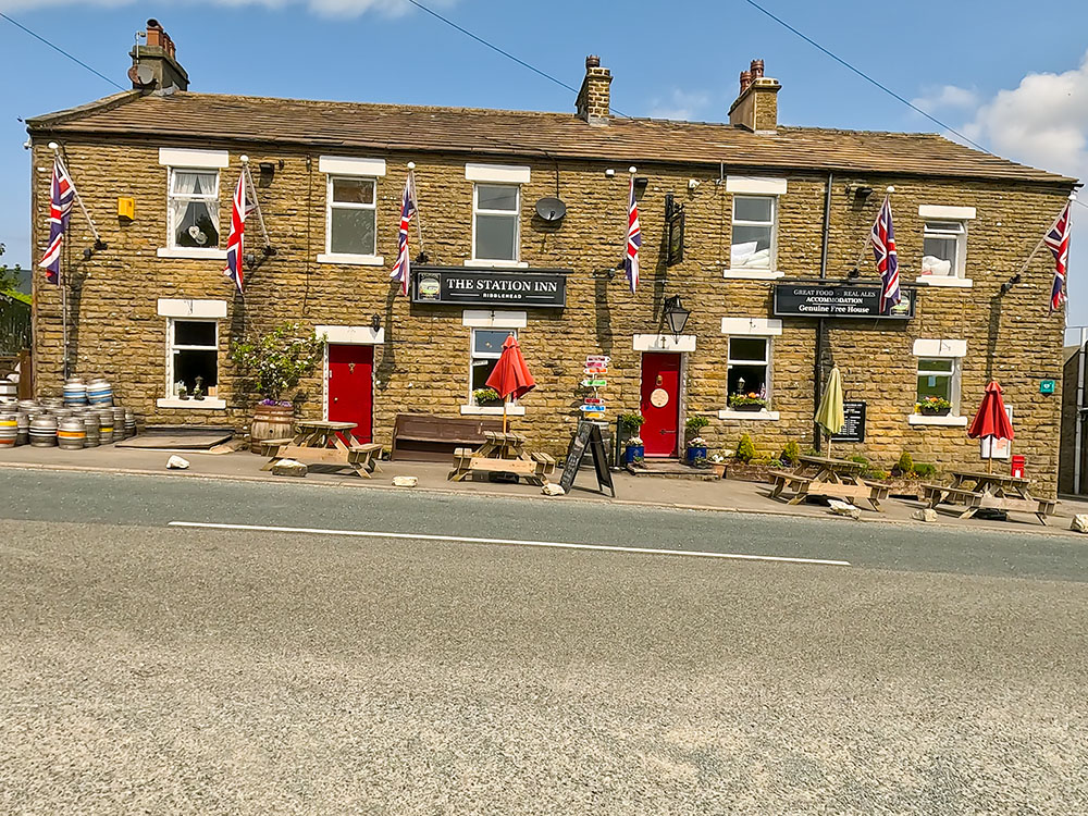
The Station Inn at Ribblehead
I've had a few good meals in the Old Hill Inn in the past, but I believe at the moment, the Old Hill Inn is only open in the evenings, and they generally only serve food to the residents staying there. But they do take extras from time to time if they have the staff. So I would suggest ringing them first to confirm.
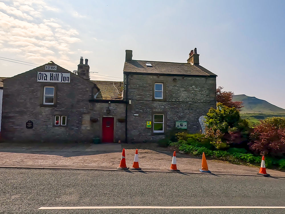
The Old Hill Inn at Chapel le Dale
On the A65, about half a mile outside Ingleton is Country Harvest. There is a large coffee shop that serves a wide selection of traditional home-cooked meals, from light bites to afternoon teas, hot lunches, desserts and cakes, with a view of Ingleborough from some of the tables.
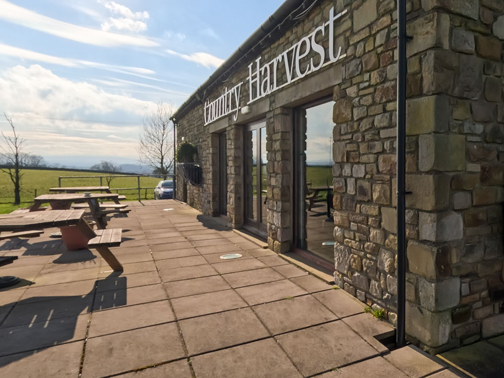
Country Harvest
There is also a butchery, farm shop, bakery, and a clothing, gift, and food hall. Dogs are not allowed inside, but there are some benches outside.
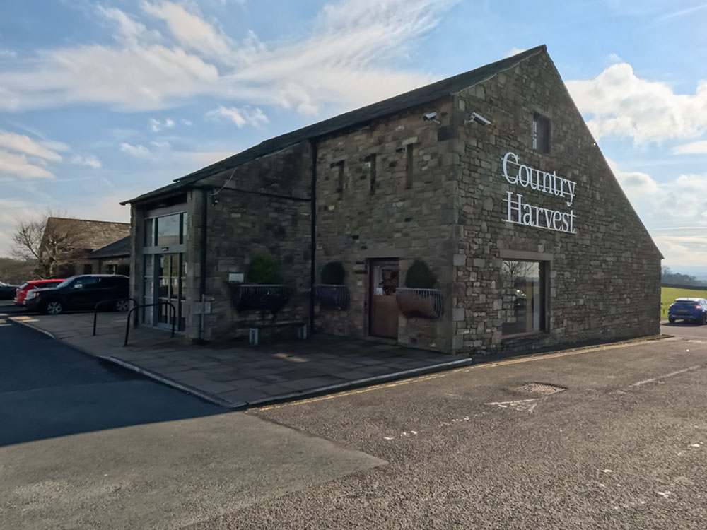
Entrance to Country Harvest
The Craven Heifer is a traditional village pub in Ingleton that serves home-cooked meals and a wide range of ales, spirits, wines and lager. It is also dog-friendly.
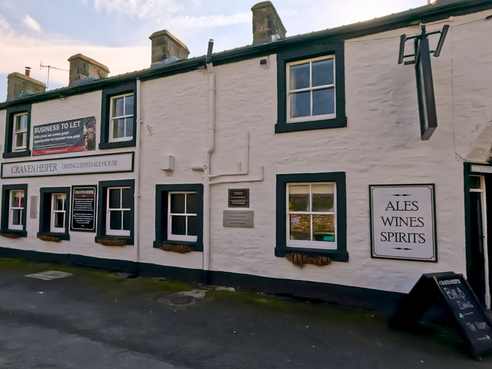
Craven Heifer at Ingleton
The Masons Freehouse is on the A65 in Ingleton and offers home-cooked food, a range of wines and spirits, and various cask ales. It has a covered terrace at the back, some accommodation, and I believe it is dog-friendly.
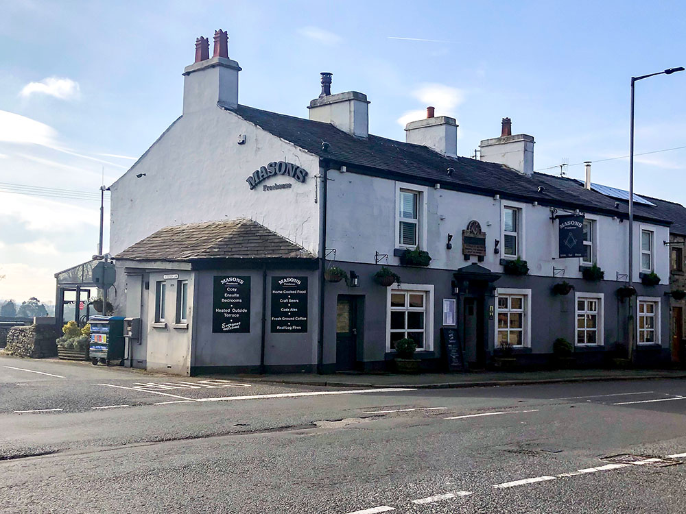
Masons Freehouse at Ingleton
The Old Post Office (OPO) Bar serves a wide range of local ales, craft beers, international beers, spirits, wine, and cocktails, along with some snacks. I believe it is currently open Thursdays through Sundays.
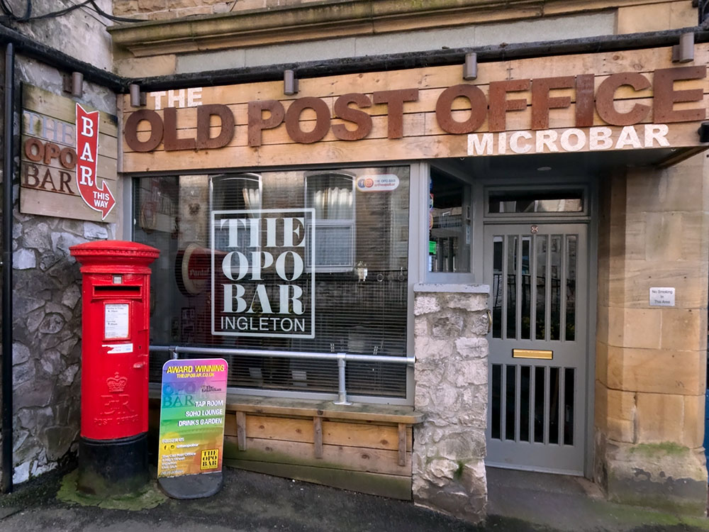
OPO Bar at Ingleton
A family-run Italian restaurant in Ingleton.
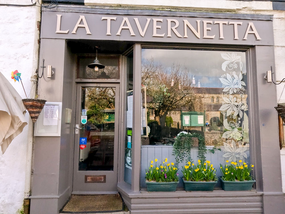
La Tavernetta Italian Restaurant at Ingleton
Small, 6-table restaurant in Ingleton providing a casual dining experience.

Peaks & Troughs at Ingleton
Fish and chip shop in the centre of Ingleton, which you pass at the end of the Ingleton Waterfalls walk.
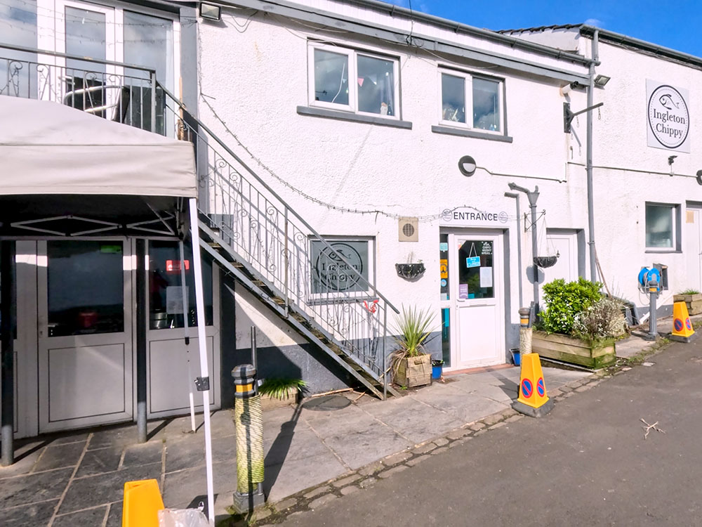
Ingleton Chippy
Bakery shop in Ingleton that offers hot and cold food to takeaway along with a range of bakery products, including their award-winning sourdough loaves, cakes and pastries. All ideal for taking on your walk!
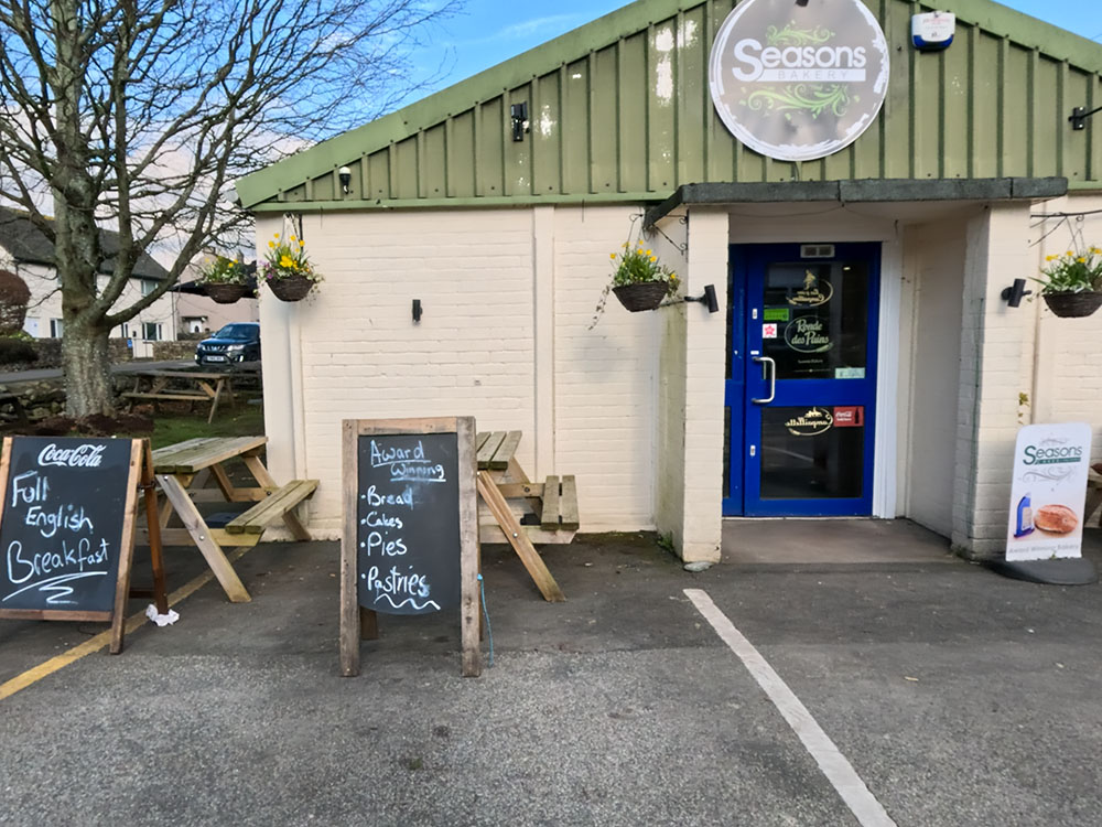
Seasons Bakery at Ingleton
Bank Top Restaurant offers a dining experience with a seasonal menu, locally sourced where possible and caters to all tastes. The restaurant is licensed, but dogs are not allowed. Menu and opening times available on the Bank Top Restaurant website.
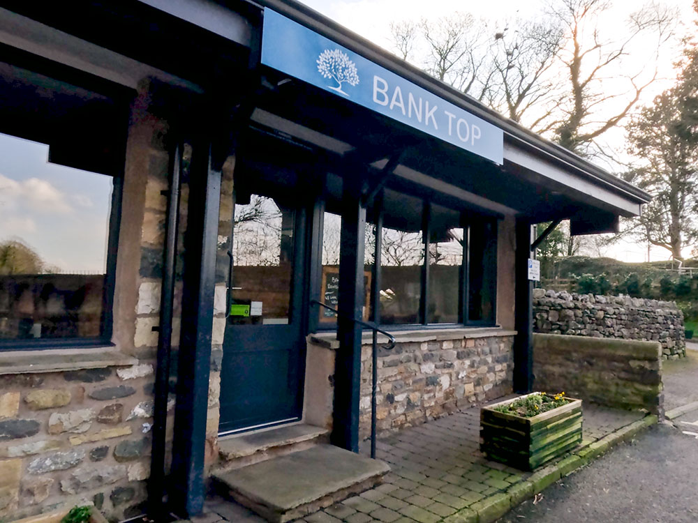
Bank Top Restauarnt at Ingleton
G&T's Café and Kitchen serves breakfast, brunch, homemade cakes, and teas and coffees. Contact details are on their Facebook page.
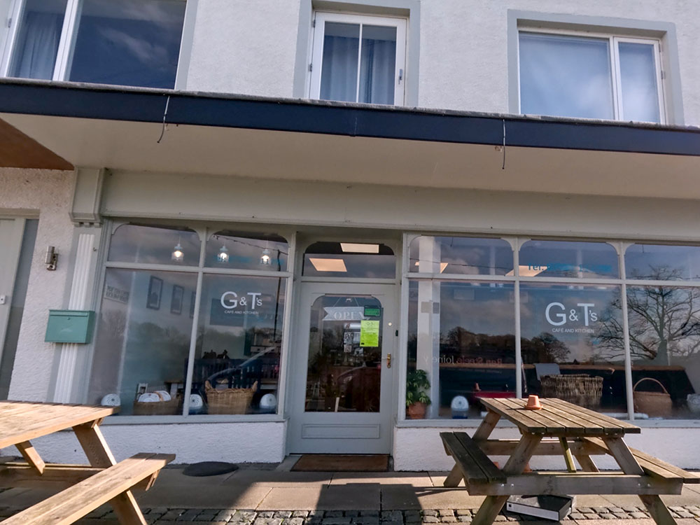
G&T's at Ingleton
Inglesport is an outdoor shop in Ingleton with a café upstairs. Amongst other things, they serve a selection of breakfasts, toasties, and specials of the day, along with home-baked cakes, scones, and tray bakes and is dog-friendly. There are further details available on the Inglesport Café Facebook page.
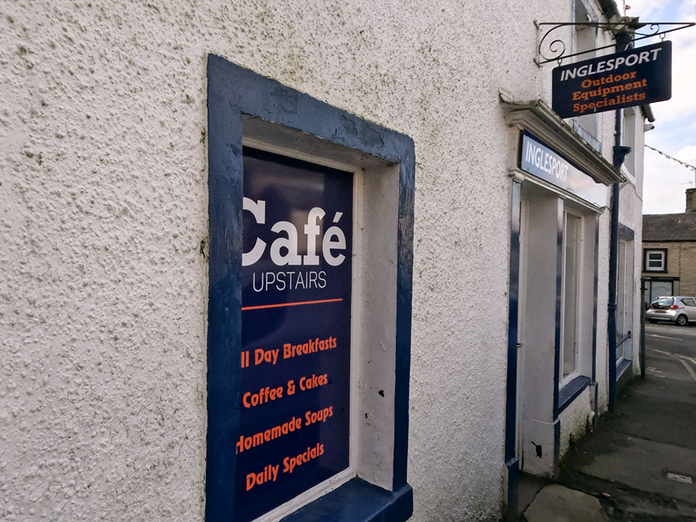
Inglesport Cafe at Ingleton
A takeaway that sells pizzas, burgers, kebabs and more. Online ordering available via their website.
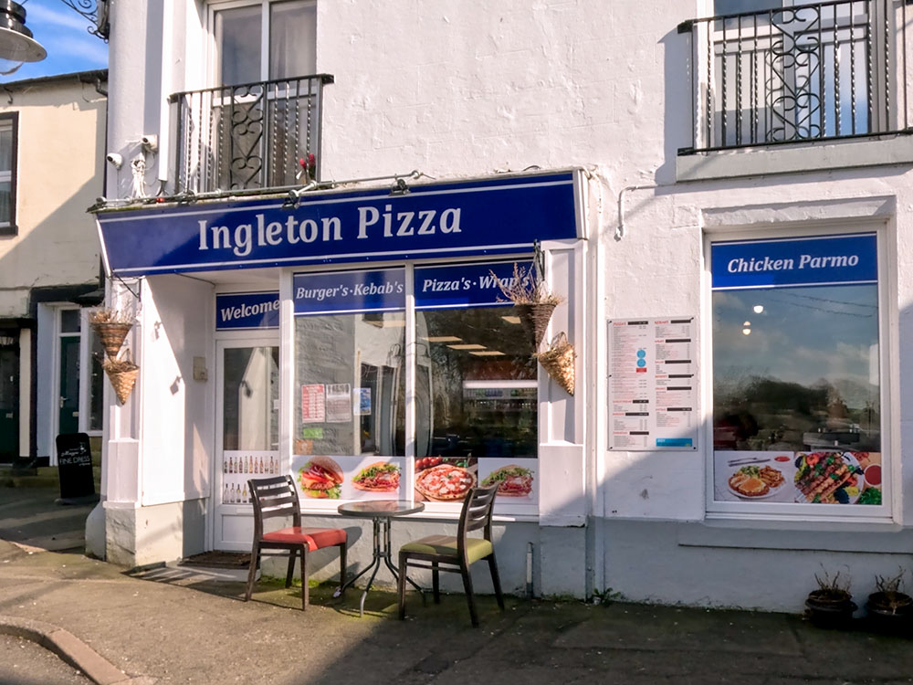
Ingleton Pizza
The Village Kitchen serves sweets, savouries and refreshments, along with a range of teas and coffees. It is all fresh, local and homemade and they have a deli-style sandwich/salad bar. Further details available on their Facebook page.
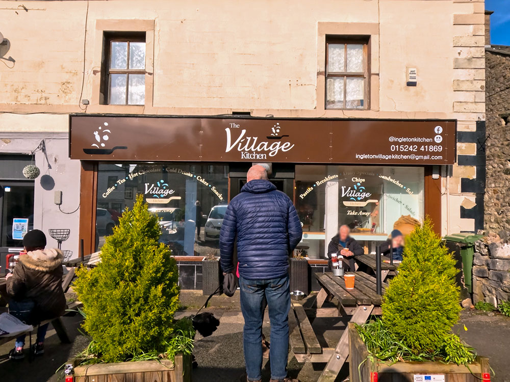
The Village Kitchen at Ingleton
The Wheatsheaf was built in the 17th century and serves cast ales, wines, spirits, and food. It has some accommodation and a good-sized beer garden at the back and a car park. It is dog-friendly.
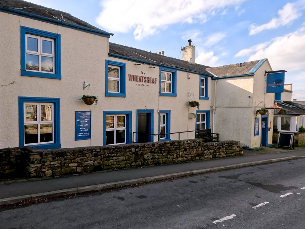
The Wheatsheaf at Ingleton
The Three Horse Shoes is a Thwaites pub that serves a range of food and drink. It's dog-friendly and has a beer garden around at the back.
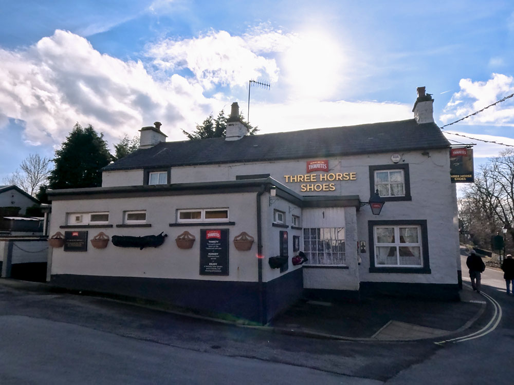
Three Horse Shoes at Ingleton
The Crown Hotel serves food and drinks, but after reading some online reports - and I've not been in for a while - I'm not sure whether it's dog-friendly or not. So it is best to check first if you've got a dog with you.
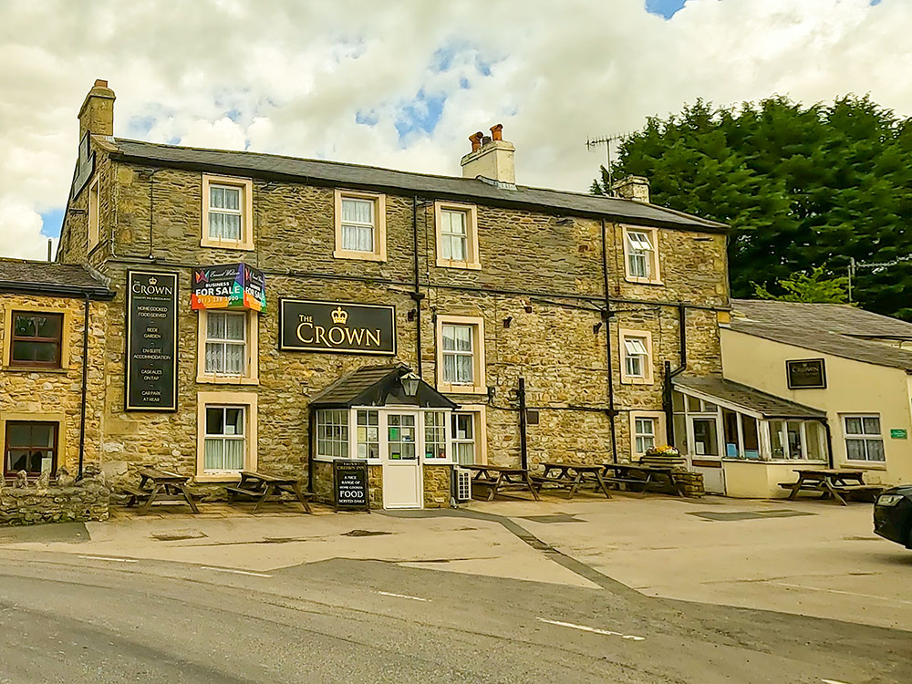
The Crown at Horton in Ribblesdale
The Golden Lion Hotel serves food and drink and has some accommodation. I believe dogs are allowed in the bar and the taproom. It also offers all-day parking.
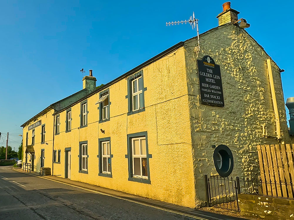
The Golden Lion Hotel at Horton in Ribblesdale
References:
White Scar Cave website
Ingleborough Cave website
The Journal of Antiquities
March 2024
 Yorkshire Three Peaks Walk from Horton in Ribblesdale
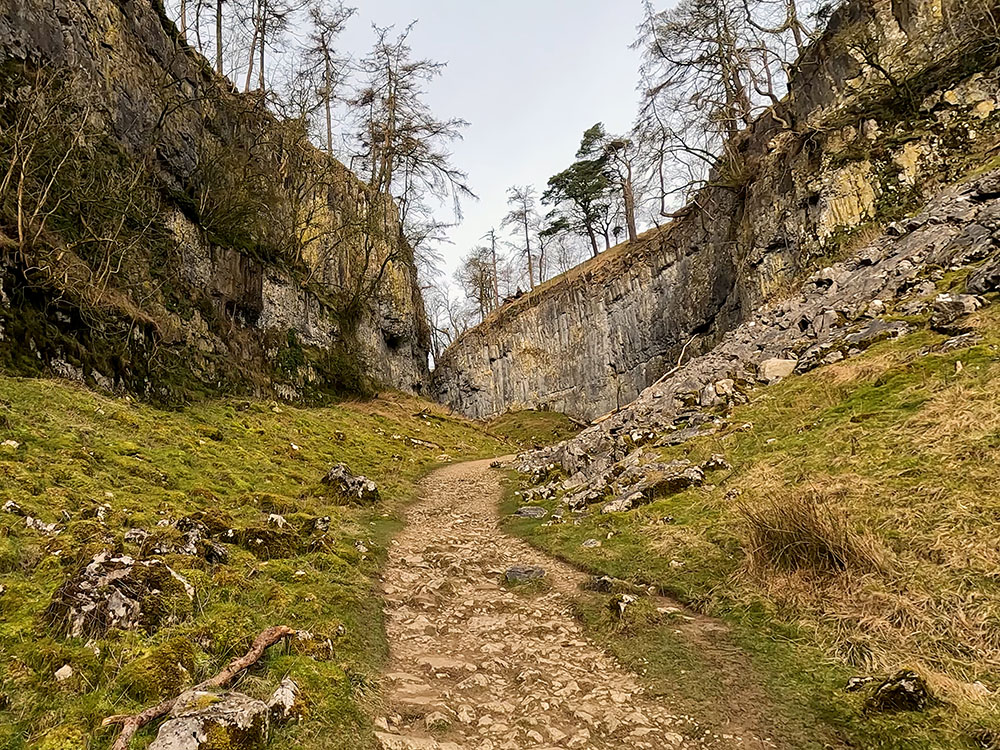 Ingleborough walk via Ingleborough Cave, Trow Gill and Gaping Gill from Clapham
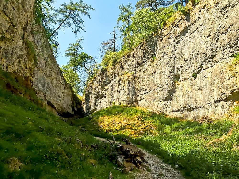 Ingleborough via Sulber, Trow Gill and Gaping Gill walk from Horton in Ribblesdale
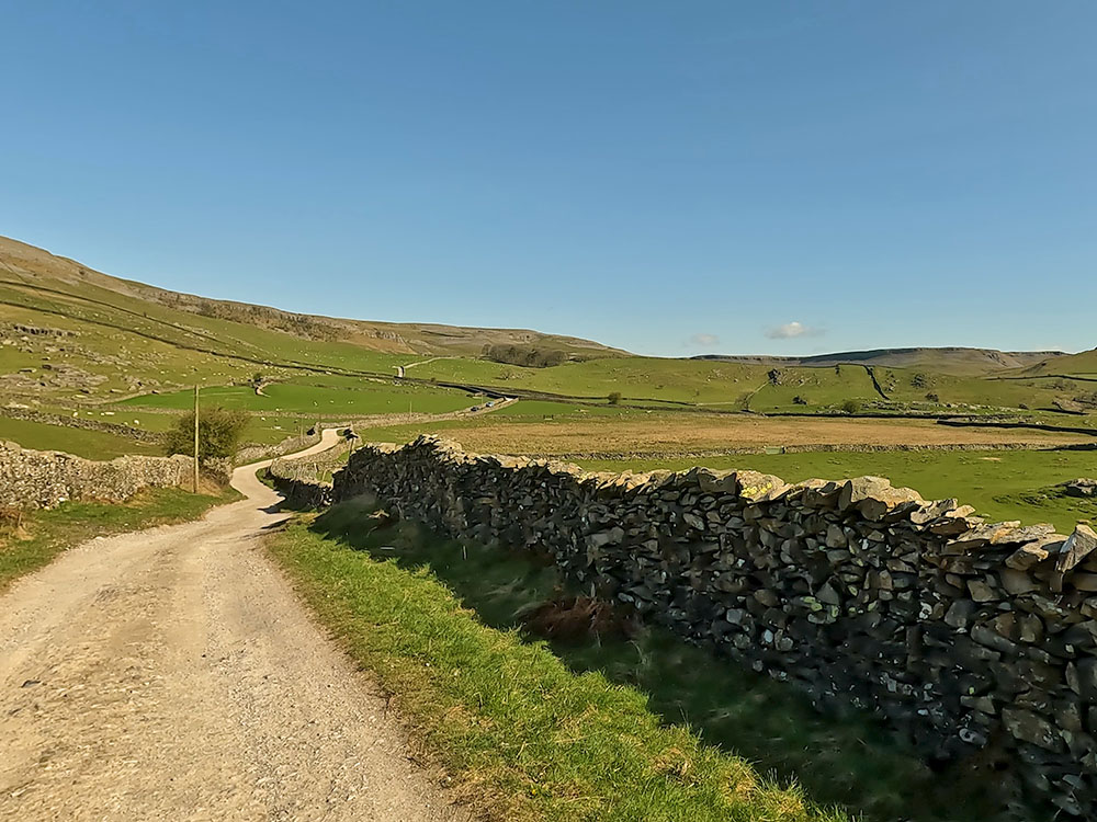 Thieves Moss, Moughton Scars and Norber Erratics walk from Clapham
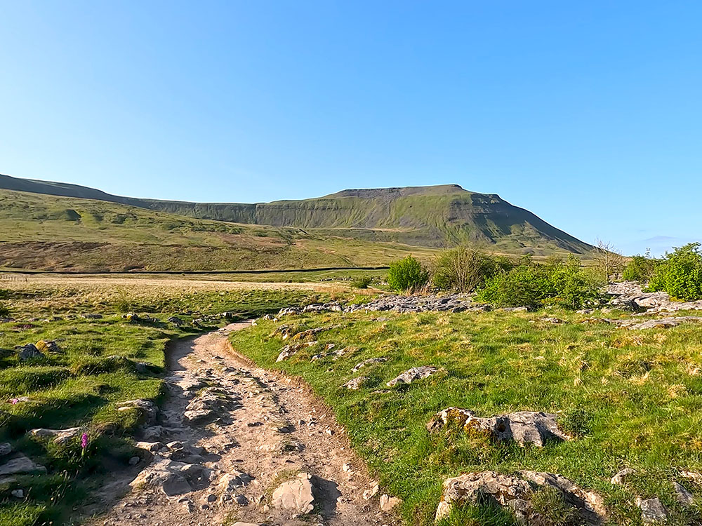 Ingleborough walk from Chapel le Dale (shortest route)
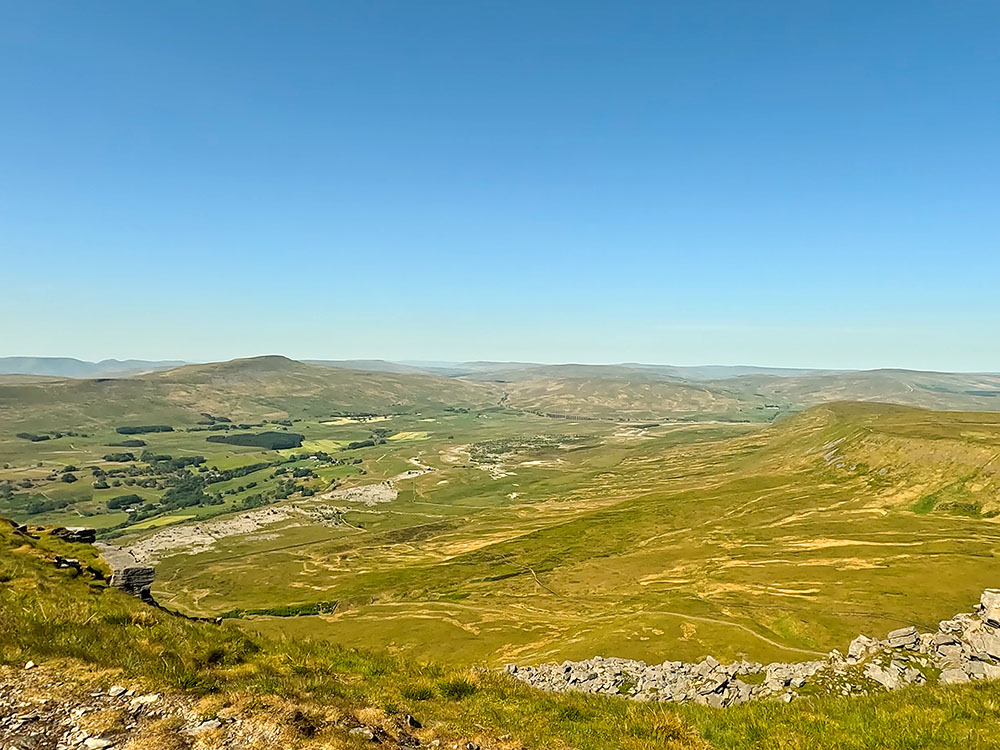 Ingleborough walk from Ingleton
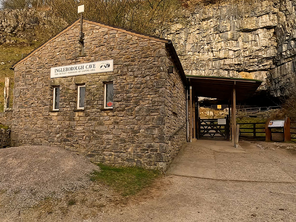 Ingleborough Estate Nature Trail and Ingleborough Cave walk from Clapham
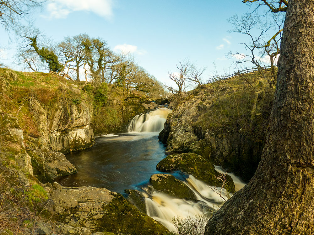 Ingleton Waterfalls Trail walk