By using this website, you agree to our use of cookies (needed to provide our website’s features) and our Terms of Use.
By: Andrew Forrest - Updated November 2024
Explore the captivating allure of Pendle Hill with our Ultimate Guide, where history, nature, and adventure converge in Lancashire's iconic landscape. From the haunting tales of the Pendle Witch Trials to exhilarating walks, picturesque villages and hidden gems, this comprehensive guide will unveil the secrets of Pendle Hill, making your visit an unforgettable journey.
This page contains affiliate links. If you buy products or services via these links, we may earn a small commission at no cost to you. If you are thinking of buying, please use our links, as it helps support our website and YouTube channel.
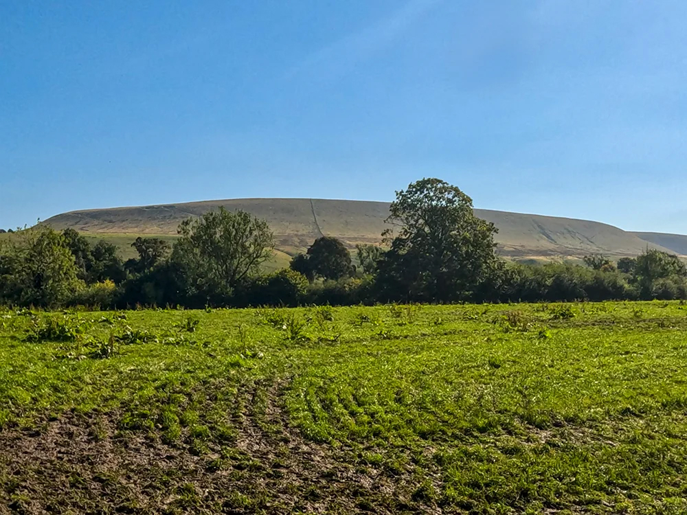
Pendle Hill is an iconic and distinctive hill nestled in the heart of Lancashire, England, amid the enchanting landscape of the Forest of Bowland. Rising to an elevation of 557 metres (1,827 feet) at its highest point, whilst it may be 53 metres (173 feet) short of being a mountain, it still commands attention with its looming presence and stunning panoramic views of the surrounding countryside. On a clear day, you can see as far as the Lake District to the north, over to the Yorkshire Three Peaks in the east, down to the Snowdon range to the south and even Blackpool Tower out to the west.
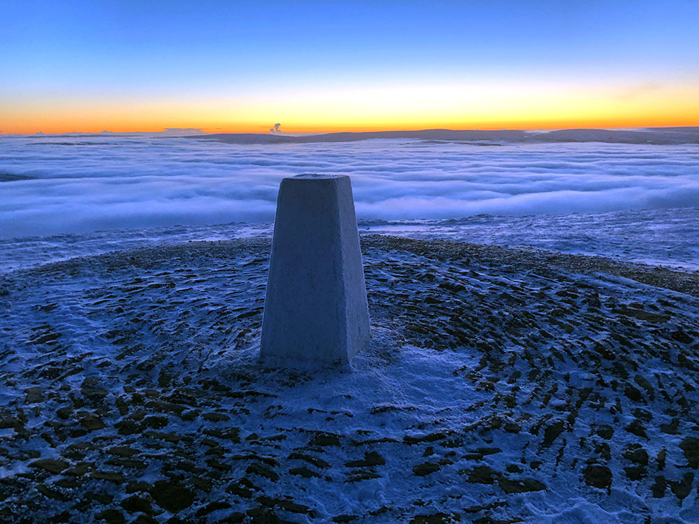
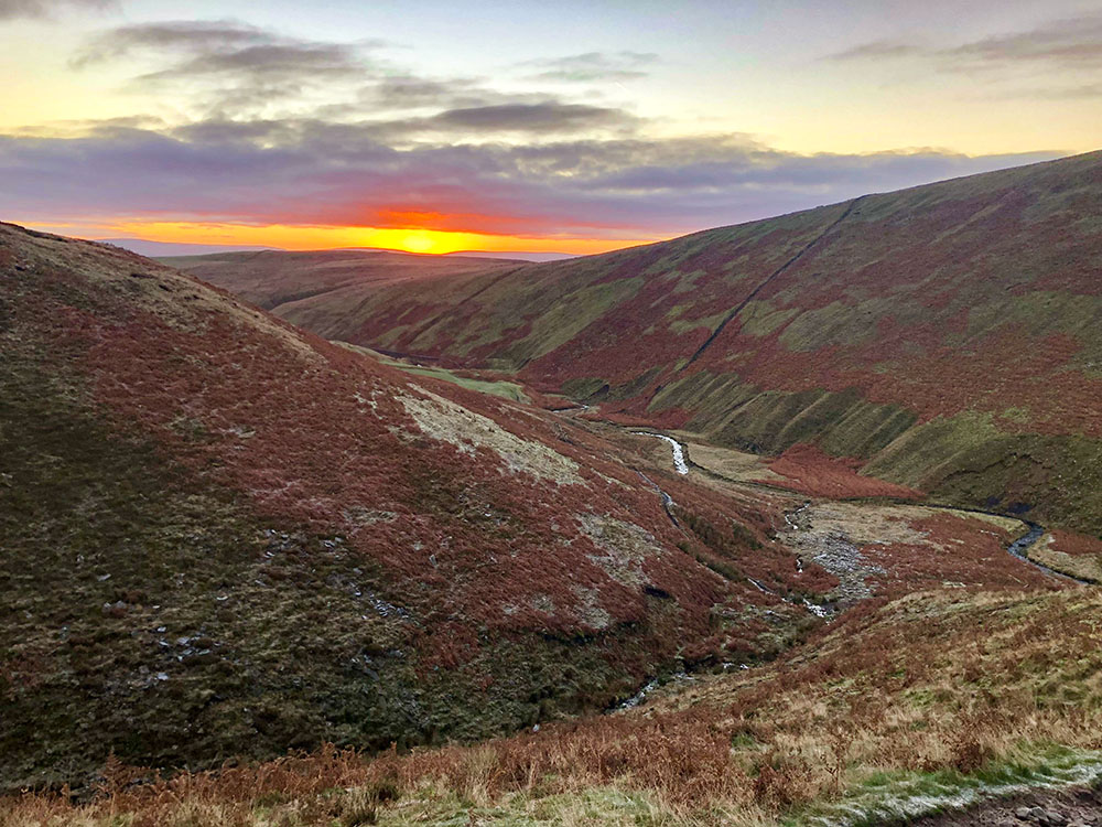
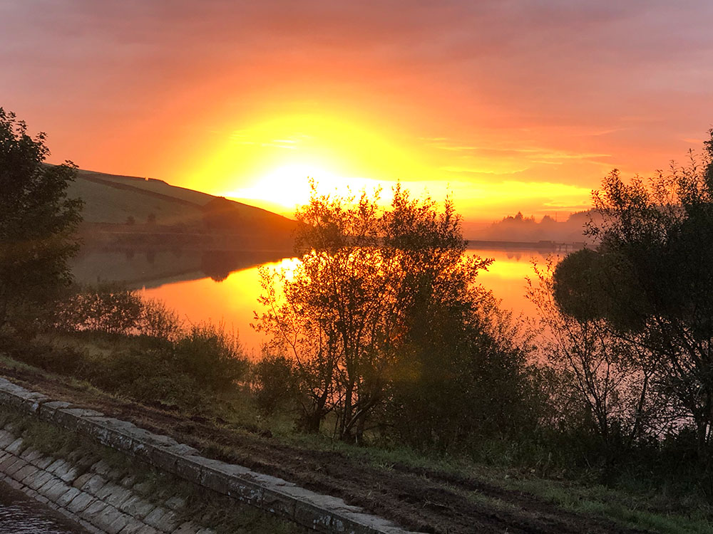
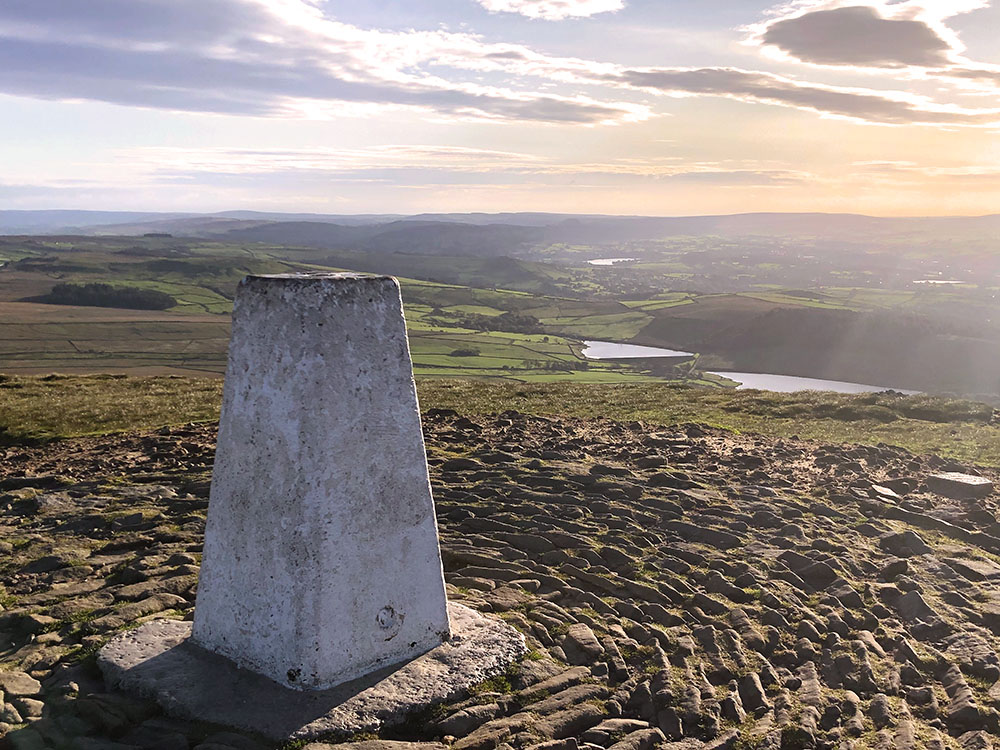
Early morning on the summit of Pendle Hill with a cloud inversion
While its natural grandeur is undeniable, Pendle Hill is perhaps most renowned for its historical significance, notably as the setting for the infamous Pendle Witch Trials of 1612, and as the site where George Fox, the founder of the Quaker movement, had a profound spiritual experience in 1652. Pendle Hill has long been a site of pilgrimage both for those interested in its bewitching past and for outdoor enthusiasts who seek the thrill of hiking its slopes and exploring its diverse landscapes, including heather-covered moors and lush woodlands.
Today, Pendle Hill continues to captivate visitors with its blend of history, natural charm, and the opportunity for adventure and reflection amidst the stunning Lancashire countryside. The picturesque villages dotting its base and the delightful local eateries nestled in these hamlets invite locals and visitors alike to savour the region's rich cultural and culinary offerings, making Pendle Hill a destination with broad appeal to people with a diverse range of interests.
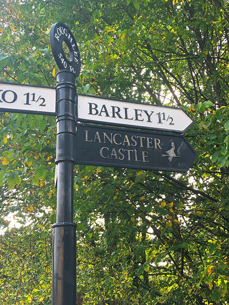
Pendle Hill is located in Lancashire, North West England, within the Forest of Bowland, an Area of Outstanding Natural Beauty. It is surrounded by charming villages and hamlets like Barley, Downham, Sabden, Roughlee, and Newchurch-in-Pendle, each contributing to its rich local culture and historical significance. Pendle Hill is easily accessible from nearby towns and cities like Burnley, Clitheroe and Blackburn, and with Pendle Hill being an isolated hill, it makes it a prominent landmark in the region.
It is called Pendle Hill because, back in the 13th century, Pendle Hill was originally called Penhul, with 'hul' or 'hyll' both meaning hill from Cumbric, which was a common language in Northern England in the Middle Ages. At that time, the word 'Pen' also meant hill in Cumbric, so all together Pendle Hill effectively is derived from hill, hill, hill! So, Pendle Hill's name is effectively three hills in one.
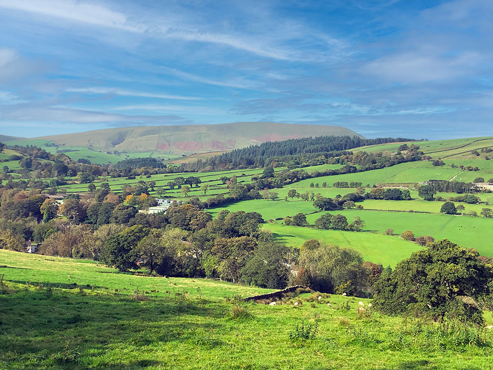
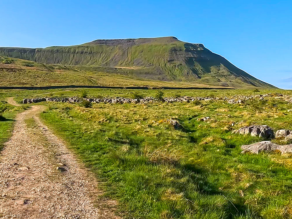
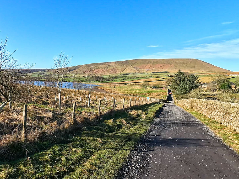
Pendle Hill from Pasture Lane
Pendle Hill offers more than just historical intrigue - it's a haven for hikers and walkers yearning for the thrill of exploration amid its natural splendour. With its rolling moorlands, lush woodlands and serene reservoirs, Pendle Hill and the surrounding countryside beckons outdoor enthusiasts to discover its diverse landscapes and numerous great walks. I have walked over Pendle Hill many hundreds of times, having been born close by and yet, with the changing seasons and the many different ways up and down, I find there is nearly always something new to discover.
We've set out six of our favourite walks over, around and near to Pendle Hill, all with a pub or two at the start and finish. Each of these walks showcases different facets of this timeless and enchanting terrain where history, nature and adventure seamlessly intertwine, so get your walking boots on and get out there and explore!
If you are new to walking, don't forget to check out our beginner's guide to walking and hiking and our hiking safety tips. If you are unsure what to wear and take on your walk, especially when undertaking some of the longer walks, check out our day hiking essentials checklist.
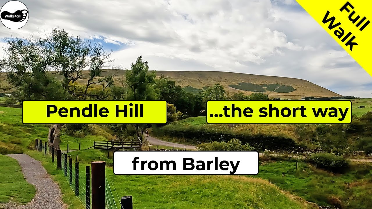
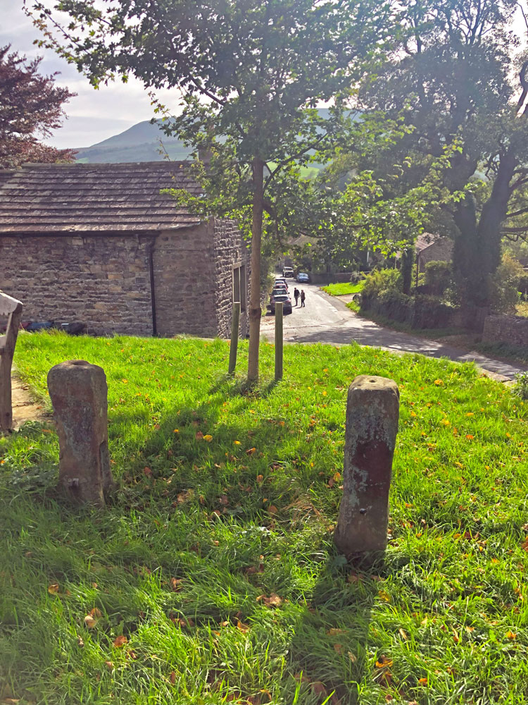
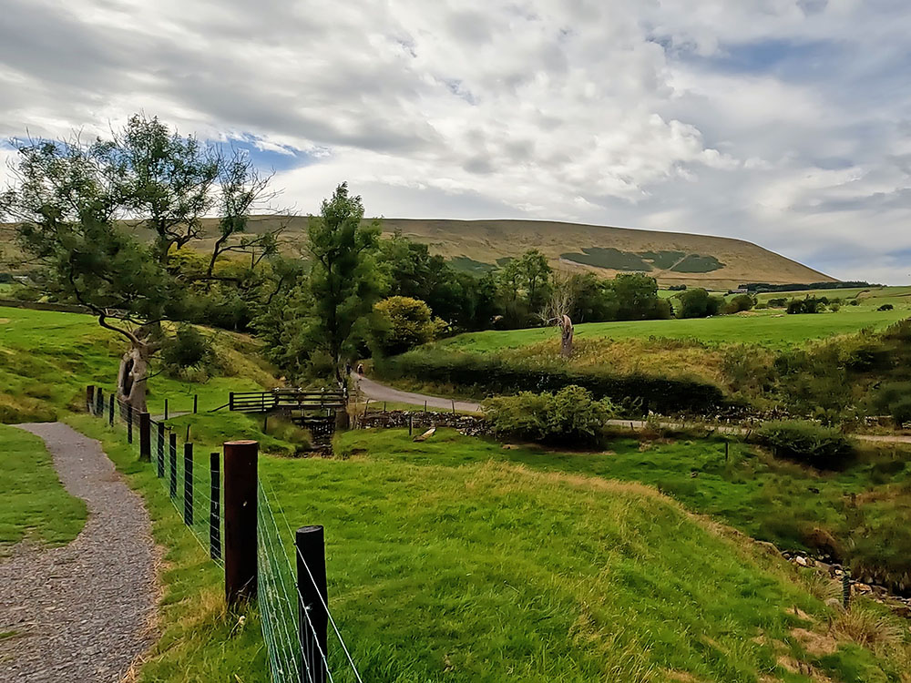
This is the iconic and most walked way up and down Pendle Hill, albeit this is not my favourite way to walk Pendle Hill - that's saved for the next walk. This Pendle Hill walk is the shortest way to climb up to the summit and back down from the village of Barley, although you can make it even shorter by parking in the laybys on Barley Lane about one mile out of Barley and just walking across from there the 500 metres to the bottom of the steps.
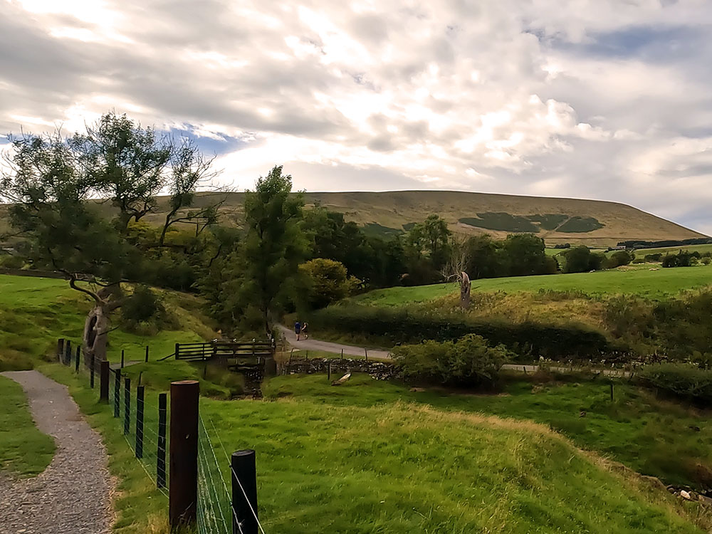
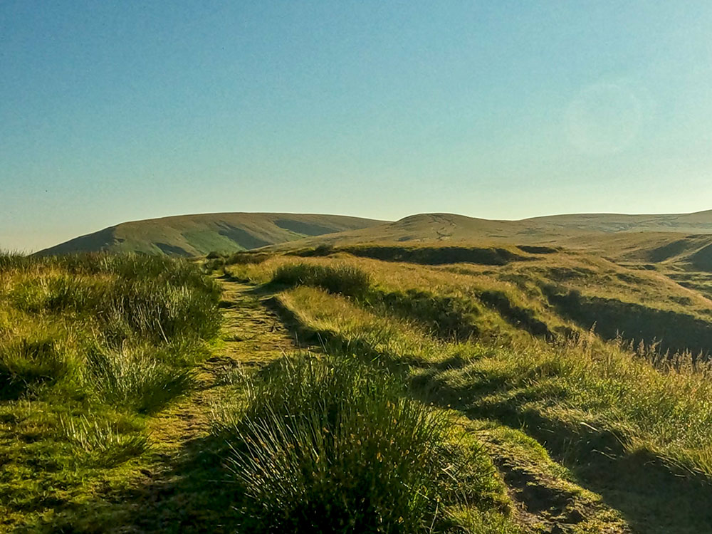
The path as it leaves Barley to head towards Pendle Hill
The walk itself is very easy to follow and starts in the car park in Barley, where you'll find toilets and the Cabin Cafe. You start by walking by the Pendle Inn and the Barley Mow pubs, before heading left out of Barley along the Pendle Way past the Croft Teagardens. It is a reasonably gentle climb along well-signed paths until you reach the steep steps just after Pendle House.
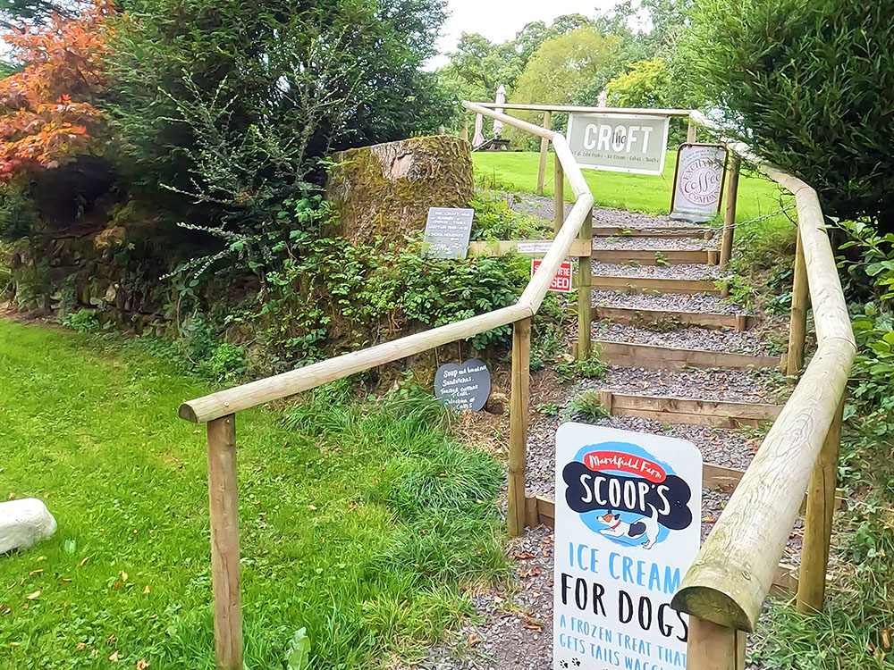
Croft Teagarden on the way to Pendle Hill
The path heading across fields towards Pendle House before the steps on Pendle Hill
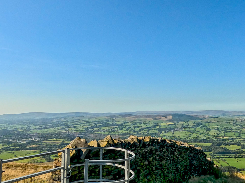
From there it is a steep climb up the steps to reach the wall at the top and the weather shelter seats, where you'll find a plaque about George Fox, but more on him later when we look at the history of Pendle Hill.
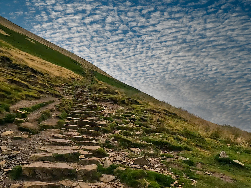
The steep steps on Pendle Hill
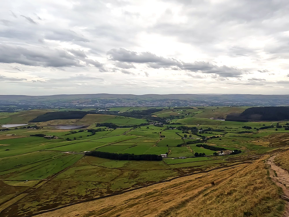
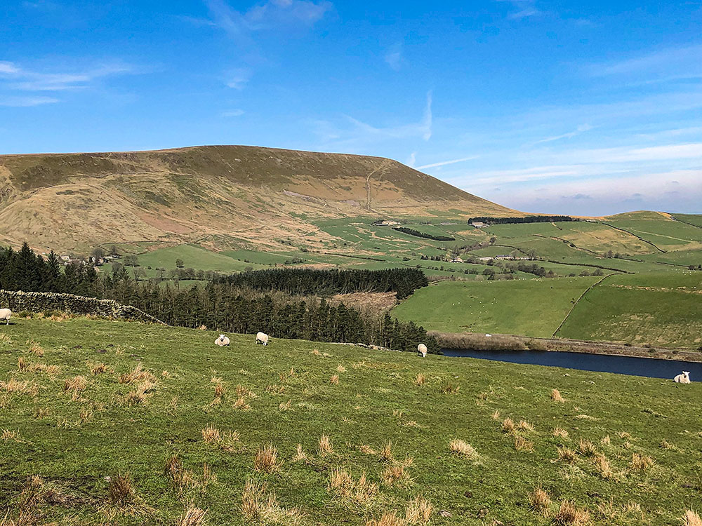
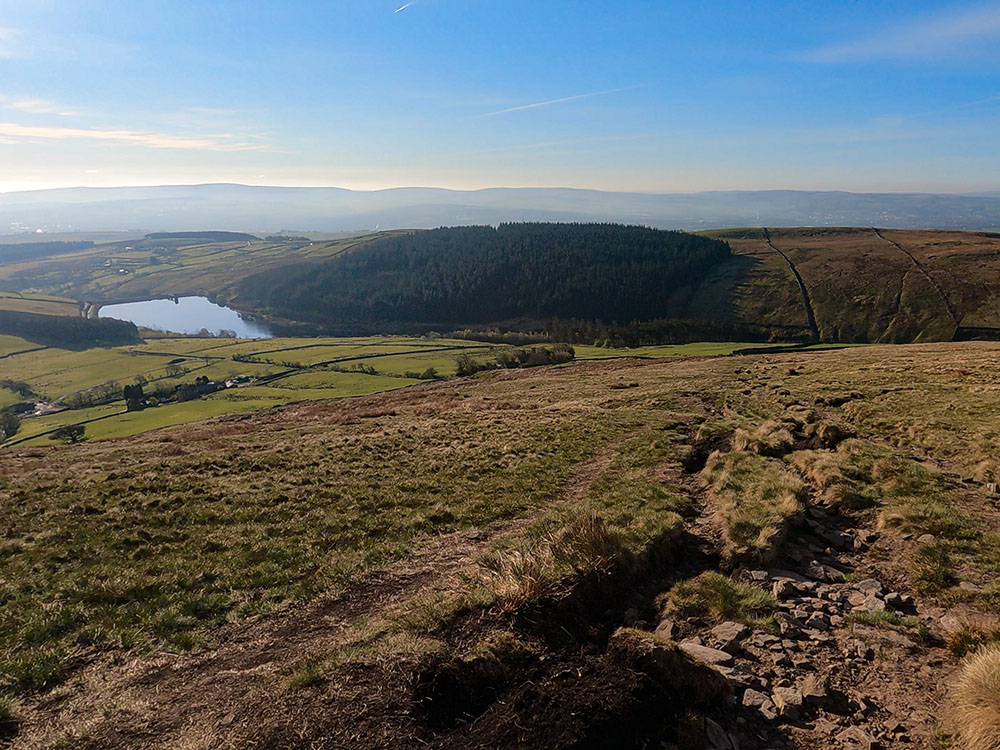
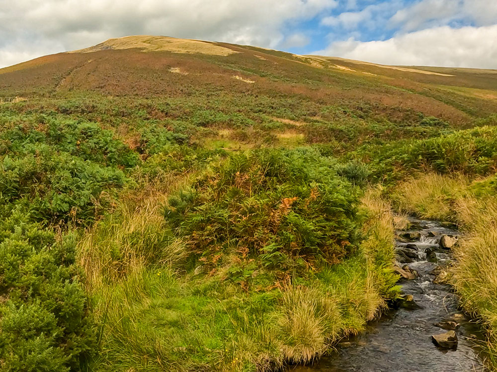
Looking back down the Pendle Hill steps towards Upper and Lower Black Moss Reservoirs and Lower Ogden Reservoir
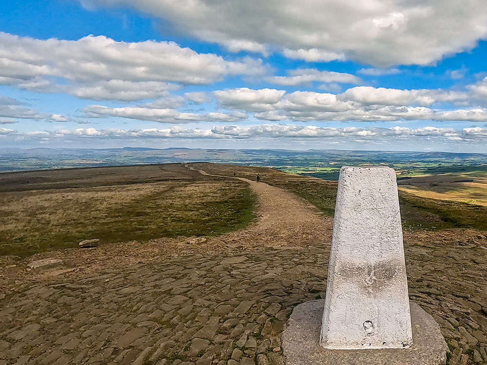
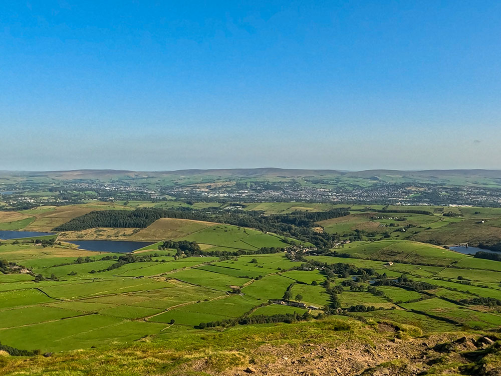
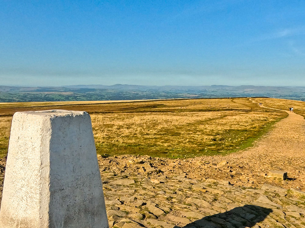
From there you just continue walking along the wide track away from the wall, the 400 metres or so across to the trig point on the summit of Pendle Hill, from where on clear days you get stunning views and can see the Lakeland Fells, out to the Yorkshire Three Peaks in the east, Blackpool tower in the west and as far distant as the Snowdon range to the south.
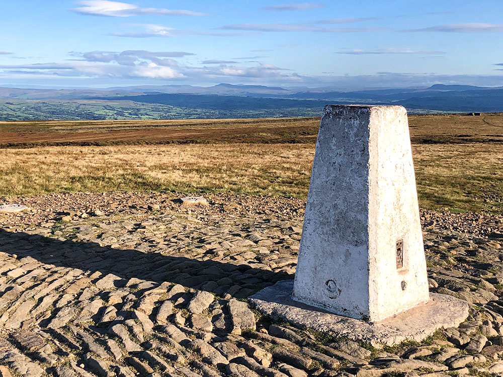
The Yorkshire Three Peaks from the summit of Pendle Hill
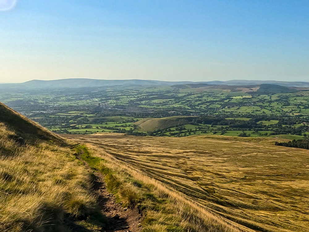
For the return to Barley, the walk continues along the wide track, with views of Lower Ogden Reservoir and the Black Moss Reservoirs down to the left. After walking for about 500 metres, we head diagonally left back on ourselves, down a steep mainly gravelled track along the side of Pendle Hill, which arrives back out at the bottom of the steps just walked up. The outward route is then reversed to Barley.
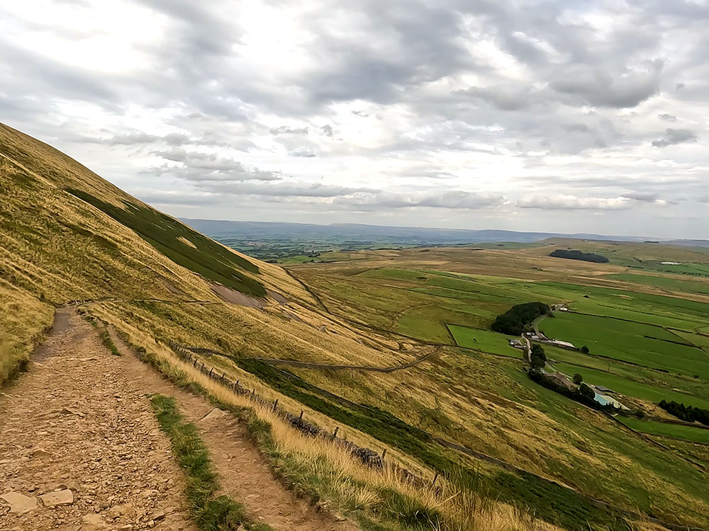
Gravelled sloping path used to descend from the summit of Pendle Hill
For where to start this Pendle Hill walk, directions to the parking, detailed walk directions, GPX download of this Pendle Hill walk from Barley walk, OS route map of the walk, elevation profile and full detailed walk directions, check out our Pendle Hill walk from Barley (via the steps).
After the walk you can relax with a drink or something to eat in the Pendle Inn or Barley Mow, where your four-legged friend is also welcome, or enjoy something back at the car park from the Cabin Cafe - there is more on these in the video.
This circular Pendle Hill walk from Barley starts again from the car park in Barley and then heads out along the road past the village hall and the old converted waterworks building, before walking by the picturesque Lower Ogden Reservoir, with Fell Wood behind it.
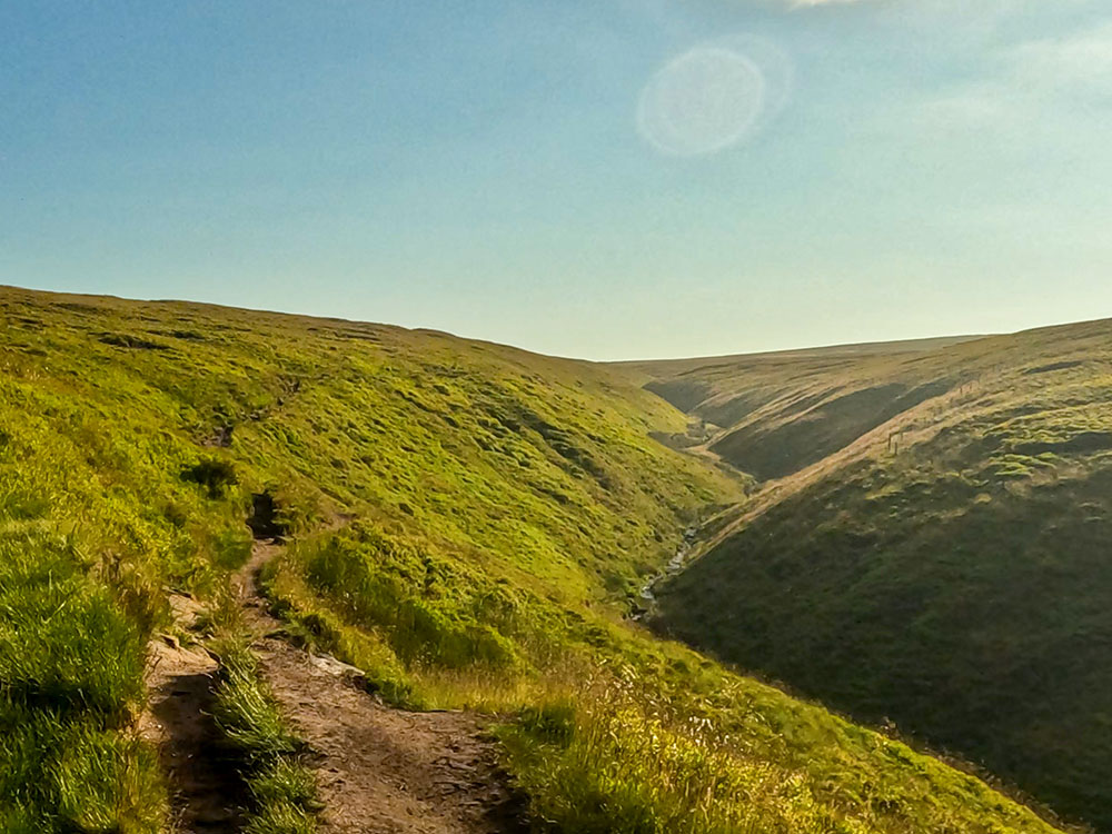
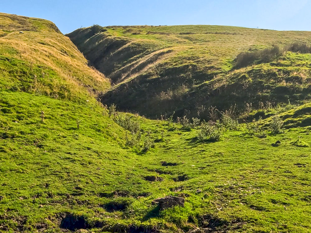
The walk then heads along the path to Upper Ogden Reservoir. On many early mornings on this stretch, I've seen deer drinking in the stream between the two Ogden reservoirs. Once past the reservoir, we head on up the Ogden Clough Valley, to a point where the path splits, and you have a choice of ways to the top.
You can head right up a short steep climb up by Boar Clough and then follow the path as climbs more gently following sporadic cairns until it meets the wide track which is followed for the final couple of hundred metres up to the trig point marking the highest point on the summit of Pendle Hill.
Looking back down Ogden Clough on Pendle Hill
Again on clear days you get stunning views and can see the Lakeland hills, out to the Yorkshire Three Peaks in the east, Blackpool Tower in the west and as far distant as the Snowdon range to the south.
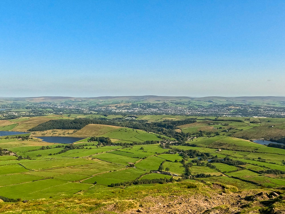
View from the summit of Pendle Hill, the Black Moss Reservoirs with Aitken Wood which houses the Pendle Sculpture Trail behind them
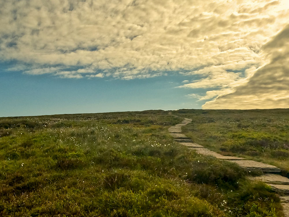
The alternative route is to go straight on along the path that keeps initially above and to the right of the stream below, before crossing over it and then walking parallel with it until it meets it again about one mile further on. The stream is again crossed and the path which soon becomes flagged underfoot is followed up the climb to the trig point at the summit of Pendle Hill.
Flagged path heading to the summit of Pendle Hill
Both routes on this Pendle Hill circular walk can be a little rough in places, or after heavy rain can get a little boggy, so walking boots are recommended on this walk.
The return to Barley from the triangulation point on Pendle Hill's summit is along the wide track (retracing your steps initially for the Boar Clough route, or turning right on meeting the trig point on the Ogden Clough route). After about 500 metres, where a path heads off diagonally left below, we just continue straight on following the path down and then across a field to arrive back just below Upper Ogden Reservoir, where the outward route is reversed back to Barley.
Heading down off Pendle Hill with Lower Ogden Reservoir and Fell Wood below
For where to start this Pendle Hill walk, directions to the parking, detailed walk directions, GPX download of the Pendle Hill walk from Barley walk, OS route map of the walk, elevation profile and full detailed walk directions, check out our Pendle Hill walk from Barley (via the Pendle Way or Ogden Clough).
Again, as you start and end the walk in Barley, you have the opportunity to unwind with a drink or a meal at either the Pendle Inn or Barley Mow, where dogs are welcome at both. Alternatively, you can enjoy some refreshments back at the car park at the Cabin Cafe.
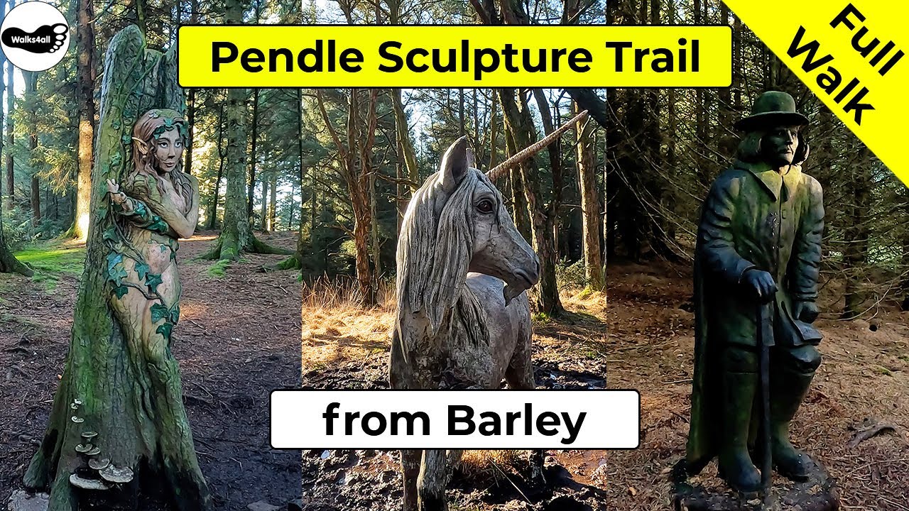
The Pendle Sculpture Trail Walk from the village of Barley is a relatively short walk. We leave the car park in Barley, walking by the Pendle Inn and the Barley Mow pubs and then onwards to pass by two picturesque reservoirs with views across to Pendle Hill, before entering Aitken Wood, a delightful woodland setting to show off the sculptures.
Pendle Hill over Lower Black Moss Reservoir
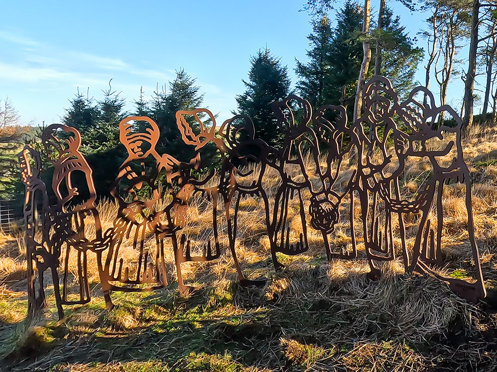
Chained Witches in the Pendle Sculpture Trail
After walking up a short climb into the woods, you start to find the sculptures. There are about 25 sculptures along the trail including the Magic Chair, the Witchfinder, the Ceramic Column, the Black Dog, and the Chained Witches amongst many others.
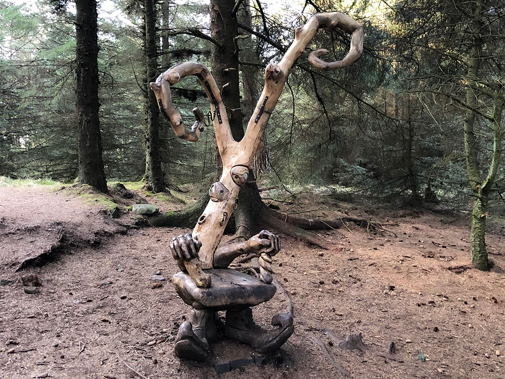
Magic Chair in the Pendle Sculpture Trail
Ceramic plaques representing 10 Pendle witches also provide additional entertainment for children for them to work out 'which witch is which'!
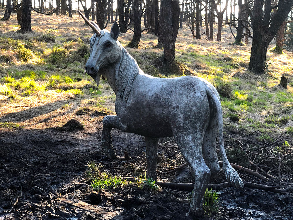
A unicorn in the Pendle Sculpture Trail
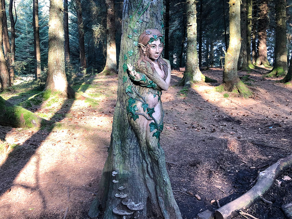
Dryad in the Pendle Sculpture Trail near Pendle Hill
To end this short walk, we head back to Barley along the outward route, walking again by Upper and Lower Black Moss Reservoirs, which both provide views across to Pendle Hill.
Heading back to Barley with Lower Black Moss Reservoir and Pendle Hill ahead
For where to start the walk, directions to the parking, detailed walk directions, GPX download of the Pendle Sculpture Trail walk, OS route map of the walk, elevation profile and full detailed walk directions, check out our Pendle Sculpture Trail walk from Barley.
Again, as with the first two Barley walks, you have the choice of the Pendle Inn, Barley Mow or Cabin Cafe if you want something to eat or drink after the walk.
This circular Pendle Hill walk from the Nick of Pendle starts from the laybys on the Nick of Pendle itself, close to the Wellsprings pub and Pendle Ski Slope. As we are already at a height of just over 300 metres at the start, there are panoramic views right from the very start of this walk. It also means there is less ascent to reach the top of Pendle Hill than walks from Barley and Downham.
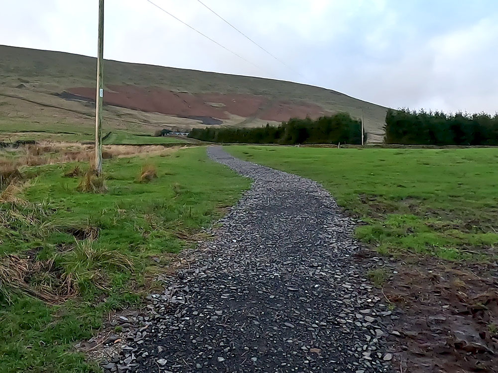
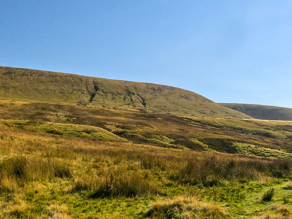
The walk initially climbs up Pendleton Moor and Apronfull Hill along the Ribble Valley Jubilee Trail.
The footpath over Pendleton Moor on the way up Pendle Hill from the Nick of Pendle
It then heads through Ogden Clough and along the flagged path used in the Ogden Clough walk from Barley to arrive at the trig point on the highest point of Pendle Hill.
Path heading along Ogden Clough on its way up Pendle Hill
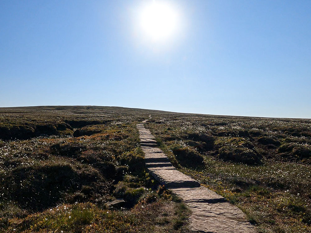
The flagged path on the way to the summit of Pendle Hill
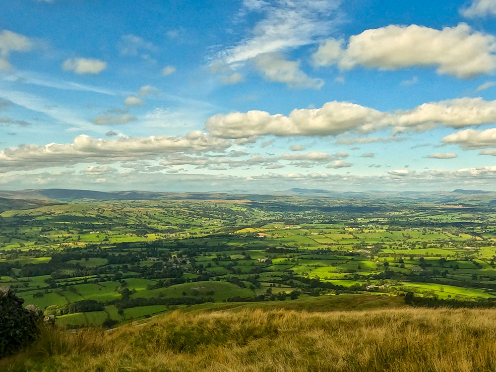
As with the other Pendle Hill walks, from its summit, a stunning panorama extends over the Ribble Valley toward the Trough of Bowland and Blackpool to the west, sweeping around to the East Lancashire Valley, the Yorkshire Three Peaks, the Yorkshire Dales, and the Southern Lakeland Fells.
Pen-y-ghent and Ingleborough from the trig point on the summit of Pendle Hill
The Black Moss reservoirs and Lower Ogden Reservoir from the summit of Pendle Hill
To return from the summit of Pendle Hill, we turn left at the trig point, walking down the wide path to a wall. We pass through the wall and head along the north side of Pendle Hill with Downham Moor, Worston Moor, and the Ribble Valley stretching out down below us.
Looking over the Ribble Valley from near the weather shelter on Pendle Hill
We continue to pass by a weather shelter and the Scout Cairn.
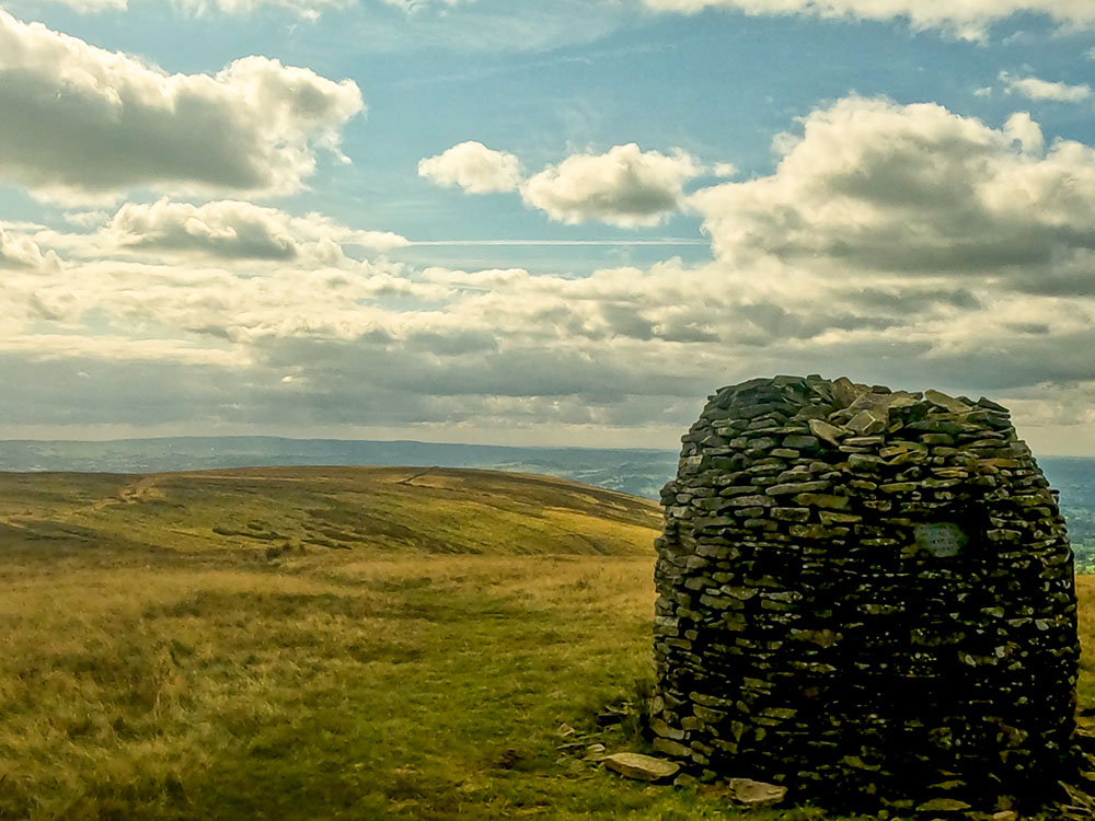
The Scout Cairn on Pendle Hill
We walk over Pendle Moor and Mearley Moor, with more views of the Ribble Valley to drop down through Howcroft Brook in Ashendean Clough.
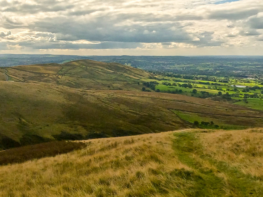
The footpath heading down into Ashendean Clough
Looking back up at the footpath off Mearley Moor
From there, it is a short climb to reach the Pendle Ski Slope and the Wellsprings pub and restaurant, before the short walk back to the start.
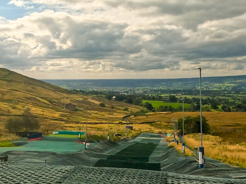
Pendle Ski Slope
After the walk, why not try something to eat or drink in the Wellsprings pub and restaurant? On a clear day, the views across the Ribble Valley are fantastic. They serve a Spanish and Mexican-inspired menu.

Enjoying a drink on the sheltered balcony of the Wellsprings after the walk
Or in nearby Sabden, there are the White Hart and The Pendle Witch pubs, or in the opposite direction, there is the Swan with Two Necks pub in Pendleton.
For where to start the walk, directions to the parking, detailed walk directions, GPX download of the Pendle Hill walk from the Nick of Pendle, OS route map of the walk, elevation profile and full detailed walk directions, check out our Pendle Hill walk from the Nick of Pendle.
This Pendle Hill from Downham circular walk starts in the car park at Downham, a village in the Ribble Valley in Lancashire.
Pendle Hill from Downham
We leave Downham and head through fields alongside Longlands Wood, which affords views across to Pendle Hill, before arriving at Worsaw Hill. Much of the 1961 film Whistle Down the Wind was shot at Worsaw End Farm.
Pendle Hill from Longlands Wood in Downham
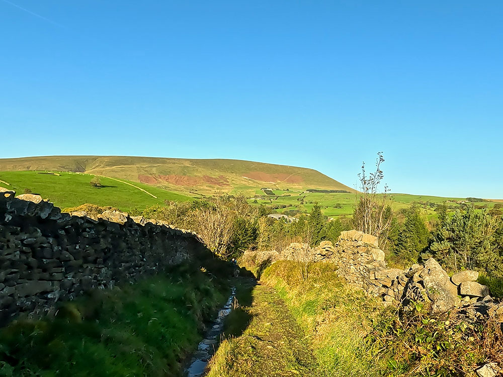
We then climb up alongside Burst Clough.
Burst Clough
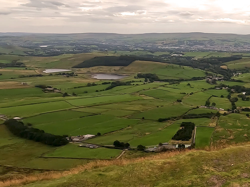
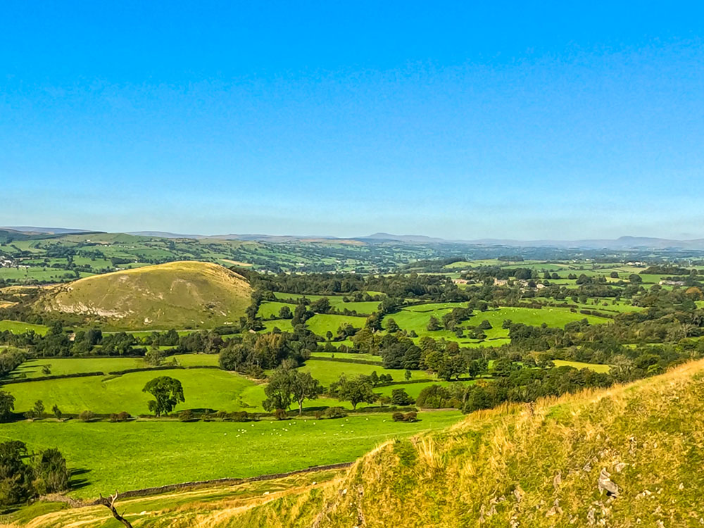
Next, we head across and up Worston Moor, which affords excellent views across the Ribble Valley and the Yorkshire Three Peaks. On a clear day, even Blackpool Tower is visible from here.
The climb up across Worston Moor
Looking back towards Worsaw Hill, the Ribble Valley, Ingleborough and Pen-y-ghent
We continue past the Scout Cairn and then on and past the weather shelter.
Looking out over the Ribble Valley and beyond
We then head along a wide grassy path and then up a gravelled path to reach the trig point on the summit of Pendle Hill.
Pen-y-ghent and Ingleborough on the horizon from the trig point on the summit of Pendle Hill
Pendle is an isolated hill with fantastic panoramic views towards Blackpool out in the West, the lower Lakeland Fells, and Ingleborough and Pen-y-ghent, both part of the Yorkshire Three Peaks.
From the summit, we return to the wall, and once through it, we head away from it and downhill towards Downham.
Descending off Pendle Hill heading back towards Downham
The path swings to the left before a short zig-zag and then in a line towards Hookcliffe plantation below.
Looking down towards Hookcliffe plantation and Downham from Pendle Hill
We pass by the trees and cross over Pendle Road to head down alongside the fields. We briefly cross over a road near Clay House and then continue again down the side of the fields before reaching Downham.
Walking down through the fields on the way back to Downham
Upon reaching the old bridge in Downham Village, we turn left past the ice cream shop and right back into the car park.
For where to start the walk, directions to the parking, detailed walk directions, GPX download of this Pendle Hill from Downham walk, OS route map of the walk, elevation profile and full detailed walk directions, check out our Pendle Hill from Downham walk.
If you want something to eat or drink after the walk, Downham has the Assheton Arms and Greendale Tearooms, along with the Downham Ice Cream shop.
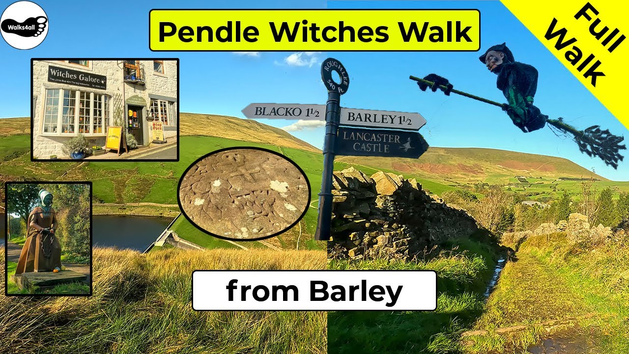
Our final walk is the Pendle Witches Walk from Barley. This 'Walking with the Witches' Trail starts in Barley and is split into two sections, so you can do one route or the other, or maybe combine them into one longer walk. Each circular walk passes by places synonymous with the Pendle Witches.
The western loop is 4 miles long and initially heads up to Newchurch, passing by the church of St Mary's, where you will find the 'Eye of God' and a 'witches grave'. In Newchurch, you will find the 'Witches Galore' shop, where you will find many a witch souvenir. The walk continues past Faugh's Quarry, where it is said Demdike claimed to have met the devil.
Church of St Mary in Newchurch in Pendle
From there, we pass Moss End and Bull Hole farms in the valley below, again both linked to the Pendle witches. On reaching Drivers Height, there is a very short steep climb before dropping down to the Ogden reservoirs and heading back into Barley.
Heading down to Upper Ogden Reservoir with Pendle Hill ahead on the Pendle Witches Walk
The eastern loop is 3.5 miles in length and again starts in Barley. The Pendle Way is followed from the car park to Whitehough and then on through the woods to the side of the Outdoor Centre and across fields before dropping down to pass Roughlee Hall.
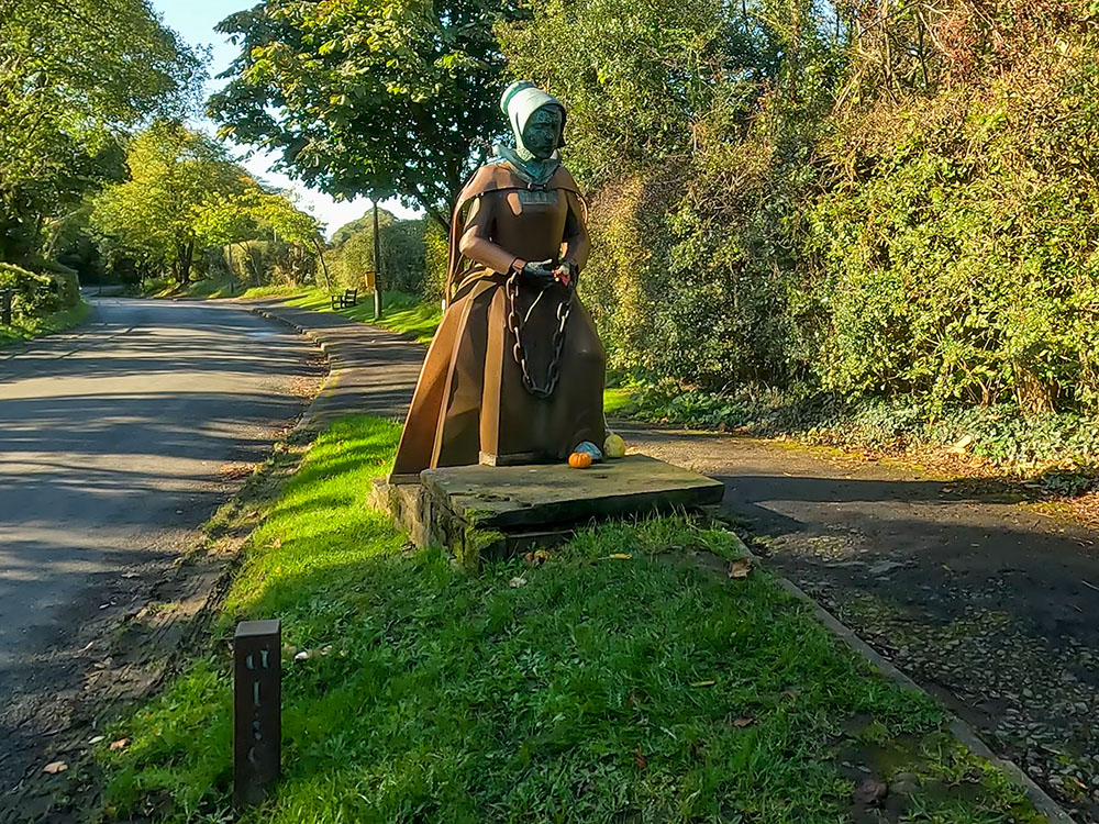
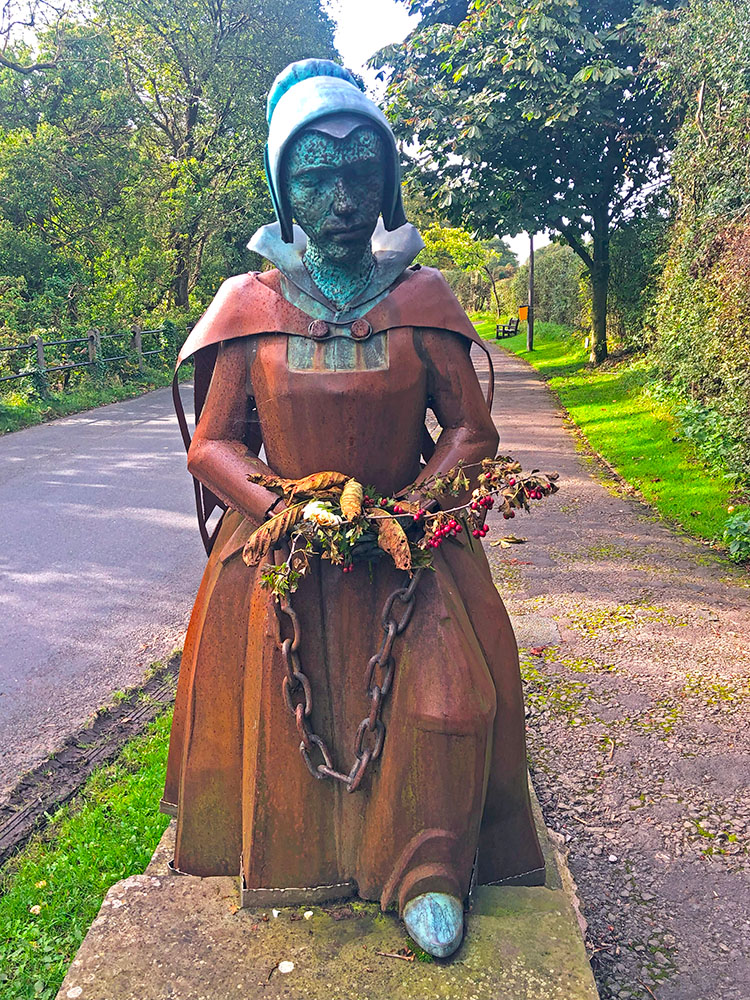
Statue of Alice Nutter in Roughlee, one of the executed Pendle witches
The road is followed through Roughlee, past the Alice Nutter statue and then back along a short section of the river towards Barley. From here we head up onto Heys Lane, which affords great views of Pendle Hill ahead and is followed back into the village of Barley.
View of Pendle Hill from Heys Lane on the Pendle Witches Walk
For where to start the walk, directions to the parking, detailed walk directions, GPX download of the Pendle Witches Walk, OS route map of the walk, elevation profile and full detailed walk directions, check out our Pendle Witches Walk from Barley.
Again, as with the other Barley walks, you have the choice of the Pendle Inn, Barley Mow or Cabin Cafe if you want something to eat or drink after the walk. Whilst walking through Roughlee, you could also call in at the Bay Horse, which is also dog-friendly.
There are three named paths that pass over and around Pendle Hill, these are the Lancashire Way, the Pendle Way and the Ribble Valley Jubilee Trail
The Lancashire Way is an extensive 396-mile walking trail divided into four sections and loops. It takes you on a journey through Lancashire's history, landscapes, and notable figures.
This trail highlights the beauty and diversity of the county's scenery, offering a rich exploration of its past and natural wonders. Along its route, it passes over Pendle Hill.
The Ribble Valley Jubilee Trail is a relatively new 65-mile circular walk through scenic rolling countryside and the spectacular uplands of the Ribble Valley and the Forest of Bowland Area of Outstanding Natural Beauty.
The walk was devised in 2022 as part of the Queen's platinum jubilee celebrations. Starting in Whalley, the route has been split into seven manageable sections, through villages like Downham, Slaidburn and Hurst Green and past places like Stocks Reservoir and over Pendle Hill.
The Pendle Way is a 45-mile circular route from Barrowford. The Pendle Way passes through Barnoldswick, Thornton in Craven, Wycoller, Reedley, Newchurch and goes over Pendle Hill. Whilst you can walk it in one long loop, many people break it down into shorter sections:
The three main summits in the area, Pendle Hill, Weets Hill and Boulsworth Hill can also be walked and are known as the Pendle Three Peaks.
Pendle Hill in Lancashire, England, is a storied landmark with a rich and multifaceted history, encompassing tales of witches, the spiritual experiences of George Fox and textile mills, creating a captivating tapestry of folklore, religious heritage and industrial history. It stands tall at 557 metres and being an isolated hill, it can be seen from miles around, so everyone in the area is aware of its looming presence.
Pendle Witch Way footpath sign with Pendle Hill in the background
The story of the Pendle Witches is a dark and enduring chapter in the history of Lancashire, England, during the early 17th century and the Pendle Witch trials are amongst the most famous witch trials in English history. Besides being one of the most famous, they are also one of the best recorded as Thomas Potts, the clerk to the court in Lancaster, where the trials took place, recorded and created an official publication of the proceedings called 'The Wonderfull Discoverie of Witches in the Countie of Lancaster'.
The story takes place in 1612 when the authorities in the country were very much anti witches. Elizabeth I introduced the Witchcraft Act in 1562. When she died, she was succeeded by James I, who became convinced Scottish witches were plotting against him. In his 1597 book 'Daemonologie', he told his followers they must denounce and prosecute any supporters or followers of witchcraft.
Later, certain people who called themselves Witchfinder Generals were appointed to hunt for witches, the most famous of which was Matthew Hopkins. He had nothing to do with the Pendle Witch trials though, coming along a little later and mainly searching for witches in East Anglia. Witches weren't just Lancashire-specific, there were witch trials all around England in the 1600s.
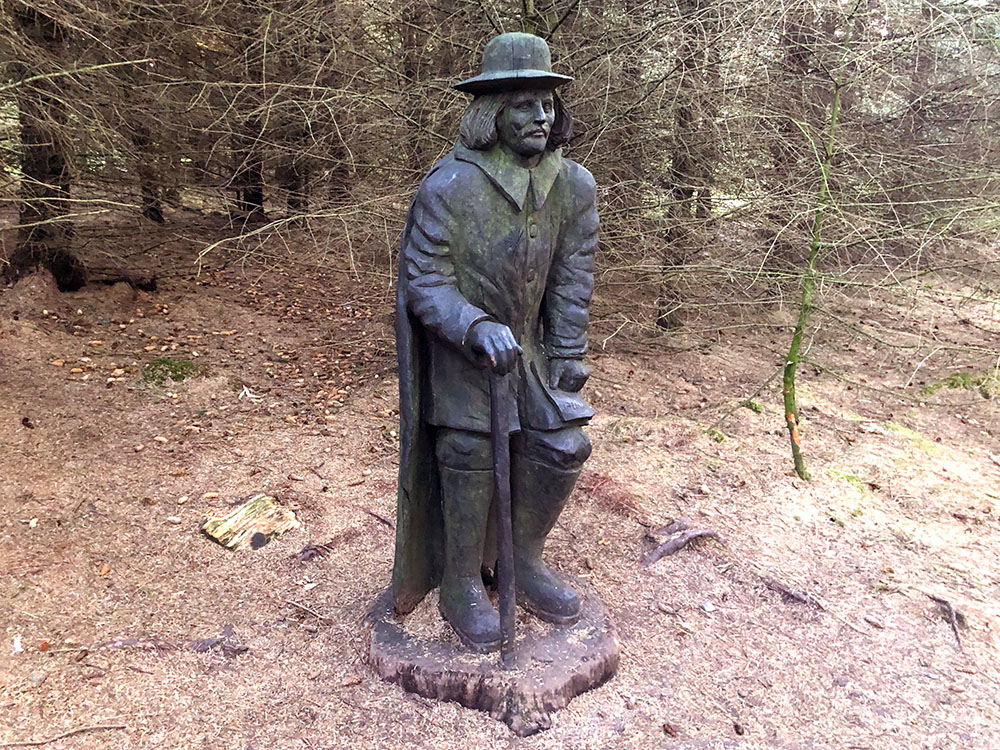
Witchfinder General in the Pendle Sculpture Trail
Then in 1612, every justice of the peace (JPs) was ordered to put together a list of those who refused to attend the English church and take communion, which was an offence at the time. One of those JPs was Roger Nowell, JP for Pendle. So with this undertone at the time, anyone found to be a witch would probably not receive a fair trial!
The initial 'spark' for the Pendle Witch trials was in March 1612, when Roger Nowell investigated a complaint by the family of John Law, who claimed to be injured by witchcraft, specifically by Alizon Device, who was the granddaughter Elizabeth Southerns (known as 'Demdike'). Alizon reportedly asked John (a pedlar) for some metal pins, but he refused. Then the devil appeared in the likeness of a black dog with fiery eyes. Shortly after John stumbled and fell, thought by some to maybe have been a stroke, but Alizon then believed in her own 'witchcraft' powers and confessed what happened to John's father who reported to Roger Nowell.
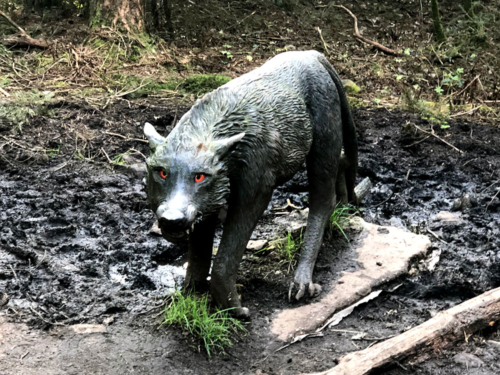
Black dog with fiery eyes in the Pendle Sculpture Trail
Things escalated quickly from there with Alizon's brother and mother Elizabeth also questioned. Alizon was also asked about another family, who did not get on with the Demdikes, who were known as the Chattox's. Anne Whittle (known as Chattox), the matriarch of the family had also reputedly been involved in witchcraft. Alizon accused Chattox of murder by witchcraft. From evidence and 'confessions', JP Nowell committed Demdike, Chattox (both believed to be in their 80s at the time), Anne Redferne (Chattox's daughter) and Alizon to Lancaster to be tried for causing harm by witchcraft.
Before the trial, events took a turn for the worse, when Elizabeth Device held a meeting at Malkin Tower, the home of the Demdikes. The actual location of Malkin Tower was believed to have been near Newchurch or Blacko but isn't known with any certainty as it was demolished after the trial. Some sympathisers and friends were present at the meeting, which Nowell subsequently found out about and investigated. Following his inquiry, 8 more people were accused of witchcraft and sent for trial - Elizabeth Device and James Device (Demdikes), Alice Nutter (from Roughlee), Katherine Hewitt, John Bulcock, Jane Bulcock, Alice Grey and Jennet Preston.
Alice Nutter
The twelve accused were charged with the murders of ten people by the use of witchcraft. Jennet Device, who was only 9 years old at the time was a key witness for the prosecution. That would normally have not been allowed, but she was allowed to be a witness as this was a witch trial.
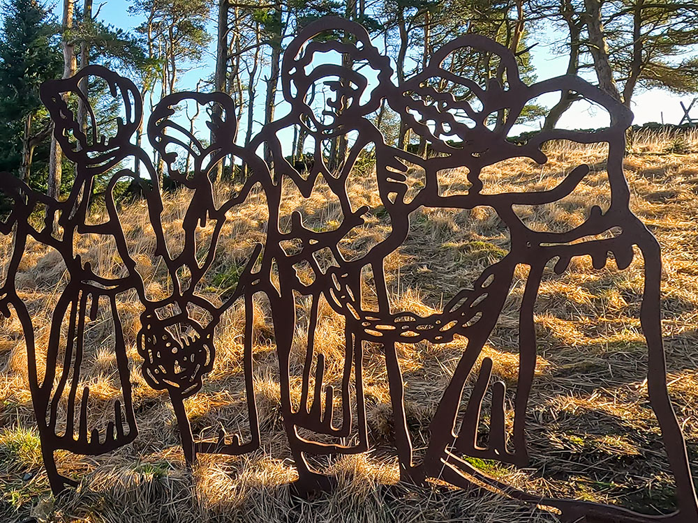
Chained Witches in the Pendle Sculpture Trail near Pendle Hill
Elizabeth Southerns died in the cells at Lancaster whilst awaiting trial. Nine of the accused were found guilty during the two-day trial and hanged at Gallows Hill in Lancaster in August 1612, with Alice Grey found not guilty. Jennet Preston, who lived in Gisburn, was tried in York and then also hung in York in July 1612.
'Witches' Lancaster Castle sign in Roughlee
The trials and executions of the Pendle Witches have left an enduring imprint on Pendle's history, serving as a reminder of the injustices and superstitions of the past. Many reminders of the witches live on today including bus routes (Pendle Witch Way), the Witches Galore shop in Newchurch, and the many beers mainly created by local brewers Moorhouses, based in the nearby town of Burnley. They have the White Witch, the Blonde Witch, Pendle Witches Brew, Broomstick Bitter, Witches Cauldron, Witchfinder General, Ice Witch (a favourite of mine with its citrus and fruity flavour) and the canned Demdike. Barley and Barrowford have also held the Guinness World record for the record number of people dressed as witches in one location.
Certain of the walks and paths in the area are similarly remembered with the Pendle Witches Walk and The Pendle Way, which is a 45-mile circular route from Barrowford. The Pendle Way passes through Barnoldswick, Thornton in Craven, Wycoller, Reedley, and Newchurch and goes over Pendle Hill.
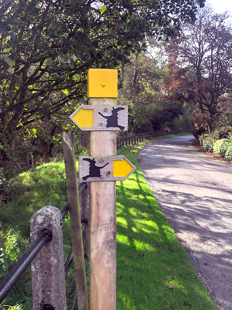
Pendle Way 'witches' footpath sign
Pendle Hill holds a unique place in the history of the Quaker movement due to its association with George Fox, the founder of the Religious Society of Friends, more commonly known as the Quakers. In 1652, George Fox had a profound and spiritually transformative experience whilst on the slopes of Pendle Hill. It was during this moment of solitude and reflection that he felt a divine calling and an inner illumination that would ultimately shape the course of his life, the Quaker faith and the Quakers' movement.
On that fateful day, George Fox climbed Pendle Hill, seeking spiritual clarity and communion with the divine. Walking towards the summit, he was overcome by a powerful spiritual revelation, which he described as a direct encounter with God's presence. This experience, often referred to as the "Pendle Hill Vision," served as a pivotal moment in his life. It solidified his belief in God and laid the foundation for the Quaker principles of simplicity, equality and peace that continue to guide the Quakers to this day.
Pendle Hill remains a place of historical and spiritual significance for Quakers worldwide. It is often visited by Quaker groups and individuals seeking to connect with the legacy of George Fox and the enduring Quaker values that found their roots on its slopes.
Pendle Hill on the outskirts of Philadelphia, Pennsylvania in the USA, was named after George Fox's 'Pendle Hill' in Lancashire in 1930, as it serves as the location of the Pendle Hill Quaker Centre, an educational and spiritual centre inspired by Quaker principles.
Spinning and weaving were amongst the earliest known arts to man. By the 13th century, a domestic industry was established in England based on wool and in 1290 Henry de Lacy built a water-driven fulling mill on Colne Water for processing the woollen cloth made in the local cottage industry. Not long after, a similar mill was built near Park Hill in Barrowford.
During the 14th and 15th centuries, the primary occupation of most Pendle households was farming, with a secondary one of spinning and weaving cloth for personal use or sold at the nearby markets in the towns of Burnley, Clitheroe or Colne. During the 17th century, the cottage industry was starting to be threatened by merchants who set up as clothiers. In the 17th century, the industry was almost entirely based around wool and this continued into the 18th century. Colne especially grew on the back of this, with people from outlying areas moving there for work. In 1775 Colne established its own Piece (Cloth) Hall and became the centre of the woollen industry for North East Lancashire.
The hand-operated spinning wheels and looms limited the speed at which cloth could be produced, so in the 18th century there was a growth in power-driven machinery, which in turn needed additional space, so there was a growth in mills. Inventions such as the 'flying shuttle', the 'spinning jenny' and the 'water frame' came along, the latter meaning that the mills were then often built by water, which drove the mill's machinery. Next along came the 'mule' which replaced the 'spinning jenny' for making the finer yarns.
It wasn't until quite a few years into the 19th century that powered machines began to replace handloom weavers in large numbers. Water-powered cotton twist spinning mills were built in Roughlee in 1787, Barley Green in 1791, Thorneyholme (between Roughlee and Barley)in 1796 and at Narrowgates (Barley) in 1799. By about 1800, there were around 12 water-powered mills in the Pendle area. Other mills were built in Colne and Barrowford, but by the 1820s the industry was in depression, as the price of cloth at markets plummeted.

Old mill chimney at Narrowgates, Barley
Yorkshire started to become the centre of the woollen industry and Manchester the centre of the cotton one. In the 1840s as the demand for cotton increased, quite a few power looms were introduced into the mills as they swapped over to processing cotton. Several new large multi-storey mills were built between 1846 and 1856, the largest being Butts Mill in Barnoldswick which contained over 80,000 spindles. In 1868 the first part of Brierfield Mills was completed that housed 116,000 spindles and it was also the longest surviving, with cotton spinning continuing there until 1957.
Between 1880 and 1920 there was a rapid increase in the number of weaving sheds built by room and power companies (basically renting space and power out), when over 70 companies were formed between 1880 and 1924. When the final 2 mills were built in 1924, it was estimated that there were over 50,000 looms in use in the weaving sheds of Pendle.
Unfortunately, then started the decline. The First World War restricted the amount of cotton reaching the country, wages declined by around 25% and the Government's newly formed Cotton Control Board reduced the amount of hours looms could run. This had a knock-on effect and 47% of all Lancashire cotton workers were unemployed by 1930. The number of cotton looms reduced by half from 1930 to 1950. During the Second World War, some mills were converted to factories to help the war effort.
In the Cotton Industry Act of 1959, the government gave grants to assist with modernising machinery and employers compensated employees who were made redundant. Around 40% of the surviving looms were scrapped and nationally between 1958 and 1962 there was a further 30% reduction in the textile workforce. Progressively the production and the need for the mills diminished and were replaced by other growing industries, so today only a few remain. Some mills remain but are being used for different purposes, some were demolished and some were converted to or cleared for housing or road construction.
Another less well-known Pendle Hill link is related to Boyle's Law - yes - remember that one from your chemistry days at school? If you don't it basically 'boils' down to... for a gas at a constant temperature, pressure × volume is also constant. It was one of those little nuggets taking space up in my head, that someone thought one day I would need!
Richard Townley, a mathematician and astronomer from Burnley and Henry Power, again in the 1600s, used a newly invented barometer to measure air pressure at different altitudes on Pendle Hill, where they realised there was a relationship between air density and pressure. They discussed the results with Robert Boyle, who went on to publish from it... Boyle's Law, but apparently what Boyle himself referred to as Mr. Townley's hypothesis.
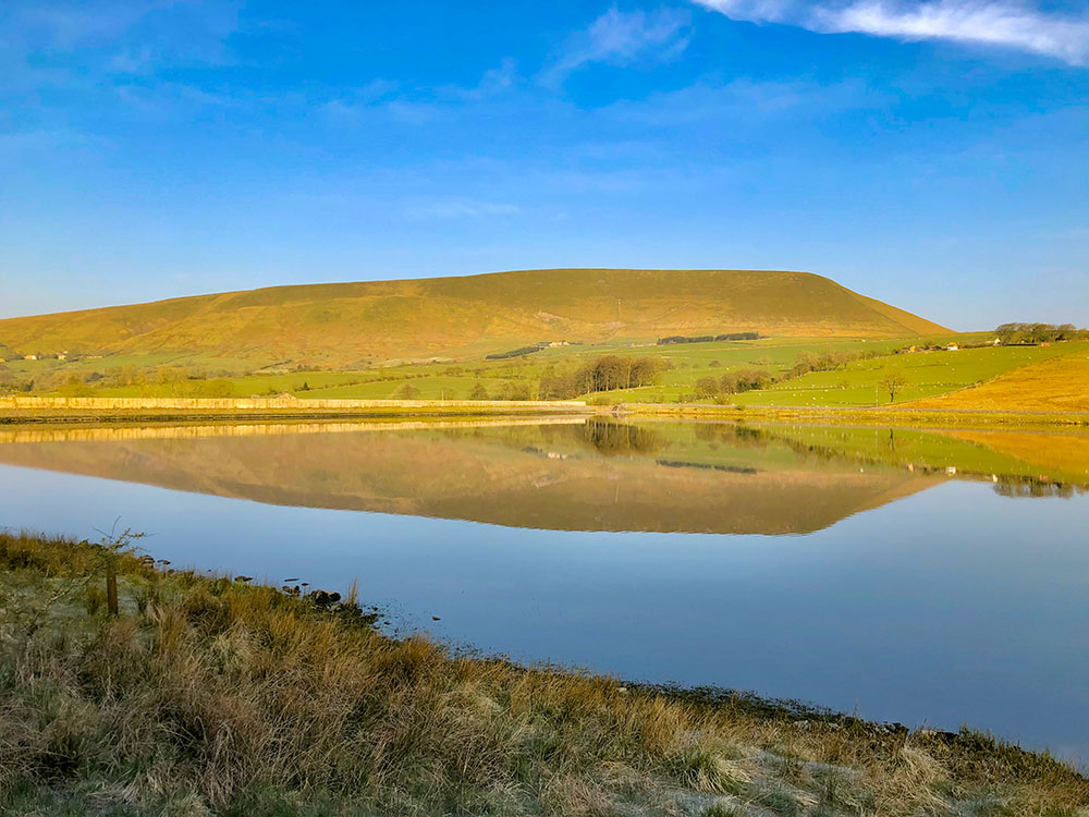
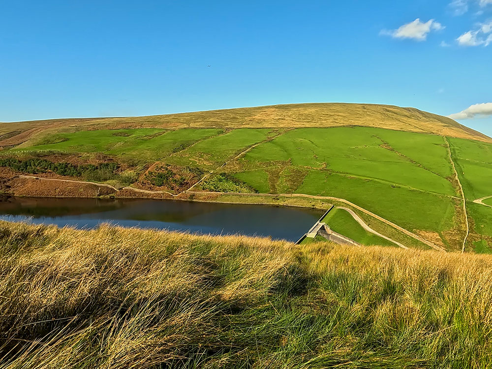
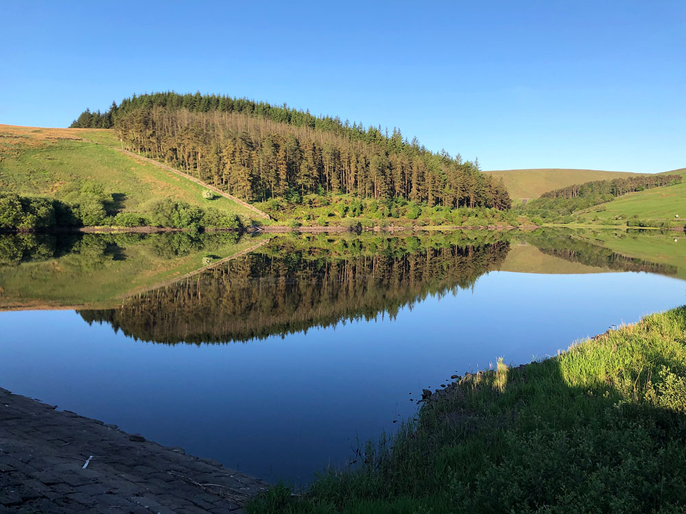
Lower Ogden Reservoir, next to Barley in Lancashire, was completed in 1914 and is the largest of the two Ogden Clough reservoirs with a surface area of approx. 85,000 square metres. It is 18 metres deep and can hold approx. 157.5 million gallons. It supplies drinking water to the Nelson area.
Early morning sunrise over Lower Ogden Reservoir near Pendle Hill
There is a footpath across its dam and a concessionary footpath down the side of it, which a couple of the Pendle Walks above utilise. On its southern shore is Fell Wood, which was originally planted in 1931 with Norway Spruce, Sitka Spruce, Scots Pine and Larch. On the northern side is the smaller Blue Wood, which was originally planted in 1935 with Scots Pine, Sitka Spruce and Larch and then replanted in 1981.
Reflections in Lower Ogden Reservoir
As you head from Lower to Upper Ogden Reservoir you also pass by Buttock Plantation, which was planted in 1935 with Sitka Spruce and Larch. Altogether these 3 forests cover around 55 acres and between the forest, the Ogden reservoirs and the surrounding area you can often find blue tits, coal tits, blackbirds, robins, pied flycatchers and goldcrest amongst many others.
Upper Ogden Reservoir, completed in 1906 and a surface area of approx. 28,000 square metres, is 17.9 metres deep and can hold 54.5 million gallons. It again supplies drinking water to the Nelson area.
Upper Ogden Reservoir
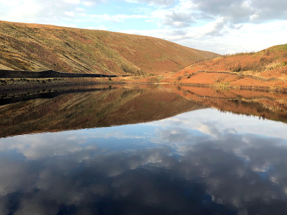
Lower Black Moss Reservoir was completed in 1903, with a surface area of approx. 72,000 square metres is 11.8 metres deep and can hold approx. 65 million gallons. It supplies drinking water to the Nelson area as and when needed.
As with the Ogden reservoirs, a variety of wildlife can be seen on the water and surrounding area, although it does seem to attract more wildfowl than they do, especially in the winter. You can often see mallards, tufted ducks, goosanders and teals. In the summer, many of these are replaced by lapwings, curlews and redshanks. Other birds that can be seen include skylarks, common sandpipers and linnets.
Lower and Upper Black Moss Reservoirs from the summit of Pendle Hill
Upper Black Moss Reservoir, completed in 1894, has a surface area of 52,000 square metres, is 9.45 metres deep and can hold 45 million gallons. It supplies drinking water to the Nelson area as and when needed. From the reservoir, there is a wonderful view across to Pendle Hill.
Nestled in the embrace of Lancashire's rolling countryside, Pendle Hill stands as an iconic landmark surrounded by a tapestry of picturesque villages and hamlets. These charming settlements, each with its unique character and history, are an integral part of the Pendle Hill experience. From the tranquil charm of Barley to the timeless allure of Downham and the hidden gems of Sabden, Roughlee, Pendleton, Wiswell and more, these villages and hamlets offer a glimpse into the region's rich heritage.
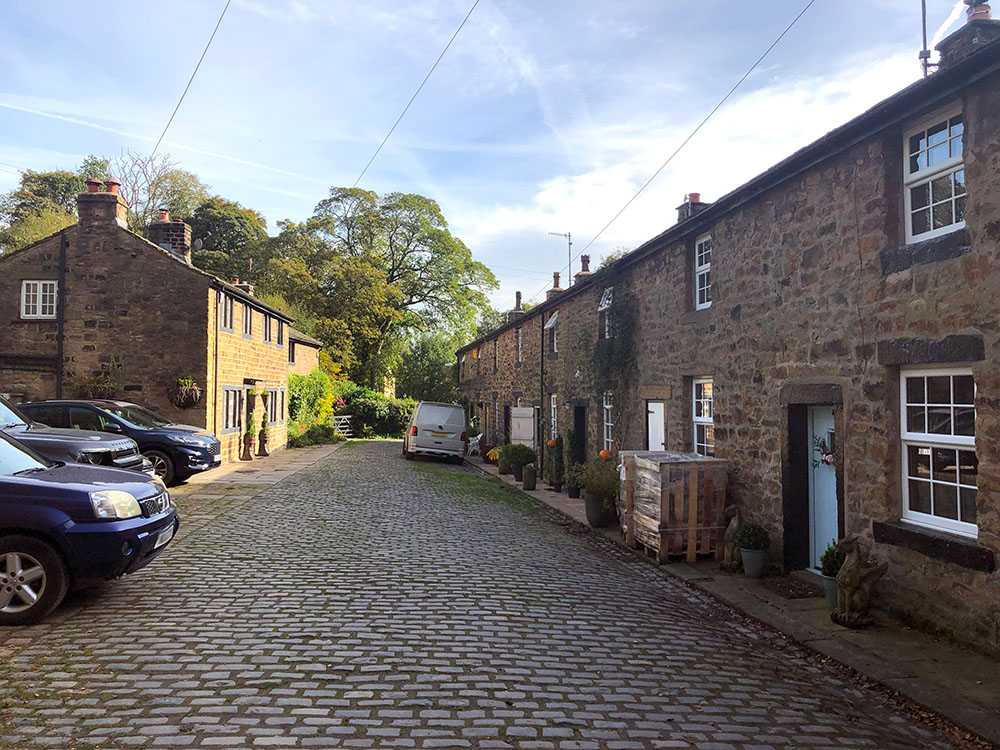
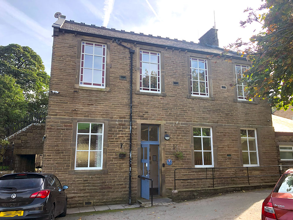
Located at the base of Pendle Hill in Lancashire, you'll find the charming village of Barley. This quaint locale is home to the popular Pendle Inn and Barley Mow pubs, making it a hub for locals and tourists alike. Its large car park, which houses the Cabin Cafe and some public toilets, provides a base for many a Pendle Hill walk and many other less strenuous walks that are available in the area. There is also a small Methodist chapel and a village hall in Barley, which holds regular activities.
Barley, which was originally referred to as Barelegh in the year 1324, is a term that translates to 'the barren meadow'. The Barley Township comprised Barley Booth, Wheatley Booth, Hay Booth and Whitehalgh, where "Booth" was a term used to denote cowsheds or barns. The 13th century saw extensive cattle-rearing activities in this region, a trend that continued for several centuries thereafter.
The livelihood of Barley was primarily based on agriculture until the 18th century. During this period, the textile industry began to flourish, and handlooms were introduced in the attics of many small properties as an additional income source. The brooks of Barley, being an efficient water power source, attracted cotton factories. Two notable factories were a small mill at Narrowgates and another at Barley Green, which became a water treatment plant site, before being converted into houses.
Barley Green Mill, at its peak, operated 200 looms until it was destroyed by floods in 1880. A cotton twist mill at Narrowgates and Weavers Cottages was established by William Hartley for spinning cotton warp thread.
The 'old' weavers cottages at Narrowgates
On August 18, 2012, an impressive gathering of 483 people came together at Barley Green, all dressed as witches. This unique event was a commemoration of the tragic Witch Trials that happened four centuries ago. This bewitching assembly set a new Guinness World Record for the largest congregation of 'witches' in a single location. Quite an enchanting spectacle!
Unfortunately, the record was short-lived when La Bruixa D'or in Spain, beat this with 1,607 people dressed as witches on 16th November 2013. Not to be outdone, Barrowford, only a couple of miles from Barley, beat this record last year on the 17th of September 2022, when 1,871 people were believed to be dressed as witches.
Barley Village Hall
Downham lies at the foot of Pendle Hill, in the southern part of the Forest of Bowland Area of Outstanding Natural Beauty. The Forest of Bowland was designated an Area of Outstanding Natural Beauty back in 1964 and is split into two areas, with the detached southern part known as the Forest of Pendle separated from the main part by the Ribble Valley. Pendle Hill lies in the detached southern part.
The history of Downham has been linked to that of the Assheton family since 1558 when they bought the lordship of the manor and it has passed through a direct male line of the Asshetons since 1680. The Assheton family is responsible for keeping the village and surrounding estate in its present unblemished condition - notice no yellow lines or satellite dishes! None of the properties on the estate are privately owned.
Downham was one of the locations used in the 1961 film 'Whistle Down the Wind' starring Hayley Mills and Alan Bates. Much of it was shot at Worsaw End Farm and included local school children. The BBC1 series 'Born and Bred', which was set in the fictional village of Ormston and initially starred James Bolam and Michael French was filmed in Downham. Downham's village pub, the Assheton Arms, features in the programme as The Signalman's Arms. Then in 2012, BBC drama The Secret of Crickley Hall featuring Suranne Jones and Tom Ellis was filmed here.
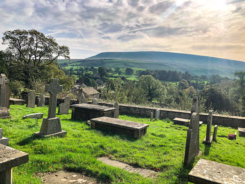
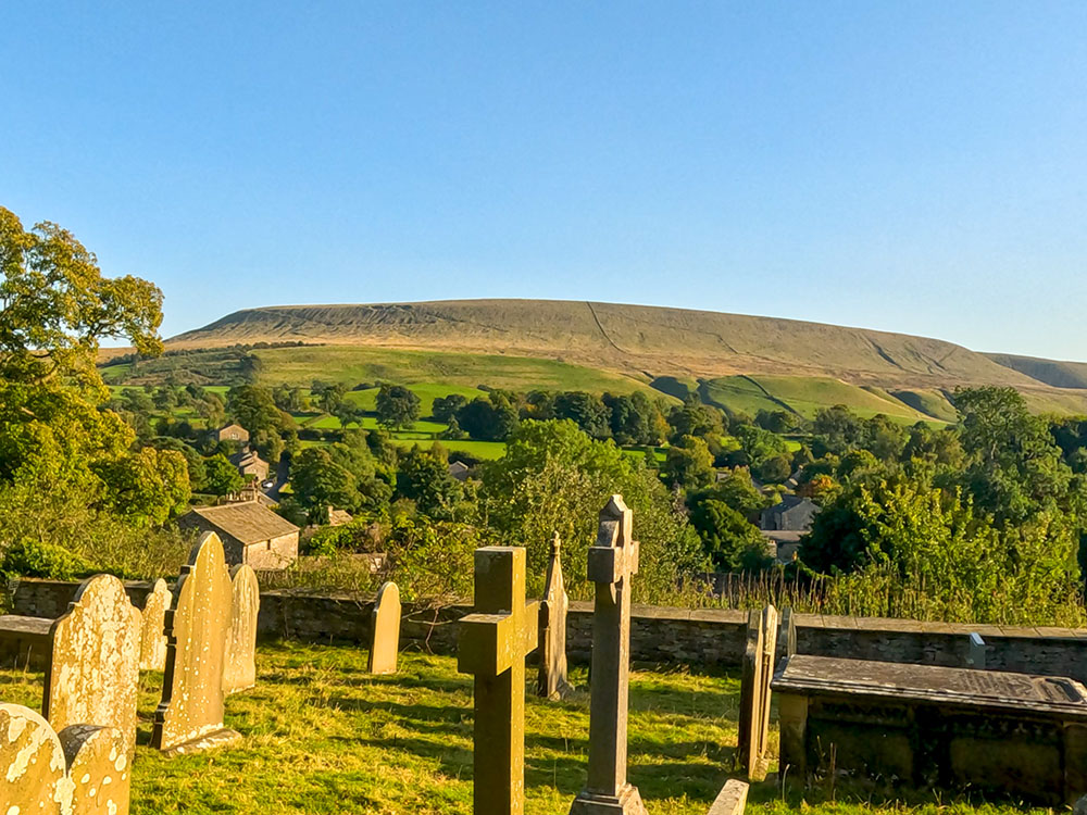
Pendle Hill from St Leonard's church in Downham
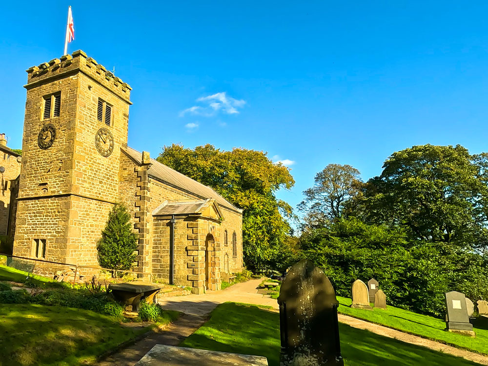
Much of the current church of St. Leonard dates from 1910, with only the tower remaining from the 15th-century original church. It is believed that there has been a church on this site since the 13th century. Many of the grey stone cottages were built in the 18th and 19th centuries, many in the heyday of the handloom weavers.
There is one pub in Downham, the Assheton Arms and a Post Office, near to which are the 'Downham Stocks'. The Assheton Arms was originally a farmhouse that brewed beer for its workers. In 1872 it became the George and Dragon and in the 1950s was renamed the Assheton Arms in honour of Sir Ralph Assheton for his contribution to the government during the Second World War.
The nearby stocks were used as a form of punishment, although the Downham stocks are now incomplete as they are missing the wooden boards that held the offender's hands and feet.
Stocks at Downham with Pendle Hill in the background
Also close by to the foot of Pendle Hill in Lancashire lies the delightful village of Roughlee. It is the home of the Bay Horse pub, the last Clarion House in England, a village hall, a statue of Alice Nutter, a school and a picturesque waterfall.
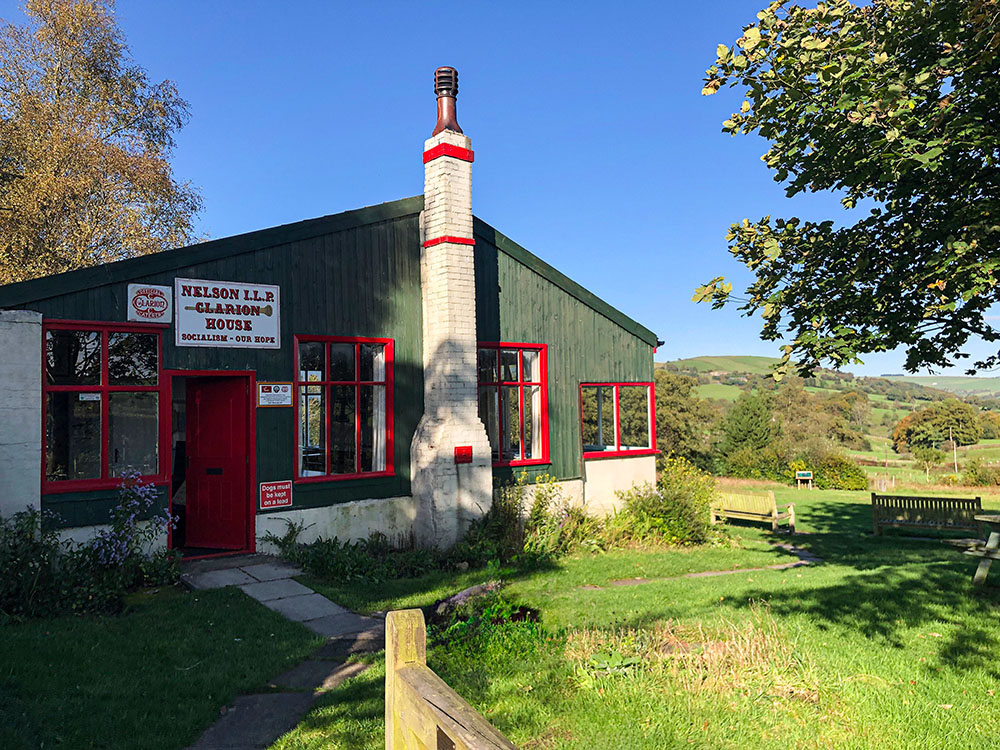
The Clarion House at Roughlee
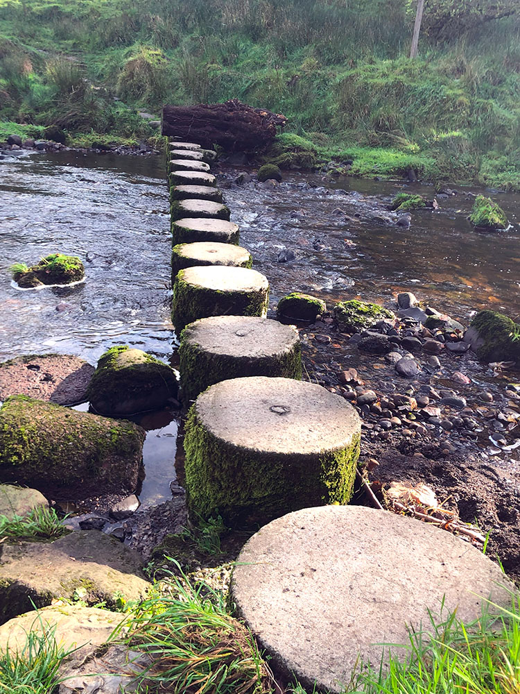
Stepping stones in Roughlee
At the start of the 20th century, there were many Clarion Houses across the North West of England, London and Scotland - the one at Roughlee is the last one remaining. It was built in 1912 by the early pioneers of socialism and the Nelson Clarion Society keeps the building open, serving refreshments to cyclists and walkers every Sunday.
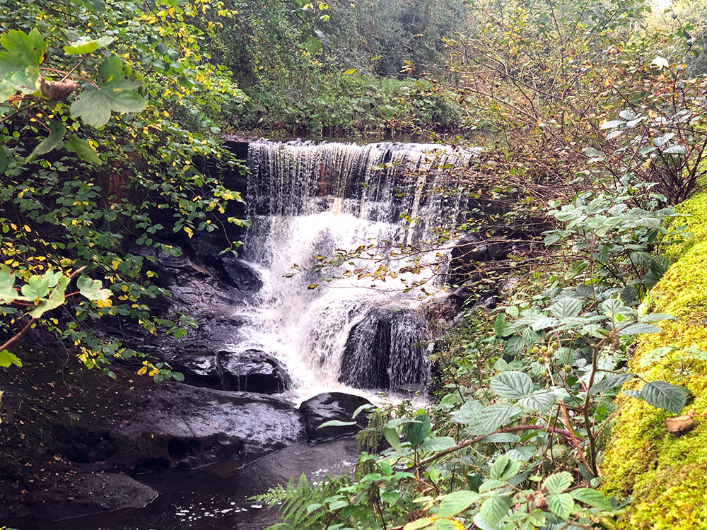
Waterfall at Roughlee
The village centre, across from the Bay Horse pub, holds various events throughout the year and is also available for private hire. Just further down the road is a statue of Alice Nutter, one of the Pendle witches. Commemorating the 400th year since the infamous witch trials, Alice Nutter was celebrated in 2012 with a statue being erected in the village she came from. It is believed Alice Nutter lived at Roughlee Old Hall.
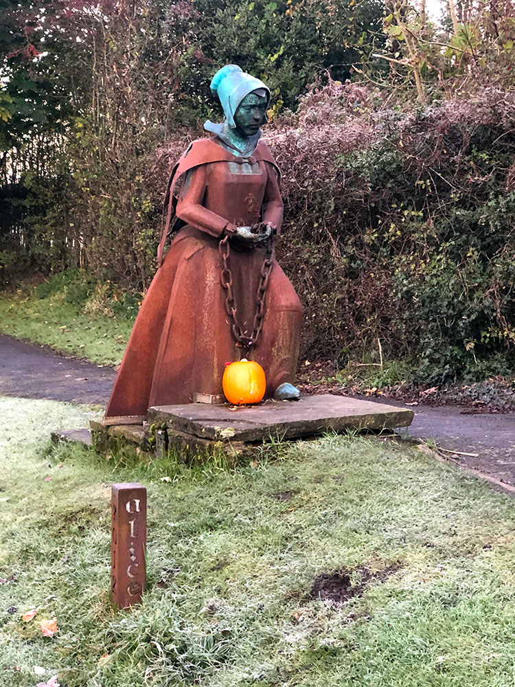
Alice Nutter statue in Roughlee
Roughlee Old Hall
Just like Barley, the history of Roughlee was heavily shaped by the textile industry, with mills at Thorneyholme (once owned by King Charles II and eventually closed in 1814), Dam Head (again once owned by King Charles II and stood on the site where Roughlee school now stands) and Roughlee Mill (nearby to where the village hall now stands and closed in 1907).
Newchurch in Pendle is a village just up the road from Barley. The settlement here was known as Goldshaw Booth (a name still in use today) until 1544 when a new church was consecrated and it then became Newchurch in Pendle. Before that, there was a chapel in the village that dated back to before 1250. Only part of the church tower remains from the original church, with work finished on the current church in 1740.
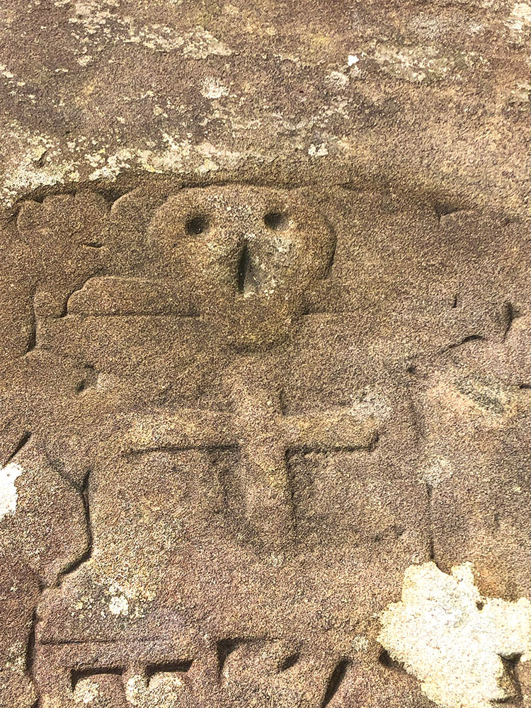
The 'Eye of God' is incorporated into the western side of the tower on the church as a protective measure against evil spirits. To the east of the church porch, near the south wall, lies the grave of a Nutter family member, faintly marked with a skull and crossbones.
The 'Eye of God' in the tower at St Mary's Church in Newchurch in Pendle
Local folklore suggests that this is the final resting place of Alice Nutter, one of the notorious Pendle witches. However, it's highly unlikely as executed witches were rarely buried in holy ground and the skull and crossbones symbol was quite common on graves at the time, making the legend probably more myth than fact, but when has that ever spoilt a good story?
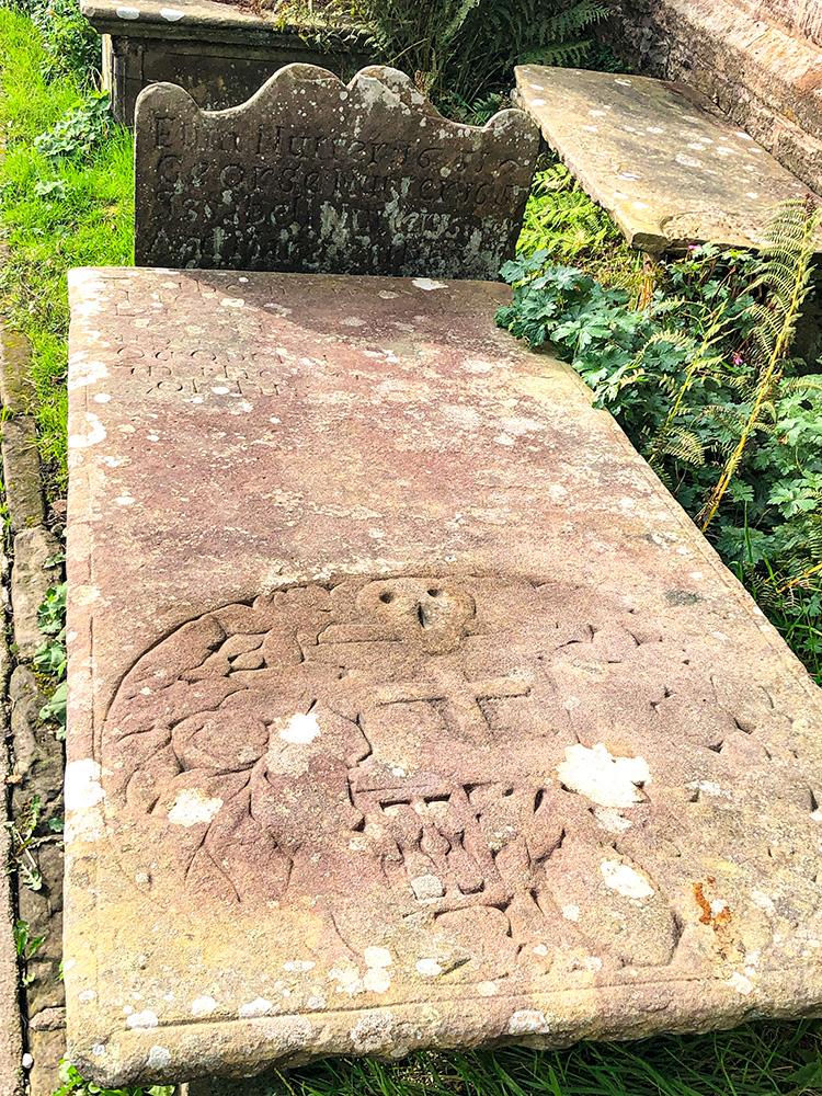
Grave with the skull and crossbones in the churchyard at St Mary's church in Newchurch in Pendle
The skull and crossbones on the grave
Historically, most inhabitants were farmers, weavers or associated tradesmen. By around 1820 there were over 300 hand looms in the village alone.
Newchurch is also synonymous with the Pendle witches and if you visit, don't forget to pop into the famous 'Witches Galore' shop. There used to be two shops and two pubs in the village, but these have all closed. One of them, the Lamb Inn, I frequented on quite a few occasions in the past in my youth, but sadly it closed in 1999.
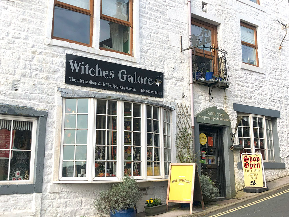
Witches Galore Shop in Newchurch
Newchurch also hosts a rush-bearing ceremony each August with a procession around the village and the Pendle Witches walk passes through the village.
Pendleton lies in a hollow below the Nick of Pendle and was mentioned as far back as the Domesday Book. For those whose history might now be in the distant past, the Domesday Book was a comprehensive survey of land and property in England commissioned by William the Conqueror in 1086 to assess the country's resources and tax potential.
Its history does go much further back than that though, as was discovered in 1969, when a Bronze Age urn was excavated there, which now resides in Clitheroe museum. The Bronze Age lasted from around 2300–800 BC in the UK.
Before the A59 bypass was opened in 1971, Pendleton was on the main road and the 'Swan With Two Necks' pub was an important coaching inn on it, constructed back in the 1720s. After originally being the Swan Inn and Swan Hotel, I believe its name was changed to the Swan with Two Necks in the 1900s.
There are quite a few 'Swan with Two Necks' in the UK. Many, many years ago, back in the 1400s, at a time when swans were eaten, they were still protected, with any unmarked swan deemed to belong to the monarch. So marks were scratched on their bills and in 1472 there was a register of swan marks. The Vintners Company marked their swans' bills with two scratches, so became known as 'Swans with Two Nicks'. Artists and others over the years chose to substitute necks for nicks and so we have the 'Swan with Two Necks'.
Sabden lies just below the Nick of Pendle on the southern edge of Pendle Hill. Its name is believed to have been derived from the Old English 'Sceppe Denu', which means the valley of the spruces. The name 'Sapedene' first appeared in 1296.
Sabden was mainly a farming valley from the 13th century onwards and then later it became more industrial with calico printing, weaving and cotton spinning at the Cobden, Victoria and Union Mills, which continued weaving until the 1960s and today it is home to the Pendle Antique Centre. At one stage there were 7 mills in the village.
Sabden was known for its 'Treacle Mines'. There have been jokes about treacle mining since the mid-19th century, with it being similar to coal. Sabden was no stranger to this cultivating various folklore about local treacle mining in the 1930s, backed up by the local newspaper publishing numerous stories about the fictitious mines.
Then in the 1980s, Bill Dewhurst and his family set up the Sabden Treacle Mines tourist attraction, which at its peak was attracting 30,000 visitors each year. On the back of that 'The Treacle People' was launched, which was an animated television series voiced by Wille Rushden amongst many others and many Treacle People furry toys were created and sold off the back of it. Unfortunately, the attraction closed in 1997, as the money dwindled from the sale of the toys due to the rise of the Teletubbies! If you want to travel back in time, The Treacle People, which was once BAFTA nominated, is now digitally remastered and available to watch on its own YouTube channel.
Just on the hill up the road from Sabden, at the Nick of Pendle, is a dry ski slope, home of the Pendle Ski Club. The club itself is member-owned and run by volunteers. It is also where Dave Ryding learnt his craft and besides competing in the Olympics and many other world downhill races. In January 2022 he took his and Great Britain's first-ever World Cup win, winning the slalom in Kitzbuhel, Austria.
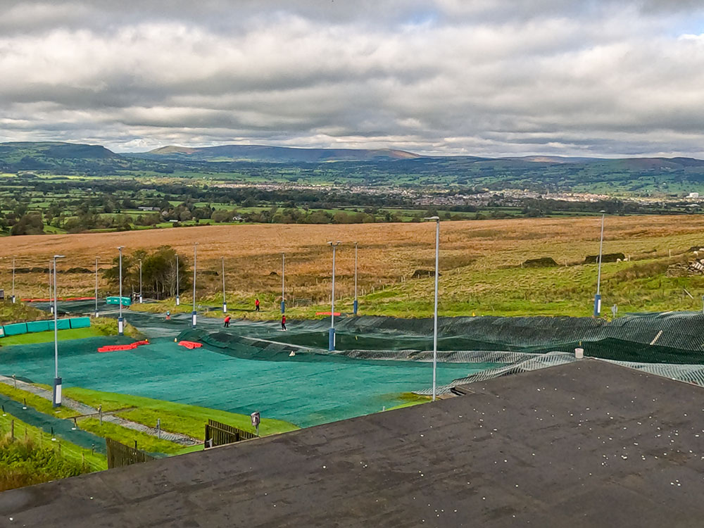
Looking out across the Pendle Ski Slope from the Wellsprings
Wiswell lies on the far south-west slopes of Pendle Hill and enjoys fine views to the west towards the Trough of Bowland. Wiswell is said to have taken its name from Old Molly's Well, which later became known as the Wise Woman's Well, which became Wiswell. The first record of Wiswell is in a charter of 1193, in the reign of Richard I (aka Richard the Lionheart), where the Lords of Clitheroe granted the de Arches family, two ploughlands, which included Wiswell.
Probably the village's most famous resident was the last Abbot of Whalley, John Paslew, who had been in charge of the abbey for thirty years. His demise was rather sudden and messy after he refused to take the King’s oath of allegiance, he was soon arrested and held in Lancaster Castle where he was found guilty of high treason in 1537. The following day he was hung, drawn and quartered on Gallows Hill, near the castle.
Within the village is Wiswell Shay Cross, a grade II listed monument, which is one of many wayside crosses in the area. Whilst it looks old, it is only the base that dates back to the 13th century, with the rest being a 19th-century restoration. Legend has it that John Paslew's ghost wanders from the Shay Cross to his home at Wiswell Old Hall.
Nowadays most visitors to Wiswell come to visit the Freemason's Arms. The Freemason's Arms was once three small cottages, one of which was a 'freemason's lodge'.
We've set out below a selection of just some of the pubs and cafes in and around the villages surrounding Pendle Hill.
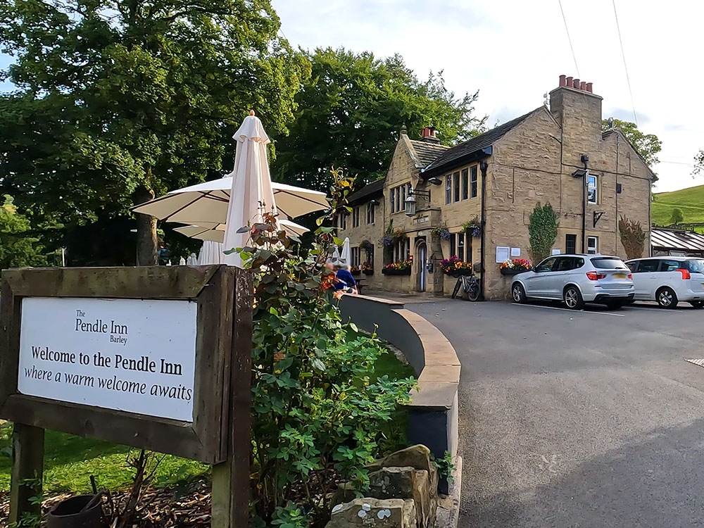
The Pendle Inn in Barley serves a selection of real ale and food and has a large beer garden outside. It is dog-friendly and has some accommodation. The perfect place for a post-walk beer.
Entrance to the Pendle Inn in Barley
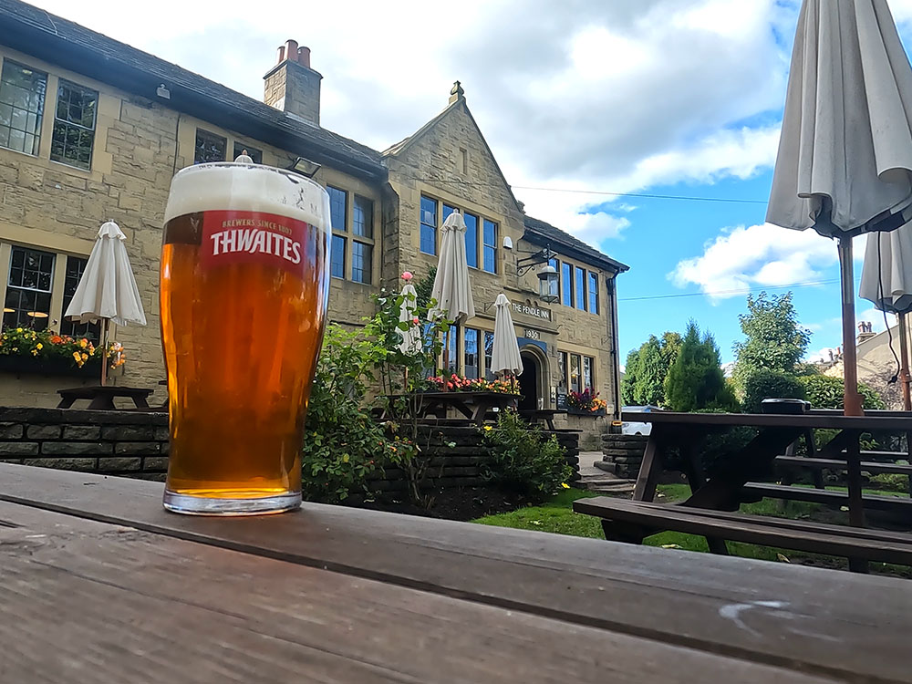
Sat outside the Pendle Inn in Barley
The Barley Mow serves local beers and a wide range of food. Depending on the weather, you can sit by the warming fires inside or use the outdoor seating. It is dog-friendly and has 6 bedrooms.

Barley Mow
The Cabin Cafe is in the car park in Barley. With seating indoors and out, it offers a wide range of food and drinks. Again, a great stop-off after a walk before getting back into your car.
Cabin Cafe in the car park in Barley
Just along from the Alice Nutter statue is the Bay Horse at Roughlee which serves food and a range of drinks including local guest ales and is dog-friendly.
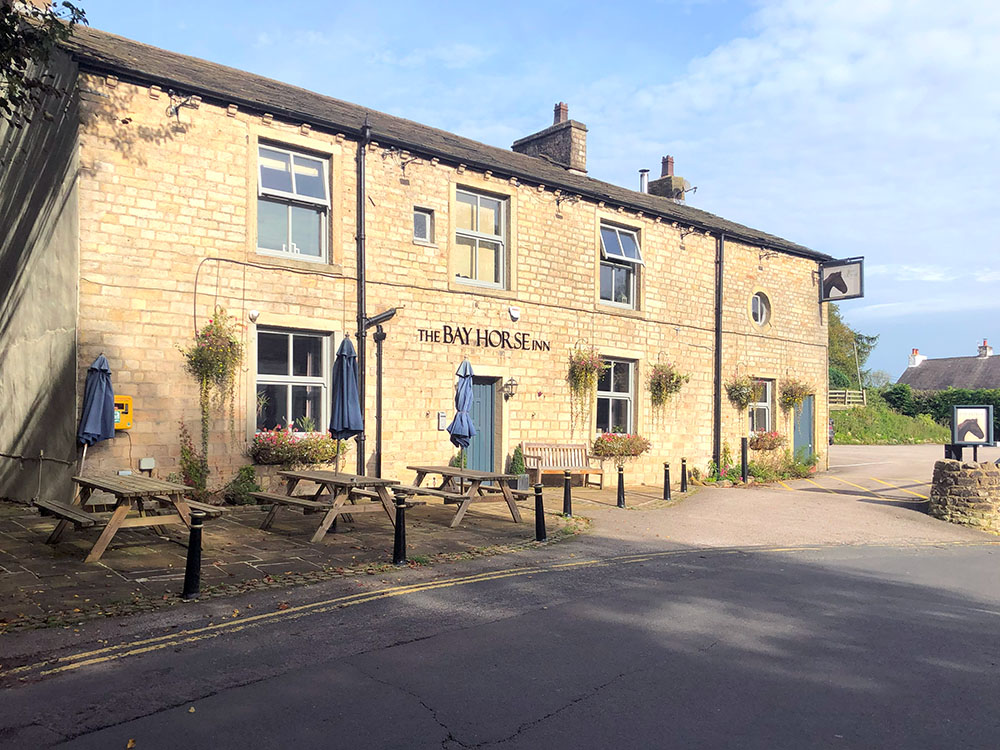
Bay Horse at Roughlee
The Assheton Arms in Downham offers food and drink and a lovely view of Pendle Hill from the seats outside. There are 12 bedrooms and it is dog-friendly. It has been awarded the Lancashire Life Dining Pub of the Year and the Lancashire Tourism Awards Pub of the Year.
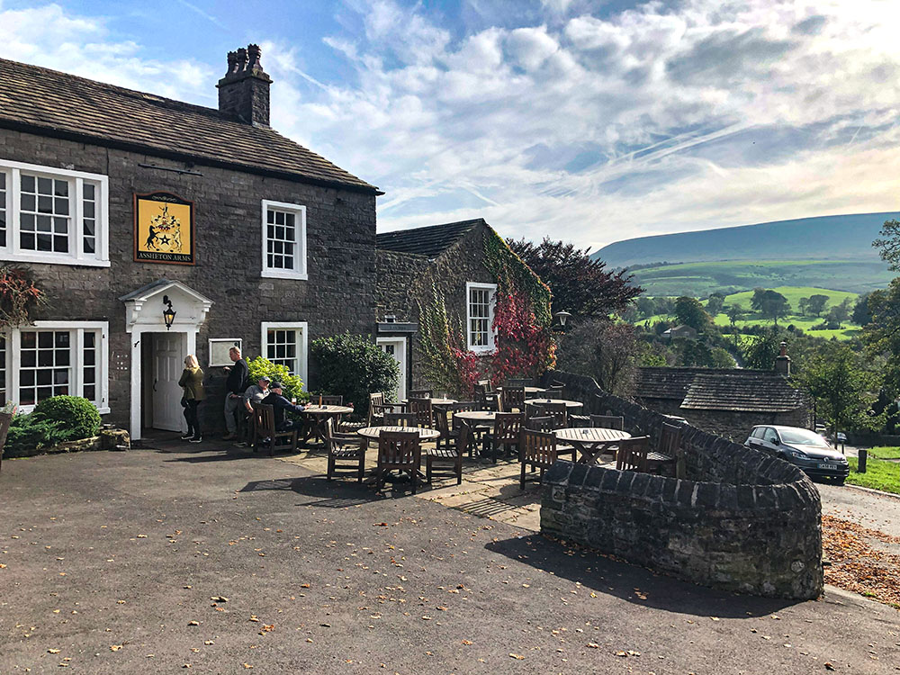
Assheton Arms at Downham with Pendle Hill in the background
On the outskirts of Downham is the Greendale Teahouse and Rooms with views across the Ribble Valley. Great range of homemade cakes, breakfasts, all-day brunch and drinks. It has 4 bedrooms and is dog-friendly.
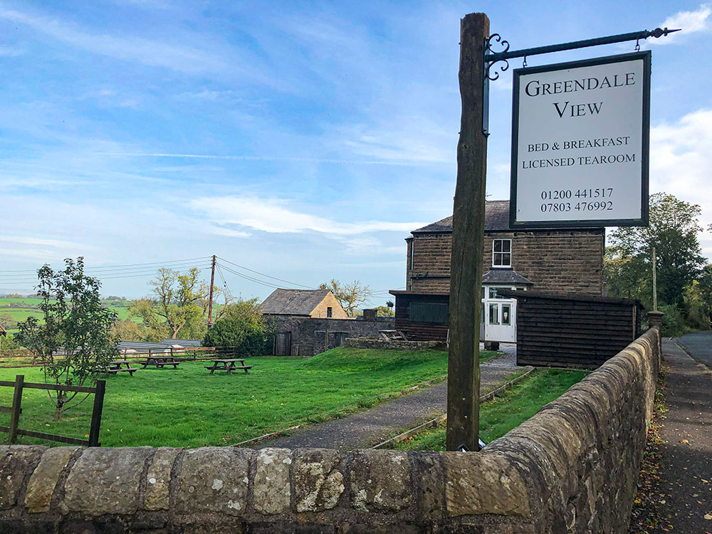
Greendale View Tearoom
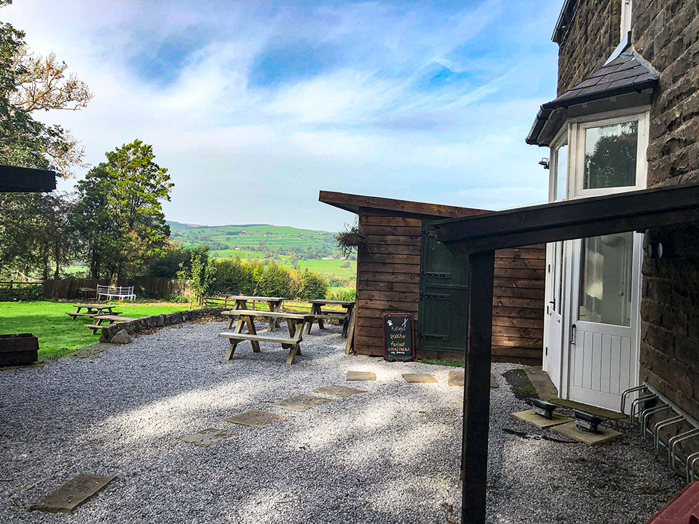
View from Greendale View Teahouse
The Swan with Two Necks at Pendleton is a CAMRA award-winning pub and has been named Lancashire Pub of the Year 2023. It features a traditional bar area with two open fires, a dining room and lots of outdoor seating looking towards Pendle Hill. It serves food and real ales.
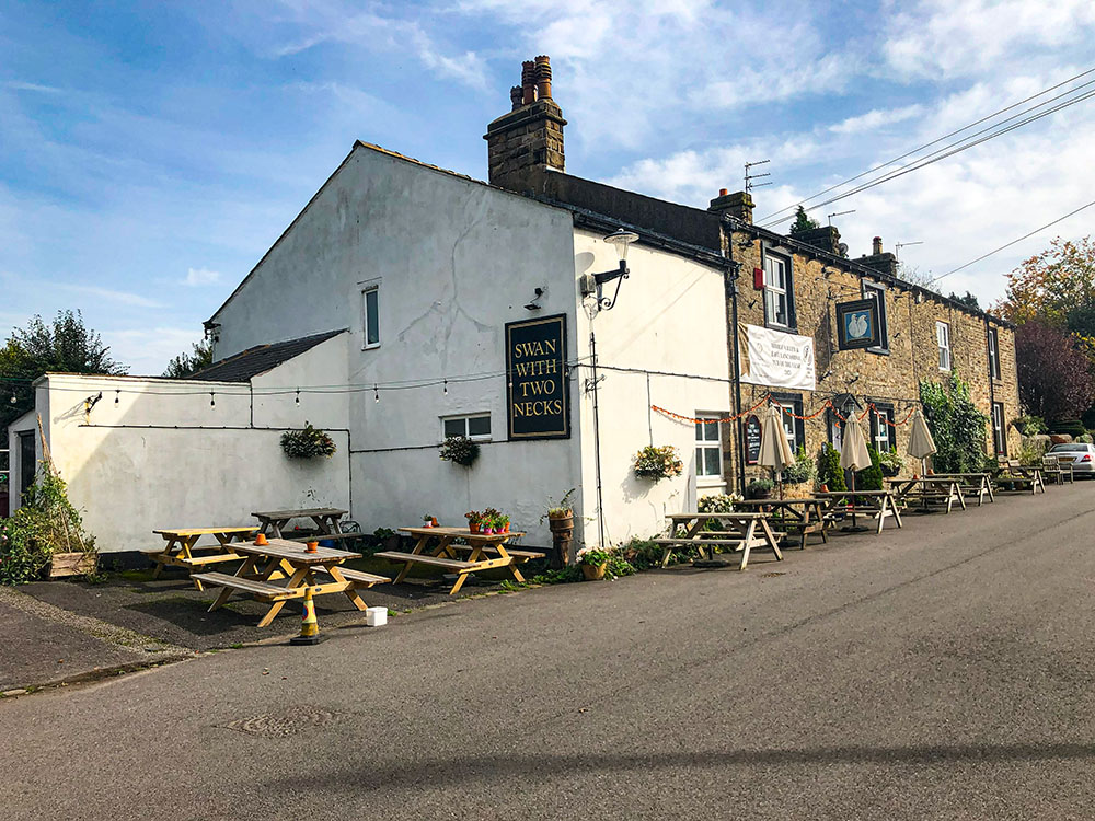
Swan with Two Necks at Pendleton
Swan with Two Necks at Pendleton Beer Garden with Pendle Hill in the background
The White Hart in Sabden serves a range of homecooked pub food along with cask ales, lager and spirits and is dog-friendly.
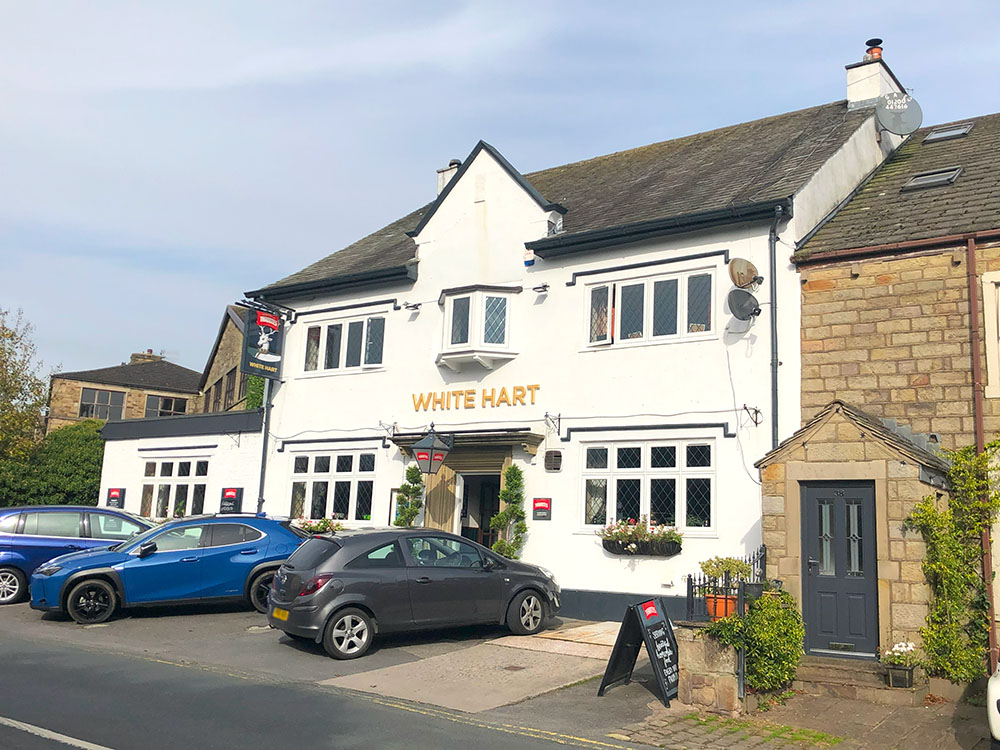
White Hart at Sabden
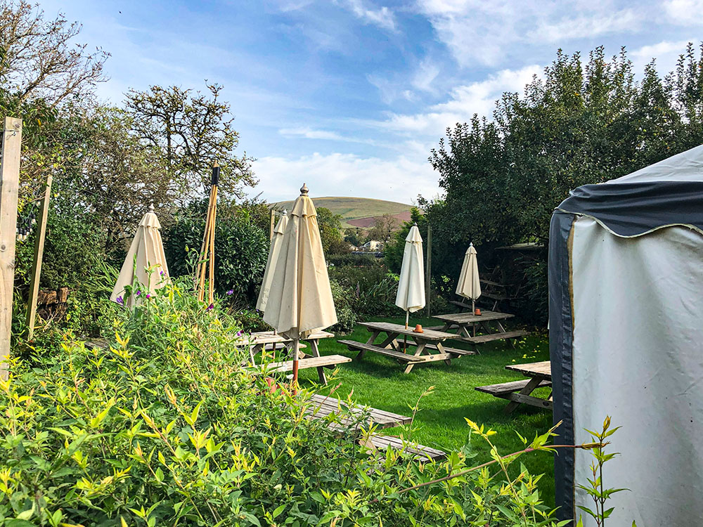
The Wellsprings is just up the road from Sabden at the Nick of Pendle. The Wellsprings is a Spanish and Mexican restaurant and bar with wonderful panoramic views across the Ribble Valley.
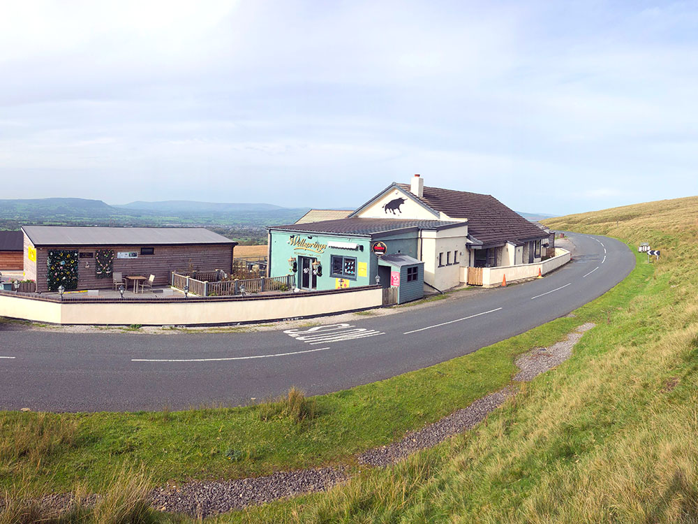
Wellsprings Restaurant and Bar
It is an ideal place to visit for a beer on a warm summer evening, or I've often called in there on a longer walk over Pendle Hill from Barley.
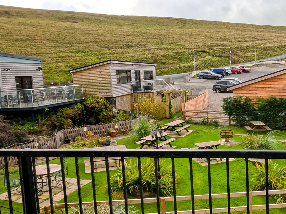
Some of the outside seating offering views across the Ribble Valley at the Wellsprings
The Freemasons Arms at Wiswell is a Gastropub serving food and cask ales in an award-winning inn. It's dog-friendly and has 4 bedrooms.
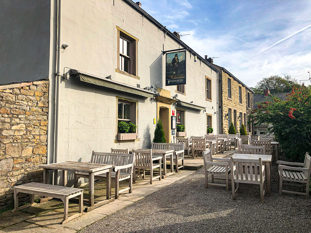
Freemasons Arms at Wiswell
We get asked many questions about Pendle Hill, and even though some of these are answered above, we have set out the most common questions below:
Pendle Hill is famous for its historical significance. It was the setting for the infamous Pendle Witch Trials of 1612, the site where George Fox, the founder of the Quaker movement, had a profound spiritual experience in 1652 that would ultimately shape the course of his life, the Quaker faith and the Quakers' movement, the place where Boyle's Law was first 'discovered' and nearby in Barley and Barrowford they have held the world record for the most people dressed as witches. It is also well known for its many picturesque walks over and around Pendle Hill.
The shortest route up Pendle Hill from Barley is 6.5 Km and takes about 2 hours.
Pendle Hill is located in Lancashire, North West England, within the Forest of Bowland, an Area of Outstanding Natural Beauty.
Yes, you can visit Pendle Hill. There are many walks over and around Pendle Hill and lovely villages to explore.
If you are coming by car, you can park in Barley, Downham or on the Nick of Pendle.
There is no train station in Barley, but there is the Clitheroe to Nelson bus that passes through it and stops in Downham and Barley.
There is a large car park in Barley, the start of many walks up Pendle Hill. The postcode for the car park is BB12 9JT and the What3words for the car park is clays.label.found.
Pendle is famous for many things, including its association with the Pendle Witch Trials of 1612, it is the place where George Fox had his spiritual experience that led to his founding the Quakers, its industrial heritage, its association with Boyle's Law and being the location where Pendle Hill is.
Pendle Hill is 53 metres (173 feet) short of being a mountain. A mountain in the UK is defined as being 2,000 feet high, and Pendle Hill is 557 metres (1,827 feet) high.
The shortest walk up Pendle Hill from Barley is 6.5 Kilometres. There are many other walks up Pendle Hill from Barley, Downham and the Nick of Pendle, but these are all longer.
Pendle Hill is 557 metres (1,827 feet) high.
The Pendle 3 Peaks are Pendle Hill, Weets Hill and Boulsworth Hill.
The village on the South-East side of Pendle Hill, where most people start their walks is Barley. Just to the North of Pendle Hill is Downham.
The Pendle Witch Trail is a driving trail, which starts in Barrowford and ends 45 miles later in Lancaster.
This should not be confused with the Pendle Witches Walk, which is a 11.6 Kilometre walk, starting and ending in Barley.
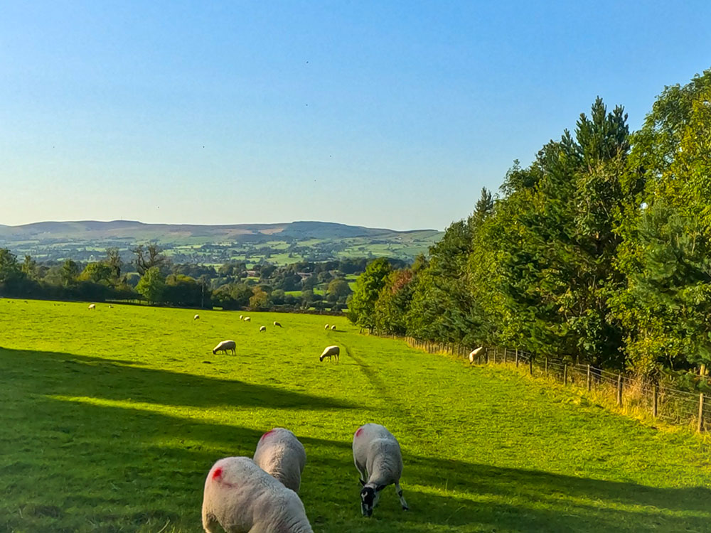
Yes, there are many sheep on Pendle Hill.
Yes, on a clear day, you can see Blackpool Tower from Pendle Hill.
The UK parts of the Haunting of Pendle Hill released in 2022 appear to have been filmed in Yorkshire, Scotland, the Lake District - anywhere except Pendle Hill! The best online review I read of it gave it 2.9 out of 10, and that was the best!
Episode 8 in season 11 of Doctor Who, entitled 'The Witchfinders', finds the TARDIS arriving in 17th century Lancashire amongst the witch trials. The episode starred Jodie Whittaker as The Doctor, along with Bradley Walsh and Tosin Cole.
The episode does include many historical inaccuracies, and James I appears in it, even though there was no record of him ever visiting Pendle. James I, a Scottish King, appeared to have picked up an English accent!
Pendle Hill is an iconic, famous and distinctive hill, standing 557 metres in height, in Lancashire, England, amid the enchanting landscape of the Forest of Bowland.
The well is on one of the paths heading towards Downham from the seats built into the wall on Pendle Hill.
From the weather shelter seats built into the wall at the top of the steps heading up Pendle Hill, you head towards Downham on the right-hand path where you soon reach the 'Well'. The well is not signed but has a metal lid on top. If you lift up the lid, there is a plaque on it with a quote from George Fox, as it is believed he drank from it when he was on Pendle Hill.
The main path up Pendle Hill from Barley has been much improved, and apart from walking alongside the stream, almost all muddy sections have gone.
Other paths up to the summit can be a little muddier in sections, but these have also been improved over the years.
Keep to the paths, though - off the paths, Pendle Hill can be very boggy and muddy in places.
References:
The History of Colne - Pendle Heritage Centre
A History of the Lancashire Cotton Industry and the Amalgamated Weavers Association - Edwin Hopwood
The Textile Mills of Pendle and Their Steam Engines - Geoff Shackleton
November 2024
 Pendle Hill walk via The Pendle Way (Short Route) from Barley
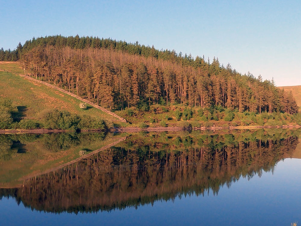 Pendle Hill walk via Ogden Clough or Boar Clough from Barley
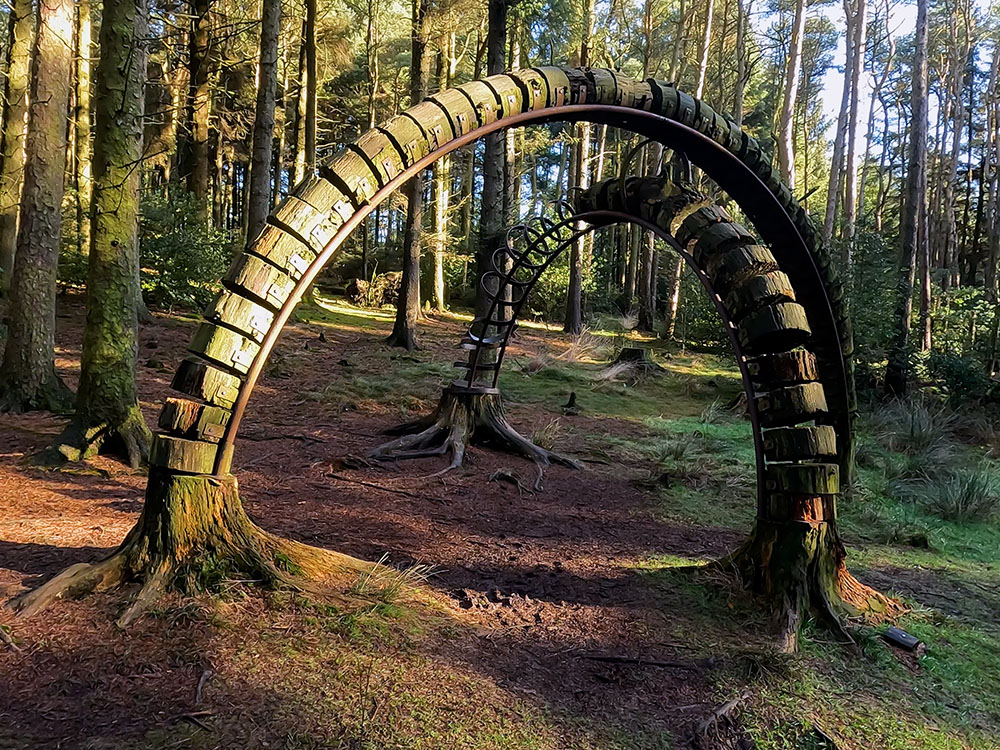 Pendle Sculpture Trail walk from Barley
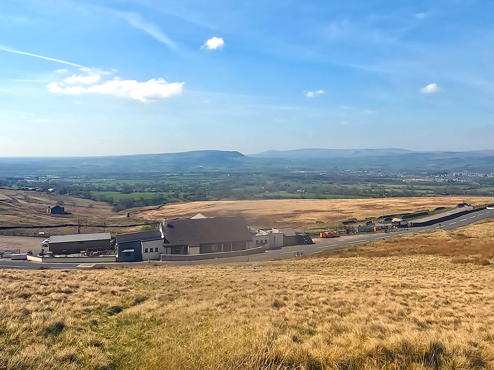 Pendle Hill walk from the Nick of Pendle
 Pendle Hill walk from Downham
 The Pendle Witches Walk (East and West Loops) from Barley