By using this website, you agree to our use of cookies (needed to provide our website’s features) and our Terms of Use.

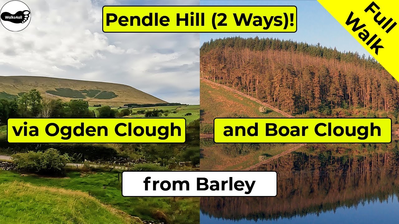
The classic circular of Pendle Hill from Barley via either Ogden Clough or Boar Clough takes in the hill synonymous with the Pendle witches. From the summit even Blackpool tower and the Lakeland fells can all be seen on a clear day!
In accordance with our Disclaimer, you agree to take full responsibility for any use you make of the information contained in these pages.
This page contains affiliate links. If you buy products or services via these links, we may earn a small commission at no cost to you.
| Walk title: | Pendle Hill walk via Ogden Clough or Boar Clough from Barley |
| Author: | Andrew Forrest - Updated November 2023 |
| Walk start point: | Pay and display car park in the centre of Barley (grid reference SD 823 403) - it can get busy at weekends and bank holidays. What3words: deriving.untruth.bloomers |
| Parking: | As above |
| Directions to nearest parking place: | Google Maps: get directions here / What3words: clays.label.found |
| Walk distance: | 9.8 km - via Ogden Clough 8.5 km - via Boar Clough |
| Estimated walk time: | 2 hours 50 minutes - via Ogden Clough 2 hours 30 minutes - via Boar Clough |
| Height climbed: | 360 metres - via Ogden Clough 355 metres - via Boar Clough |
| Technical difficulty: | Moderate - as determined by our interpretation of the Ordnance Survey guidance on technical difficulties |
| Peaks / summits: | Pendle Hill (577m) |
| Map: | Ordnance Survey - Explorer OL41 (Forest of Bowland & Ribblesdale) Buy this map from Ordnance Survey |
| GPS/GPX file: | Download available to registered users - Register and Login here - It's FREE to register |
| Facilities / refreshments: | Toilets and the Cabin Café in the car park at Barley. Pubs: Pendle Inn and Barley Mow in Barley |
| Nearest town: | Walk starts in Barley |
| Local self-catering accommodation: | View self-catering accommodation close to the start of this walk |
Estimated walk time
Walk time estimates used are from the Ordnance Survey mapping app, which uses a refined Naismith's rule, adjusted by OS overlaying their own data collected from more than one million people using the OS mapping app. Naismith's rule allowed one hour for every three miles walked and added pro-rata an additional hour for every 2000ft of ascent - roughly one hour for every 5km, plus one hour for every 600m of ascent.
Ordnance Survey Mapping App
Use on any device and make it easy to explore the great outdoors for just the price of a coffee a month. Premium allows full UK access to all OS Explorer and Landranger mapping, along with the ability to import and export routes, save maps offline, aerial 3D, and print A3/A4 maps.
In this Pendle Hill walk from Barley, we are taking you to the summit by two different routes, both of which share some of the same paths and are what I consider to be two of the more scenic routes up Pendle Hill.
The Pendle Hill walk from Barley via Ogden Clough takes approximately 2 hours and 50 minutes, whilst the Pendle Hill walk from Barley using the Pendle Way up Boar Clough takes approximately 2 hours and 30 minutes.
Both routes initially pass by Lower Ogden Reservoir and then head along the side of it to reach Upper Ogden Reservoir. This provides views around and back down Ogden Clough to Lower Ogden Reservoir. Walking on for about another 500 metres brings us to where our path splits and here you have a choice. The walk video initially keeps straight on heading up Ogden Clough and then along the flagged section to reach the top of Pendle Hill.
We then return to where the path splits to show you the right-hand path heading up Boar Clough and following the Pendle Way path to reach the summit. To the west on a clear day you can see out to Blackpool Tower and then around to the Snowdon range. A bit closer to home, looking down below, you can see Upper and Lower Black Moss Reservoirs back in the direction of Barley and then further around you can see on the horizon the Yorkshire Three Peaks, with the Lakeland Fells a more distant outline.
Both routes then return down a third route, both using the same paths to drop back down to Upper Ogden Reservoir before walking along back into Barley.
Both these Pendle walks are shown in full in the video and the routes for the walks are shown on the Ordnance Survey map - both above. Below is a brief description of the walk. Places where you can eat and drink after the walk are shown at the end of the video.
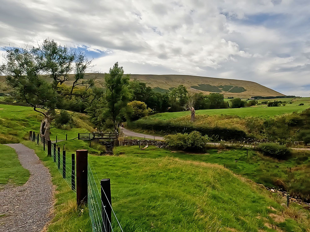
Head to the car entrance of the pay and display car park in Barley and then turn right along the road. Just before the road junction, we cross over the stream next to which there are benches that you can use and enjoy on those warmer days.
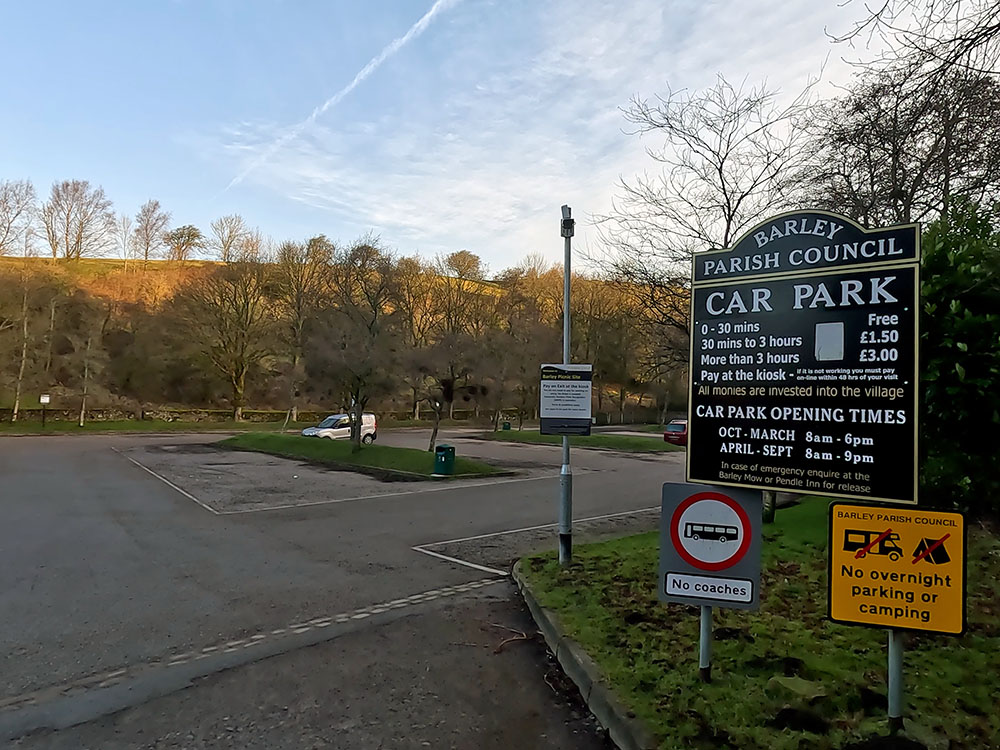
Car Park in Barley
Cross the road and then head down the lane opposite passing to the right of Barley Village Hall. After the next bend, pass by the old waterworks building now converted into seven dwellings and continue walking along the road.
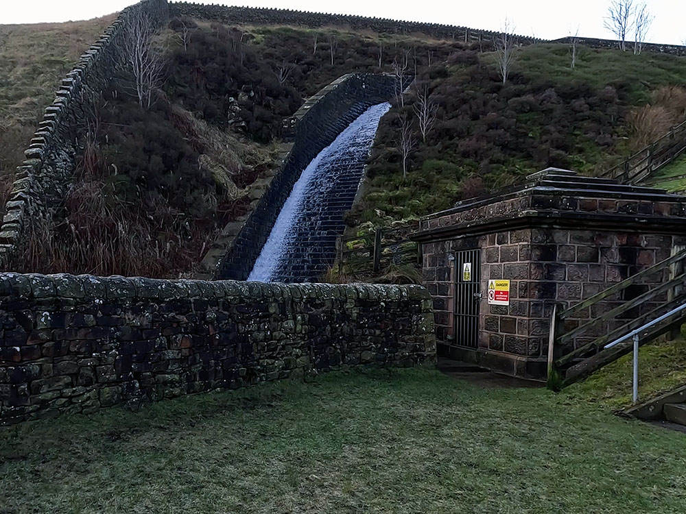
After a short climb along the road, the retaining dam and spillway of Lower Ogden Reservoir come into view over to the left.
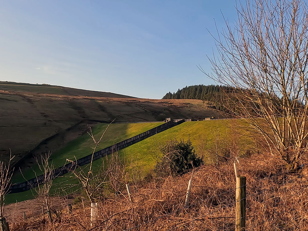
Dam and spillway at Lower Ogden Reservoir
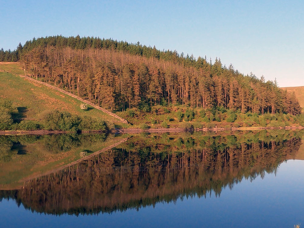
Both Upper and Lower Ogden reservoirs supply water to Nelson. Lower Ogden Reservoir here is the larger of the two, with its building being completed in 1914. It can hold almost 160 million gallons of water.

Lower Ogden Reservoir
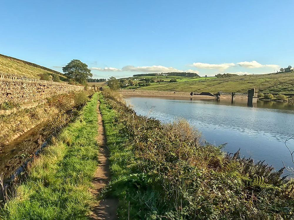
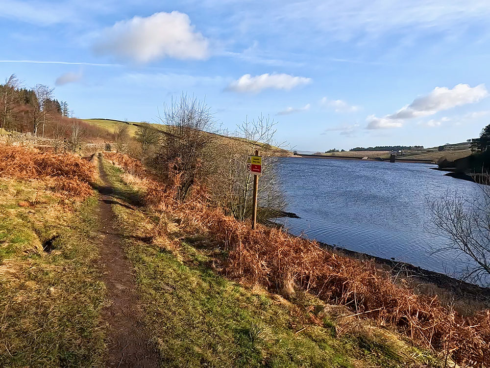
Just after the reservoir starts, you have a choice. You can keep on the road all the way to Upper Ogden Reservoir or head through the gate on the left along a concessionary footpath. This is always my preferred route to keep off the road. But, after heavy rain, parts of this can get a little boggy, so you may want to stick to the road on those days. It is a private road so very little through traffic.
Pass through the gate on the left and then head over the wooden footbridge to then turn right and head along the path that runs between the reservoir and the waterside channel spillway.
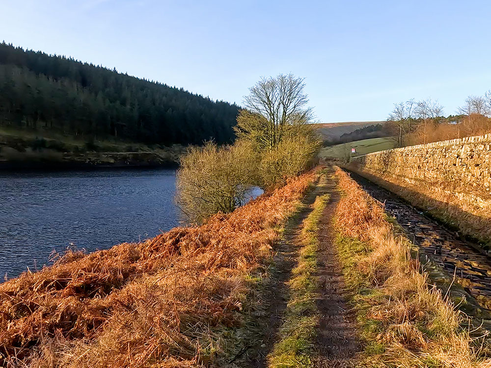
Path alongside Lower Ogden Reservoir and side channel spillway
Just after the end of the reservoir, over to the right is a bridge and a gate through which you could re-join the road if you wanted. You can see the road starting to rise to the right of the trees as it moves away from our path to meet up with us at Upper Ogden Reservoir.
Down to the left there is a path heading up into Fell Wood, which is part of the Pendle Witches' walk.
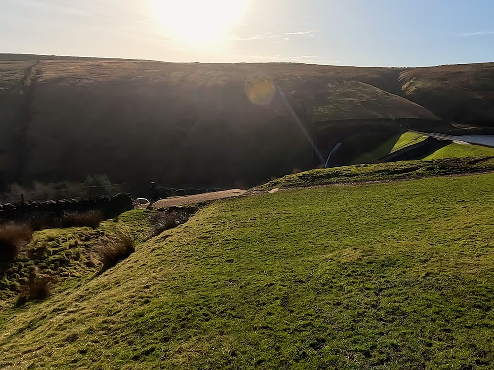
For now, we ignore both of these and just walk straight on. After a while, you reach a gate that heads back onto the road that we left earlier. Looking over to the left here, you can see the dam and spillway of Upper Ogden Reservoir.
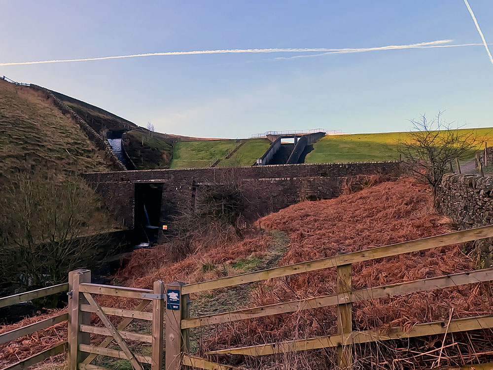
Dam at Upper Ogden Reservoir
Pass through the gate, then turn left onto the road, which has now become a gravel track and then just walk straight on. We are going to head straight on here, but after a few yards, if you look over to the right, you can see the path coming down that we will return on.
Pass through the kissing gate. You can just head straight up the gravel path here, but first, we'll just explore a little around the dam. If you head left, over to the right, you can see the spillway. Just past the steps, you can see the water chutes coming down from the side channel spillway.
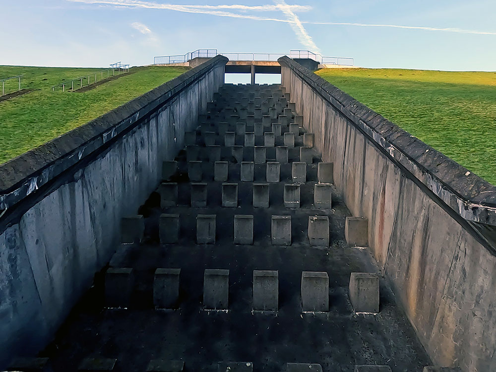
Stepped spillway at Upper Ogden Reservoir
Side channel spillway chute at Upper Ogden Reservoir
Head up the steps to reach the dam retaining Upper Ogden Reservoir.

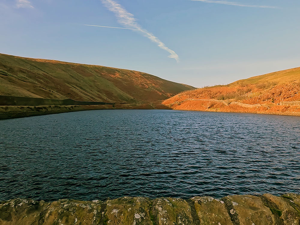
Upper Ogden Reservoir
Upper Ogden Reservoir was built before Lower Ogden Reservoir and was completed in 1906. It's approximately the same depth as Lower Ogden, but with a smaller surface area holds a lot less water at approximately 55 million gallons.
It does though afford good views back there in the valley to Lower Ogden Reservoir.
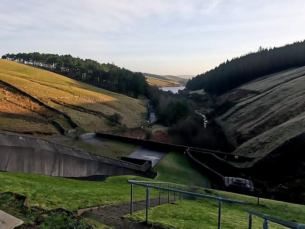
View from Upper Ogden Reservoir back down Ogden Clough towards Lower Ogden Reservoir
The path we follow heads up the right-hand side of the reservoir, so if you did a little exploring, head back along the dam to the information board.
From the information board, follow the path straight ahead between the fence and the wall. Pass through the gate.
A little further on there is a bench on your right if you want to sit and admire the views.
Keep on and pass through the next gate on which there's a Lancashire Way sign.
The Lancashire Way is a 396-mile-long walk designed to showcase the beautiful scenery and varied history Lancashire has to offer. The walk is divided into four sections and where we are is part of the central loop, which is under 101 miles long beginning and ending in Preston taking in the Ribble Valley and Pendle Hill along its way.
Head on and through the next gate and immediately head diagonally up to the right.

Gate through which Pendle Way path heads up diagonally right
After about 150 metres, just before we drop down to the stream, if you look ahead, you can see the path splitting with the straight-on path heading up Ogden Clough to Pendle Hill summit and the right-hand path heading along the Pendle Way up Boar Clough to Pendle Hill summit – both are described below.
Path junction of Ogden Clough and Boar Clough
Continue on to pass over the stream to the path junction by the stone Pendle Way marker that marks the start of the Boar Clough climb.
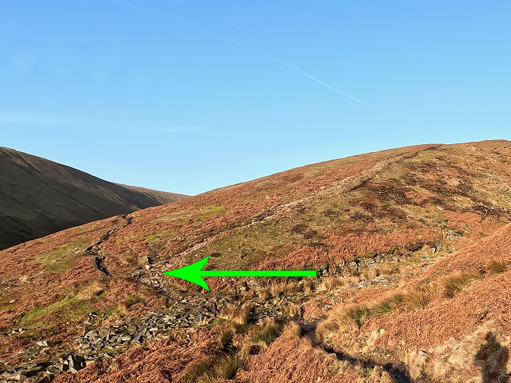
At the path junction, keep straight on following the path up Ogden Clough, with the stream down below to your left.

Direction of Ogden Clough path to be followed
Heading along Ogden Clough
Just over half a mile further on, pass through the gate and then drop down to the stream.
Crossing over the stream in Ogden Clough
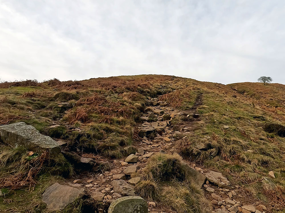
Cross over the stream and then turn right to follow the path as it zigzags up the hill. As the path becomes less steep, you pass by a stone marker indicating the 'summit' straight on.
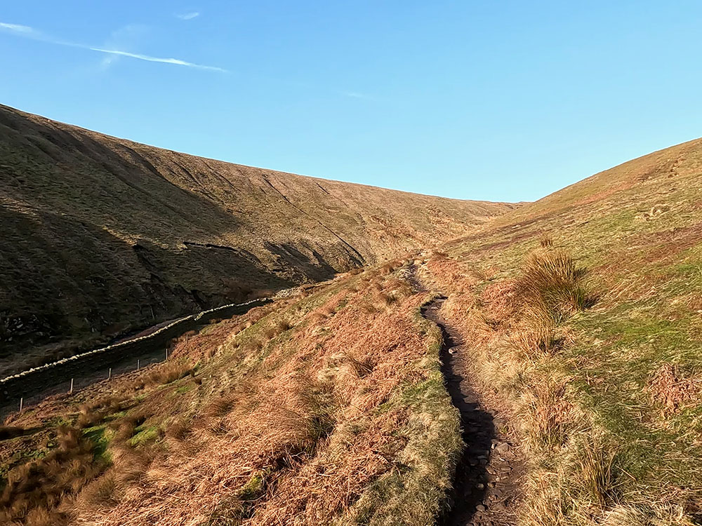
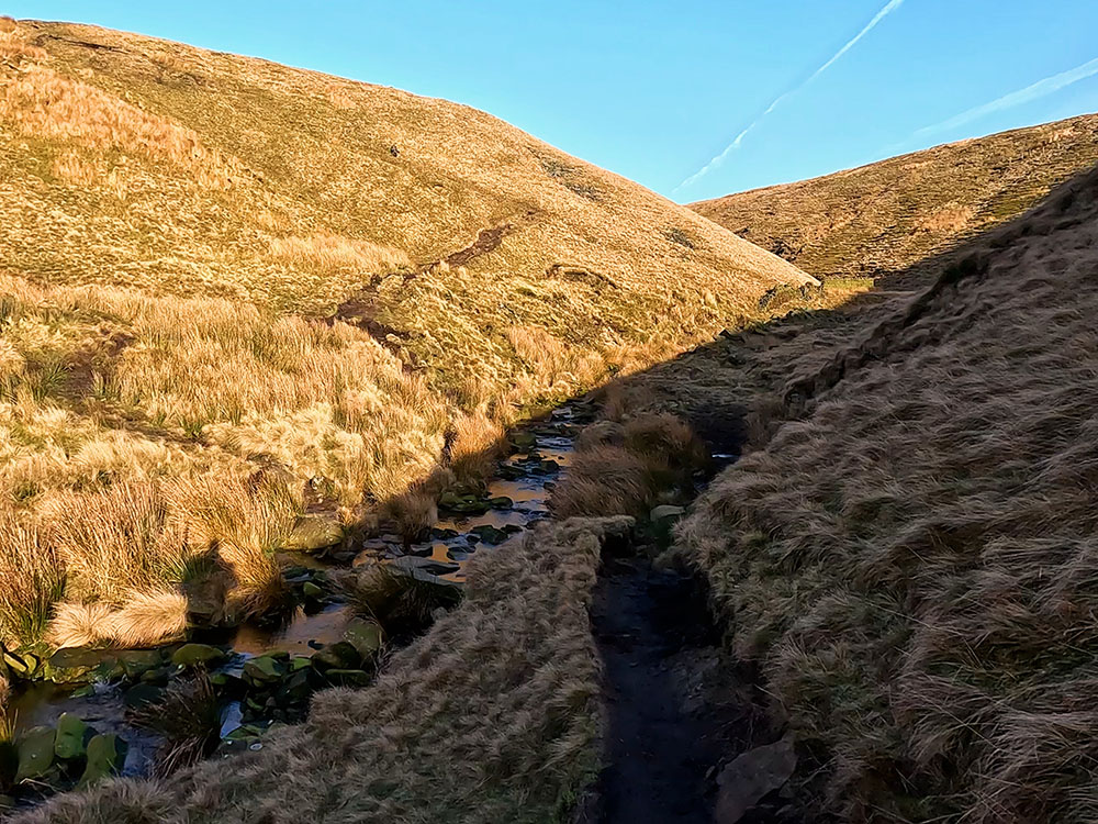
Keep on walking along the path as it winds its way along Ogden Clough with the stream now down below to your right.
Heading along Ogden Clough with the stream now down below to the right
After about a further kilometre, the path pulls in beside the stream we had been getting ever nearer. There is another stone marker here for the summit.
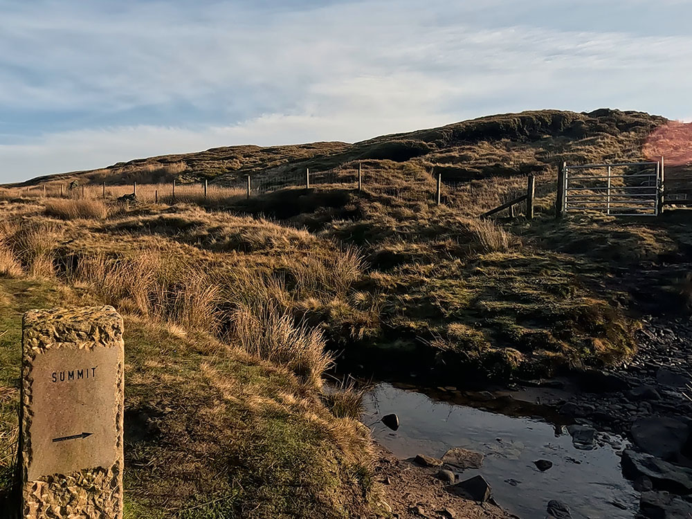
Stone summit marker and gate leading up onto flagged section to the summit
Here we cross the stream again and head over to the gate. Pass through the wooden gate and then start to climb the path which soon becomes flagged underfoot.
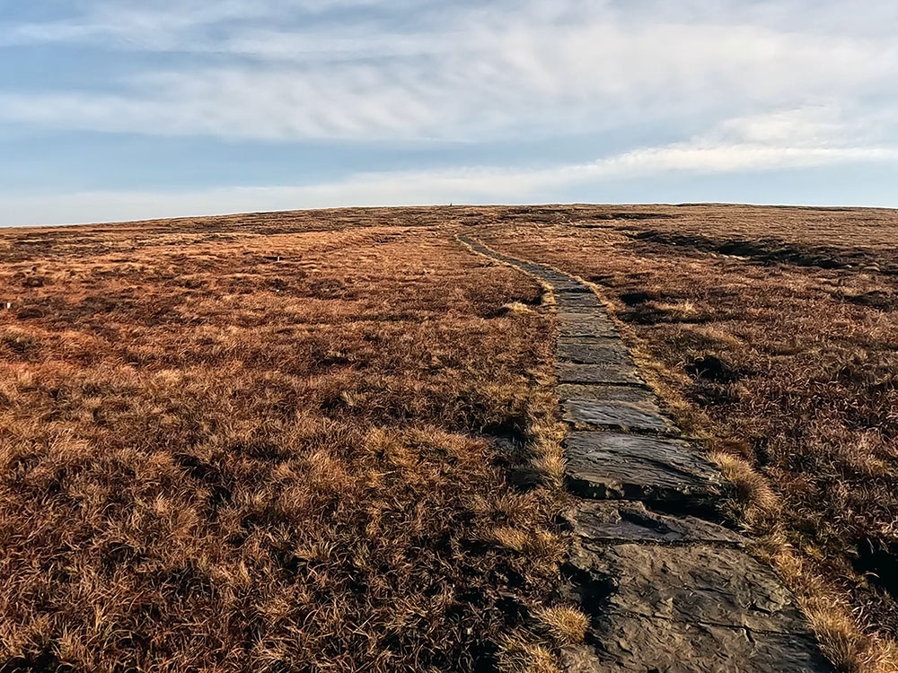
Flagged path heading to summit of Pendle Hill
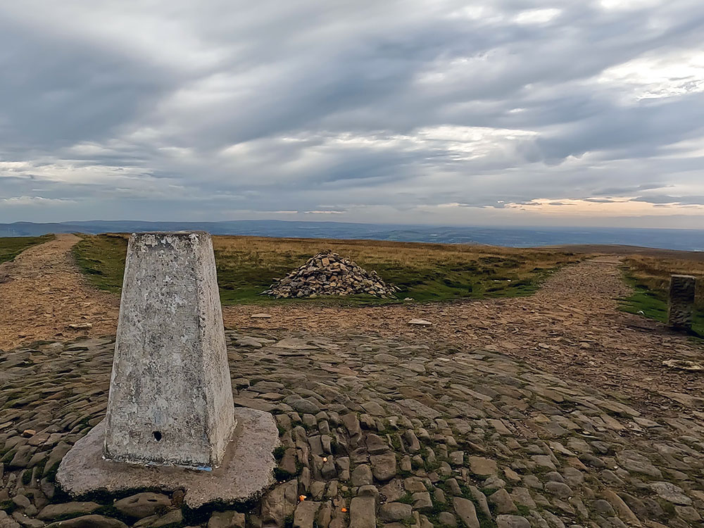
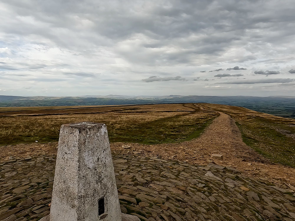
We follow the flags for about a kilometre up to the summit of Pendle Hill. We arrive at the trig point on the top of Pendle by the stone marker pointing towards Ogden Clough.
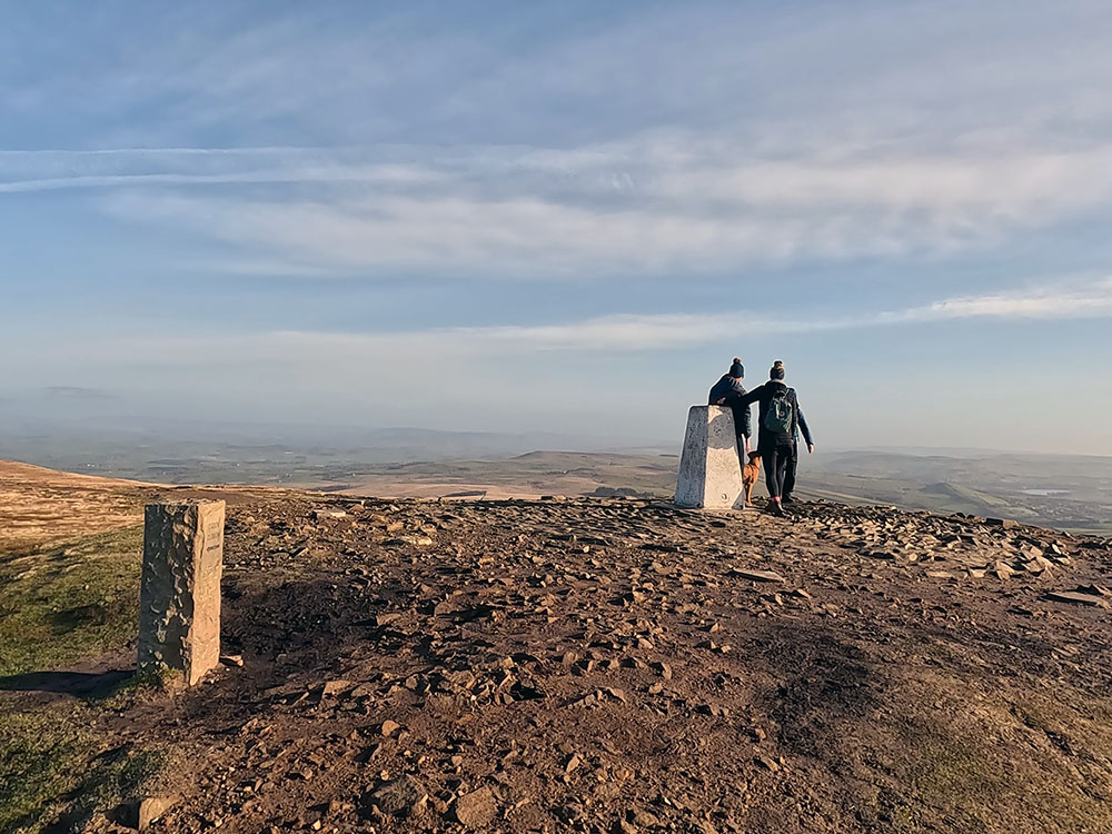
Arriving at the trig point on the summit of Pendle Hill
Back at the path junction that we left earlier by the Pendle way stone marker, this time rather than heading along Ogden Clough, we turn right and head more steeply up the well-defined path up Boar Clough, with another stream down to our right.
Back at path junction with arrow pointing up Boar Clough path
Heading up the initial steep part of Boar Clough
A clough as in Ogden Clough and Boar Clough is another name for a narrow, generally steep-sided valley or a cleft in a hill.
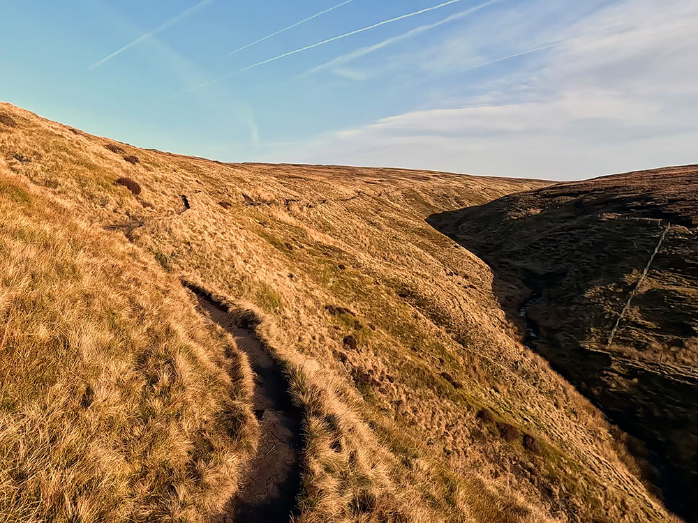
The path is only steep for a short while, but with this small amount of height gain, we get quite a good view back down Ogden Clough.
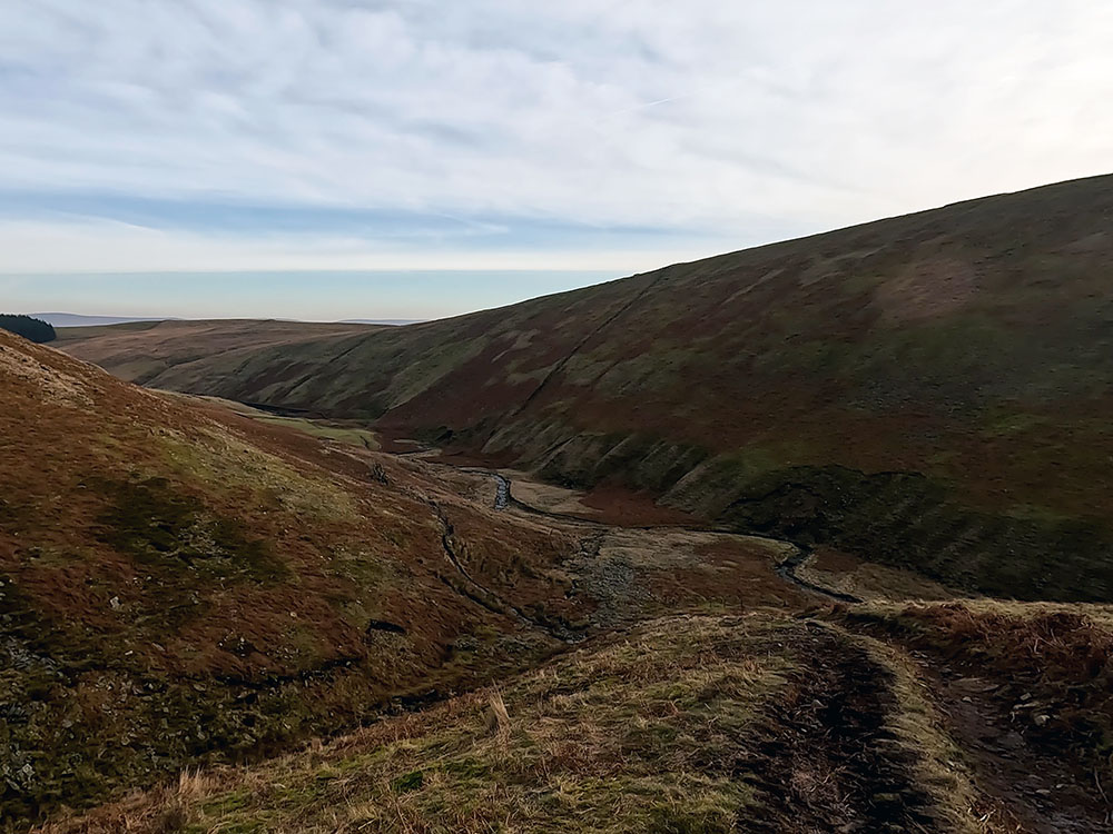
Looking back down Ogden Clough
At the top of the first rise just before crossing the stream, there is another path that comes in from the left by another stone marker. Ignore that and just continue on to cross over the stream and again keep straight on, on the well-defined path that is sometimes boggy in places.
Pendle Hill was once home to wild boar and wolves, so this is probably where the name Boar Clough was derived.
With the stream to our right rising at a slightly steeper gradient than the path, after a while, the path pulls in alongside the stream near some exposed stone slabs. Keep straight on here, crossing the small stream, heading up on the same line.
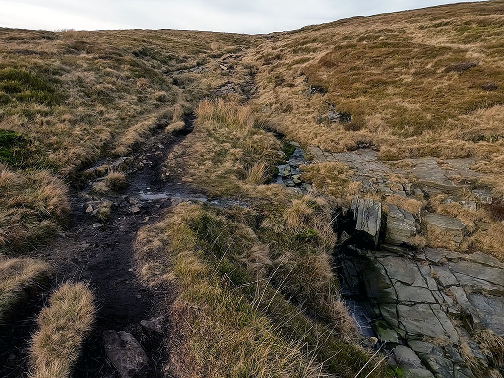
Pendle Way path heading up Boar Clough pulls in beside the stream
In places, the path becomes a little less distinct, but it is marked intermittently by cairns.
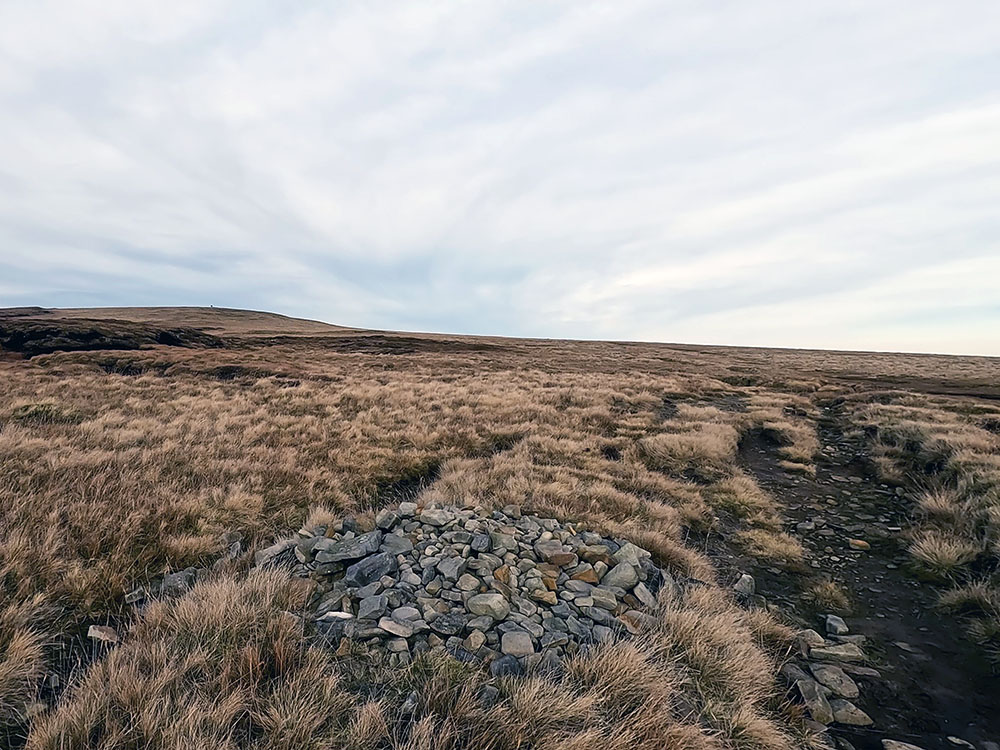
Pendle Way path heading up towards the summit of Pendle Hill
If you have any thoughts about this walk you'd like to share or find any issues with any of the footpaths used, please share that with us in the review section below.
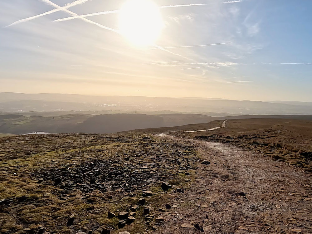
After about another 600 metres, we then intersect the main path that runs across the top of Pendle, which is much improved over the last couple of years. We're going to turn left here to head up to the summit of Pendle Hill. But before we do, if you look around, you can see a much-expanded panorama.
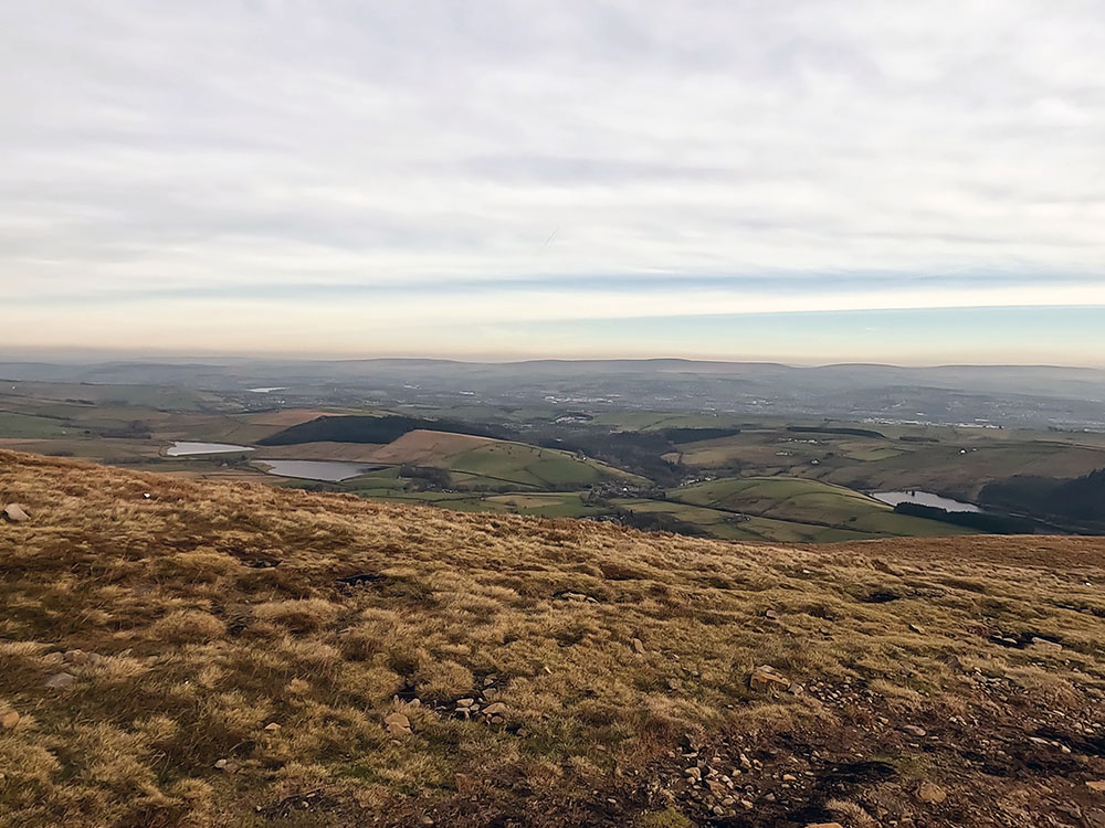
View down towards Lower and Upper Black Moss Reservoirs and Lower Ogden Reservoir
You can see down to the Lower and Upper Black Moss Reservoirs and then around to Lower Ogden Reservoir that we walked past at the start of the walk.
Turn left along this wide path and head up the final 400 metres or so to the summit of Pendle Hill.
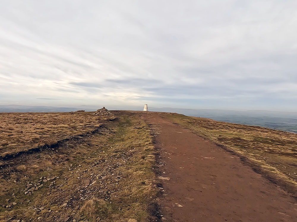
Approaching the trig point on Pendle Hill
With these two routes up and a different way down that we'll look at shortly, that's three ways to get to the summit. If you also look at the two ways to the summit on our Pendle Hill from Barley via The Pendle Way (short route) walk, the steps up or the slope up give two more ways to the summit, so five ways in total.
So between these two walks, we have five ways up, five ways down, so you have 25 different ways of going up and down Pendle Hill from Barley, on just these two videos. If that's not enough and you want to walk up Pendle Hill from the other side, then try our Pendle Hill from Downham walk.
Pendle Hill at 557 metres affords fantastic views in every direction due to it being an isolated hill. It is though, 53 metres or 173 feet short of the 2,000 feet generally recognised as the minimum height of a mountain in the UK.
Looking back down both paths walked up from the trig point on Pendle Hill
Out to the west on a clear day, you can see out to Blackpool Tower and then around to the Snowdon range. A bit closer to home the Upper and Lower Black Moss Reservoirs can be seen down below and around over the next path you can see the Yorkshire Three Peaks and then a distant outline of the Lakeland Fells.
Looking towards the Yorkshire Three Peaks from the trig point on Pendle Hill
Take time to have a look around the summit and explore all the views.
Pendle and Pendle Hill are most well-known for the Pendle witches, and there are many places associated with them that you can still visit.
In August 1612, 12 people from Pendle were accused of witchcraft and imprisoned at Lancaster Castle. Of these 12 people, nine were sentenced to death after being found guilty of performing witchcraft. The 10th person died in the cells before the trial could take place.
Whilst Pendle is famous for the witches also in the 1600s, well 1652, George Fox climbed Pendle Hill where he had the vision that inspired the first followers of the worldwide Quaker movement. George Fox was the founder of the Religious Society of Friends, commonly known as the Quakers.
Another less well-known Pendle Hill link is related to Boyle's Law - yes - remember that one from your chemistry days at school? If you don't it basically 'boils' down to for a gas at a constant temperature, pressure × volume is also constant.
Richard Townley, a mathematician and astronomer from Burnley and Henry Power, again in the 1600s, used a newly invented barometer to measure air pressure at different altitudes on Pendle Hill, where they realised there was a relationship between air density and pressure. They discussed the results with Robert Boyle, who went on to publish from it... Boyle's Law, but apparently what Boyle himself referred to as Mr Townley's hypothesis.
If you're interested in delving deeper into Pendle Hill, be sure to explore our Ultimate Pendle Hill Guide. This guide harmoniously combines the rich history, natural beauty, and thrilling adventures found in the iconic Lancashire landscape. From the eerie stories of the Pendle Witch Trials to invigorating hikes, charming villages and places to eat, this all-encompassing guide will uncover the mysteries of Pendle Hill, ensuring that your visit becomes a memorable and unforgettable experience.
Back to the trig point on the summit of Pendle Hill, we will now look at our way down. You initially retrace your steps along the wide path we came upon from Boar Clough. As you look back down at Barley from the trig point, the path is to your right.
Starting the descent along the wide path across the top of Pendle Hill
We follow this wide path down for just over half a mile until we reach the Pendle Way marker, where a wide gravel track heads back diagonally left that is used on our Pendle Hill short route from Barley walk. Ignoring this track back diagonally left, we follow the Pendle Way marker straight on, keeping on in the same direction that you were walking.
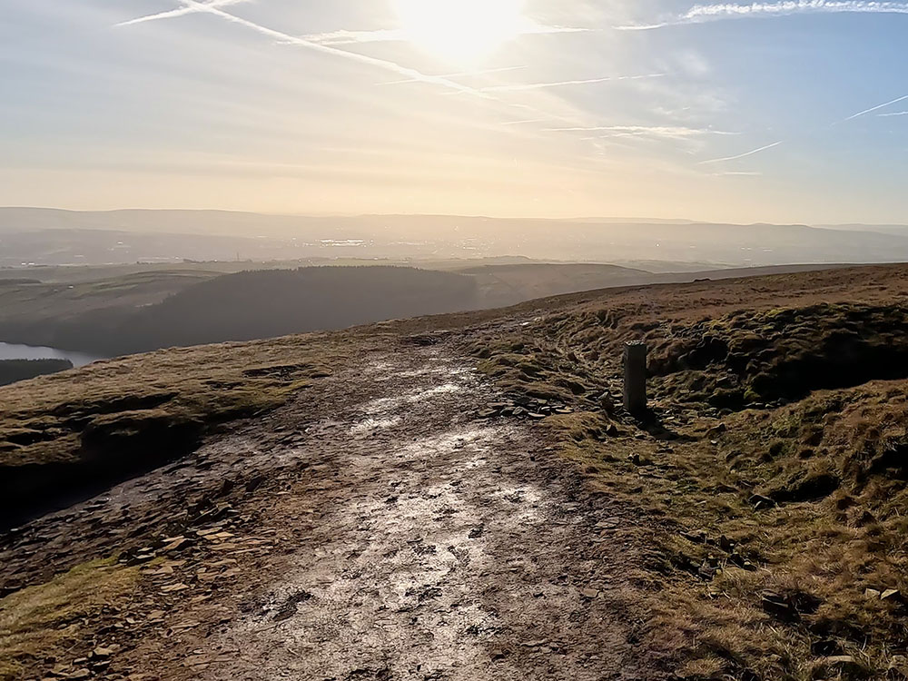
Approaching Pendle Way marker
You then quickly pass quite a large cairn - carry on along the path as it descends. The path heads roughly for the right-hand side of the trees of Fell Wood ahead.
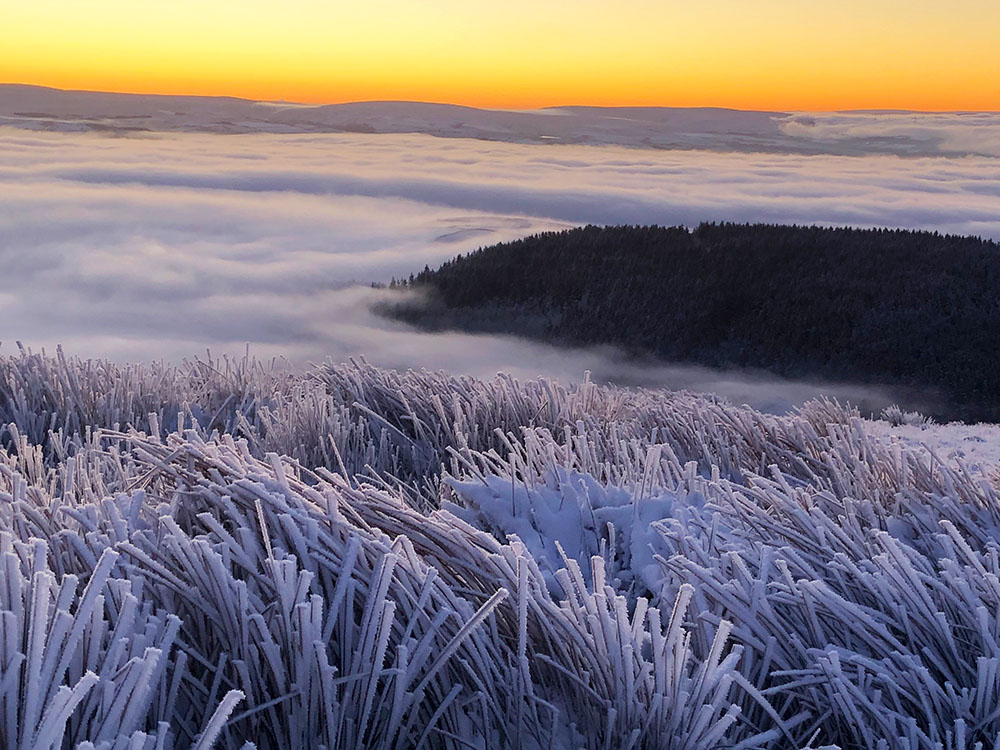
Looking down towards Lower Ogden Reservoir and Fell Wood in a temperature inversion
About half a mile after the Pendle Way marker, the path pulls into a kissing gate near which is a 'Barley' stone marker. Pass through the kissing gate and then through another gate almost immediately a few yards further on.
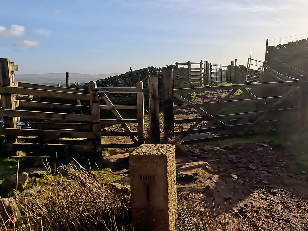
Stone Barley marker with wooden kissing gate and onward gate
Head down now across this field by the right-hand side of the wall for about 300 metres until you meet a track with Upper Ogden Reservoir ahead to your right.
Heading down beside the wall to Upper Ogden Reservoir
Left at the track takes you back onto the road up to Upper Ogden Reservoir. Ignore that and follow the wooden waymarker more steeply downhill to reach the gate in the corner of the field.
Pass through the gate and turn left along the track to very quickly reach the gate we came out of earlier.
You then have the same choice as on the outward route. Continue straight on along the road, back into Barley or head right through the gate as we are doing to follow the almost parallel path that keeps off the road.
Pass through the gate and follow the path back along to Lower Ogden Reservoir and then down the side of it. Turn left over the footbridge, pass through the gate and turn right onto the road.
Heading back alongside Lower Ogden Reservoir
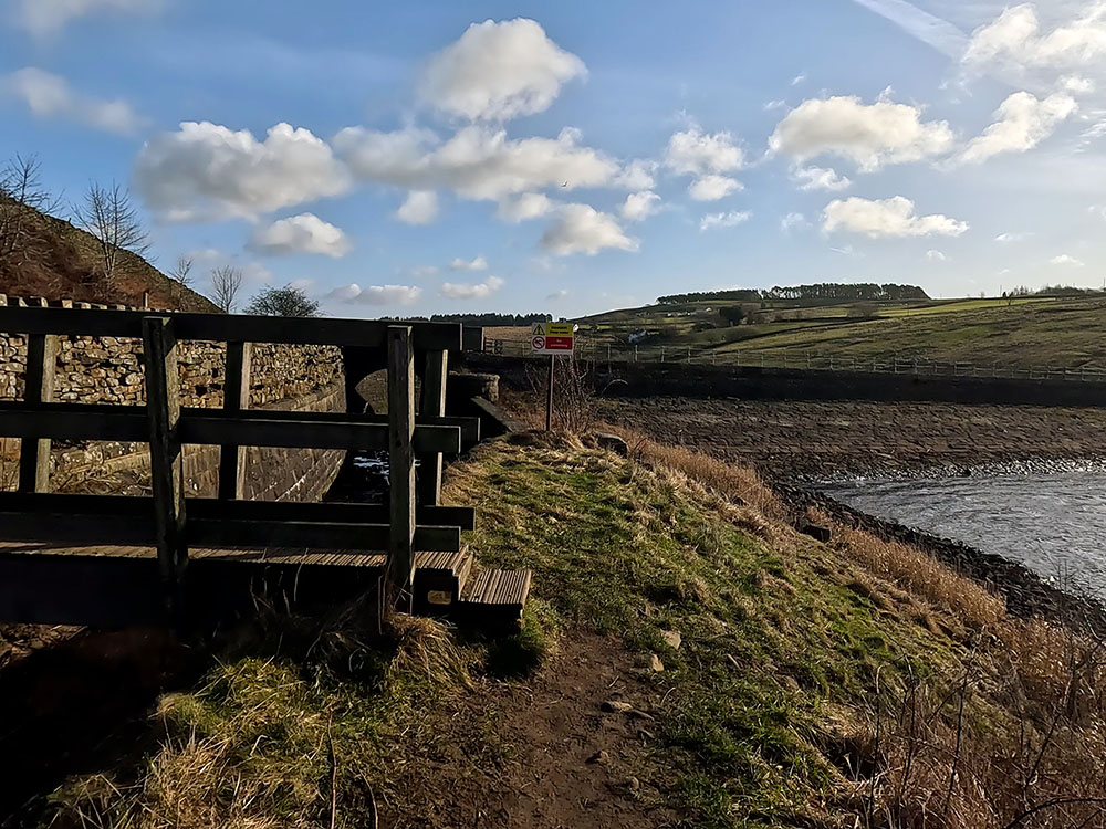
Footbridge back onto the road at Lower Ogden Reservoir
Follow this road now the half mile or so, back to the road junction in Barley, by the Barley village hall. Cross the road and head down and left back into the car park.
If you are wanting something to eat and drink after the walk, the Cabin Cafe is in the car park. It sells alcohol, soft drinks, coffees and cakes, amongst other things and has outside seating.
If you are in the area for the weekend or want a short easier walk to walk off any overindulgence in the pubs/café, why not try our Pendle Sculpture Trail walk from Barley.
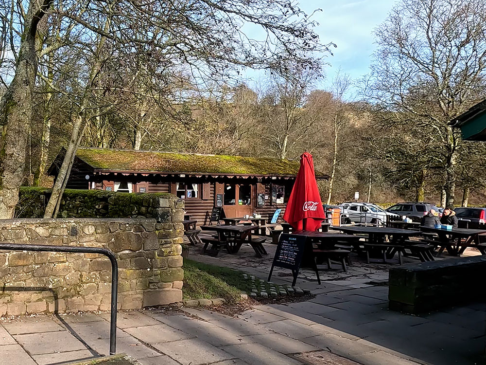
Cabin Cafe in Barley car park
Alternatively, you can head along the gravel path away from the toilets for about 100 metres, where just over the bridge you can see the Pendle Inn just across the road. If you look around to the right here, a few yards further down the road, you can see the brown sign on the side of the Barley Mow.
You can eat and drink in the Pendle Inn and round the back there is a conservatory with some additional room. To the front when the weather's fine there are plenty of beer tables. Or you can maybe pop inside and on the cooler days maybe just sit next to the fire. There is a range of Thwaites ales on the bar along with generally a couple of guest ales. It is dog friendly.
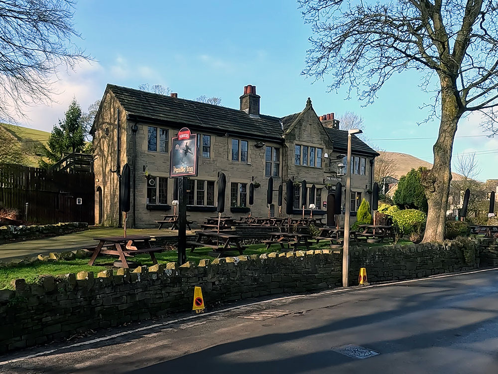
Pendle Inn
Just a few yards across the road is the Barley Mow, which is also dog friendly. It has a range of different menus and also serves breakfast. It has a varied drinks menu and generally has three cask ales on the bar.
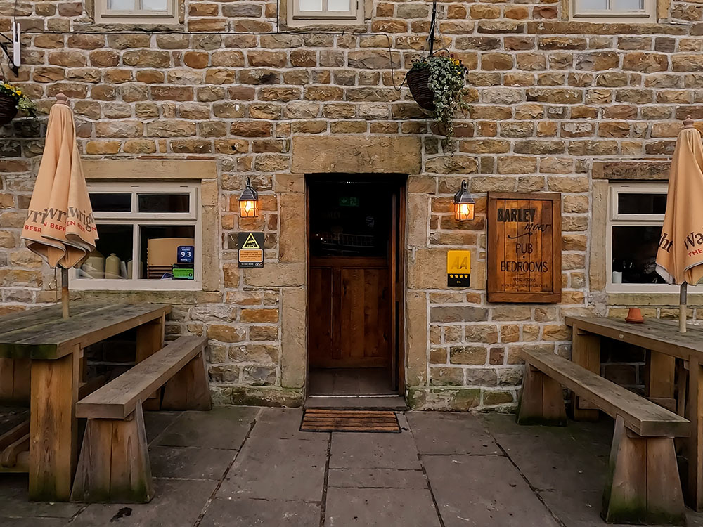
Barley Mow
So that's the Pendle Inn and Barley Mow - the choice is yours!
Gifts and presents for hikers and walkers
Are you struggling to pick the perfect gift for your hiking-loving friend or family member? Don't fret! Explore our curated selection of top-notch gifts for walkers and hikers that will have them trekking with joy on their special day.
What to wear and take on your walk or hike
Whether you are a seasoned hiker or new to walking, wearing and taking suitable hiking kit and clothing is essential for a day hike for your comfort and safety. So we have put together a hiking essentials checklist to cover all you'll need. Our Hiking Essentials checklist for 2026 takes you through planning your walk, the hiking essentials checklist itself, optional extras, explanations, and recommendations for all the hiking essentials.
Check out the reviews for this walk: