By using this website, you agree to our use of cookies (needed to provide our website’s features) and our Terms of Use.


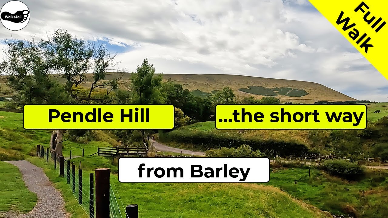
The classic Pendle Hill circular walk from Barley via The Pendle Way takes in the hill synonymous with the Pendle witches. From the summit even Blackpool tower and the Lakeland fells can all be seen on a clear day!
In accordance with our Disclaimer, you agree to take full responsibility for any use you make of the information contained in these pages.
This page contains affiliate links. If you buy products or services via these links, we may earn a small commission at no cost to you.
| Walk title: | Pendle Hill walk via The Pendle Way (Short Route) from Barley |
| Author: | Andrew Forrest - Updated October 2023 |
| Walk start point: | Pay and display car park in the centre of Barley (grid reference SD 823 403) - it can get busy at weekends and bank holidays. What3words: deriving.untruth.bloomers |
| Parking: | As above |
| Directions to nearest parking place: | Google Maps: get directions here / What3words: clays.label.found |
| Walk distance: | 6.5 km |
| Estimated walk time: | 2 hours 10 minutes |
| Height climbed: | 350 metres |
| Technical difficulty: | Moderate - as determined by our interpretation of the Ordnance Survey guidance on technical difficulties |
| Peaks / summits: | Pendle Hill (577m) |
| Map: | Ordnance Survey - Explorer OL41 (Forest of Bowland & Ribblesdale) Buy this map from Ordnance Survey |
| GPS/GPX file: | Download available to registered users - Register and Login here - It's FREE to register |
| Facilities / refreshments: | Toilets and the Cabin Café in the car park at Barley. Pubs: Pendle Inn and Barley Mow in Barley |
| Nearest town: | Walk starts in Barley |
| Local self-catering accommodation: | View self-catering accommodation close to the start of this walk |
Estimated walk time
Walk time estimates used are from the Ordnance Survey mapping app, which uses a refined Naismith's rule, adjusted by OS overlaying their own data collected from more than one million people using the OS mapping app. Naismith's rule allowed one hour for every three miles walked and added pro-rata an additional hour for every 2000ft of ascent - roughly one hour for every 5km, plus one hour for every 600m of ascent.
Ordnance Survey Mapping App
Use on any device and make it easy to explore the great outdoors for just the price of a coffee a month. Premium allows full UK access to all OS Explorer and Landranger mapping, along with the ability to import and export routes, save maps offline, aerial 3D, and print A3/A4 maps.
This Pendle Hill walk takes you on the shortest route up Pendle Hill from Barley, heading up via the Pendle Way. The route down uses a more gradual slope rather than the steeper steps and then retraces the outward path. It's a short sharp hike up the steps, but with ever-expanding views afforded as more height is gained, it's always a good excuse for a break to stop and enjoy them!
At the summit, Pendle Hill is 557 metres high and from there Blackpool Tower, the Snowden range and the Lakeland Fells can all be seen on a clear day. Whilst Pendle Hill is synonymous with the Pendle Witches (the 400th anniversary of their hanging was in 2012), it is enjoyed by many thousands of people each year.
Whilst this is the shortest and most walked route up and down Pendle Hill from Barley car park, if you wanted a more picturesque route (well in our opinion it is), why not try our Pendle Hill walk from Barley via Ogden Clough or Boar Clough.
The full walk is shown in the video and the Pendle Hill walk route is shown on the Ordnance Survey Pendle Hill walk route map, both above. Below is a brief description of the walk.
This Pendle Hill walk starts in the Pay and Display car park in Barley. Barley is in the Forest of Bowland in Lancashire. There is some additional road side parking, but using the car park helps support the village.
To start the walk, we head across the car park by the side of the toilet block, round the corner of which you can see back to the cabin cafe, one of the places to eat and drink on this walk.
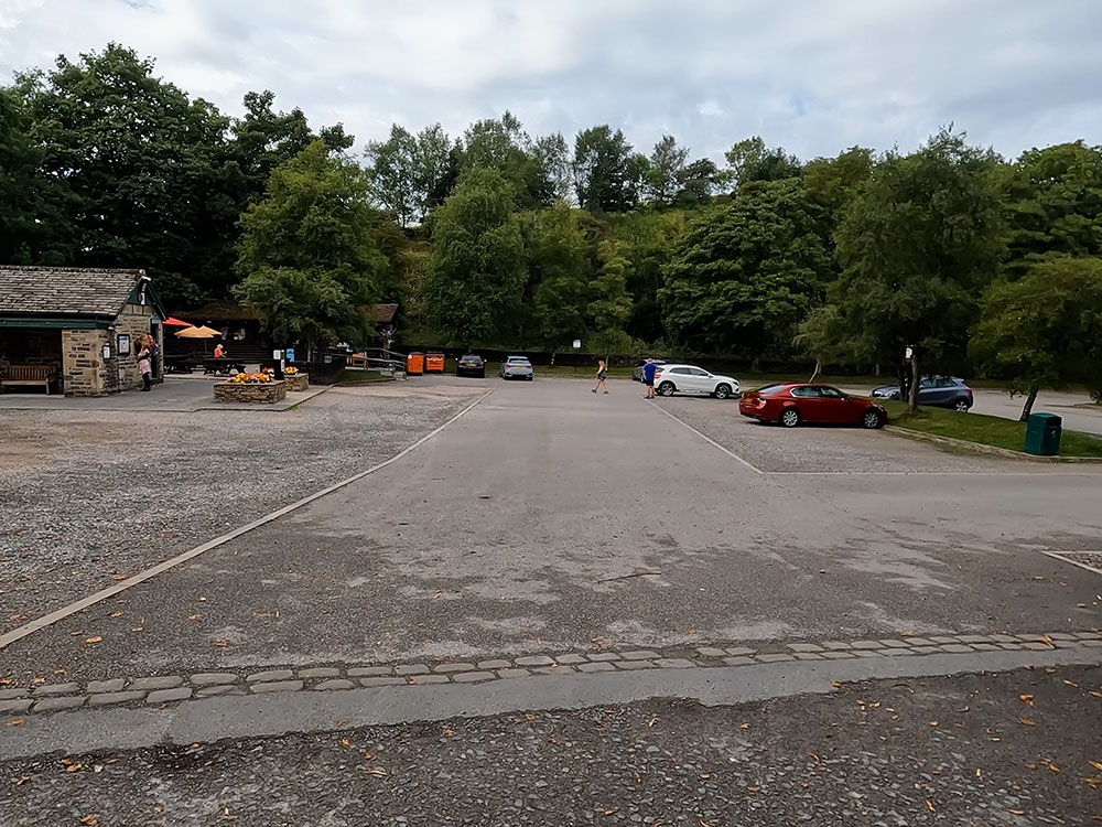
Barley Car Park
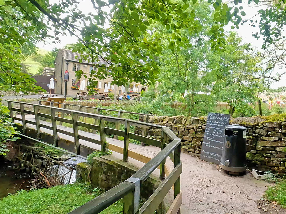
Footbridge heading towards Pendle Inn
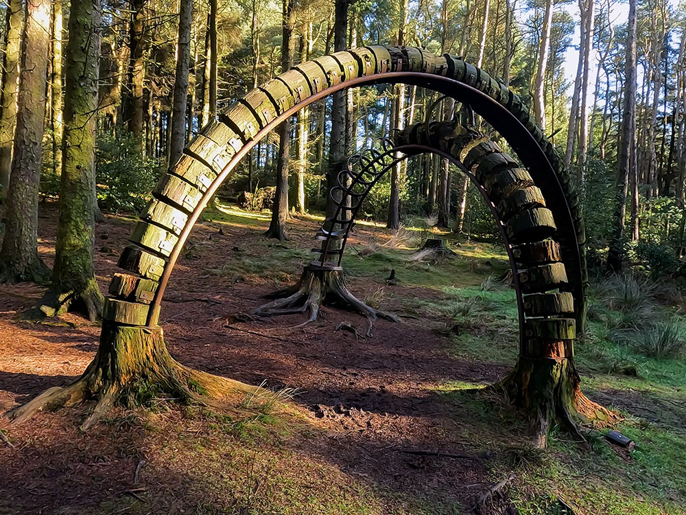
Head away and proceed along the gravelled path and then cross the bridge over the beck. Over to the left now is the Pendle Inn, another place to eat and drink after the walk - it's also dog friendly. To the right of the path here is an information board about Barley. It shows the route of today's walk and also shows where the Pendle Sculpture Trail is.
As you progress along the gravel path by the side of the children's play area, over to the left you can see more of the Pendle Inn and the round to the conservatory at the back of it, where you can also eat and drink. Continuing straight on, you quickly reach the Barley Mow on the right-hand side. The Barley Mow has accommodation, serves food and drink and again is dog friendly.
Continue now for a short distance along the pavement where just before reaching the Barley Methodist Chapel on the right-hand side, over on the left you can see a footpath sign by the bridge. Cross over the road to the sign.
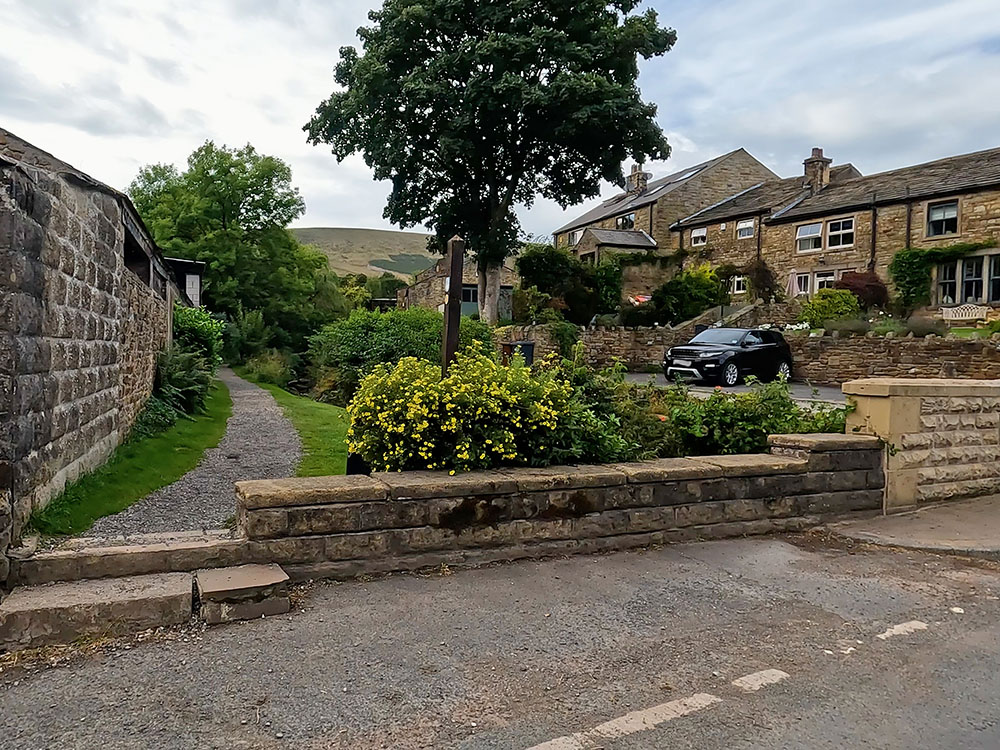
Footpath to Pendle Hill leaving the road in Barley
Head away from the road, following the gravel track by the side of the stream to pass through the kissing gate and head straight on. Pass over a wooden footbridge and continue on the gravel path.
As Pendle Hill appears in front of us, the path descends to another wooden bridge. Pass over the bridge and turn left along the lane. Shortly on the right-hand side, you reach the Croft Teagarden which serves drinks, snacks, ice cream and even ice cream for dogs.
Footbridge and Pendle Hill
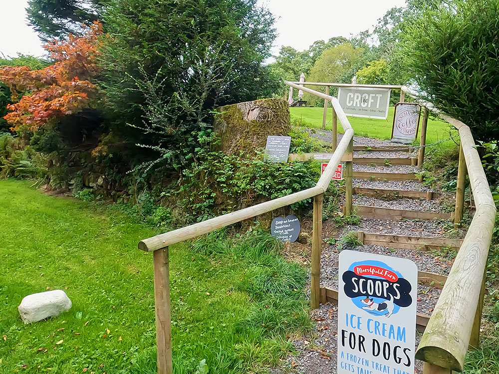
Entrance to Croft Teagarden Pendle
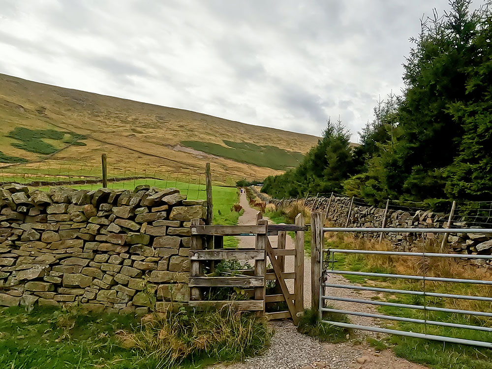
Continue on now along the road past the houses for a short distance, turning right through the metal gate, following the sign 'This way to Pendle Hill'. Head along the initially cobbled narrow path by the fence which soon affords views of Pendle Hill directly ahead. Cross over the wooden footbridge and then on through the next wooden kissing gate.
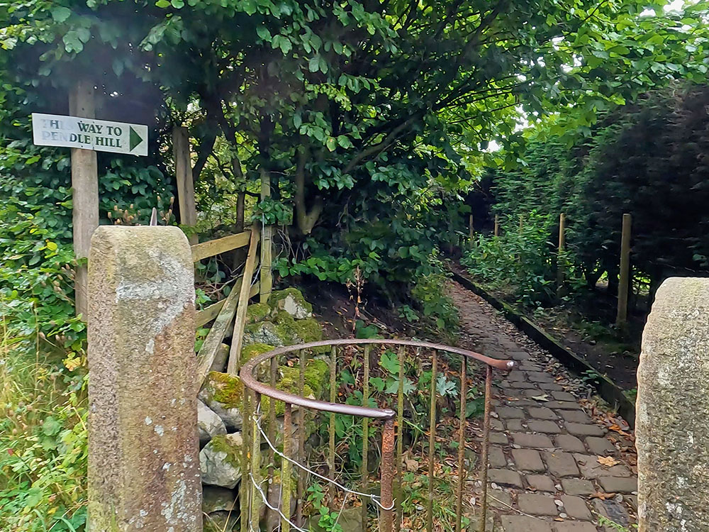
This Way to Pendle Hill sign
View of Pendle Hill from gravelled path
We are walking here along the Pendle Way, which is a 45 mile circular route from Barrowford. The Pendle Way passes through Barnoldswick, Thornton in Craven, Wycoller, Reedley, Newchurch and goes over Pendle Hill.
Pass through the next wooden kissing gate and keep ahead. Through the next kissing gate follow the yellow sign across the track and then through the gap to continue along the gravel track which passes along the side of the fence.
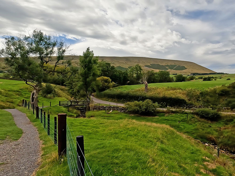
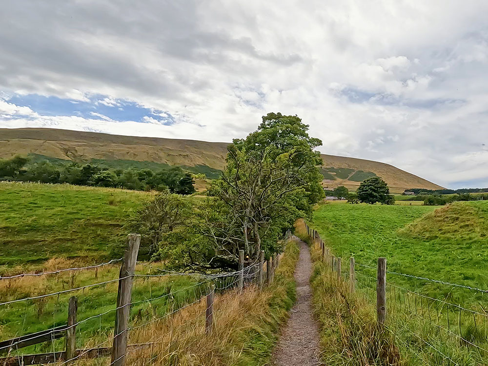
Pass through the next gate and head down the gravel track before climbing up to the next gate. Pass through this metal gate and then head diagonally across the field heading for the top righthand corner. Walk through the kissing gate in the corner of the field to head up along the wide gravel track by the side of the wall.
Kissing gate and gravel path heading alongside field looking towards Pendle Hill
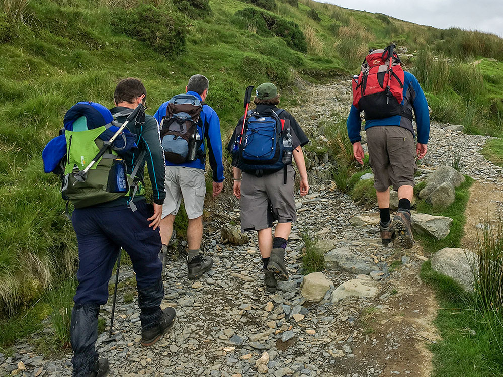
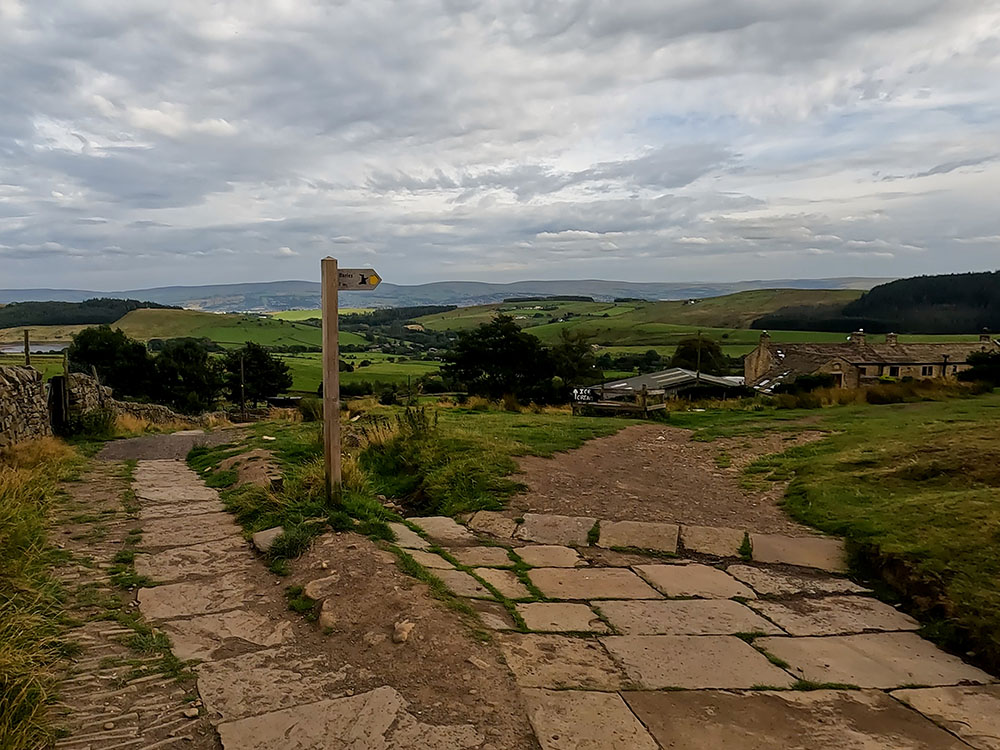
On reaching the gate, turn right following the yellow Pendle Way sign passing through the gate to head initially along the side of a fence. The steep steps that we're going to use to climb Pendle Hill can be seen now directly ahead. If you look up to the left here, you can see coming down from left to right, the slope that we will be walking back down.
Keep on along the path that leaves the fence and head for the junction of the walls. Pass through the kissing gates and head towards the sign that tells you about Pendle Hill.
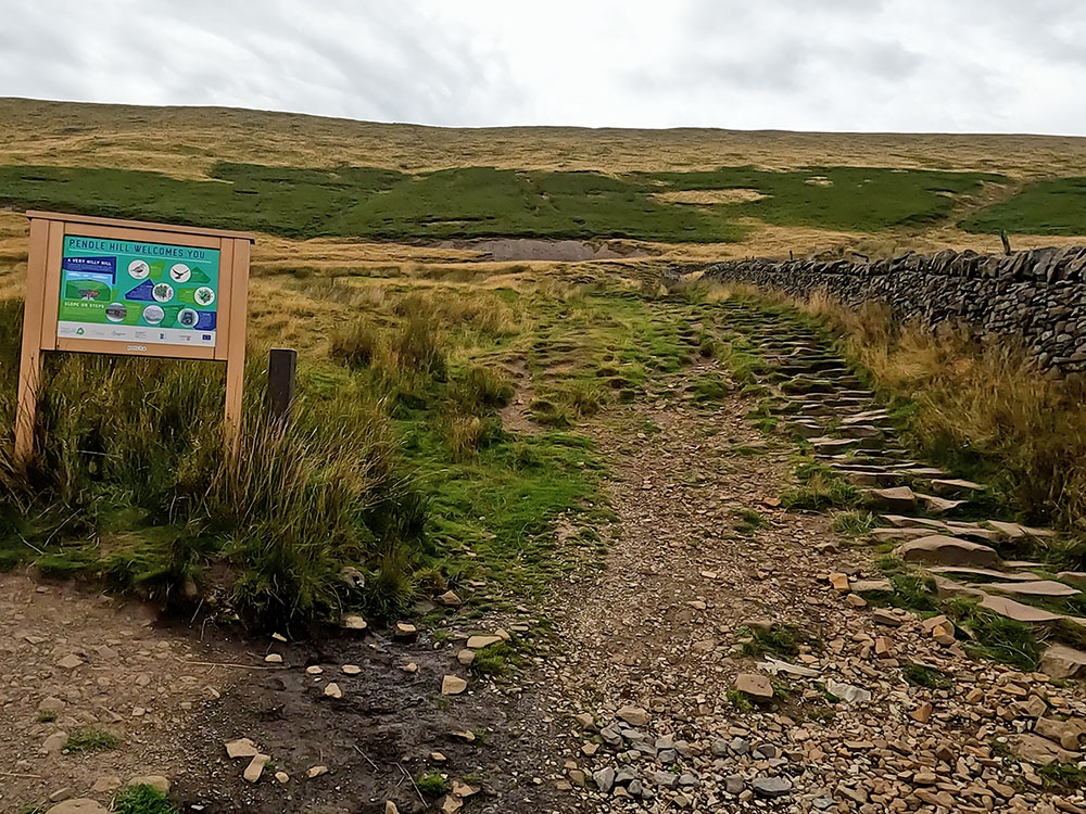
Information board by the start of the steps heading up Pendle Hill
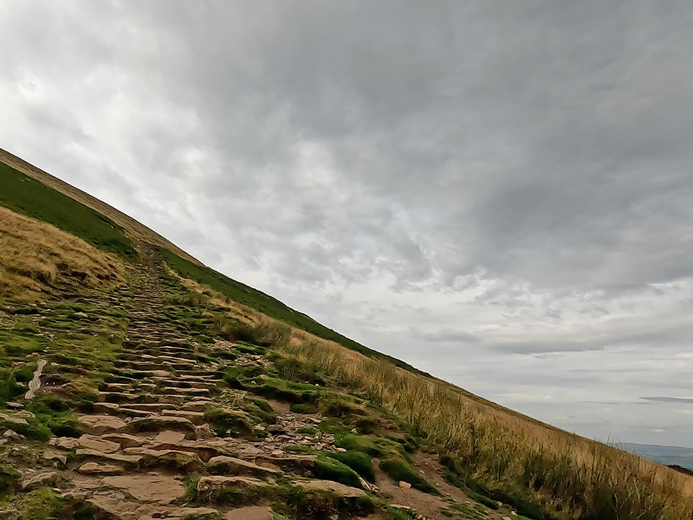
The steps up Pendle Hill
We now start climbing the steps. As you gain some height, if you look around over to the left, you can see the gravel slope path that we're going to walk back down.
Don't forget if you watch the accompanying video and enjoy it, whilst you are watching on YouTube please click the like button, subscribe to our channel and hit the notification bell, so you know when any new walks have been uploaded. It is free to subscribe and your likes and comments really do help our channel.
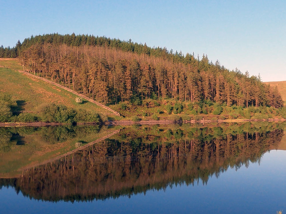
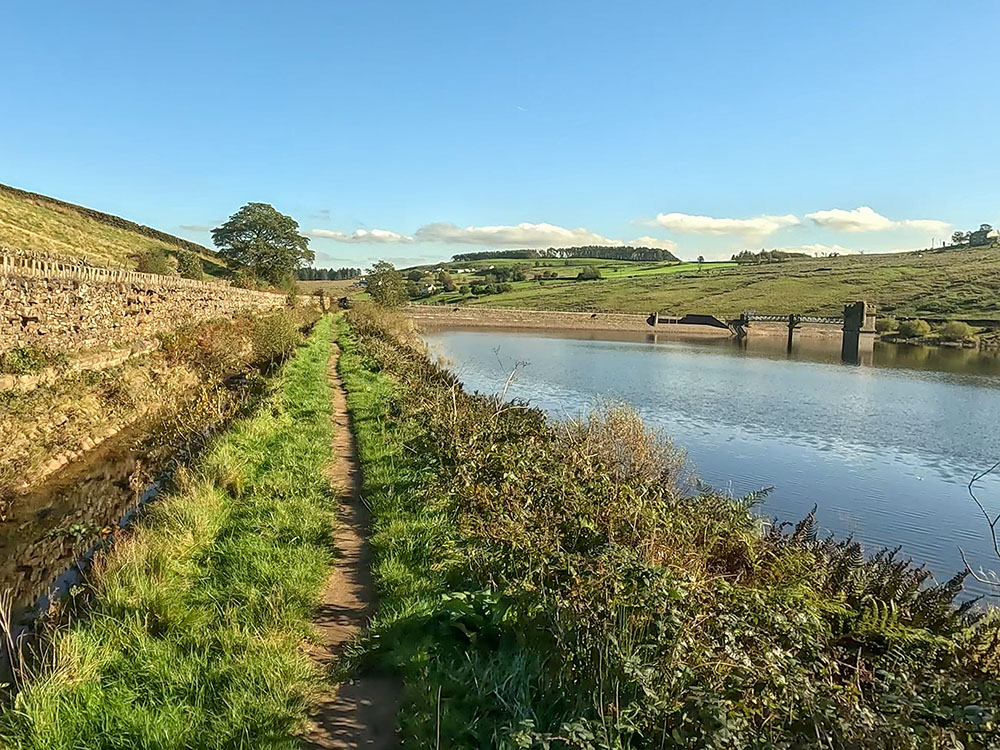
From the steps, over to the right you can now see Upper and Lower Black Moss Reservoirs and in the wood just behind them is where the Pendle Sculpture Trail is. Down below you can see the path we just walked up, with Barley in the distance. Then you see around to Fell Wood and in front of that is Lower Ogden Reservoir.
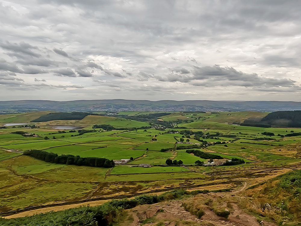
View to Black Moss Reservoirs Barley and Fell Wood from the steps
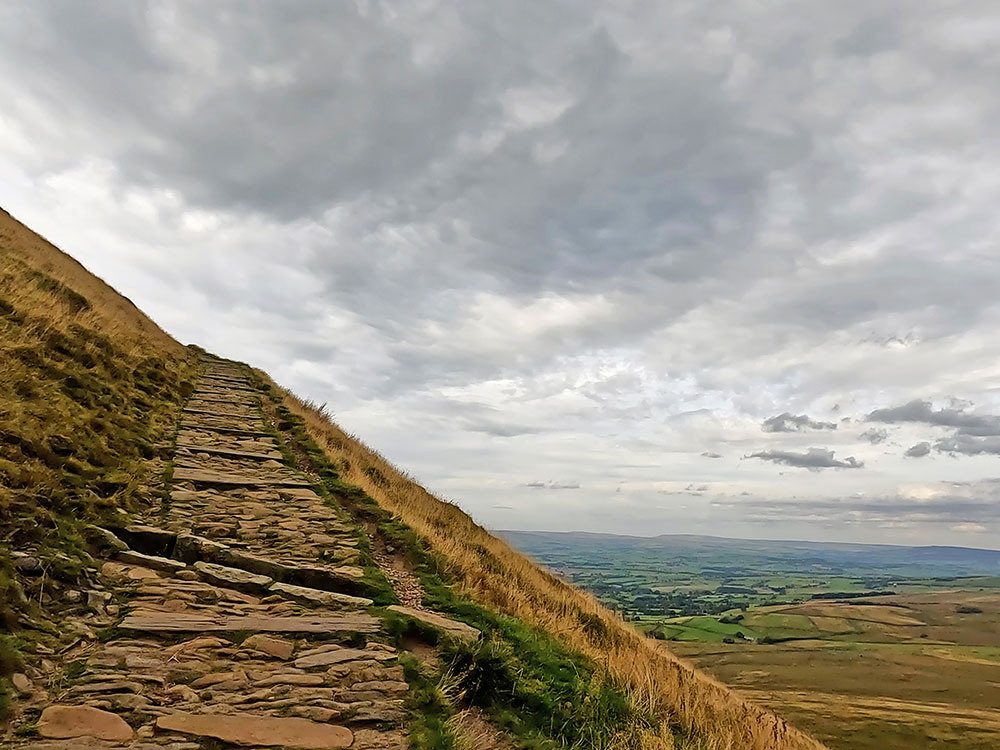
The steps up Pendle Hill
As you hike up the steps and more height is gained, it creates an ever-expanding panorama all around. At the top of the steps, the path pulls into a wall over which you can see the path down to Downham, a short way along which, is Fox's Well. In the distance here on the horizon are the Yorkshire Three Peaks - Ingleborough, Pen-y-ghent and Whernside.
Also by the wall is a stone Pendle Way marker. Don't go over the wall, but continue the walk now on this side of it passing this marker along the wide track up the side of the wall, where there is a gate over which you can see two more paths.
One goes along towards the Nick of Pendle eventually and the straight on one again goes on to Downham. The Downham walk up to Pendle Hill shows the other side of Pendle Hill and affords great views across the Ribble Valley.
Again as it's the same view, you see the Yorkshire Three Peaks on the horizon. If you want to have a little rest here before you go up to the summit, there are a couple of seats which there are walls around, that provide a little bit of protection from the weather.
In the wall by the seats there is a plaque about George Fox. The well just mentioned was named after George Fox, the founder of the Religious Society of Friends, commonly known as the Quakers. In 1652, George Fox climbed Pendle Hill, where he had the vision that inspired the first followers of the worldwide Quaker movement.
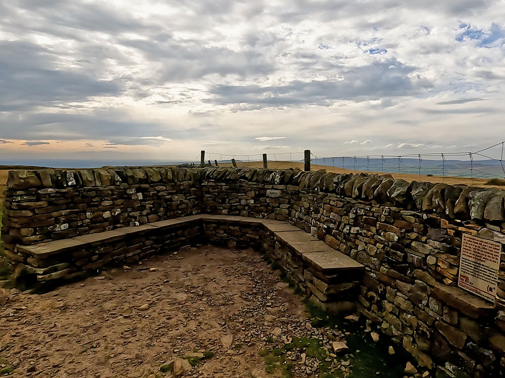
Seats and George Fox plaque on Pendle Hill
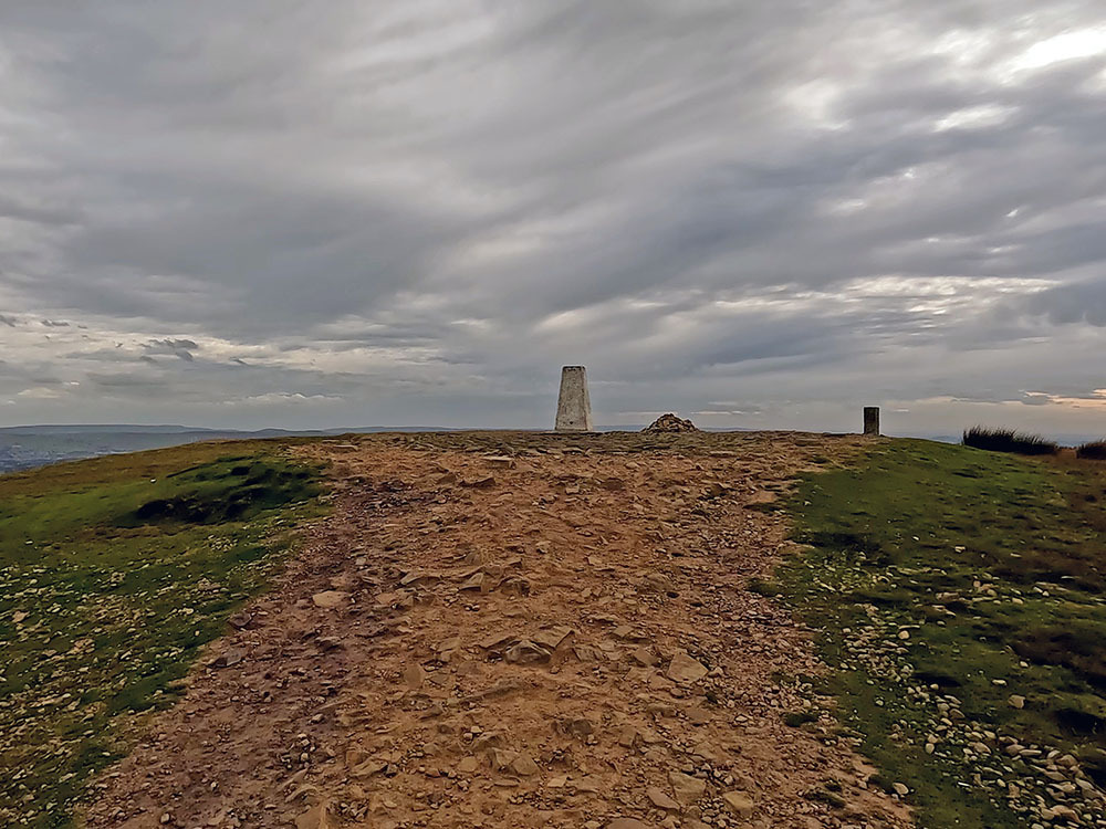
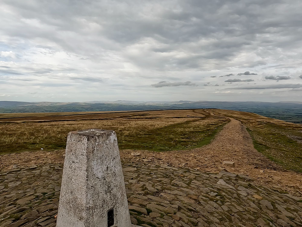
Approaching the trig point on the summit of Pendle Hill
We now head directly away from the wall to follow the wide gravelled path all the way up to the trig point on the summit.
Pendle Hill at 557 meters affords fantastic views in every direction due to it being an isolated hill. It is 53 metres or 173 feet short of the 2,000 feet generally recognized as the minimum height of a mountain in the UK.
Out to the west on a clear day can see out to Blackpool Tower and then around to the Snowdon range. A bit closer to home, the Upper and Lower Black Moss Reservoirs can be seen down below and further around over the path walked up, you can see down to the Yorkshire Three Peaks. Take time to have a look around the summit and explore all the views.
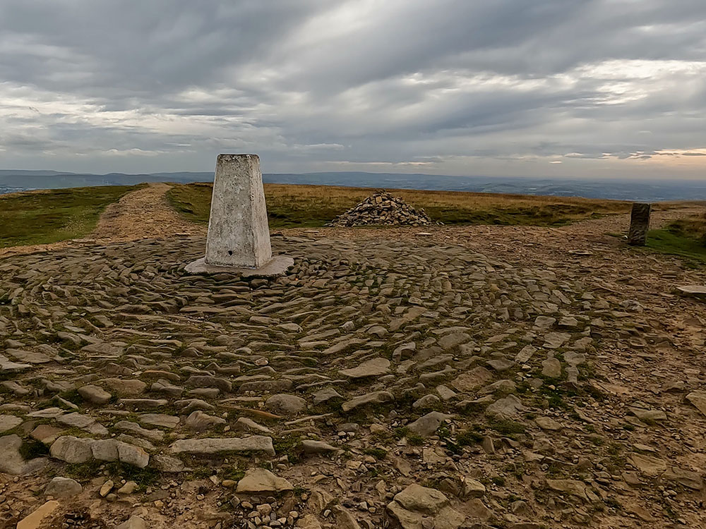
Summit of Pendle Hill
Looking towards the Yorkshire Three Peaks from the summit of Pendle Hill
Pendle Hill and the surrounding area are notorious for their association with the Pendle Witches and there is a walk from Barley that passes by many places synonymous with the Pendle Witches. In August 1612, twelve people from Pendle were accused of witchcraft and imprisoned at Lancaster Castle. Of these twelve people, nine were sentenced to death after being found guilty of performing witchcraft. A tenth person died in the cells before the trial could take place. Six of the Pendle Witches came from just two families. Over the years many books, poems and TV programmes have featured the Pendle Witches.
Pendle Hill from its name is effectively three hills in one. In the 13th century it was called Penhul, with 'hul' or 'hyll' both meaning hill from Cumbric. The word 'Pen' also meant hill in Cumbric, so all together Pendle Hill effectively is derived from hill, hill, hill! Cumbric was a common language in Northern England in the middle ages.
If you want to read more on Pendle Hill, check out our Ultimate Guide to Pendle Hill, where history, nature and adventure converge in Lancashire's iconic landscape. From the haunting tales of the Pendle Witch Trials to exhilarating walks, picturesque villages and hidden gems, this comprehensive guide will unveil the secrets of Pendle Hill, making your visit an unforgettable journey.
From the summit continue to walk along the top of Pendle Hill past the trig point, continuing on in the same direction as you approached it and along the wide gravel path that starts to head downwards along the top of the hill.
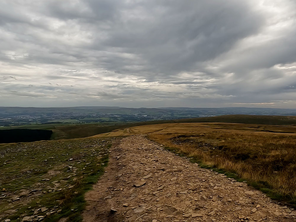
Heading along the top of Pendle Hill from the summit
Where the path back down comes up from the left
After about 600 meters you can see the path to be taken down coming up diagonally from your left. It did meet this path at a stone Pendle Way marker here but unfortunately someone seems to have knocked it over recently. It is still there, but just laid on the ground. Maybe it'll be back up when you are there?
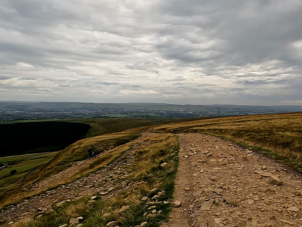
At this marker we turn back left on ourselves to start heading more steeply down the wide gravelled slope that pulls back across the front of Pendle Hill.
Heading down the slope across the front of Pendle Hill
Ahead can be seen Lower and Upper Black Moss Reservoirs with the sculpture trail in the trees behind it. To the right of that is Barley and then right again to Lower Ogden Reservoir, which is very low at the moment in September 2022.
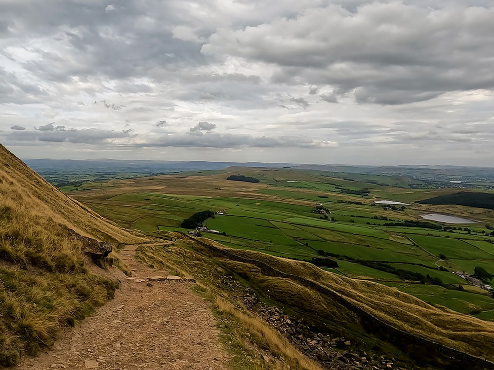
As the gravel path splits, take the right-hand wider fork to walk down a short series of zigzags to arrive back at the gate we walked through on the way up. Pass through the gate and then at the Pendle Way sign head right.
Heading back right at the Pendle Way sign
Pull in alongside the fence and then pass through the gate. Once through the gate walk down the gravel track. Through the next kissing gate head across the field to pass through the metal gate and keep on along the gravel track.
Heading back towards Barley
Through the next gate head down by the side of the fence. Cross over the track and pass through the next kissing gate to continue walking down the gravel track.
Through yet another kissing gate and then one more before heading back over the wooden bridge.
Take time to look back at what you've just climbed once.
Walk down the narrow path and at the metal gate turn left back along the road and then upon meeting the footbridge turn right to head back over it. Pass over the wooden footbridge and then walk onto and through the kissing gate.
On reaching the road in Barley turn right then head back along by the side of the Barley Mow pub. If you want something to eat or drink after the walk you always pop in here or before heading back down the side of the river you can always pop over the road and have a look in the Pendle Inn.
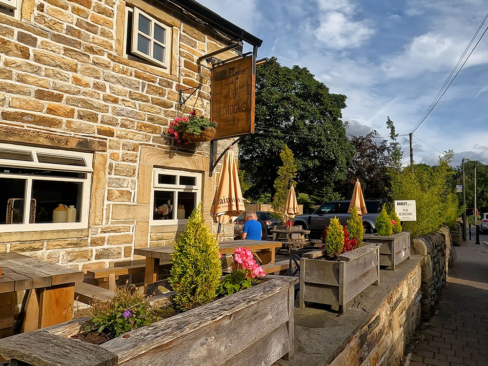
Barley Mow
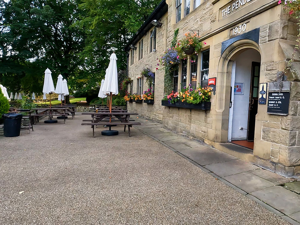
Pendle Inn, Barley
If you don't want to detour by the Pendle Inn just continue straight on and down the side of the children's play area along the gravel path to pass back over the bridge we walked over at the start and walk along the gravel track back to the car park.
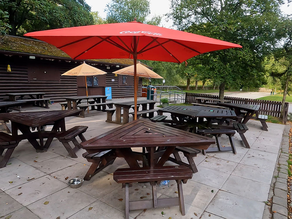
In the car park, when it's open, you can also visit the Cabin. The cafe also sells alcohol, soft drinks, coffee and cakes among other things.
Cabin Cafe, Barley
Yes, the Pendle Hill walk is easy to follow. The route is well-signed and most of the paths are now gravelled. After heavy rain, parts of the path can be muddy as you head up near the stream after passing Ings End. The field, which was quite often muddy before reaching Pendle House, now has a gravel path up the side of it and the paths on the top of Pendle Hill to the trig point were flattened and reset a couple of years ago, although they are starting to rough up a little in places.
Pendle Hill, being an isolated hill, is a very distinctive hill nestled in the heart of Lancashire, amid the Forest of Bowland Area of Outstanding Natural Beauty.
While its undeniable natural beauty is captivating, Pendle Hill is also celebrated for its historical importance, notably serving as the backdrop for the infamous Pendle Witch Trials of 1612 and as the location where George Fox, the Quaker movement's founder, experienced a profound spiritual awakening in 1652.
On a clear day, from the summit of Pendle Hill, you can see as far as the Lake District to the North, the Yorkshire Three Peaks to the East, the Snowdon range to the South and out to Blackpool Tower in the West.
Pendle Hill is located in Lancashire, Northwest England, within the Forest of Bowland, an Area of Outstanding Natural Beauty and is easily accessible from the nearby towns and cities of Burnley, Clitheroe and Blackburn.
Surrounding it are delightful villages and hamlets such as Barley, Downham, Sabden, Roughlee and Newchurch-in-Pendle, each adding to its vibrant local culture and historical importance.
Pendle Hill is 557 metres (1,827 feet) high, and whilst it may be 53 metres (173 feet) short of being a mountain, it still commands attention with its looming presence and being an isolated hill is visible from miles around.
The main parking is in the car park in Barley, where there are also toilets and the Cabin Café. There is additional roadside parking near the car park on the way into Barley from Roughlee.
There is also a layby on the road heading out of Barley towards Downham, which can be used for this walk. If you use this layby, you will save on some of the climbing and join the walk near the bottom of the steps.
The car park in Barley is also very handy for the two pubs - the Pendle Inn and the Barley Mow.
The directions to the parking, postcode and the What3words are in the walk information box above.
Gifts and presents for hikers and walkers
Are you struggling to pick the perfect gift for your hiking-loving friend or family member? Don't fret! Explore our curated selection of top-notch gifts for walkers and hikers that will have them trekking with joy on their special day.
What to wear and take on your walk or hike
Whether you are a seasoned hiker or new to walking, wearing and taking suitable hiking kit and clothing is essential for a day hike for your comfort and safety. So we have put together a hiking essentials checklist to cover all you'll need. Our Hiking Essentials checklist for 2026 takes you through planning your walk, the hiking essentials checklist itself, optional extras, explanations, and recommendations for all the hiking essentials.
Check out the reviews for this walk: