By using this website, you agree to our use of cookies (needed to provide our website’s features) and our Terms of Use.


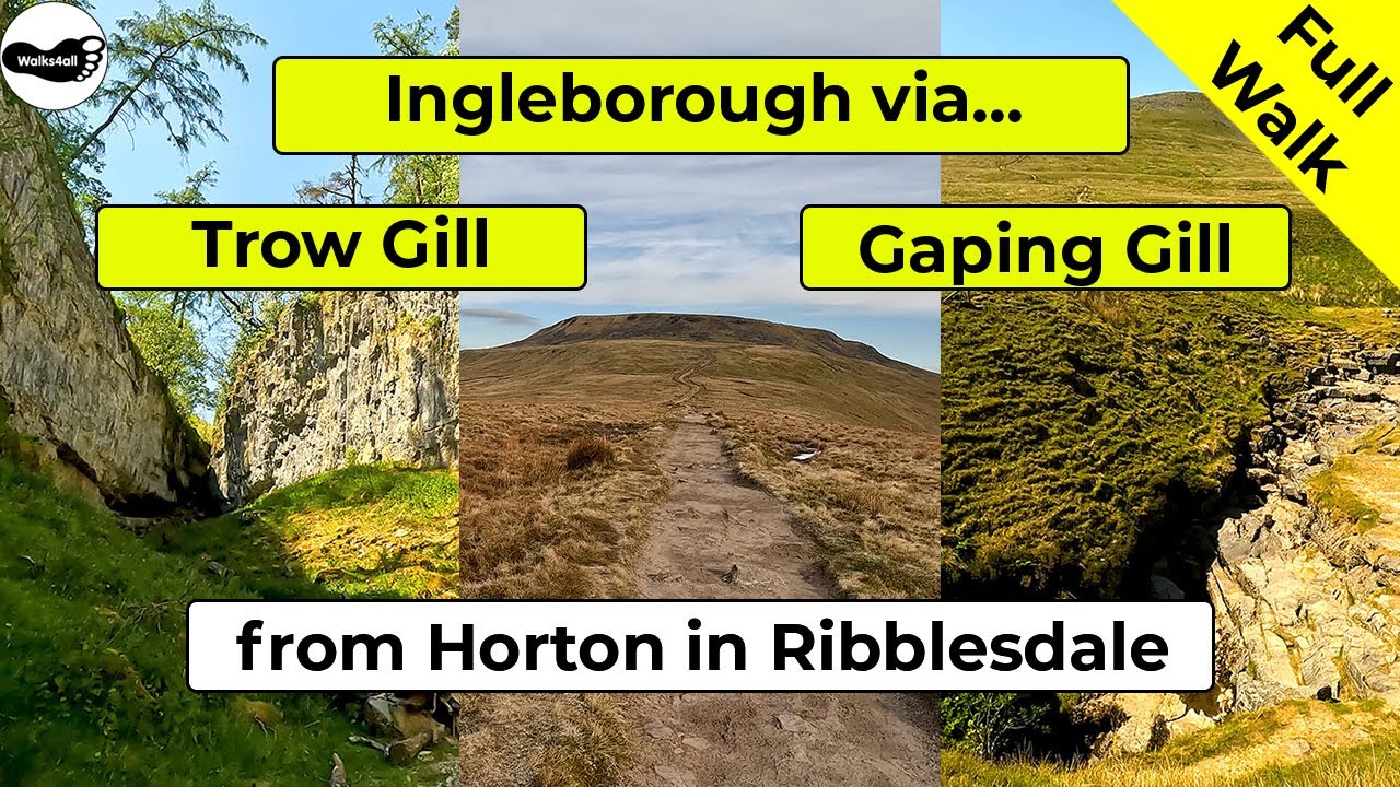
A circular walk from Horton in Ribblesdale to Ingleborough, one of the Yorkshire 'Three Peaks'. This picturesque Yorkshire Dales walk passes through Sulber, Trow Gill, Gaping Gill and Little Ingleborough along the way.
In accordance with our Disclaimer, you agree to take full responsibility for any use you make of the information contained in these pages.
This page contains affiliate links. If you buy products or services via these links, we may earn a small commission at no cost to you.
| Walk title: | Ingleborough via Sulber, Trow Gill and Gaping Gill walk from Horton in Ribblesdale |
| Author: | Andrew Forrest - July 2023 |
| Walk start point: | Pay and display car park in Horton in Ribblesdale (grid reference SD 807 725). What3words: tonality.curl.routs |
| Parking: | As above. Some paid parking at Golden Lion Hotel. A small amount of roadside parking is available, but please park responsibly as Horton does get busy, especially at weekends and bank holidays. |
| Directions to nearest parking place: | Google Maps: get directions here / What3words: harmless.outgrown.fake |
| Walk distance: | 18.5 km |
| Estimated walk time: | 5 hours 20 minutes |
| Height climbed: | 690 metres |
| Technical difficulty: | Moderate - as determined by our interpretation of the Ordnance Survey guidance on technical difficulties |
| Peaks / summits: | Ingleborough (724m) |
| Map: | Ordnance Survey - Explorer OL2 (Yorkshire Dales - Southern & Western Area) Buy this map from Ordnance Survey |
| GPS/GPX file: | Download available to registered users - Register and Login here - It's FREE to register |
| Facilities / refreshments: | Helwith Bridge Inn and Middle Studfold Farm Tearoom are within 2 miles on the road to Settle. Golden Lion Hotel and Crown Hotel in Horton in Ribblesdale itself. For a wider selection, there are many pubs, restaurants and cafés in Settle 6 miles away - check out the walk video for further details. |
| Nearest town: | Walk starts in Horton in Ribblesdale |
| Local self-catering accommodation: | View self-catering accommodation close to the start of this walk |
Estimated walk time
Walk time estimates used are from the Ordnance Survey mapping app, which uses a refined Naismith's rule, adjusted by OS overlaying their own data collected from more than one million people using the OS mapping app. Naismith's rule allowed one hour for every three miles walked and added pro-rata an additional hour for every 2000ft of ascent - roughly one hour for every 5km, plus one hour for every 600m of ascent.
Ordnance Survey Mapping App
Use on any device and make it easy to explore the great outdoors for just the price of a coffee a month. Premium allows full UK access to all OS Explorer and Landranger mapping, along with the ability to import and export routes, save maps offline, aerial 3D, and print A3/A4 maps.
This Ingleborough walk from Horton in Ribblesdale via Sulber, Trow Gill, Gaping Gill and Little Ingleborough in the Yorkshire Dales takes approximately 5 hours and 20 minutes.
Leave Horton in Ribblesdale by passing over the train tracks that form part of the Settle to Carlisle railway and then pass through fields and through some limestone outcrops before heading along the path towards Sulber, which affords views of Ingleborough ahead.
At Sulber, turn left, where shortly over to our left, there are panoramic views over Thieves Moss and Moughton Scars, with Pen-y-ghent visible on the horizon. Head on to and through Trow Gill, a narrow, steep-sided limestone gorge before arriving at Gaping Gill, a 98-metre deep pothole, and one of the most famous caves and largest underground chambers in the UK.
This is quickly followed by a steep climb up towards Little Ingleborough and then on to the top of Ingleborough itself, which at 724 metres high is the second highest of the Yorkshire Three Peaks behind Whernside.
Ingleborough summit on a clear day provides views to the Lakeland Fells to the north, and as far away as the Snowdonia range to the south. Wandering the edges provides excellent views across to the Howgills, Whernside and the Ribblehead Viaduct.
The return route is across Simon Fell Breast and then on through some limestone pavements and outcrops near Nick Pot. From Sulber the path back to Horton in Ribblesdale affords views of Pen-y-ghent for most of the way back.
This full Ingleborough walk from Horton in Ribblesdale via Sulber, Trow Gill, Gaping Gill and Little Ingleborough is shown in the video and the route for the walk is shown on the Ordnance Survey map - both above.
Below is a brief description of the walk. Places where you can eat and drink after the walk are shown below and at the end of the video.
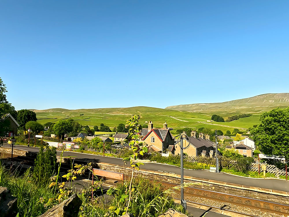
The walk starts from the pay and display car park in Horton in Ribblesdale.
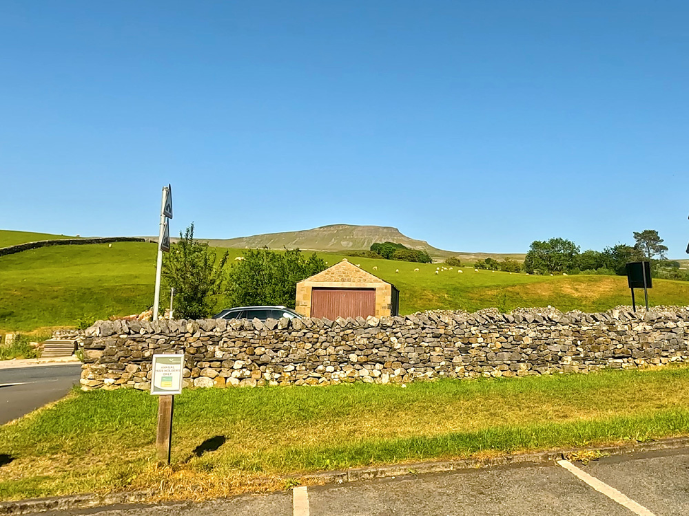
Pen-y-ghent from the car park in Horton in Ribblesdale
Exit the car park by the path that goes down the side of the toilet block and then pass over a wooden footbridge over the River Ribble, before then turning left, to head a couple of hundred yards along the pavement.
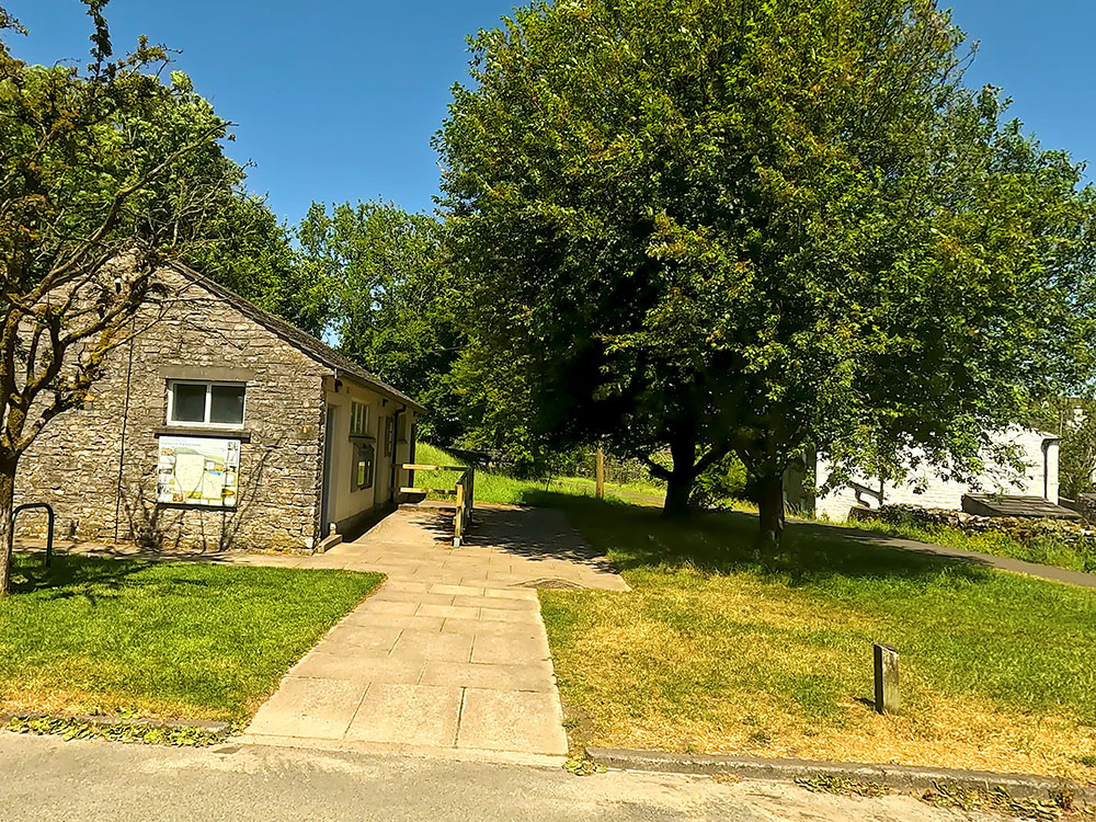
The path passes by the toilets in the car park in Horton in Ribblesdale
As the road bends round to the right, leave the road to head straight on into Horton in Ribblesdale train station. Horton in Ribblesdale train station is on the Settle to Carlisle railway line, which is a very picturesque journey. There are steam trains that go on that route on certain days of the year.
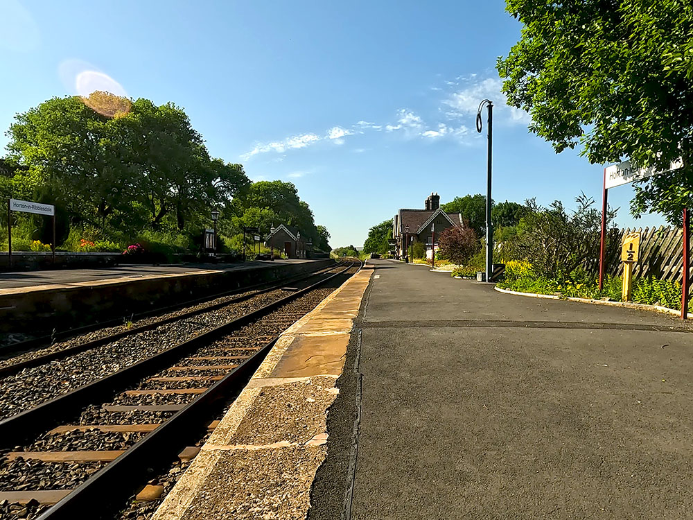
The Settle to Carlisle railway line and platform at Horton in Ribblesdale train station
On reaching the platform, as the sign says, Stop, Look and Listen. If clear, carefully cross over the train tracks and head up the path opposite between the fence and the wall. Pass through the gate and head away from the wall crossing some fields.
Crossing the fields heading out of Horton in Ribblesdale
On meeting the next wall, pass through this next gate and continue ahead to meet yet another wall.
Again, just pass through the gate and continue along the wide path.
Pass through the next gate, just through which there is a sign informing you about Ingleborough National Nature Reserve.
Continue ahead on the well-defined path as it winds its way through bits of limestone outcrops. There are also some of these wooden waymarkers that mark the path's route. Over to the right, you can see Pen-y-ghent on the horizon.
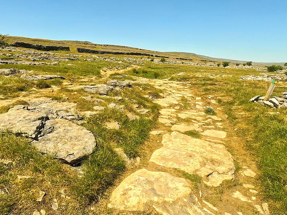
The path passing through exposed limestone
The path then passes through a gap in the next wall. Then shortly afterwards, at a Three Peaks footpath sign, keep straight on following the Ingleborough 3½ miles sign.
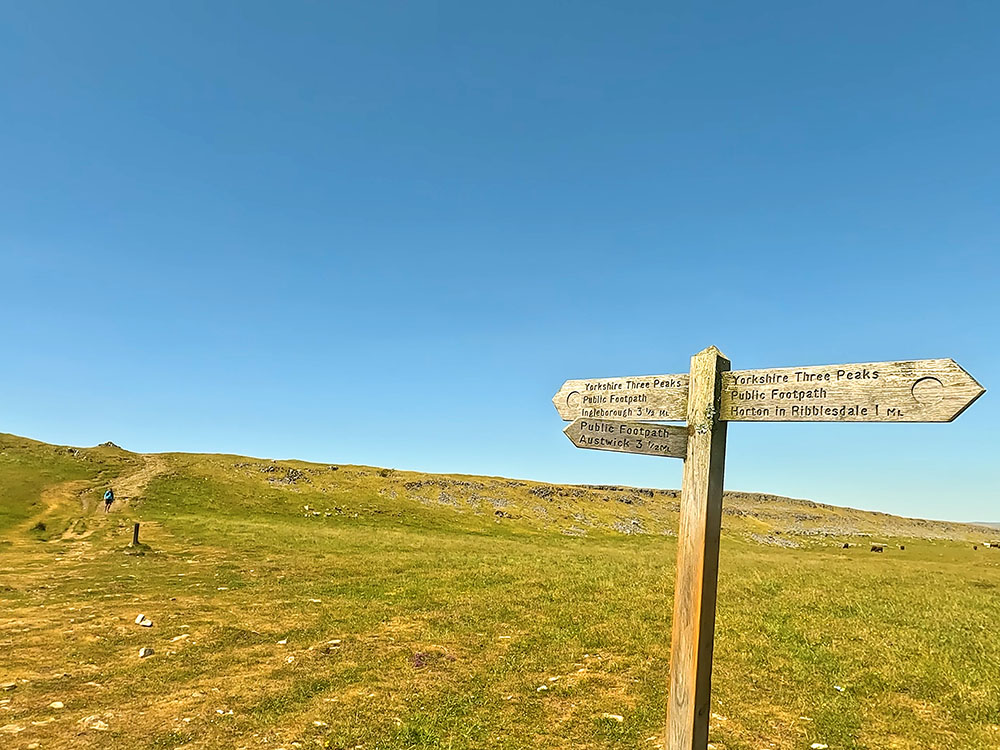
3-way footpath sign to Austwick, Ingleborough and Horton in Ribblesdale
On meeting the next wall, pass through the gate, where, if you look behind, it does frame Pen-y-ghent quite nicely.
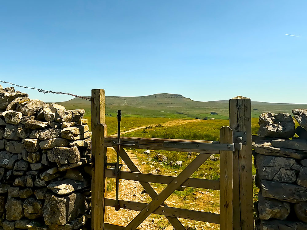
Looking back through the gate towards Pen-y-ghent
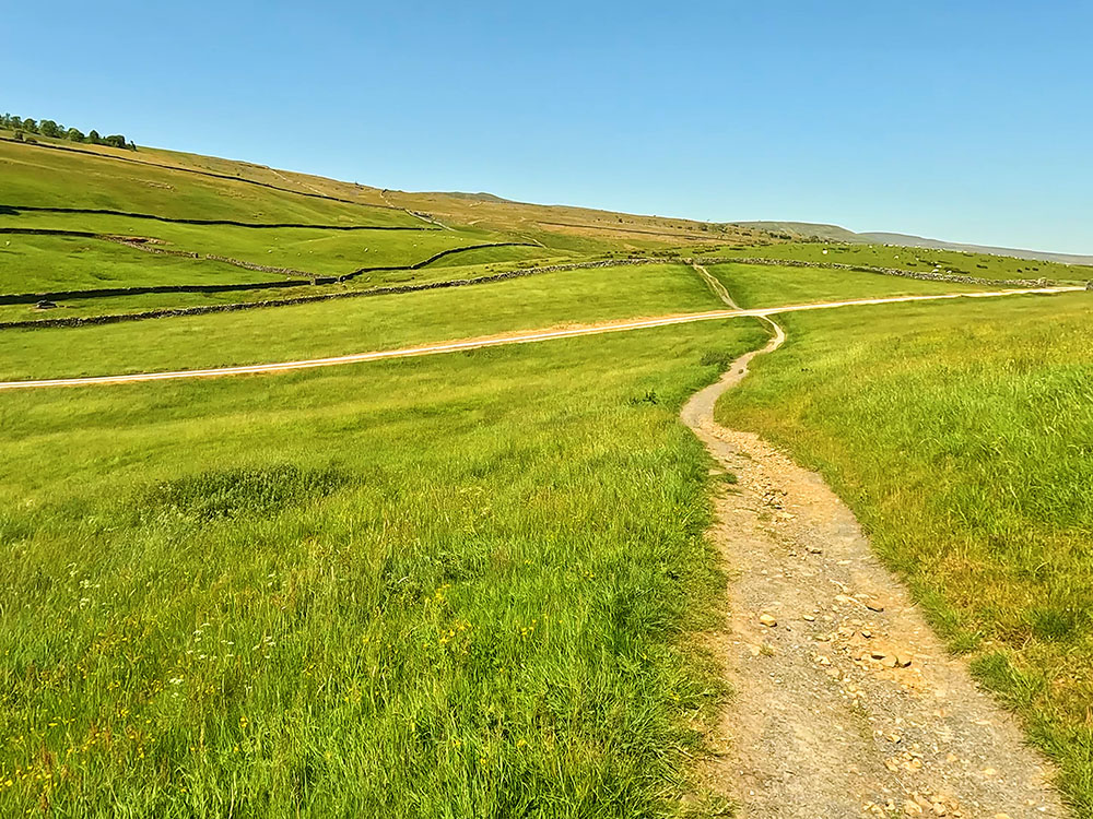
Walk away from the wall, walking now along the intermittently flagged footpath.
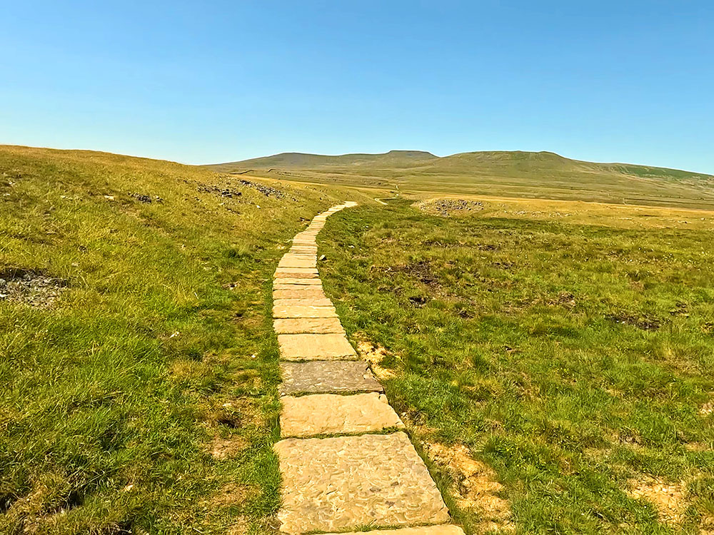
The flagged path through Sulber Nick heading towards Ingleborough
The path does provide views ahead towards Ingleborough on the horizon.
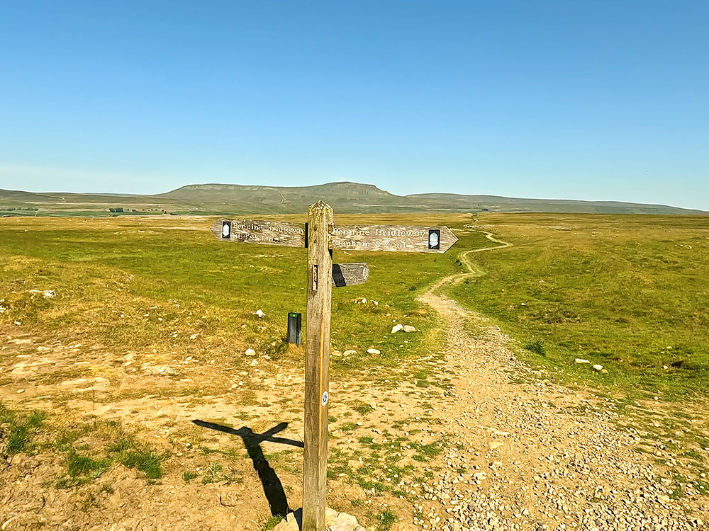
After almost a kilometre, the next signpost is reached. Straight on here, is our return path from Ingleborough. The signpost, though is sadly missing its fourth finger that used to point towards Ingleborough.
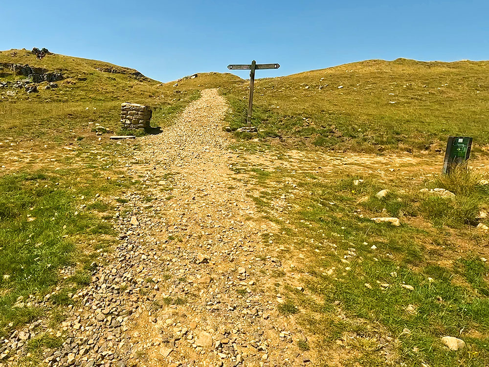
4-way signpost - straight on is the path to Ingleborough as it intersects with the Pennine Bridleway crossing from right to left
For now, we are going to turn left following the Pennine Bridleway sign towards Clapham and head along the wide grassy path, where after about 400 metres, we pull into a wall.
Pass through the gate in the wall and then before continuing on, take time to look over the gate a few yards away on your left.
Over the gate you can see Pendle Hill on the horizon, then Moughton Scars and Thieves Moss. If you want to explore Thieves Moss and Moughton Scars further, check out our Thieves Moss, Moughton Scars and Norber Erratics walk from Clapham. On the horizon, you can also see Pen-y-ghent in the distance.
Looking over Thieves Moss and Moughton Scars with Pendle Hill on the horizon from Sulber Gate
Continue along the wide path on the right-hand side of the wall. As you walk alongside the wall, take time every so often to stop and look again across Moughton Scars, this time from a different angle.
Looking over Thieves Moss and Moughton Scars with Pen-y-ghent on the horizon
Keep on along the grassy path as it leaves the wall. At a wooden waymarker, keep on the main path to the right.
This section of the walk is part of the Pennine Bridleway, which is a 205-mile trail from Middleton Top in Derbyshire to Ravenstonedale in Cumbria, with its full length officially opened in 2012 by Martin Clunes, the then-president of the British Horse Society.
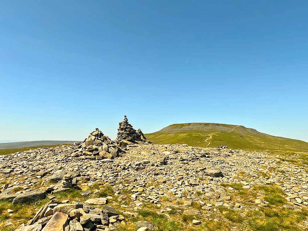
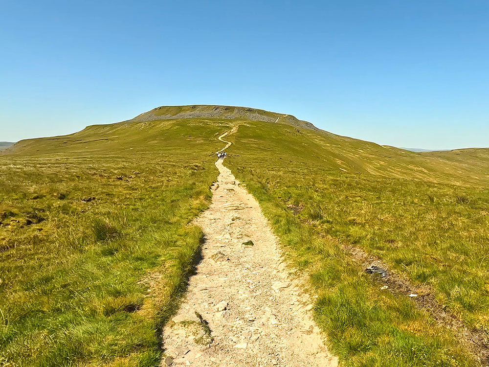
Upon reaching the next wooden waymarker where a path comes in from the right, just keep straight on heading for the cairn, just visible on the horizon. At the next wooden waymarker, you can take either path as they meet further on, but we'll take the left-hand path because we want to go via the cairn.
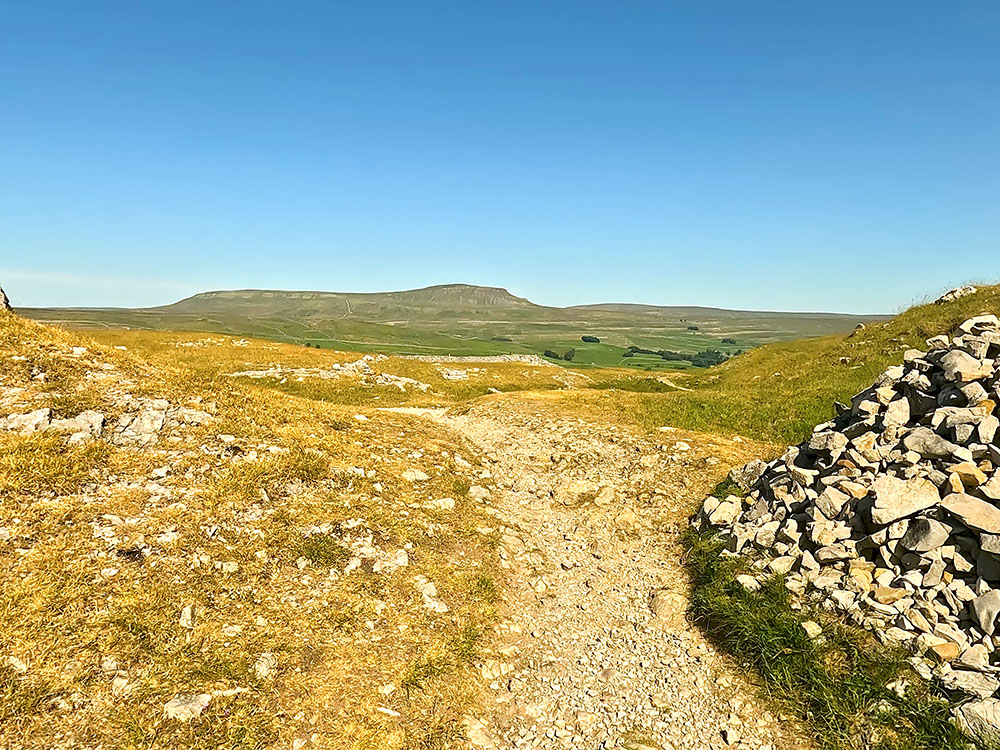
On reaching the cairn, divert briefly from the main path if you want to visit it. From the cairn, the near wooded area ahead is Trow Gill Gorge which will be visited shortly and then looking around to the right, Little Ingleborough and Ingleborough itself are both visible.
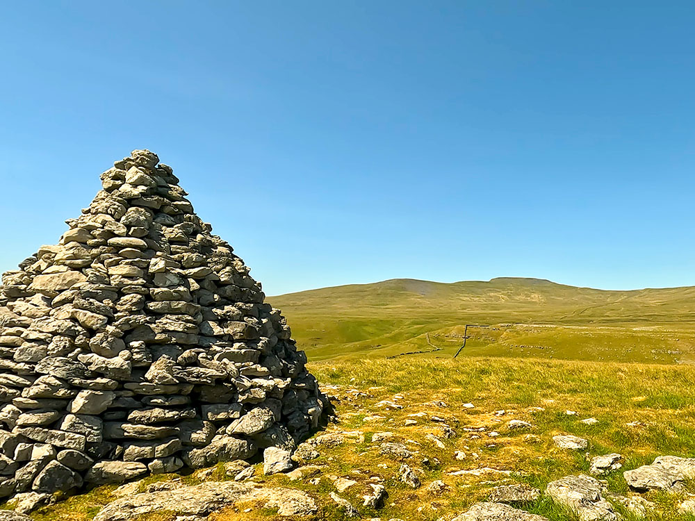
Ingleborough and Little Ingleborough from the cairn
Further around, over the path you've just come up, you can see Pen-y-ghent on the horizon. From the cairn just drop down to rejoin the main path that we were walking on before and follow that as it starts to slowly descend.
At a path junction, just keep straight on the path. Coming from the right here is the path that took the right fork at the wooden waymarker passed earlier.
On meeting the next wall, pass through the gate and again just continue straight on along the grassy path. The path pulls into the gate at the top of Long Lane which will go through shortly on the way down to Trow Gill.
Before going through the gate, if you wanted to miss out Trow Gill and not lose as much height, over to the right here, you can drop down and then follow the path of the far side (see the video) and then I'll mention below where we'll meet that path later on.
Return to and pass through the gate at the top of Long Lane.
Head down Long Lane now for a couple of hundred metres until you reach a stile on the right-hand side. Pass over the stile, where, down below you can see the next stile over the wall ahead.
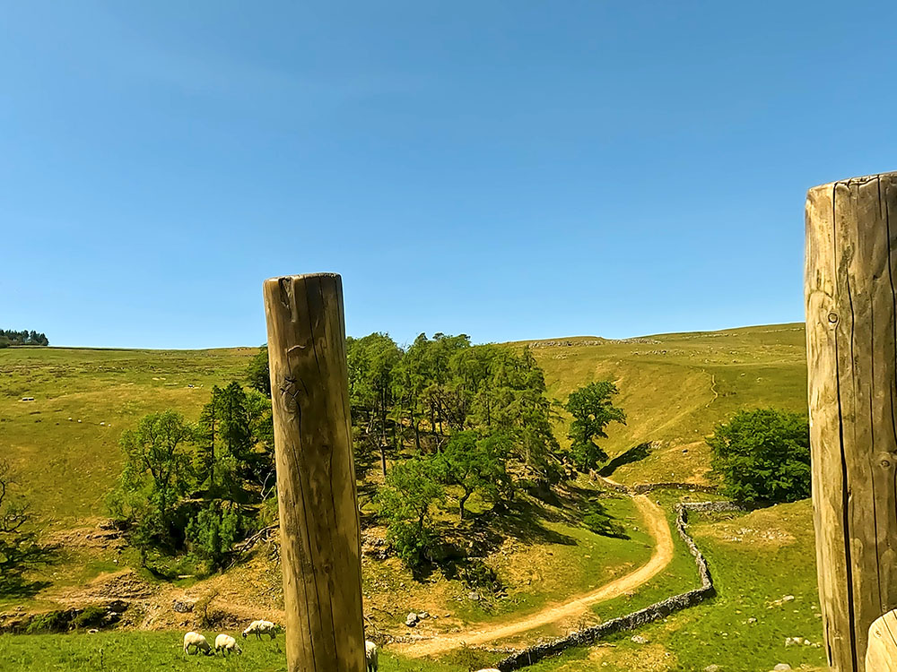
Looking towards the wooden ravine of Trow Gill from the stile on Long Lane
It is quite a reasonable drop over this stile, so if you didn't fancy climbing it, you could go the alternative route I mentioned above. Head steeply down to the stile in the next wall.
Pass over the stile, where a track is met coming up from Ingleborough Cave from your left. If you wanted a walk that goes by Ingleborough Cave, check out our Ingleborough walk from Clapham.
Once over the stile, turn right along the track to head slightly uphill. Pass through a gate and then just continue straight on along the track.
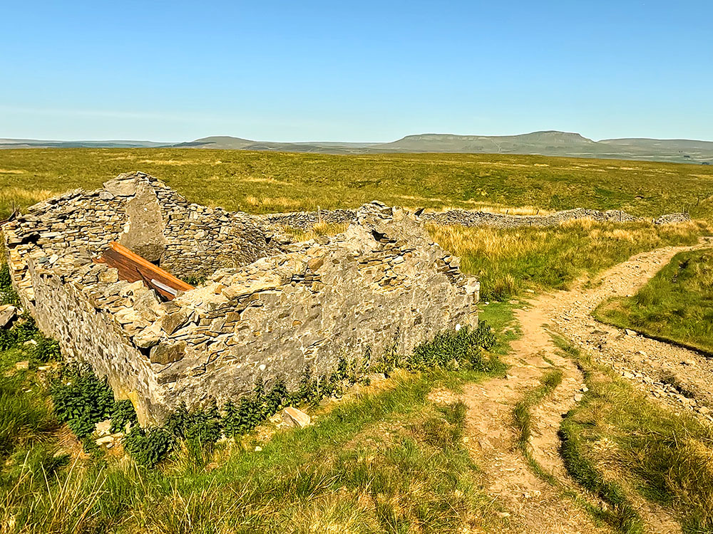
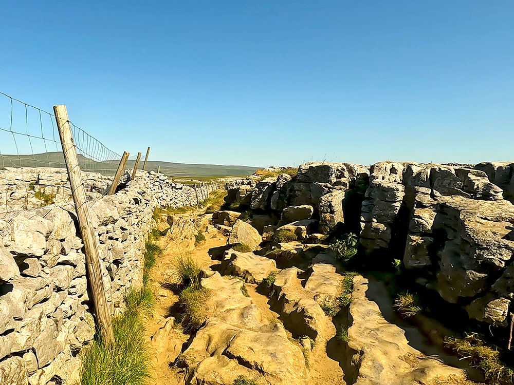
Shortly after, you then reach Trow Gill, which is a limestone gorge. Pass through the gorge and at the top of the initial climb, just continue straight on.
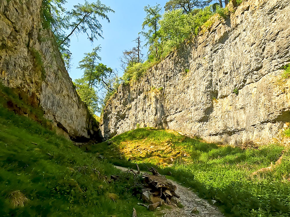
Trow Gill
This path is part of A Pennine Journey. A Pennine Journey is a 247-mile trail, starting and ending in Settle in the Yorkshire Dales.
It is based on a 211-mile walk Alfred Wainwright undertook in 1938 and then later wrote a book about it called The Pennine Journey The Story of a Long Walk in 1938. The book was eventually published in 1986.
The path follows the right-hand side of the wall. Keep on the path now for about three-quarters of a mile until just when you can see Ingleborough over to your left, you reach two wooden gates in the wall stile.
Double stile heading over the wall towards Ingleborough
Looking around from the stile that will be crossed shortly, you can see the path just walked up and then another path. If you took the alternative path I mentioned at the top of Long Lane, this is where you would rejoin this walk.
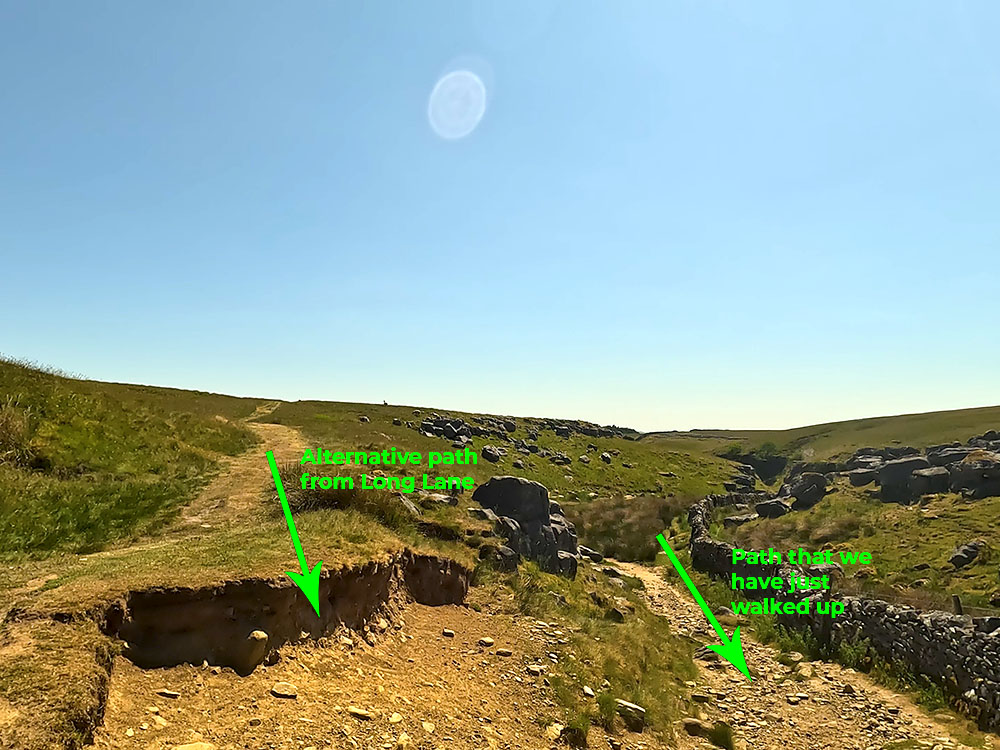
The alternative path from the end of Long Lane coming in to meet our path at the double stile
Head over either of the stiles and then follow the path directly away from the wall. Little Ingleborough and Ingleborough lie ahead of us now, as the path bends slowly around to the right.
After a couple of hundred yards at a path junction, the left-hand path goes up Little Ingleborough and we'll be joining that path shortly. For now, take the right-hand path, that heads over towards Gaping Gill, which is reached after about another 100 yards.
Gaping Gill is one of the largest underground chambers in the UK. Fell Beck runs into the Gaping Gill pothole here and falls 98 metres to the floor of the chamber, so forming the highest unbroken waterfall in England.

Gaping Gill
Take note of the signs that tell you to keep yourself, your children and your dogs well away from the top as it's unfenced and it's a sheer drop. Very sadly, people have died at Gaping Gill.
If you do feel the need to explore it further, twice a year Bradford Pothole Club for a week in May and Craven Pothole Club for a week in August, set up a winch above it and you can be lowered down it in a chair. More information about the charge, what to wear and when it takes place is available on their respective websites.
Retrace your steps and head the short distance back along the path by the side of the fence and then this time just branch off to the right to meet the path that starts to head up Little Ingleborough. After about 50 yards you meet the other path. Turn right on this path to start to head more steeply up the hill.
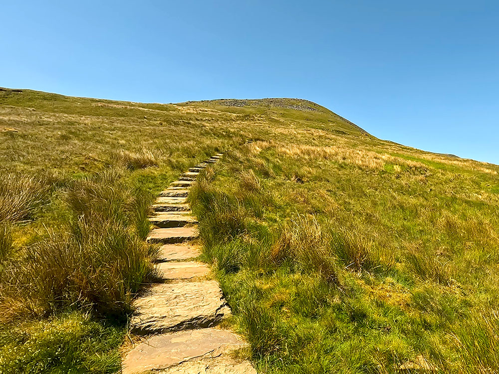
The flagged steps heading up Little Ingleborough
Stop every so often, just have a look around and take in the views. Over to the right you can see Simon Fell Breast that will be walked back down from Ingleborough and then over on the far horizon, you can see Pen-y-ghent and more in the foreground, the path that was just walked up. Then further around, again on the horizon, you can see the distinctive outline of Pendle Hill.
Looking back down the path and towards Pen-y-ghent
Continue steeply up the path and steps until, after just over one kilometre, you then arrive at the cairns marking the top of Little Ingleborough, which is 639 metres in height.
Over the cairns you can see the outline of the Lakeland Fells and then around to Morecambe Bay out to the west. Further around, you can again see Pendle Hill and then following around again you can see Pen-y-ghent with Fountains Fell just to the right of it.
Cairn on Little Ingleborough summit looking out towards the sea and the distant Lakeland Fells
Continue along the main path now as it heads for Ingleborough. After about 800 metres, the path starts to climb a little more steeply and narrows just before it reaches the summit plateau on Ingleborough.
The path from Little Ingleborough heading up towards the flat-topped plateau of Ingleborough
Upon reaching the plateau, by a cairn, the path gets a lot flatter. If you look around now you can see the path that we're going to walk down over there on Simon Fell Breast with Pen-y-ghent again on the horizon. And then if you look further around, you can see the path that we just walked up from Little Ingleborough.
Looking back down the path towards Little Ingleborough
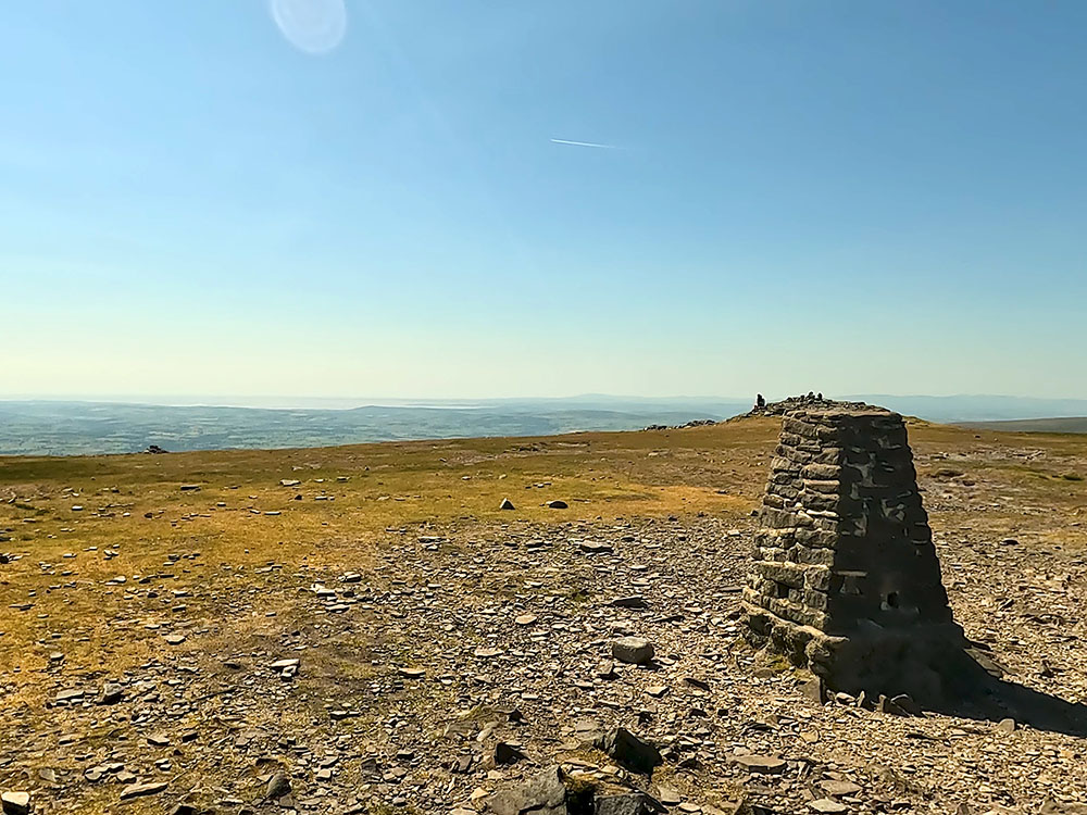
From the cairn, head diagonally left from the path that you walked up, past another cairn to head on for about 200 metres towards the trig point and weather shelter on the summit. In bad visibility, you should always take a compass bearing from the cairns to the summit.
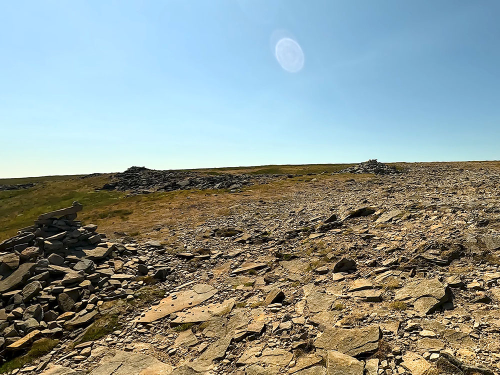
The small cairns on turning left to cross the flat-topped summit plateau on Ingleborough
At 724 metres high, Ingleborough is the second highest of the Yorkshire 'Three Peaks' behind Whernside. Ingleborough on a clear day provides views to the Lakeland Fells to the north and as far away as the Snowdonia range to the south.
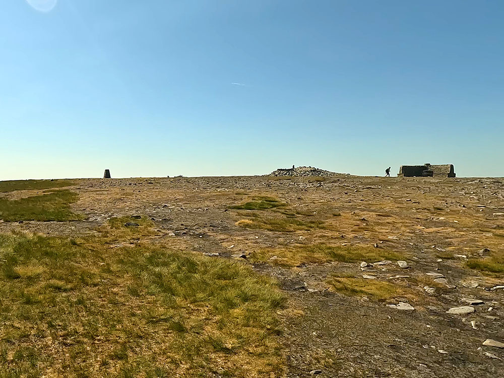
Approaching the weather shelter and trig point on Ingleborough
Ingleborough along with Pen-y-ghent and Whernside make up what is known as the Yorkshire Three Peaks. The Yorkshire Three Peaks Walk is approximately 24 miles long and takes in just over 1500 metres of climbing. Pen-y-ghent is the shortest at 694 metres, Ingleborough is 724 metres high and Whernside is the highest at 736 metres.
Looking out towards Morecambe Bay and the Lakeland Fells from the trig point on Ingleborough
From the trig point, if you look out to the west, you can see out to the sea at Morecambe Bay, and then as you look around to the right, you can see the faint outline of the Lakeland Fells and then to the left to the weather shelter, you can see the top of Whernside and on the far horizon the Howgills.
Our Ultimate Guide to Ingleborough's Geology and Walks takes you through what you can see underground and overground on Ingleborough, including Ingleborough Cave, White Scar Cave, and Gaping Gill, and sets out our favourite walks around and over Ingleborough.
Looking towards the Howgills, Whernside and the weather shelter from the trig point on Ingleborough
As you look further around, you can again see the outline of Pen-y-ghent and then the outline of Pendle Hill again on the horizon before coming full circle and looking back out to sea.
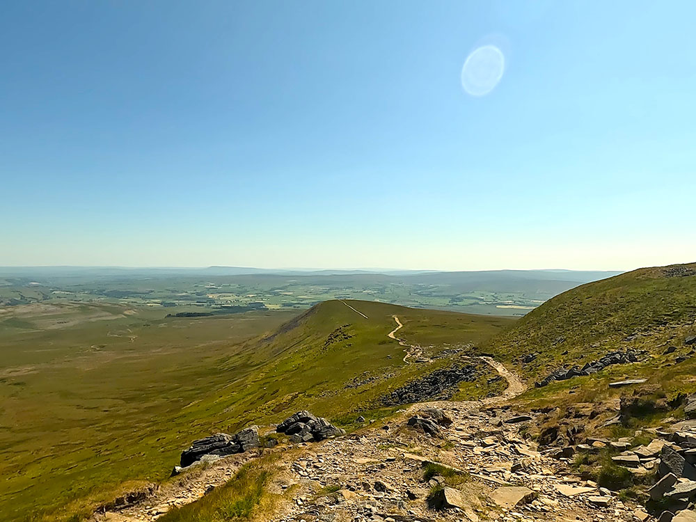
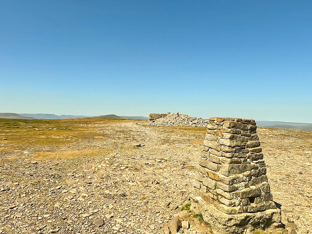
Start the descent by heading over to the right of the weather shelter from the trig point. The four-sided weather shelter helps makes sure whatever the direction of the wind there is somewhere to shelter.
Then once past the weather shelter if you carry on in the same direction, you soon pick up the path along the edge of Ingleborough. Wandering the edges of Ingleborough does provide some additional views. Down below on this side, you can see the Ribblehead Viaduct and then again around to Whernside.
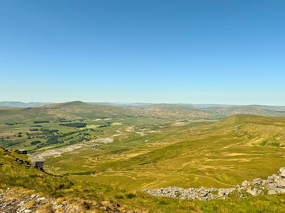
Whernside and the Ribblehead Viaduct from the summit of Ingleborough
Just continue along the path that keeps quite close to the edge. After another hundred metres or so and passing a couple of cairns, you need to look out for where the path starts to branch off left downhill. The path isn't that clear initially from the top but just heads down slightly left of a large boulder.
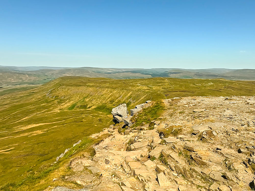
Where the path leaves the summit plateau of Ingleborough to pass down the left-hand side of the large boulder
From this large boulder, you again get a great view down towards Ribblehead Viaduct and Whernside.
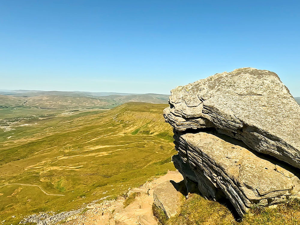
The path passes by the large boulder with Ribblehead Viaduct in the distance
Continue on down this rough path past the boulder - hands may be needed on odd little sections until you soon reach the stone marker.
The left-hand path here heads down the other side of Ingleborough towards the Hill Inn at Chapel le Dale, but we're going to take the right-hand path that heads across Simon Fell Breast.
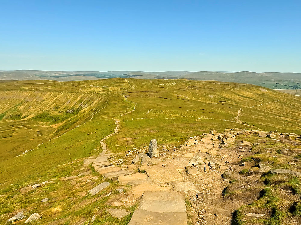
Stone marker by path junction - we take the right-hand path heading across Simon Fell Breast
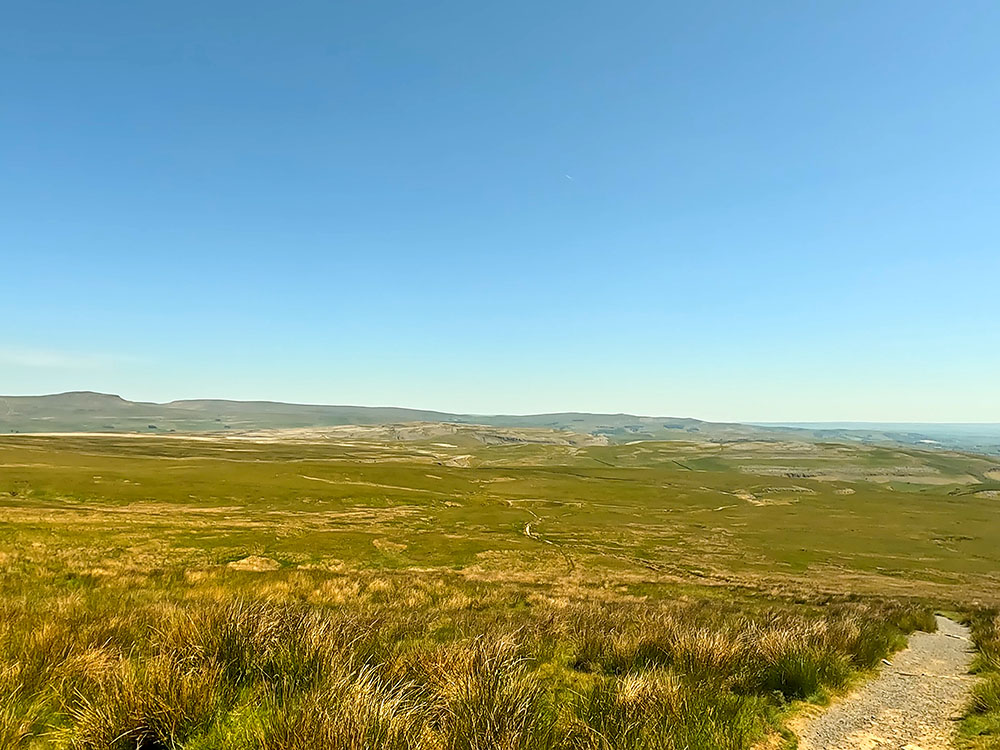
Head down the path steeply at first, soon passing a small tarn on your left. After a couple of hundred metres, the path becomes less steep as it makes its way across Simon Fell Breast.
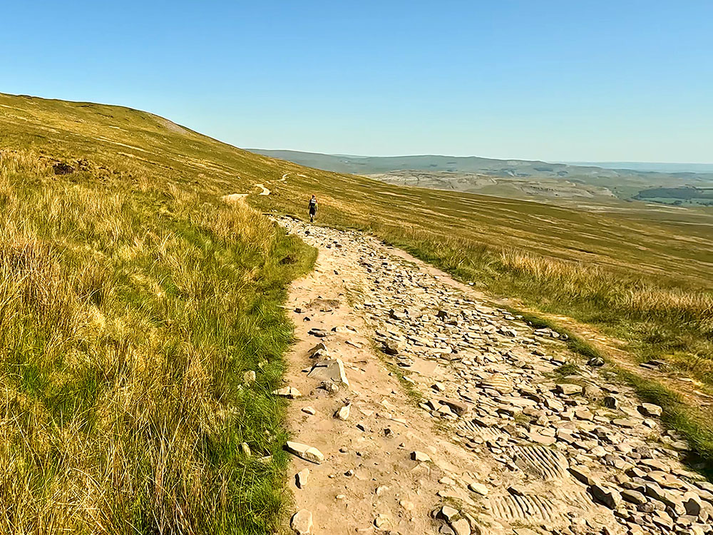
The Dales High Way path heading across Simon Fell Breast
Over to the right from this path, you can see Little Ingleborough and around to Ingleborough that we've just walked over.
About one mile from where the path split, a wall stile is reached. Pass over this and just continue straight on in the direction of Pen-y-ghent.
Keep on along this path, which at one point passes over some wooden boards, that keep you out of the marshy area underneath.
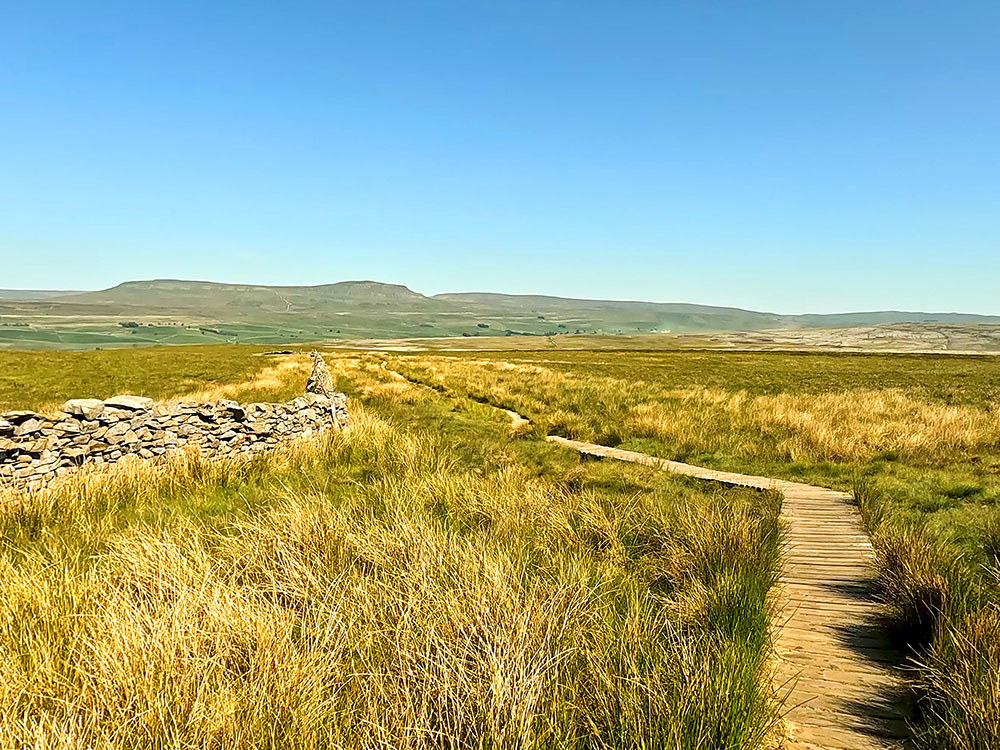
The path as it heads over the wooden walkway
Continuing on, just after a short flagged section, pass by a disused shooting hut, which is shown on the Ordnance Survey map.
The shooting hut just beside the path before Nick Pot
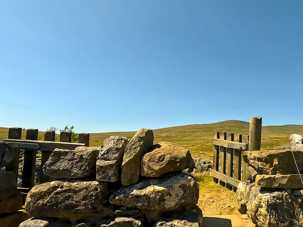
Not long after that, the path then crosses a small stream, straight after which pass through the wooden gate. There is a signpost at that gate showing 2¾ miles back to Horton in Ribblesdale.
Once through the gate, head away from the wall, and then shortly after at a path junction by a wooden waymarker, take the left-hand path following the yellow arrow.
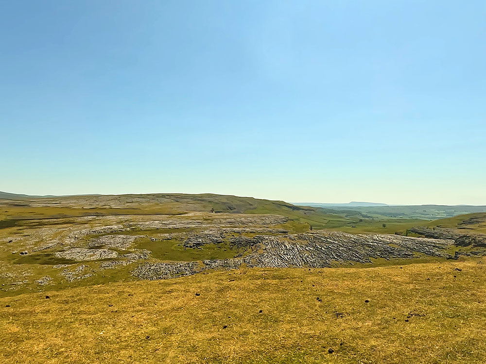
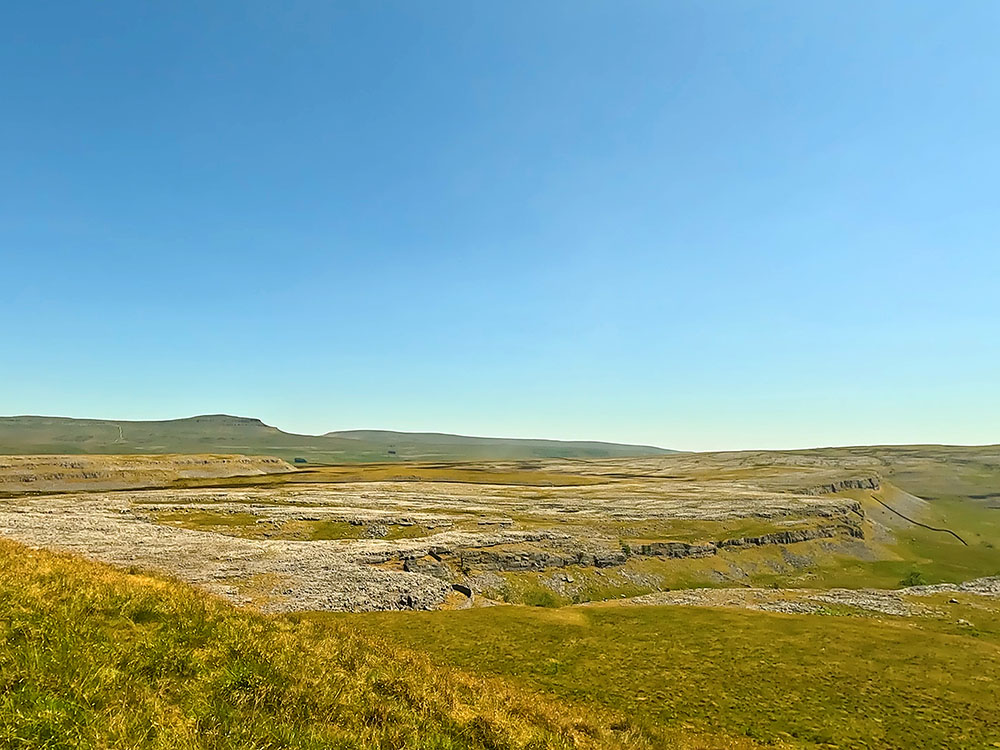
The path continues on and then pulls in between a wall on your left and the limestone pavement on your right. This short section can get a little boggy in winter or after wet weather.
The path between the walk and the limestone pavement near Nick Pot
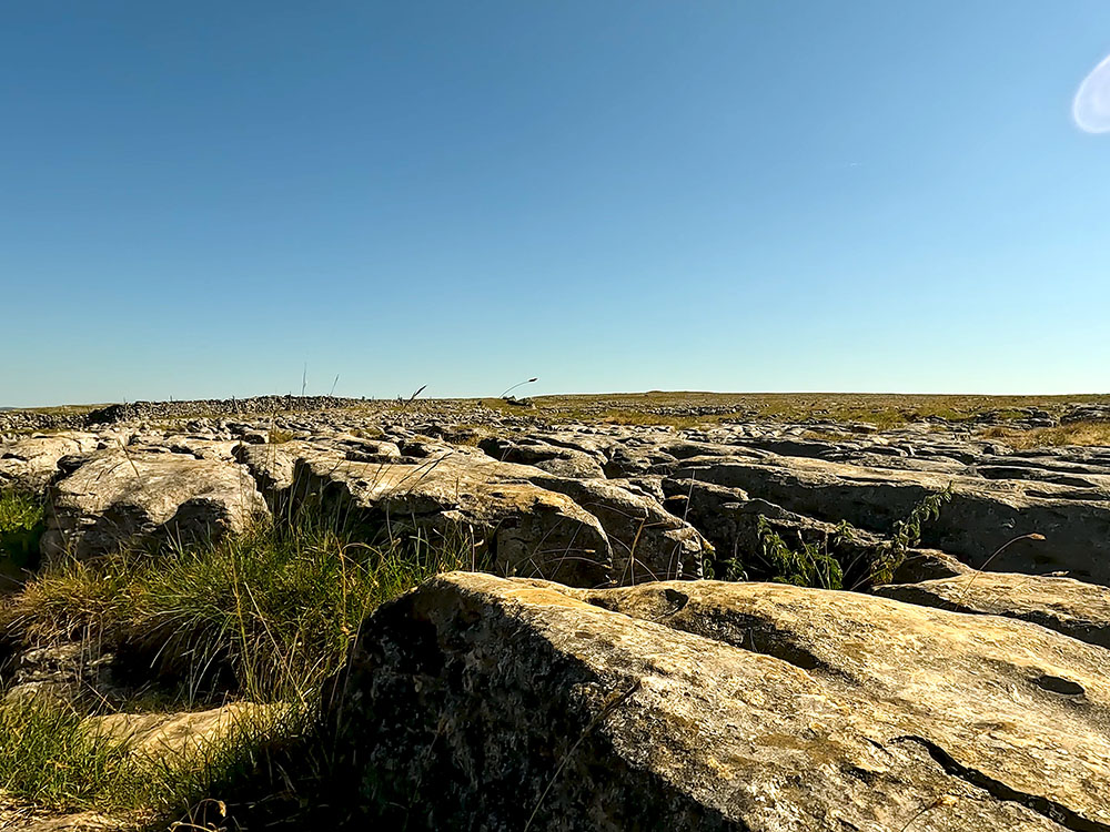
Looking across the limestone pavement near Nick Pot
On meeting the next gate, pass through it and continue straight on along the path. Where there were views of Ingleborough on the outward path, on the way home to Horton, there are the views of Pen-y-ghent for most of the way back.
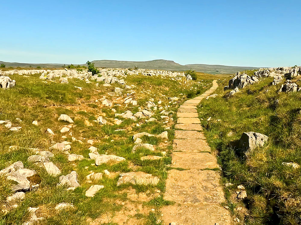
The flagged path with Pen-y-ghent on the horizon
After a few hundred metres, we then arrive back at the three-fingered used-to-be four-fingered signpost that we passed earlier on the walk.
The 4-way signpost, with one finger missing, where we rejoin the outbound path heading back towards Horton in Ribblesdale
This time just continue straight on following the footpath sign for Horton in Ribblesdale 2 miles. As you walk along through the limestone, you may notice a lot of yellow and purple flowers. I'm not the greatest with flora, but I think the yellow flowers are the Common Rock Rose and the purple ones are Bloody Cranes Bill. If that's not right though, just let me know in the comments below.
The footpath passing by a cairn at Sulber Nick with Pen-y-ghent on the horizon
Just before the view disappears, we'll look back around again for one last time to have a look at where we've walked today.
Pass through the next gate and just continue straight on to pass by the signpost passed earlier following the Horton in Ribblesdale sign for one mile.
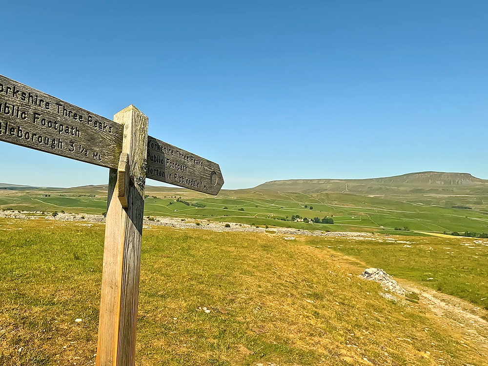
Yorkshire Three Peaks footpath sign back to Horton in Ribblesdale
Continue back along the outbound path heading through the bits of exposed limestone then through the gap in the wall.
If you are enjoying this walk, whilst you are in the area, and if you have time on another day, why not check out the Ingleton Waterfalls Trail?
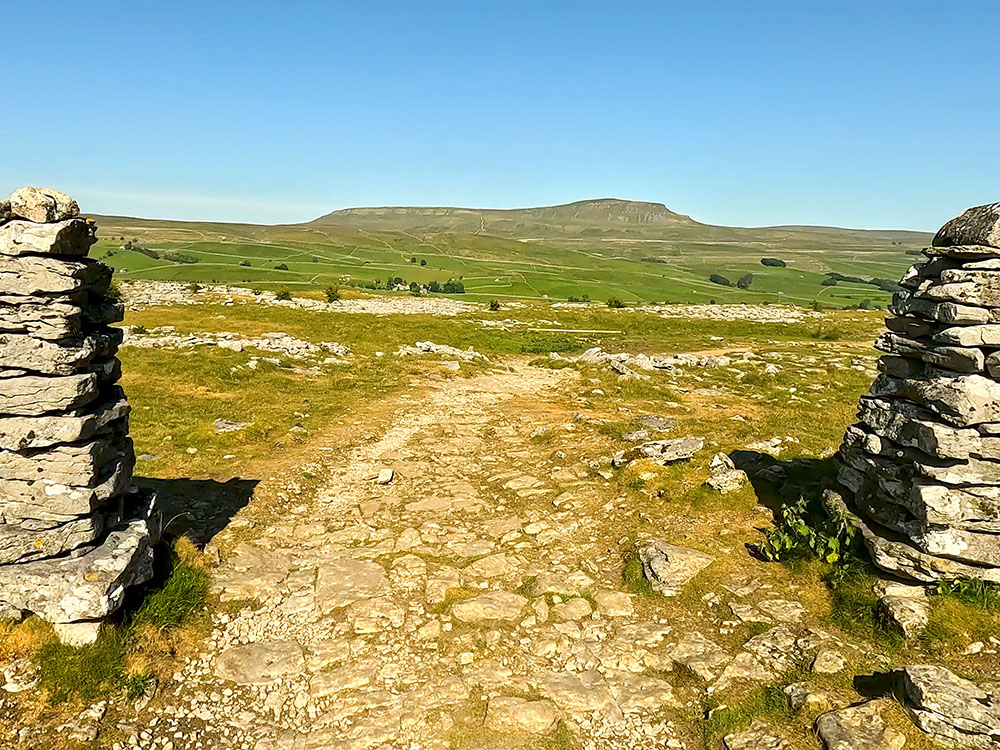
Passing back through the gap in the wall with Pen-y-ghent ahead on the horizon
Pass back through the gate by the side of the information board and then pass back through the next gate you meet and head straight on, continuing across the fields.
Pass again through the next gate, where you can now see Horton in Ribblesdale just down below.

Dropping back down into Horton in Ribblesdale
Head on and pass again through the gate from which you can see the platform of Horton in Ribblesdale station just down below, and then once through the gate head down the side of the fence, and watch to ensure no oncoming trains cross over the train track, taking great care yet again.
Heading back across the Settle to Carlisle train line at Horton in Ribblesdale train station
Footbridge in Horton in Ribblesdale heading back to the car park
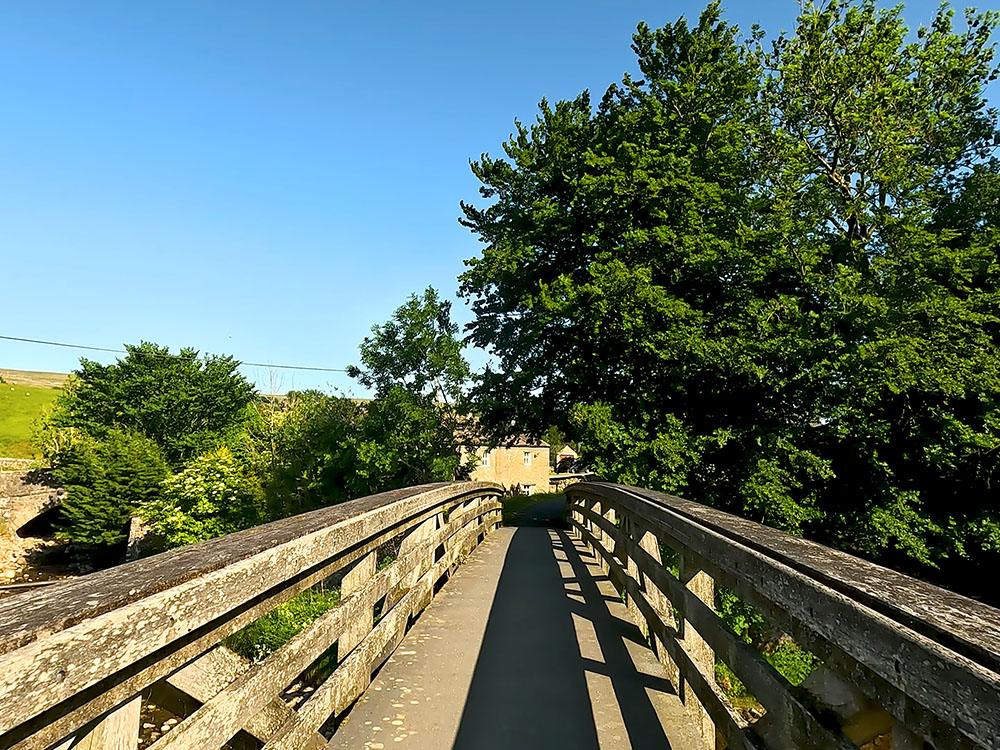
Once over the track pass through the gate opposite and head back down to the road and then continue straight across until you meet the road at the bottom.
Upon meeting the road just continue straight on along the pavement. At the end of the pavement, just before the hedge, turn right to pass back over the wooden bridge walked over at the start of the walk.
If you look over to the left from the bridge, you can see the Crown Hotel, which is one of the two pubs in Horton in Ribblesdale along with the Golden Lion.
Looking towards the Crown Inn from the footbridge in Horton in Ribblesdale
Once over the bridge, head back into the car park.
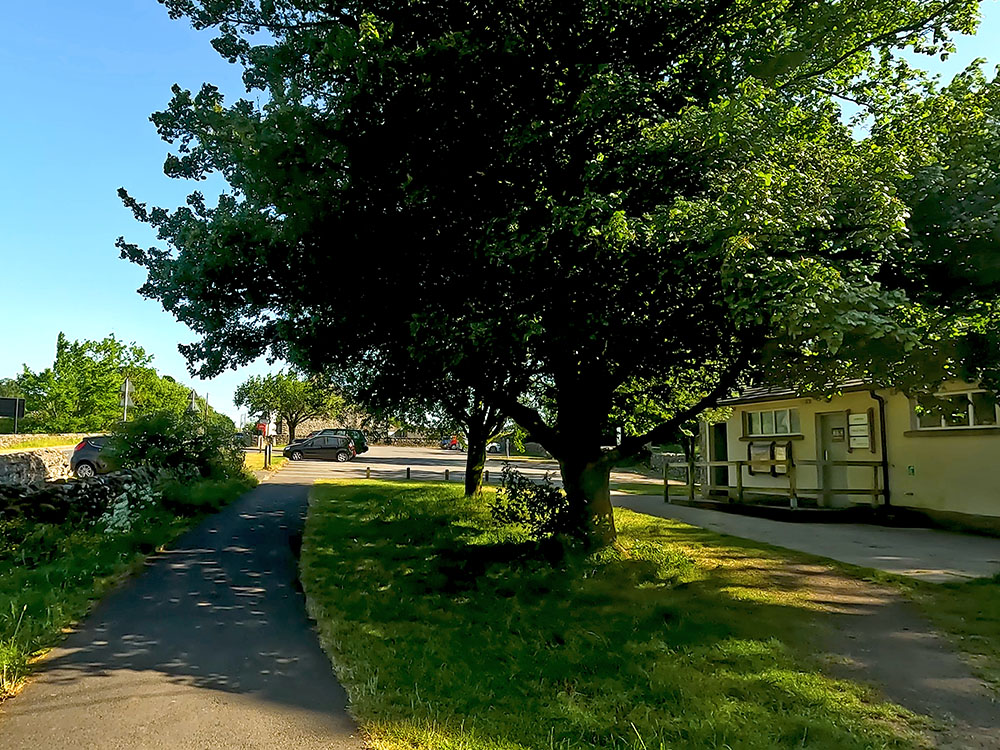
Heading back into the car park at Horton in Ribblesdale
There are a few places to eat and drink nearby if you want something after the walk.
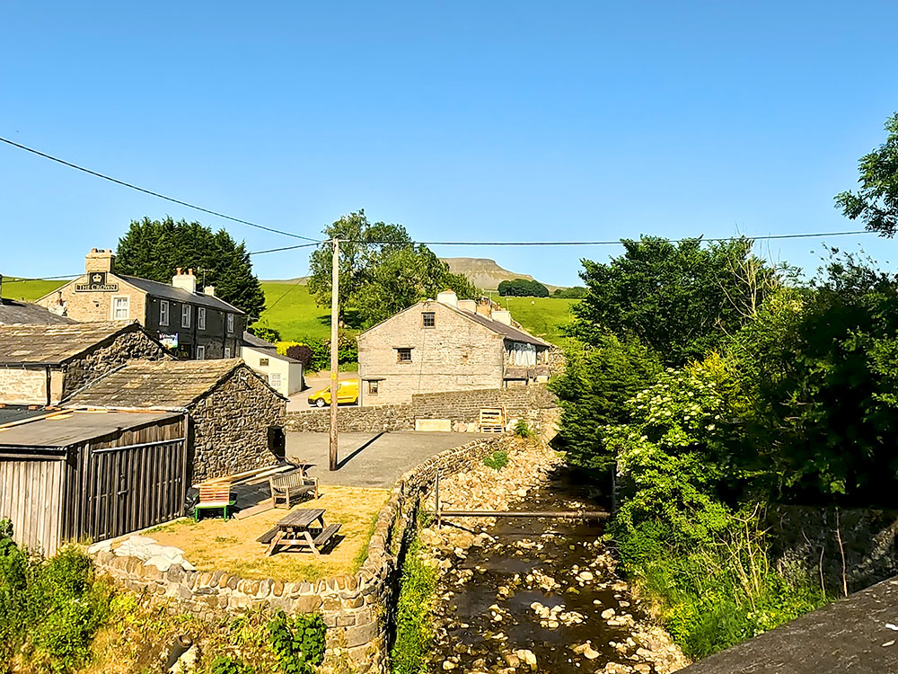
The first place is the Crown Hotel which you saw from the footbridge. To get there, just turn left out to the car park and wander along the road and it's just over the bridge. As of July 23, I believe the Crown Hotel is still open, but as you can see from the sign, the business is currently up for sale.
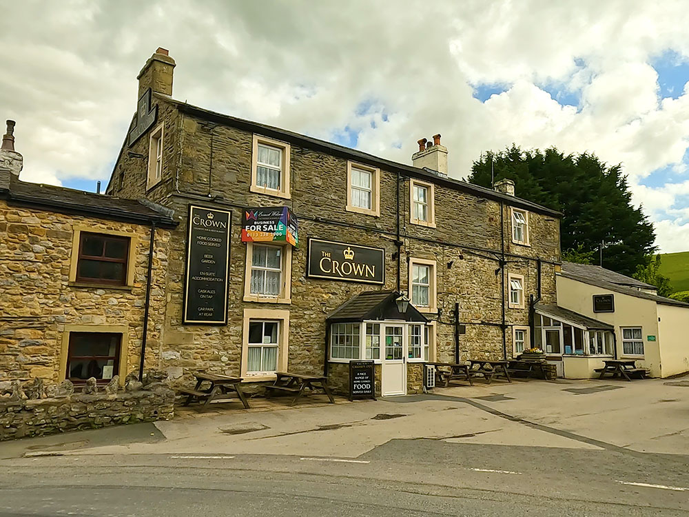
The Crown Hotel in Horton in Ribblesdale
It serves food and drink, but I've been in for a while and on reading some online reports, I'm not sure whether it's dog-friendly, so it's probably best just checking first.
Instead of turning left out of the car park, if you turn right and headed along the road for a couple of hundred meters, you reach the Golden Lion Hotel. Again, this serves food, drink and has accommodation. I believe dogs are allowed in the bar and in the taproom. It also offers all-day parking.
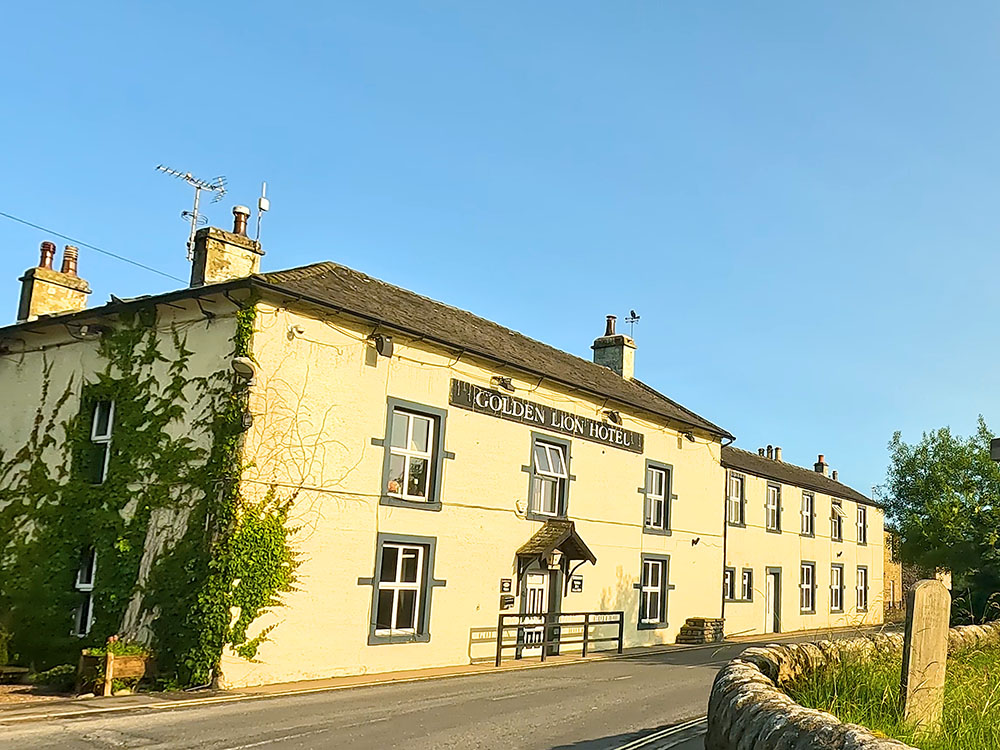
The Golden Lion Hotel in Horton in Ribblesdale
When you came out of the train station instead of heading straight on, if you turn left after about 400 metres is the Blindbeck tea room on the right-hand side, which, according to their website, serves hot and cold refreshments and has its own car park. It does, though, say that dogs aren't allowed in the tea room.
Everyone will have their own favourites, but my preferences nearby if you've got a car are Middle Studfold Farm Tea Room and Helwith Bridge Inn, both within two miles heading along the road to Settle.
I like Middle Studfold as it is off the main road with views. It serves homemade food, sandwiches, all-day breakfast, toasties and cakes, along with a range of alcohol, teas and coffees.
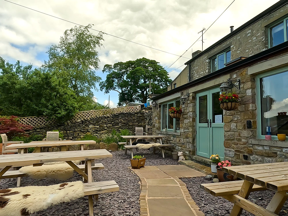
Middle Studfold Farm Tea Room near Horton in Ribblesdale
Just further on, just off the road to Settle is the Helwith Bridge Inn. They serve good food and also often have up to eight real ales on the bar, many brewed locally. It is on the side of the river Ribble and there's the Settle to Carlisle railway line running right past it. It's also dog-friendly.
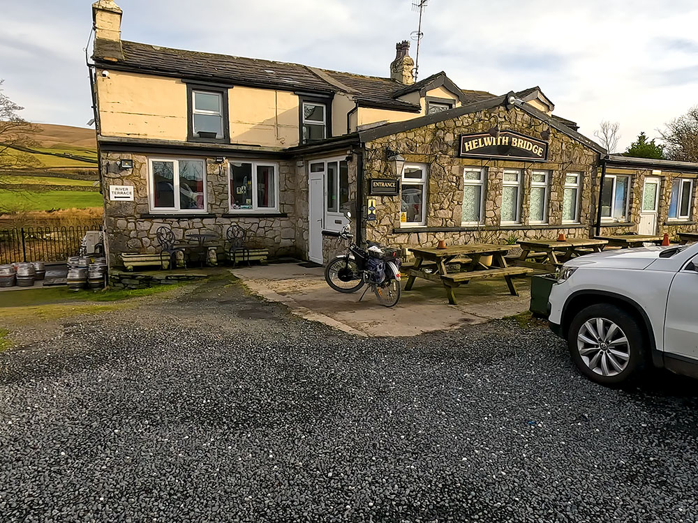
The Helwith Bridge Inn
If you need more choice, there is a wider range of pubs, restaurants and takeaways in nearby Settle and Ingleton.
Gifts and presents for hikers and walkers
Are you struggling to pick the perfect gift for your hiking-loving friend or family member? Don't fret! Explore our curated selection of top-notch gifts for walkers and hikers that will have them trekking with joy on their special day.
What to wear and take on your walk or hike
Whether you are a seasoned hiker or new to walking, wearing and taking suitable hiking kit and clothing is essential for a day hike for your comfort and safety. So we have put together a hiking essentials checklist to cover all you'll need. Our Hiking Essentials checklist for 2026 takes you through planning your walk, the hiking essentials checklist itself, optional extras, explanations, and recommendations for all the hiking essentials.
Check out the reviews for this walk: