By using this website, you agree to our use of cookies (needed to provide our website’s features) and our Terms of Use.

A circular walk from the picturesque village of Clapham, which affords wonderful views of Ingleborough and Pen-y-ghent. It heads past Ingleborough Cave, which can be visited and then on through the impressive Trow Gill to reach Gaping Gill.
In accordance with our Disclaimer, you agree to take full responsibility for any use you make of the information contained in these pages.
This page contains affiliate links. If you buy products or services via these links, we may earn a small commission at no cost to you.
| Walk title: | Ingleborough walk via Ingleborough Cave, Trow Gill and Gaping Gill from Clapham |
| Author: | Andrew Forrest - March 2023 |
| Walk start point: | Pay and display car park in Clapham (grid reference SD 745 692). What3words: makeovers.dares.daffodils |
| Parking: | As above. A small amount of roadside parking is available, but please park responsibly as Clapham does get busy, especially at weekends and bank holidays. |
| Directions to nearest parking place: | Google Maps: get directions here / What3words: graver.joined.brightens |
| Walk distance: | 16.5 km |
| Estimated walk time: | 4 hours 50 minutes |
| Height climbed: | 660 metres |
| Technical difficulty: | Moderate - as determined by our interpretation of the Ordnance Survey guidance on technical difficulties. In bad visibility, this would rise to Difficult as compass navigation needed on the summit of Ingleborough. |
| Peaks / summits: | Ingleborough (724m) |
| Map: | Ordnance Survey - Explorer OL2 (Yorkshire Dales - Southern & Western Area) Buy this map from Ordnance Survey |
| GPS/GPX file: | Download available to registered users - Register and Login here - It's FREE to register |
| Facilities / refreshments: | The New Inn, Lake House Bar and Kitchen, Old Sawmill Café and Croft Café in Clapham are all within a couple of minutes' walk of the car park. There is also the Game Cock pub in nearby Austwick - check out the walk video for further details. |
| Nearest town: | The walk starts in Clapham in the Yorkshire Dales |
| Local self-catering accommodation: | View self-catering accommodation close to the start of this walk |
| Local hotels, inns and B&Bs: | View hotels and inns close to the start of this walk from The Inn Collection Group |
Estimated walk time
Walk time estimates used are from the Ordnance Survey mapping app, which uses a refined Naismith's rule, adjusted by OS overlaying their own data collected from more than one million people using the OS mapping app. Naismith's rule allowed one hour for every three miles walked and added pro-rata an additional hour for every 2000ft of ascent - roughly one hour for every 5km, plus one hour for every 600m of ascent.
Ordnance Survey Mapping App
Use on any device and make it easy to explore the great outdoors for just the price of a coffee a month. Premium allows full UK access to all OS Explorer and Landranger mapping, along with the ability to import and export routes, save maps offline, aerial 3D, and print A3/A4 maps.
This Ingleborough walk from Clapham via Ingleborough Cave, Trow Gill, Gaping Gill and Little Ingleborough in the Yorkshire Dales takes approximately 4 hours and 50 minutes and is one of the most popular Yorkshire Dales walks. Ingleborough along with Pen-y-ghent and Whernside make up what is known as the Yorkshire Three Peaks and the 24.6-mile circular walk that joins them together is the Yorkshire Three Peaks Walk.
We climb out of Clapham passing the entrance to Ingleborough Cave, one of the best show caves in Britain. We then head on to and through Trow Gill, a narrow, steep-sided limestone gorge, before continuing to Gaping Gill, a 98-metre-deep pothole and one of the most famous caves and largest underground chambers in the UK.
The climb gets steeper and more exposed now as we head up towards Little Ingleborough and then onto Ingleborough itself, which at 724m high, provides views to the Lakeland Fells to the north and as far away as the Snowdonia range to the south. Wandering the edges also provides excellent views across the Howgills, Whernside and the Ribblehead Viaduct.
The return route is across Simon Fell Breast and then through some limestone pavement before heading down Long Lane back into Clapham.
This full Ingleborough walk is shown in the video and the route for the walk is shown on the Ordnance Survey map - both above. Below is a brief description of the walk. Places where you can eat and drink after the walk are shown at the end of the video.
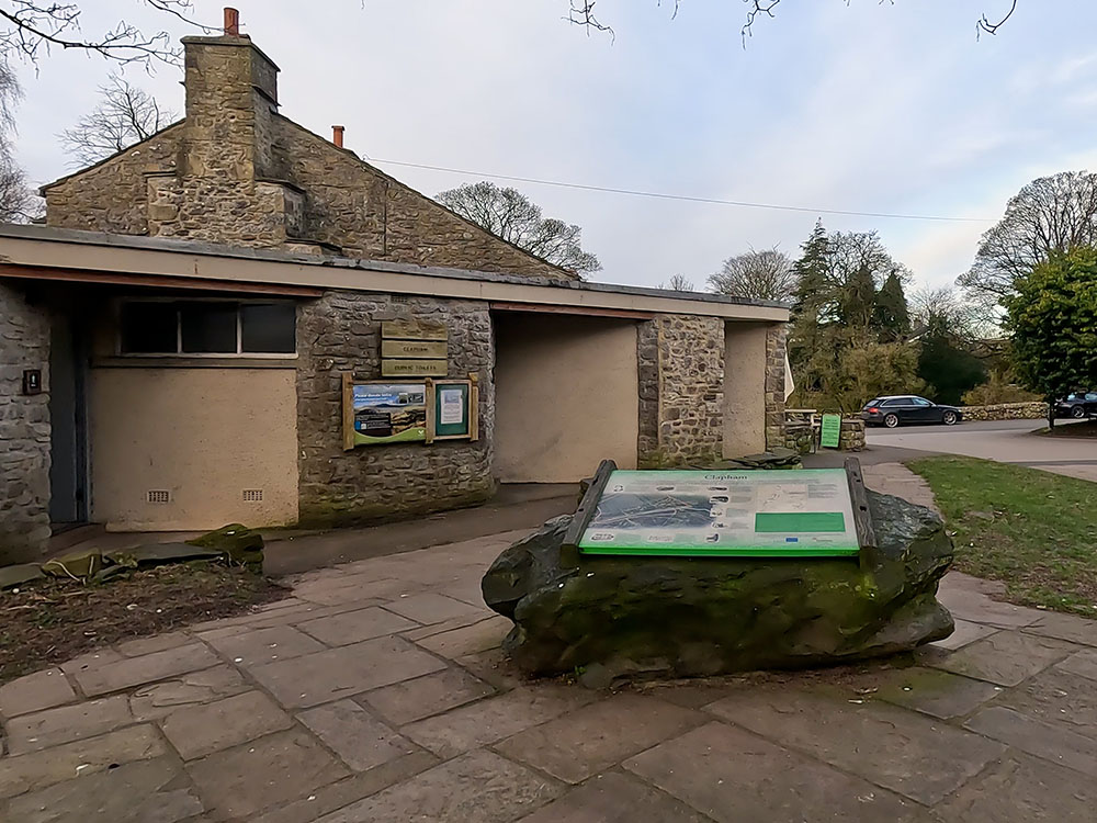
The walk starts in the pay and display car park in Clapham which is in the Yorkshire Dales. There is an information board in front of the toilets informing you about Clapham. Head towards the car park entrance next to the Lake House and turn right along the road.
Car park in Clapham in the Yorkshire Dales
Follow the road as it heads towards St James Church. To the right here is the track that we will return down at the end of the walk, but for now, we just follow the road around to the left as it passes by the church.
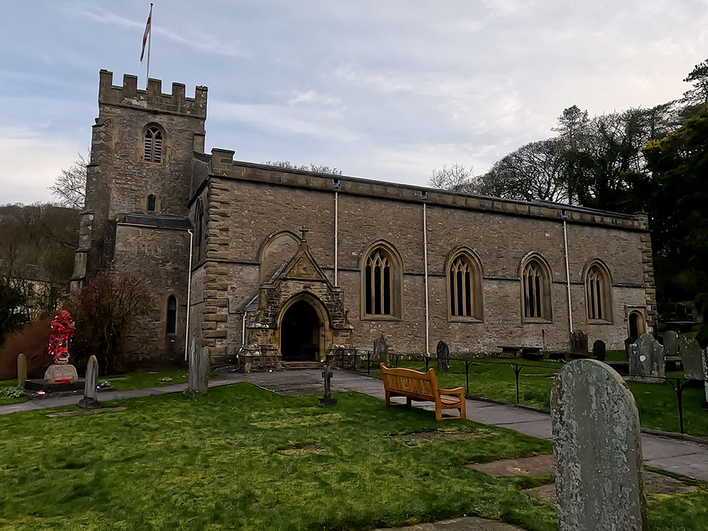
St James Church in Clapham
The road passes over Clapham Beck, which is fed further up from Fell Beck and originates on the slopes of Ingleborough before it tumbles into Gaping Gill, which we will visit shortly. It exits that via the Ingleborough Cave system and then drops into Clapham Beck.
Once over Clapham Beck, on meeting the road, turn right where shortly on your right you will get a view across to Clapham Falls, a man-made falls constructed in 1837 as part of the remodelling of the Ingleborough Estate.
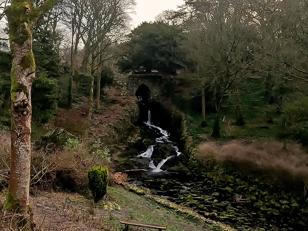
Clapham Falls
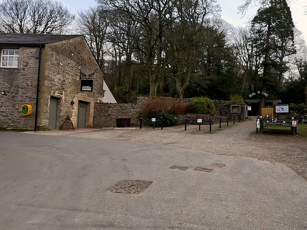
A few yards further at the top of this road is the entrance to Ingleborough Trail. There's an entry charge currently £2.50 in March 2023. You can use this route to look at the Trail if you wish, and if you do, you can see below where you re-join our walk further on. For now, we just follow the road around to the left in front of the Trail entrance, past the old Sawmill Café, and then continue along the road for about 75 metres.
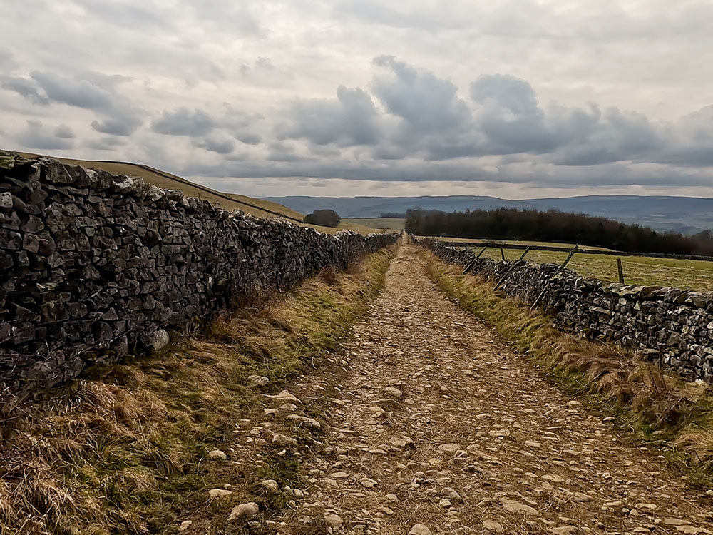
We then arrive at the footpath sign for Ingleborough and Gaping Gill. We turn right here following the footpath sign to walk up Clapdale Lane, which is a walled track.
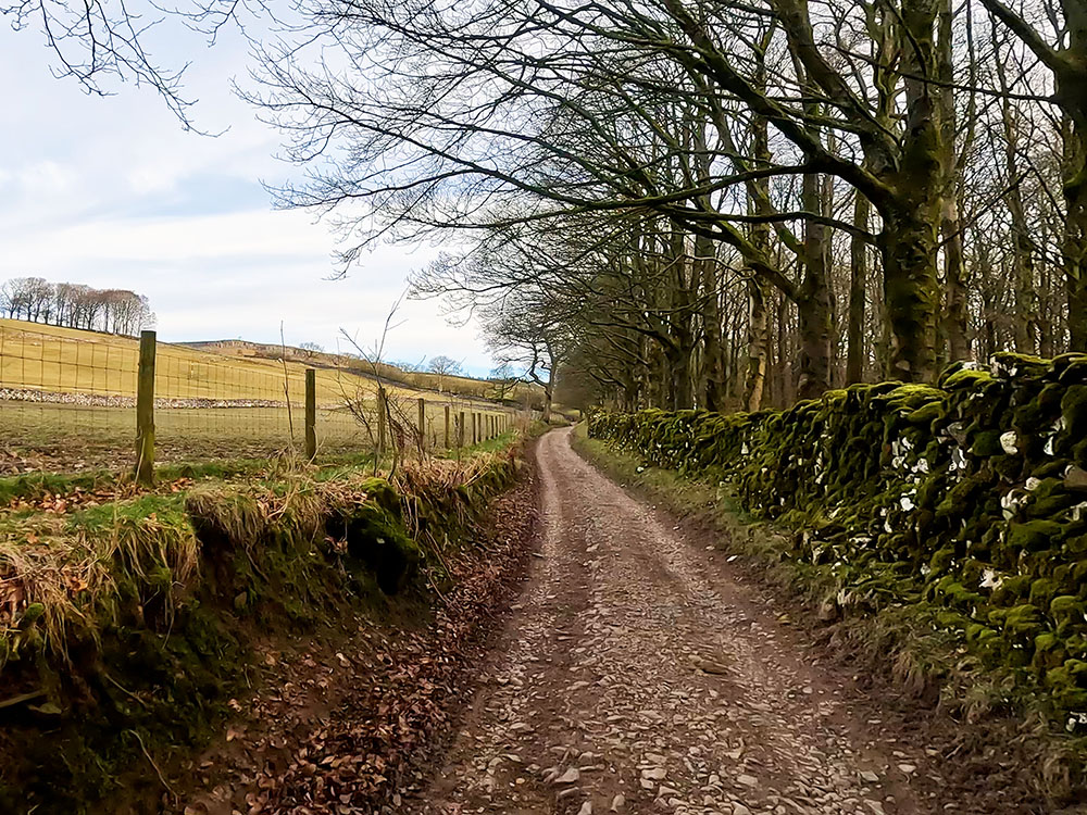
Clapdale Lane
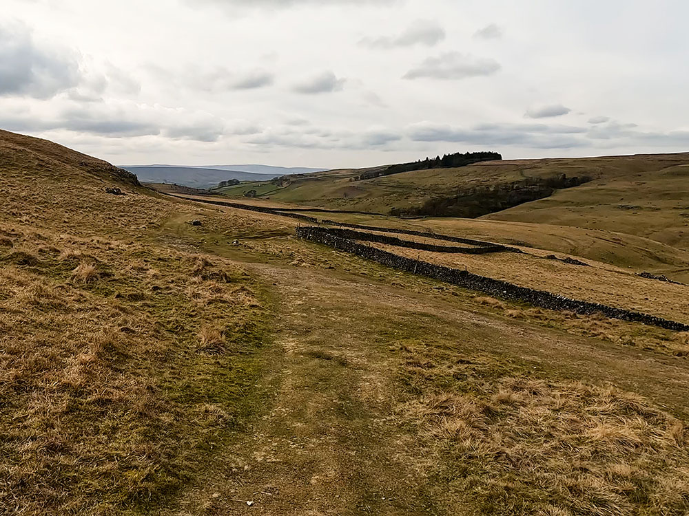
You walk along Clapdale Lane now for about one kilometre until you reach a gate. Pass through the gate and continue straight on. After about another 500 metres you reach the farm buildings at Clapdale. Just keep straight ahead on the track through the buildings and then pass through the far gate.
Immediately through the gate, you will see a footpath sign by a stone. We turn right here to follow the footpath downhill. We are dropping here down onto Clapdale Drive. This was the track that you would have walked up if you came through the Ingleborough Trail.
Footpath sign at Clapdale
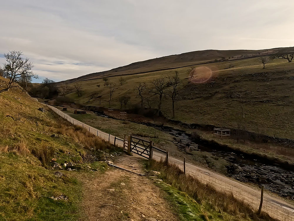
Dropping down on Clapdale Drive near to Ingleborough Cave
Head down to and pass through the gate to turn left onto the track. If you came up via the Ingleborough Trail, you join this walk again here.
Heading along the track you will likely hear a thumping sound ahead. The noise is coming from hydraulic ram pumps in the two stone brick shelters. They are used to pump water uphill from Clapham Beck to provide a water supply to nearby dwellings and troughs.
Heading past these along the track, we soon reach Ingleborough Cave. You can pay to go in and explore the amazing sculpted passages and cave formations which Ingleborough has to offer. These were hidden from view until 1837, when James Farrer and his workmen broke down the dams to reveal the cave as it is today. There is now a concrete path inside where you can walk along, and lighting to view the wonderful stalagmites, stalactites and calcite flows.
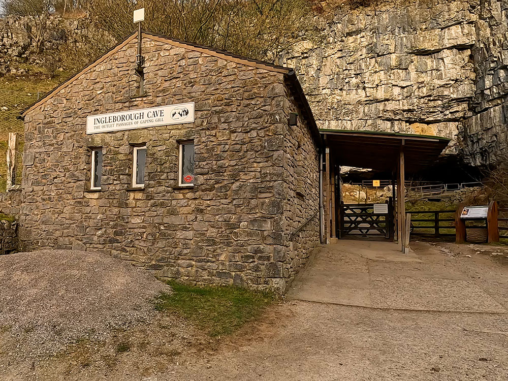
Entrance to Ingleborough Cave
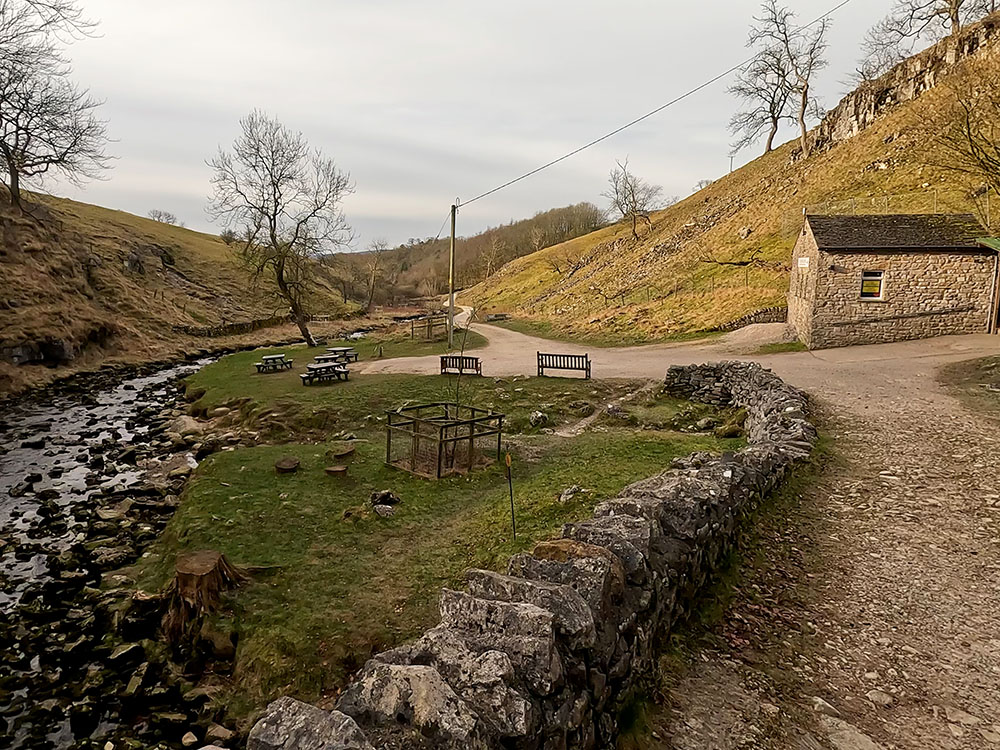
Clapham Beck and picnic tables in front of Ingleborough Cave
It is one of the country's natural wonders, and as the sign outside modestly claims the best show cave in Britain - they don't do things by half in Yorkshire!
If you are not visiting Ingleborough Cave, walk on past it over the small bridge and pass through the next gate. Walk on now along the track, pass through another next gate and then again keep straight on as we head up towards Trow Gill.
Trow Gill is an impressive wooded limestone gorge. It was thought to have been fashioned by meltwater from the last or the previous ice ages as a deep sheet of ice that covered Ingleborough slowly melted.
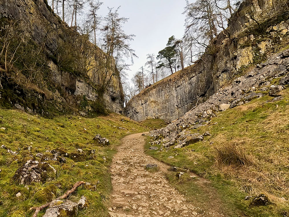
Heading into Trow Gill in the Yorkshire Dales
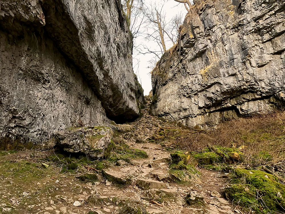
Trow Gill in the Yorkshire Dales
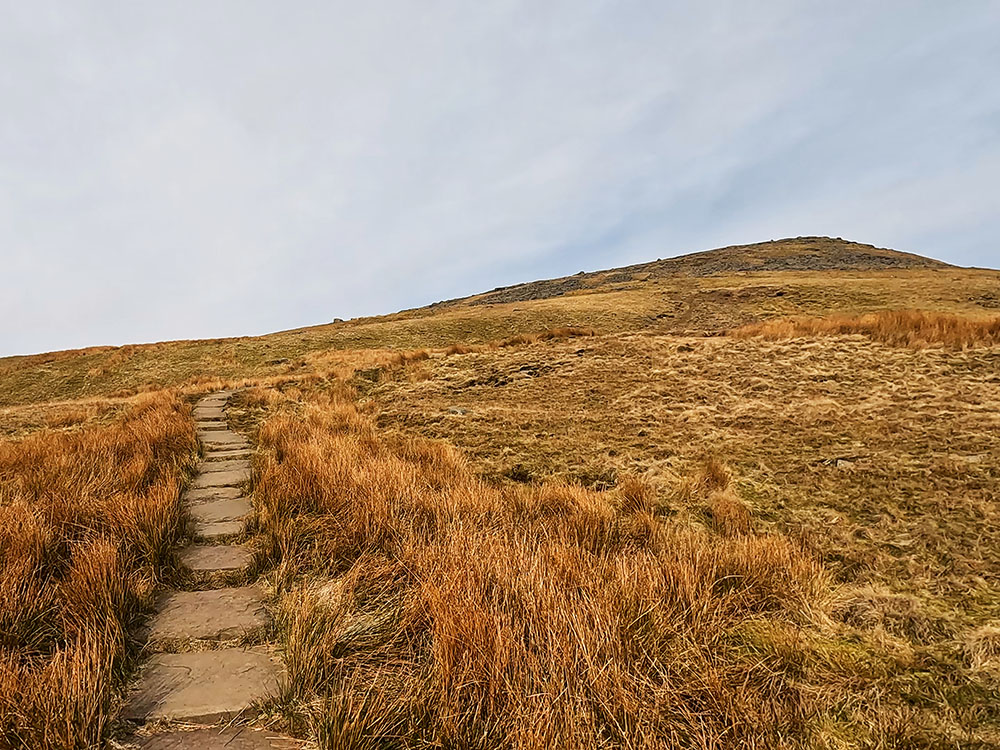
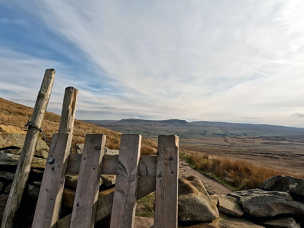
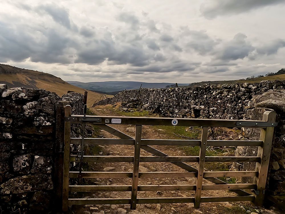
The path climbs up through the Gill. At the top of the short climb, the path starts to flatten and now you just walk ahead keeping on to the right of the wall. Keep on the path now for about three-quarters of a mile. If you keep looking over to the left, not long after Ingleborough appears on your left in the distance, you reach two wooden gates in the wall stile.
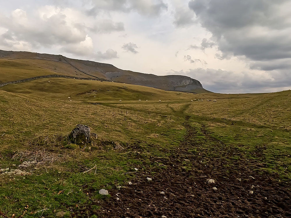
Pass over either of the stiles and ahead you can see the path to be followed, heading up Little Ingleborough with Ingleborough itself beyond that.
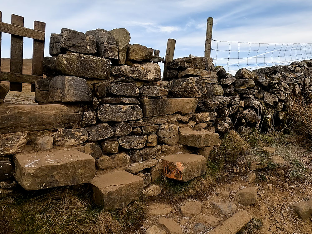
Gate on the way to Gaping Gill
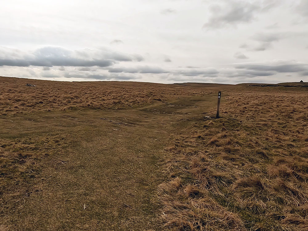
Once over the stile, head directly away from the wall in the direction of Little Ingleborough ahead. After a couple of hundred metres, the path splits. If you want to go via Gaping Gill take the right-hand path, if not just take the left-hand path and we'll be re-joining that shortly after Gaping Gill.
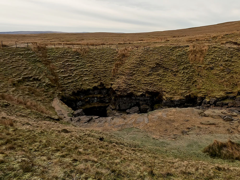
Looking down on Gaping Gill
Heading on Gaping Gill is then soon reached. Gaping Gill is one of the largest underground chambers in the UK. Fell Back runs into the Gaping Gill pothole that we can see here and falls 98 metres to the floor of the chamber, so forming the highest unbroken waterfall in England.
Looking back down the path whilst heading up Little Ingleborough
As the nearby sign says, and other signs say further down, keep yourself and any children or dogs well away from the top as it's unfenced and it's a sheer drop. Very sadly, people have died at Gaping Gill.
If you do feel the need to explore it further, twice a year, Bradford Pothole Club for a week in May and Craven Pothole Club for a week in August, set up a winch above it and you can be lowered down into it in a chair. More information about the charge, what to wear and when it takes place is available on their respective websites.
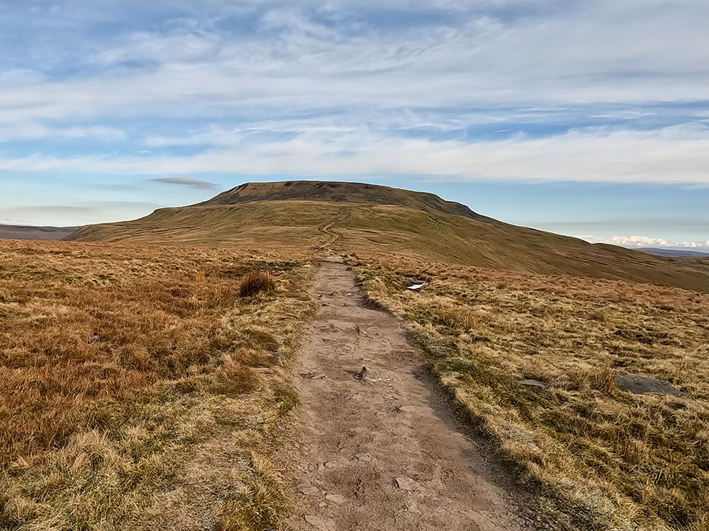
Head back around the side of the fence to head over and re-join the path that heads up onto Little Ingleborough. It is just over a kilometre now from here up to the summit of Little Ingleborough.
The path up Little Ingleborough
As you climb, the height gained affords views around to Simon Fell Breast that will form part of our return route and then to the right of that is Pen-y-ghent which is the lowest of what is known as the Yorkshire Three Peaks with Whernside being the highest and Ingleborough the next highest. The Yorkshire 3 Peaks Walk is a 24.6-mile circular walk with over 1,600 metres of climbing, that passes over all three mountains.
Then as we look further around, we look back down the path that we just walked up and then on the horizon is the distinctive outline of Pendle Hill. The final part of the climb now up Little Ingleborough does get a little bit steeper. Once on Little Ingleborough, you can see the outline of the Lakeland Fells to the north and then around to Morecambe Bay out to the west. From Little Ingleborough, at 639m in height, looking further around you can still see the distinctive outline of Pendle Hill on the horizon. Then further around from that you can see Pen-y-ghent.

Looking towards the Lakeland Fells and Morecambe Bay from the cairn on Little Ingleborough
Head the few yards back over to the path from the cairns and then continue on towards the summit of Ingleborough itself.
The path up towards Ingleborough from Little Ingleborough
As the path starts to flatten as the summit plateau is reached, you arrive at a cairn. We turn left at this cairn, pass by a second cairn and then head on towards the trig point. In bad visibility, you should always take a compass bearing from here to the summit and again leaving the summit to pick up the downward path.
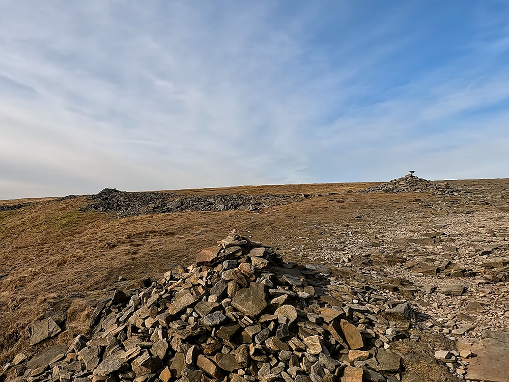
The two cairns on reaching Ingleborough summit plateau
Looking back down the path towards Little Ingleborough from Ingleborough
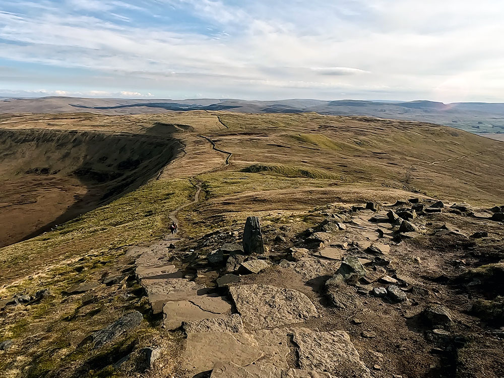
Many people get disorientated in bad visibility on the top of Ingleborough. At 724 metres high, it is the second highest of the Yorkshire Three Peaks behind Whernside. Ingleborough on a clear day provides views to the Lakeland Fells to the north, and as far away as the Snowdonia range to the south. Wandering its edges provides excellent views across to the Howgills, Whernside and the Ribblehead Viaduct.
If this walk is giving you a taste for the Yorkshire Dales, don't forget to check out our list of the best Yorkshire Dales walking books.
The name Ingleborough is believed to be derived from 'Ing' being the Old English for 'peak' and the old English word 'Burh' meaning a fortified place. The summit plateau of Ingleborough itself is encircled by stone remains containing the foundations of Iron Age huts believed to have been built by the Brigantes, the largest group of tribes in Iron Age Britain in the first century A.D.
For more on Ingleborough, its geology, and more walks, check out our Guide to Ingleborough.
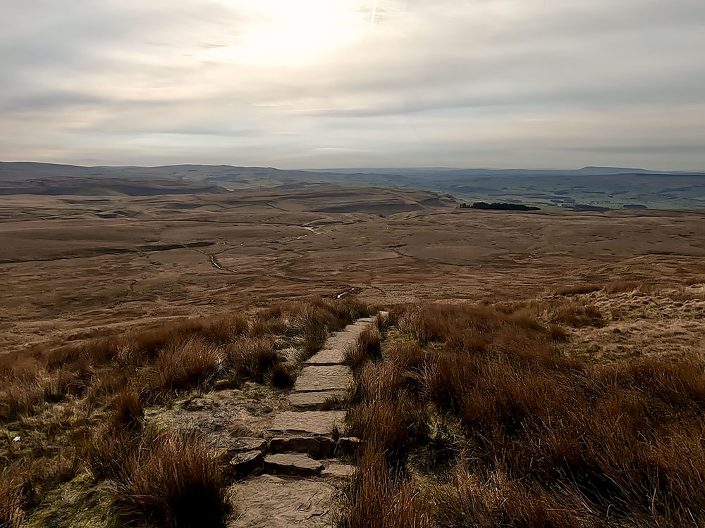
Near the trig point on Ingleborough summit is a weather shelter. Walking in a line from the trig past the weather shelter, we head along the sketchy path away from it, which quickly pulls in by the northern edge of the summit plateau. In bad visibility ensure you take a compass bearing before leaving the weather shelter so that you do not miss the path.
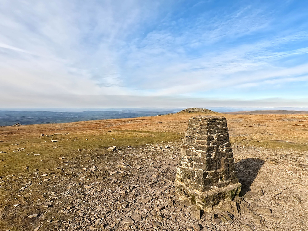
The Lakeland Fells over the trig point on Ingleborough summit
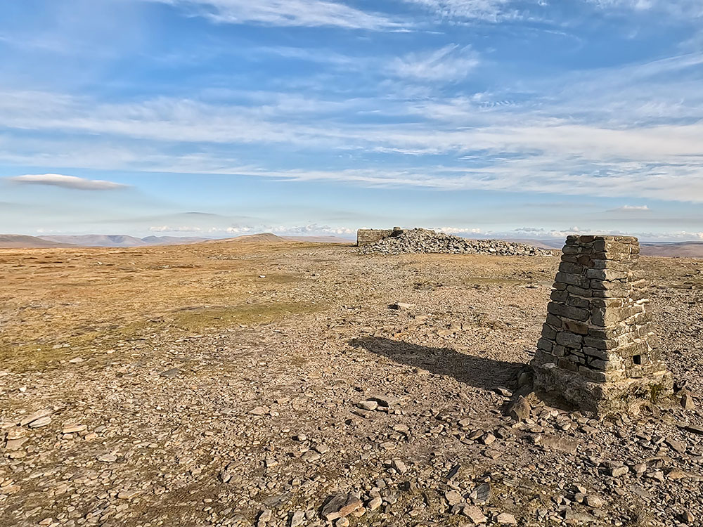
Trig point on Ingleborough and weather shelter
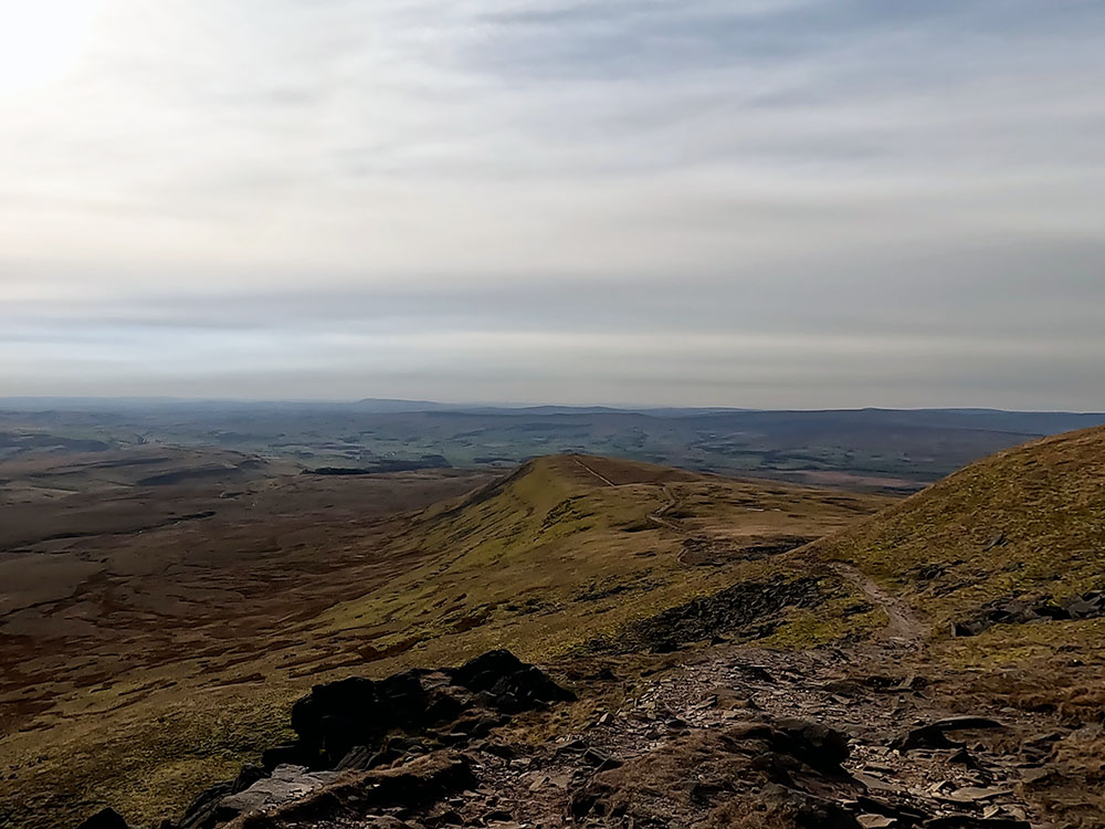
Upon reaching the edge of the summit plateau, it does reveal magnificent panoramic views across to the Ribblehead Viaduct, Whernside and the Howgills beyond.
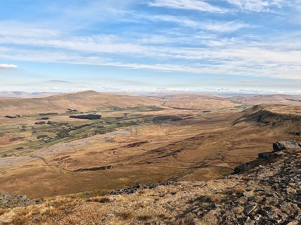
Ribblehead Viaduct, Whernside and the Howgills beyond
We continue along the edge of the summit plateau in roughly an easterly direction, passing cairns from time to time. Then, before the summit plateau starts to fall away ahead, over to the left slightly below, you can see a large boulder.
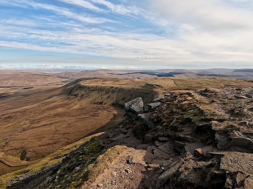
Path heading down the side of the large boulder
The path starts to head down here, diagonally left, to pass close by the left-hand side of the large boulder. As you descend, the path quickly becomes much more obvious and becomes flagged underfoot.
The flagged path heads down to a stone marker, where the path splits. The left-hand path here is the path up from the Old Hill and forms part of the 'Three Peaks' route to reach the summit of Ingleborough.

Where the path splits at the stone marker on Ingleborough
The right-hand path is the one we'll be taking and again forms part of the Yorkshire Three Peaks path, but this time back to Horton. Again, in bad visibility, this marker is crucial to ensure you head off Ingleborough in the right direction.
Take the right-hand path where you soon pass by a small tarn on your left. Keep heading downhill, where after a while the path lessens in steepness as it heads across Simon Fell Breast. If you look down from time to time, you can see some grooves in the stones and flags in the ground. I'm not sure if these were made by some heavy machinery that's been up there, or maybe grooves in recycled flagstones from old mill floors, but if anyone does know, please let me know in the reviews section below.
If you stop to have a look around from time to time, over to your right you can now see Little Ingleborough and Ingleborough in a different profile. Eventually, you reach a wall stile. Pass through the small wooden gate built into it and head away from the wall along the path.
Pen-y-ghent over the gate on Simon Fell Breast
The path is now heading directly towards Pen-y-ghent in the distance. Keep on the path as it slowly descends heading down flagged sections and across wooden boards along the way. The path drops down and passes by some old ruins, which are an old shooting hut and are marked on the 1:25,000 map if you need to find out where you are.
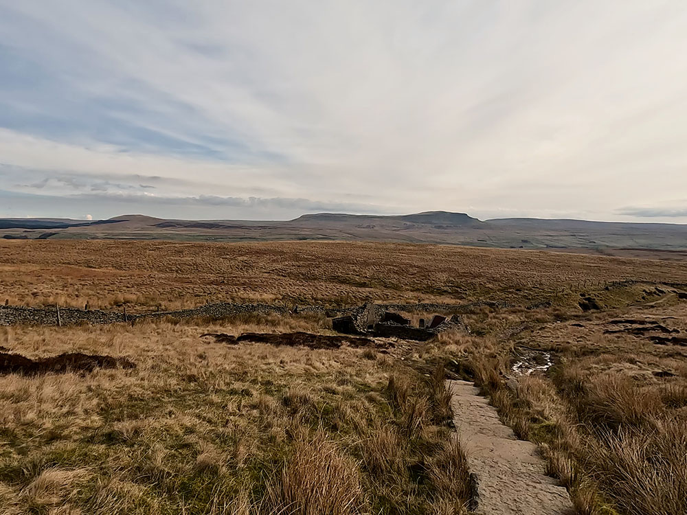
The flagged path leading down to ruins of shooting hut with Pen-y-ghent on the horizon
Shortly after these, pass through the next gate and then head straight on for about 50m to where the path forks. The path forks by the wooden way marker with the left-hand path heading towards Pen-y-ghent being the Three Peaks route that heads towards Sulber and then eventually on towards Horton in Ribblesdale. We're ignoring that for this walk, but if you want to check out that path to Horton in Ribblesdale, have a look at our Ingleborough via Sulber, Trow Gill, Gaping Gill and Little Ingleborough from Horton in Ribblesdale walk.
Path junction where we take right-hand path
We are going to take the right-hand path there. Head along this grassy path which pulls in briefly by a wall. If you stop and look around to the right, you can see Little Ingleborough, Ingleborough and then Simon Fell from yet another angle. There are many grassy paths like this in this area of the Dales - it's almost as if they have been mown for you.
Grassy path
Follow the path as it winds its way slowly downhill. After about half a mile, the path heads through an area of limestone. Over the limestone, you can see across to Pen-y-ghent. The Yorkshire Dales is home to some magnificent limestone landscapes and contains almost half of Britain's limestone pavements. Limestone allows water to trickle through it, which over time has shaped the extensive cave systems that lie in the many parts of the Yorkshire Dales.
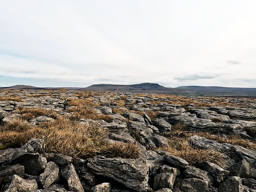
Pen-y-ghent over the limestone
Path through the limestone
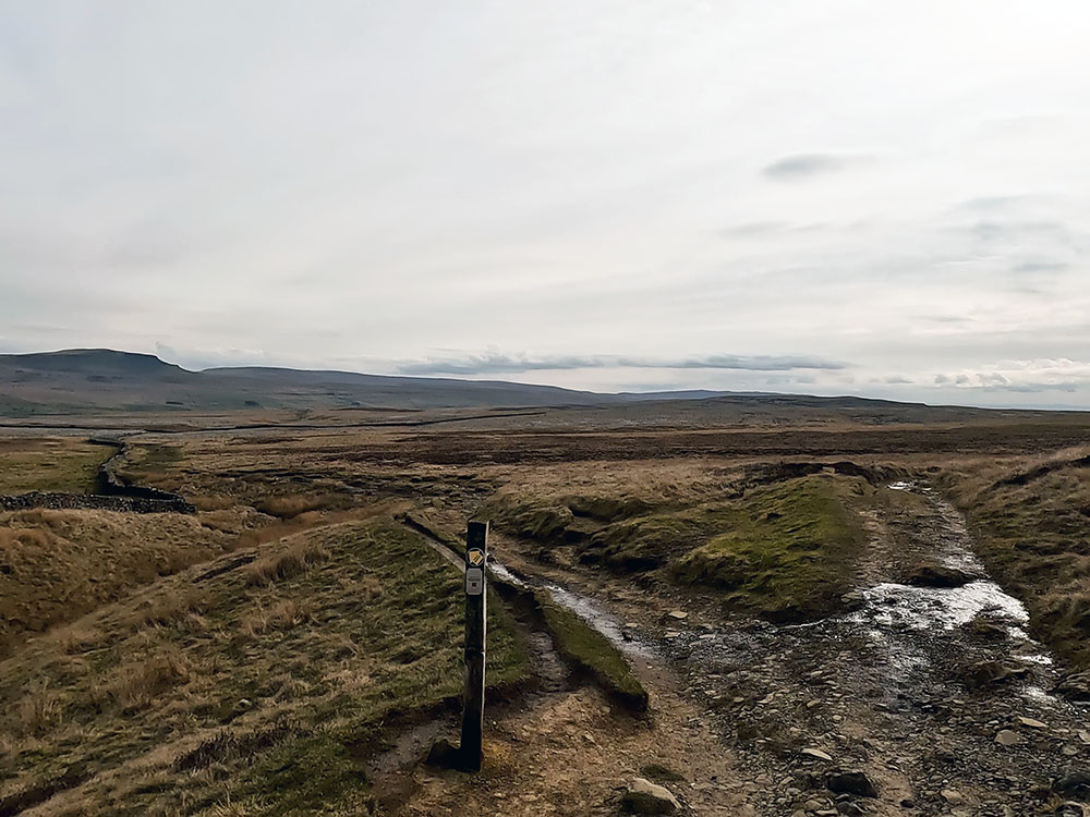
Continue along the path through and out of the limestone. Continuing on, at one point the path passes the remains of a tumbled-down wall. Not long after that, we meet another path coming in from the side by a wooden waymarker. We turn right here and head on towards the cairn on the horizon.
Turning right at the wooden marker
There is another path almost straight away on the left to Crummack, which could be an alternative route back and you could also take in the Norber Erratics that way.
We ignore that and just walk straight on. At another waymarker, the path splits. You can take either path here as they meet up a little further on, but as I wanted to visit the cairn you can see on the horizon, I'm going to take the left-hand path.
Continue along the path towards the cairn. The path does just bypass the cairn to the left, but as with all these little mini tops, I find I always feel I have to visit them. Here again, you can see Little Ingleborough, Ingleborough and Simon Fell behind the cairn on the horizon.
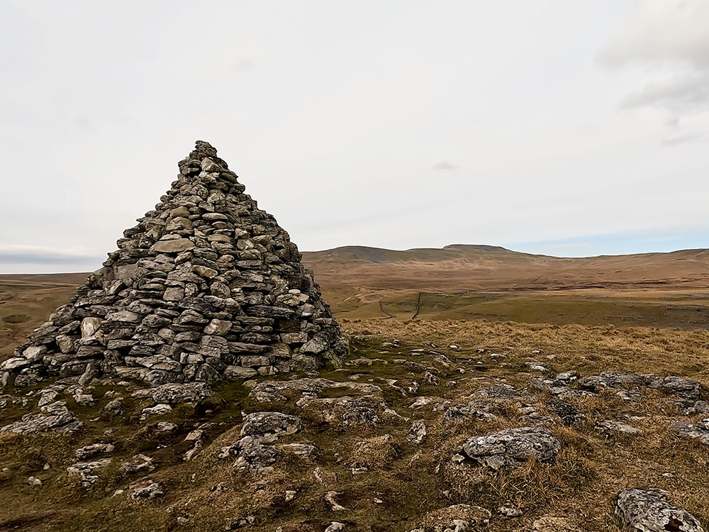
Ingleborough, Little Ingleborough and Simon Fell over the cairn
From the cairn, head back down to and turn right along the path that you were just on. Looking ahead as you walk down, the first lot of trees that you can see ahead are those around Trow Gill that we walked through earlier. If you took the right-hand path at the last path junction, as you head down that is the path here that's coming in from the right now to join back up with us.
Dropping down towards Long Lane
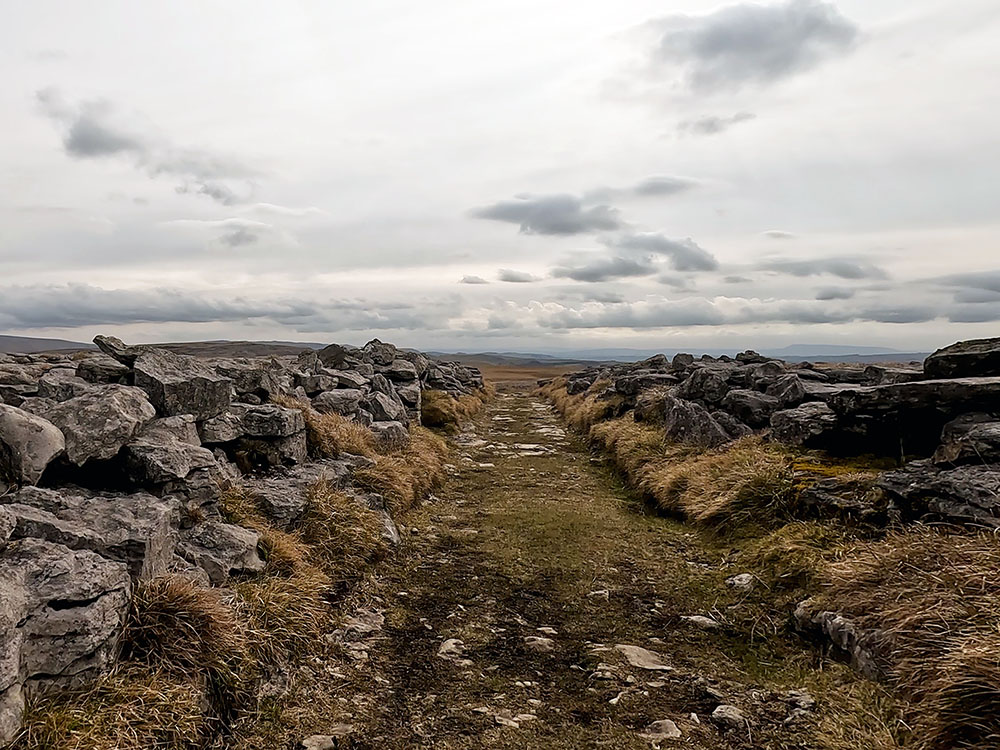
Head down to pass through the gate, then keep walking straight ahead towards the trees. Pass through the next gate to enter Long Lane.
If you are enjoying this walk, whilst you are in the area, and if you have time on another day, why not check out the Ingleton Waterfalls Trail?
Entering Fell Lane
Not too far down the lane, there is a stile on the right. If you paid for entry into the Ingleborough Trail and want to return that way, the path from this stile leads back down onto Clapdale Drive. So you just turn left and head back down into the Trail.
Heading along Fell Lane
For now, we just continue straight on. If you have any thoughts about this walk or find any issues with any of the footpaths used, please share that with us in the review section below.
After about one mile on Long Lane and just before the lane rises, if you look over to the left, you can see Robin Proctor's Scar, with supposedly the scar being named after a local farmer who lived in Crummack.
Robin Proctor's Scar
He would ride his horse every night down to the local inn. Many times he came back drunk and often fell asleep on the horse and from time to time fell off it. The horse, walking the route he knew many times, knew the way. Then one night after getting very drunk, he came out of the inn and got on the wrong horse in bad weather. The horse wandered along the lanes and over the moors until eventually heading over the edge of the scar - Robin Proctor's Scar.
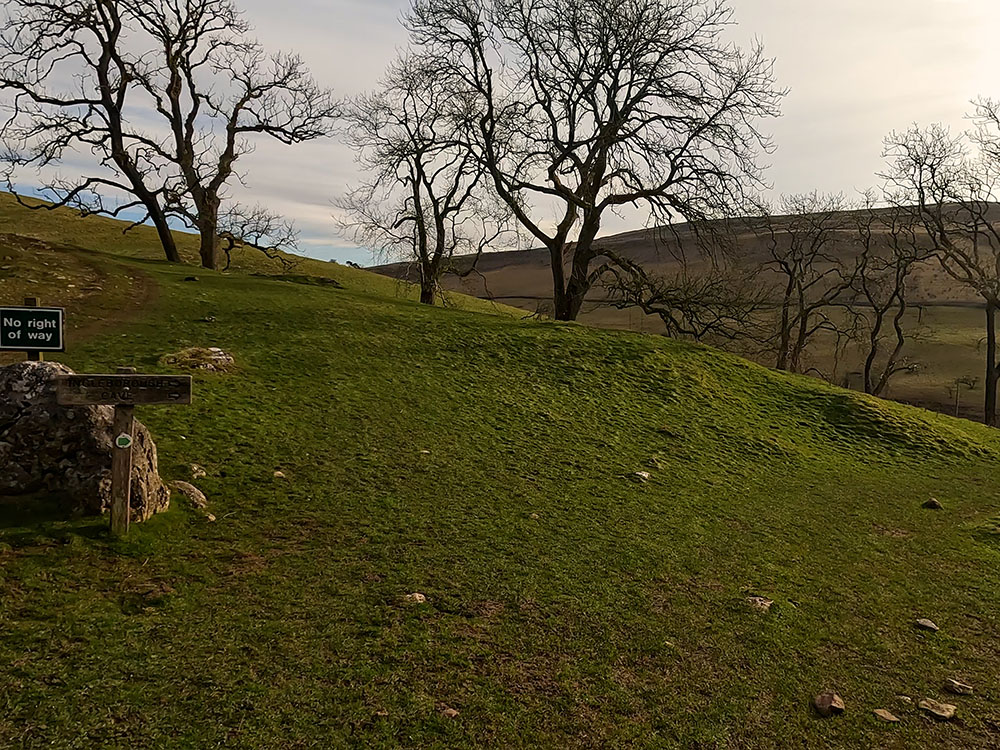
Keep on now along the track, climbing the small hill. As the path flattens, another lane comes in from the left. If you did change the ending of this walk and headed via Crummack and maybe Norber, this is the lane that you would come back along.
We ignore this lane though and just follow our lane around to the right following the bridleway sign. The track heads downhill for a few hundred metres before it reaches two tunnels. Pass through the two tunnels, taking care as the ground is uneven and again it's quite dark in the middle of the first one.
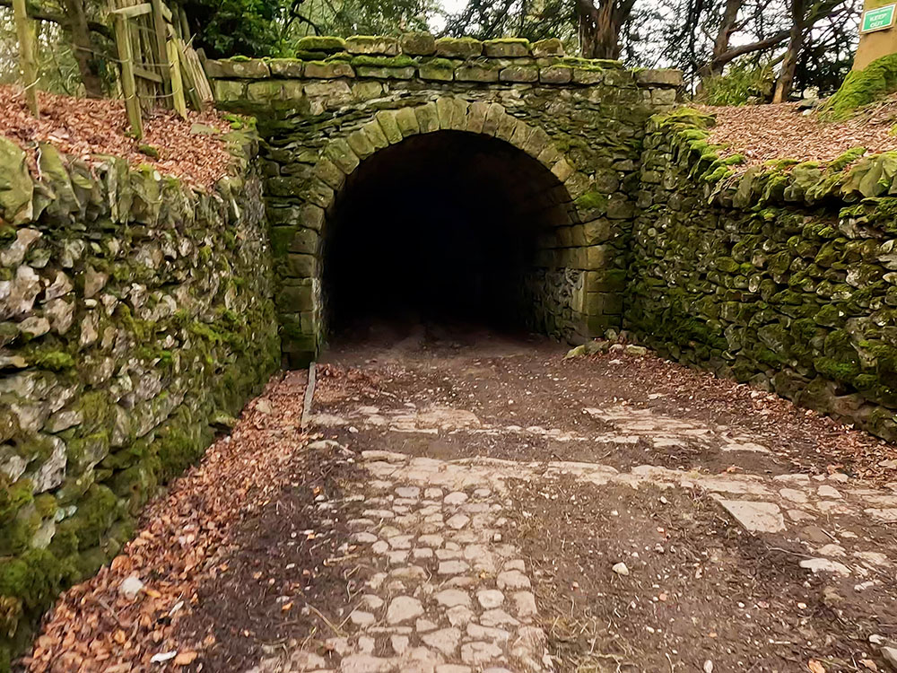
The entrance to the first tunnel heading back into Clapham
Once through the tunnels, over to the right you can see you have arrived back at the church. Follow the track back around the bend, and then upon meeting the road, turn left and head back along the road. Turn left back into the car park.
If you want somewhere to eat and drink after the walk, there are a few places within 100m or so of the car park. The first place is on the corner of the car park itself. The Lake House Bar and Kitchen is dog-friendly and specialises in local real ales, small brewery craft ales and real cider. It offers food all day long, including its speciality pizzas. I don't think they open every day of the week, so maybe check first.
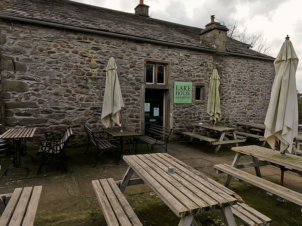
Lake House Bar and Kitchen in Clapham
If you exit the car park and turn left and head towards the white building at the end of the road, you quickly reach the Croft Café. It was closed when I passed and looked like it maybe hadn't been open recently, but I may be wrong though. Take a look if you are there and if you know any more, please let me know in the review section below.
Just past that is the New Inn which has accommodation and I believe is dog-friendly. It serves brunch 10 to 12, lunch 12 until 3 and evening meals 5 until 9. It serves coffees, teas, a range of ales and gins from around the world. There are a few seats at the front and then a beer garden around the back.
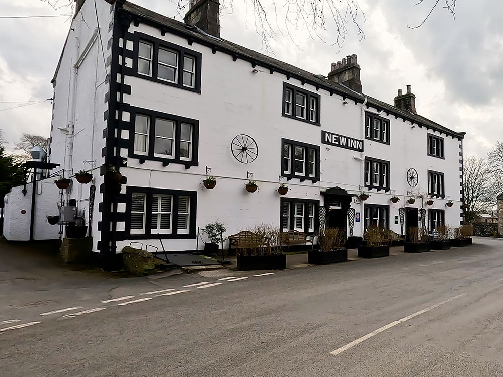
New Inn in Clapham
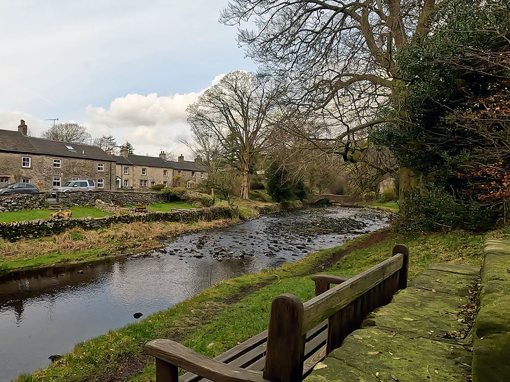
Heading back towards the car park on your left by the wall is the market cross. The base is believed to date from around the time when Clapham was granted market status in 1201, whereas the cross itself was erected in 1897 to mark Queen Victoria's Diamond Jubilee. If you brought your own sandwiches, the bench in front of it is an excellent place just to sit and watch the water go by.
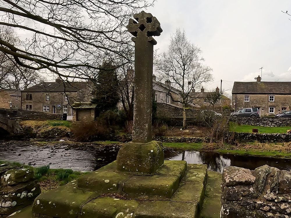
Market Cross by Clapham Beck

Bench with a view in Clapham
The final place to eat and drink after the walk is the Old Sawmill Café we passed near the start of the walk by the Ingleborough Trail entrance. It's open 9:30 to 4:30 each day, except for a short period over Christmas. It is dog-friendly, serves teas, and coffees, and has a small menu and cake bakes. It also has outside seating.
The Old Sawmill Café
Not food related, but certainly worth a mention is that next to the New Inn, is the Cave Rescue Organisation and Mountain Rescue post should you ever need them. There's a sign that says dial 999, ask for the Police. They will then alert the local mountain rescue team should they ever be needed.
Gifts and presents for hikers and walkers
Are you struggling to pick the perfect gift for your hiking-loving friend or family member? Don't fret! Explore our curated selection of top-notch gifts for walkers and hikers that will have them trekking with joy on their special day.
What to wear and take on your walk or hike
Whether you are a seasoned hiker or new to walking, wearing and taking suitable hiking kit and clothing is essential for a day hike for your comfort and safety. So we have put together a hiking essentials checklist to cover all you'll need. Our Hiking Essentials checklist for 2026 takes you through planning your walk, the hiking essentials checklist itself, optional extras, explanations, and recommendations for all the hiking essentials.
Check out the reviews for this walk: