By using this website, you agree to our use of cookies (needed to provide our website’s features) and our Terms of Use.


A circular walk from Clapham which affords wonderful views of Ingleborough and Pen-y-ghent. It heads across the limestone pavements of Thieves Moss, then on to Moughton Scars before the wonderfully shaped Norber Erratics.
In accordance with our Disclaimer, you agree to take full responsibility for any use you make of the information contained in these pages.
This page contains affiliate links. If you buy products or services via these links, we may earn a small commission at no cost to you.
| Walk title: | Thieves Moss, Moughton Scars and Norber Erratics walk from Clapham |
| Author: | Andrew Forrest - May 2023 |
| Walk start point: | Pay and display car park in Clapham (grid reference SD 745 692). What3words: makeovers.dares.daffodils |
| Parking: | As above. A small amount of roadside parking is available, but please park responsibly as Clapham does get busy, especially at weekends and bank holidays. |
| Directions to nearest parking place: | Google Maps: get directions here / What3words: graver.joined.brightens |
| Walk distance: | 13.8 km |
| Estimated walk time: | 3 hours 50 minutes |
| Height climbed: | 410 metres |
| Technical difficulty: | Moderate - as determined by our interpretation of the Ordnance Survey guidance on technical difficulties. This walk can be shortened as shown in the video. |
| Peaks / summits: | None |
| Map: | Ordnance Survey - Explorer OL2 (Yorkshire Dales - Southern & Western Area) Buy this map from Ordnance Survey |
| GPS/GPX file: | Download available to registered users - Register and Login here - It's FREE to register |
| Facilities / refreshments: | The New Inn, Lake House Bar and Kitchen, Old Sawmill Café, Clapham Village Store and Croft Café in Clapham are all within a couple of minutes' walk of the car park. There is also the Game Cock pub in nearby Austwick - check out the walk video for further details. |
| Nearest town: | The walk starts in Clapham in the Yorkshire Dales |
| Local self-catering accommodation: | View self-catering accommodation close to the start of this walk |
| Local hotels, inns and B&Bs: | View hotels and inns close to the start of this walk from The Inn Collection Group |
Estimated walk time
Walk time estimates used are from the Ordnance Survey mapping app, which uses a refined Naismith's rule, adjusted by OS overlaying their own data collected from more than one million people using the OS mapping app. Naismith's rule allowed one hour for every three miles walked and added pro-rata an additional hour for every 2000ft of ascent - roughly one hour for every 5km, plus one hour for every 600m of ascent.
Ordnance Survey Mapping App
Use on any device and make it easy to explore the great outdoors for just the price of a coffee a month. Premium allows full UK access to all OS Explorer and Landranger mapping, along with the ability to import and export routes, save maps offline, aerial 3D, and print A3/A4 maps.
This Thieves Moss, Moughton Scars and Norber Erratics walk from Clapham in the Yorkshire Dales takes approximately 3 hours and 50 minutes.
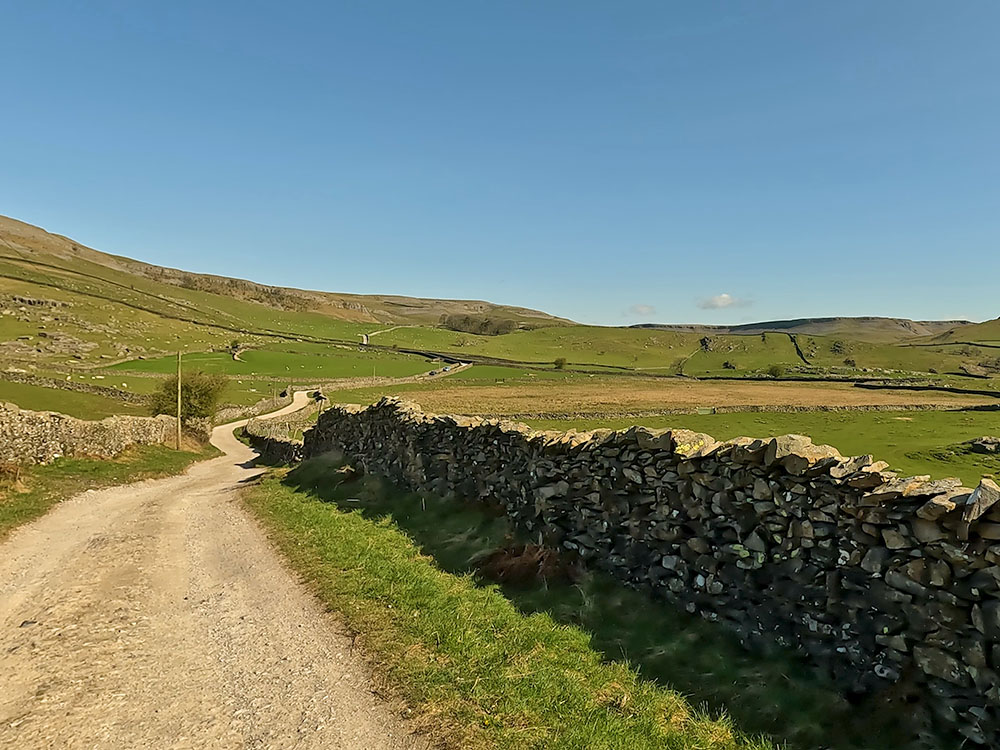
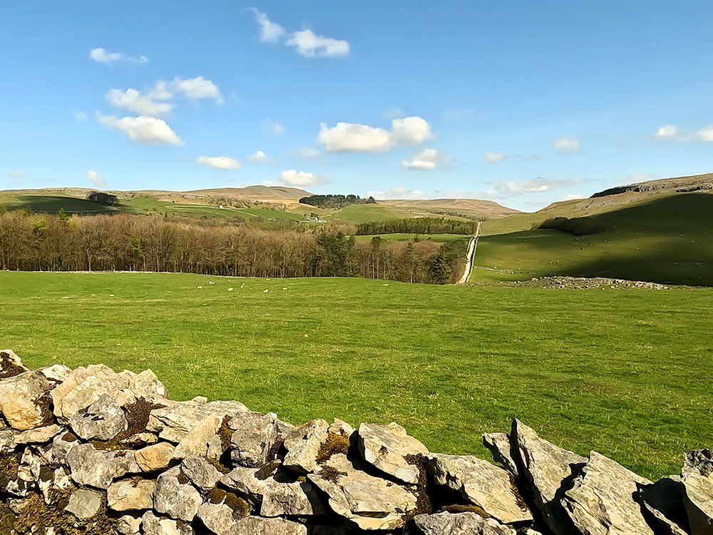
We leave Clapham, taking a short climb up a walled lane. We then walk along Long Lane, a track which forms part of the Pennine Bridleway. A cairn shortly after leaving Long Lane affords views of Ingleborough and Little Ingleborough and this wonderful 360-panorama also takes in Pen-y-ghent on the horizon in the direction of Moughton Scars.
We continue walking along the Pennine Bridleway before dropping down onto and through the limestone pavement at Thieves Moss and through Moughton Scars.
From here we head across Crummack Dale to arrive at Norber, where many unusual Erratics can be found. Erratics are rocks that have been transported by glaciers and the movement of ice and are usually a different composition to the underlying bedrock on which they came to rest.
We then follow walled lanes back down into Clapham
This full Thieves Moss, Moughton Scars and Norber Erratics walk from Clapham is shown in the video and the route for the walk is shown on the Ordnance Survey map - both above. Below is a brief description of the walk. Places where you can eat and drink after the walk are shown at the end of the video.
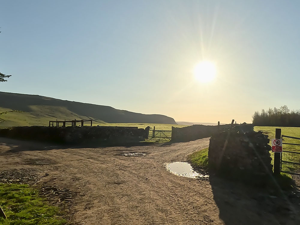
From the pay and display car park in Clapham in the Yorkshire Dales, we leave the car park by passing by the side of the toilets and then passing by the Lake House bar and kitchen.
We then turn right onto the road to head up to the church. St James Church was originally built in 1829 before being destroyed in the Battle of Britain in 1940. The church was rebuilt and reopened in 1958.
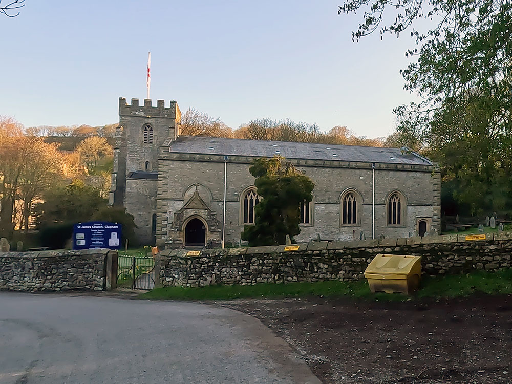
St James Church in Clapham
With St James Church in front of us, we turn right off this road to head along the track that bends around to the left. Then shortly afterwards, pass through two tunnels. Watch your footing through these two short tunnels as the ground is a little uneven in places.
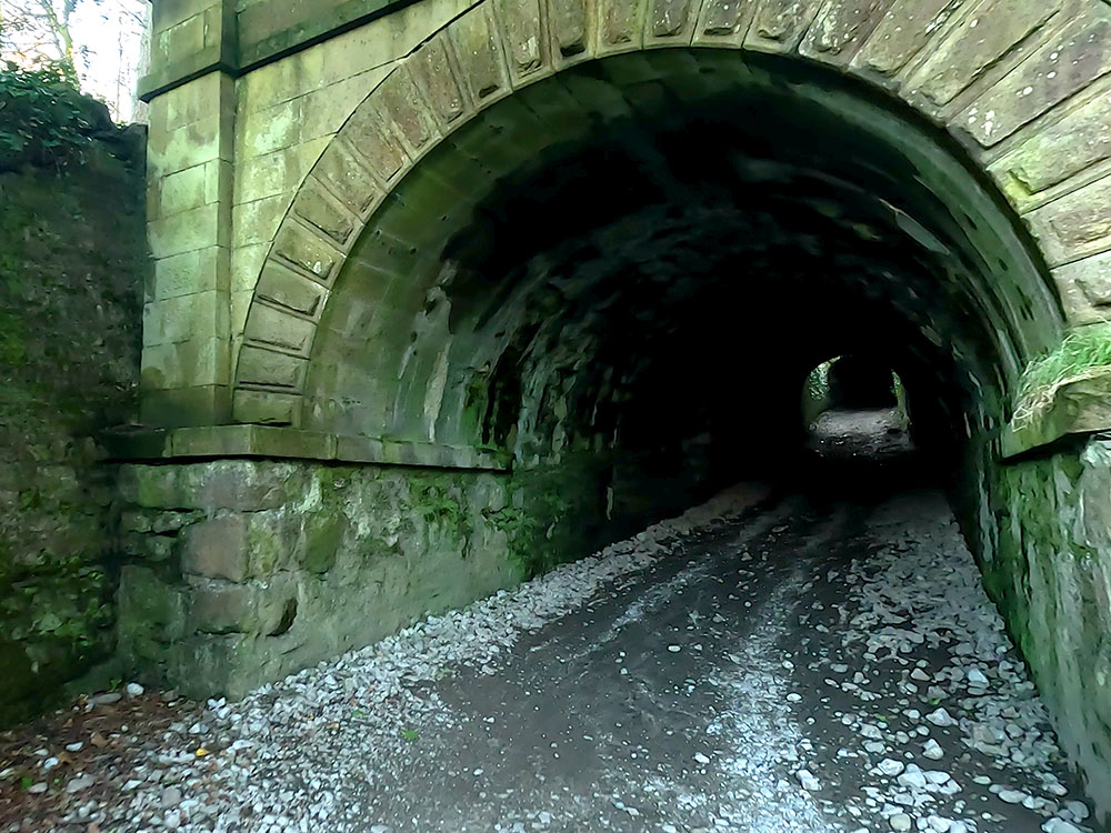
Track entering tunnel in Clapham
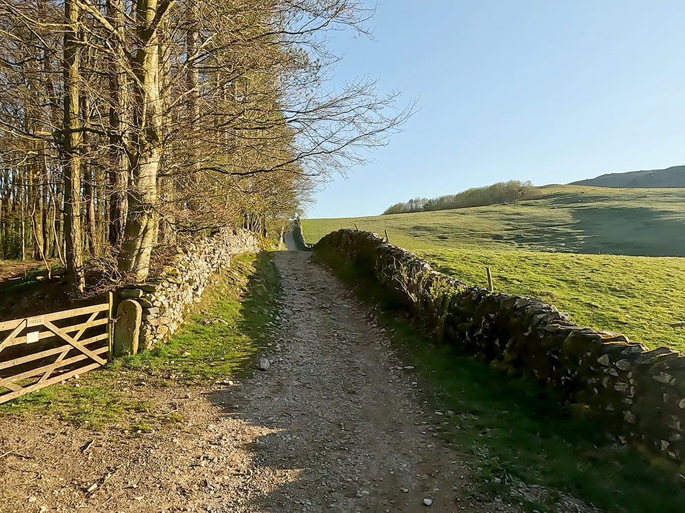
We then walk up the walled track. As the track flattens, it splits. The track straight on here goes to Austwick and forms part of our return route.
Track junction - Austwick straight on along Thwaite Lane and Long Lane to the left
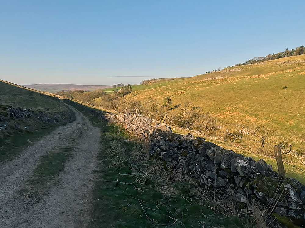
For now, though, we just turn left to walk down Long Lane. Long Lane initially descends affording views over to the right of Robin Proctor's Scar and then ascends before levelling to more of a gentle climb.
Dip in Long Lane
The walled Long Lane is just over a mile long. From time to time, stop just to look around to see the additional views the small height gain is afforded us. After a while, pass through the gate across the lane. Over to the left here, you can see the entrance to Ingleborough Caves. If you check out our Ingleborough walk from Clapham, we do walk past the entrance of the cave.
Looking down across to Ingleborough Cave from Long Lane
Just before the end of Long Lane over a stile that leads left down onto Clapdale Drive below, you can see the entrance to Trow Gill. Ignore this and keep on along Long Lane until you reach another gate at the top of the lane.
Looking across to Trow Gill from Long Lane
Looking back down Long Lane
Pass through the gate and turn right to walk uphill along the grassy path in the direction of the cairn visible on the horizon.
Grassy path heading away from the gate at the top of Long Lane
Every so often, especially in the southern end of the Yorkshire Dales, you end up walking through some limestone. Upon reaching a wall, just before passing through this next gate, if you look over to the left now, you get a good view of Ingleborough. Looking around, you can also see the top of Trow Gill and the grassy path that we have just walked up.
Looking left towards Ingleborough and Little Ingleborough
Pass through this next gate.
Continue ahead walking along the grassy path. In a short distance, the path splits. They re-join a little further on, so it doesn't really matter which you take. Just before the wooden waymarker, the path splits again. Take the right-hand path here as you want to head by the cairn ahead on top of the hill. The paths do re-join further on.
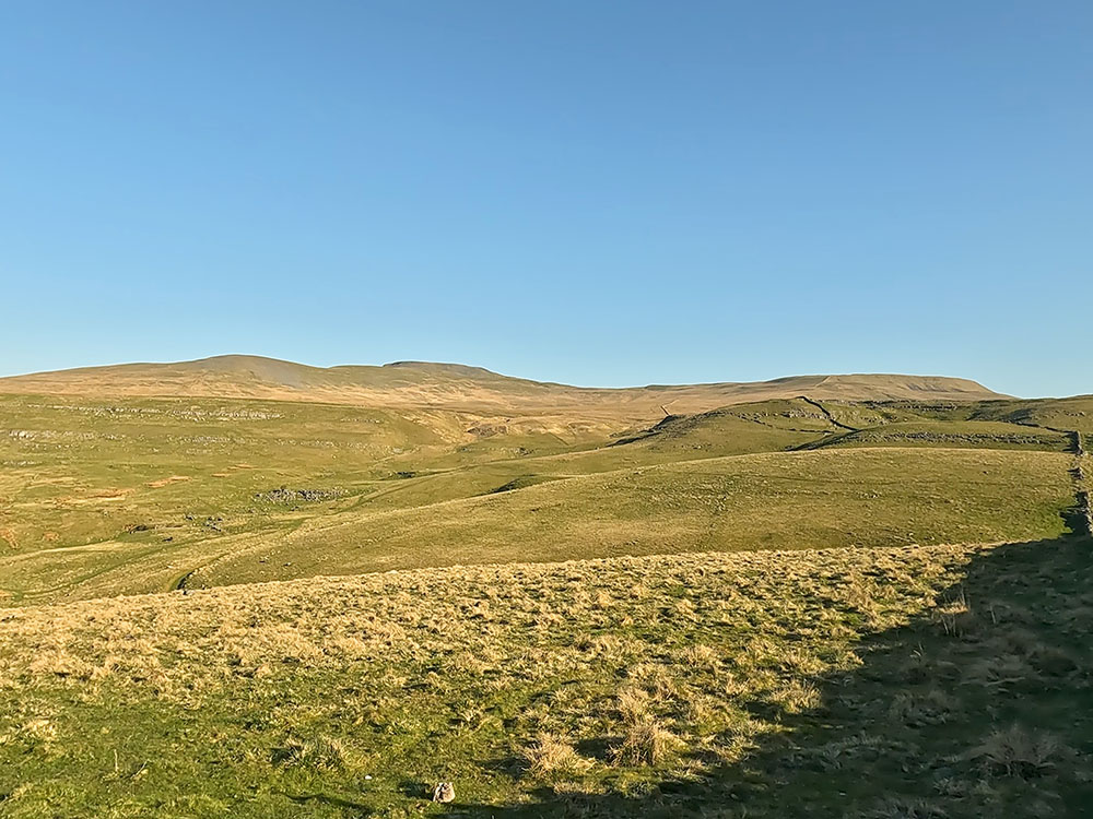
If you want to visit the cairn, divert left a short distance off the main path. Straight ahead now the silhouetted outline of Pen-y-ghent comes into view on the horizon. Pen-y-ghent along with Whernside and Ingleborough make up what is known as the Yorkshire Three Peaks, a 24-mile round trip with over 1,500 metres of climbing. From the cairn, Ingleborough and Little Ingleborough can be seen.
This wonderful 360-panorama also takes in Pen-y-ghent on the horizon in the direction of Moughton Scars.
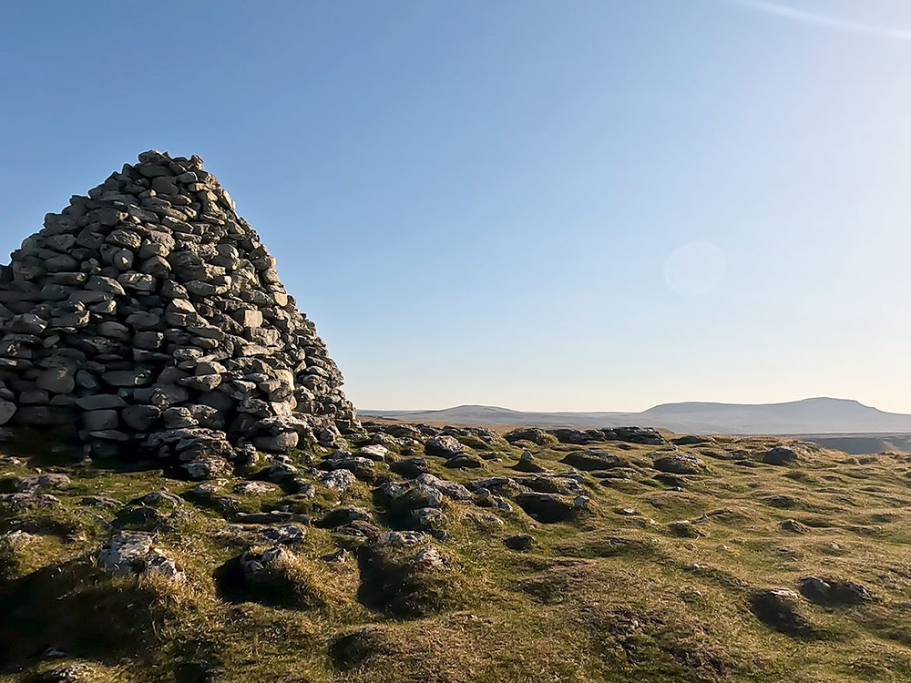
Pen-y-ghent on the horizon from the cairn
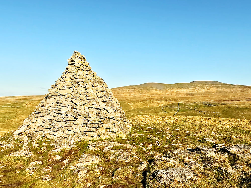
Ingleborough and Little Ingleborough from the cairn
From the cairn head back down to and turn left along the grassy path we were just on. Ignore the path coming in from the right here. A short distance further on the path splits with Pen-y-ghent again directly ahead.
We are going to take the left-hand fork here, but if you wanted to cut the walk short and miss Thieves Moss and Moughton Scars the path to the right heads down the 600 metres or so to Crummack and you could re-join our walk there. I'll point that out below. Looking in that direction, you can see Pendle Hill on the horizon.
Taking the left-hand fork, we just continue along the grassy path.
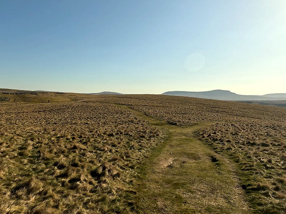
Grassy path forming part of the Pennine Bridleway with Ingleborough on the horizon
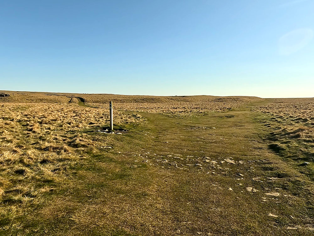
At the next wooden waymarker, we are going to continue straight on. The path from the left here is the left-hand path split we left earlier just before the cairn. For a short diversion, heading up behind the waymarker provides you with a superb view over the limestone pavement towards Ingleborough.
If you want to find out more about Ingleborough, its fascinating geology, both above and below ground and our selection of the best Ingleborough walks, then check out our Ultimate Guide to Ingleborough.
Looking towards Ingleborough over a limestone pavement
If you take the diversion, head back down to the waymarker and turn left heading on in the same direction. A little further on, just before the next wooden waymarker, there is another path off to the right. This again heads down to Crummack and meets the other path.
Ignore the path off to the left just beyond the waymarker and just continue along that wide grassy path generally in the direction of Pen-y-ghent again ahead.
Waymarker on grassy path forming part of the Pennine Bridleway
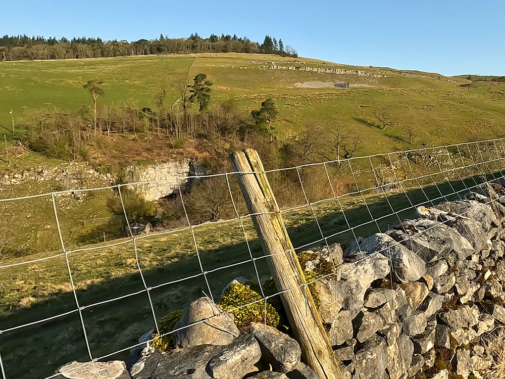
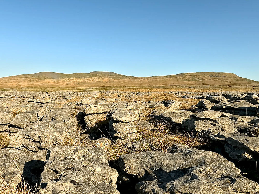
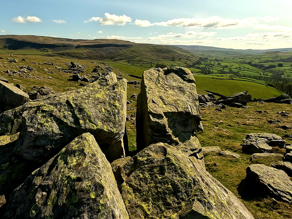
At the next waymarker, walk straight on. Over to the right, the limestone pavements of Thieves Moss and Moughton Scars are now more in view in front of Pen-y-ghent. The grassy path pulls in alongside a wall over which, you now have an even better view of the limestone pavement.
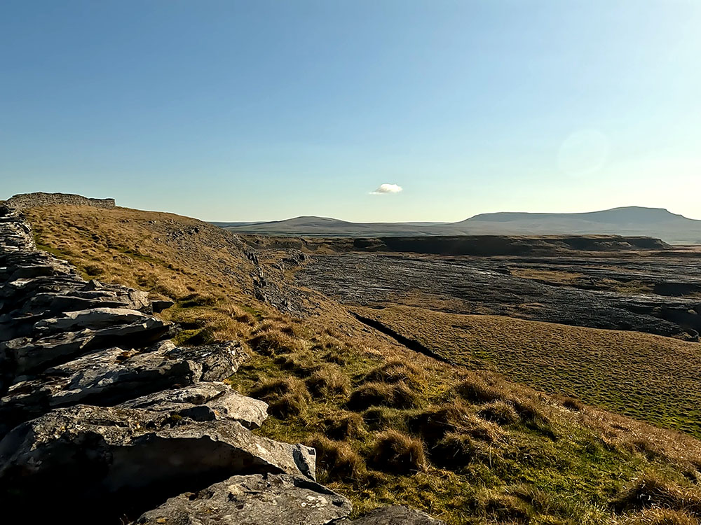
Looking over the wall onto Thieves Moss and limestone pavement at Moughton Scars and towards Pen-y-ghent
Looking over Moughton Scars
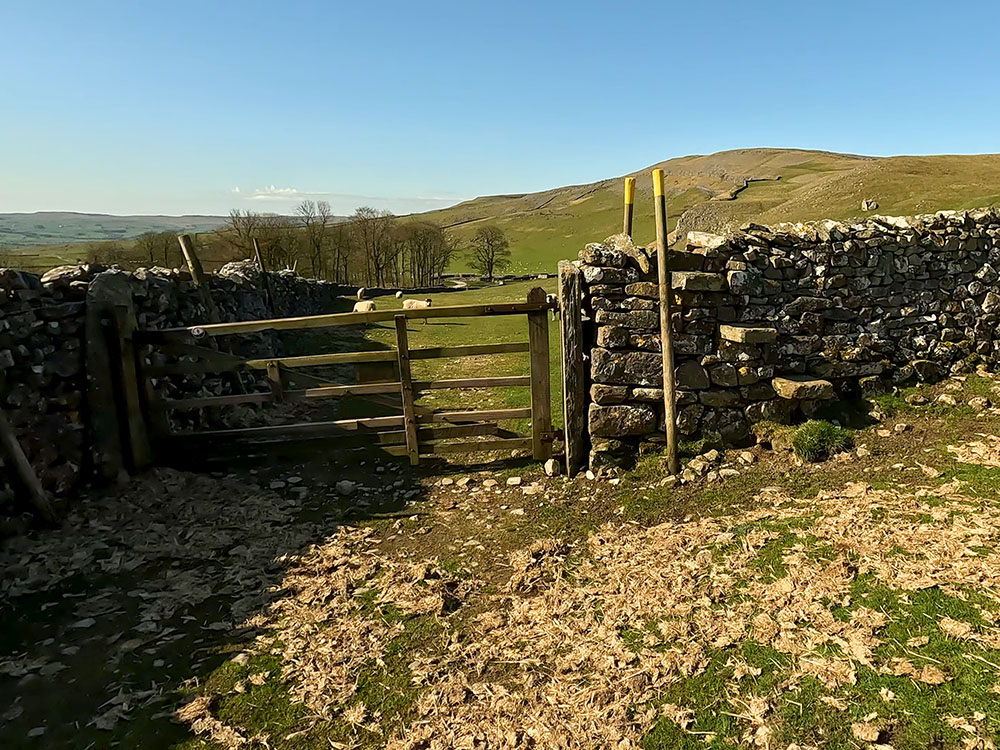
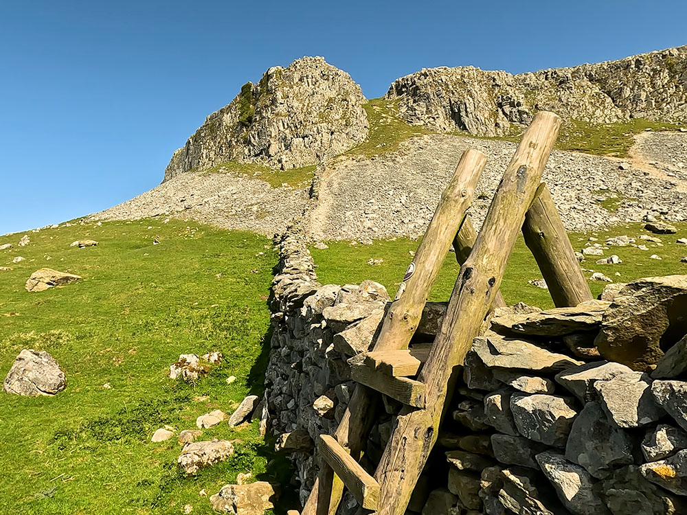
Keep ahead and when you reach the wall with a stile and gate in it ahead, turn right here to pass through the small wooden gate in the right-hand wall before heading down to the limestone pavement.
Gate leading down onto Thieves Moss with Pen-y-ghent on the horizon
Take time to enjoy the views. Pendle Hill is visible on the horizon and the top of Moughton Scars are visible at the far end of the limestone pavement.

Limestone pavement above Moughton Scars
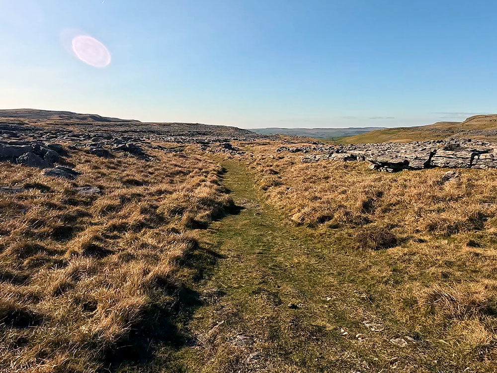
We were going to drop down onto Thieves Moss and then turn right to head through the limestone pavement to Beggar's Stile. There is another path before that that skirts more of the limestone that you could use if you wish. Head down now onto Thieves Moss.
Path heading down onto Thieves Moss and limestone pavement with Pen-y-ghent on the horizon
Pass over the first path and then a short distance afterwards, there's a sketchy path that heads off to the right. Turn right here to start heading through the limestone.
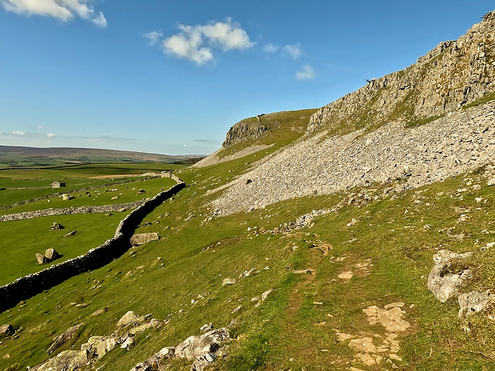
The path does become a little more obvious after a short distance. It is believed that Thieves Moss got its name as it was once used as a showground for the sale of stolen sheep and cattle in the area. The limestone pavement itself was formed over many years by the scouring action of glaciers, which on their retreat revealed a flat limestone landscape.
Then, over the years, water and chemical weathering have created, widened and deepened cracks to form fissures. Gaps in the limestone are known as Grykes. The exposed blocks of limestone left behind are called Clints. Be careful with your footing when walking through the limestone, it can be very slippery when wet.
After a short distance, we meet another path here coming through the limestone. Just turn right and keep on the grassy path.
Path heading through the limestone heading towards Moughton Scars
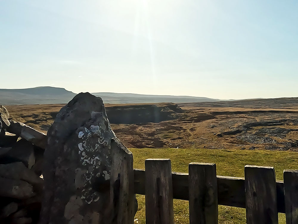
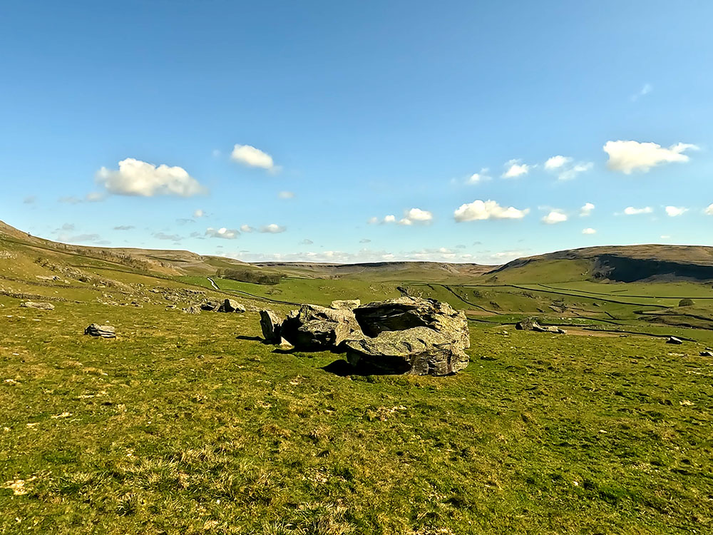
After a few hundred metres you arrive at Beggar's Stile. Over the stile, you can see down towards Crummack over Crummack Dale, the distinctive outline of Pendle Hill on the horizon. I pointed out earlier the shortcut that you could have taken over to Crummack. Some of you with dogs may well want to do this because this isn't the most dog friendly of stiles.
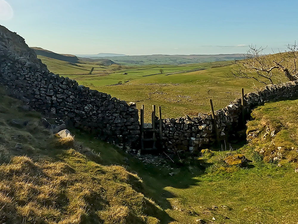
Looking down onto Beggar's Stile at Moughton Scars
It doesn't look too bad from this side, but when you pass over the stile, it is about a seven to eight-foot drop onto stones.
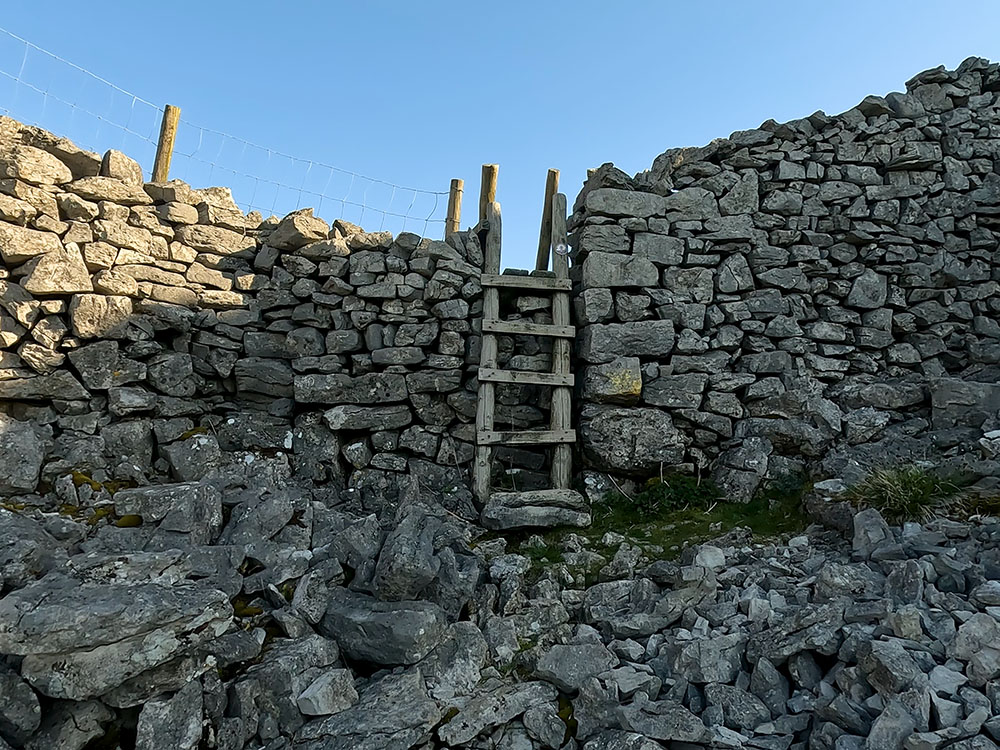
Looking back up at Beggar's Stile
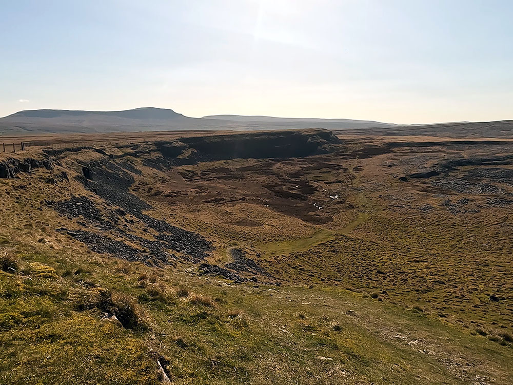
Pass over the stile and head away from it now across the fields, basically just keeping on a straight line. Looking behind now you get a much better view of Moughton Scars.

Looking down Crummack Dale with Pendle Hill on the horizon
Looking back at Moughton Scars
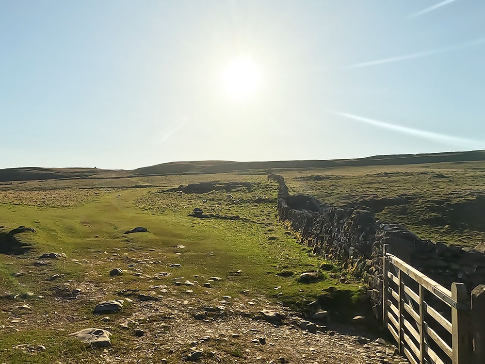
After just over half a mile, the path pulls in by a wall on which there is a stile. Pass over the stile in the wall.
Gate at Crummack
From the stile, if you look to the right, you can see two footpaths merging. These are the two footpaths I mentioned earlier in the walk if you wanted to shorten the walk and miss Thieves Moss to just cut straight across to Crummack.
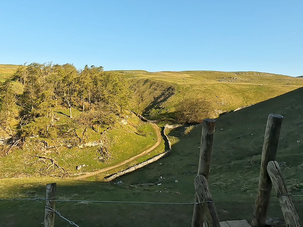
Keep on now by the side of the wall, where after a short distance you pass a footpath sign, where those two footpaths join us. Walk on for a few more yards and pass through a gate and then onto and through the second wooden gate shortly afterwards to then head along to and then start going down the track.
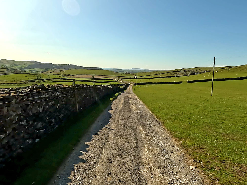
Looking down the track which is part of the Dales Highway
The first part of this track forms part of the Dales Highway, a 90-mile long walk starting in Saltaire in West Yorkshire and ending at Moot Hall in Appleby, in Westmoreland in Cumbria.
After a while, pass over a cattle grid or through the gate at the side of it.
If you have any thoughts about this walk or find any issues with any of the footpaths used, please share that with us in the comments below.
Then further on, at a track junction, we carry straight on. The track off to the left here heads towards Wharf and then on towards Helwith Bridge.
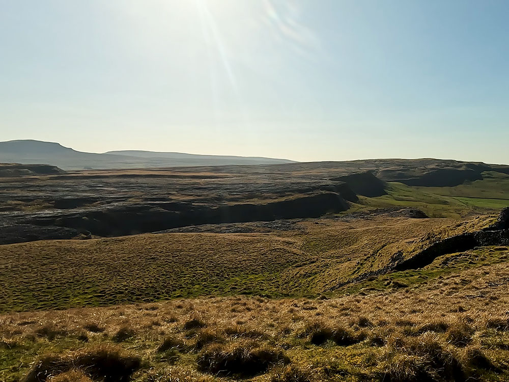
Behind you can see Moughton Scars and the track that we just walked down.

Looking back along the Dales Highway towards Moughton Scars
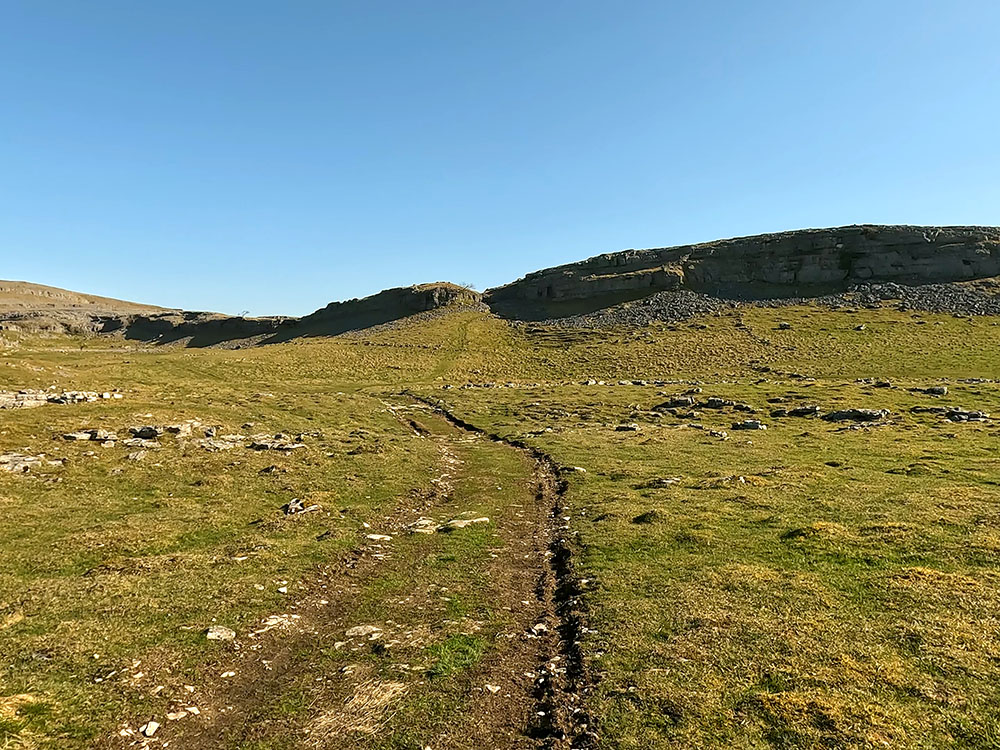
After walking a little further, at a Thieves Moss footpath sign, the road becomes tarmacked underfoot. Then just around a right-hand bend, as the road starts to descend a little more steeply, there are two footpath signs, one on either side of the road. We are going to turn right here and follow the right-hand sign. The left footpath here heads the half a mile or so over to Austwick.
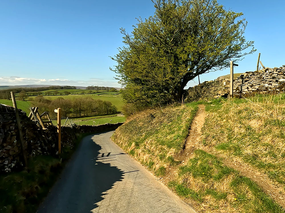
Wall stile off Crummack Lane
Head up right off the road to pass over the stone stile built into the wall following the footpath sign to Norber. Follow the path now along the side of the wall. The footpath passes through Nappa Scars.
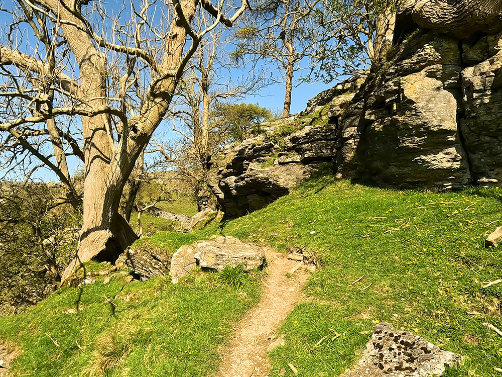
Footpath through Nappa Scars
Head through the gap in the wall and then diagonally left across the small field towards the stone stile in the wall ahead. Over the stone stile you get your first sight of the Erratics and what lies ahead.
Wall stile in front of the Erratics
Once over the stile, turn left the head down the side of the wall. At the bottom of this next short steep section, take the right-hand fork in the path to head over to the four-way signpost. At the signpost, we are going to take a short diversion up the hill to Norber. The path heads up and then bends around to the right to pass by this first real erratic.
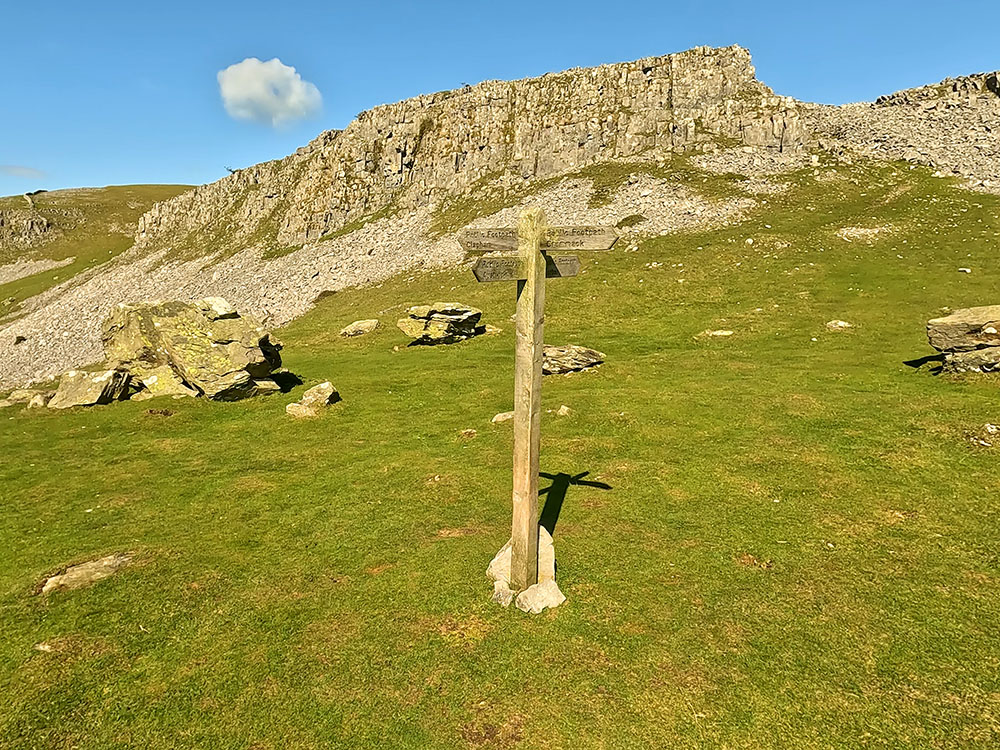
4-way signpost leading up to Norber Erratics
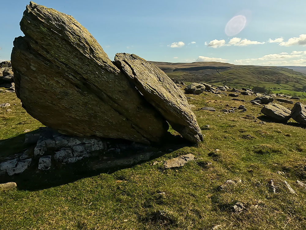
Just walk ahead now and take time to explore the area, wander around the many different shaped Erratics here at Norber. There are well over 100 Norber Erratics and they are probably the best examples of erratics in the UK. Erratics are rocks that have been transported by glaciers and the movement of ice and then deposited at a new location.
An Erratic at Norber
They are usually a different composition to the underlying bedrock on which they came to rest, but sometimes it can be the same stone.
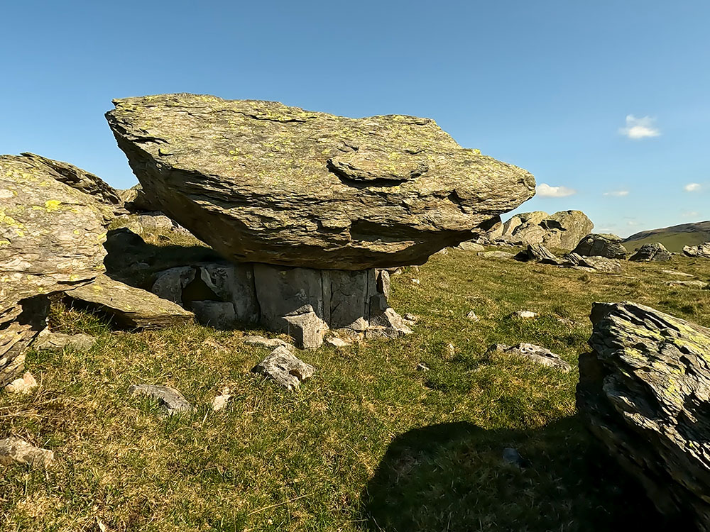
An Erratic at Norber on a pedestal
A gap through an Erratic at Norber looking towards Wharfe
Some Erratics have limestone pedestals under them, which are now protected from further erosion by the umbrella effect of the overhanging stone on top. You do have to wonder how some of the pedestals hold that much weight above them.
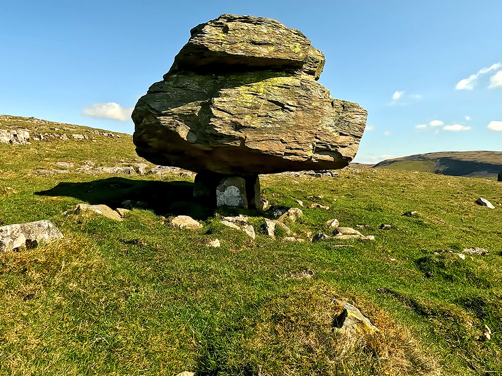
An Erratic at Norber on a small limestone pedestal
If you look over of the wall at the far end of the erratic field, you can see back up to Moughton Scars where we walked down from earlier.
Looking back towards Moughton Scars from the Norber Erratics
From here, we turn around now and head back down through the Erratics and then back down to the four-way signpost we left earlier on time.
On reaching the signpost, we turn right following the footpath to Clapham sign. The path heads down to and pulls in just the right-hand side of the wall. Pass over the stile and keep straight on. Up to the right here is Robin Proctor's Scar.
Path heading away from the 4-way signpost at Norber
Looking up towards Robin Proctor's Scar
The path follows and then leaves the wall as the wall bends around to the left and then heads across the field just to the left of the two large rocks. It heads across the field to a stile in a wall.
Pass over the wall stile just to the left of the gate in the wall, and then turn right along the lane.
Over to the right you can again see Robin Proctor's Scar with supposedly the scar being named after a local farmer who lived in Crummackdale. He would ride his horse every night down to the local inn. Many times he came back drunk and often fell asleep on the horse and from time to time fell off it.
The horse walking the route he knew many times, knew the way. Then one night after getting very drunk, he came out of the inn and got on the wrong horse. In bad weather, the horse wandered along the lanes and over the moors until eventually he went over the edge of the scar - Robin Proctor's Scar.
The lane we are walking along is Thwaites Lane. It forms part of the Pennine Bridleway and 'A Pennine Journey'.
The Pennine Bridleway is a 205-mile trail from Middleton Top in Derbyshire to Ravenstonedale in Cumbria with its full length officially opened in 2012 by Martin Clunes, the then-president of the British Horse Society.
Whereas 'A Pennine Journey' is a 247-mile trail starting and ending in Settle in the Yorkshire Dales. It is based on a 211-mile walk Alfred Wainwright undertook in 1938 and then later wrote a book about it called 'The Pennine Journey - The Story of a Long Walk in 1938'. The book was eventually published in 1986.
Walking further along the track, over to the right now again Ingleborough is in view and then to the right can see Long Lane, the track that we walked earlier.
Looking across towards Long Lane and Ingleborough from Thwaite Lane
Walking along the track you meet the same track junction we were at near the start of the walk. This time we just veer slightly left, basically walking straight on following the Clapham sign.
Walk on now down the walled track back, to pass back through the two tunnels back into Clapham. On reaching the road by the church we turn left along the road and then turn left again back into the car park.
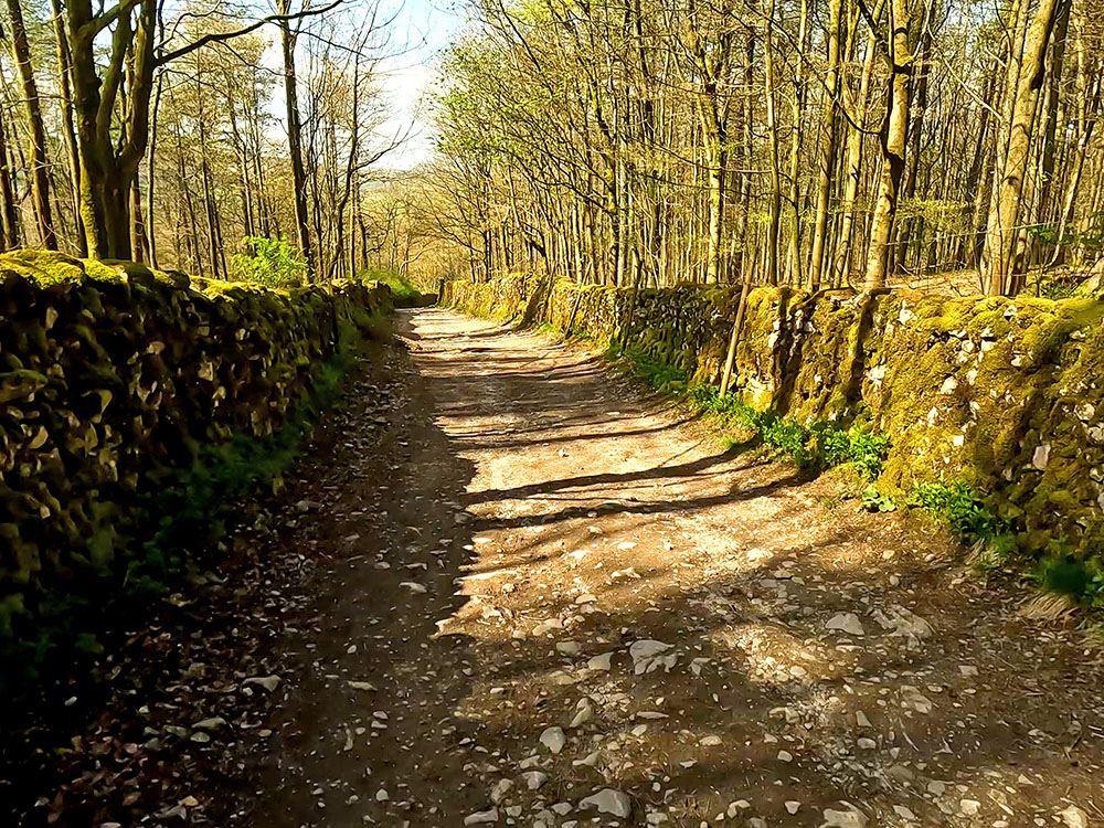
Heading down the walled track back to Clapham
If you want somewhere to eat and drink after the walk, there are a few places within 100m or so of the car park. The first place is on the corner of the car park itself. The Lake House Bar and Kitchen is dog-friendly and specialises in local real ales, small brewery craft ales and real cider. It offers food all day long, including its speciality pizzas. I don't think they open every day of the week, so maybe check first.

Lake House Bar and Kitchen in Clapham
If you exit the car park and turn left and head towards the white building at the end of the road, you quickly reach the Croft Café. It was closed when I passed and looked like it maybe hadn't been open recently, but I may be wrong though. Take a look if you are there and if you know any more, please let me know in the review section below.
Just past that is the New Inn which has accommodation and I believe is dog-friendly. It serves brunch 10 to 12, lunch 12 until 3 and evening meals 5 until 9. It serves coffees, teas, a range of ales and gins from around the world. There are a few seats at the front and then a beer garden around the back.
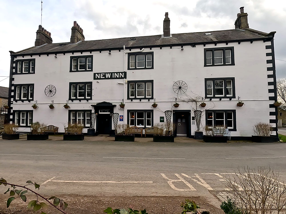
The New Inn in Clapham
Heading back towards the car park on your left by the wall is the market cross. The base is believed to date from around the time when Clapham was granted market status in 1201, whereas the cross itself was erected in 1897 to mark Queen Victoria's Diamond Jubilee.

The market cross by Clapham Beck in Clapham
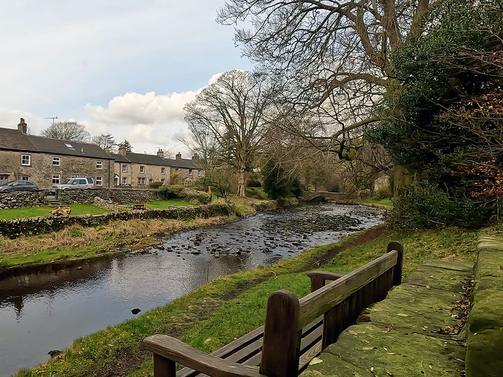
Bench with a view in Clapham
If you brought your own sandwiches, the bench in front of the market cross is an excellent place just to sit and watch the water go by. Just over the bridge if you didn't bring your own food, is the Clapham Village Store.
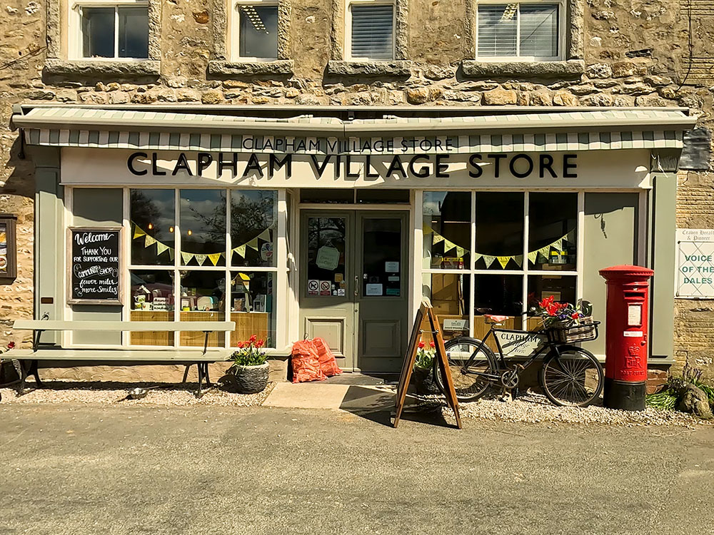
Clapham Village Store
Just to the left of the bridge when you're heading back over it, you can see the fish water fountain erected in 1897 to commemorate the Diamond Jubilee of Queen Victoria.
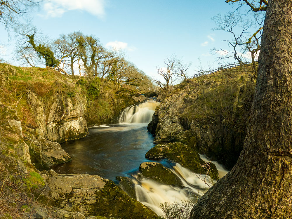
The final place to eat and drink is the Old Sawmill Cafe. Head away from the car park as we did at the start of the walk to the church, but this time turn left in front of the church and along to meet the road junction. On meeting the road turn right where shortly you'll get a view across to Clapham Falls, a man-made falls constructed in 1837 as part of the remodelling of the Ingleborough estate.
A few yards further on, you reach the Old Sawmill Cafe. It is open 9:30 to 4:30 each day except for a short period over Christmas. It is dog-friendly, serves teas, coffees, has a small menu and cake bakes. It also has outside seating.
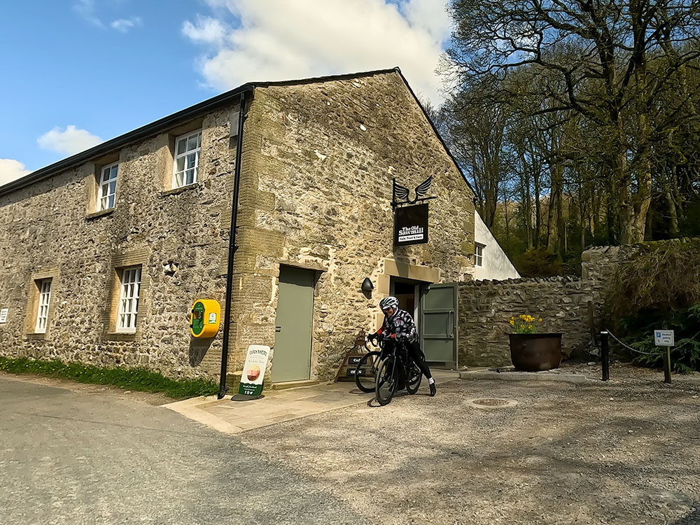
The Old Sawmill Cafe in Clapham
Not food related, but certainly worth a mention is that next to the New Inn is the Cave Rescue Organisation and Mountain Rescue post, should you ever need them. There's a sign that says dial 999, ask for the Police. They will then alert the local mountain rescue team should they ever be needed.
Gifts and presents for hikers and walkers
Are you struggling to pick the perfect gift for your hiking-loving friend or family member? Don't fret! Explore our curated selection of top-notch gifts for walkers and hikers that will have them trekking with joy on their special day.
What to wear and take on your walk or hike
Whether you are a seasoned hiker or new to walking, wearing and taking suitable hiking kit and clothing is essential for a day hike for your comfort and safety. So we have put together a hiking essentials checklist to cover all you'll need. Our Hiking Essentials checklist for 2026 takes you through planning your walk, the hiking essentials checklist itself, optional extras, explanations, and recommendations for all the hiking essentials.
Check out the reviews for this walk: