By using this website, you agree to our use of cookies (needed to provide our website’s features) and our Terms of Use.
By: Andrew Forrest - Updated January 2026
Even though walking any of Pen-y-ghent, Whernside, or Ingleborough in isolation is a satisfying walk in itself, there's one thing that many people seem to like: a challenge! As with many challenges, people like doing them for charity.
The Three Peaks of Yorkshire Walk provides that challenge. So, if you want to walk the Yorkshire 3 Peaks for charity, read on.
The Yorkshire 3 Peaks Walk takes in Pen-y-ghent, Whernside and Ingleborough in a 24.6-mile long walk and includes 1,610 metres of climbing.
Traditionally, to be able to join the Yorkshire Three Peaks club, you needed to finish in under 12 hours and with reasonable levels of fitness and proper preparation, most people do manage that.
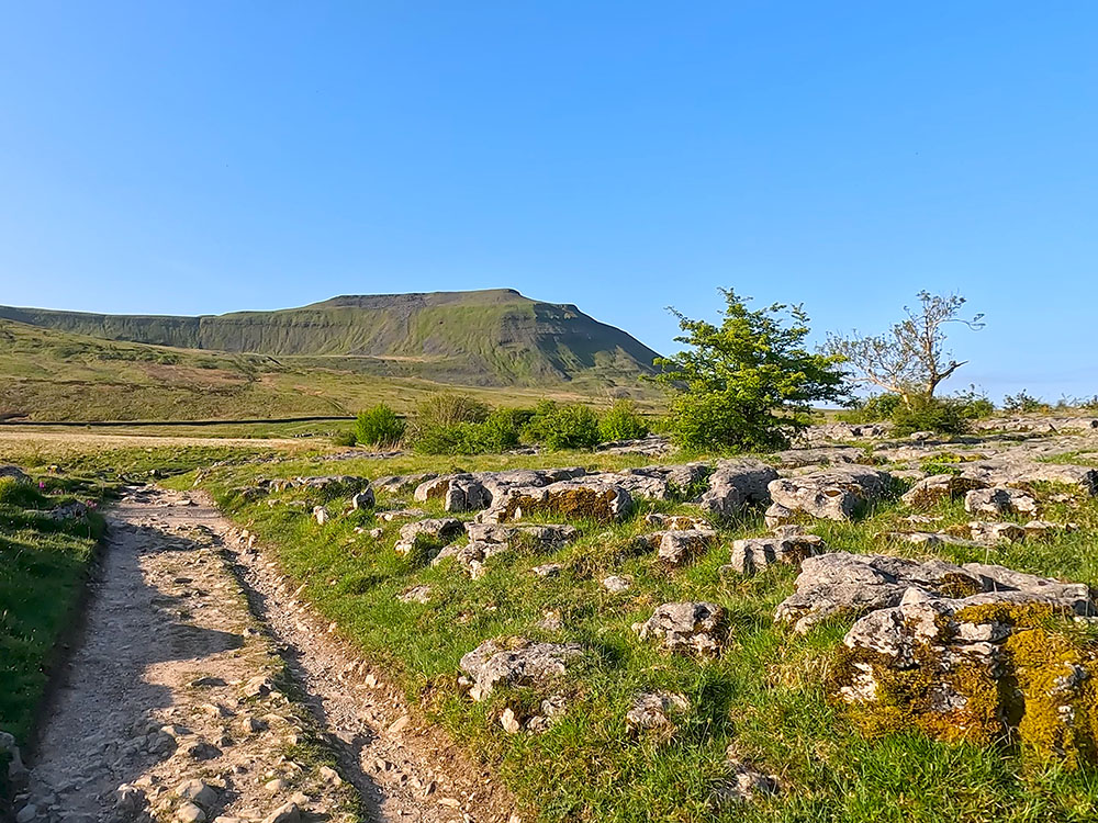
Ingleborough
As the walk is a challenge, many people do the walk for charity. You can do the walk on your own and raise money for your own chosen charity, or you could sign up and join one of the many charities (local and national) that organise a 3 Peaks Walk each year.
We have set out below organised Yorkshire 3 Peaks Charity walks that we are aware of, but please keep checking back as we will update the page for 2025 walks when we are aware of them.
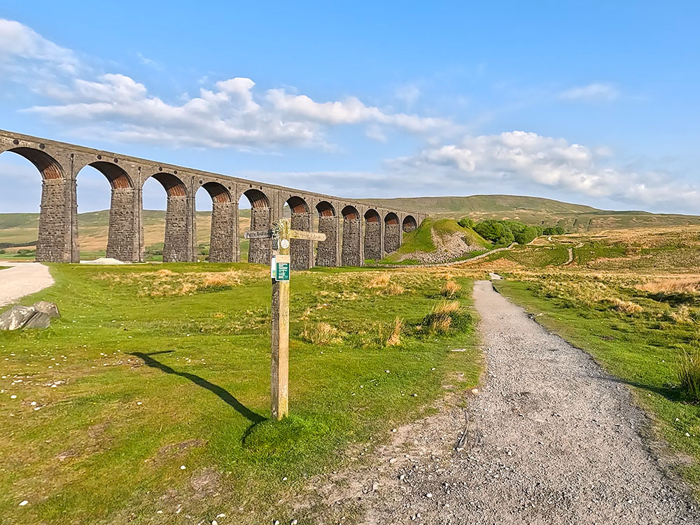
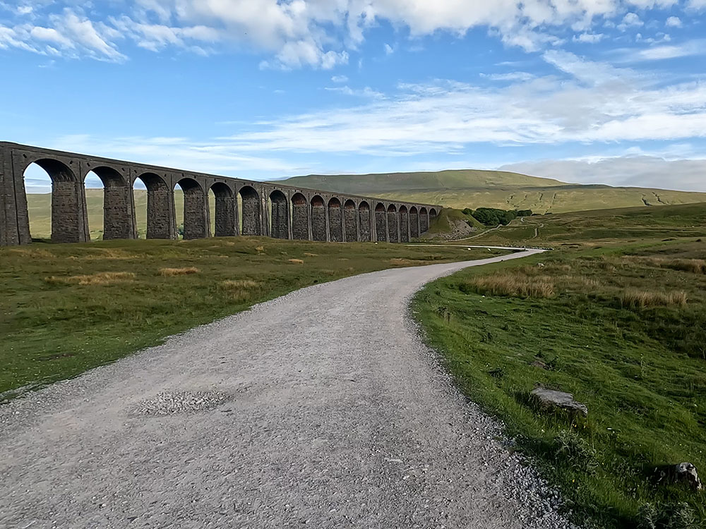
Whernside and the Ribblehead Viaduct
I know many people like to raise money for their chosen charities and just want to do the walk themselves or in small groups, so if that's the case check out our detailed Yorkshire 3 Peaks Walk and 4K video that takes you around the walk in full so you know what to expect.
We have put together a free Yorkshire 3 Peaks Guide, which includes tips for before, during and after the walk, parking, where to eat and drink, training, what to wear, what to take and much more.
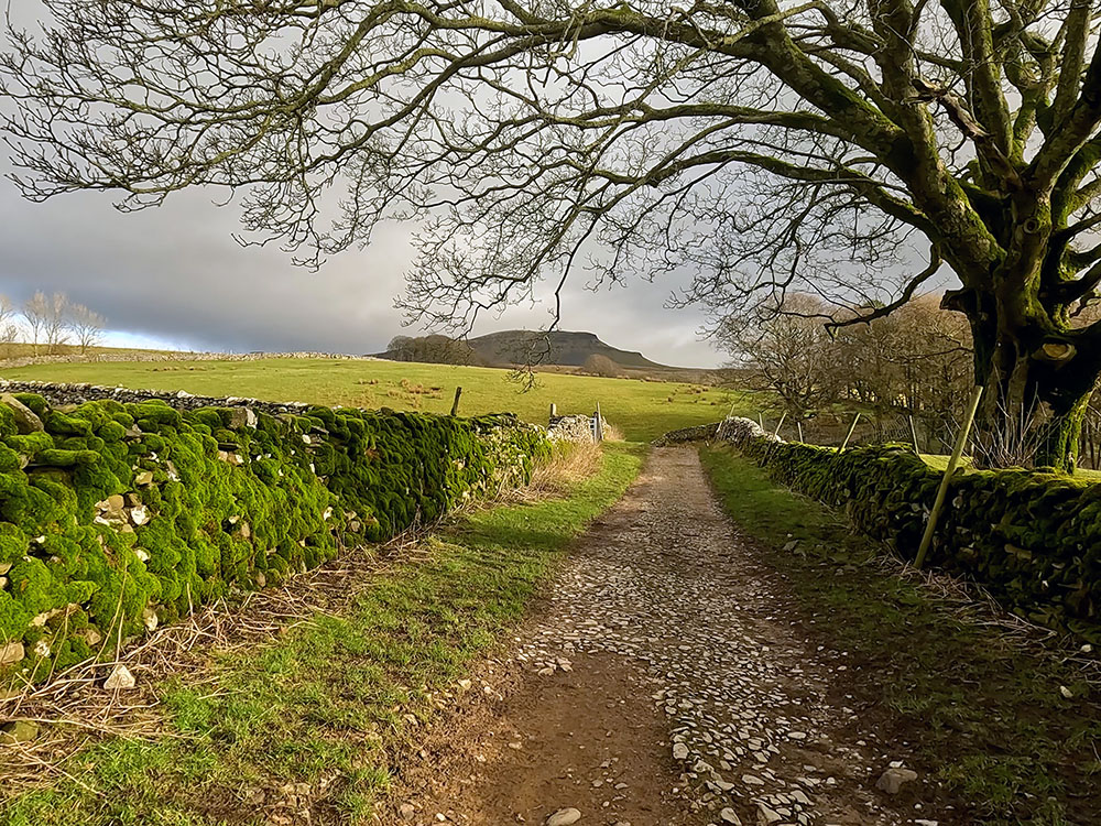
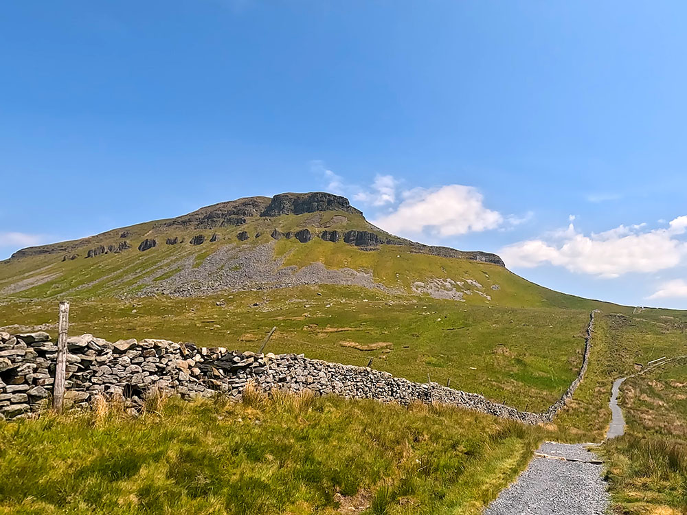
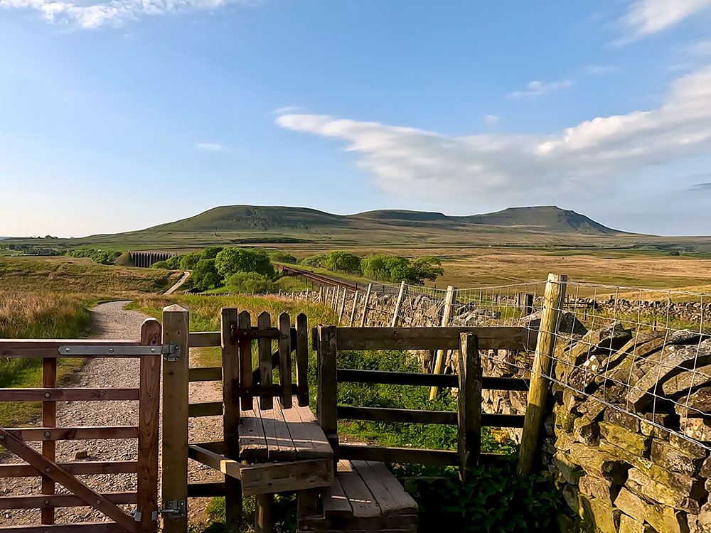
Pen-y-ghent from the path back into Horton in Ribblesdale
Below are charities we know are doing the Yorkshire 3 Peaks walk in 2026. We will update this list when we become aware of more 2026 dates.
If you are a charity and want your walk included, please send us your details via our Contact Us form.
 |
Event date: 11 July 2026 |

|
Event date: 13 June 2026 |

|
Event date: May to October |

|
Event date: 11 July 2026 |

|
Event date: 9 May 2026 |

|
Event date: TBA |

|
Event date: 11 July 2026 |
Whilst you are raising money for your chosen charity, please consider setting a small amount aside for the Yorkshire Three Peaks themselves.
The Yorkshire Dales National Park relies on donations and maintaining the paths in the Yorkshire Three Peaks area costs an average of £35/metre.
So, please consider donating some of what you have received in sponsorship, so that they can keep the public rights of way in a great condition for people to enjoy walking in the area for many years to come.
To donate, please go to the Yorkshire Dales National Park donation page.
Ingleborough, the Settle to Carlisle Railway and the Ribblehead Viaduct
There are many reasons why you should do the walk for charity which include:
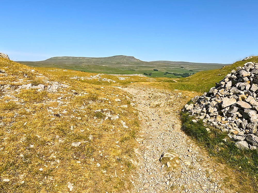
Pen-y-ghent, the Ribblehead Viaduct and Ingleborough from the summit of Whernside
This page contains affiliate links. As an Amazon Associate, we earn from qualifying Amazon purchases at no additional cost to you. We may also earn commissions from other retailers, again at no additional cost to you.
The Yorkshire 3 Peaks Walk is a 24.6-mile long walk and includes 1,610 metres of climbing that takes in the summits of Pen-y-ghent (694m), Whernside (736m) and Ingleborough (724m).
No, you do not have to do the Yorkshire 3 Peaks walk for charity. Most people do it on their own or with small groups of friends. If you are unsure of the directions or want to raise money for your chosen charity, there are many organised charity Yorkshire 3 Peaks Walks that you could sign up for.
Yes, the Yorkshire 3 Peaks charity walk route map takes in Pen-y-ghent, Whernside and Ingleborough joining them together in a circular route from Horton in Ribblesdale.
If you have a phone or GPS device you can download for free the GPX route for the Yorkshire 3 Peaks Walk.
Many people just download the GPX route file onto their smartphone and look at it in a mapping app. The mapping app I currently use is the Ordnance survey mapping app, and for just £2.99/month I get access to all their 1:25,000 maps in the UK along with many other maps and features, including the ability to print maps.
Ordnance Survey Mapping App
Use on any device and make it easy to explore the great outdoors for just the price of a coffee a month. Premium allows full UK access to all OS Explorer and Landranger mapping, along with the ability to import and export routes, save maps offline, aerial 3D, and print A3/A4 maps.
Just in case my phone runs out of power I always take a
power bank with me.
Mobile phones and GPS devices use more power when utilising GPS and that and taking lots of photographs on the way around can cause
your battery to run low or run out of power.
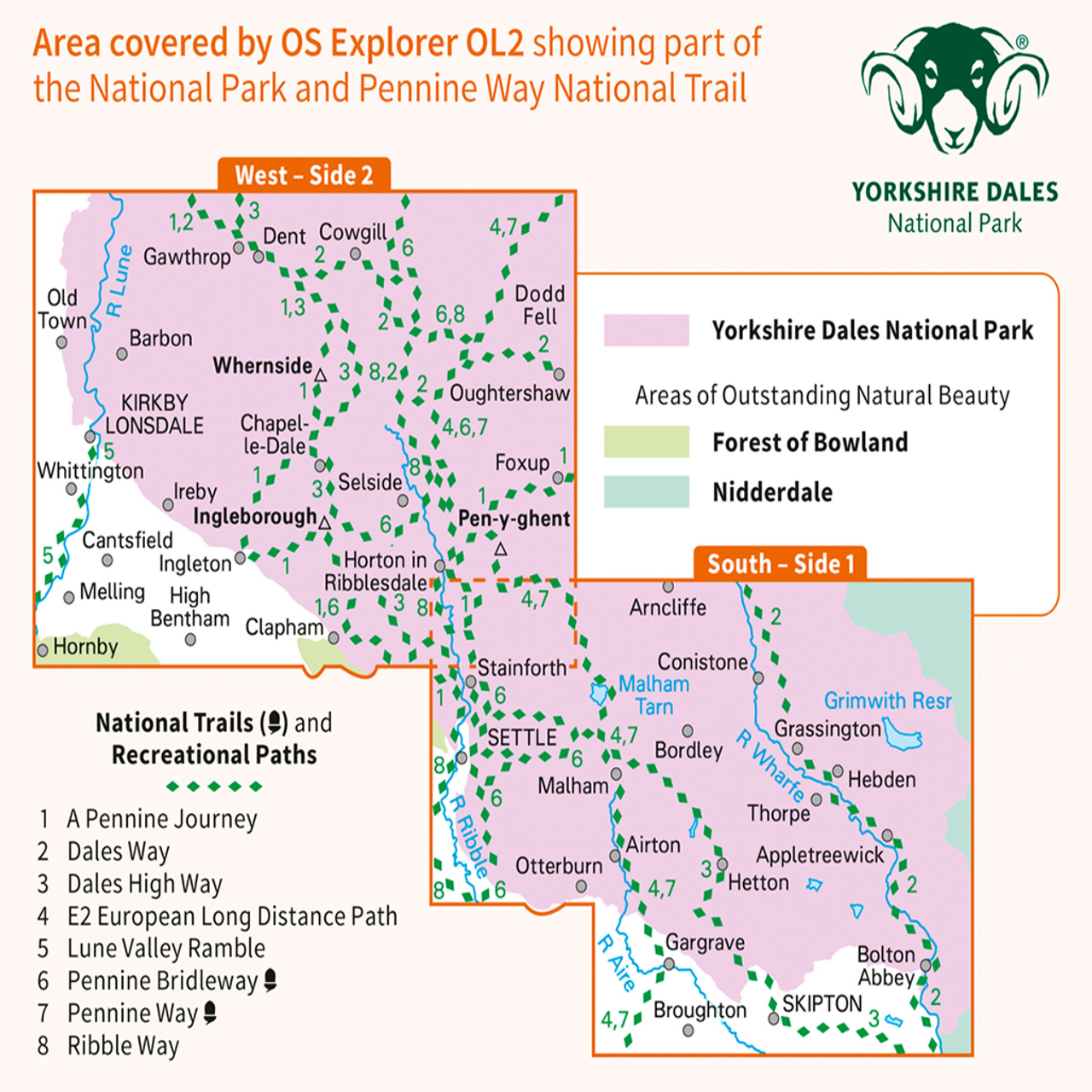
So, I also always ensure I have a paper map of the area that I'm walking in as well. If you have the mapping app, you can print the relevant map areas out and take them with you, or just take the OS map that includes the walk. The Ordnance Survey map that includes the Yorkshire 3 Peaks walk is the Ordnance Survey - Explorer OL2 (Yorkshire Dales - Southern & Western Area) map.
How long it takes to do the Yorkshire 3 Peaks walk depends upon your level of fitness and how much you have prepared and trained for the walk. The Yorkshire 3 Peaks 'challenge' is to do the walk in under 12 hours. Most reasonably fit, well-prepared walkers average between 9 and 11 hours to do the walk.
The Yorkshire Three Peaks Challenge for Charity is doing the 24.6 miles Yorkshire 3 Peaks walk of Pen-y-ghent, Whernside and Ingleborough, which includes 1,610 metres of climbing, within 12 hours for your chosen charity.
The Yorkshire 3 Peaks charity walk route in the Yorkshire Dales goes over Pen-y-ghent, Whernside and Ingleborough joining them together in a circular route from Horton in Ribblesdale that is 24.6 miles long and includes over 1,600 metres of climbing.
If you have a phone or GPS device you can download for free the GPX route for the Yorkshire 3 Peaks Walk.
The GPX file can be used on mapping apps such as the Ordnance Survey mapping app, from which besides having the app on your phone, you can also print a paper copy of the Yorkshire 3 Peaks charity walk route.
Sometimes whilst using GPS and taking photographs, mobile phones can run out of power. One solution is to take a power bank with you, but as a backup, I always take the relevant Ordnance Survey map, which in this case is the Ordnance Survey - Explorer OL2 (Yorkshire Dales - Southern & Western Area) map, which includes the paths used in the Yorkshire Three Peaks walk.
January 2026