By using this website, you agree to our use of cookies (needed to provide our website’s features) and our Terms of Use.

From the Ribblehead Viaduct the Settle-Carlisle railway line is followed before summiting Whernside, one of Yorkshire's 'Three Peaks', to reveal panoramic views out to sea, the Lakeland Fells and the Howgills.
In accordance with our Disclaimer, you agree to take full responsibility for any use you make of the information contained in these pages.
This page contains affiliate links. If you buy products or services via these links, we may earn a small commission at no cost to you.
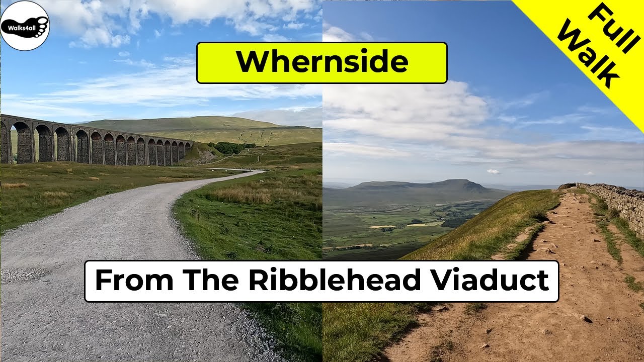
| Walk title: | Whernside walk from the Ribblehead Viaduct |
| Author: | Andrew Forrest - December 2022 |
| Walk start point: | Roadside laybys near to the 'T' junction of the B6255 and the B6479 (grid reference SD 765 793) - further parking is available near to the Station Inn, but please park responsibly as it can get very busy around this area, especially as weekends. What3words: kebabs.estimate.unwound |
| Parking: | As above |
| Directions to nearest parking place: | Google Maps: get directions here / What3words: response.trickling.sweeping |
| Walk distance: | 13.0 km |
| Estimated walk time: | 4 hours |
| Height climbed: | 447 metres |
| Technical difficulty: | Moderate - as determined by our interpretation of the Ordnance Survey guidance on technical difficulties |
| Peaks / summits: | Whernside (736m) |
| Map: | Ordnance Survey - Explorer OL2 (Yorkshire Dales - Southern & Western Area) Buy this map from Ordnance Survey |
| GPS/GPX file: | Download available to registered users - Register and Login here - It's FREE to register |
| Facilities / refreshments: | Station Inn at the Ribblehead viaduct and there is often a caravan selling tea/coffee bacon sandwiches etc in the layby by the 'T' junction at the start and end of the walk. More pubs/cafés/restaurants in Settle, Ingleton, Hawes and Horton-in-Ribblesdale |
| Nearest town: | Nearest larger places are Settle, Ingleton and Hawes |
| Local self-catering accommodation: | View self-catering accommodation close to the start of this walk |
Estimated walk time
Walk time estimates used are from the Ordnance Survey mapping app, which uses a refined Naismith's rule, adjusted by OS overlaying their own data collected from more than one million people using the OS mapping app. Naismith's rule allowed one hour for every three miles walked and added pro-rata an additional hour for every 2000ft of ascent - roughly one hour for every 5km, plus one hour for every 600m of ascent.
Ordnance Survey Mapping App
Use on any device and make it easy to explore the great outdoors for just the price of a coffee a month. Premium allows full UK access to all OS Explorer and Landranger mapping, along with the ability to import and export routes, save maps offline, aerial 3D, and print A3/A4 maps.
This Whernside circular walk from the Ribblehead Viaduct takes approximately 4 hours. The walk passes by the Ribblehead Viaduct and follows close to the Settle to Carlisle railway tracks, before climbing to reach the summit of Whernside, which affords wonderful panoramic views out to the sea and along the Lakeland Fells.
Whernside is in the Yorkshire Dales and together with Pen-y-ghent and Ingleborough, they are collectively known as the Yorkshire Three Peaks and the area around here provides some of the best views in England.
There is a walk joining together the three peaks and this Yorkshire Three Peaks route is over 24 miles long and includes almost 1500 meters of climbing. Whernside itself is the highest of the three peaks at 736 meters high.
The descent is down to Bruntscar before heading along pleasant tracks and fields along the base of Whernside to pass back out through the Ribblehead Viaduct.
This full Whernside walk is shown in the video and the route for the walk is shown on the Ordnance Survey map - both above. Below is a brief description of the walk.
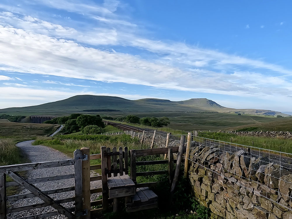
The walk over Whernside from Ribblehead starts from the roadside parking at Ribblehead next to the junction of the B6255 and the B6549, near to the Station Inn. From the parking, Whernside can be seen ahead in the direction of the Ribblehead Viaduct, with Ingleborough and Pen-y-ghent also visible to the left and behind.
At the corner of the parking area, there is an information board about Blea Moor Common and the Ribblehead railway construction camp, which forms the area on the far side of the road - more about that at the end of the walk.

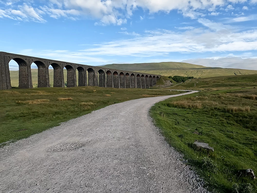
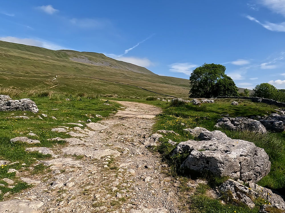
Whernside from the Ribblehead Viaduct
Cross the road and head down the gravel path opposite. After a couple of hundred metres, turn right along the wide gravel track that you meet and head on towards the viaduct. Before reaching the viaduct there is an information sign on a boulder by the track for the Ribblehead locomotive depot and brickworks. The arches to the left frame Ingleborough from here.
The Ribblehead Viaduct is constructed of 24 stone arches which at its highest point are 32 metres above the ground. Steam trains can be seen from time to time passing over the viaduct mainly in the summer months for you to take that classic 'steam train on the viaduct' image. The steam trains aren't part of the regular timetable, they are run by specialist tours.
We leave the wide track here to head along the narrower path on the right towards the footpath sign for Whernside four and a half miles. Head straight on, up the steps to pull into the right of the wall by the railway. The path runs parallel to the railway for quite a way now.
Pass through a wooden gate and walk straight on. With that rise in height, the expanded panorama affords views of all of the Yorkshire Three Peaks. First, Whernside ahead left and then back further around to the left is Ingleborough over the railway tracks and behind is Pen-y-ghent on the far horizon.
After a while by the railway, we reach Blea Moor Signal Box which, according to the Network Rail website, is the most remote signal box on their railways. There can't be many views from signal boxes in the country that are better than this one.
Park Fell, Simon Fell and Ingleborough
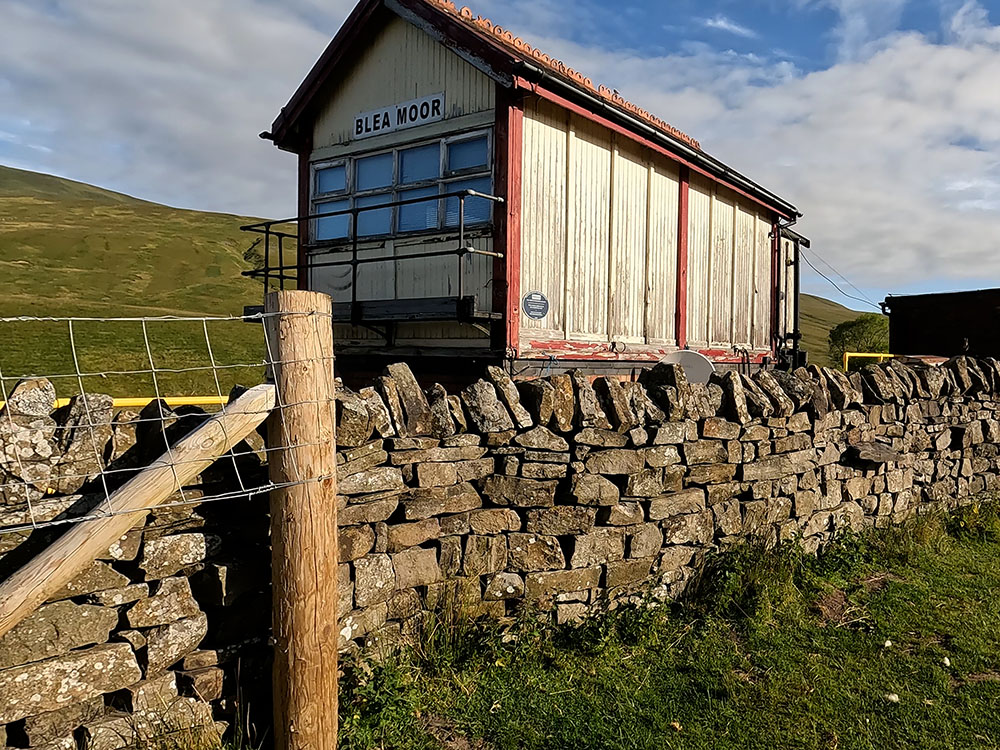
Blea Moor Signal Box
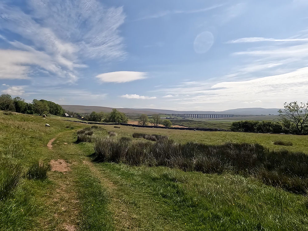
From the signal box we continue to walk along the gravelled path and after about one kilometre pass over the footbridge over Little Dale Beck. Shortly after that, the track pulls in beside the aqueduct to cross over the railway line.
Over to the left Park Fell, Simon Fell, going up onto Ingleborough can be seen over the railway, whereas over to the right the railway tracks disappear into Bleamoor Tunnel in Smithy Hill. The couple of mounds that you can see just on the horizon on the top of the hill are air shafts that go down into the tunnel. Four air shafts were built to ventilate the Settle to Carlisle railway as it passes through the tunnel.
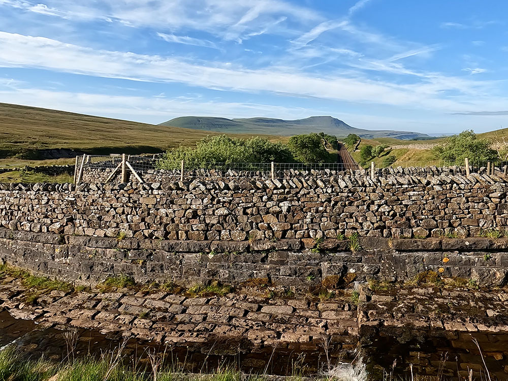
Ingleborough over the Settle to Carlisle railway line
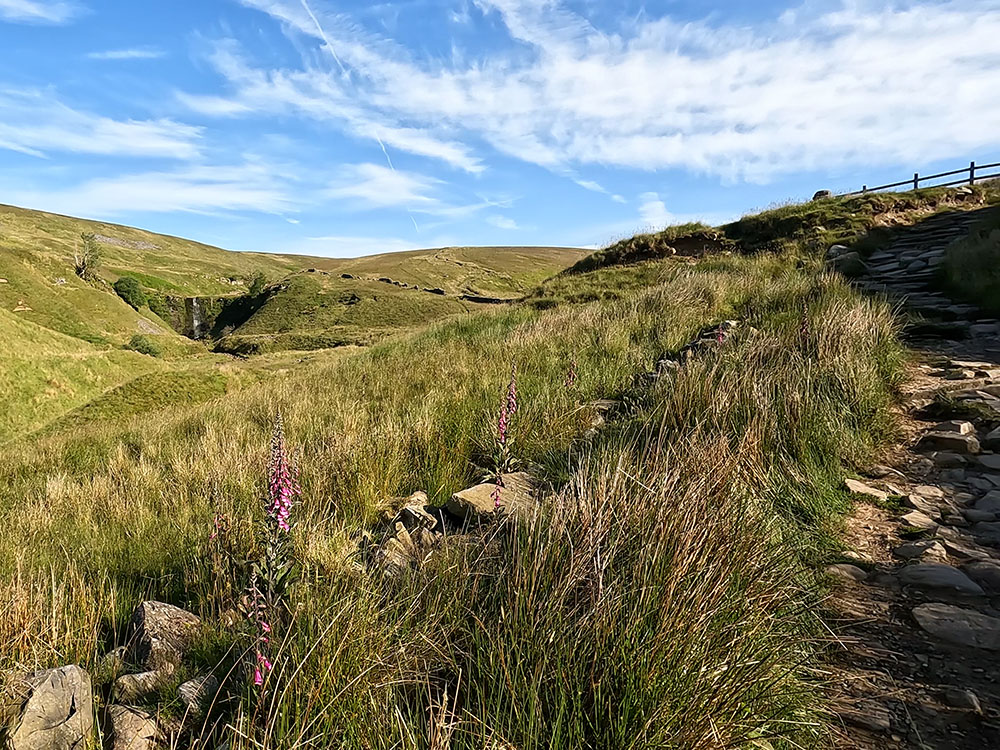
Force Gill waterfall
Once over the railway, pass through the wooden gate and then keep straight on following the bridleway 'Dent Dale 4 miles' sign. The path climbs up some steps from where over to the left Force Gill waterfall can be seen. Pass through the wooden gate and keep on hiking up the hill.
After about 600m, the path passes by a wooden stile by a footpath sign. Take time to have a look around at the expanded vista and then climb over the stile and follow the Three Peaks Whernside footpath sign directly away from the fence.
After about 500m, the path runs parallel with the wall for about 500m and then becomes flagged underfoot. Over to the left now, as more height is gained, you can see Greensett Moss and Tarn.
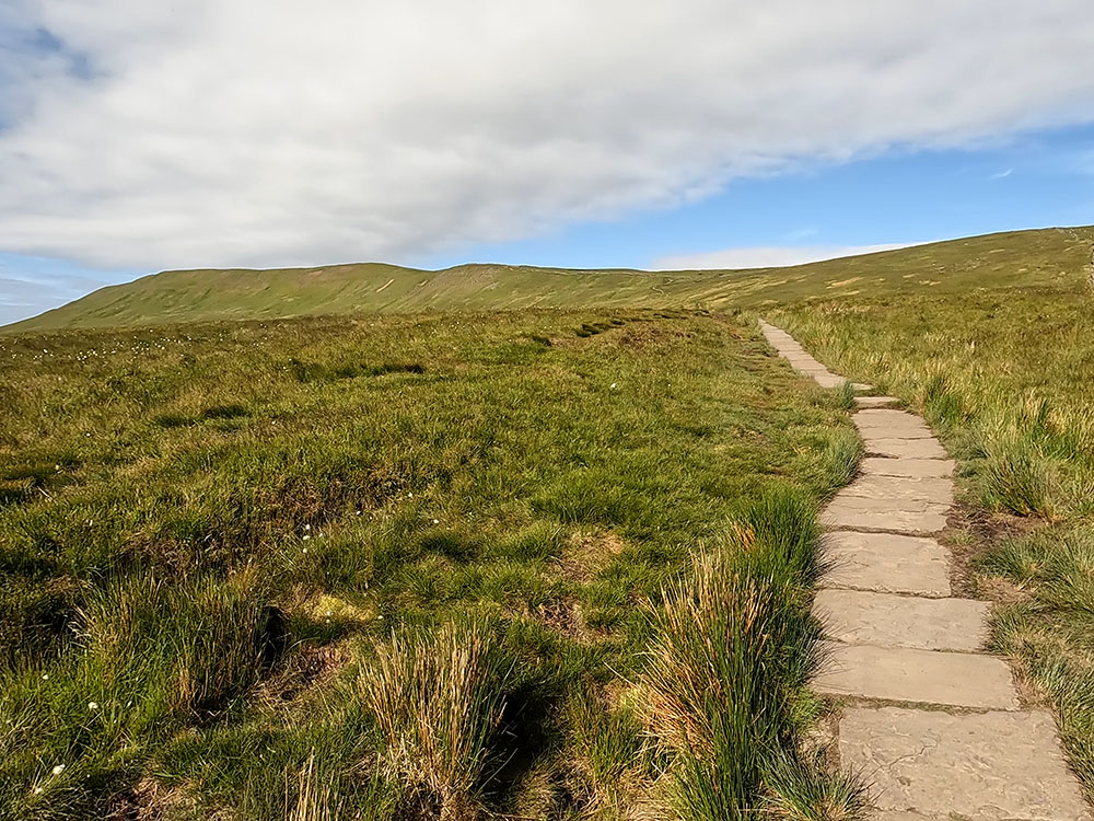
Flagged path on Whernside
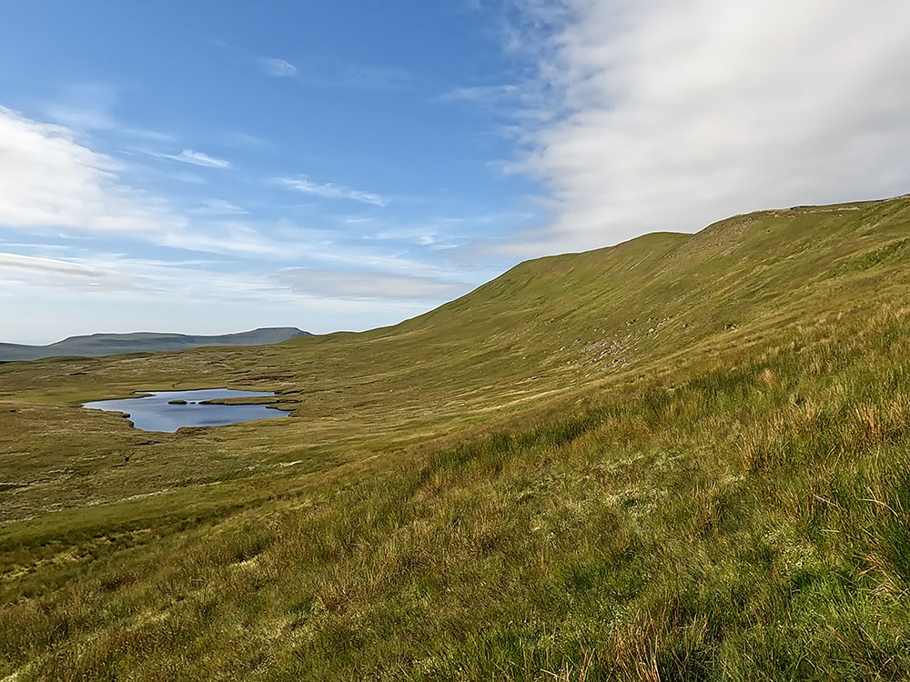
Greensett Moss Tarn, Whernside and Ingleborough
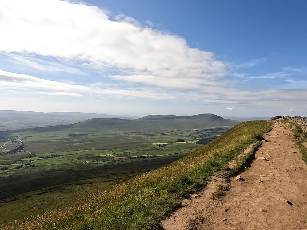
The path eventually pulls in by the side of the wall which is followed now all the way to the summit. The trig point indicating the summit of Whernside is just through the gap on the other side of the wall. Whernside is in the Yorkshire Dales and is the highest of the Three Peaks at 736 meters.
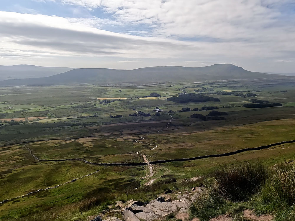
From the summit, you can see across to Pendle Hill, then around out to the sea and then along the line of the Lakeland Fells. Further around you can see the Howgill Fells. Down below in the direction of Pen-y-ghent is the Ribblehead Viaduct. On both sides of the wall, there is a weather shelter which is very useful for having a sandwich break and getting out of the wind.
Ingleborough and the Ribblehead Viaduct from the summit of Whernside
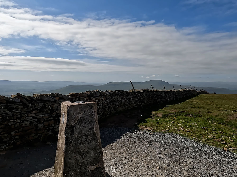
Triangulation point on Whernside
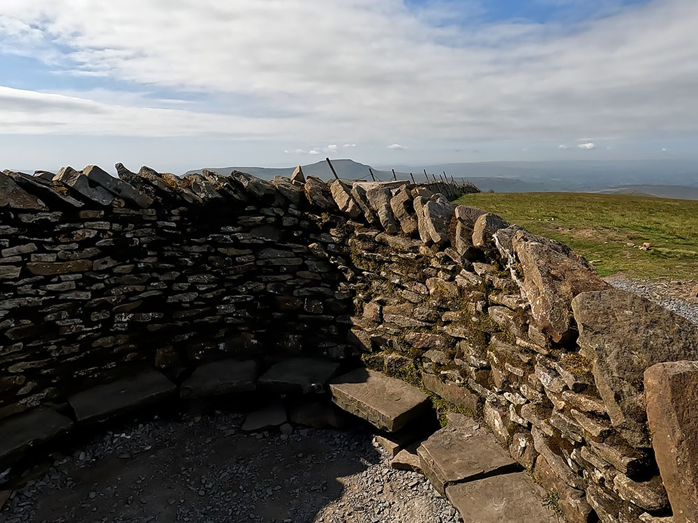
Weather shelter on the summit of Whernside
To continue we pass back through the gap in the wall onto the path we came up on and then turn right to continue along that path.
The path down continues to follow the wall and affords wonderful views ahead of Ingleborough. Pass through either of the wooden gates. After about 800m, just before a slightly steeper downhill section, over to the left, our path off Whernside can now be seen heading down to Bruntscar.
A little further on, at the top of a second slightly steeper downhill section, our path down now can be clearly seen leaving the wall down below. There is a grassy path that continues alongside the wall, but this is not taken.
Head now directly away from the wall to start descending the steeper path. The initial steps down have been much improved but are still a little bit difficult to walk down.

The path off Whernside looking towards Ingleborough
After about 300m, pass through a wooden gate and keep walking straight on. Keep on descending and after a while pass through either of the wooden gates and continue down.
Just before passing through the next gate, take time to look around and look back at the path you just walked down. Pass through the gate to start to walk along the track.
Looking back up towards the summit of Whernside
The walk so far has been along the Yorkshire Three Peaks route but this is now where we divert from that and head back over towards Ribblehead. The Three Peaks route heads around to the right following the main track, however, on this bend, we go left through the gate following the Winterscales sign.
The walk back now is much flatter and goes through pleasant meadows, fields and along farm tracks. Head across the field in the direction of Ribblehead.
As the buildings are approached, head through the gate and just walk straight on, keeping to the right of the buildings, then pass through the gap to the right of the wall just before the last building and bend around to the left to continue following the footpath across the field.
Pass through the next gate and continue ahead across the next field to pass through another gate. Looking back over to the left affords different views and angles of Whernside.
Keep on walking across the field and through another gate. Head straight aiming slightly right and you soon pick up the farm track. After 100m or so, pass through the metal gate and again keep on along the track.
Heading across the fields towards the Ribblehead Viaduct
As the farm buildings are approached pass through the two gates and continue along the track to the right of the house heading for the footpath sign just before the barn labelled Scartop. We now walk along this tarmac road following the Ribblehead footpath sign.
Initially pass through the gates by the 2 barns and continue along the road and over a cattle grid until about 250m after the second barn you meet a T-junction. Here we follow the road around to the right following the footpath sign for the viaduct.
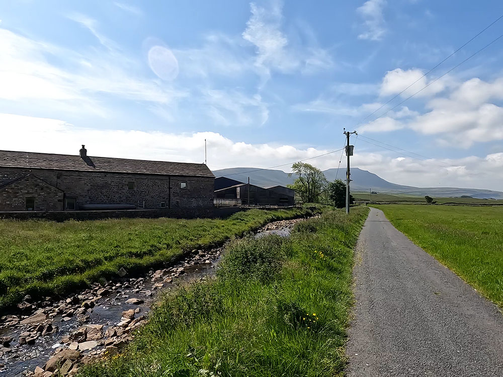
Heading slightly downhill the road passes through the gap in the wall in the direction of Park Fell and Ingleborough. The road heads towards Gunnerfleet Farm. After passing by the farm buildings which are over to the left on the far side of Winterscales Beck, a gate is reached where the road forks.
Heading back towards the Ribblehead Viaduct
Heading towards Gunnerfleet Farm
Follow the road around to the left and over the bridge following the public bridleway Ribblehead sign. Over the cattle grid, keep on along the track as it bends around to the right.
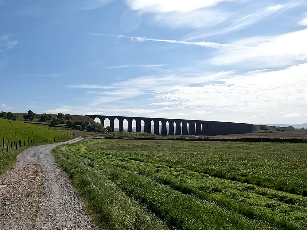
After about 200m pass through the gate and head on to the viaduct. The Ribblehead Viaduct or Batty Moss Viaduct, as it used to be known, carries the Settle to Carlisle railway across Batty Moss. It began being built in 1869 by over 2000 men, most of whom lived in shanty towns specifically set up nearby.
Over 100 men lost their lives whilst it was being built. Some died in accidents, some through fighting and others due to disease in the shanty towns. Many of these are buried in the Church of St Leonard in nearby Chapel-le-Dale which has a plaque in their memory. In 1874 the viaduct was completed and the Settle to Carlisle railway line was opened for passengers in May 1876.
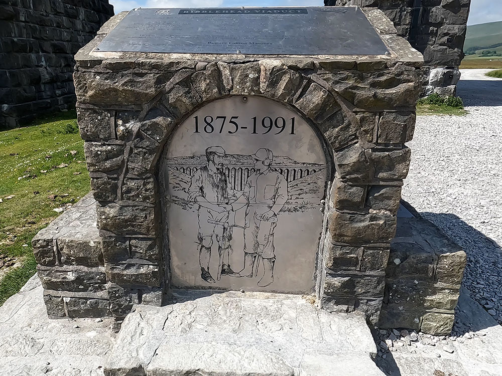
Monument in front of the Ribblehead Viaduct
Just through one of the arches, there is a commemorative cairn. On the back of it, you can see the names of the shanty towns laid out on the plaque.
From the viaduct head away along the wide gravel track that we first walked down. As the Station Inn and the car parking comes into view ahead, take the narrower gravelled path off to the left.
Head back across the road to the car parking.
Gifts and presents for hikers and walkers
Are you struggling to pick the perfect gift for your hiking-loving friend or family member? Don't fret! Explore our curated selection of top-notch gifts for walkers and hikers that will have them trekking with joy on their special day.
What to wear and take on your walk or hike
Whether you are a seasoned hiker or new to walking, wearing and taking suitable hiking kit and clothing is essential for a day hike for your comfort and safety. So we have put together a hiking essentials checklist to cover all you'll need. Our Hiking Essentials checklist for 2026 takes you through planning your walk, the hiking essentials checklist itself, optional extras, explanations, and recommendations for all the hiking essentials.
Check out the reviews for this walk: